1 191 résultats
1881Wien, Pest, Leipzig, Hertleben's Verlag, 1881. Orig. full pictorial cloth, gilt. Very light wear to spine ends. A stamp on halftitle. (8), 247 pp. maps, plates and textillustrations. Clean and fine.
1881réf. 54199Wien, Pest, Leipzig, Hertleben's Verlag, 1881. Orig. full pictorial cloth, gilt. Very light wear to spine ends. A stamp on halftitle. (8), 247 pp. maps, plates and textillustrations. Clean and fine.
1960Firenze, Casini, (anni '60), 8vo tutta tela con sovraccopertina illustrata a colori, pp. XII-410 con 120 fotogr. in nero e col. n.t.
1960Brescia, La Scuola, 1960, 8vo cart. cop. ill. col. pp. 76 + 4 tav. col. f.t.
1898Roma, 1898, pp. 209/212 nel fasc. 4, serie III, vol. XI del 'Bollettino della Società Geografica Italiana'.
1900réf. 28458Washington, Government Printing Office, 1900. Orig. full cloth. Light discolouring to back. 169 pp., 168 photographic plates and 1 large folded map.
1900Washington, Government Printing Office, 1900. Orig. full cloth. Light discolouring to back. 169 pp., 168 photographic plates and 1 large folded map.
Paris, Grasset, 1958. In-8, broché, couverture illustrée, 315 pp. Bon exemplaire.
réf. 8518Paris, Grasset, 1958. In-8, broché, couverture illustrée, 315 pp.
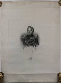
réf. R60Steel engraving print size 39x345 cm on a large sheet 655x485 cm. “B.R. Davies direxit. J. Thomson sculpt.” underneath the image. With an engraved title in Russian and Lazarev’s coat of arms engraved on the lower margin. Blank margins with minor repaired tears creases on the upper and lower blank margins not affecting the images overall a very good print. Official portrait of Admiral Mikhail Petrovich Lazarev 1788-1851 Russian naval officer circumnavigator and the discoverer of Antarctica. The print engraved in England on the special order of the Russian Naval Ministry shows Lazarev in his late years as the Chief of Staff of the Black Sea Fleet since 1832; the Admiral is depicted waist length dressed in uniform with all his regalia and holding a spyglass under his left arm. His name under the portrait is adorned with the coat of arms of Lazarev noble family. ‘‘Lazarev first circumnavigated the globe in 1813-1816 aboard the vessel Suvorov; the expedition began at Kronstadt and reached Alaska. During this voyage Lazarev discovered the Suvorov Atoll. As a commander of the ship Mirny and Fabian Gottlieb von Bellingshausen’s deputy on his world cruise in 1819–1821 Bellingshausen commanded Vostok Lazarev took part in the discovery of Antarctica and numerous islands. On January 28 1820 the expedition discovered the Antarctic mainland approaching the Antarctic coast at the coordinates 69°21’28’’S 2°14’50’’W / 69.35778°S 2.24722°W / -69.35778; -2.24722 and seeing ice-fields there. In 1822-1825 Lazarev circumnavigated the globe for the third time on his frigate Kreyser conducting broad research in the fields of meteorology and ethnography’’ Wikipedia. Later Lazarev took part in the Battle of Navarino 1827 part of the Greek War of Independence 1821-32; was in charge of the naval units of the Baltic Fleet 1830 and became the Commander of the Black Sea Fleet the Black Sea ports and military governor of Sevastopol and Nikolayaev since 1833. unknown
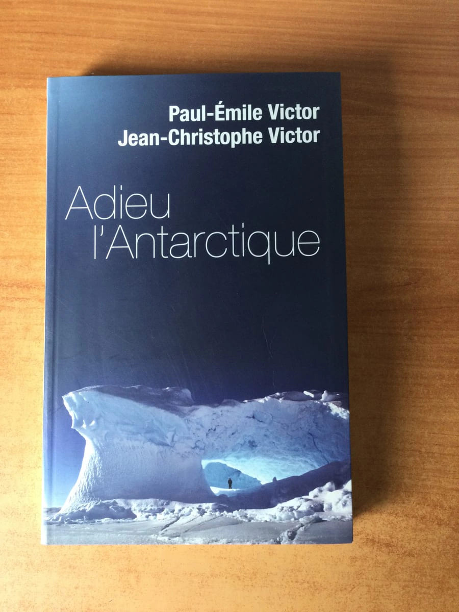
réf. 72766Le grand livre du mois 2007 livre récit 24,5*15,5 194 pages
1820réf. P1-22ATLASP1-4E-0AVEC L'ATLAS: LA HARPE (J.F). Abrégé de l'histoire générale des voyages, contenant ce qu'il y a de plus remarquable, de plus utile et de mieux avéré dans les pays où les voyageurs ont pénétré; les mœurs des habitants, la religion, les usages, arts et sciences, commerce et manufactures; par J.F. LAHARPE. Nouvelle édition, revue et corrigée avec le grand soin, et accompagnée d'un bel Atlas In-folio. Paris, Etienne Ledoux, 1820. 24 volumes in-8° (205x135) reliés demi-maroquin olive, dos ornés, tranches marbrées, belle série. 500pp. par volume, le dernier (XXIV) étant la table des matières. TARDIEU A., Atlas pour servir à l'intelligence de l'histoire générale des voyages de LA HARPE. In-folio (455x295mm), couverture éditeur, coins écornés. Paris, Ledentu, 1825. 15 cartes géographique (595x460mm), contours couleurs dressés par AMBROISE TARDIEU. Mappemonde, Afrique, Asie (2), Indes, Océanie, Chine, Japon, Sibérie, Golfe du Mexique, Mexique, Amérique Méridionale, Pérou, Brésil, Amérique Septentrionale, Europe.
1842Lyon, Paris, Librairie d'Education de Perisse frères, 1842. In-12 plien veau d'époque, dos lisse très orné, tranches marbrées, 311 pages. Gravures. Bon exemplaire.
1842réf. 174098Lyon, Paris, Librairie d Lyon, Paris, Librairie d'Education de Perisse frères, 1842. In-12 plien veau d'époque, dos lisse très orné, tranches marbrées, 311 pages. Gravures. Bon exemplaire.
1919London, T. Werner Laurie, (1919 ?). Orig. full pictorial cloth. Gilt. A stamp on verso of frontispiece. Frontispiece. X,(4),347 pp., 33 plates, 2 folded maps.
1919réf. 53879London, T. Werner Laurie, (1919 ?). Orig. full pictorial cloth. Gilt. A stamp on verso of frontispiece. Frontispiece. X,(4),347 pp., 33 plates, 2 folded maps.
1773London, Strahan & Cadell, 1784, due volumi in-4° (cm. 29 x 21,5) legatura ottocentesca in mezza pelle con angoli, titoli dorati al dorso, tagli marmorizzati, pp. XL-378 con 37 tavole fuori testo, compreso il ritratto dell’A. in antiporta + 396 con 27 tavole fuori testo. Le stupende incisioni in rame, anche a piena e doppia pagina, sono realizzate per lo più sui disegni dal vero di W. Hodges; ci sono inoltre mappe della spedizione, anche di grandi dimensioni e più volte ripiegate, sezioni di piroghe, tavole raffiguranti piante, animali e vari oggetti provenienti dalle isole del Pacifico esplorate dall’A. In fine, il prospetto delle rotte della spedizione; un vocabolario della lingua parlata nelle Society Isles; una lista delle varie lingue parlate nei Mari del Sud; e un saggio di Sir J. Pringle su come preservare la salute dei marinai. L’opera è il resoconto ufficiale della seconda spedizione di Cook nell’emisfero australe, quella in cui per la prima volta viene oltrepassato il Circolo Polare Antartico (gennaio 1773). Vengono scoperti ed esplorati, inoltre, vari gruppi insulari del Pacifico meridionale, in merito ai quali viene fornita qui per la prima volta una grande quantità d’informazioni. Qualche lieve spellatura e sbucciatura ai dorsi, angoli consunti; vistosi restauri ai due frontespizi e alla seconda carta del secondo volume, senza mai perdita di testo. Rare e leggere fioriture, alcune carte un po’ brunite. Nel complesso, una copia molto buona, completa di tutte le tavole, di quest’opera famosa, la più bella di Cook. Questa edizione è l’ultima a essere del medesimo formato di quella originale del 1777.
1622London, 1622. (Reprinted by Caedmon of Whitby, Yorkshire 1980). Small 4to. Orig. full cloth with dustjacket. 68 pp.
1622réf. 26842London, 1622. (Reprinted by Caedmon of Whitby, Yorkshire 1980). Small 4to. Orig. full cloth with dustjacket. 68 pp.
1835Paris, Baudry's European Library, 1835. 8vo. Cont. modest hcalf. Traces of use. (1),475 pp. and 1 large folde engraved map and 2 engraved plates. Some foxing. Stamp on title.
1835réf. 22555Paris, Baudry's European Library, 1835. 8vo. Cont. modest hcalf. Traces of use. (1),475 pp. and 1 large folde engraved map and 2 engraved plates. Some foxing. Stamp on title.
réf. 64582Paris, Librairie Nationale d’Education et de Récréation 1905, 290x215mm, 223pages, reliure d'éditeur. Auteur, titre et ornementation au dos et sur le premier plat. Tranches dorées. Couverture un peu défraîchie, sinon en bon état.
réf. QWA-10280Librairie Nationale d'Education et de Récréation, 1906, in-4 rel. 1/2 toile bleue (22,5 x 30), 223 p., préface par le Dr Richer, illustré de 12 gravures, reliure récente, dos muet, bon état.
1938Un volume de format petit in 8° de 256 pp.; une grande carte dépliante des pôles nord et sud. Couverture entièrement conservée; en première, une photo de Paul-Emile Victor. Bon état. Premier tirage. Voir photos.
1938réf. 397251938 Paris, Albin Michel, 1938, in 12 broché, 253 pages ; complet de la carte dépliante ; couverture spéciale "Sélections Lardanchet, Cercle Lyonnais de Sélection"