[LOCKE (John)].Livre Rare Book

3,428 results
1722ref. 4938Paris, Étienne Ganeau, 1722. 1722 2 vol. in-12° (163 x 102 mm) de: I. [6] ff. (titre, préface, approbation, privilège); 378 pp.; [3] ff. (table); II. [4] ff. (titre, table); 316 pp. Plein veau granité dépoque, dos à nerfs orné, titres et tomaisons de maroquin rouge, filet à froid encadrant les plats, roulette dorée sur les coupes, tranches jaspées de rouge. (Rares rousseurs ou tâches).
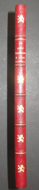
1956ref. 447261956 Lyon, Chambre de Commerce, Edition Pierre Bissuel, 1956, in 4° relié demi-chagrin rouge, dos à 5 nerfs, orné d'un lion doré à chaque entre-nerfs, couverture et dos conservés (très légèrement fanées), 142 pages ; très nombreuses photographies et dessins.
1956ref. 884951956 Lyon, Chambre de Commerce, 1956, in 4° broché, 142 pages ; très nombreuses photographies et dessins ; couverture rempliée.
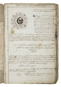
1710ref. ABC_46964The Netherlands 1710. Contemporary flexible paperboards. Folio 33.5 x 21.5 cm. With more than 300 mathematical figures and illustrations mainly full- half- and quarter-circle diagrams. The Dutch text is written in a clearly legible 18th-century cursive hand in brown ink. Early 18th-century Dutch manuscript on the art of navigation based on Klaas de Vries Schat-kamer ofte konst der stuurlieden . 1702. De Vries taught mathematics in Amsterdam his work proved very popular and appeared in numerous editions between 1702 and 1818. The author of the present manuscript unknown but was most likely a student of mathematics possibly even a student of De Vries himself at the beginning of the 18th century.The manuscript deals with several subjects regarding navigation including many different calculations for calendars for example the golden number the tides and determining the time at night. Furthermore theories and examples of correcting compass declination and determining the time of sunrise and sunset from the declination of the sun in combination with the pole star map reading and course calculation. It ends with approximately 50 sample problems in trigonometry and geometry showing the student author's mathematical work.Binding soiled edges frayed lacking the first 7 leaves quires 3 and 5 detached. With several ink stains the ink has bled through some leaves. Otherwise in good condition. An interesting manuscript on navigation probably from a Dutch student ca. 1702/13.l For De Vries's work: The Crone library 374 1st ed 1702. hardcover
1757ref. 21280Paris H.-L. Guérin et L.-F. Delatour 1757 -in-4 plein-veau un volume, reliure de l'époque plein veau blond raciné in-quarto (binding full calfskin in-4), dos à nerfs (spine with raised bands), décoré "or" et à froid (gilt and blind stamping decoration), à filets "or" (gilt line) et filets à froid (blind-stamping line decoration), entre-nerfs à fleuron au fer plein "or" (floweret with full blocking stamp) dans un encadrement à double filets "or" avec fleurons fleurettes aux angles, titre frappé or (gilt title), pièce de titre sur fond bordeaux avec double filets "or" en encadrement, roulette "or" en pace des nerfs avec un filet à froid de part et d'autre des nerfs, coiffe de tête avec ancienne restauration (propre), mors avec restauration ancienne sur 4 cm en haut de la première de couverture mais reliure trés solide, dos trés légèrement frotté, plats décorés à froid d'un double filet à froid en encadrement, coins écornés, double filets "or" sur les coupes (fillets on the cuts) avec légers manques de dorure (blurred gilding), toutes tranches jaspées (all marbled edges) rouges (red edges), etiquette ex-libris gravée en noir aux "Armes" d'un Marquis "au lion naissant d'une forest de sinople" + tampon ex-libris encre noire de franc-maçon, titre imprimé en rouge et noir, orné de 15 planches dépliantes hors-texte gravées sur bois en noir et orné de bandeaux tête de chapitre historiés et de culs-de-lampe (illuminated of tailpieces) gravés sur Bois (engraving-wood) en noir, XXX + 520 pages, 1757 Paris : H.-L. Guérin et L.-F. Delatour Editeur,
1775ref. 21314Rouen Vve Besongne & Fils 1775 in-8 plein-veau 3 parties en 1 volume, reliure plein veau raciné (binding full calfskin) havane in-octavo, dos à nerfs (spine with raised band), décoré or et à froid (gilt and blind stamping decoration), à filets et roulettes "or" (gilt line and fillets), titre frappé "or" (gilt title), pièce de titre sur fond bordeaux avec double filets "or" en encadrement, roulette "or" en place des nerfs avec un filet à froid de part et d'autre des nerfs, entre-nerfs à fleuron "or" dans in encadrement d'un double filet "or" avec rinceaux "or" aux angles, roulette "or" en pied, dos légèrement frotté(spine lightly rubbed), coins écornés (corners dog-eared), filet "or" sur les coupes (gilt line on the cuts) avec léger manque de dorrure (blurred gilding), toutes tranches lisses peignées bleu et rose, Ex-Libris gravé en noir sur etiquette de papier velin au dos de la 1ère de couverture : Antoine-Charles Farmain, orné de 8 planches dépliante hors-texte gravées sur cuivre en noir, ([4]-XVII-[2]-[1bl.]-356-45-[3bl.]-8planches-52) pages, 1775 à Rouen Vve Besongne & Fils Editeur,
ref. 201611058Paris, Seuil, 1990 ; petit in-4, 1135 pp., cartonnage de l'éditeur. En bon état avec sa jaquette et son rhodoide.
Hardcover, dark blue cloth on board, fold out maps and charts. loose inside is a supplement n°3-1961 relating to this edition book. This is a stapled booklet agin with fold outs and charts, staples are rusting. Book is a hefty volume of 525pp. Book has minimal wear to cover and binding. Good/No Jacket. [TX-8]
ref. 558570Paris, Arthus Bertrand, s.d. [1869] In-4 broché, couverture muette postérieure, 12pp, 13 tableaux synoptiques des principales dimensions des navires de 75 à 1200 tonneaux de jauge.
1952ref. 95827Paris, Société d'éditions géographiques, maritimes et coloniales, impr. Keller, Maître-Imprimeur 1952 In-4 28,5 x 22,5 cm. Cartonnage éditeur remplié, dos muet, premier plat gaufré d’un blason polychrome, 170 pp., illustrations en noir & blanc dans le texte, 2 fac-similés hors texte, armoiries polychromes de la Ville de La Rochelle in fine. Bel exemplaire.
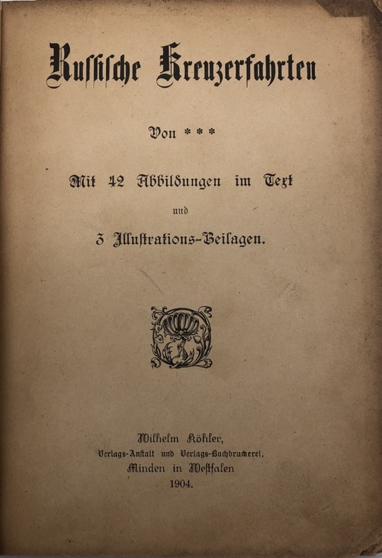
ref. 232514Minden [Westphalie], Wilhelm Köhler, 1904 petit in-8, [2] ff. n. ch., 106 pp., [3] ff. n. ch., avec des illustrations en noir dans le texte et 3 planches hors texte, dont un frontispice sous serpente, broché sous couverture noire illustrée. Manquent le dos et la seconde couverture.
Hardcover in 8, 291 pp., cartonnage sous jaquette illustree en couleurs. Très bel exemplaire. [CA31-5]
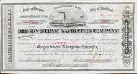
1518ref. 60240Seattle WA & Portland OR; San Francisco: Oregon Steam Navigation Company OSN Lithographers Britton Rey & Co. May 15 1874. Oblong 8vo. 9.5 x 5.25 in. 1 lithographed stock certificate printed in red & black image of OSN sidewheeler decorative borders signed by Wygant Ainsworth & Thompson at lower fore-edge transfer printed on verso signed by Edwin M. Lewis to Mrs. Kate J. Jones w/ stamps of paid dividends in 1878 and 1880. A nicely lithographed and rare original stock certificate issued in 1874 by Jay Cooke and the Northern Pacific Railroad to raise money for OSN after many of its original stockholders had sold out in 1867 as the Company continued to compete with Ben Holladay’s Pacific Mail Steamship Co. Unfortunately OSN became entangled with the declining financial woes of the Northern Pacific to the extent that by 1879 Henry Villard representing German Bondholders in 1879 purchased the OSN paid off the certificate holders by 1880 and the company disappeared into Villard’s transcontinental railroad. Edwin Lewis in Shasta OR transferred this certificate to Kate J. Jones May 1 1875 and shows the stamps of being paid off in dividends when the Northern Pacific absorbed OSN’s four railroads 26 steamboats and real estate in Portland Astoria The Dalles Umatilla OR and Vancouver WA. Oregon Steam Navigation Company (OSN), Lithographers, Britton, Rey & Co., unknown
1920Very Good Turkish, Ottoman (1500-1928) Original color map. Elephant folio. (59x75 cm). In Ottoman script. [OTTOMAN MILITARY MAP of PATAGONIA and FALKLAND ISLANDS: ROUTE of DRESDEN] Alman kruvazörü Dresden'in takîbi ve tahrîbi. SMS Dresden cruiser's routes between 1913-1915 (World War 1) on the Patagonian shelf; western shores of South America, Patagonia and Falkland Islands. Dresden spent much of her career overseas. After commissioning, she visited the United States in 1909 during the Hudson-Fulton Celebration, before returning to Germany to serve in the reconnaissance force of the High Seas Fleet for three years. In 1913, she was assigned to the Mediterranean Division. She was then sent to the Caribbean to protect German nationals during the Mexican Revolution. In mid-1914, she carried the former dictator Victoriano Huerta to Jamaica, where the British had granted him asylum. She was due to return to Germany in July 1914, but was prevented by the outbreak of World War I from doing so. At the onset of hostilities, Dresden operated as a commerce raider in South American waters in the Atlantic, then moved to the Pacific Ocean in September and joined Maximilian von Spee's East Asia Squadron. Dresden saw action in the Battle of Coronel in November, where she engaged the British cruiser HMS Glasgow, and at the Battle of the Falkland Islands in December, where she was the only German warship to escape destruction. She eluded her British pursuers for several more months, until she put into Robinson Crusoe Island in March 1915. Her engines were worn out and she had almost no coal left for her boilers, so the ship's captain contacted the local Chilean authorities to have Dresden interned. She was trapped by British cruisers, including her old opponent Glasgow. The British violated Chilean neutrality and opened fire on the ship in the Battle of Más a Tierra. The Germans scuttled Dresden and the majority of the crew escaped to be interned in Chile for the duration of the war. The wreck remains in the harbor; several artifacts, including her bell and compass, have been returned to Germany.
1719ref. 59230Washington D.C.: Government Printing Office Hydrographic Office U.S. Navy 1917; 1930. Two vols. 8vo. ix 1 4 364 pp.; 19 mimeograph leaves. With 2 large folding colour map. First vol. in black publisher’s buckram silver lettering stamped on front cover & spine minor shelfwear slight interior toning shelfwear 2nd vol. mimeographed typescript & stapled at gutter margin minor dustsoiling edgewear predation to lower fore-edge tear to last leaf of blank lower portion still a VG set. First editions of these coast pilot guides to Arctic waters during and after World War I issued about the time of the Russian Revolution and offered key navigational guides for Naval forces during the ill-fated White Russia Revolution and over 13000 troops in the Polar Bear Expedition. Prior to modern GPS systems and satellite navigation these regularly updated and revised navigation handbooks provided key sailing instructions often drawing not only from Russian & British sources but also sailing reports from U.S. Navy vessels and those from merchant ships. The two maps serve as indexes to sailing charts to be ordered from the Hydrographic Office and keyed to sailing instructions within the coast pilots. The supplement is uncommon no copies located in Worldcat. Government Printing Office, Hydrographic Office, U.S. Navy, hardcover
1920ref. 59233Washington D.C.: Government Printing Office Hydrographic Office U.S. Navy 1920-1930. Seven vols. 8vo. 4 365 1; 584; v 1 4 447 1 pp.; 2 22; 1; 2 57 1; 1 36 2 leaves. With 3 large folding colour maps numerous photo plates elevation views. Three uniformly bound in blue publisher’s buckram gilt lettering stamped on front covers & spines edgewear dustsoiling very slight uniform toning bowing to covers on vol. III some scuffing supplements all w/ self-printed softcovers edgewear rippling toning to fore-edges some predation still a G set w/ maps in bright condition. First editions stated of these uncommon coast pilot guides to Australian waters drawing upon British Royal Navy coast pilots Australian and U.S. Navy reports. Prior to modern GPS systems and satellite navigation these regularly updated and revised navigation handbooks provided key sailing instructions. The maps outlines the available charts for the designated areas surrounding Australia as well as those for the East Indies Pilot. First editions of these Hydrographic Office pilots are quite scarce and seldom seen with the supplements. Government Printing Office, Hydrographic Office, U.S. Navy, paperback
1926ref. 59234Washington D.C.: Government Printing Office Hydrographic Office U.S. Navy 1926; 1930. Two vols. 8vo.viii 478 pp.; 1 22; 1 leaves. With 1 large folding colour map. First vol. in tan publisher’s buckram black lettering front cover & spine minor soiling spotting fore-edges of covers darkening to spine very slight uniform interior toning; 2nd. vol. w/ self-printed softcovers toning to fore-edges minor chipping still VG set. Second edition stated of vol. I and 1st edition of Supplement. These uncommon coast pilot guides to Eastern Mediterranean waters the Black Sea and the Sea of Azov draw upon British Royal Navy Ottoman Empire & Turkish coast pilots Russian & U.S. Navy reports. Prior to modern GPS systems and satellite navigation these regularly updated and revised navigation handbooks provided key sailing instructions. The maps outlines the available charts for the designated areas surrounding the Black Sea as well as detailing those for the extensive set of the Mediterranean Sea. Government Printing Office, Hydrographic Office, U.S. Navy, paperback
1920ref. 59237Washington D.C.: Government Printing Office Hydrographic Office U.S. Navy 1920-1940. Five vols. 8vo. vi 638; v 1 287 1; 8 390 pp.; 1; 2 17 1 leaves. With 5 large folding colour maps numerous plates showing elevations. Three volumes uniformly bound in blue publisher’s buckram gilt lettering front cover & spine darkening to spines fore-edges minor shelfwear dustsoiling slightly shaken Supplements in self-printed softcovers edgewear toning to fore-edges minor chipping still VG- set. Third editions revised & updated of vols. I & II second edition of vol. II and 1st editions of both scarce Supplements of these coast pilot guides to British Columbia including lower Alaska and upper Washington in the years between the World Wars. Prior to modern GPS systems and satellite navigation these regularly updated and revised navigation handbooks provided key sailing instructions often drawing not only from Brazilian Argentine and British coast pilots as well as sailing reports from U.S. Navy vessels and those from merchant ships. The first large map delineates the requisite coast pilots for sailing in B.C. waters and charts to be ordered from the Hydrographic Office while the second maps depict the sailing routes to Asia the Soviet Union and the Arctic across the Pacific. Both editions of Vol. II are offered here with the expanded 3rd edition featuring nearly double the material and extra map of the 2nd. Government Printing Office, Hydrographic Office, U.S. Navy, paperback
1927ref. 59226Washington D.C.: Government Printing Office Hydrographic Office U.S. Navy 1927-1928. Two vols. 8vo. 8 viii 424; 6 v 1 446 pp. With 4 large folding colour maps 1 double-sided elevation maps showing harbor entrances numerous photo plates. Beige publisher’s cloth black lettering front cover & spine darkening to spine fore-edges minor shelfwear dustsoiling still VG set. Third & Seventh editions revised & updated of these coast pilot guides to Central America and Mexico in the 1920’s. Prior to modern GPS systems and satellite navigation these regularly updated and revised navigation handbooks provided key sailing instructions often drawing not only from Mexican and West Indies sources but also governmental publications in the Panama Canal sailing reports from U.S. Navy vessels and those from merchant ships. The first large map delineates not only the requisite coast pilots for sailing in American waters but also the charts to be ordered from the Hydrographic Office. Government Printing Office, Hydrographic Office, U.S. Navy, hardcover
1924ref. 59232Washington D.C.: Government Printing Office Hydrographic Office U.S. Navy 1924; 1930. Two vols. 8vo. 608 pp.; 1 32 1 leaves. With1 large folding colour map. 1st vol. in light-green publisher’s buckram black lettering stamped on front cover & spines slight uniform toning darkening to spines shelfwear 2nd vol. w/ self-printed softcovers toning & minor predation minor chipping to fore-edges still VG- set w/ map in bright condition. Second edition of vol. 1 substantially revised & expanded 1st of 2nd of these very scarce coast pilot guides to waters of Indonesia drawing upon British Royal Navy coast pilots Australian Southeast Asian Polynesian and U.S. Navy reports. Prior to modern GPS systems and satellite navigation these regularly updated and revised navigation handbooks provided key sailing instructions. The map outlines the available charts for those covering the difficult sailing conditions through Java the Celebes Borneo Sumatra the Gulf of Siam the Celebes Timor and more. Worldcat locates only 4 copies of the first vol. Yale NYPL BN Mexico Stattsbibliotheck Berlin & 1 copy of the 2nd U of W. Government Printing Office, Hydrographic Office, U.S. Navy, paperback
1719ref. 59235Washington D.C.: Government Printing Office Hydrographic Office U.S. Navy 1917-1930. Nine vols. 8vo. x 4 470; 4 687 1; ix 1 586; ix 1 750 pp. plus publisher’s ads; ii 38; 5; 1 47; 1 60 3; 1 35 7 leaves. With 4 large folding colour maps. Four uniformly bound in tan publisher’s buckram black lettering front covers & spines minor soiling spotting fore-edges of covers darkening to spines very slight uniform interior toning; remaining Supplement vols. w/ self-printed softcovers toning to fore-edges minor chipping minor soiling chipping still VG set. First edition stated of vol. III and Supplements 2nd editions of other three vols. of these surprisingly scarce coast pilot guides to the Mediterranean Sea encompassing the coasts of Spain Morocco Algeria Tunisia Libya Egypt Palestine Turkey the Balearics and more draw upon British Royal Navy Ottoman Empire & Turkish coast pilots North African Russian & U.S. Navy reports. Prior to modern GPS systems and satellite navigation these regularly updated and revised navigation handbooks provided key sailing instructions. The maps outlines the available charts for the designated areas surrounding the Mediterranean Sea as well as detailing those for the Black Sea volume. Very uncommon to find complete set with all supplements to 1930. Government Printing Office, Hydrographic Office, U.S. Navy, paperback
1847ref. 1008098vo slate blue cloth stamped in gilt and blind illustrated with frontispiece and folding charts viii 21 429 3 24 pp.Wear to spine ends spine faded small splits to joints hinges cracked copious nautical notes to endpapers slight aging but text and charts are generally clean and unworn; about very good. This is rare first edition of what is known as "The Atlantic Navigator" which includes detailed sailing instructions for the North and South Atlantic. Includes ten folding charts and much of the text is from various captains and navigators familiar the routes contained in this work. The first numbered section of 21 pages is an 1847 supplement and the catalogue at the rear is dated 1851. Sabin noting 2300 only an 1854 fourth edition. James Imray,
1922ref. 59239Washington D.C.: Government Printing Office Hydrographic Office U.S. Navy 1922; 1930. Two vols. 8vo. v 1 4 397 1 pp.; 1 60 2 leaves. With 1 large folding colour map. 1st vol. in green publisher’s buckram gilt lettering stamped on front cover & spine darkening to spine shelfwear minor scuffing; 2nd vol. Supplement in self-printed softcovers toning chipping & tears to fore-edges minor creasing to corner still VG- set. Third edition stated of vol. I 1st edition of Supplement vol. of these surprisingly scarce coast pilot guides detailing the sailing directions for the treacherous coasts of Great Britain France Belgium Netherlands German & Denmark notoriously treacherous for sailing and powered vessels. Prior to modern GPS systems and satellite navigation these regularly updated and revised navigation handbooks provided key sailing instructions drawing upon British French German Dutch & Danish sailing directions and charts. Worldcat locates no copies of the Supplement. Government Printing Office, Hydrographic Office, U.S. Navy, paperback
1926ref. 59231Washington D.C.: Government Printing Office Hydrographic Office U.S. Navy 1926-1928. Two vols. 8vo. xxxii 4 788; ix 1 619 pp. With 5 large folding colour maps 2 double-sided. Uniformly bound in light-green publisher’s buckram gilt lettering stamped on front covers & spines slight uniform toning darkening to spines shelfwear still VG set w/ maps in bright condition. Third editions revised & expanded of these coast pilot guides to waters of the South Pacific Southeast Asia and Australasia encompassing New Zealand New Guinea the Gilbert Caroline Marshall Fiji Samoan Hawaiian New Hebrides and Indonesian Islands drawing upon British Royal Navy coast pilots Australian Southeast Asian Polynesian and U.S. Navy reports. Prior to modern GPS systems and satellite navigation these regularly updated and revised navigation handbooks provided key sailing instructions. The map outlines the available charts for the entire Pacific. Government Printing Office, Hydrographic Office, U.S. Navy, hardcover
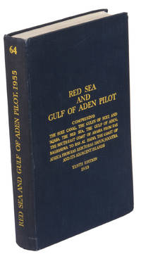
1955ref. ABC_47446London 1955. 8vo. Published for the Hydrographic Department Admiralty Original blue cloth with yellow lettering on the spine and the front board the supplement is loosely inserted at the end of the volume: original printed paper wrappers stapled. With a folding map printed on both sides 2 coloured plates with diagrams printed on both sides 28 plates showing coastlines and occasionally a map many printed on both sides and many some illustrations in text. 2 LI = LIII: II plus 1 1 blank 1 blank 518 1 1 blank pp; Supplement: 20 pp. The essential standard sailing directions for the Red Sea and Gulf of Aden corresponding with zone NP64 on the official Admiralty charts. These nautical works - pilot guides and charts - were published by the United Kingdom Hydrographic Office which provides the necessary hydrographic and marine geospatial data to all kinds of maritime organisations across the world. The publications are not only used by the British Royal Navy but can also be found on board the majority of international merchant ships. The data provided in the pilot guides and other publications are compliant with SOLAS the Safety of Life at Sea treaty guidelines and are updated constantly in weekly "Notices to mariners" and supplements to and new editions of the pilot guides whenever necessary.The present copy is the 10th edition 1955 of the pilot guide with sailing directions and other information on the weather currents radar ranges etc. relating to the Red Sea and Gulf of Aden including the supplement issued in 1957. It includes an erroneous "advertisement to the eight edition" by the Hydrographer of the Navy Rear-Admiral Kenneth St Barbe Collins 1904-1982. The advertisement states that with the publication of "the ninth edition" presumably this volume the previous edition and its supplements are cancelled since the most up-to-date information has been compiled in the new edition and the weekly "Notices to mariners" that appeared after the publication of the 11th edition. The 10th edition of 1955 and its 1957 supplement were made redundant with the publication of the 11th edition in 1967. Each subsequent edition of the pilot supersedes the last which have appeared infrequently depending on newly available information from the mid-19th century until the present day.The front paste-down and recto of the first free endpaper contain a "caution" notice and room for the notation of "supplements and annual summaries of notices to mariners relating to this book" the first two pages are printed on red-pink paper. The binding shows minor signs of wear around the spine and corners of the boards the gutter after page II is somewhat weakened the head edge of the wrappers of the supplement are very slightly browned. Otherwise in very good condition. hardcover