NAVIGATION IN CHINABiblio.com
3439 risultati
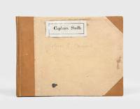
1928rif. 174745Likely Shanghai: 1928-34. Mariners are warned to exercise due caution when approaching and when in the waterways A collection of otherwise untraced notices to mariners compiled by a civilian captain who plied the lower Yangtse during the late 1920s and early 1930s. Yangtse shipping was regulated by the Maritime Customs Service which issued around 100 navigational advisories per year. During the late 1920s shipping traffic on the Yangtse rebounded after several years of decline during the Warlord Era. Low water however continued to pose problems for navigators and increased the need for effective river management. The 39 notices are technical directions concerning specific parts of the channel. They specify when vessels may and may not enter stretches of water warning of the persistent presence of Chinese craft not subject to the same notices offer guidance for navigating buoyed channels provide optimum bearings and relay a change to the position of the Bend and Gravener Island beacons due to the erosion of the channel. The majority date from 1929. The identify of the "Captain Smith" referenced on the front cover has proved elusive but he may be the individual pictured in photograph Sw13-045 G. Warren Swire collection SOAS. Landscape octavo. Contemporary brown half cloth binder with metal clasp spine lettered in gilt buff paper sides front board with manuscript label "Captain Smith" boards lined with pink paper typescript list of charts on inner front cover 39 sheets each typed one side only in black or blue most duplicate typescript a few top copy. Boards lightly soiled clasp rusted sheets generally well preserved a few creased or with holes near clasp legibility unaffected typescript list with a few losses to text: a very good example. hardcover
rif. 0259322008.Gpaperback. Good. Access codes and supplements are not guaranteed with used items. May be an ex-library book. paperback
rif. 0484080059.Ghardcover. Good. Access codes and supplements are not guaranteed with used items. May be an ex-library book. hardcover
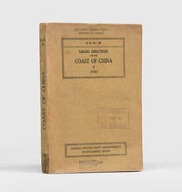
1943rif. 172166Washington DC: United States Navy Department Hydrographic Office 1943. First edition first printing pleasingly with all the printed supplement tickets still present and the detailed maps well preserved. Updated chapters offer information on general subjects such as pilotage storm and weather signals quarantine regulations and ocean currents as well as detailed discussion of stretches of river and ocean along China's east coast down to Hong Kong and up the Yangtze. While common institutionally as expected copies are now seldom encountered in commerce. Octavo. With 2 folding maps 2 diagrammatic plates illustrations in text. With all 8 leaves 4 blank of printed supplement tickets bound in at front as issued. Original brown card wrappers spine and front cover printed in black. Ex-Civil Affairs Training School University of Chicago with its ink stamps on front cover and "discard" noted in pencil. Wrappers well preserved first map with stub tear just touching neatline second map split along one fold neatly repaired on verso with archival tape couple of small nicks and chips internally not affecting text: a very good copy. unknown
rif. 1236977394.Gpaperback. Good. Access codes and supplements are not guaranteed with used items. May be an ex-library book. paperback
1937rif. 31172Imray Laurie Norie & Wilson 1937. 4to. First Edition with frontispiece and plates; blue cloth gilt back a very good bright clean copy. This copy was formerly in the library of The Cruising Association and bears its bookplate on front paste-down and neat blind stamp on title. Traces the history of the firm of Imray and irs successors from 1670 to 1937. VERY SCARCE. Imray Laurie Norie & Wilson, hardcover
rif. 0656758597.Ghardcover. Good. Access codes and supplements are not guaranteed with used items. May be an ex-library book. hardcover
rif. 1334233497.Gpaperback. Good. Access codes and supplements are not guaranteed with used items. May be an ex-library book. paperback
rif. 1334249520.Gpaperback. Good. Access codes and supplements are not guaranteed with used items. May be an ex-library book. paperback
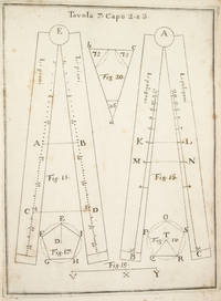
1753rif. 3742NAPLES: IGNAZIO RUSSO 1753. FIRST EDITION. Hardcover. Fine. Bound in contemporary vellum over boards. Foxing. Complete with the 15 engraved plates. Little is known of the author other than that he wrote another book on navigation in 1750. This work on the sector was translated into Spanish in 1758. By the time this book was published the design of the European sector had become standardized. Compare this design for example with that in the fourth edition of the works of Ozanam seventeen years earlier L’usage du compas de proportion 1736. The physical design of Pagnini’s instrument is better with pegs and decorative tenons to hold the two legs in alignment but the scales are essentially identical. The work is well illustrated with engravings showing exactly how a pair of dividers should be used to take the various lateral and transverse measurements. Pagnini provides eight tables that detail the exact markings for each scale. He also provides other material for reference use e.g. he includes not only a table for the construction of the line of metals but also one of their relative weights and their alchemical symbols etc. IGNAZIO RUSSO hardcover books
19374to., First Edition, with frontispiece and plates; blue cloth , gilt back, a very good, bright, clean copy. This copy was formerly in the library of The Cruising Association and bears its bookplate on front paste-down and neat blind stamp on title. Traces the history of the firm of Imray and irs successors from 1670 to 1937. VERY SCARCE.
rif. 100-04578Navy Department Bureau of Navigation. Hardcover. Good. Good condition with wear and markings. Navy Department Bureau of Navigation hardcover
2001Fine English Paperback., Fine., 20 x 14 cm., 368 p., "Sanli Bahriye; Türk Bahriyesinin ikiyüz yillik tarihçesi 1173-1973.", Nejat Gülen, Kastas Yayinlari, Ist., 2001.
2001Fine English Paperback. Pbo. Roy. 8vo. (23 x 16 cm). In Turkish. [xiii], 354 p. With Ottoman documents. Osmanli döneminde Istanbul deniz ulasimi ve kayikçilar.
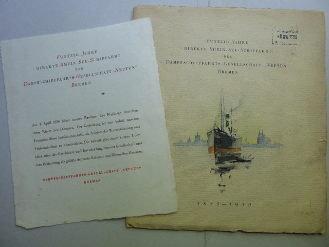
1939rif. 136776Bremen. 1939. 24 Seiten. Mit 4 großformatigen Abbildungen, einer Linien-Neztkarte u. einer Illustration sowie einem Widmungsblatt als Beilage. Dekorativ farbig illustrierte Originalbroschur mit Fadenheftung. (Einband teils fleckig u. mit einem Eingangsstempel versehen). 25x22 cm
1877rif. z015748London: Netherlands India Steam Navigation Company 1877. Very Good. Two page letter of transmittal from a Netherlands India Steam Navigation Company agent to James M. Lincoln of the Pacific Mail Steamship Co. New York. Measures 8.5 by 11 inches recto only. Very good. Pages toned and lightly creased else clean and unmarked. 2p. Netherlands India Steam Navigation Company unknown
1879rif. z015731Batavia: Netherlands India Steam Navigation Company 1879. Very Good. Measures 8.5 by 10 inches printed recto only with corrections in contemporary hand. Very good. Edge wear and creasing else complete and clean. Netherlands India Steam Navigation Company unknown
1968rif. 111061Editions Maritimes et d'Outre-Mer 1968 In-8 broché 24 cm sur 16. 187 pages. Couverture légèrement passée. Bon état d’occasion.
rif. 5849les Normands en Amérique depuis le Xème siècle jusqu’au XVème siècle.In 8 demi-chagrin rouge,titre,fer, roulette, filets dorés,filets à froid.Faux-titre, frontispice, titre avec vignette,VI,295 pages,illustrations hors-texte de G. ROUX et de L.BENETT.Bibliothèque d’éducation et de récréation J.Hetzel & Cie sans date,très bon état
rif. 0366372718.Gpaperback. Good. Access codes and supplements are not guaranteed with used items. May be an ex-library book. paperback
rif. 0366372815.Ghardcover. Good. Access codes and supplements are not guaranteed with used items. May be an ex-library book. hardcover
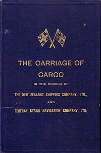
rif. 67990Shipping Companies. London. 1935. . May 1935 edition. 6 472 2 PP plus 30 folded capacity plans 13 Distance tables 14-20 Depths of water and tides 12 maps and XXIII Index. Text with b/w illustrations drawings and photos and colour illustrations 1 folded Capacity Plan 1 folded chart "Load Line 1932" and over 115 plans of Ports. Navy cloth covers with light shelf wear on corners gilt "Crossed Flags" on front cover gilt title on front cover and spine. Discreet stamp of The Tasmanian Maritime & Folk Museum with signature of previous owner on title page. Light foxing on first few pages and around a few page edges. Printed on superior paper and in near fine condition. Scarce. 25.2 x 16.3. Shipping Companies. London. 1935. hardcover
1911rif. 19610Toronto: Niagara Navigation Company. Very Good. 1911. First Edition. Softcover. Water damage in the gutter at the bottom which does not show on the wraps. This brochure is both advertising and a timetable. As-is. ; 8vo 8" - 9" tall; 32 pages . Niagara Navigation Company paperback
rif. 0364128054.Gpaperback. Good. Access codes and supplements are not guaranteed with used items. May be an ex-library book. paperback
rif. 0364897430.Ghardcover. Good. Access codes and supplements are not guaranteed with used items. May be an ex-library book. hardcover