3417 risultati
rif. AUB-1100
rif. 033101209X.Gpaperback. Good. Access codes and supplements are not guaranteed with used items. May be an ex-library book. paperback
1952Roy. 8vo., First Edition, with numerous plates and illustrations in the text, neat signature on front free endpaper, rear free endpaper creased but complete; cloth, gilt back, a very good, bright, clean copy in unclipped dustwrapper, the latter very lightly browned and chipped at head of backstrip. First edition of a maritime classic. Scarce in this condition.
rif. 1333797621.Gpaperback. Good. Access codes and supplements are not guaranteed with used items. May be an ex-library book. paperback
rif. 026671725X.Gpaperback. Good. Access codes and supplements are not guaranteed with used items. May be an ex-library book. paperback
rif. 1120119685.Gpaperback. Good. Access codes and supplements are not guaranteed with used items. May be an ex-library book. paperback
Santiago de Chile, Imprenta Nacional, 1879, in-8, brossura editoriale (più rifilata del resto delle pagine), pp. 163. Consunzioni marginali esterne e asportato l'angolo inferiore della copertina posteriore. Non presente in alcuna biblioteca italiana.
rif. 0243166591.Gpaperback. Good. Access codes and supplements are not guaranteed with used items. May be an ex-library book. paperback
1930pp. xi, 339 + Plus frontis and photographs. Map endpapers. 8vo. Original full blue cloth binding, decorated in blue. Original dust jacket, torn with loss. First Edition. "A narrative of gallant men and bold exploits in Antarctica" - Spence 579. **PRICE JUST REDUCED! POLAR 1
1992New New Turkish Original bdg. Dust wrapper. 4to. (33 x 23 cm). Edition in Turkish. 159, [1] p., color ills. Turkish Edition of the Ottoman nautical charts and the Atlas of Ali Macar Reis. 16th century Ottoman nautical charts figure significantly in the history of cartography. Dating from the time when the Ottoman Empire was approaching its zenith of wealth and power, these charts are a valuable source of information about the history of the period. The work of the Ottoman privateers who then held sway over most of the Mediterranean, these charts cover a geographical area far beyond the bounds of the Ottoman Empire. as rulers of an expanding empire, the Ottoman sultans took a close interest in mapmaking and may well have commissioned their sea captains to draw the charts. When Piri Reis presented his first world map to Sultan Selim I, conqueror of Egypt, in 1517, the sultan is said to have declared, "How small is the world for a conqueror.".
1832pp. 373, (2) + Folding map, and woodcut engravings. Foxed. Small 12 mo. 160mm. Original Harper's printed cloth binding (with the date 1834 on the front cover), stained and worn, with old spine repairs. Good. **PRICE JUST REDUCED! POLAR 1
2013New New Turkish Original bdg. Dust wraper. 4to. (29 x 25 cm). In Turkish. 304 p., b/w and color ills. Vapur donatanlari ve acenteleri tarihi.
1935Very Good Turkish Modern cloth. Demy 8vo. (21 x 14 cm). In Turkish. 40 p. Rare. First and Only Edition. Kasimpasa'nin tarihçesi. Binark & Sefercioglu 2.
1859406p. (20)[Publisher's catalogue] + Plus engraved portrait frontis. Slightly foxed. Early ownership stamp of Eliza McWilliams. 8vo. Original full brown cloth binding, embossed in blind. Gilt lettered spine. Usually found only in poor condition, this is quite a nice example. Includes biographies of: John Charles Fremont; Elisha Kent Kane; John Ledyard, Matthew C. Perry; Charles Wilkes; et. al. Covers explorations in: Africa; Arctic; Japan; New Zealand; North Pole; Peru; Siberia; South America; Tahiti; and the American West. Samuel Mosheim Schmucker or Smucker (1823-1863) was an American historical writer, Lutheran pastor, educator, and popular biographer. **PRICE JUST REDUCED! POLAR 1
1854131p. XLib stamp on title page. 8vo. Original full leather binding, gold lettered. Edges of boards ruled in gold. Front board detached. Spine worn. Hardbound. Scarce. **PRICE JUST REDUCED! NAVAL/2
rif. 1333622465.Gpaperback. Good. Access codes and supplements are not guaranteed with used items. May be an ex-library book. paperback
rif. 1334730172.Gpaperback. Good. Access codes and supplements are not guaranteed with used items. May be an ex-library book. paperback
rif. 1331898234.Gpaperback. Good. Access codes and supplements are not guaranteed with used items. May be an ex-library book. paperback
rif. 1528408136.Gpaperback. Good. Access codes and supplements are not guaranteed with used items. May be an ex-library book. paperback
1809115pp Fair/none Prima (unica?) edizione, copertina cartonata coeva consunta, con piatto anteriore staccato, mancante di sguardia (frontespizio come prima pagina), tracce di polvere ma internamente buono, a fogli ancora chiusi.
Huelva, Instituto de Estudios Onubenses, 1981. Dos volúmenes en 4to. mayor; 491 pp. y 418 pp. Ilustraciones. Cubiertas originales.
rif. 0259933163.Gpaperback. Good. Access codes and supplements are not guaranteed with used items. May be an ex-library book. paperback
rif. 0282691022.Gpaperback. Good. Access codes and supplements are not guaranteed with used items. May be an ex-library book. paperback
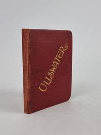
1903rif. 4159Derby United Kingdom: Bemrose and Sons Ltd. 1903. hardcover. Very Good. Various. Publication: Derby London and Watford Bemrose and Sons Ltd. 1903 Formatting: 24mo pp. 136. Condition Report: Very Good. The original publisher's maroon cloth binding remains remarkably tight square and structurally sound exhibiting minimal shelf-wear across the boards and exceptionally bright unoxidised gilt lettering to both the upper cover and spine. Internally the hinges are secure and the text block is firm with pages remaining clean crisp and largely free of foxing. Institutional provenance stamps present to the rear leaf and a notable closed tear along the fold of the rear supplementary map though the volume presents as an exceptionally attractive well-preserved surviving example overall. Catalogue Note: This second edition designated on the title page as the "Twenty-Fourth Thousand" represents a substantially revised and enlarged printing issued directly for the Ullswater Steam Navigation Company. Produced during the height of Edwardian Lake District tourism this pocket-sized guide was crafted to accompany travelers aboard the company's iconic steam yachts navigating England's second-largest lake. The volume is profusely illustrated with half-tone monochrome photographic plates highlighted by a dramatic frontispiece view capturing Ullswater from Gowbarrow Fell alongside three detailed folding maps and two folding panoramic vistas of the surrounding mountain ranges. Noteworthy institutional provenance is established by a neat circular blue ink stamp from the Lancaster Public Libraries and associated accession numbers on the rear leaf. Early twentieth-century ephemeral travel guides of this nature were routinely subjected to rigorous field use; consequently surviving examples that retain their fragile folding cartographic inserts in complete unrendered condition have become increasingly scarce on the open market. An evocative and indispensable companion to the dramatic landscapes of the Lake District this official guide invites readers to explore the majestic waters of Ullswater. Combining romantic topography celebrated through prefatory verse by Cumberland with practical navigation local history and sweeping panoramic vistas this charming pocket volume captures the timeless allure of England’s most celebrated fells. Bemrose and Sons, Ltd. hardcover