Commissioner of NavigationBiblio.com
3 414 résultats
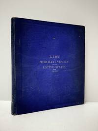
1898réf. 111111113294Government Printing Office 1898. Hardcover. Good. Government Printing Office; Washington 1898. Hardcover. A Good blue cloth binding with gilt lettering on front board and spine binding intact starting hinges handling/scuffing and some discoloration to boards bit frayed spine edges age toning to pages small abrasions to board corners rubbing along board edges sunned spine bit of scattered foxing to front and back matters mild musty odor without Dust wrapper. A good copy. 8vooctavo or approx. 6 x 9 inches 405pp. We pack securely and ship daily with delivery confirmation on every book. The picture on the listing page is of the actual book for sale. Additional Scans are available for any item please inquire. Government Printing Office hardcover
1878réf. z015709Marseille: Nouvelle Compagnie Marseillaise de Navigation A Vapeur 1878. Good. 2p. brochure of sailing schedule and rates measures 5.5 by 8 inches French language. With letter of conveyance on company letterhead addressed to James M. Lincoln of the Pacific Mail Steamship Co. 1878. Good. Tape and paper repair to brochure spine perforation along spine. Burn stain to corner of letter else both remain clean and unmarked. Nouvelle Compagnie Marseillaise de Navigation A Vapeur unknown
1911réf. 18041Portland Oregon: Oregon-Washington Railroad & Navigation Co. & Southern Pacific Lines. Good. 1911. First Edition. Softcover. Covers are soiled lightly worn. Some spots & staining inside. ; 12mo 7" - 7½" tall; 64 pages . Oregon-Washington Railroad & Navigation Co. & Southern Pacific Lines paperback
1937réf. 31172Imray Laurie Norie & Wilson 1937. 4to. First Edition with frontispiece and plates; blue cloth gilt back a very good bright clean copy. This copy was formerly in the library of The Cruising Association and bears its bookplate on front paste-down and neat blind stamp on title. Traces the history of the firm of Imray and irs successors from 1670 to 1937. VERY SCARCE. Imray Laurie Norie & Wilson, hardcover
réf. 1396837647.Ghardcover. Good. Access codes and supplements are not guaranteed with used items. May be an ex-library book. hardcover
2 Vols., 4to, 350; 322pp., numerous coloured illustrs., throughout, orig. pictorial cloth, 552 lots.
réf. 0266986730.Ghardcover. Good. Access codes and supplements are not guaranteed with used items. May be an ex-library book. hardcover
réf. 0666952779.Ghardcover. Good. Access codes and supplements are not guaranteed with used items. May be an ex-library book. hardcover
1935Very Good Turkish Modern cloth bdg. Roy. 8vo. (24 x 17 cm). In Turkish. 50, [2] p., 9 unnumbered folded maps. Türk süel alaninda harita ve krokilere verilen deger ve Ali Macar Reis atlasi. First Edition. Extremely rare.
2011Fine Fine English Original binding. Dust wrapper. Oblong 4to. (24 x 31 cm). In English and Turkish. Color and b/w ills. 151, [i], p. Historical diving equipment. Jeff Hakko Collection.= Tarihi dalgiç malzemeleri. Jeff Hakko Koleksiyonu. COLLECTION Scuba Diving Sports Diver Navigation.
1992Fine Fine English Original bdg. Dust wrapper. Folio. (33 x 23 cm). In English. 159, [1] p., color ills. Ottoman nautical charts and the Atlas of Ali Macar Reis. 16th century Ottoman nautical charts figure significantly in the history of cartography. Dating from the time when the Ottoman Empire was approaching its zenith of wealth and power, these charts are a valuable source of information about the history of the period. The work of the Ottoman privateers who then held sway over most of the Mediterranean, these charts cover a geographical area far beyond the bounds of the Ottoman Empire. as rulers of an expanding empire, the Ottoman sultans took a close interest in mapmaking and may well have commissioned their sea captains to draw the charts. When Piri Reis presented his first world map to Sultan Selim I, conqueror of Egypt, in 1517, the sultan is said to have declared, "How small is the world for a conqueror.". A very heavy volume.
2019New Turkish Original bdg. HC. 4to. (29 x 24 cm). In Turkish. 173 p., fully color ills., 1 folded map in end-pocket. Yeryüzü suretleri: M. Sinan Genim Koleksiyonundan. [Antique Maps of Istanbul Exhibition catalogue]. 12-27 Nisan 2019. Curated by Erkan Doganay. Ancient Istanbul / Constantinople maps from the Collection of M. Sinan Genim. Includes 78 items such as rare plans, maps, panoramic photographs, engravings of Istanbul and districts from the 15th century to 19th century. Mostly they are printed in Europe, but also in the Ottoman Empire as well. Folded map in end-pocket is "Carte de la Mer de Marmara du Canal des Dardanelles et de celui de Constantinople" par Kauffer. Size: 45 x 86 cm.
réf. 0666027900.Ghardcover. Good. Access codes and supplements are not guaranteed with used items. May be an ex-library book. hardcover
réf. 033209460X.Ghardcover. Good. Access codes and supplements are not guaranteed with used items. May be an ex-library book. hardcover
réf. 026085431X.Ghardcover. Good. Access codes and supplements are not guaranteed with used items. May be an ex-library book. hardcover
réf. 25281A Paris, Au bureau de l'administration du Journal des Notaires et des Avocats - 1843 - In-4 - 1/2 Reliure - Tables Analytique & Méthodique 444pages - Table Chronologique, An X, XI & XII & Notes Années 1813, 1814, 1816, 1817, 1820, 1821, 1823, 1825, 1826, 1827, 1828, 1829, puis 1830 à 1840, 287 & 71 pages - - reliure usagée, Intérieur Très frais
réf. 25282A Paris, Au bureau de l'administration du Journal des Notaires et des Avocats - 1861 - In-4 - 1/2 Reliure (coiffe de tête usagée) - 649 pages - Intérieur Très frais
A Paris, Au bureau de l'administration du Journal des Notaires et des Avocats - 1861 - In-4 - 1/2 Reliure (coiffe de tête usagée) - 649 pages - Intérieur Très frais
A Paris, Au bureau de l'administration du Journal des Notaires et des Avocats - 1843 - In-4 - 1/2 Reliure - Tables Analytique & Méthodique 444pages - Table Chronologique, An X, XI & XII & Notes Années 1813, 1814, 1816, 1817, 1820, 1821, 1823, 1825, 1826, 1827, 1828, 1829, puis 1830 à 1840, 287 & 71 pages - - reliure usagée, Intérieur Très frais
1973réf. B117309Brussel, Paleis der Academiën 1973 xli + 505pp. + 1 grote uitvouwbare tabel (in fine), 26cm., in de reeks "Verhandelingen van de Koninklijke Academie voor Wetenschappen, Letteren en Schone Kunsten van België. Klasse der Letteren" nr.72 (Jg.35, 1973), fraai ingebonden in solide gecart. band, roodlinnen rug met titel in goudopdruk, ex-libris op blanco schutblad, tekst is helder, goede staat, [with an English summary], gewicht: 1.4 kg., B117309
1938réf. 22311Belley, Société Nationale des Entreprises de Presse, imprimerie du Bugey, 1953 ; in-16 (228 mm), broché ; 227, [5] pp., couverture bleue.
réf. 49184Epa 2001 in 4 (32x24,5) 1 reliure cartonnée illustrée de l'éditeur, jaquette illustrée en couleurs, 144 pages, avec de nombreuses illustrations et en encart, les gabarits des six voilier, dépliants volants, au format des maquettes. Le Pen Duick, célèbre voilier d'Éric Tabarly ; le Kurun, sloop à corne ; La Perle, bisquine de Cancale ; le Marie-Fernand, cotre-pilote du Havre ; le Saint Domingo, canot douarneniste. Très bel exemplaire ( Photographies sur demande / We can send pictures of this book on simple request )
réf. 607350Oxford, BAR International Series 1181, 2003. In-4 carré collé, XI-199 pp., très nb. fig., cartes, tableaux, graphiques etc en n/b. in-t., texte en anglais sur 2 colonnes, bibliographie.
Madrid, 1994. Folio; XIV-306 pp. Mapas y láminas fuera de texto. Cubiertas originales.
1912réf. 28787Vancouver Development Company EDITEUR ( Impr. Draeger Fr. Paris) 1912 une plaquette, brochée à cordonnet de soie beige in-douze à l'italienne éditeur (22,3 x 17,6 cm) (paperback in-12 oblong editor), dos muet, couverture marron gauffrée vert avec titre imprimé en noir, page de titre ainsi que toutes les pages sont imprimées en noir dans un encadrement en marron, orné d'une carte hors-texte en marron et noir indiquant "les Lignes Maritimes partant du port de Vancouver à travers le Monde" + une photographie hors-texte en noir du Port de Vancouver + une photographie hors-texte en noir de la Gare terminus du Canadian Pacific Railway + une photographie double page hors-texte en noir : "Vue panoramique de Vancouver et de son port" + une photographie hors-texte en noir des Nouveaux Quartiers (de Vancouver) + une photographie hors-texte en noir : " Vue du Parc (de Vancouver)" + une photographie hors-texte en noir; "Le Quartier des Affaires (de Vancouver)" + une photographie hors-texte "PLANCHE DEPLIANTE" en noir (de 75 cm de large une fois dépliée) : "Vue panoramique de Vancouver en 1912", fines rousseurs sur les gardes, sinon bel exemplaire, 16 pages, 1912 Vancouver Development Company EDITEUR ( Impr. Draeger Fr. Paris).