Reesor, E.B.B.; Thomson, NorahMareMagnum

3 480 résultats
1912128 pages. Index. Printed on glossy stock. Contains dozens of magnificent archival black and white photographic plates. Published to promote Owen Sound on the occasion of its becoming a city in 1912. A wonderful snapshot of city life as it was 100 years ago. If only other communities had compiled references of similar high quality for themslves. Contents include: Collage of Mayoral portraits; A brief history; the Board of Trade; Local Banks; City Council; Insurance and Real Estate personalities; Local industries - including photo of the local creamery surrounded by a line of cream-carrying horses and wagons - looks just like the drive-through lineup around a modern-day Tim Hortons!; Photos of local products including lovely furniture, matches, hardware, iron products (stove, furnace, pump, etc.), carts, condiments, butter, baskets, candy, flour, knit goods, blankets and tweeds, and an electric trolley car; harbour/navigation activities; the Sydenham Club; Legal officials; the Hospital; Churches and their leaders; Schools and representative students; Many lovely homes and gardens; local natural scenes of note and beauty; King's Royal Hotel; Farms and Farmers - including a super photo of a local barn raising bee; Local crops - with considerable textual detail; Special local pets, including dogs, cats, cows, horses, chickens and sheep!; Boy Scouts; Lacrosse - great photo collage plus a full page of informative text; Local sports; and much more written information. The final thirteen pages consist of wonderful local advertisements, our favourite being the handsome full-page photo-illustrated ad for the Northern Navigation Company, Limited. Unmarked. Somewhat above-average wear to blue card covers attractively detailed in gilt. Textblock separated from covers. Page 133 loose but present. Pages 131-132 missing. This is perhaps the finest pictorial local history we have had the pleasure to offer. Book
réf. BN635056ATPL Radio Navigation CBT CD-ROM Sep 20 2011 ATPL Radio Navigation CBT CD-ROM Sep 20 2011 ATPL Radio Navigation CBT CD-ROM Sep 20 2011 unknown
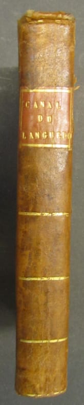
1805réf. 825871805 Paris, chez Deterville, de l'Imprimerie de Crapelet, An XIII-1805, in 8° relié demi-basane fauve de l'époque, dos lisse orné de filets gras dorés, étiquette rouge, VIII-399 pages ; petits défauts et frottis d'usage.
1912Features: The Present Railway Situation in the United States; B.F. Bush becomes president of the Denver & Rio Grand (with photo of Bush); Railway Mileage in 1911; Interstate Commerce Commission Decisions; Coast Shipbuilding Companies Rushed With Work - feature article with photo of submarine F.3 immediately after launching, apparently at the Seattle Construction & Drydock Co.; Representative of the Royal Mail Steam Packet Line inspects the northwest for business opportunities which will open with the Panama Canal; Economy of the [Seattle] Municipal Plan (part 3); Free Ships and Revised Navigation Laws - discussion of the rehabilitation of the merchant marine; Free [Panama Canal] Tolls To American Ships Would Solve Problem; What Is The Merchant's Exchange of Seattle? - an explanatory article by R.C. Hill, whose photo accompanies the article; Seattle People Honor Captain "Buck" Bailey; Port Commission Plan for Grays Harbor; Review of Marine Insurance and Shipping Law; Bogue Plans for Tacoma Harbor Are Extensive - article with map; Tacoma Will Be Ready When Panama Canal Opened - brief article includes nice birdseye view illustration of the harbor and environs showing present developments and developments under way; and more. 44 pages including several pages of nostalgic ads, some illustrated in black and white, featuring local marine and rail interests. Printed upon glossy coated stock. Average wear. Binding intact. Few library markings to front cover. A well-preserved copy of this highly-informative memento of Pacific Northwest transportation over a century ago. 12" x 9". Magazine
1912Features: B.F. Bush on Evil Results to Accrue from Diversion of Capital from Railway Enterprises; Japanese Trainmaster kills self after Emperor is delayed; Tell the Truth, Mr. (Gifford) Pinchot! - fallout from a December 16th article about Alaska; Charles F. Speare discusses the alliance between the Northern Pacific and the Chicago & Northwestern Railroads; Southern Pacific and Pacific Mail (article from the Wall Street Journal); Cash Shortage in Western Canada; Captain N.E. Cousins has been in the employ of the Pacific Coast Steamship Lines Co. since 1878 - article with photo; Get Ready for the Opening of the Panama Canal; Economy of the [Seattle] Municipal Plan (part 2) - major article with map; Cunard and Anchor Lines Amalgamate - article with list of the vessels, and their tonnage, of each company; Protest the Carriage of Navy Coal in Foreign Bottoms - George F. Thorndyke of the Globe Navigation Company speaks out; Edvard Jansen to take over from Ida Wilson Lewis, "The Grace Darling of America", tending the Lime Rock light station; Review of Marine Insurance and Shipping Law; Illustration of the central winch on Dredge New Orleans; Portland News Notes; Schedule for Canadian-Pacific Railways Steamships connecting Seattle with Victoria and Vancouver; and more. 44 pages including several pages of nostalgic ads, some illustrated in black and white, featuring local marine and rail interests. Printed upon glossy coated stock. Average wear. Binding intact. Few library markings to front cover. A well-preserved copy of this highly-informative memento of Pacific Northwest transportation over a century ago. 12" x 9". Magazine
1912Features: Northern Pacific Railway Co. Making Big Improvements in the State of Washington; Julius Kruttschnitt an Optimist; Mobilization and the Railways - article from the Army & Navy Journal; Amending Our Shipping Laws; George G. Gould Retains His Position; Railway News in Brief; Noted Engineer E.C. Hawkins - Obituary with photo; Interstate Commerce Decisions; San Francisco Will Be Ready for the Panama Canal and the Panama Pacific International Exposition in 1915 - article with photos of "San Francisco's Two Big Men", James Rolph Jr., Mayor, and C.C. Moore; Statutory Regulation of Ocean Traffic; Pacific Coast S.S. Co. Places Order for 10,000-Ton Steamer - article with diagram of outboard profile of the vessel; Comprehensive Review of Far Eastern Shipping Situation by U.S. Consul General at Hong Kong, George E. Anderson; Astoria Getting Ready for Panama Canal; Panama Canal Rates - The Big Issue; Captain John Truebridge - Obituary; Review of Marine Insurance and Shipping Law; Some Perils of the Deck Load - Feature article includes photo of a leaning steamer Cuzco; The Advantages of the Water-Tube Boiler; Record of a Ballin Water Tube Boiler - article with photo; The International Navigation Congress; Boiler Inspection for [Panama] Canal Zone; General Shipping News; Oil Engined Barges to Revolutionize Shipping; and much more. 40 pages including several pages of nostalgic ads, some illustrated in black and white, featuring local marine and rail interests. Printed upon glossy coated stock. Average wear. Binding intact. Few library markings to front cover. A well-preserved copy of this highly-informative memento of Pacific Northwest transportation over a century ago. 12" x 9". Magazine
BRUXELLES, Association internationale du congrès de Navigation, 1905 - Complet en 3 Volumes - Format à l'Italienne 26 x 34,5 - T. I) broché, T. II & III) cartonnés. Riche iconographie de 7 cartes, 277 illustrations sur 74 planches et 150 figures en couleurs sur 100 planches. Couvertures illustrées - Bandeaux, Culs-de-lampe & lettrines - Texte sur 2 colonnes, entourés d'un double écoinçon; T. I : - Bandeaux, Culs-de-lampe & lettrines en Sépia, 111 pages & 7cartes hors-texte couleurs. T. II - 74 planches représentant 277 gravures T. III - 100 planches représentant 150 chromolithographies. Splendide ensemble sur le développement de la navigation de l'antiquité à la fin du 19ème siècle concentré particulièrement sur le développement des navires de cargaison à faible tirant d'eau des Pays Bas.
réf. DADAX0471445371New unknown
réf. DADAX0470402288New unknown
réf. 18547Paris, P. Duménil éditeur [imp. Firmin Didot frères], s.d. 12 vol. in-8, demi-veau vert, dos lisse orné de caissons dorés et de fleurons à froid, tranches mouchetées (dos éclaircis, épidermures, quelques petites taches, rousseurs).
1874réf. 55786BBPrag, Heinrich Mercy Verlag, 1874. 4°. 29 cm. 400 Seiten. Illustrierter Original-Leinenband mit goldgeprägter Deckelillustration und goldgeprägtem Rückentitel.
1949réf. 2082402113503178Not Available 1949. Soft Cover. Fine. Number of books: 14 Not Available paperback
2017New English Original bdg. HC. Oblong large folio. (31 x 45 cm). In English and Turkish. [198] p., color maps, 4 maps in end-pocket. Istanbul PTT Museum Collections map catalog.= Istanbul PTT Müzesi Koleksiyonlari harita katalogu. Prep. by Kenan Bozgeyik, Selahattin Ekinci, Makbule Akyol. 3000 copies were printed. Contents: Catalogue of maps, sketchs and graphics.; Maps: Ottoman era: Turkish (Old script), Foreign languuage.; Turkish Republic era: Postal maps, road maps, maps of medical department, maps of civilian administration.; Plans and schemas.; Statistical maps.; Graphics.; Military maps: Anatolia, Rumelia, Outside of Turkey.; Additional.; Today PTT [Turkish Post Office].
1926Very Good German Paperback. Small 4to. (26 x 18 cm). In German. [xLviii], 88 p., 4 numerous b/w plates (Tafeln). Piri Re'îs [sic. Pirî Reis] Bahrîje. Das türkische Segelhandbuch für das Mittellandische Meer vom Jahre 1521. Band II: Übersetzung. 1. Lieferung, Kapitel 1-28. First Edition.
Second edition, 8vo (195 x 125 mm), viii, 525, [3]pp., with a final contents leaf, lacks front fly-leaf, margins of title page browned, folding engraved plate, numerous illustrations in the text, contemporary calf, slightly rubbed. Provenance: Cont. signature of Sir John Kalkett at head of title page, the armorial bookplate of Pitfirrane Castle; University of Keele, Turner Collection label on front paste-down. Wallis, 730PAT30/39.
réf. DADAX1138297623New unknown
réf. 44433Paris, Imprimerie Nationale 1874-1876, 270x170mm, VI- 656 + 650pages, reliure demi-chagrin. Dos à nerfs, titre doré, quelques rousseurs. Bon état.
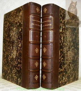
réf. 138591aafParis, Librairie Hachette, 1885, in-4°, XII (dont le portrait gravé de l'auteur et le titre en rouge et noir) + 481 p. / VI (dont le portrait gravé d'Oscar II et le titre en rouge et noir) + 478 p., très abondamment illustré de vignettes, de planches et de cartes, papier très frais, avec signet, Ex libris Peter E. Obergfell, doublures et gardes en beau papier marbré solides et élégantes reliures en demi-chagrin rouge aux coins, dos à cinq nerfs doré, pièce de titre et de tomaison vert, bas du dos avec Paris 1885 R. T. Bel ensemble, très bon exemplaire.
réf. 127378aafParis, Arthus Bertrand, Librairie maritime et scientifique, s.d. (1873), gr. in-8°, 164 p. avec 1 planche (sur papier mince) ‘Rose des vents’ (en partie déchirée, mais complète) + 14 planches dépliantes (croquis et cartes), pte. découpe en-tête du titre (un nom coupé), solide reliure artisanale en demi-maroquin brun foncé, dos à quatre nerfs sobrement décoré, monogramme doré ‘A.H.’.
1719réf. 59230Washington D.C.: Government Printing Office Hydrographic Office U.S. Navy 1917; 1930. Two vols. 8vo. ix 1 4 364 pp.; 19 mimeograph leaves. With 2 large folding colour map. First vol. in black publisher’s buckram silver lettering stamped on front cover & spine minor shelfwear slight interior toning shelfwear 2nd vol. mimeographed typescript & stapled at gutter margin minor dustsoiling edgewear predation to lower fore-edge tear to last leaf of blank lower portion still a VG set. First editions of these coast pilot guides to Arctic waters during and after World War I issued about the time of the Russian Revolution and offered key navigational guides for Naval forces during the ill-fated White Russia Revolution and over 13000 troops in the Polar Bear Expedition. Prior to modern GPS systems and satellite navigation these regularly updated and revised navigation handbooks provided key sailing instructions often drawing not only from Russian & British sources but also sailing reports from U.S. Navy vessels and those from merchant ships. The two maps serve as indexes to sailing charts to be ordered from the Hydrographic Office and keyed to sailing instructions within the coast pilots. The supplement is uncommon no copies located in Worldcat. Government Printing Office, Hydrographic Office, U.S. Navy, hardcover
1920réf. 59237Washington D.C.: Government Printing Office Hydrographic Office U.S. Navy 1920-1940. Five vols. 8vo. vi 638; v 1 287 1; 8 390 pp.; 1; 2 17 1 leaves. With 5 large folding colour maps numerous plates showing elevations. Three volumes uniformly bound in blue publisher’s buckram gilt lettering front cover & spine darkening to spines fore-edges minor shelfwear dustsoiling slightly shaken Supplements in self-printed softcovers edgewear toning to fore-edges minor chipping still VG- set. Third editions revised & updated of vols. I & II second edition of vol. II and 1st editions of both scarce Supplements of these coast pilot guides to British Columbia including lower Alaska and upper Washington in the years between the World Wars. Prior to modern GPS systems and satellite navigation these regularly updated and revised navigation handbooks provided key sailing instructions often drawing not only from Brazilian Argentine and British coast pilots as well as sailing reports from U.S. Navy vessels and those from merchant ships. The first large map delineates the requisite coast pilots for sailing in B.C. waters and charts to be ordered from the Hydrographic Office while the second maps depict the sailing routes to Asia the Soviet Union and the Arctic across the Pacific. Both editions of Vol. II are offered here with the expanded 3rd edition featuring nearly double the material and extra map of the 2nd. Government Printing Office, Hydrographic Office, U.S. Navy, paperback
1927réf. 59236Washington D.C.: Government Printing Office Hydrographic Office U.S. Navy 1927-1930. Three vols. 8vo. x 4 550; viii 4 560 pp.; 1 17 2 leaves. With 4 large folding colour maps 1 w/ toning at fore-edge from being improperly folded some edgewear numerous plates showing lighthouses. Two volumes uniformly bound in red publisher’s cloth gilt lettering front cover & spine darkening to spine fore-edges minor shelfwear dustsoiling minor paint drip at fore-edge 1 vol. Supplement in self-printed softcovers edgewear toning to fore-edges minor predation still VG- set. Third editions revised & updated of vols. I & II first edition of scarce Supplement of these coast pilot guides to South America and Antarctica in the 1920’s. Prior to modern GPS systems and satellite navigation these regularly updated and revised navigation handbooks provided key sailing instructions often drawing not only from Brazilian Argentine and British coast pilots as well as sailing reports from U.S. Navy vessels and those from merchant ships. The first large map delineates the requisite coast pilots for sailing in American waters and charts to be ordered from the Hydrographic Office while the second maps depict the sailing routes. The expanded 3rd edition is quite scarce with 1 copy located of both vols. in Worldcat NYPL. Government Printing Office, Hydrographic Office, U.S. Navy, paperback
réf. DADAX4431544747Springer 2014-03-27. 2014. hardcover. New. 6.14x0.88x9.21. Buy with confidence. Excellent Customer Service & Return policy. Springer hardcover
2010New English Original cloth bdg. In publisher's special slip-case. Oblong large 4to. (33 x 34 cm). 264 p., ills. Hidden cultural treasures of Islamic civilization come to light. A book from a qualified name Prof. Fuat Sezgin. Islamic civilization is a journey full of hidden scientific history. Modern man knows the Arab-Islamic culture around the true meaning of universal history of science very little. Islamic civilization is a valuable work which has been collected from the German five-volume "Wissenchaft und Technik im Islam" s translation and describes astronomy, geography and maritime studies. Prof. Fuat Sezgin's a reflection of the long years of research and studies. This book is a real source of reference that will be to keep in the library's most special point.
1908réf. 18754Helsingfors, Hufvudstadsbladet, 1908. 53 p. with numerous photographical and schematic illustrations, 2 foldable maps. 4° (24 x 32 cm), original wrappers with decorative illustration on front cover. The boards especially on the back slightly defective.