ORIGINAL PHOTOGRAPH.MareMagnum
Livre Rare Book

Librairie Le Carrérès · Paris, Frankreich180,00 €
3.417 Ergebnisse
1937Very Good Turkish Original albumen print mounted on cardboard. 21x48 cm. Handwritten Turkish note at the lower on empty section. Dated July 19, 1937. Slight fading on board. The photo is in very good condition. It was very significant both politically and militarily showing a Turkish war fleet visiting the British navy in Valletta, the capital of Malta, in 1937. The commander of the fleet was Admiral Sükrü Okan (1880-1957). The Turkish fleet consisted of the cruisers and destroyers named Yavuz Selim, Adatepe, Tinaztepe, Kocatepe, and Zafer, as well as four submarines and the submarine mothership Erkin. This very scarce photograph shows the Turkish fleet with the English fleet in the Valletta port on July 19, 1937.
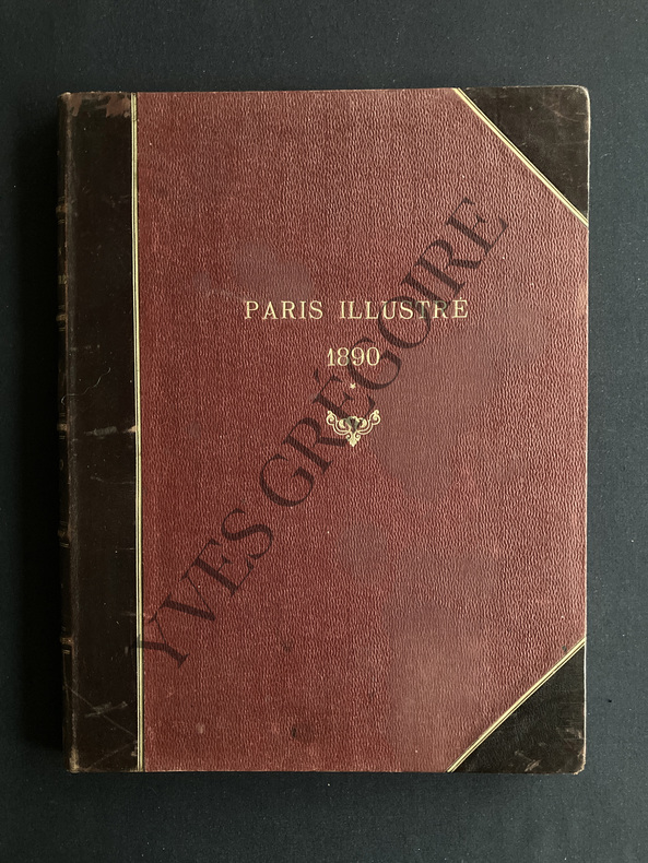
Best.-Nr. ABE-1270472158DU 4 JANVIER AU 29 MARS 1890 (N°105 A 117)-RELIURE EDITEUR CUIR A COINS-5 NERFS-TITRE DORE SUR LE DOS ET LE PREMIER PLAT-LEGERES ROUSSEURS SUR CERTAINES PAGES-BEL ENSEMBLE (ETACA)
1898Best.-Nr. 10577Paris, Bardey, 1898 ; in-8, broché ; 183 pp., 12 très grandes planches dépliantes.
1853Best.-Nr. 17111853 Imp. Jean-Matthieu Douladoure, Toulouse, 1853. In-8 broché. (viii), 216 pages. Frontispice gravé(portrait de Riquet), planche du monument à Riquet, 2 cartes dépliantes
Best.-Nr. 9480P., Imprimerie nationale, 1791. 60 pp.
Best.-Nr. 214201Paris, Hachette, 1874 gr. in-8, IV-360 pp., illustrations in-t., une carte dépliante, demi-chagrin vert, dos à nerfs orné, tranches dorées (reliure de l'époque).
1871Best.-Nr. 10753Paris, Imprimerie Monrocq, mai 1871 ; 2 tomes in-folio, dos percaline et plats cartonnés gris ; 78 pp. ; 2 profils dépliants en couleurs : de Paris au kilomètre 147 et du kilomètre 147 à Rouen, ensemble lithographié, y compris le texte manuscrit.
Best.-Nr. 224802Paris, Retaux-Bray, 1889 in-8, XII-433 pp., carte sur double page, demi-chagrin rouge, dos à nerfs orné (rel. de l'époque).
Best.-Nr. 196728Paris, Guillaumin, 1893 gr. in-8, XXIII-469 pp., demi-chagrin brun, dos à nerfs orné (rel. de l'époque). Bon exemplaire.
1906Best.-Nr. 29885Paris, Vuibert & Nony, 1906. Kl. 2°. Title printed in red and black, 392 illustrations, 498 p., half calf binding with gilt spine and edges. - French text. Very good and clean condition.
New York, Printed for the Author, by A. Cunningham, Stereotyper, 1872. 4to.mayor; XVIII-206 pp. Con 32 ilustraciones entre el texto, más 257 páginas de Tablas, y una excelente lámina aparte con el retrato del Capitán Thoms, litografiada por J. Cameron. Encuadernación en piel marbreada, de la época, ligeramente fatigada. Planos desencajados de lomera.
Best.-Nr. BN168889Audio Navigation und Telematik für Kraftfahrzeuge Audio Navigation und Telematik für Kraftfahrzeuge Audio Navigation und Telematik für Kraftfahrzeuge unknown
Best.-Nr. BN375463General Navigation - Air Transport Pilot´s Licence JAR-FCL Unknown Binding Unknown Binding General Navigation - Air Transport Pilot´s Licence JAR-FCL Unknown Binding Unknown Binding General Navigation - Air Transport Pilot´s Licence JAR-FCL Unknown Binding Unknown Binding unknown
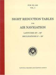
Best.-Nr. BN604932PUB 249 Sight Reduction Tables for Air Navigation Volume 3: Latitudes 39° to 89° Declinations 0° to 29° Spiral-bound Jan 01 1878 PUB 249 Sight Reduction Tables for Air Navigation Volume 3: Latitudes 39° to 89° Declinations 0° to 29° Spiral-bound Jan 01 1878 PUB 249 Sight Reduction Tables for Air Navigation Volume 3: Latitudes 39° to 89° Declinations 0° to 29° Spiral-bound Jan 01 1878 unknown
2007Best.-Nr. BN499264Mariusz Adamski 2007. 2007. siegnac nieba. / reaching for the sky. siegnac nieba. / reaching for the sky. Polska Agencja Zeglugi Powietrznej. Polish Air Navigation Services Agency Herausgeber Editor Photos Mariusz Admaski Mariusz Adamski unknown
Best.-Nr. BN324090Segeln Schnelle Hilfe an Bord: Manöver · Navigation · Technik · Sicherheit Schwarzmeier Thomas Segeln Schnelle Hilfe an Bord: Manöver · Navigation · Technik · Sicherheit Schwarzmeier Thomas Segeln Schnelle Hilfe an Bord: Manöver · Navigation · Technik · Sicherheit Schwarzmeier Thomas unknown
1927Best.-Nr. 59226Washington D.C.: Government Printing Office Hydrographic Office U.S. Navy 1927-1928. Two vols. 8vo. 8 viii 424; 6 v 1 446 pp. With 4 large folding colour maps 1 double-sided elevation maps showing harbor entrances numerous photo plates. Beige publisher’s cloth black lettering front cover & spine darkening to spine fore-edges minor shelfwear dustsoiling still VG set. Third & Seventh editions revised & updated of these coast pilot guides to Central America and Mexico in the 1920’s. Prior to modern GPS systems and satellite navigation these regularly updated and revised navigation handbooks provided key sailing instructions often drawing not only from Mexican and West Indies sources but also governmental publications in the Panama Canal sailing reports from U.S. Navy vessels and those from merchant ships. The first large map delineates not only the requisite coast pilots for sailing in American waters but also the charts to be ordered from the Hydrographic Office. Government Printing Office, Hydrographic Office, U.S. Navy, hardcover
1940Best.-Nr. Bing89SM025United states government printing office 1940. pamphlet. good. Prompt shipment with tracking. we ship in CLEAN SECURE NEW boxes 8vo acceptable pamphlet pages 276 book in acceptabl;e condition and prompted for shipping. Cover worn along tips and edges. Pages browning along for edges. United states government printing office unknown
1888Best.-Nr. 0009730New York 1888. First edition. Map. Fine. 15 x 11 inches / 36 x 26 cm 3 folds matted glazed and framed. Very Scarcce This map was removed from an Annual Report. The black-and-white map shows the boundaries of Illinois in outline presenting the Illinois River improved passage from Chicago to Grafton where it pours into the Mississippi River. It also shows the Rock River traversing to the Quad Cities. Toward the east is the Illinois & Michigan Canal the DesPlaines River the Little Calumet River and the Little Kankakee River and Calumet Harbor. The map is attributed to Thomas H. Handburg. The University of Illinois-Urbana has a photocopy of it from the photocopy in the National Archives. I have not identified to which Annual Report this belonged Nor can I find another map attribued to Thomas H. Handburg. unknown
Best.-Nr. 118852sd Sans mention d'édition / Héliogravure Maurice Lescuyer, 16 Rue des Remparts-d'Ainay, Lyon / Visa N° 69. Section des Informations Maritimes. Secrétariat d'Etat à la Marine - Sans date (Approx. 1950) - Grand in-4, broché avec décor sur la première de couverture - 50 pages - Illustrations et reproductions photographiques en N&B in et hors texte (2 grandes illustrations de Jacques Touchet en couleurs hors texte) - Exemplaire numéroté N° 400 / 500
1807Best.-Nr. 55849Philadelphia: Published by B.B. Hopkins and Co. and sold by W.P. Farrand No. 170 Printed by T. & G. Palmer 1807. 8vo. xxiii 1 270; 271-275 1 40 16 15-16 17-220 4 pp. including binders instructions and publisher’s advertisement. With 7 copper-engraved plates & maps 6 engraved by Benjamin Tanner. Contemporary polished brown calf red & gilt morocco spine label chipping to head of spine minor edgewear occasional interior foxing & toning still a VG- copy from the library of John L. Gow 1797-1866 noted Pennsylvania attorney w/ ownership label and markings on front pastedown. First American edition of this classic navigation handbook which was first published in 1804 and here contained substantial corrections to the tables of the latitudes and longitudes of places on the American coast and in the West Indies as well as an improved system of finding the longitude by P. Delamar of Philadelphia. Mackay 1760-1809 was noted Scottish mathematician and astronomer taught navigation and instructed in methods of how to find longitude. Shoemaker 12965. Published by B.B. Hopkins and Co., and sold by W.P. Farrand, No. 170, Printed by T. & G. Palmer, unknown
1945Best.-Nr. 39135Chatham: Shepherd Printing n. d. ca 1945. 1945. CANADA. 18" x 24" sheet one side opens to a half-sheet color map and numerous advertisements for lodging including the Joe Gawa Hotel one of Ontario's newest and finest hotels. The other side has 12 panels of promotional text regarding the various cruise packages of the beautiful Muskoka Lakes time tables and schedules and views of the inland waterways steamships R. M. S. Sagamo and the R. M. S. Cherokee. Some minor to light wear to the folds else a very good copy. Shepherd Printing, n. d. (ca 1945). unknown
1930Best.-Nr. 822DGca. 1930. Farbiges Aquarell. 18 x 10 cm.