Marine Navigation - Hobbs, Richard RBiblio.com

3 417 résultats
1990réf. BN151395U S Naval Inst Pr 1990. 1990. Marine Navigation: Piloting and Celestial and Electronic Nagivation Marine Navigation: Piloting and Celestial and Electronic Nagivation Marine Navigation - Hobbs Richard R. U S Naval Inst Pr unknown
réf. M16949Couverture souple P , Imprimerie nationale , 1958 , 2 vols grand in 8 brochés , 601 pp - 157 planches souvent dépliantes. Couvertures défraichies , intérieurs très frais . Langue: Français
1963réf. 1236061963 Editions non-renseignées - 1963 - In-8 broché - 267 pages - Illustrations et dépliantes en N&B et en couleurs dans l'ouvrage
réf. 562499P., Editions maritimes et coloniales, 1956. Petit in-8 broché, 241 pp. + index. Deuxième édition revue et corrigée.
réf. c3743Paris, 1902 ; in-4°, demi- cuir de Russie bleu, plats de toile granitée bleue, titre doré au 1er plat, dos lisse orné de jeux de filets dorés, titre et année dorés; 312pp. + VIII pp. d'annonces par numéro. Illustrations photographiques et figures ou dessins dans le texte.Reliure frottée avec épidermures, rares piqûres.
réf. cROU-1980Paris, Journaux Officiles, 1975 ; in-8°, broché, couverture vert d'eau imprimée en noir ; (2), 119pp.Illustré des signaux de navigation en couleurs.
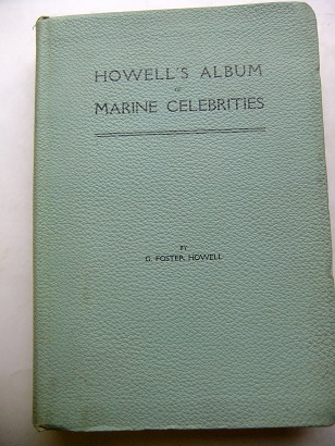
1906réf. 128380New York. Published by "The American Shipbuilder" 1906. 177 pages (plates). With more than 200 illustrations (Portraits). Original cloth binding. (A little used). 23x16 cm
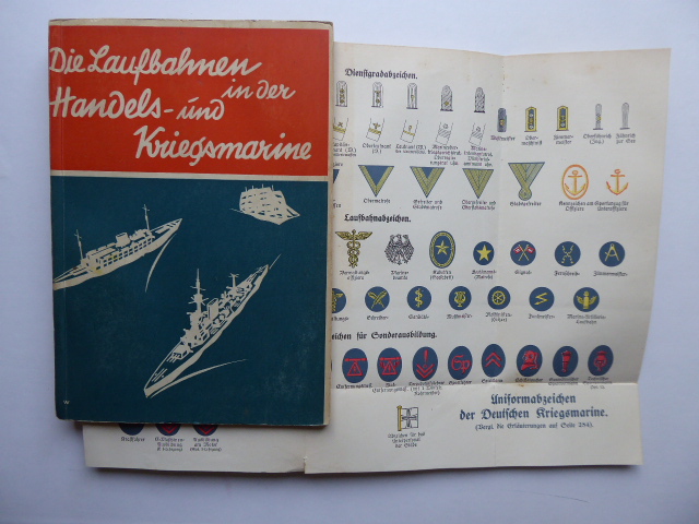
1930réf. 146318Druck und Verlag von Wilhelm Köhler, Minden (1930). 195, (1) Seiten u. eine mehrfach gefaltete Tafel mit Abbildungen von Dienstgradabzeichen, Laufbahnabzeichen und Abzeiche für Sonderausbildung. Dekorativ farbig illustrierte Originalbroschur. (Teils mit geringeren Gebrauchsspuren. Papier qualitätsbedingt gebräunt). 21x15 m
1971réf. 126253The Richmond Publishing Co. Ltd. Richmond, Surrey, England. 1971. (4), XV, (1), 312 and 127 pages. With som illustrations. Green original cloth binding and an illustrated dustjacket. (Dustjacket partially used). 18x13 cm
réf. ORD-6868Petit cabotage. Pêche. Plaisance. Paris. Sté d'Éditions Géographiques, Maritimes et Coloniales. 1944. In-8 (140 x 220mm) dos lisse toile rouge, plats marbrés, gardes résillées, 332 pages, nombreuses illustrations dans le texte et 36 planches hors texte. Etiquette et cachets de bibliothèque avec mention Reformé sur une garde, papier normalement bruni. Assez bon exemplaire. Pas à Polak.
réf. 44433Paris, Georges Ventillard, 1946. 19 x 25, 2 volumes, 544 + 622 pp., broché, bon état (couvertures un peu défraîchies).
réf. 98410Paris, Georges Ventillard, 1947. 19 x 25, 2 volumes, 544 + 622 pp., broché, non coupé, très bon état.
1949réf. M1631981949 Segmc Couverture souple 1949 UTILISATION & SECURITE DES PETITS NAVIRES. Petit cabotage - pêche - plaisance. Paris, Société d' éditions géographiques, maritimes et coloniales , 1949. In8 broché, 336 pp.Non coupé . 36 planches de plans à pleine page .
1948Réimpression d'un ouvrage publié en 1944 par Jean MARIE, ingénieur du Génie maritime; photo en frontispice, nombreux croquis, vignettes et pleines pages, dont 1 planche dépliante; exemplaire relié. Français
1948réf. 15682Paris, Société d'éditions géographiques, maritimes et coloniales, 1948 1 volume In-8° (13,2 x 21,6cm) Reliure d'époque demi-toile rouge, auteur et titre dorés au dos soulignés roulettes dorées. 336p.; 67 figures in texte et planches dont 1 planche dépliante. Dos insolé; bords frottés; feuilles légèrement fumées en marges.
1917227pp + index VG/none PB printed editorial wrappers, minimal tear on the back and light traces of dust, overall a very good copy, clean inside. Important work on the subject (Longitude), won a prize from the Academie des Sciences. In French. This is the original edition, not a modern reprint. Photos available on request. brossura editoriale con lievi tracce di polvere e infimo strappo sul retro, nel complesso in ottime condizioni e fresco internamente. Importante opera sulla storia della determinazione della longitudine, premiata dall'Accademia delle Scienze francese. In francese. Edizione originale, non ristampa moderna. Immagini disponibili su richiesta.
1939réf. 020272Paris Société d'éditions géographiques, maritimes et coloniales 1939 un volume grand in-8°, 322 pp. (couvertures défraichies, plis au dos, tranches et gouttière piquées). 158 figures.
réf. 860In 8 demi-chagrin à nerfs,titre,fers dorés, 344 pages,tranches dorées.Illustrations dans et hors-texte.Th.Lefèvre libraire éditeur sans date.(pages de garde remontées; semble-t-il?)
1868réf. 94558Paris, E. Maillet, Libraire-éditeur 1868 In-8 24,5 x 16,5 cm. Reliure demi-chagrin vert, XVII-340 pp., 17 gravures sur bois h.-t. Vues de Montréal, Cayenne, Manille etc... nombreuses illustrations dans le texte. Reliure légèrement frottée, gouttière irrégulière, rousseurs marginales.
réf. AEROS162P., Bachelier, 1847. Grand in-8, 351 pages, IX planches dépliantes hors-texte, broché.
Engraved map with contemporary hand-colouring, (1010 x 660 mm), divided into 25 sections and laid on linen, scale approximately 12 miles to the inch, occasional minor handling and age marks but overall in good condition, in restored orig. slip-case, orig. gold printed label on upper cover. A colour coded key provides information on 26 types of rock, with two horizontal sections beneath the map showing rocks and soils from Lands End to the German Ocean along an east-west line and a line north-south from St. Georges Channel to the English Channel.
1888réf. 0009730New York 1888. First edition. Map. Fine. 15 x 11 inches / 36 x 26 cm 3 folds matted glazed and framed. Very Scarcce This map was removed from an Annual Report. The black-and-white map shows the boundaries of Illinois in outline presenting the Illinois River improved passage from Chicago to Grafton where it pours into the Mississippi River. It also shows the Rock River traversing to the Quad Cities. Toward the east is the Illinois & Michigan Canal the DesPlaines River the Little Calumet River and the Little Kankakee River and Calumet Harbor. The map is attributed to Thomas H. Handburg. The University of Illinois-Urbana has a photocopy of it from the photocopy in the National Archives. I have not identified to which Annual Report this belonged Nor can I find another map attribued to Thomas H. Handburg. unknown
réf. 27456un feuillet ancien XVIIIe s.,2p.- 30x22 cm,- dessins PROFILS de la cote
Madrid, 1997. Folio; XXXII pp., 143 pp., 1 h., con 108 reproducciones en color de mapas. Cubiertas originales.
Madrid, 1999. Folio; 170 pp. Con reproducción de mapas en color. Cubiertas originales.