Berthelon (Louis) :Livre Rare Book

3471 risultati
1938rif. 22311Belley, Société Nationale des Entreprises de Presse, imprimerie du Bugey, 1953 ; in-16 (228 mm), broché ; 227, [5] pp., couverture bleue.
1932rif. 7394Paris imprimerie Pailhé 1932 Plaquette in8, brochée, imprimée 25 pp illustrées, envoi de l'auteur
1900rif. 10586Chaumont, 5 juin 1900 ; in-8, broché ; pp.267-296, tableau et croquis (probablement extrait des Annales des Ponts et Chaussées), couverture verte muette.
1908rif. 10598Paris, A. Dumas, 1909 ; in-8, broché ; 5 pp. et couverture bleue imprimée.
rif. 22339Paris, P.V. Stock, 1902. In-8, 292 pp., demi-toile orange à la bradel, dos long orné d'un fleuron et de filets dorés, pièce de titre brune, couverture conservée (reliure un peu défraîchie mais solide, quelques taches et rousseurs éparses).
1996rif. 22915Erin: Boston Mills Press Stoddart. Fine in Near Fine dust jacket. 1996. Hardcover. 1550461656 . Black and white photographs throughout. First edition. Fine in a very near fine spot of edge wear at the top of the front panel dust jacket. . Boston Mills Press (Stoddart) hardcover books
1996240pp. 29 cm. Hardcover Very good condition good
rif. 0331472287.Ghardcover. Good. Access codes and supplements are not guaranteed with used items. May be an ex-library book. hardcover
1968120 p., illus. Hardcover Good condition; front endpapers clipped
19722nd edition. Hardback in dustjacket. Fine/VG. ISBN 0229974325. 14857. eng
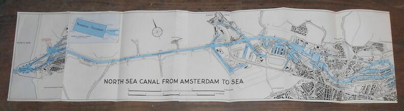
1957rif. 160861957. Amsterdam (Pays-Bas) Publishers WYT 1957 - Carte en noir et bleu 22 cm x 130 cm- Texte en anglais - Bon état
1922rif. 59239Washington D.C.: Government Printing Office Hydrographic Office U.S. Navy 1922; 1930. Two vols. 8vo. v 1 4 397 1 pp.; 1 60 2 leaves. With 1 large folding colour map. 1st vol. in green publisher’s buckram gilt lettering stamped on front cover & spine darkening to spine shelfwear minor scuffing; 2nd vol. Supplement in self-printed softcovers toning chipping & tears to fore-edges minor creasing to corner still VG- set. Third edition stated of vol. I 1st edition of Supplement vol. of these surprisingly scarce coast pilot guides detailing the sailing directions for the treacherous coasts of Great Britain France Belgium Netherlands German & Denmark notoriously treacherous for sailing and powered vessels. Prior to modern GPS systems and satellite navigation these regularly updated and revised navigation handbooks provided key sailing instructions drawing upon British French German Dutch & Danish sailing directions and charts. Worldcat locates no copies of the Supplement. Government Printing Office, Hydrographic Office, U.S. Navy, paperback
1970rif. wc1212Adlard Coles Limited Cartonné avec jaquette 1970 In-4 (19,3 x 24,9 cm), cartonné avec jaquette, 280 pages, texte en anglais, illustrations en noir et blanc ; coife supérieure de la jaquette usée, quelques traces et matques d'usage sur les plats de la jaquette, par aileurs intérieur frais, bon état général. Livraison a domicile (La Poste) ou en Mondial Relay sur simple demande.
rif. 1658Souhamoton, R. Ross, 1951 ; in-8, cartonnage éditeur. Nombreuse illustration en noir et en couleurs, figures.
1989rif. 31579Paris Nathan 1989 GRAND In-8 carré Fontaine des arts - Photographies de Daniel Pilippe et Raymond Vanderplasche - 191 pp illustrées
1900rif. MARI0790(Hamburg-Amerika Linie um 1900). quer 32x26,5 cm, Tit., 195 nn. Bildseiten nach Fotos, dunkelbrauner OLdrbd. (Krokoimitat) mit gldn. Deckelmedaillon, Kanten u. Ecken berieb. u. etw. bestoß., gezeichnete Vorsätze, Vollgoldschn., insges. sehr schönes u. dekoratives Expl. Neben dem Interior der Dampfer "Victoria Luise" und "Meteor" werden Fotos von den Fahrten in den hohen Norden bis nach Hammerfest gezeigt.
1919rif. 3613860Bremen, Leuwer, 1919. VI, 419 S. Mit zahlreichen Abbildungen auf Tafeln. OLwd (Stempel auf Vorsatz und Titelrückseite, Bibliotheksschild, hinterer Vorsatz mit geringen Feuchtigkeitsspuren).
in-8, 79 pages, illustrations et figures, broche, couverture illustree.- 9782737309700 Tres bel exemplaire [DV-20]
1859rif. 102259Richmond Va.: Ritchie Dunnavant & Co. 1859. First Edition. Paperback. Good. 45 p. 23 cm. Fold-out map of the Coal River at Boone and Kanawha Counties with minor repairs mild spotting a few tears. Rebound with original front cover applied and new back. Mild spotting former owner's label on title page. Includes president and directors of the company charter company stock by-laws rates of toll info on coal fields and shipping coal. Ritchie, Dunnavant & Co. paperback
1887rif. 38573Washington DC: Govenment Printing Office 1887. First edition. Hardcover. Good. 8 3/4 x 9 3/4 inches. 421 pages. Condition is Good Very light wear to spine ends and edges rear cover lightly soiled stains on endpapers a few light stains on text pages binding is tight. STK Govenment Printing Office hardcover
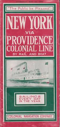
1915rif. 21548New York: Colonial Navigation Company. Very Good-. Softcover. One page separated and with staple binding weakening.; A stapled illustrated brochure promoting the steam ships Concord and Lexington as well as the; Oblong 8vo 8" to 9" tall; 12 pages . 1915. Colonial Navigation Company paperback
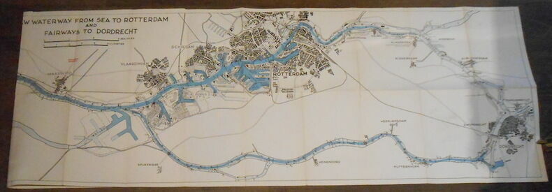
1957rif. 160871957. Rotterdam(Pays-Bas) Publishers WYT 1957 - Carte en noir et bleu 39 cm x 144 cm- Texte en anglais - Bon état
1906rif. 38084München u. Berlin. R. Oldenbourg. 1906. XIII, 144, (2) Seiten. Mit 67 Abbildungen. OLwd.-Einband. Gutes Exemplar! 24x17 cm
1879rif. z015731Batavia: Netherlands India Steam Navigation Company 1879. Very Good. Measures 8.5 by 10 inches printed recto only with corrections in contemporary hand. Very good. Edge wear and creasing else complete and clean. Netherlands India Steam Navigation Company unknown
rif. 78918Genève, Fondation Neptune 1999, 240x210mm, 85pages, broché. Bel exemplaire.