677 résultats
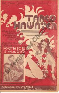
1942réf. 5129Partitions sur la Polynésie d'AnellaMarcel 1942
1942réf. 5715Partitions sur la Polynésie d'AnellaMarcel 1942
1924réf. 27932Partitions sur la Polynésie Salabert 1924
1921réf. 72468Partitions sur la Polynésie,Partitions sur les États-Unis Feist Leo 1921
1947réf. 113925Partitions sur la Polynésie Krier Georges 1947
1981réf. 22567Partitions sur la Polynésie Rideau Rouge 1981
1907Passes and Anchorages in Tuamotu or Low Archipelago. In the left side of the chart insert of Rarola Pass and Anchorage From the French Government Survey, 1904, Makemo I.N.E. Pass and Anchorages From the French Government Survey, 1874. With additions from the United States Government Survey, 1899. In the upper middle part of the chart insert of Tahanea I. Passes From the French Government Survey, 1902. London Published at the Admiralty 9th July 1907, under the Superintendence of Rear Admiral A. Mostyn Field, Hydrographer.Small corrections: 1920. Folded editorially. Autore: Admiralty Charts. Luogo: Tuamotu Islands - Polynesia - Pacific Ocean. Anno: 1907 [1920]. Tecnica: incisione. Dimensioni: 619x977 mm
1983Bound in green leather. 9"w x 12 1/4"h. 128 pages. Ribbon bookmark and gilt edges. 46 pages of text with b & w illustrations, followed by full-page color plates faced on opposite page with description of each painting.
2001réf. 179403Ouessant Ouessant, 2001. In-8 broché, 208 pageds. Publié à l'occasion du 3e salon du livre insulaire. Bon état
réf. 14555Paris Somogy éditions d'Art 2003 in 4 (29x25,5) 1 volume reliure cartonnée de l'éditeur, illustrée en couleurs, 103 pages. Nombreuses illustrations en couleurs. Bel exemplaire
réf. sa623Perthuis Broché In-8 (20 x 24,8 cm), broché, 161 pages, sans date, tome 1 seul (la botanique), illustrations en noir ; quelques pliures et traces sur les plats, papier bruni, assez bon état général par ailleurs. Livraison a domicile (La Poste) ou en Mondial Relay sur simple demande.
1994réf. 34582Paris Galerie Régine LUSSAN 1994 Cartonnage éditeur en bel état, seul, l'étui est légèrement endommagé
réf. 13977092Paris: Muséum d'Histoire Naturelle, 1967 in-4, 94 pages, 91 illustrations. Bibliographie. Broché. Etude typologique de la collection des pilons polynésiens du Musée de l'Homme.
1958Paris, Amiot Dumont, 1958. Un volume de format in 8° de 224 pp., nombreuses illustrations. Reliure de l'éditeur en pleine toile verte, jaquette papier et jaquette rhodoïd. Bon état. Envoi autographe signé de l'auteur.
1958réf. 71391958 Paris, Amiot Dumont, 1958. Un volume de format in 8° de 224 pp., nombreuses illustrations. Reliure de l'éditeur en pleine toile verte, jaquette papier et jaquette rhodoïd.
195618x16 cm, rilegatura con tavola a colori applicata; pp. 82, numerose tavole a colori applicate
195686, [2] pp., ill. a colori n.t.; 19 cm. Leg. edit. Piccola etichetta alla prima pagina. Buono
1851réf. 2027AG1851. London & New York J & F. Tallis 1851. Original steel engraving / Vintage map. Drawn and engraved by John Rapkin. Partly hand-coloured. Plate Size: 35.7 cm x 25.8 cm. Sheet Size: 37.5 cm x 27.3 cm. Vintage 19th century map in very good condition. John Tallis 7 November 1817 3 June 1876 was an English cartographic publisher. His company John Tallis and Company published views maps and atlases in London from roughly 1838 to 1851. Tallis set up as a publisher with Frederick Tallis in Cripplegate in 1842; the business moved to Smithfield in 1846 and was dissolved in 1849. From 1851 to 1854 Tallis operated as John Tallis and Company. He started The illustrated news of the world and national portrait gallery of eminent personages in 1858 selling it for £1370 in 1861; it folded in 1863. Wikipedia The most important project John Tallis undertook was the 'Illustrated Atlas' from 1851. The original map we offer here was part of this exceptional Atlas and all the maps it contained are still today considered as the last reminder of an era of lavish map production. Tallis worked the project together with John Rapkin 1815-1876 and it was Rapkin's style and talent that we have to thank for when we marvel at these maps today. What makes these maps so special is the detail of engraved vignettes that surround the map and often show indigenous scenes people in their environment and even more so historical buildings or historical views of towns and cities architecture and landscape. The project of 'The Illustrated Atlas' was designed to be finished just in time for the anxiously awaited "Great Exhibition of the Works of Industry of All Nations" or The Great Exhibition sometimes referred to as the Crystal Palace Exhibition in reference to the temporary structure in which it was held was an international exhibition that took place in Hyde Park London from 1 May to 11 October 1851. It was the first in a series of World's Fairs exhibitions of culture and industry that became popular in the 19th century and it was a much anticipated event. The Great Exhibition was organized by Henry Cole and Prince Albert husband of the reigning monarch Queen Victoria. It was attended by numerous notable figures of the time including Charles Darwin Samuel Colt members of the Orléanist Royal Family and the writers Charlotte Brontë Charles Dickens Lewis Carroll George Eliot and Alfred Tennyson. Music for the opening was under the direction of Sir George Thomas Smart and the continuous music from the exhibited organs for the Queen's procession was "under the superintendence of William Sterndale Bennett". Wikipedia unknown
2002A clean, unmarked book with a tight binding. 305 pages.
réf. 13979428Northboro (MA): Mack-Nassar Publishing, Inc., 1982 in-4, 304 pages, nombreuses illustrations. Reliure d'édition percaline rouge, bon état.
réf. 13982441Bruxelles: Kevin Conru Editions, 2023 in-4, 270 pages, illustrations. Relié, état neuf. Sommaire : Emilie JOLLY, Acknowledgements - George NUKU, Manatuanga-Standing Mana - Bernard de GRUNNE, C14 Chronology of Ancient Polynesian Statuary - Kevin CONRU, Art of the Polynesian Outliers - Anne Vanderstraete, Speaking Bodies - Tim TEUTEN & Kevin CONRU, Life and Art in Polynesia. Tiré à 500 exemplaires.
1855réf. 4619Murray, London 1855. XVI, 333 S. mit gest. Frontispiz, gest. Titelvignette, 11 Tafeln, 2 Abbildungen u. mehreren Notenbeispielen. Grünes Illustr.-Ln. Einband verblichen. Rücken stärker beschädigt. Gelenke locker. Teils etwas stärker stockfleckig.
1866réf. PHO-2509London : Chapman and Hall, 1866. In-8° (23x15cm), xii-428pp., percale éditeur, dos lisse avec titre, auteur et éditeur en pied, ex-libris et cachet en page de garde. Défauts au dos, coins usés, coiffes abimées. Illustré d’un frontispice et 3 lithographies (complet).
1971Brescia, 1971, 8vo stralcio con copertina posticcia muta, pp. 97/116 con una cartina, 7 figure e 7 illustrazioni fotografiche. - !! ATTENZIONE !!: Con il termine estratto (o stralcio) intendiamo riferirci ad un fascicolo contenente un articolo, completo in se, sia che esso sia stato stampato a parte utilizzando la stessa composizione sia che provenga direttamente da una rivista. Le pagine sono indicate come "da/a", ad esempio: 229/231 significa che il testo è composto da tre pagine. Quando la rivista di provenienza non viene indicata é perché ci è sconosciuta. - !! ATTENTION !!: : NOT A BOOK : “extract” or “excerpt” means simply a few pages, original nonetheless, printed in a magazine. Pages are indicated as in "from” “to", for example: 229/231 means the text comprises three pages (229, 230 and 231). If the magazine that contained the pages is not mentioned, it is because it is unknown to us.
1981réf. LFA0079cUn ouvrage de 118 pages, format 230 x 300 mm, illustré, relié cartonnage sous jaquette couleurs, publié en 1981, Editions Atlas, bon état