Uraz Balkan Alper DincerBiblio.com
Google Maps API Cookbook
réf. 697767737Packt Publishing Limited . Papeback. New. pp. 316 Packt Publishing, Limited unknown

Cold Books · Inde73,42 $US≈ 65,59 €
1 703 résultats
réf. DADAX3639200322New unknown
réf. DADAX3030330575New unknown
réf. DADAX1436679192New unknown
réf. DADAX0195174291New unknown
réf. DADAX0195158490New unknown
réf. DADAX023000539XNew unknown
réf. DADAX0230239722New unknown
réf. DADAX0415122937New unknown
réf. DADAX0415229472New unknown
réf. DADAX0559360274New unknown
réf. DADAX0312217366New unknown
réf. DADAX0312239610New unknown
réf. DADAX0415229464New unknown
réf. DADAX0415215978New unknown
réf. DADAX0472081497New unknown
réf. 697767737Packt Publishing Limited . Papeback. New. pp. 316 Packt Publishing, Limited unknown
2001réf. AME_9781590331293NOVA 2001. 1st. Hardcover. New/New. _ NOVA hardcover
réf. BIB-7022253Original Hardcover. Publisher: Kropka Utg. 2022 Original Hardcover 48 p. This book is brand new. Original title: Book of Dinosaurs Language: Polska We have this book in our store house - please allow for a couple of extra days for delivery. hardcover
2015réf. AME_9781782386384BerghahBooks 2015. 1. Hardcover. New/New. _ BerghahBooks hardcover
2003réf. AME_9781590592212Apress 2003. 1st. Paperback. New/New. _ Apress paperback
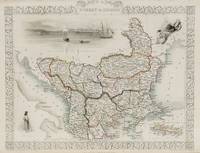
1851réf. 200055AG1851. London and New York J & F. Tallis 1851. Original steel engraving / Vintage map. Drawn and engraved by John Rapkin. Partly hand-coloured. Illustrations by H. Warren and engraved by J. Rogers. Plate Size: 32.5 cm x 26 cm. Sheet Size : 37.4 cm x 27.3 cm. Vintage 19th century map in very good condition. Published in the Illustrated Atlas And Modern History Of The World Geographical Political Commercial & Statistical Edited By R. Montgomery Martin. Beautiful and interesting map of South East Europe. Much of the Balkans was then under the control of the Ottoman Turks. The region is delineated into the historic - and future - nations and states including Croatia Herzegovina Bosnia Serbia Albania Macedonia northern Greece Bulgaria Walachia in Romania and Moldova. Russia can be seen extending down into the areas around the Black Sea. Hapsburg-Austria and the heel of the Italian peninsula is shown. Corfu Cyprus and the Greek islands can be seen lying of the archipelago. Gallipoli Sea of Marmara the Bosporus and Constantinople/Istanbul and Asia Minor/Anatolia are shown in the lower right corner. John Tallis 7 November 1817 3 June 1876 was an English cartographic publisher. His company John Tallis and Company published views maps and atlases in London from roughly 1838 to 1851. Tallis set up as a publisher with Frederick Tallis in Cripplegate in 1842; the business moved to Smithfield in 1846 and was dissolved in 1849. From 1851 to 1854 Tallis operated as John Tallis and Company. He started The illustrated news of the world and national portrait gallery of eminent personages in 1858 selling it for £1370 in 1861; it folded in 1863. Wikipedia The most important project John Tallis undertook was the 'Illustrated Atlas' from 1851. The original map we offer here was part of this exceptional Atlas and all the maps it contained are still today considered as the last reminder of an era of lavish map production. Tallis worked the project together with John Rapkin 1815-1876 and it was Rapkin's style and talent that we have to thank for when we marvel at these maps today. What makes these maps so special is the detail of engraved vignettes that surround the map and often show indigenous scenes people in their environment and even more so historical buildings or historical views of towns and cities architecture and landscape. The project of 'The Illustrated Atlas' was designed to be finished just in time for the anxiously awaited "Great Exhibition of the Works of Industry of All Nations" or The Great Exhibition sometimes referred to as the Crystal Palace Exhibition in reference to the temporary structure in which it was held was an international exhibition that took place in Hyde Park London from 1 May to 11 October 1851. It was the first in a series of World's Fairs exhibitions of culture and industry that became popular in the 19th century and it was a much-anticipated event. The Great Exhibition was organized by Henry Cole and Prince Albert husband of the reigning monarch Queen Victoria. It was attended by numerous notable figures of the time including Charles Darwin Samuel Colt members of the Orléanist Royal Family and the writers Charlotte Brontë Charles Dickens Lewis Carroll George Eliot and Alfred Tennyson. Music for the opening was under the direction of Sir George Thomas Smart and the continuous music from the exhibited organs for the Queen's procession was "under the superintendence of William Sterndale Bennett". Wikipedia unknown
réf. A9780271091587Hardback. New. hardcover
réf. 62112614Springer . Papeback. New. pp. 304 Springer unknown
réf. 44019757like new. unknown
réf. 8567487-nnew. unknown