Ungarn - Deáky Zita, Zsigmond Cosma & Vörös ÉvaAntiquariat.de
1 607 résultats
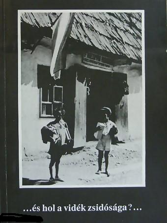
1994réf. 121350Budapest 1994. 265 Seiten. Mit zahlreichen, teils faks. Abbildungen. Ill. Originalbroschur. 25x18 cm
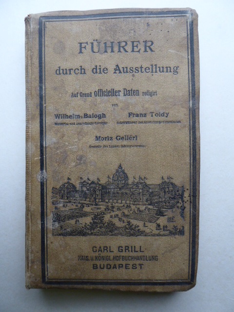
1885réf. 35591Budapest. Carl Grill. (1885). 239, (95) Seiten. Mit zahlr. teils ganzseitigen Holzschnittansichten, vielen teils ill. Werbeanzeigen u. einem mehrfach gefalteten und farbigen Situationsplan i. Anhang. Ill. Original-Leinwand-Einband. (Einband fleckig. Papier teils etwas fleckig) 17x10 cm
1877réf. 146662Stuttgart. Verlag von August Auerbach. 1877. XII, (1), 397, (3) Seiten. Ansprechender Halbleinwand-Einband der Zeit mit marmorierten Deckeln. (Geringe Gebrauchsspuren). 21x13,5 cm
1935réf. 0323-23Bln. u. Lpz.,de Gruyter 1935. gr.8°. XV,(1),272,(2) S. Vlgsanzeigen. Okart., 2 Bl. mit kl. Eselsohren, gutes Expl.
1851réf. 200055AG1851. London and New York J & F. Tallis 1851. Original steel engraving / Vintage map. Drawn and engraved by John Rapkin. Partly hand-coloured. Illustrations by H. Warren and engraved by J. Rogers. Plate Size: 32.5 cm x 26 cm. Sheet Size : 37.4 cm x 27.3 cm. Vintage 19th century map in very good condition. Published in the Illustrated Atlas And Modern History Of The World Geographical Political Commercial & Statistical Edited By R. Montgomery Martin. Beautiful and interesting map of South East Europe. Much of the Balkans was then under the control of the Ottoman Turks. The region is delineated into the historic - and future - nations and states including Croatia Herzegovina Bosnia Serbia Albania Macedonia northern Greece Bulgaria Walachia in Romania and Moldova. Russia can be seen extending down into the areas around the Black Sea. Hapsburg-Austria and the heel of the Italian peninsula is shown. Corfu Cyprus and the Greek islands can be seen lying of the archipelago. Gallipoli Sea of Marmara the Bosporus and Constantinople/Istanbul and Asia Minor/Anatolia are shown in the lower right corner. John Tallis 7 November 1817 3 June 1876 was an English cartographic publisher. His company John Tallis and Company published views maps and atlases in London from roughly 1838 to 1851. Tallis set up as a publisher with Frederick Tallis in Cripplegate in 1842; the business moved to Smithfield in 1846 and was dissolved in 1849. From 1851 to 1854 Tallis operated as John Tallis and Company. He started The illustrated news of the world and national portrait gallery of eminent personages in 1858 selling it for £1370 in 1861; it folded in 1863. Wikipedia The most important project John Tallis undertook was the 'Illustrated Atlas' from 1851. The original map we offer here was part of this exceptional Atlas and all the maps it contained are still today considered as the last reminder of an era of lavish map production. Tallis worked the project together with John Rapkin 1815-1876 and it was Rapkin's style and talent that we have to thank for when we marvel at these maps today. What makes these maps so special is the detail of engraved vignettes that surround the map and often show indigenous scenes people in their environment and even more so historical buildings or historical views of towns and cities architecture and landscape. The project of 'The Illustrated Atlas' was designed to be finished just in time for the anxiously awaited "Great Exhibition of the Works of Industry of All Nations" or The Great Exhibition sometimes referred to as the Crystal Palace Exhibition in reference to the temporary structure in which it was held was an international exhibition that took place in Hyde Park London from 1 May to 11 October 1851. It was the first in a series of World's Fairs exhibitions of culture and industry that became popular in the 19th century and it was a much-anticipated event. The Great Exhibition was organized by Henry Cole and Prince Albert husband of the reigning monarch Queen Victoria. It was attended by numerous notable figures of the time including Charles Darwin Samuel Colt members of the Orléanist Royal Family and the writers Charlotte Brontë Charles Dickens Lewis Carroll George Eliot and Alfred Tennyson. Music for the opening was under the direction of Sir George Thomas Smart and the continuous music from the exhibited organs for the Queen's procession was "under the superintendence of William Sterndale Bennett". Wikipedia unknown
1966Very Good English Modern cloth bdg. Cr. 8vo. (20 x 14 cm). In Turkish. 145, [3] p., musical scores. One of the publications of Communist Bulgarian Turks printed in Sofia. Rare. Vintage cover. Yeni sarkilar. New songs.
réf. 18086Paris, Presses Universitaires de France 1977, 240x155mm, 269pages, broché. Bel exemplaire.
1911réf. 29190Sarajevo, Selbstverlag des B.-H. Instituts für Balkanforschung, 1911. Gr.-8°. Mit 1 farb. Kte. u. 5 Kartenskizzen. 2 Bll., 95 SS. Hldr. d. Zt. (gering beschabt).
1904réf. 1354-19Sarajewo, Studnicka 1904. 4°. 79 S. Mit zahlr. Abb. Ln. d. Zt. m. Gold- u. Blindpräg. In gutem Zustand. [2 Warenabbildungen]
1945réf. KIBU1935Wien u. Leipzig, Deutscher Vlg. f. Jugend und Volk (1945). 64 S. Mit 14 Schattenrissen, 14 Init. u. farb. Deckelill. v. Herta SLADKY. OBrosch., Umschl. mit kleinen Randrissen. Der seltenste Band der Reihe. Wie stets ohne S.5/6 (Vorwort). Nicht bei Hopster.
1945réf. KIBU0742Wien u. Leipzig, Deutscher Vlg. f. Jugend und Volk (1945). 84 S. Mit 12 Schattenrissen, Init. u. farb. Deckelill. v. Herta SLADKY. OHLn. Geringf. berieb., Text papierbedingt gebräunt.
1910réf. 8511BBDubrovnik, o.J. [um 1910]. 24 s/w. Fotografien. OLwd.
Burgos, Hijos de Santiago Rodriguez, 1958 [Publicaciones del Seminario Metropolitano]. 4to.mayor; 147 pp. Cubiertas originales.
réf. 65415, Brepols, 2021 Hardback, 304 pages, Size:156 x 234 mm, Language: English. ISBN 9782503587882.
1827réf. 61539Znaim, Gedruckt bei Martin Hofmann, 1827. 8°. VIII, 208 S., 1 Bl.; 214 S., 17 Bll. (Register, Pränumeranten-Verzeichnis u. Berichtigungen), HLdr. d. Zt. m. Rückenverg., goldgepr. Rückenschild u. dreiseitigem Farbschnitt.
1883réf. 5754Paris Plon 1883 Grand in-8 de 4 ff. lim. n.ch. (le premier blanc) et 412 pp., demi chagrin, dos à nerfs orné, dos orné, tranches dorées, petit accroc en haut du mors sup., des rousseurs. (Ch. Magnier rel.).
1974réf. 0V2932Bukarest (Kriterion Verlag) 1974. 8°, Originalleinen mit Lesebändchen, 400 S., 1
réf. 49067Zürich : Chronos [2020]. 230 Seiten : Illustrationen ; 23 cm, 425 g Top Zustand, Broschur, Softcover/Paperback, Exemplar in sehr gutem Erhaltungszustand
réf. 599671Hamburg, Helmut Buske, 1976. In-8 broché, 366 pp., textes en allemand, albanais, roumain et latin, bibliographie.
1956réf. 2272Budapest 1956. 425 S. mit 190 Tafeln. 4°. Leinen.
1940réf. 63167Berlin, Herbert Stubenrauch, 1940. Gr.-8°. 109 (1) S., 1 Bl., OKart. m. OUmschlag.
1940réf. 3516ABWien, Leipzig, Wiener Vlgs.ges., 1940. E.A. 179 S., 2 Bl. mit vielen Bildtafeln. Ln., guter Zust.
1941réf. 4187CBWien, Adolf Luser, 1941. Groß 8°. 179 + 4 S. OLwd. u. OSch., Abbildung
1992Fine English Paperback. Pbo. Roy. 8vo. (24 x 17 cm). In English. 111 p., color and b/w ills. The Western Thrace Turks issue in Turkish - Greek relations. ISBN: 9757769003. "The book on 'the Western Thrace Turks issue in Turkish-Greek relations' has been prepared by the research division of the International Affairs Agency (INAF) in the framework of the programme titled 'File on the problems of Turkey".
1920réf. 042004London: The Rolls House Publishing Company Ltd. 1920. Soft cover. Very Good. 8vo - over 7¾ - 9¾" tall. Paperback. Pbo. Roy. 8vo. 24 x 17 cm. In English. 77-159 1 pp. The Balkan review. Vol. III. No: 2. March 1920. Edited by Crawfurd Price. Contents: Editor's scauseire. English civilisation in a Greek setting. M. E. Repoules.; The Albanian question. Yovan Tomitch.; The curse of Macedonia Capt. J. A. Delmege.; Truth and prejudice J. Saxon Mills.; The Serbs and Scutari: A meeting-place of five nations. Ignotius. Books on the Near East. etc. The Rolls House Publishing Company Ltd. paperback