1 767 résultats
1818réf. 031792London: Henry Colburn 1818. First English Language Edition 1st Printing. Hardcover. Very Good. Xi339 Pp. First English Edition And First English Translation 1818 Following The 1817 First Edition Published In France. Half Calf Colored Morocco Spine Labels Gilt One Recent Calf Tips Over Peach Cloth Marbled Endpapers 5 Bands Gilt Spine With Center Tools Top Edge Gilt. Light Wear Fraying At Tips Small Repaired Chip At Lower Left Edge Of Spine Refurbished. Stendhal's Too Frank Travel Observations Scarce In This First English Translation. His Observations At Geneva Begin "The Prudery Of The Women At Geneva Is Incredible And Truly Ridiculous. I Have Observed That They Say Exactly The Same Thing To Every Stranger Presented To Them. To Repeat A Certain Formula Taught Them By Their Nurses. I Would Fain Know Who The Traveler Is That First Asserted There Was Such A Thing As Liberty In Switzerland. At Geneva And Berne There Are Four Hundred Surveillans. If You Offend Them Only By The Manner In Which Your Cravat Is Tied You Immediately Become An Object Of Their Persecution." Further Observations Made The Likelihood Of A Further English Translation Small Indeed: "Nothing Can Equal My Admiration Of The English Legislature Unless It Be The Repulsion I Feel From English Society. They Are The Most Unsocial Of Beings; Perhaps For That Reason The Least Happy. To Be Held In Consideration By An Englishman The Most Perfect Air Of Coldness Must Be Assumed." I Don't See Such Observations In My Michelin Or Lonely Planet Guides Perhaps We Have Evolved Or Perhaps We Are Too Terrified To Speak Out. Henry Colburn hardcover
1981réf. 7492Oxford University Press. Very Good in Very Good dust jacket. Hardcover. Very light bumping to bottom corners else book is fine. DJ is price-clipped. Dustjacket is protected in mylar.; A credible representation of a lost narrative describing struggles among the successors of Alexander.; Oxford Classical Monographs; 314 pages . 1981. 0198147171 . Oxford University Press hardcover
1982réf. 8977Oxford Clarendon Press. Near Fine in Near Fine dust jacket. First Edition. Hardcover. Creasing to DJ now protected in mylar. Signed by author to scholar. Corrigenda page taped to inner cover.; This book is a study of the fourth-century-BC Hekatomnid dynasty whose members ruled Karia a district in south-west Asia Minor as Persian satraps. The title of the book denotes only the central figure in the story of the hellenization of Karia. Recent archaeological finds and newly discovered inscriptions help bring alive this fascinating dynasty whose members though native Karians actively diffused Greek culture through their corner of Anatolia in the two generations before Alexander.; 424 pages; Signed by Author . 1982. 0198148445 . Oxford Clarendon Press hardcover
réf. DADAX036742083XNew unknown
réf. DADAX0415630169New unknown
réf. DADAX0367318008New unknown
réf. DADAX0415742110New unknown
réf. DADAX0415138949New unknown
réf. DADAX0415690560New unknown
réf. DADAX0367205300New unknown
réf. 22075115like new. unknown
2011réf. 173218Part I: Folio: 66 facsimile sheets 35x50 cm; plus book 38x28 cm 152 pp. ill.: 250 colour photographs and maps. In 1829 during the Greek War of Independence the French government gave its backing to a Scientific Expedition to the Peloponnese Moreas which soon began to carry out a thorough historical geographical archaeological and pictorial documentation of the region. The material collected by the French scientists artists and officers-surveyors was processed and published in France between 1831 and 1838 in four volumes and a large Atlas by the Natural Sciences Section of the Expedition as well as three large-format volumes prepared by the Architecture and Sculpture Section. These include accounts of the journeys scores of maps and a vast array of data regarding the conditions in the region as well as the state of ancient and more recent remains. Pride of place among the French achievements was the Map of the Moreas 1832. Despite its success wealth of material and enormous value for science and for the country the work of the French Scientific Expedition has not been given the recognition it deserves and has remained somewhat hidden from the view of the wider public. The current edition includes original contributions by over 25 Greek and French researchers from different fields all with expertise on the Peloponnese and aims at giving a wider readership the opportunity to learn more about the illustrative and cartographic documentation various previously unpublished maps and other accounts by members of the Expedition. It consists of three parts which correspond to the Natural Sciences Section Part I printed the Architecture & Sculpture Section and the Archaeology Section Part II forthcoming Botany and Zoology Section Part III forthcoming of the Expedition. All parts include numerous illustrations of exquisite artistry created by the scientists and artists of the Expedition. Part I consists of 66 facsimile sheets of maps engravings and drawings selected from French originals and an accompanying book with critical essays. Melissa paperback
1856réf. 21151New York: Harper & Brothers Publishers. Very Good-. Hardcover. Boards with light rubbing to extremities. Gilt spine lettering a bit faded. A bit of creasing to front pastedown. Endpapers with a bit of browning.; An early and detailed account of modern Greece with a steel-engraved front fold-out map and 53 vignettes on the title pages it reads: illustrated by about 60 engravings. INSCRIBED by the author on front free endpaper: "Miss A. L. Barber with the author's kind regards. March 09 1890". Dark green boards with bindstamped circular pattern.; 12mo 7" - 7½" tall; xii 380 pages . 1856. Harper & Brothers, Publishers hardcover
réf. DADAX1409403459New unknown
1965réf. 43399Burt Franklin. Very Good with no dust jacket. Hardcover. Volumes range from VG a few corners mildly bumped to fine.; Reprint originally published Oxford: 1891. Likely published 1965; 4 Volume Set. Burt Franklin Research & Source Work Series 95.; Vol. I 609 pages; Vol. II 583 pages; Vol. III 749 pages; Vol. IV 551 pages. This was the definitive history of ancient Sicily from the earliest times to the death of Agathokles 361-289 B. C. ruler of Syracuse by the leading English-speaking authority of the late 19th century Edward A. Freeman who also wrote the Encyclopedia Britannica article on Sicily. Each volume contains occasional one-page black-and white topographic maps to illustrate battle locales and dominions of tyrants; Volume I also contains a fold-out frontispiece map of the Island see picture. Volume I-The Native Nations: the Phoenicians and Greek Settlements; Volume II-From the Beginning of Greek Settlement to the Beginning of Athenian Intervention; Volume III-The Athenian and Carthaginian Invasions; Volume IV-From the Tyranny of Dionysius to the death of Agathokles edited from posthumous Mss. With Supplements and Notes by Arthur J. Evans. Each volume contains a separate index. . 1965. Burt Franklin hardcover
réf. DADAX0754664988New unknown
réf. DADAX0415725151New unknown
1851réf. 200114AG1851. London Edinburgh & Dublin. J & F. Tallis 1851. Original steel engraving / Vintage map. Drawn and engraved by John Rapkin. Partly hand-coloured. Illustrations by A.H. Wray and engravings by J.b Allen. Plate Size: 30.5 cm x 25.3 cm. Sheet Size: 37.3 cm x 27.4 cm. Vintage 19th century map in very good condition. Published in the Illustrated Atlas And Modern History Of The World Geographical Political Commercial & Statistical Edited By R. Montgomery Martin. Beautiful map of Greece from the Victorian era. The marvelous vignettes may harken back to more ancient times but this was Greece of the mid-19th Century a recently independent modern kingdom the result of a successful war of independence in the 1820s waged by Greek revolutionaries against the Ottoman Empire that had ruled Greece for hundreds of years. The Turkish territory in the Blakans can still be seen near to the north as the Greek frontier runs across from the Gulf of Arta to the Gulf of Volo. The Greek regions are listed as Livadia and in the Peloponnese peninsula Morea. The large island Negropont is also shown. The many islands off the mainland are also included: islands such as; Andro; Tino; Naxia; Santorini; Milo; Cerigo; Zante and; Cephalonia to name but a few. The names of famous cities such as Corinth Athens and Sparta are also included on the map. The rugged and mountainous topography of the region is depicted through hachuring. The major rivers including the Aspropotamo Achelous are also shown on the map. A scale-bar is shown near the map's lower decorative border. John Tallis 7 November 1817 3 June 1876 was an English cartographic publisher. His company John Tallis and Company published views maps and atlases in London from roughly 1838 to 1851. Tallis set up as a publisher with Frederick Tallis in Cripplegate in 1842; the business moved to Smithfield in 1846 and was dissolved in 1849. From 1851 to 1854 Tallis operated as John Tallis and Company. He started The illustrated news of the world and national portrait gallery of eminent personages in 1858 selling it for £1370 in 1861; it folded in 1863. Wikipedia The most important project John Tallis undertook was the 'Illustrated Atlas' from 1851. The original map we offer here was part of this exceptional Atlas and all the maps it contained are still today considered as the last reminder of an era of lavish map production. Tallis worked the project together with John Rapkin 1815-1876 and it was Rapkin's style and talent that we have to thank for when we marvel at these maps today. What makes these maps so special is the detail of engraved vignettes that surround the map and often show indigenous scenes people in their environment and even more so historical buildings or historical views of towns and cities architecture and landscape. The project of 'The Illustrated Atlas' was designed to be finished just in time for the anxiously awaited "Great Exhibition of the Works of Industry of All Nations" or The Great Exhibition sometimes referred to as the Crystal Palace Exhibition in reference to the temporary structure in which it was held was an international exhibition that took place in Hyde Park London from 1 May to 11 October 1851. It was the first in a series of World's Fairs exhibitions of culture and industry that became popular in the 19th century and it was a much-anticipated event. The Great Exhibition was organized by Henry Cole and Prince Albert husband of the reigning monarch Queen Victoria. It was attended by numerous notable figures of the time including Charles Darwin Samuel Colt members of the Orléanist Royal Family and the writers Charlotte Brontë Charles Dickens Lewis Carroll George Eliot and Alfred Tennyson. Music for the opening was under the direction of Sir George Thomas Smart and the continuous music from the exhibited organs for the Queen's procession was "under the superintendence of William Sterndale Bennett". Wikipedia unknown
réf. DADAX0870440713New unknown
réf. SONG0415425778Used: Good unknown
réf. DADAX0521879515New unknown
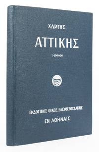
réf. 52898Athens 1923. Folding map of Attica text all in Greek overall 96 x 79 cm dissected into 30 sections backed onto linen folding into original black pebble cloth covered boards titled in white on upper cover with 51 pp. index inserted. Very good condition. Athens, 1923. hardcover
1979réf. BN473661Brill 1979. 1979. Corpus Hermeticum Xiii and Early Christian Literature Studia ad Corpus Hellenisticum Novi Testamenti 5 Band 5 Corpus Hermeticum Xiii and Early Christian Literature Studia ad Corpus Hellenisticum Novi Testamenti 5 Band 5 W Grece Brill unknown
réf. 1d1253Paris 1789. Zusammen 2600 S. original Pappbände etwas berieben u. bst. - Gestoch. Wappen - ExLibris auf Vorsatz - unknown
réf. DADAX0198152884New unknown