18 076 résultats
1829P., Chez Méquignon l'aîné Père, 1829. In-8 relié à la Bradel, papier à la cuve (reliure moderne), pièce de titre, tranches jaunes, 175pp. En 1828, G.Roux est le médecin principal d'une expédition en Grèce et en 1830, il est médecin-chef de l'expédition d'Afrique. Très bon état, quelques rares rousseurs. Ouvrage très rare.
1799réf. PHO-1999À Paris, Chez F. Buisson, Imprimeur-Libraire, an VII (1799). 4 tomes TEXTE ; 3 volumes in-8°, 2ff.-VII-425pp.1f (catalogue), 2ff.-417pp.(2 tableaux dépliants), 2ff.-424pp., demi basane et coins, dos lisse avec pièce de titre et tomaison havane, tranches mouchetées bleues, petits frottements, accroc à une coiffe, petit travail de ver en coin sur qlqs feuillets (T2). ATLAS Voyage dans la Haute et Basse Égypte et Voyage en Grèce et en Turquie Paris, F. Buisson, An VII de la République (1799). In-4, 2 pp., 39 planches et une carte, mouillure angulaire à la carte, frottements, charnières fendillées et petit manque de matière, manque de papier au plat.
1729Bella mappa dell'arcipelago maltese di Pieter van der Aa tratta dal suo atlante “La Galérie Agréable du Monde” pubblicato a Leida nel 1729.Bell'esempalre di questa decorativa mappa dell'isola di Malta.Incisione in rame, in buono stato di conservazione. Map of the Mediterranean islands of Malta and Gozo by Pieter van der Aa taken from his atlas of the world, “La Galérie Agréable du Monde” published in Leiden in 1729. It includes two compass roses, with rhumb lines emanating from each one, along with details of the towns and harbours of the islands. The map includes a decorative title cartouche that portrays on its right side two battling sailing ships and a Maltese knight with his sword, shield and banner; and on the left a shipwreck together with snake emerging from a fire, which is a reference to the biblical story of St Paul’s visit to the island. Blank verso. A finely example of this uncommon map with wide margins in excellent condition.
1958réf. 7747Paris Gallimard 1958 1 vol. Broché in-12, broché, non coupé, 292 pp. Édition originale de cette analyse de l'oeuvre du poète grec. Un des 33 exemplaires sur vélin pur fil Lafuma-Navarre, seul grand papier (celui-ci hors commerce). En excellente condition.
1581pp. [viii], 182, [ii], 79, [i]. Woodcut Estienne device on title page. Greek and Latin in parallel columns. Text uniformly foxed. Manuscript description of the acquistion (in 1800) of this copy and other bibliographic points. 4to. 26 cm. 18th century full limp vellum binding. Herodianus, supposed to have been a Syrian Greek, flourished during the third century A.D. In 203 he was in Rome, where he held some minor posts. His great historical work was written in Greek and narrates the events of the fifty-eight years between the death of Marcus Aurelius and the proclamation of Gordianus III. (180-238). The narrative is of special value as supplementing Dion Cassius, whose history ends with Alexander Severus. Chronicling the events of his own times, gifted with ordinary powers of observation, indubitable candour and independence of view his work is of inestimable value. He gives a lively account of many events such as: the death of Commodus; the assassination of Pertinax; how Didius Julianus bought the Roman Empire at auction; etc. Extensive use has been made of Herodianus by later chroniclers, especially the 'Scriptores historiae Au gustae' and John of Antioch. Poliziano did the first translation into Latin (1493) which conferred celebrity status on Herodian for the duration of the Renaissance. This Herodian was described by Dibdin as `an elegant, rare and critical edition', with notes and textual revisions by Henri Estienne. This is the first edition of any part of Zosimus (Editio Princeps), although Estienne only printed the first two books, translated by Leunclavius. The volume was dedicated to Sir Philip Sidney. Estienne (Etienne) (Latinized as Stephanus) was a great family of Parisian and Genevan printers of the 16th and 17th century, distinguished through five generations in scholarship as well as in their craft. Henri Estienne , Jr. (1531?-1598), was the greatest scholar of the family. He inherited his father's (Robert) press on the express condition that it should not be moved from Geneva. He was a well-trained scholar and devoted years to searching for manuscripts. Although humanism was far advanced, he, nevertheless, discovered numerous works of classical authors of which he issued first editions. His editions of Greek and Latin works are remarkable for their accuracy and textual criticism. Renouard 149/7; Schreiber 209; Dibdin II, 15; Adams H388, S1738. **PRICE JUST REDUCED! Small Box OST 1
1872in folio, pp. 124, leg. edit. m. tela con impress. oro al piatto sup. Con 12 belliss. tavv. in acciaio (su 18) raff. paesaggi della Grecia e delle zone vicine. Le tavv. (mm. 180x270) rappr.: Corfù, Navarino, il monte Imetto, il campo di Platea, Tebe, il lago di Copai, Delfo, Crissa, Messene, il convento a Megaspileo, la sorgente dello Stige, Efeso. [111-6]
réf. c5066Paris, Ducollet, Libraire-Editeur, 1833-1835 ; 7 tomes reliés en 7 volumes in-8°, demi-veau fauve de l' époque, dos lisse très orné en long de larges fleurons dorés dans 2 rectangles de double filet doré, auteur, titre et tomaison dorés au centre.2 ff.nch.,IVpp.,468 pp. ; 2ffn.ch.,VIIIpp.,416 pp. ; 2ff.nch., 503 pp. ; 2ff.nch.,440 pp. ; 2ff.nch.,543 pp. ; 2ff.nch.,IIIpp., 478 pp. ; 2ff.nch. 607 pp. et 1 carte dépliante de l' Itinéraire de Michaud et Poujoulat dressée par Dufour.Des feuillets jaunis dans les marges, quelques piqûres, 1 très petit trou d'insecte à la charnière supérieure du tome 1.
réf. 200913373Paris, Libraire stéréotype de TH. DABO, 1820-1830 ; in-4, 555-603-571-578-566-522-514-atlas 40 pp., pleine basane marbré dos orné - atlas chagrin vert. Les 8 volumes. Atlas Grand in 4 a l'italienne (format 33,5x26) de 1830 rédigé d'après les explorations des voyageurs les plus modernes, Paris, ARMAND-AUBRÉE, éditeur (40 planches).
réf. 5619In-16, plein vélin à recouvrement,d’époque,titre manuscrit à la plume.Restes de cordons sur les plats.Titre,XXX,703 pages. [Genevae],Excudebat Henricus Stephanus,illustris viri Huldrichi,Fggentypographus 1568. Bon exemplaire Henri Estienne"collection populaire d'anecdotes grecques, sur le modèle de Apophtegmata Erasmus ... C'est le dernier livre de Henri Estienne qui styles lui-même Viri Huldrichi Fuggeri typographus…"(Shreiber) "Henri Estienne's popular collection of greek anecdotes, modelled after Erasmus's Apophtegmata...This is the last book in which Henri Estienne styles himself Viri Huldrichi Fuggeri typographus..." (Schreiber) Caractères grecs de corps 12 dit Cicero de Garamond. Renouard, p.131, n°5 ; Schreiber, n°172
réf. 4158Paris, De Bure, 1788 et 1790 pour l'atlas, 20 X 25 cm., reliés, Edition originale pour les quatre premiers tomes, troisième édition pour l'atlas. Reliures en demi-veau à dos lisses et plats, toutes tranches teintées. Les quatre premiers tomes sont protégés par une reliure d'époque, l'atlas par une reliure récente reprenant les caractéristiques des anciennes. Ces dernières présentent toutes des épidermures légères, et des frottements sur les plats et les coupes. Tome I : VII-553 pages, petite mouillure en tête des pages 1 à 24. Tome II : 646 pages, trace colorée sur les trois premiers feuillets, petit manque dans le coin de la page 291. Tome III : 599 pages, couleur des feuillets inégale. Tome IV : 383-CLXXXIV pages. Atlas : "Recueil de cartes géographiques, plans, vues et médailles de l'ancienne Grèce, relatifs au Voyage du jeune Anacharsis, précédé d'une analyse critique des cartes", XL-31 planches. Ces planches, sont à simple ou double page, dépliantes ou non. [par Barbié du Bocage]. Un bien bel ensemble. [Brunet, I, 674]
17826 volumi legati in 3, in 16, cm 11 x 17, pp. XII + 270 + (2); VI + 296; VI + 292; VIII + 278; VIII + 276; VIII + 270 + (2). Mezza pelle coeva con pochi segni d'uso. Macchia d'inchiostro all'angolo superiore del 5o volume. Pochi minimi fori al margine superiore del frontespizio del primo volume. Edizione originale rara pubblicata tra il 1782 - 1787 dalla tipografia di Poschiavo fondata e finanziata dal Barone Tommaso Francesco De Bassus e che ebbe come direttore il bergamasco Giuseppe Ambrosioni. Proprio nel 1782 questa tipografia, grazie anche ai rapporti del De Bassus con l'ambiente degli 'Illuminati di Baviera', pubblico' la prima edizione italiana del Werther goethiano nella traduzione di Giuseppe Grassi. Questa raccolta di memorie di viaggio che toccano Francia, Italia, Savoia, Svizzera, Olanda, Inghilterra, Turchia e Grecia, pubblicate sotto forma di lettere da questo orientalista svedese, rappresentano un modello estremamente esaustivo di quello che poteva essere un viaggio di studio durante il XVIII secolo. Molti sono i personaggi che Bjoernstaehl incontra: di Rousseau descrive l'enorme interesse per la botanica esaltato dalla comune conoscenza con Linneo mentre su Voltaire, che visita a Ferney, dopo iniziali difficolta' ad esser ricevuto nonostante la presentazione del D'Alembert, narra una giornata di fitta conversazione. A Napoli descrive il Museo Reale di Portici, gli incontri con Ignarra e il genovese Piaggio finalizzati a esaminare i Papiri di Ercolano e fornisce un quadro abbastanza preciso dello stato degli studi archeologici e relative pubblicazioni e cosi' fa in Roma dove descrive l'udienza papale e gli incontri con studiosi come il Cordara e il Lagomarsini ecc. A Torino, dove descrive l'incontro con Vittorio Amedeo, II, ha rapporti con il Dedina, Gerdil, il Beccaria (e' il piu' forte nell'elettricita')... Pur rimanendo centrale l'interesse per la visita a biblioteche e per il mondo degli studi, Bjoernstaehl sovente si sofferma su particolarita' piu' ordinarie seppure molte curiose. Da citarsi e' la descrizione del 'celebre formaggio parmigiano' che in realta' vien fatto nella campagna intorno a Lodi ma cosi' vien chiamato perche' nelle zone di Parma e Piacenza vi sono molti magazzini 'per poi ispacciarlo in tutta Italia'. Curiose notazioni troviamo poi nella parte dedicata ai viaggi in Turchia, Costantinopoli in particolare. Descrive l'epidemia di peste del 1778, il comportamento degli abitanti riguardo il contagio e i rapporti tra turchi e i rappresentanti delle potenze straniere stabiliti in quel paese. La parte finale (lettere VII e VIII) descrive poi l'arrivo in Grecia: Negroponte, Tessaglia. Particolare rilievo viene dato alla descrizione degli usi dei 'ladroni albanesi'.
1572réf. LBW-1449[Venise, 1572]. 177 x 209 mm.
1720réf. GR041Parisiis 1720, in-16o, XXXII+480+14 p. Jolie rel. plein veau cont., dos orne.
1845réf. 4548Paris Chez l'auteur [Valence, Impr. de J. Marc Aurel] 1845 in-8 demi-bas. verte, dos lisse orné, filets et fleurons dorés, tr. mouch. [Rel. de l'époque], qq. piqûres
1851réf. 31382Paris Jacques Lecoffre 1851 2 vol. in-8 brochés sous couvertures imprimées, des mouillures claires
1733réf. GR469Venetiis, P. Bassaleae,, 1733 2 gr. in-4o,(XIII)+ 480; 356+ (24) p. avec 9 planches chalcographies hors-texte depliantes, p. de titre rouge et noir, initiales decorees, culs-de-lampe. Premiere edition den Italie, la premiere anglaise en 1698 par l'archevêque de Canterbury. Rel. plein velin souple contemporain, orne a froid, dos a nerfs -petits manques aux deuxeime dos, etiquettes de titre maroquin.
1794RARITA’ CARTOGRAFICA Sconosciuta piccola carta geografica con imprint di Giacomo Zatta e data 1794, appartenente a un non documentato atlante in miniatura dal titolo “Atlante tascabile per le dame”, suddiviso in tre tomi, stampati “IN VENETIA Presso G. Zatta”, senza data ma circa 1795. Si tratta di carte da visita – con un apposito spazio bianco dove apporre il proprio nome – dove compare l’imprint o di Pietro Zancon (accompagnato dalla data 1794) o di Giacomo Zatta (con data 1794 o 1795), che, come si legge sul frontespizio, risulta l’editore dell’opera. Possiamo ipotizzare che la serie, iniziata da Zancon fu poi terminata dallo Zatta. Sulla carta dell’Italia – presumibilmente la prima tavola dell’opera – compare stampato il nome di Chiara Minelli Rota, nobildonna veneziana che sposò Antonio Rota nel 1794; tutte le restanti 65 carte recano lo spazio bianco privo di nome. In precedenza, le carte erano note solo attraverso una serie, priva di imprint editoriale, venduta 21 anni fa (1999) dall’Antiquariaat Haas di Bedburg Hau; parlando con Stephan Haas, la serie, priva di titolo e dati editoriali si componeva di 70 mappe. Le carte furono vendute separatamente sotto il nome di G. Bonatti, firma dell’incisore che si trova nella carta della Francia. In seguito, le tavole furono attribuite a Pietro Zaricen da Geoffrey King (cfr. Miniature Antique Maps, p. 181). Il nome dello Zaricen viene dedotto dalla carta della contea del Roussillon, che reca l’iscrizione “Venezia 1794 App.o P. Zancon”, letto erroneamente come Zaricen. Lajos Szantai include la carta dell’Ungheria nella sua cartobibliografia, traducendo il nome dell’autore in Zancen (cfr. Atlas Hungaricus 1528-1850). Sempre King, che non menziona nessuna carta firmata da Zatta, sostiene che “About the turn of the century a signed card of the first edition, with a map of the province of Roussillon in the south of France, was seen at an Ephemera Society Fair in London”. Questo esemplare sembrerebbe oggi quello conservato alla Yale University Library [1978 351], che lo descrive composto da 70 carte geografiche. Non sappiamo se sia il numero totale delle mappe, e l’assenza di un indice o dell’elenco non consente di stabilire l’esatto numero delle carte che lo compongono. http://hdl.handle.net/10079/bibid/3611852Confrontando le carte erroneamente attribuite allo Zaricen ci si accorge che la lastra è abrasa in corrispondenza della firma di Zancon o Zatta. Molto scarse sono le notizie sulle carte che possiamo ora definire “ex Zaricen”. Jason Hubbard nella sua bibliografia recente sulle carte del Giappone raffigura la carta priva dell’imprint “App.o G. Zatta” attribuendola - sulla base delle informazioni bibliografiche finora note – a Giuseppe Bonatti e Pietro Zaricen: “This is one of the 70-odd geographical cards, printed on one side only, acquired by the Haas brothers in 1999. The cards cover countries around the world and include detailed map of Italian provinces. The card with the map of France carries the inscription: G. Bonatti fece; and it is presumed that Bonatti engraved all of them although this is questioned by King” (cfr. J. Hubbard, Japoniae Insulae, n. 124). Il nostro esemplare della carta della Francia, che reca l’imprint “Venezia 1794, App.o P. Zancon” reca in basso a destra la firma di Bonatti sopra menzionata. Dunque, l’unica differenza tra questa serie di sconosciute carte sembra essere la presenza degli imprint editoriali di Zancon e Zatta, accompagnati dalla data 1794 o 1795. Giuseppe Bonatti è menzionato da V. Valerio nella qualità di incisore cresciuto alla scuola Remondini di Bassano, autore di alcune carte per l’atlante di Pazzini Carli (Siena, 1788-1800) e per l’Atlante Geografico di Carlo Antonio Barbiellini (Milano, 1807). Dal 1809 in poi lavorò come incisore per il Deposito della Guerra di Milano (cfr. V. Valerio, Cartografi Veneti, p. 153). Pietro Zancon era, assieme ... A GREAT RARITY Unknown small map with imprint by Giacomo Zatta and date 1794, belonging to an undocumented miniature atlas entitled “Atlante tascabile per le dame” (Pocket Atlas for ladies), divided into three volumes, printed "IN VENETIA Presso G. Zatta", undated but about 1795. A rare set of visiting cards published in Italy features pretty little maps of all parts of the world - with a special white space where to put your name - where the imprint appears or of Pietro Zancon (accompanied by the date 1794) or Giacomo Zatta (with the date 1794 or 1795), who, as can be read on the title page, is the publisher of the whole Atlas. We can speculate that the series, started by Zancon was later terminated by Zatta. On the map of Italy is printed - presumably the first map of the work - the name of Chiara Minelli Rota, Venetian noblewoman who married Antonio Rota in 1794; all remaining 65 maps bear the blank space without names. Previously, the maps were known only through a series, without editorial imprint, sold 21 years ago (1999) by the Antiquariaat Haas of Bedburg Hau; speaking with Stephan Haas, the series, without title and printing details, consisted of 70 maps. The maps were sold separately under the name of G. Bonatti, the engraver's signature found on the map of France. Later, the plates were attributed to Pietro Zaricen by Geoffrey King (see Miniature Antique Maps, p. 181). The name of Zaricen is derived from the Roussillon county map, which bears the inscription "Venice 1794 App.o P. Zancon", incorrectly read as Zaricen. Lajos Szantai includes the map of Hungary in his cartobibliography, translating the author's name into Zancen (see Atlas Hungaricus 1528-1850). Always King, who does not mention any map signed by Zatta, said: "About the turn of the century a signed card of the first edition, with a map of the province of Roussillon in the south of France, was seen at an Ephemera Society Fair in London ". This copy would seem to be the one preserved in the Yale University Library [call number 1978 351], which describes it as being composed of 70 maps. We do not know if it is the total number of maps, and the absence of an index or list does not allow to establish the exact number of maps. http://hdl.handle.net/10079/bibid/3611852 Comparing the maps erroneously attributed to Zaricen one realizes that the plate is erased in correspondence with the signature of Zancon or Zatta. There are very little information on the maps, that we can now define as "ex Zaricen". Jason Hubbard in his recent bibliography on the maps of Japan depicts the map without the imprint "App.o G. Zatta" attributing it - on the basis of the bibliographic information so far known - to Giuseppe Bonatti and Pietro Zaricen: “This is one of the 70-odd geographical cards, printed on one side only, acquired by the Haas brothers in 1999. The cards cover countries around the world and include detailed map of Italian provinces. The card with the map of France carries the inscription: G. Bonatti fece; and it is presumed that Bonatti engraved all of them although this is questioned by King” (cf. J. Hubbard, Japoniae Insulae, n. 124). Our copy of the map of France, which bears the imprint "Venice 1794, App.o P. Zancon", also shows the signature of Bonatti mentioned at the bottom right. Therefore, the only difference between this series of unknown maps seems to be the presence of the addresses of Zancon and Zatta, accompanied by the date 1794 or 1795. Giuseppe Bonatti is mentioned by V. Valerio as an engraver raised at the Remondini school in Bassano, author of some maps for the atlas of Pazzini Carli (Siena, 1788-1800) and for the geographical atlas of Carlo Antonio Barbiellini (Milan, 1807). From 1809 onwards he worked as an engraver for the Milan Deposito della Guerra (see V. Valerio, Cartografi Veneti, p. 153). Pietro Zancon was, together with the most famous brother Gaetano, a native engraver of Bassano del Grappa, who grew up at the Remondini prin...
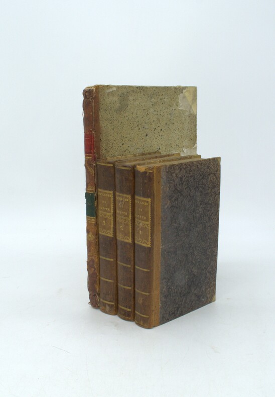
Norimbergue, (hacia 1730), mapa montado sobre cartulina, de 49,5 x 58,5 cm., en colores de época, con bella cartela con figuras alegóricas.
1763pp. [4], 415, [1]. Small age and damp stains to the first and last 40 leaves or so. Wide margined. Large 4to. 300mm. All edges gold gilt. Early plain full vellum binding. Marbled endpapers. Hand lettered ownership of: J.M Hicks, Winton, September 1910. Sole quarto printing of the Greek New Testament using Baskerville type (i.e., Greek type that Baskerville designed and cut himself). The text follows the 1707 edition by John Mill (1645-1707), with seven variations. This quarto edition was limited to 500 copies, and is much scarcer than the 8vo edition issued around the same time. Gaskell - Add. 1; Darlow & Moule 4755. John Baskerville (1706-1775) was the greatest printer of his era. Born in Wolverley, Hereford - Worcester, England, he became a writing master in Birmingham. He also carried on a successful japanning (varnishing) business there. In about 1750 he began to make experiments in letter founding, and produced the wonderful series of types now named after him. His first book, the Virgil of 1757, was also the first to be printed upon wove paper (manufactured by a process that he invented). In 1758 he became printer to Cambridge University. There he designed other fonts, including his remarkable Greek type. All of his books bear the marks of fine craftsmanship and a refined sense of design.**PRICE JUST REDUCED! RARE. SAFE ADD 1
1913Very Good Turkish, Ottoman (1500-1928) Original wrappers. Foolscap 8vo. (18 x 12 cm). In Ottoman script (Old Turkish with Arabic letters). 142, [4] p. Some pages are untrimmed and unopened. Foxing on extremities. Overall a good copy. First and only edition of this uncommon first-hand account in verse of the Siege of Scutari, also referred to as the Siege of Shkodër (Shkodra), took place from 28 October 1912 to 23 April 1913 when the army of the Kingdom of Montenegro defeated the forces of the Ottoman Empire and invaded Shkodër, written by Mehmed Fahri Pasha, who served in Serbia as the chief physician of Shkodra by participating in the Balkan Wars (1912-1913). On 8 October 1912, Turkish General Hasan Riza Pasha announced that Montenegro had declared war on the Ottoman Empire in order to erase 600 years of oppression by the "Turkish foot", as the enemy claimed, and that its troops were crossing the border between Montenegro and Albania. Two hours after the news, the Montenegrin troops, as expected, approached Scutari. As much as 70% of the Turkish army in the interior of the Balkans was composed of Muslim Albanians conscripted during the freedom struggle from the Ottoman Empire. Özege 12224.
1803réf. 8426A Paris, Chez Barba, 1803. 4 volumes in-8 de [6]-CIV-444 / [6]-438-[2] / [6]-383 et [6]-XII-466-[2] pages, demi-veau brun à coins, dos lisses ornés de roulettes et filets dorés, étiquettes de titre bordeaux, pastilles de tomaison noires (chiffre arabe), tranches mouchetées. Quelques très légers frottements, quelques rousseurs, belle condition générale.
1809réf. 29822Paris Didot jeune [ou :] Rignoux 1809-1852 3 vol. in-4 déreliés
1772réf. 18100Paris Barbou 1772 in-12 de viii, 166 pp., 1 f.n.ch. et 1 carte repliée veau marbré, encadrement de trois filets dorés sur les plats, dos lisse orné de motifs dorés, pièce de titre marron, tranches rouges [[Rel. de l'époque]]
1800réf. PHO-1932Paris, de l’imprimerie de Guilleminet, 1800, 2 tomes en 1, in-8, xvi-303pp,1f-319pp., demi basane, dos lisse avec pièce de titre rouge et date verte, tranches mouchetées, illustré de 8 planches dont 2 dépliantes, étiquette en page de garde « Marquis de Civille » et ex-libris manuscrit au titre, quelques écritures en marge, frottements aux plats et coupes. A été relié avec, écrit à la plume, la table des volumes ainsi qu’un texte fustigeant le coté révolutionnaire de l’auteur considéré comme un espion de Bonaparte désirant conquérir la Grèce.