DEMOSTHENES (DEMOSTENE)MareMagnum

17 924 résultats
1607In-4 gr. (mm. 343x215), 2 volumi in 1, mz. pelle con ang. settecentesca (risg. rifatti), tit. oro su tassello al dorso, pp. (42),744; 499 (ma 491),(34), 1 c.b.; bella marca tipografica al frontespizio, ornato da testate, grandi iniziali e finali, tutti inc. su legno. Testo su due colonne, in greco e in latino. “Cum utriusque autoris vita et Ulpiani Commentariis, ex postrema recognitione Graecolatina sex codicum tam impressorum, quam manuscriptorum, à mendis repurgata, doctissimique notis illustrata. Per Hieronymum Vuolfium Oetingensem, utriusque linguae in Augustana Schola olim professorem”. Terza edizione (la prima e’ del 1572). Cfr. Brunet,II, 588 - Graesse,II,358. Con uniformi arross. e fiorit. margin. ma complessivam. un discreto esemplare.
1885réf. CCC-485livres entierement en grec . apla. Les 5 volumes, edition 1885-1887. Reliure demi chagrin tres frotte, coins rapes et abimes, quelques taches de rousseurs dans les livres. Tome 1 : edition 1885, cartes couleurs hors texte dans l'ouvrage et en fin d'ouvrage carte couleur qui se deplie. Tome 2 : edition de 1886, gravure hors texte et une carte qui se deplie en fin d'ouvrage. Tome 3 : les coins ont ete refaient en scootch marron epais, gravures hors texte. Tome 4 : edition de 1887, gravures hors-texte et une carte couleur qui se deplie en fin d'ouvrage et Tome 5 : fin et dernier volume, edition 1887, gravure hors texte et une carte couleur qui se deplie en fin d'ouvrage. "Il est l'auteur d'une Histoire de la Nation hellène des temps les plus anciens jusqu'à nos jours. (Ιστορία του Ελληνικού Έθνους) publiée en 5 tomes entre 1860 et 1874.Son "Manuel d'histoire générale", était fondé sur les "Nouveaux éléments d'histoire générale" de David...." photos possibles
1743London, printed for the author by W. Bowyer, 1743 - 1745. Tre volumi, rilegati in due, in folio. Mezza pelle dell'epoca con titolo ai dorsi (usure e spellature). pp. (2), vi, (8), 310; xi(i), 268; vii(1), 308. Esemplare mancante di tutte le tavole f.t. Internamente ottimo esemplare.
réf. 056627Paris Typographie de Ambroise Firmin-Didot 1868-1879 1868 in 8 (22,5x15) 3 forts volumes reliures demi chagrin vert de l'époque, dos à nerfs ornés de caissons à froid (dos uniformément fanés), lettres JR dorées au en queue. Tome 1: CLXXXIVet 586 pages, avec une grande carte dépliante en couleurs et une planche gravée hors-texte (1868-1872). Tome 2: 716 pages (1873-1877). Tome 3: 718 pages et 4 cartes en couleurs in fine, et une table des matières des volumes (1877-1879). Edition bilingue: texte en grec avec en regard la traduction française établie par Ambroise Firmin Didot . Seconde édition bien complète en 3 volumes. Ensemble en bon état et exempt de rousseurs
réf. 61525c.1880. . Large albumen print. Good tonal range and in good condition; Dimensions: 270 x 370mm. 10.5 x 14.5 inches. The Temple of Olympian Zeus is a former colossal Corinthian temple at the foot of the Acropolis in the centre of Athens. Construction began in the 6th century BC during the rule of the Athenian tyrants but was not completed until the reign of Roman Emperor Hadrian in the 2nd century AD taking a total of 638 years to complete. The temple was reduced to ruins just a century after its completion after being pillaged during a barbarian invasion in 267 AD. However a substantial part of the temple remains despite centuries of extensive quarrying for building materials after the fall of the Roman Empire. Pictured here are only 15 of the original 104 columns still standing with a sixteenth column lying on the ground where it fell during a storm in 1852. The Acropolis is visible behind. Chairs and benches have been laid out around the base of the temple for people to rest. The site remains virtually unchanged today. [c.1880]. unknown
1540Carta tratta dalla Geographia universalis, vetus et nova, complectens. Claudii Ptolemaei Alexandrini Ennarationis libros VIII, pubblicata per la prima volta nel 1540 a Basilea da Heinrich Petri, figliastro di Münster e suo fidatissimo stampatore. Il volume è illustrato da 27 carte costruite seguendo le indicazioni di Tolomeo, a cui si affiancano 21 carte “moderne”, delineate in base alle recenti scoperte geografiche. La Geographia di Münster ebbe un notevole successo, e Petri la ristampò l'anno seguente (1541) e quello successivo ancora. Aumentate di sei le carte moderne, tra le quali la Carta Marina di Olao Magnus descrittiva della Scandinavia, l'editore la ristampò ancora nel 1545, nel 1551 e infine nel 1552, sempre con 54 carte geografiche, ma con la sostituzione della Pomerania al posto del Lago di Costanza. Alla scomparsa di Münster l’opera non venne più ristampata; le matrici lignee, debitamente emendate, furono utilizzate per il Rerum Geographicarum dello Strabo, edizione stampata a Basileae: Ex Officina Henricpetriana, 1571 Mense Augusto. Silografia, in ottimo stato di conservazione. Map taken from the Geographia universalis, vetus et nova, complectens. Claudii Ptolemaei Alexandrini Ennarationis libros VIII, published for the first time in 1540 in Basel by Heinrich Petri, stepson of Münster and his trusted printer. The book is illustrated by 27 maps built following the indications of Ptolemy, which are flanked by 21 "modern" maps, outlined on the basis of recent geographical discoveries. The Geographia of Münster was a great success, and Petri reprinted it the following year (1541) and then in 1542.. Having increased the number of modern maps by six, including the Carta Marina of Olao Magnus describing Scandinavia, the publisher reprinted it again in 1545, in 1551 and finally in 1552, still with 54 maps, but with the substitution of Pomerania in place of Lake Constance. At the death of Münster the work was not reprinted, the wooden plates, duly amended, were used for the Rerum Geographicarum of Strabo, edition printed in Basileae: Ex Officina Henricpetriana, 1571 Mense Augusto. Woodcut, in excellent condition. Zacharakis C. G. "A Catalogue of Printed Maps of Greece 1477 - 1800 (2009), n. 2438.
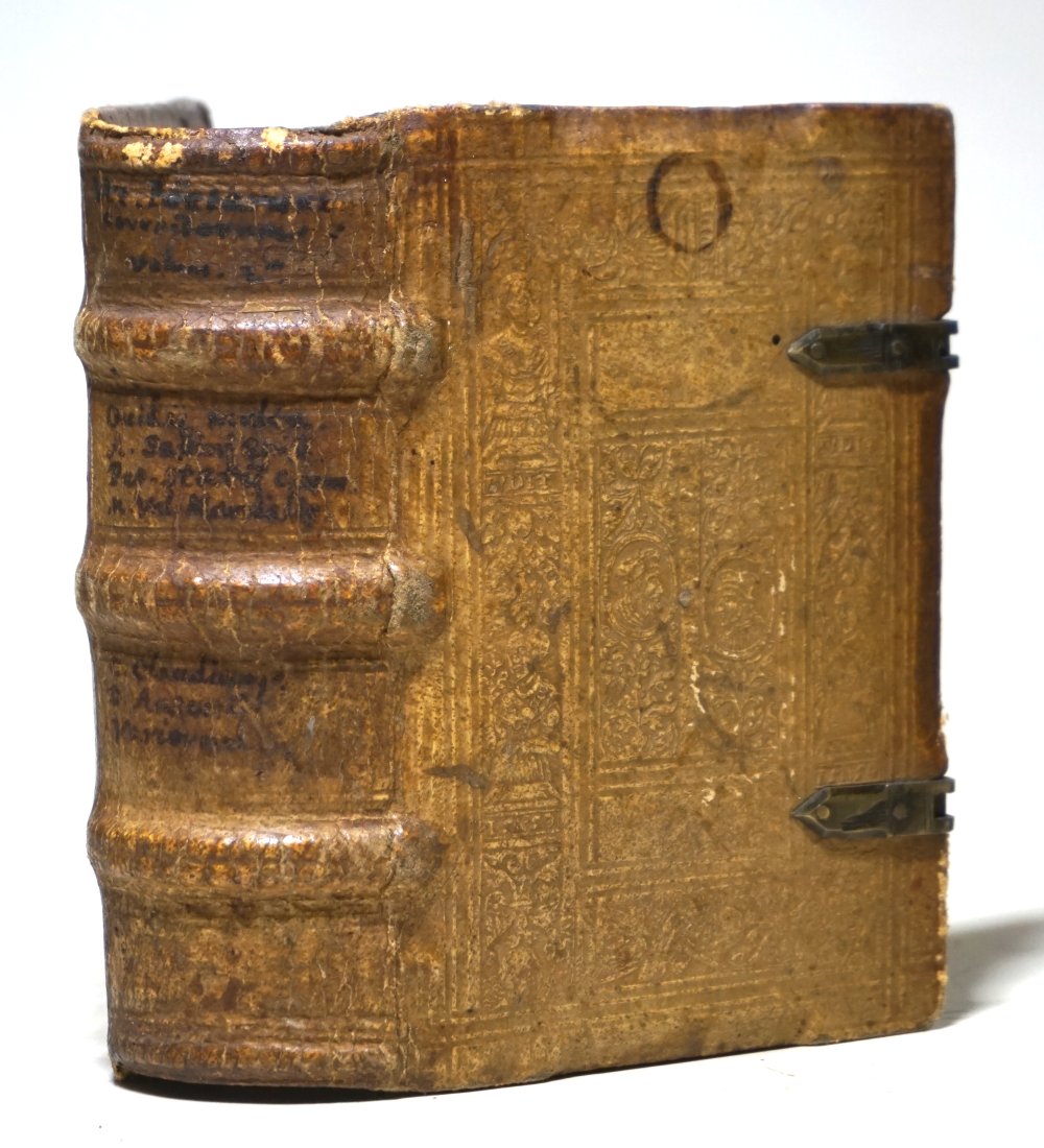
1596réf. 33393-zn4Coloniae Agrippinae (Köln): Officina Birckmannica sumptibus Arnoldii Mylij (Birckmann für Arnold Mylius) 1596. 8 unpaginierte Blatt und 688 Seiten. Mit Plattenstempeln blindgeprägtes Schweinsleder auf Holzdeckeln über drei echte Bünde mit Schließen sowie handschriftlichen Rückentiteln (die Schließbänder fehlend, der Einband mti eine paar Flecken und kleinen Fehlstellen (vgl. Abbildungen), auf dem vorderen Innendeckel ein teilrasiertes Wappen-Exlibris, auf dem Titelblatt ein Besitzvermerk von alter Hand, beim letzten Blatt (Seiten 687/688 wurden drei Zeilen sauber herausgeschnitten, sonst gutes und sauberes Exemplar). 12,5 x 9 cm. [3 Warenabbildungen]
1788réf. 30874Dublin: L. White P. Byrne J. Moore and B. Dornin 1788. First Edition Irish Issue same year as the English Issue. Rare. 8vo bound in contemporary polished calf the spine gilt ruled and with red morocco lettering piece gilt. iiv 407 8 index pp. A very well preserved copy the binding still strong and with only light evidence of age or use the text-block clean and crisp. FIRST EDITION PRINTED IN DUBLIN AT THE SAME TIME AS THE ENGLISH PRINTING IN LONDON. 'Savary was the first Frenchman to cite Arabic texts in his work.and indeeed his knowledge of Arabic served him well in his traels when there were many difficutlites for European travelers in the Mediterranean areas. His letters on Greece are descriptive of the places and inhabitants he viited especially the Dodecanese.' see Blackmer 977 p. 445 L. White, P. Byrne, J. Moore, and B. Dornin unknown
Madrid, Benito Cano, 1786, 15,5 x 10,5 cm., plena piel, lomo con adornos dorados, 10 hojas + 298 págs. + 1 hojs.
1911Very Good Greek, Modern (post 1453) Original wrappers. Large 8vo. (21 x 16 cm). In Greek (Modern). 21 p. First and only edition of this exceedingly rare and one of the earliest church regulations of the Greek Orthodox community of Attalia [Antalya]. Attalia was not a large urban center or major trading hub, but neither was the Greek Community marginal, and it was well integrated into the regional economy. It was different from other areas in Asia Minor due to a combination of factors ranging between demography, geography, local Orthodox leadership, and the city's social milieu. In contrast to the West-coast cities and many villages in Asia Minor with Orthodox majorities, Attalia's population was only about one-third Orthodox. The main area of difference in Antalya was the Community leadership, which was key to the maintenance of cordial relationships between Christians and Muslims, and the secular and ecclesiastical elements of Orthodox leadership in Antalya tended to cooperate for collective benefit. Throughout this period, a local elite managed to control education and other Community institutions, perpetuating an identity that was compatible with the local Ottoman context. In this last period, the Greek Community printed several books and tractates including a brief history of Antalya and this "regulation book" in the Meli Printing House, which was the only printing house of the Greek Community in Antalya. Only one institutional copy is located in OCLC 1030075331 (Suna Kiraç Library of the Koç University).
1800Very Good French Original decorated map. Hand-coloured. Oblong elephant folio. (54 x 76 cm). In French. Shows Greece, Archipelago, Isle de Candie, Asia Minor (Western side), and East Mediterranean. Delisle od de l'Isle was a French cartographer known for his popular and accurate maps of Europe and the newly explored Americas. At 27, Delisle was admitted into the French Académie Royale des Sciences, an institution financed by the French state. After that date, he signed his maps with the title of "Géographe de l'Académie". Five years later, he moved to the Quai de l'Horloge in Paris, a true publishing hub where his business prospered. Delisle's progress culminated in 1718 when he received the title of Premier Géographe du Roi. He was appointed to teach geography to the Dauphin, King Louis XIV's son, a task for which he received a salary. Again, his father's reputation as a man of science probably helped the younger Delisle. Historian Mary Sponberg Pedley says, 'once authority was established, a geographer's name might retain enough value to support two or three generations of mapmakers'. Delisle's case, it could be said that his accomplishments surpassed his father's. Up to that point, he had drawn maps not only of European countries, such as Italy, Spain, Germany, Great Britain, Poland, and regions such as the Duchy of Burgundy, but he had also contributed to the empire's claims to recently explored continents of Africa and the Americas. Like many cartographers of his day, Delisle did not travel with the explorers. He drew maps mostly in his office, relying on a variety of data. The quality of his maps depended on a solid network to provide him first-hand information. Given his family's and his own reputation, Delisle had access to fairly recent accounts of travellers who were returning from the New World, which gave him an advantage over his competitors. Being a member of the Académie, he also kept current with recent discoveries, especially in astronomy and measurement. When he could not confirm the accuracy of a source, he would indicate it clearly on his maps. For instance, his Carte de la Louisiane shows a river that the baron of Lahontan claimed he discovered. As no one else could validate it, Delisle noted a warning to the viewer that it might not exist. (Source: Wikipedia). Tooley, p.43.
1909Very Good Turkish, Ottoman (1500-1928) Original color map on cloth. A little foxing on cloth. Very good. Folded. Oblong atlas folio. (66 x 72 cm). In Ottoman script. Scale: 1/210.000. Ottoman sanjaks in Albania and Greece. A rare Ottoman map of Balkans with Turkish place names for the period of pre-Balkan Wars, (1912-1913). Very important for onomastics and historical geography. Written 'Paris -French meridian- was accepted as the 0 meridian'. The Paris meridian is a meridian line running through the Paris Observatory in Paris, France-now longitude 2°20'14.03" east. It was a long-standing rival to the Greenwich meridian as the prime meridian of the world. Personal stamp of Muhiddin Pasha on cloth, under the printed descriptive texts. It's from the collection of him. Hasan Muhiddin Pasha [Çanga], (1866-1944), who was a lieutenant in Hedjaz Army of the Ottoman Empire in 1887. After he suppressed the rebellion in Yemen, 1891, his rank was promoted to the 'major'. After the Imam Yahya rebellion in Yemen, 1904, he prepared a report for the Ottoman government. He also took part in Ethiopia, Sudan, Yemen, Arabian Peninsula for various military duties. After promotion to division command, he was provincial president of CHP (Republican People's Party). He was a very important politic and diplomatic figure for the last period of Ottoman and early Republican Turkey. Not in Tooley. Extremely rare.
1909Very Good Turkish, Ottoman (1500-1928) Original color map on cloth. A little foxing on cloth. Very good. Folded. Oblong atlas folio. (66 x 72 cm). In Ottoman script. Scale: 1/210.000. Ottoman cities in Bulgaria. A rare Ottoman map of Balkans with Turkish place names for the period of pre-Balkan Wars, (1912-1913). Very important for onomastics and historical geography. Written 'Paris -French meridian- was accepted as the 0 meridian'. The Paris meridian is a meridian line running through the Paris Observatory in Paris, France-now longitude 2°20'14.03" east. It was a long-standing rival to the Greenwich meridian as the prime meridian of the world. Personal stamp of Muhiddin Pasha on cloth, under the printed descriptive texts. It's from the collection of him. Hasan Muhiddin Pasha [Çanga], (1866-1944), who was a lieutenant in Hedjaz Army of the Ottoman Empire in 1887. After he suppressed the rebellion in Yemen, 1891, his rank was promoted to the 'major'. After the Imam Yahya rebellion in Yemen, 1904, he prepared a report for the Ottoman government. He also took part in Ethiopia, Sudan, Yemen, Arabian Peninsula for various military duties. After promotion to division command, he was provincial president of CHP (Republican People's Party). He was a very important politic and diplomatic figure for the last period of Ottoman and early Republican Turkey. Not in Tooley. Extremely rare.
1909Very Good Turkish, Ottoman (1500-1928) Original color map on cloth. A little foxing on cloth. Very good. Folded. Oblong atlas folio. (66 x 72 cm). In Ottoman script. Scale: 1/210.000. Ottoman sanjaks in Greece, mostly in Greek Macedonia. A rare Ottoman map of Balkans with Turkish place names for the period of pre-Balkan Wars, (1912-1913). Very important for onomastics and historical geography. Written 'Paris -French meridian- was accepted as the 0 meridian'. The Paris meridian is a meridian line running through the Paris Observatory in Paris, France-now longitude 2°20'14.03" east. It was a long-standing rival to the Greenwich meridian as the prime meridian of the world. Personal stamp of Muhiddin Pasha on cloth, under the printed descriptive texts. It's from the collection of him. Hasan Muhiddin Pasha [Çanga], (1866-1944), who was a lieutenant in Hedjaz Army of the Ottoman Empire in 1887. After he suppressed the rebellion in Yemen, 1891, his rank was promoted to the 'major'. After the Imam Yahya rebellion in Yemen, 1904, he prepared a report for the Ottoman government. He also took part in Ethiopia, Sudan, Yemen, Arabian Peninsula for various military duties. After promotion to division command, he was provincial president of CHP (Republican People's Party). He was a very important politic and diplomatic figure for the last period of Ottoman and early Republican Turkey. Not in Tooley. Extremely rare.
1909Very Good Turkish, Ottoman (1500-1928) Original color map on cloth. A little foxing on cloth. Very good. Folded. Oblong atlas folio. (66 x 72 cm). In Ottoman script. Scale: 1/210.000. Ottoman sanjaks in Greece, mostly in Greek Macedonia. A rare Ottoman map of Balkans with Turkish place names for the period of pre-Balkan Wars, (1912-1913). Very important for onomastics and historical geography. Written 'Paris -French meridian- was accepted as the 0 meridian'. The Paris meridian is a meridian line running through the Paris Observatory in Paris, France-now longitude 2°20'14.03" east. It was a long-standing rival to the Greenwich meridian as the prime meridian of the world. Personal stamp of Muhiddin Pasha on cloth, under the printed descriptive texts. It's from the collection of him. Hasan Muhiddin Pasha [Çanga], (1866-1944), who was a lieutenant in Hedjaz Army of the Ottoman Empire in 1887. After he suppressed the rebellion in Yemen, 1891, his rank was promoted to the 'major'. After the Imam Yahya rebellion in Yemen, 1904, he prepared a report for the Ottoman government. He also took part in Ethiopia, Sudan, Yemen, Arabian Peninsula for various military duties. After promotion to division command, he was provincial president of CHP (Republican People's Party). He was a very important politic and diplomatic figure for the last period of Ottoman and early Republican Turkey. Not in Tooley. Extremely rare.
1909Very Good Turkish, Ottoman (1500-1928) Original color map on cloth. A little foxing on cloth. Very good. Folded. Oblong atlas folio. (66 x 72 cm). In Ottoman script. Scale: 1/210.000. Ottoman sanjaks in Greece, mostly in Thessaly. A rare Ottoman map of Balkans with Turkish place names for the period of pre-Balkan Wars, (1912-1913). Very important for onomastics and historical geography. Written 'Paris -French meridian- was accepted as the 0 meridian'. The Paris meridian is a meridian line running through the Paris Observatory in Paris, France-now longitude 2°20'14.03" east. It was a long-standing rival to the Greenwich meridian as the prime meridian of the world. Personal stamp of Muhiddin Pasha on cloth, under the printed descriptive texts. It's from the collection of him. Hasan Muhiddin Pasha [Çanga], (1866-1944), who was a lieutenant in Hedjaz Army of the Ottoman Empire in 1887. After he suppressed the rebellion in Yemen, 1891, his rank was promoted to the 'major'. After the Imam Yahya rebellion in Yemen, 1904, he prepared a report for the Ottoman government. He also took part in Ethiopia, Sudan, Yemen, Arabian Peninsula for various military duties. After promotion to division command, he was provincial president of CHP (Republican People's Party). He was a very important politic and diplomatic figure for the last period of Ottoman and early Republican Turkey. Not in Tooley. Extremely rare.
1909Very Good Turkish, Ottoman (1500-1928) Original color map on cloth. A little foxing on cloth. Very good. Folded. Oblong atlas folio. (66 x 72 cm). In Ottoman script. Scale: 1/210.000. Ottoman sanjaks in Greece, mostly in Thessaly. A rare Ottoman map of Balkans with Turkish place names for the period of pre-Balkan Wars, (1912-1913). Very important for onomastics and historical geography. Written 'Paris -French meridian- was accepted as the 0 meridian'. The Paris meridian is a meridian line running through the Paris Observatory in Paris, France-now longitude 2°20'14.03" east. It was a long-standing rival to the Greenwich meridian as the prime meridian of the world. Personal stamp of Muhiddin Pasha on cloth, under the printed descriptive texts. It's from the collection of him. Hasan Muhiddin Pasha [Çanga], (1866-1944), who was a lieutenant in Hedjaz Army of the Ottoman Empire in 1887. After he suppressed the rebellion in Yemen, 1891, his rank was promoted to the 'major'. After the Imam Yahya rebellion in Yemen, 1904, he prepared a report for the Ottoman government. He also took part in Ethiopia, Sudan, Yemen, Arabian Peninsula for various military duties. After promotion to division command, he was provincial president of CHP (Republican People's Party). He was a very important politic and diplomatic figure for the last period of Ottoman and early Republican Turkey. Not in Tooley. Extremely rare.
1909Very Good Turkish, Ottoman (1500-1928) Original color map on cloth. A little foxing on cloth. Very good. Folded. Oblong atlas folio. (66 x 72 cm). In Ottoman script. Scale: 1/210.000. Ottoman sanjaks in Greece. A rare Ottoman map of Balkans with Turkish place names for the period of pre-Balkan Wars, (1912-1913). Very important for onomastics and historical geography. Written 'Paris -French meridian- was accepted as the 0 meridian'. The Paris meridian is a meridian line running through the Paris Observatory in Paris, France-now longitude 2°20'14.03" east. It was a long-standing rival to the Greenwich meridian as the prime meridian of the world. Personal stamp of Muhiddin Pasha on cloth, under the printed descriptive texts. It's from the collection of him. Hasan Muhiddin Pasha [Çanga], (1866-1944), who was a lieutenant in Hedjaz Army of the Ottoman Empire in 1887. After he suppressed the rebellion in Yemen, 1891, his rank was promoted to the 'major'. After the Imam Yahya rebellion in Yemen, 1904, he prepared a report for the Ottoman government. He also took part in Ethiopia, Sudan, Yemen, Arabian Peninsula for various military duties. After promotion to division command, he was provincial president of CHP (Republican People's Party). He was a very important politic and diplomatic figure for the last period of Ottoman and early Republican Turkey. Not in Tooley. Extremely rare.
1909Very Good Turkish, Ottoman (1500-1928) Original color map on cloth. A little foxing on cloth. Very good. Folded. Oblong atlas folio. (66 x 72 cm). In Ottoman script. Scale: 1/210.000. Ottoman sanjaks in Greece. A rare Ottoman map of Balkans with Turkish place names for the period of pre-Balkan Wars, (1912-1913). Very important for onomastics and historical geography. Written 'Paris -French meridian- was accepted as the 0 meridian'. The Paris meridian is a meridian line running through the Paris Observatory in Paris, France-now longitude 2°20'14.03" east. It was a long-standing rival to the Greenwich meridian as the prime meridian of the world. Personal stamp of Muhiddin Pasha on cloth, under the printed descriptive texts. It's from the collection of him. Hasan Muhiddin Pasha [Çanga], (1866-1944), who was a lieutenant in Hedjaz Army of the Ottoman Empire in 1887. After he suppressed the rebellion in Yemen, 1891, his rank was promoted to the 'major'. After the Imam Yahya rebellion in Yemen, 1904, he prepared a report for the Ottoman government. He also took part in Ethiopia, Sudan, Yemen, Arabian Peninsula for various military duties. After promotion to division command, he was provincial president of CHP (Republican People's Party). He was a very important politic and diplomatic figure for the last period of Ottoman and early Republican Turkey. Not in Tooley. Extremely rare.
1909Very Good Turkish, Ottoman (1500-1928) Original color map on cloth. A little foxing on cloth. Very good. Folded. Oblong atlas folio. (66 x 72 cm). In Ottoman script. Scale: 1/210.000. Ottoman sanjaks in Greece, mostly in Thessaly and Macedonian Greece. A rare Ottoman map of Balkans with Turkish place names for the period of pre-Balkan Wars, (1912-1913). Very important for onomastics and historical geography. Written 'Paris -French meridian- was accepted as the 0 meridian'. The Paris meridian is a meridian line running through the Paris Observatory in Paris, France-now longitude 2°20'14.03" east. It was a long-standing rival to the Greenwich meridian as the prime meridian of the world. Personal stamp of Muhiddin Pasha on cloth, under the printed descriptive texts. It's from the collection of him. Hasan Muhiddin Pasha [Çanga], (1866-1944), who was a lieutenant in Hedjaz Army of the Ottoman Empire in 1887. After he suppressed the rebellion in Yemen, 1891, his rank was promoted to the 'major'. After the Imam Yahya rebellion in Yemen, 1904, he prepared a report for the Ottoman government. He also took part in Ethiopia, Sudan, Yemen, Arabian Peninsula for various military duties. After promotion to division command, he was provincial president of CHP (Republican People's Party). He was a very important politic and diplomatic figure for the last period of Ottoman and early Republican Turkey. Not in Tooley. Extremely rare.
1909Very Good Turkish, Ottoman (1500-1928) Original color map on cloth. A little foxing on cloth. Very good. Folded. Oblong atlas folio. (66 x 72 cm). In Ottoman script. Scale: 1/210.000. Ottoman sanjaks in Balkans. A rare Ottoman map of Balkans with Turkish place names for the period of pre-Balkan Wars, (1912-1913). Very important for onomastics and historical geography. Written 'Paris -French meridian- was accepted as the 0 meridian'. The Paris meridian is a meridian line running through the Paris Observatory in Paris, France-now longitude 2°20'14.03" east. It was a long-standing rival to the Greenwich meridian as the prime meridian of the world. Personal stamp of Muhiddin Pasha on cloth, under the printed descriptive texts. It's from the collection of him. Hasan Muhiddin Pasha [Çanga], (1866-1944), who was a lieutenant in Hedjaz Army of the Ottoman Empire in 1887. After he suppressed the rebellion in Yemen, 1891, his rank was promoted to the 'major'. After the Imam Yahya rebellion in Yemen, 1904, he prepared a report for the Ottoman government. He also took part in Ethiopia, Sudan, Yemen, Arabian Peninsula for various military duties. After promotion to division command, he was provincial president of CHP (Republican People's Party). He was a very important politic and diplomatic figure for the last period of Ottoman and early Republican Turkey. Not in Tooley. Extremely rare.
1909Very Good Turkish, Ottoman (1500-1928) Original color map on cloth. A little foxing on cloth. Very good. Folded. Oblong atlas folio. (66 x 72 cm). In Ottoman script. Scale: 1/210.000. Ottoman sanjaks in Albania, Macedonia, Greece and Serbia. A rare Ottoman map of Balkans with Turkish place names for the period of pre-Balkan Wars, (1912-1913). Very important for onomastics and historical geography. Written 'Paris -French meridian- was accepted as the 0 meridian'. The Paris meridian is a meridian line running through the Paris Observatory in Paris, France-now longitude 2°20'14.03" east. It was a long-standing rival to the Greenwich meridian as the prime meridian of the world. Personal stamp of Muhiddin Pasha on cloth, under the printed descriptive texts. It's from the collection of him. Hasan Muhiddin Pasha [Çanga], (1866-1944), who was a lieutenant in Hedjaz Army of the Ottoman Empire in 1887. After he suppressed the rebellion in Yemen, 1891, his rank was promoted to the 'major'. After the Imam Yahya rebellion in Yemen, 1904, he prepared a report for the Ottoman government. He also took part in Ethiopia, Sudan, Yemen, Arabian Peninsula for various military duties. After promotion to division command, he was provincial president of CHP (Republican People's Party). He was a very important politic and diplomatic figure for the last period of Ottoman and early Republican Turkey. Not in Tooley. Extremely rare.
1966réf. 44041Princeton University Press. Very Good with no dust jacket. Hardcover. Very minor shelfwear to volumes. Old price to ffeps.; 3 volumes in 4 parts as issued: Volumes I-III complete.; 3 Volumes in 4 Parts; 4to 11" - 13" tall; Textually complete with all plates and illustrations called for. This massive work on Nestor's Palace was compiled following its excavation by the University of Cincinnati in the 1950s. Nestor was a figure immortalized by Homer and his palace is believed to date back to 13000 B. C. It remained covered by an olive grove until the excavation and this work details all of the finds including tablets seals and frescoes etc. . 1966. Princeton University Press hardcover
réf. 4395...d'Ariste et d'Eudoxe. Physique nouvelle en dialogues. A Paris en 1745. 5 vol. in-12 en veau moucheté. Dos à nerfs fleurdelisés. Très nombreuses planches. Etat correct.
1963réf. mon0003749499Mouton & Co. 1963T. hardcover. Good. 2.2000 9.6000 6.6000. Mouton & Co. hardcover