FERRETTI Francesco (1523 - 1593)MareMagnum

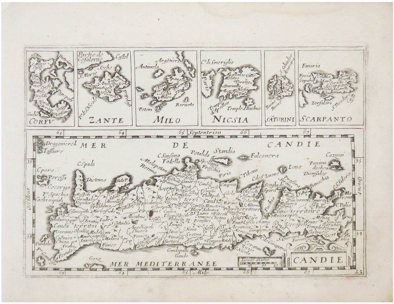
1579Elegante piccola carta geografica dell'isola tratta dai Dialoghi Notturni del Capitano Francesco Ferretti Cavaglier di S. Stefano, edito ad Ancona da Giovan Battista Ciotti, nel 1604. Si tratta della seconda edizione del celebre “isolario” di Francesco Ferretti (per la prima volta edito nel 1579), che contiene 28 mappe di isole europee incise in rame, e racchiuse dentro una cornice ornamentale di forma rotonda, che conferisce alle carte un’inusuale e particolarissima forma alla mappa. Questo raro trattato che fornisce nozioni scientifiche e militari, oltre che geografiche e matematiche. La parte geografica costituisce il corpus principale dell’opera, con le 28 mappe raffiguranti le principali isole del Mediterraneo rappresentate con l’inusuale forma circolare, finemente intagliate da Michelangelo Marelli. Le carte derivano da quelle intagliate da Girolamo Porro per L’isole Piu Famose Del Mondo Descritte Da Thomaso Porcacchi Da Castiglione, edito per la prima volta nel 1572. Ogni carta è racchiusa entro una cornice ornamentale, e mostra le linee dei venti. Il titolo, racchiuso nella parte superiore, è molto grande ed è espresso con la formula Ragionevol’ Forma et vera postura del’ Isola di, seguito dal nome dell’isola. Le mappe sono di piccole dimensioni ma molto accurate. L’opera del Ferretti venne ristampata nel 1608 con il titolo di Arte Militare. Acquaforte e bulino, rifilata la rame o con piccoli margini, in ottimo stato di conservazione. Bibliografia Mortimer 184; Olschki 4539; Cockle 548; Shirley T.FRR-1a. - Nordenskiold Collection I, p.156 no.73; Dufour/La Gumina, p. 85; Ganado 1985 S. 231; Stylianou 81, Navari 33; Zacharakis/Scutari 1499/1003-1518/1022; King, Miniature Antique Maps, pp. 62/3. Nice miniature map of the island, taken from Dialoghi Notturni del Capitano Francesco Ferretti Cavaglier di S. Stefano published in Ancona in 1604. It's the second edition of the rare “Isolario” by Ferretti, that provides scientific knowledge and military, as well as geography and mathematics. The geographical part is the main body of the work, with 28 maps depicting the main islands in the Mediterranean represented with the unusual circular shape, finely carved by Michelangelo Marelli. The maps derive from those engraved by Girolamo Porro for the L’isole Piu Famose Del Mondo Descritte Da Thomaso Porcacchi Da Castiglione, published for the first time in 1572. Each map is enclosed within an ornamental frame, and shows the lines of the winds. The title, enclosed at the top, is very large and is expressed by the formula Ragionevol’ Forma et vera postura del’ Isola di, followed by the name of the island; the maps are small but very accurate. The work of Ferretti was reprinted in 1608 with the title Arte Militare. Literature Mortimer 184; Olschki 4539; Cockle 548; Shirley T.FRR-1a. - Nordenskiold Collection I, p.156 no.73; Dufour/La Gumina, p. 85; Ganado 1985 S. 231; Stylianou 81, Navari 33; Zacharakis/Scutari 1499/1003-1518/1022; King, Miniature Antique Maps, pp. 62/3. G. Tolias, Mapping Greece, 0722; Zacharakis, A Catalogue of Printed Maps of Greece 1477-1800, 1504.
1579Elegante piccola carta geografica dell'isola tratta dai Dialoghi Notturni del Capitano Francesco Ferretti Cavaglier di S. Stefano, edito ad Ancona da Giovan Battista Ciotti, nel 1604. Si tratta della seconda edizione del celebre “isolario” di Francesco Ferretti (per la prima volta edito nel 1579), che contiene 28 mappe di isole europee incise in rame, e racchiuse dentro una cornice ornamentale di forma rotonda, che conferisce alle carte un’inusuale e particolarissima forma alla mappa. Questo raro trattato che fornisce nozioni scientifiche e militari, oltre che geografiche e matematiche. La parte geografica costituisce il corpus principale dell’opera, con le 28 mappe raffiguranti le principali isole del Mediterraneo rappresentate con l’inusuale forma circolare, finemente intagliate da Michelangelo Marelli. Le carte derivano da quelle intagliate da Girolamo Porro per L’isole Piu Famose Del Mondo Descritte Da Thomaso Porcacchi Da Castiglione, edito per la prima volta nel 1572. Ogni carta è racchiusa entro una cornice ornamentale, e mostra le linee dei venti. Il titolo, racchiuso nella parte superiore, è molto grande ed è espresso con la formula Ragionevol’ Forma et vera postura del’ Isola di, seguito dal nome dell’isola. Le mappe sono di piccole dimensioni ma molto accurate. L’opera del Ferretti venne ristampata nel 1608 con il titolo di Arte Militare. Acquaforte e bulino, rifilata la rame o con piccoli margini, in ottimo stato di conservazione. Bibliografia Mortimer 184; Olschki 4539; Cockle 548; Shirley T.FRR-1a. - Nordenskiold Collection I, p.156 no.73; Dufour/La Gumina, p. 85; Ganado 1985 S. 231; Stylianou 81, Navari 33; Zacharakis/Scutari 1499/1003-1518/1022; King, Miniature Antique Maps, pp. 62/3. Nice miniature map of the island, taken from Dialoghi Notturni del Capitano Francesco Ferretti Cavaglier di S. Stefano published in Ancona in 1604. It's the second edition of the rare “Isolario” by Ferretti, that provides scientific knowledge and military, as well as geography and mathematics. The geographical part is the main body of the work, with 28 maps depicting the main islands in the Mediterranean represented with the unusual circular shape, finely carved by Michelangelo Marelli. The maps derive from those engraved by Girolamo Porro for the L’isole Piu Famose Del Mondo Descritte Da Thomaso Porcacchi Da Castiglione, published for the first time in 1572. Each map is enclosed within an ornamental frame, and shows the lines of the winds. The title, enclosed at the top, is very large and is expressed by the formula Ragionevol’ Forma et vera postura del’ Isola di, followed by the name of the island; the maps are small but very accurate. The work of Ferretti was reprinted in 1608 with the title Arte Militare. Literature Mortimer 184; Olschki 4539; Cockle 548; Shirley T.FRR-1a. - Nordenskiold Collection I, p.156 no.73; Dufour/La Gumina, p. 85; Ganado 1985 S. 231; Stylianou 81, Navari 33; Zacharakis/Scutari 1499/1003-1518/1022; King, Miniature Antique Maps, pp. 62/3. G. Tolias, Mapping Greece, 0723; Zacharakis, A Catalogue of Printed Maps of Greece 1477-1800, 1505.
1579Elegante piccola carta geografica dell'isola tratta dai Dialoghi Notturni del Capitano Francesco Ferretti Cavaglier di S. Stefano, edito ad Ancona da Giovan Battista Ciotti, nel 1604. Si tratta della seconda edizione del celebre “isolario” di Francesco Ferretti (per la prima volta edito nel 1579), che contiene 28 mappe di isole europee incise in rame, e racchiuse dentro una cornice ornamentale di forma rotonda, che conferisce alle carte un’inusuale e particolarissima forma alla mappa. Questo raro trattato che fornisce nozioni scientifiche e militari, oltre che geografiche e matematiche. La parte geografica costituisce il corpus principale dell’opera, con le 28 mappe raffiguranti le principali isole del Mediterraneo rappresentate con l’inusuale forma circolare, finemente intagliate da Michelangelo Marelli. Le carte derivano da quelle intagliate da Girolamo Porro per L’isole Piu Famose Del Mondo Descritte Da Thomaso Porcacchi Da Castiglione, edito per la prima volta nel 1572. Ogni carta è racchiusa entro una cornice ornamentale, e mostra le linee dei venti. Il titolo, racchiuso nella parte superiore, è molto grande ed è espresso con la formula Ragionevol’ Forma et vera postura del’ Isola di, seguito dal nome dell’isola. Le mappe sono di piccole dimensioni ma molto accurate. L’opera del Ferretti venne ristampata nel 1608 con il titolo di Arte Militare. Acquaforte e bulino, rifilata la rame o con piccoli margini, in ottimo stato di conservazione. Bibliografia Mortimer 184; Olschki 4539; Cockle 548; Shirley T.FRR-1a. - Nordenskiold Collection I, p.156 no.73; Dufour/La Gumina, p. 85; Ganado 1985 S. 231; Stylianou 81, Navari 33; Zacharakis/Scutari 1499/1003-1518/1022; King, Miniature Antique Maps, pp. 62/3. Nice miniature map of the island, taken from Dialoghi Notturni del Capitano Francesco Ferretti Cavaglier di S. Stefano published in Ancona in 1604. It's the second edition of the rare “Isolario” by Ferretti, that provides scientific knowledge and military, as well as geography and mathematics. The geographical part is the main body of the work, with 28 maps depicting the main islands in the Mediterranean represented with the unusual circular shape, finely carved by Michelangelo Marelli. The maps derive from those engraved by Girolamo Porro for the L’isole Piu Famose Del Mondo Descritte Da Thomaso Porcacchi Da Castiglione, published for the first time in 1572. Each map is enclosed within an ornamental frame, and shows the lines of the winds. The title, enclosed at the top, is very large and is expressed by the formula Ragionevol’ Forma et vera postura del’ Isola di, followed by the name of the island; the maps are small but very accurate. The work of Ferretti was reprinted in 1608 with the title Arte Militare. Literature Mortimer 184; Olschki 4539; Cockle 548; Shirley T.FRR-1a. - Nordenskiold Collection I, p.156 no.73; Dufour/La Gumina, p. 85; Ganado 1985 S. 231; Stylianou 81, Navari 33; Zacharakis/Scutari 1499/1003-1518/1022; King, Miniature Antique Maps, pp. 62/3. G. Tolias, Mapping Greece, 0719; Zacharakis, A Catalogue of Printed Maps of Greece 1477-1800, 1501.
1579Elegante piccola carta geografica dell'isola tratta dai Dialoghi Notturni del Capitano Francesco Ferretti Cavaglier di S. Stefano, edito ad Ancona da Giovan Battista Ciotti, nel 1604. Si tratta della seconda edizione del celebre “isolario” di Francesco Ferretti (per la prima volta edito nel 1579), che contiene 28 mappe di isole europee incise in rame, e racchiuse dentro una cornice ornamentale di forma rotonda, che conferisce alle carte un’inusuale e particolarissima forma alla mappa. Questo raro trattato che fornisce nozioni scientifiche e militari, oltre che geografiche e matematiche. La parte geografica costituisce il corpus principale dell’opera, con le 28 mappe raffiguranti le principali isole del Mediterraneo rappresentate con l’inusuale forma circolare, finemente intagliate da Michelangelo Marelli. Le carte derivano da quelle intagliate da Girolamo Porro per L’isole Piu Famose Del Mondo Descritte Da Thomaso Porcacchi Da Castiglione, edito per la prima volta nel 1572. Ogni carta è racchiusa entro una cornice ornamentale, e mostra le linee dei venti. Il titolo, racchiuso nella parte superiore, è molto grande ed è espresso con la formula Ragionevol’ Forma et vera postura del’ Isola di, seguito dal nome dell’isola. Le mappe sono di piccole dimensioni ma molto accurate. L’opera del Ferretti venne ristampata nel 1608 con il titolo di Arte Militare. Acquaforte e bulino, rifilata la rame o con piccoli margini, in ottimo stato di conservazione. Bibliografia Mortimer 184; Olschki 4539; Cockle 548; Shirley T.FRR-1a. - Nordenskiold Collection I, p.156 no.73; Dufour/La Gumina, p. 85; Ganado 1985 S. 231; Stylianou 81, Navari 33; Zacharakis/Scutari 1499/1003-1518/1022; King, Miniature Antique Maps, pp. 62/3. Nice miniature map of the island, taken from Dialoghi Notturni del Capitano Francesco Ferretti Cavaglier di S. Stefano published in Ancona in 1604. It's the second edition of the rare “Isolario” by Ferretti, that provides scientific knowledge and military, as well as geography and mathematics. The geographical part is the main body of the work, with 28 maps depicting the main islands in the Mediterranean represented with the unusual circular shape, finely carved by Michelangelo Marelli. The maps derive from those engraved by Girolamo Porro for the L’isole Piu Famose Del Mondo Descritte Da Thomaso Porcacchi Da Castiglione, published for the first time in 1572. Each map is enclosed within an ornamental frame, and shows the lines of the winds. The title, enclosed at the top, is very large and is expressed by the formula Ragionevol’ Forma et vera postura del’ Isola di, followed by the name of the island; the maps are small but very accurate. The work of Ferretti was reprinted in 1608 with the title Arte Militare. Literature Mortimer 184; Olschki 4539; Cockle 548; Shirley T.FRR-1a. - Nordenskiold Collection I, p.156 no.73; Dufour/La Gumina, p. 85; Ganado 1985 S. 231; Stylianou 81, Navari 33; Zacharakis/Scutari 1499/1003-1518/1022; King, Miniature Antique Maps, pp. 62/3. G. Tolias, Mapping Greece, 0733; Zacharakis, A Catalogue of Printed Maps of Greece 1477-1800, 1515.
1579Elegante piccola carta geografica dell'isola tratta dai Dialoghi Notturni del Capitano Francesco Ferretti Cavaglier di S. Stefano, edito ad Ancona da Giovan Battista Ciotti, nel 1604. Si tratta della seconda edizione del celebre “isolario” di Francesco Ferretti (per la prima volta edito nel 1579), che contiene 28 mappe di isole europee incise in rame, e racchiuse dentro una cornice ornamentale di forma rotonda, che conferisce alle carte un’inusuale e particolarissima forma alla mappa. Questo raro trattato che fornisce nozioni scientifiche e militari, oltre che geografiche e matematiche. La parte geografica costituisce il corpus principale dell’opera, con le 28 mappe raffiguranti le principali isole del Mediterraneo rappresentate con l’inusuale forma circolare, finemente intagliate da Michelangelo Marelli. Le carte derivano da quelle intagliate da Girolamo Porro per L’isole Piu Famose Del Mondo Descritte Da Thomaso Porcacchi Da Castiglione, edito per la prima volta nel 1572. Ogni carta è racchiusa entro una cornice ornamentale, e mostra le linee dei venti. Il titolo, racchiuso nella parte superiore, è molto grande ed è espresso con la formula Ragionevol’ Forma et vera postura del’ Isola di, seguito dal nome dell’isola. Le mappe sono di piccole dimensioni ma molto accurate. L’opera del Ferretti venne ristampata nel 1608 con il titolo di Arte Militare. Acquaforte e bulino, rifilata la rame o con piccoli margini, in ottimo stato di conservazione. Bibliografia Mortimer 184; Olschki 4539; Cockle 548; Shirley T.FRR-1a. - Nordenskiold Collection I, p.156 no.73; Dufour/La Gumina, p. 85; Ganado 1985 S. 231; Stylianou 81, Navari 33; Zacharakis/Scutari 1499/1003-1518/1022; King, Miniature Antique Maps, pp. 62/3. Nice miniature map of the island, taken from Dialoghi Notturni del Capitano Francesco Ferretti Cavaglier di S. Stefano published in Ancona in 1604. It's the second edition of the rare “Isolario” by Ferretti, that provides scientific knowledge and military, as well as geography and mathematics. The geographical part is the main body of the work, with 28 maps depicting the main islands in the Mediterranean represented with the unusual circular shape, finely carved by Michelangelo Marelli. The maps derive from those engraved by Girolamo Porro for the L’isole Piu Famose Del Mondo Descritte Da Thomaso Porcacchi Da Castiglione, published for the first time in 1572. Each map is enclosed within an ornamental frame, and shows the lines of the winds. The title, enclosed at the top, is very large and is expressed by the formula Ragionevol’ Forma et vera postura del’ Isola di, followed by the name of the island; the maps are small but very accurate. The work of Ferretti was reprinted in 1608 with the title Arte Militare. Literature Mortimer 184; Olschki 4539; Cockle 548; Shirley T.FRR-1a. - Nordenskiold Collection I, p.156 no.73; Dufour/La Gumina, p. 85; Ganado 1985 S. 231; Stylianou 81, Navari 33; Zacharakis/Scutari 1499/1003-1518/1022; King, Miniature Antique Maps, pp. 62/3. G. Tolias, Mapping Greece, 0726; Zacharakis, A Catalogue of Printed Maps of Greece 1477-1800, 1508.
1579Elegante piccola carta geografica dell'isola tratta dai Dialoghi Notturni del Capitano Francesco Ferretti Cavaglier di S. Stefano, edito ad Ancona da Giovan Battista Ciotti, nel 1604. Si tratta della seconda edizione del celebre “isolario” di Francesco Ferretti (per la prima volta edito nel 1579), che contiene 28 mappe di isole europee incise in rame, e racchiuse dentro una cornice ornamentale di forma rotonda, che conferisce alle carte un’inusuale e particolarissima forma alla mappa. Questo raro trattato che fornisce nozioni scientifiche e militari, oltre che geografiche e matematiche. La parte geografica costituisce il corpus principale dell’opera, con le 28 mappe raffiguranti le principali isole del Mediterraneo rappresentate con l’inusuale forma circolare, finemente intagliate da Michelangelo Marelli. Le carte derivano da quelle intagliate da Girolamo Porro per L’isole Piu Famose Del Mondo Descritte Da Thomaso Porcacchi Da Castiglione, edito per la prima volta nel 1572. Ogni carta è racchiusa entro una cornice ornamentale, e mostra le linee dei venti. Il titolo, racchiuso nella parte superiore, è molto grande ed è espresso con la formula Ragionevol’ Forma et vera postura del’ Isola di, seguito dal nome dell’isola. Le mappe sono di piccole dimensioni ma molto accurate. L’opera del Ferretti venne ristampata nel 1608 con il titolo di Arte Militare. Acquaforte e bulino, rifilata la rame o con piccoli margini, in ottimo stato di conservazione. Bibliografia Mortimer 184; Olschki 4539; Cockle 548; Shirley T.FRR-1a. - Nordenskiold Collection I, p.156 no.73; Dufour/La Gumina, p. 85; Ganado 1985 S. 231; Stylianou 81, Navari 33; Zacharakis/Scutari 1499/1003-1518/1022; King, Miniature Antique Maps, pp. 62/3. Nice miniature map of the island, taken from Dialoghi Notturni del Capitano Francesco Ferretti Cavaglier di S. Stefano published in Ancona in 1604. It's the second edition of the rare “Isolario” by Ferretti, that provides scientific knowledge and military, as well as geography and mathematics. The geographical part is the main body of the work, with 28 maps depicting the main islands in the Mediterranean represented with the unusual circular shape, finely carved by Michelangelo Marelli. The maps derive from those engraved by Girolamo Porro for the L’isole Piu Famose Del Mondo Descritte Da Thomaso Porcacchi Da Castiglione, published for the first time in 1572. Each map is enclosed within an ornamental frame, and shows the lines of the winds. The title, enclosed at the top, is very large and is expressed by the formula Ragionevol’ Forma et vera postura del’ Isola di, followed by the name of the island; the maps are small but very accurate. The work of Ferretti was reprinted in 1608 with the title Arte Militare. Literature Mortimer 184; Olschki 4539; Cockle 548; Shirley T.FRR-1a. - Nordenskiold Collection I, p.156 no.73; Dufour/La Gumina, p. 85; Ganado 1985 S. 231; Stylianou 81, Navari 33; Zacharakis/Scutari 1499/1003-1518/1022; King, Miniature Antique Maps, pp. 62/3. G. Tolias, Mapping Greece, 0729; Zacharakis, A Catalogue of Printed Maps of Greece 1477-1800, 1511.
1579Elegante piccola carta geografica dell'isola tratta dai Dialoghi Notturni del Capitano Francesco Ferretti Cavaglier di S. Stefano, edito ad Ancona da Giovan Battista Ciotti, nel 1604. Si tratta della seconda edizione del celebre “isolario” di Francesco Ferretti (per la prima volta edito nel 1579), che contiene 28 mappe di isole europee incise in rame, e racchiuse dentro una cornice ornamentale di forma rotonda, che conferisce alle carte un’inusuale e particolarissima forma alla mappa. Questo raro trattato che fornisce nozioni scientifiche e militari, oltre che geografiche e matematiche. La parte geografica costituisce il corpus principale dell’opera, con le 28 mappe raffiguranti le principali isole del Mediterraneo rappresentate con l’inusuale forma circolare, finemente intagliate da Michelangelo Marelli. Le carte derivano da quelle intagliate da Girolamo Porro per L’isole Piu Famose Del Mondo Descritte Da Thomaso Porcacchi Da Castiglione, edito per la prima volta nel 1572. Ogni carta è racchiusa entro una cornice ornamentale, e mostra le linee dei venti. Il titolo, racchiuso nella parte superiore, è molto grande ed è espresso con la formula Ragionevol’ Forma et vera postura del’ Isola di, seguito dal nome dell’isola. Le mappe sono di piccole dimensioni ma molto accurate. L’opera del Ferretti venne ristampata nel 1608 con il titolo di Arte Militare. Acquaforte e bulino, rifilata la rame o con piccoli margini, in ottimo stato di conservazione. Bibliografia Mortimer 184; Olschki 4539; Cockle 548; Shirley T.FRR-1a. - Nordenskiold Collection I, p.156 no.73; Dufour/La Gumina, p. 85; Ganado 1985 S. 231; Stylianou 81, Navari 33; Zacharakis/Scutari 1499/1003-1518/1022; King, Miniature Antique Maps, pp. 62/3. Nice miniature map of the island, taken from Dialoghi Notturni del Capitano Francesco Ferretti Cavaglier di S. Stefano published in Ancona in 1604. It's the second edition of the rare “Isolario” by Ferretti, that provides scientific knowledge and military, as well as geography and mathematics. The geographical part is the main body of the work, with 28 maps depicting the main islands in the Mediterranean represented with the unusual circular shape, finely carved by Michelangelo Marelli. The maps derive from those engraved by Girolamo Porro for the L’isole Piu Famose Del Mondo Descritte Da Thomaso Porcacchi Da Castiglione, published for the first time in 1572. Each map is enclosed within an ornamental frame, and shows the lines of the winds. The title, enclosed at the top, is very large and is expressed by the formula Ragionevol’ Forma et vera postura del’ Isola di, followed by the name of the island; the maps are small but very accurate. The work of Ferretti was reprinted in 1608 with the title Arte Militare. Literature Mortimer 184; Olschki 4539; Cockle 548; Shirley T.FRR-1a. - Nordenskiold Collection I, p.156 no.73; Dufour/La Gumina, p. 85; Ganado 1985 S. 231; Stylianou 81, Navari 33; Zacharakis/Scutari 1499/1003-1518/1022; King, Miniature Antique Maps, pp. 62/3. G. Tolias, Mapping Greece, 0728; Zacharakis, A Catalogue of Printed Maps of Greece 1477-1800, 1510.
1579Nice miniature map of the island, taken from Dialoghi Notturni del Capitano Francesco Ferretti Cavaglier di S. Stefano published in Ancona in 1604. It's the second edition of the rare “Isolario” by Ferretti, that provides scientific knowledge and military, as well as geography and mathematics. The geographical part is the main body of the work, with 28 maps depicting the main islands in the Mediterranean represented with the unusual circular shape, finely carved by Michelangelo Marelli. The maps derive from those engraved by Girolamo Porro for the L’isole Piu Famose Del Mondo Descritte Da Thomaso Porcacchi Da Castiglione, published for the first time in 1572. Each map is enclosed within an ornamental frame, and shows the lines of the winds. The title, enclosed at the top, is very large and is expressed by the formula Ragionevol’ Forma et vera postura del’ Isola di, followed by the name of the island; the maps are small but very accurate. The work of Ferretti was reprinted in 1608 with the title Arte Militare. Literature Mortimer 184; Olschki 4539; Cockle 548; Shirley T.FRR-1a. - Nordenskiold Collection I, p.156 no.73; Dufour/La Gumina, p. 85; Ganado 1985 S. 231; Stylianou 81, Navari 33; Zacharakis/Scutari 1499/1003-1518/1022; King, Miniature Antique Maps, pp. 62/3. Nice miniature map of the island, taken from Dialoghi Notturni del Capitano Francesco Ferretti Cavaglier di S. Stefano published in Ancona in 1604. It's the second edition of the rare “Isolario” by Ferretti, that provides scientific knowledge and military, as well as geography and mathematics. The geographical part is the main body of the work, with 28 maps depicting the main islands in the Mediterranean represented with the unusual circular shape, finely carved by Michelangelo Marelli. The maps derive from those engraved by Girolamo Porro for the L’isole Piu Famose Del Mondo Descritte Da Thomaso Porcacchi Da Castiglione, published for the first time in 1572. Each map is enclosed within an ornamental frame, and shows the lines of the winds. The title, enclosed at the top, is very large and is expressed by the formula Ragionevol’ Forma et vera postura del’ Isola di, followed by the name of the island; the maps are small but very accurate. The work of Ferretti was reprinted in 1608 with the title Arte Militare. Literature Mortimer 184; Olschki 4539; Cockle 548; Shirley T.FRR-1a. - Nordenskiold Collection I, p.156 no.73; Dufour/La Gumina, p. 85; Ganado 1985 S. 231; Stylianou 81, Navari 33; Zacharakis/Scutari 1499/1003-1518/1022; King, Miniature Antique Maps, pp. 62/3. G. Tolias, Mapping Greece, 0721; Zacharakis, A Catalogue of Printed Maps of Greece 1477-1800, 1503.
1579Elegante piccola carta geografica dell'isola tratta dai Dialoghi Notturni del Capitano Francesco Ferretti Cavaglier di S. Stefano, edito ad Ancona da Giovan Battista Ciotti, nel 1604. Si tratta della seconda edizione del celebre “isolario” di Francesco Ferretti (per la prima volta edito nel 1579), che contiene 28 mappe di isole europee incise in rame, e racchiuse dentro una cornice ornamentale di forma rotonda, che conferisce alle carte un’inusuale e particolarissima forma alla mappa. Questo raro trattato che fornisce nozioni scientifiche e militari, oltre che geografiche e matematiche. La parte geografica costituisce il corpus principale dell’opera, con le 28 mappe raffiguranti le principali isole del Mediterraneo rappresentate con l’inusuale forma circolare, finemente intagliate da Michelangelo Marelli. Le carte derivano da quelle intagliate da Girolamo Porro per L’isole Piu Famose Del Mondo Descritte Da Thomaso Porcacchi Da Castiglione, edito per la prima volta nel 1572. Ogni carta è racchiusa entro una cornice ornamentale, e mostra le linee dei venti. Il titolo, racchiuso nella parte superiore, è molto grande ed è espresso con la formula Ragionevol’ Forma et vera postura del’ Isola di, seguito dal nome dell’isola. Le mappe sono di piccole dimensioni ma molto accurate. L’opera del Ferretti venne ristampata nel 1608 con il titolo di Arte Militare. Acquaforte e bulino, rifilata la rame o con piccoli margini, in ottimo stato di conservazione. Bibliografia Mortimer 184; Olschki 4539; Cockle 548; Shirley T.FRR-1a. - Nordenskiold Collection I, p.156 no.73; Dufour/La Gumina, p. 85; Ganado 1985 S. 231; Stylianou 81, Navari 33; Zacharakis/Scutari 1499/1003-1518/1022; King, Miniature Antique Maps, pp. 62/3. Nice miniature map of the island, taken from Dialoghi Notturni del Capitano Francesco Ferretti Cavaglier di S. Stefano published in Ancona in 1604. It's the second edition of the rare “Isolario” by Ferretti, that provides scientific knowledge and military, as well as geography and mathematics. The geographical part is the main body of the work, with 28 maps depicting the main islands in the Mediterranean represented with the unusual circular shape, finely carved by Michelangelo Marelli. The maps derive from those engraved by Girolamo Porro for the L’isole Piu Famose Del Mondo Descritte Da Thomaso Porcacchi Da Castiglione, published for the first time in 1572. Each map is enclosed within an ornamental frame, and shows the lines of the winds. The title, enclosed at the top, is very large and is expressed by the formula Ragionevol’ Forma et vera postura del’ Isola di, followed by the name of the island; the maps are small but very accurate. The work of Ferretti was reprinted in 1608 with the title Arte Militare. Literature Mortimer 184; Olschki 4539; Cockle 548; Shirley T.FRR-1a. - Nordenskiold Collection I, p.156 no.73; Dufour/La Gumina, p. 85; Ganado 1985 S. 231; Stylianou 81, Navari 33; Zacharakis/Scutari 1499/1003-1518/1022; King, Miniature Antique Maps, pp. 62/3. G. Tolias, Mapping Greece, 0734; Zacharakis, A Catalogue of Printed Maps of Greece 1477-1800, 1516.
1579Elegante piccola carta geografica dell'isola tratta dai Dialoghi Notturni del Capitano Francesco Ferretti Cavaglier di S. Stefano, edito ad Ancona da Giovan Battista Ciotti, nel 1604. Si tratta della seconda edizione del celebre “isolario” di Francesco Ferretti (per la prima volta edito nel 1579), che contiene 28 mappe di isole europee incise in rame, e racchiuse dentro una cornice ornamentale di forma rotonda, che conferisce alle carte un’inusuale e particolarissima forma alla mappa. Questo raro trattato che fornisce nozioni scientifiche e militari, oltre che geografiche e matematiche. La parte geografica costituisce il corpus principale dell’opera, con le 28 mappe raffiguranti le principali isole del Mediterraneo rappresentate con l’inusuale forma circolare, finemente intagliate da Michelangelo Marelli. Le carte derivano da quelle intagliate da Girolamo Porro per L’isole Piu Famose Del Mondo Descritte Da Thomaso Porcacchi Da Castiglione, edito per la prima volta nel 1572. Ogni carta è racchiusa entro una cornice ornamentale, e mostra le linee dei venti. Il titolo, racchiuso nella parte superiore, è molto grande ed è espresso con la formula Ragionevol’ Forma et vera postura del’ Isola di, seguito dal nome dell’isola. Le mappe sono di piccole dimensioni ma molto accurate. L’opera del Ferretti venne ristampata nel 1608 con il titolo di Arte Militare. Acquaforte e bulino, rifilata la rame o con piccoli margini, in ottimo stato di conservazione. Bibliografia Mortimer 184; Olschki 4539; Cockle 548; Shirley T.FRR-1a. - Nordenskiold Collection I, p.156 no.73; Dufour/La Gumina, p. 85; Ganado 1985 S. 231; Stylianou 81, Navari 33; Zacharakis/Scutari 1499/1003-1518/1022; King, Miniature Antique Maps, pp. 62/3. Nice miniature map of the island, taken from Dialoghi Notturni del Capitano Francesco Ferretti Cavaglier di S. Stefano published in Ancona in 1604. It's the second edition of the rare “Isolario” by Ferretti, that provides scientific knowledge and military, as well as geography and mathematics. The geographical part is the main body of the work, with 28 maps depicting the main islands in the Mediterranean represented with the unusual circular shape, finely carved by Michelangelo Marelli. The maps derive from those engraved by Girolamo Porro for the L’isole Piu Famose Del Mondo Descritte Da Thomaso Porcacchi Da Castiglione, published for the first time in 1572. Each map is enclosed within an ornamental frame, and shows the lines of the winds. The title, enclosed at the top, is very large and is expressed by the formula Ragionevol’ Forma et vera postura del’ Isola di, followed by the name of the island; the maps are small but very accurate. The work of Ferretti was reprinted in 1608 with the title Arte Militare. Literature Mortimer 184; Olschki 4539; Cockle 548; Shirley T.FRR-1a. - Nordenskiold Collection I, p.156 no.73; Dufour/La Gumina, p. 85; Ganado 1985 S. 231; Stylianou 81, Navari 33; Zacharakis/Scutari 1499/1003-1518/1022; King, Miniature Antique Maps, pp. 62/3. G. Tolias, Mapping Greece, 0732; Zacharakis, A Catalogue of Printed Maps of Greece 1477-1800, 1514.
1579Elegante piccola carta geografica dell'isola tratta dai Dialoghi Notturni del Capitano Francesco Ferretti Cavaglier di S. Stefano, edito ad Ancona da Giovan Battista Ciotti, nel 1604. Si tratta della seconda edizione del celebre “isolario” di Francesco Ferretti (per la prima volta edito nel 1579), che contiene 28 mappe di isole europee incise in rame, e racchiuse dentro una cornice ornamentale di forma rotonda, che conferisce alle carte un’inusuale e particolarissima forma alla mappa. Questo raro trattato che fornisce nozioni scientifiche e militari, oltre che geografiche e matematiche. La parte geografica costituisce il corpus principale dell’opera, con le 28 mappe raffiguranti le principali isole del Mediterraneo rappresentate con l’inusuale forma circolare, finemente intagliate da Michelangelo Marelli. Le carte derivano da quelle intagliate da Girolamo Porro per L’isole Piu Famose Del Mondo Descritte Da Thomaso Porcacchi Da Castiglione, edito per la prima volta nel 1572. Ogni carta è racchiusa entro una cornice ornamentale, e mostra le linee dei venti. Il titolo, racchiuso nella parte superiore, è molto grande ed è espresso con la formula Ragionevol’ Forma et vera postura del’ Isola di, seguito dal nome dell’isola. Le mappe sono di piccole dimensioni ma molto accurate. L’opera del Ferretti venne ristampata nel 1608 con il titolo di Arte Militare. Acquaforte e bulino, rifilata la rame o con piccoli margini, in ottimo stato di conservazione. Bibliografia Mortimer 184; Olschki 4539; Cockle 548; Shirley T.FRR-1a. - Nordenskiold Collection I, p.156 no.73; Dufour/La Gumina, p. 85; Ganado 1985 S. 231; Stylianou 81, Navari 33; Zacharakis/Scutari 1499/1003-1518/1022; King, Miniature Antique Maps, pp. 62/3. Nice miniature map of the island, taken from Dialoghi Notturni del Capitano Francesco Ferretti Cavaglier di S. Stefano published in Ancona in 1604. It's the second edition of the rare “Isolario” by Ferretti, that provides scientific knowledge and military, as well as geography and mathematics. The geographical part is the main body of the work, with 28 maps depicting the main islands in the Mediterranean represented with the unusual circular shape, finely carved by Michelangelo Marelli. The maps derive from those engraved by Girolamo Porro for the L’isole Piu Famose Del Mondo Descritte Da Thomaso Porcacchi Da Castiglione, published for the first time in 1572. Each map is enclosed within an ornamental frame, and shows the lines of the winds. The title, enclosed at the top, is very large and is expressed by the formula Ragionevol’ Forma et vera postura del’ Isola di, followed by the name of the island; the maps are small but very accurate. The work of Ferretti was reprinted in 1608 with the title Arte Militare. Literature Mortimer 184; Olschki 4539; Cockle 548; Shirley T.FRR-1a. - Nordenskiold Collection I, p.156 no.73; Dufour/La Gumina, p. 85; Ganado 1985 S. 231; Stylianou 81, Navari 33; Zacharakis/Scutari 1499/1003-1518/1022; King, Miniature Antique Maps, pp. 62/3. G. Tolias, Mapping Greece, 0730; Zacharakis, A Catalogue of Printed Maps of Greece 1477-1800, 1512.
1579Elegante piccola carta geografica dell'isola tratta dai Dialoghi Notturni del Capitano Francesco Ferretti Cavaglier di S. Stefano, edito ad Ancona da Giovan Battista Ciotti, nel 1604. Si tratta della seconda edizione del celebre “isolario” di Francesco Ferretti (per la prima volta edito nel 1579), che contiene 28 mappe di isole europee incise in rame, e racchiuse dentro una cornice ornamentale di forma rotonda, che conferisce alle carte un’inusuale e particolarissima forma alla mappa. Questo raro trattato che fornisce nozioni scientifiche e militari, oltre che geografiche e matematiche. La parte geografica costituisce il corpus principale dell’opera, con le 28 mappe raffiguranti le principali isole del Mediterraneo rappresentate con l’inusuale forma circolare, finemente intagliate da Michelangelo Marelli. Le carte derivano da quelle intagliate da Girolamo Porro per L’isole Piu Famose Del Mondo Descritte Da Thomaso Porcacchi Da Castiglione, edito per la prima volta nel 1572. Ogni carta è racchiusa entro una cornice ornamentale, e mostra le linee dei venti. Il titolo, racchiuso nella parte superiore, è molto grande ed è espresso con la formula Ragionevol’ Forma et vera postura del’ Isola di, seguito dal nome dell’isola. Le mappe sono di piccole dimensioni ma molto accurate. L’opera del Ferretti venne ristampata nel 1608 con il titolo di Arte Militare. Acquaforte e bulino, rifilata la rame o con piccoli margini, in ottimo stato di conservazione. Bibliografia Mortimer 184; Olschki 4539; Cockle 548; Shirley T.FRR-1a. - Nordenskiold Collection I, p.156 no.73; Dufour/La Gumina, p. 85; Ganado 1985 S. 231; Stylianou 81, Navari 33; Zacharakis/Scutari 1499/1003-1518/1022; King, Miniature Antique Maps, pp. 62/3. Nice miniature map of the island, taken from Dialoghi Notturni del Capitano Francesco Ferretti Cavaglier di S. Stefano published in Ancona in 1604. It's the second edition of the rare “Isolario” by Ferretti, that provides scientific knowledge and military, as well as geography and mathematics. The geographical part is the main body of the work, with 28 maps depicting the main islands in the Mediterranean represented with the unusual circular shape, finely carved by Michelangelo Marelli. The maps derive from those engraved by Girolamo Porro for the L’isole Piu Famose Del Mondo Descritte Da Thomaso Porcacchi Da Castiglione, published for the first time in 1572. Each map is enclosed within an ornamental frame, and shows the lines of the winds. The title, enclosed at the top, is very large and is expressed by the formula Ragionevol’ Forma et vera postura del’ Isola di, followed by the name of the island; the maps are small but very accurate. The work of Ferretti was reprinted in 1608 with the title Arte Militare. Literature Mortimer 184; Olschki 4539; Cockle 548; Shirley T.FRR-1a. - Nordenskiold Collection I, p.156 no.73; Dufour/La Gumina, p. 85; Ganado 1985 S. 231; Stylianou 81, Navari 33; Zacharakis/Scutari 1499/1003-1518/1022; King, Miniature Antique Maps, pp. 62/3. G. Tolias, Mapping Greece, 0731; Zacharakis, A Catalogue of Printed Maps of Greece 1477-1800, 1513.
1580Rara carta geografica inserita in cornice circolare, con la sovrastante scritta "Ragionevol' Forma et Vera Postura del' Isola di..." descritta da Francesco Ferretti ed incisa da Michelangelo Marelli. La carta è inserita nell'opera "Diporti notturni..." stampata ad Ancona nel 1580. La stessa carta fu utilizzata per illustrare l’opera "Dialoghi notturni..." stampata in Venezia nel 1604 ed ancora in Ancona "Arte militare..." del 1608.
1745rif. 22184Paris de Bure l'aîné 1745 in-12 de xxxii, 476 pp. et 2 ff.n.ch. veau marbré, dos à nerfs orné de motifs dorés, pièce de titre rouge, tranches rouges [Rel. de l'époque], coiffes arasées, coins frottés
1802rif. 15258Paris Imprimerie Crapelet An X (1802) 2 volumes in-8 (13 X 20 cm) basane havane avec double filet or en encadrement sur les plats, dos lisse, fers dorés, pièces de titre rouges, tranches jaunes mouchetées. VI + 400 + 450 pp. (Reliure de l'époque avec quelques frottements d'usage).
1750rif. 1000329AG[Augsburg], Lotter, [um 1750]. Kupferstich mit altem Grenz- und Flächenkolorit, oben links Entfernungskartusche. Bildformat 45 xc 56 cm, frei unter Passepartou 60 x 70 cm, [5 Warenabbildungen] schönes frisches und sauber koloriertes Exemplar,
1864Vol. 19 legati in-10 in-8° di pp. XVIII-6828 con 12 carte f.t. di cui 2 ripiegate. leg. in mezza tela coeva con picc. guasto ininfluente al dorso di un volume.
1980rif. 8754University of Oklahoma Press. Very Good in Very Good dust jacket. Hardcover. Paperclip indent to top of first few pages. Dustjacket has minor edgewear to extremities but is now protected in mylar.; This volume deals with Alexander and his times by offering a detailed examination of the most important extant inscriptions contemporary with the conqueror. In each chapter tha author offers an epigraphic commentary of the specific inscription giving its modern location its condition and the history of the stele or fragment itself. Then on the basis of personal examination of the documents he provides a historical interpretation of its contents.; 252 pages . 1980. 0806116129 . University of Oklahoma Press hardcover
1980rif. 6129University of Oklahoma Press. Near Fine with no dust jacket. Hardcover. Former classics scholar's name on ffep Christian Habicht. Bump to top corner. Mild shelfwear.; This volume deals with Alexander and his times by offering a detailed examination of the most important extant inscriptions contemporary with the conqueror. In each chapter tha author offers an epigraphic commentary of the specific inscription giving its modern location its condition and the history of the stele or fragment itself. Then on the basis of personal examination of the documents he provides a historical interpretation of its contents.; 252 pages . 1980. 0806116129 . University of Oklahoma Press hardcover
2006rif. yam06303 BEAUX VOLUMES in-4 reliures pleine toile éditeur sous jaquettes illustrées de 350 pages chacun Picard éditions
1851rif. 64761Troisième édition corrigée et considérablement augmentée, Chez J. B. Baillière, Paris, Londres, New York, Madrid, 1851, XVI-191 pp. et Typographie et Lithographie Eugène Grodot Fils, Angoulême, Novembre 1852, 19 pp.
1667rif. LBW-6492[Paris, Jollain, 1667). 125 x 185 mm.
rif. 245016Paris, Plon, 1876 2 vol. in-12, 356 pp. et 346 pp., carte dépliante, demi-basane noire, dos à nerfs, couv. cons. (reliure moderne).
rif. 5181Paris GP Maisonneuve et Larose 1962 - 4 volumes In8 pleine toile éditeur - 320, 453, 395, 516 pages - exemplaire numéroté d'un tirage total à 325 exemplaires.
rif. 234094Paris, Ernest Leroux, 1910 2 vol. in-8, IX pp., 431 pp. ; [2] ff. n. ch., pp. 432-860, un f. n. ch. d'errata, 4043 numéros décrits, brochés. Dos du vol. I défraîchi.