FERRETTI Francesco (1523 - 1593)MareMagnum

18 269 résultats
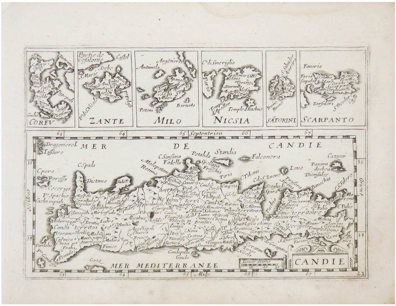
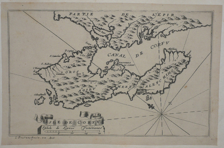
1579Elegante piccola carta geografica dell'isola tratta dai Dialoghi Notturni del Capitano Francesco Ferretti Cavaglier di S. Stefano, edito ad Ancona da Giovan Battista Ciotti, nel 1604. Si tratta della seconda edizione del celebre “isolario” di Francesco Ferretti (per la prima volta edito nel 1579), che contiene 28 mappe di isole europee incise in rame, e racchiuse dentro una cornice ornamentale di forma rotonda, che conferisce alle carte un’inusuale e particolarissima forma alla mappa. Questo raro trattato che fornisce nozioni scientifiche e militari, oltre che geografiche e matematiche. La parte geografica costituisce il corpus principale dell’opera, con le 28 mappe raffiguranti le principali isole del Mediterraneo rappresentate con l’inusuale forma circolare, finemente intagliate da Michelangelo Marelli. Le carte derivano da quelle intagliate da Girolamo Porro per L’isole Piu Famose Del Mondo Descritte Da Thomaso Porcacchi Da Castiglione, edito per la prima volta nel 1572. Ogni carta è racchiusa entro una cornice ornamentale, e mostra le linee dei venti. Il titolo, racchiuso nella parte superiore, è molto grande ed è espresso con la formula Ragionevol’ Forma et vera postura del’ Isola di, seguito dal nome dell’isola. Le mappe sono di piccole dimensioni ma molto accurate. L’opera del Ferretti venne ristampata nel 1608 con il titolo di Arte Militare. Acquaforte e bulino, rifilata la rame o con piccoli margini, in ottimo stato di conservazione. Bibliografia Mortimer 184; Olschki 4539; Cockle 548; Shirley T.FRR-1a. - Nordenskiold Collection I, p.156 no.73; Dufour/La Gumina, p. 85; Ganado 1985 S. 231; Stylianou 81, Navari 33; Zacharakis/Scutari 1499/1003-1518/1022; King, Miniature Antique Maps, pp. 62/3. Nice miniature map of the island, taken from Dialoghi Notturni del Capitano Francesco Ferretti Cavaglier di S. Stefano published in Ancona in 1604. It's the second edition of the rare “Isolario” by Ferretti, that provides scientific knowledge and military, as well as geography and mathematics. The geographical part is the main body of the work, with 28 maps depicting the main islands in the Mediterranean represented with the unusual circular shape, finely carved by Michelangelo Marelli. The maps derive from those engraved by Girolamo Porro for the L’isole Piu Famose Del Mondo Descritte Da Thomaso Porcacchi Da Castiglione, published for the first time in 1572. Each map is enclosed within an ornamental frame, and shows the lines of the winds. The title, enclosed at the top, is very large and is expressed by the formula Ragionevol’ Forma et vera postura del’ Isola di, followed by the name of the island; the maps are small but very accurate. The work of Ferretti was reprinted in 1608 with the title Arte Militare. Literature Mortimer 184; Olschki 4539; Cockle 548; Shirley T.FRR-1a. - Nordenskiold Collection I, p.156 no.73; Dufour/La Gumina, p. 85; Ganado 1985 S. 231; Stylianou 81, Navari 33; Zacharakis/Scutari 1499/1003-1518/1022; King, Miniature Antique Maps, pp. 62/3. G. Tolias, Mapping Greece, 0729; Zacharakis, A Catalogue of Printed Maps of Greece 1477-1800, 1511.
1579Elegante piccola carta geografica dell'isola tratta dai Dialoghi Notturni del Capitano Francesco Ferretti Cavaglier di S. Stefano, edito ad Ancona da Giovan Battista Ciotti, nel 1604. Si tratta della seconda edizione del celebre “isolario” di Francesco Ferretti (per la prima volta edito nel 1579), che contiene 28 mappe di isole europee incise in rame, e racchiuse dentro una cornice ornamentale di forma rotonda, che conferisce alle carte un’inusuale e particolarissima forma alla mappa. Questo raro trattato che fornisce nozioni scientifiche e militari, oltre che geografiche e matematiche. La parte geografica costituisce il corpus principale dell’opera, con le 28 mappe raffiguranti le principali isole del Mediterraneo rappresentate con l’inusuale forma circolare, finemente intagliate da Michelangelo Marelli. Le carte derivano da quelle intagliate da Girolamo Porro per L’isole Piu Famose Del Mondo Descritte Da Thomaso Porcacchi Da Castiglione, edito per la prima volta nel 1572. Ogni carta è racchiusa entro una cornice ornamentale, e mostra le linee dei venti. Il titolo, racchiuso nella parte superiore, è molto grande ed è espresso con la formula Ragionevol’ Forma et vera postura del’ Isola di, seguito dal nome dell’isola. Le mappe sono di piccole dimensioni ma molto accurate. L’opera del Ferretti venne ristampata nel 1608 con il titolo di Arte Militare. Acquaforte e bulino, rifilata la rame o con piccoli margini, in ottimo stato di conservazione. Bibliografia Mortimer 184; Olschki 4539; Cockle 548; Shirley T.FRR-1a. - Nordenskiold Collection I, p.156 no.73; Dufour/La Gumina, p. 85; Ganado 1985 S. 231; Stylianou 81, Navari 33; Zacharakis/Scutari 1499/1003-1518/1022; King, Miniature Antique Maps, pp. 62/3. Nice miniature map of the island, taken from Dialoghi Notturni del Capitano Francesco Ferretti Cavaglier di S. Stefano published in Ancona in 1604. It's the second edition of the rare “Isolario” by Ferretti, that provides scientific knowledge and military, as well as geography and mathematics. The geographical part is the main body of the work, with 28 maps depicting the main islands in the Mediterranean represented with the unusual circular shape, finely carved by Michelangelo Marelli. The maps derive from those engraved by Girolamo Porro for the L’isole Piu Famose Del Mondo Descritte Da Thomaso Porcacchi Da Castiglione, published for the first time in 1572. Each map is enclosed within an ornamental frame, and shows the lines of the winds. The title, enclosed at the top, is very large and is expressed by the formula Ragionevol’ Forma et vera postura del’ Isola di, followed by the name of the island; the maps are small but very accurate. The work of Ferretti was reprinted in 1608 with the title Arte Militare. Literature Mortimer 184; Olschki 4539; Cockle 548; Shirley T.FRR-1a. - Nordenskiold Collection I, p.156 no.73; Dufour/La Gumina, p. 85; Ganado 1985 S. 231; Stylianou 81, Navari 33; Zacharakis/Scutari 1499/1003-1518/1022; King, Miniature Antique Maps, pp. 62/3. G. Tolias, Mapping Greece, 0728; Zacharakis, A Catalogue of Printed Maps of Greece 1477-1800, 1510.
1579Nice miniature map of the island, taken from Dialoghi Notturni del Capitano Francesco Ferretti Cavaglier di S. Stefano published in Ancona in 1604. It's the second edition of the rare “Isolario” by Ferretti, that provides scientific knowledge and military, as well as geography and mathematics. The geographical part is the main body of the work, with 28 maps depicting the main islands in the Mediterranean represented with the unusual circular shape, finely carved by Michelangelo Marelli. The maps derive from those engraved by Girolamo Porro for the L’isole Piu Famose Del Mondo Descritte Da Thomaso Porcacchi Da Castiglione, published for the first time in 1572. Each map is enclosed within an ornamental frame, and shows the lines of the winds. The title, enclosed at the top, is very large and is expressed by the formula Ragionevol’ Forma et vera postura del’ Isola di, followed by the name of the island; the maps are small but very accurate. The work of Ferretti was reprinted in 1608 with the title Arte Militare. Literature Mortimer 184; Olschki 4539; Cockle 548; Shirley T.FRR-1a. - Nordenskiold Collection I, p.156 no.73; Dufour/La Gumina, p. 85; Ganado 1985 S. 231; Stylianou 81, Navari 33; Zacharakis/Scutari 1499/1003-1518/1022; King, Miniature Antique Maps, pp. 62/3. Nice miniature map of the island, taken from Dialoghi Notturni del Capitano Francesco Ferretti Cavaglier di S. Stefano published in Ancona in 1604. It's the second edition of the rare “Isolario” by Ferretti, that provides scientific knowledge and military, as well as geography and mathematics. The geographical part is the main body of the work, with 28 maps depicting the main islands in the Mediterranean represented with the unusual circular shape, finely carved by Michelangelo Marelli. The maps derive from those engraved by Girolamo Porro for the L’isole Piu Famose Del Mondo Descritte Da Thomaso Porcacchi Da Castiglione, published for the first time in 1572. Each map is enclosed within an ornamental frame, and shows the lines of the winds. The title, enclosed at the top, is very large and is expressed by the formula Ragionevol’ Forma et vera postura del’ Isola di, followed by the name of the island; the maps are small but very accurate. The work of Ferretti was reprinted in 1608 with the title Arte Militare. Literature Mortimer 184; Olschki 4539; Cockle 548; Shirley T.FRR-1a. - Nordenskiold Collection I, p.156 no.73; Dufour/La Gumina, p. 85; Ganado 1985 S. 231; Stylianou 81, Navari 33; Zacharakis/Scutari 1499/1003-1518/1022; King, Miniature Antique Maps, pp. 62/3. G. Tolias, Mapping Greece, 0721; Zacharakis, A Catalogue of Printed Maps of Greece 1477-1800, 1503.
1579Elegante piccola carta geografica dell'isola tratta dai Dialoghi Notturni del Capitano Francesco Ferretti Cavaglier di S. Stefano, edito ad Ancona da Giovan Battista Ciotti, nel 1604. Si tratta della seconda edizione del celebre “isolario” di Francesco Ferretti (per la prima volta edito nel 1579), che contiene 28 mappe di isole europee incise in rame, e racchiuse dentro una cornice ornamentale di forma rotonda, che conferisce alle carte un’inusuale e particolarissima forma alla mappa. Questo raro trattato che fornisce nozioni scientifiche e militari, oltre che geografiche e matematiche. La parte geografica costituisce il corpus principale dell’opera, con le 28 mappe raffiguranti le principali isole del Mediterraneo rappresentate con l’inusuale forma circolare, finemente intagliate da Michelangelo Marelli. Le carte derivano da quelle intagliate da Girolamo Porro per L’isole Piu Famose Del Mondo Descritte Da Thomaso Porcacchi Da Castiglione, edito per la prima volta nel 1572. Ogni carta è racchiusa entro una cornice ornamentale, e mostra le linee dei venti. Il titolo, racchiuso nella parte superiore, è molto grande ed è espresso con la formula Ragionevol’ Forma et vera postura del’ Isola di, seguito dal nome dell’isola. Le mappe sono di piccole dimensioni ma molto accurate. L’opera del Ferretti venne ristampata nel 1608 con il titolo di Arte Militare. Acquaforte e bulino, rifilata la rame o con piccoli margini, in ottimo stato di conservazione. Bibliografia Mortimer 184; Olschki 4539; Cockle 548; Shirley T.FRR-1a. - Nordenskiold Collection I, p.156 no.73; Dufour/La Gumina, p. 85; Ganado 1985 S. 231; Stylianou 81, Navari 33; Zacharakis/Scutari 1499/1003-1518/1022; King, Miniature Antique Maps, pp. 62/3. Nice miniature map of the island, taken from Dialoghi Notturni del Capitano Francesco Ferretti Cavaglier di S. Stefano published in Ancona in 1604. It's the second edition of the rare “Isolario” by Ferretti, that provides scientific knowledge and military, as well as geography and mathematics. The geographical part is the main body of the work, with 28 maps depicting the main islands in the Mediterranean represented with the unusual circular shape, finely carved by Michelangelo Marelli. The maps derive from those engraved by Girolamo Porro for the L’isole Piu Famose Del Mondo Descritte Da Thomaso Porcacchi Da Castiglione, published for the first time in 1572. Each map is enclosed within an ornamental frame, and shows the lines of the winds. The title, enclosed at the top, is very large and is expressed by the formula Ragionevol’ Forma et vera postura del’ Isola di, followed by the name of the island; the maps are small but very accurate. The work of Ferretti was reprinted in 1608 with the title Arte Militare. Literature Mortimer 184; Olschki 4539; Cockle 548; Shirley T.FRR-1a. - Nordenskiold Collection I, p.156 no.73; Dufour/La Gumina, p. 85; Ganado 1985 S. 231; Stylianou 81, Navari 33; Zacharakis/Scutari 1499/1003-1518/1022; King, Miniature Antique Maps, pp. 62/3. G. Tolias, Mapping Greece, 0734; Zacharakis, A Catalogue of Printed Maps of Greece 1477-1800, 1516.
1579Elegante piccola carta geografica dell'isola tratta dai Dialoghi Notturni del Capitano Francesco Ferretti Cavaglier di S. Stefano, edito ad Ancona da Giovan Battista Ciotti, nel 1604. Si tratta della seconda edizione del celebre “isolario” di Francesco Ferretti (per la prima volta edito nel 1579), che contiene 28 mappe di isole europee incise in rame, e racchiuse dentro una cornice ornamentale di forma rotonda, che conferisce alle carte un’inusuale e particolarissima forma alla mappa. Questo raro trattato che fornisce nozioni scientifiche e militari, oltre che geografiche e matematiche. La parte geografica costituisce il corpus principale dell’opera, con le 28 mappe raffiguranti le principali isole del Mediterraneo rappresentate con l’inusuale forma circolare, finemente intagliate da Michelangelo Marelli. Le carte derivano da quelle intagliate da Girolamo Porro per L’isole Piu Famose Del Mondo Descritte Da Thomaso Porcacchi Da Castiglione, edito per la prima volta nel 1572. Ogni carta è racchiusa entro una cornice ornamentale, e mostra le linee dei venti. Il titolo, racchiuso nella parte superiore, è molto grande ed è espresso con la formula Ragionevol’ Forma et vera postura del’ Isola di, seguito dal nome dell’isola. Le mappe sono di piccole dimensioni ma molto accurate. L’opera del Ferretti venne ristampata nel 1608 con il titolo di Arte Militare. Acquaforte e bulino, rifilata la rame o con piccoli margini, in ottimo stato di conservazione. Bibliografia Mortimer 184; Olschki 4539; Cockle 548; Shirley T.FRR-1a. - Nordenskiold Collection I, p.156 no.73; Dufour/La Gumina, p. 85; Ganado 1985 S. 231; Stylianou 81, Navari 33; Zacharakis/Scutari 1499/1003-1518/1022; King, Miniature Antique Maps, pp. 62/3. Nice miniature map of the island, taken from Dialoghi Notturni del Capitano Francesco Ferretti Cavaglier di S. Stefano published in Ancona in 1604. It's the second edition of the rare “Isolario” by Ferretti, that provides scientific knowledge and military, as well as geography and mathematics. The geographical part is the main body of the work, with 28 maps depicting the main islands in the Mediterranean represented with the unusual circular shape, finely carved by Michelangelo Marelli. The maps derive from those engraved by Girolamo Porro for the L’isole Piu Famose Del Mondo Descritte Da Thomaso Porcacchi Da Castiglione, published for the first time in 1572. Each map is enclosed within an ornamental frame, and shows the lines of the winds. The title, enclosed at the top, is very large and is expressed by the formula Ragionevol’ Forma et vera postura del’ Isola di, followed by the name of the island; the maps are small but very accurate. The work of Ferretti was reprinted in 1608 with the title Arte Militare. Literature Mortimer 184; Olschki 4539; Cockle 548; Shirley T.FRR-1a. - Nordenskiold Collection I, p.156 no.73; Dufour/La Gumina, p. 85; Ganado 1985 S. 231; Stylianou 81, Navari 33; Zacharakis/Scutari 1499/1003-1518/1022; King, Miniature Antique Maps, pp. 62/3. G. Tolias, Mapping Greece, 0732; Zacharakis, A Catalogue of Printed Maps of Greece 1477-1800, 1514.
1579Elegante piccola carta geografica dell'isola tratta dai Dialoghi Notturni del Capitano Francesco Ferretti Cavaglier di S. Stefano, edito ad Ancona da Giovan Battista Ciotti, nel 1604. Si tratta della seconda edizione del celebre “isolario” di Francesco Ferretti (per la prima volta edito nel 1579), che contiene 28 mappe di isole europee incise in rame, e racchiuse dentro una cornice ornamentale di forma rotonda, che conferisce alle carte un’inusuale e particolarissima forma alla mappa. Questo raro trattato che fornisce nozioni scientifiche e militari, oltre che geografiche e matematiche. La parte geografica costituisce il corpus principale dell’opera, con le 28 mappe raffiguranti le principali isole del Mediterraneo rappresentate con l’inusuale forma circolare, finemente intagliate da Michelangelo Marelli. Le carte derivano da quelle intagliate da Girolamo Porro per L’isole Piu Famose Del Mondo Descritte Da Thomaso Porcacchi Da Castiglione, edito per la prima volta nel 1572. Ogni carta è racchiusa entro una cornice ornamentale, e mostra le linee dei venti. Il titolo, racchiuso nella parte superiore, è molto grande ed è espresso con la formula Ragionevol’ Forma et vera postura del’ Isola di, seguito dal nome dell’isola. Le mappe sono di piccole dimensioni ma molto accurate. L’opera del Ferretti venne ristampata nel 1608 con il titolo di Arte Militare. Acquaforte e bulino, rifilata la rame o con piccoli margini, in ottimo stato di conservazione. Bibliografia Mortimer 184; Olschki 4539; Cockle 548; Shirley T.FRR-1a. - Nordenskiold Collection I, p.156 no.73; Dufour/La Gumina, p. 85; Ganado 1985 S. 231; Stylianou 81, Navari 33; Zacharakis/Scutari 1499/1003-1518/1022; King, Miniature Antique Maps, pp. 62/3. Nice miniature map of the island, taken from Dialoghi Notturni del Capitano Francesco Ferretti Cavaglier di S. Stefano published in Ancona in 1604. It's the second edition of the rare “Isolario” by Ferretti, that provides scientific knowledge and military, as well as geography and mathematics. The geographical part is the main body of the work, with 28 maps depicting the main islands in the Mediterranean represented with the unusual circular shape, finely carved by Michelangelo Marelli. The maps derive from those engraved by Girolamo Porro for the L’isole Piu Famose Del Mondo Descritte Da Thomaso Porcacchi Da Castiglione, published for the first time in 1572. Each map is enclosed within an ornamental frame, and shows the lines of the winds. The title, enclosed at the top, is very large and is expressed by the formula Ragionevol’ Forma et vera postura del’ Isola di, followed by the name of the island; the maps are small but very accurate. The work of Ferretti was reprinted in 1608 with the title Arte Militare. Literature Mortimer 184; Olschki 4539; Cockle 548; Shirley T.FRR-1a. - Nordenskiold Collection I, p.156 no.73; Dufour/La Gumina, p. 85; Ganado 1985 S. 231; Stylianou 81, Navari 33; Zacharakis/Scutari 1499/1003-1518/1022; King, Miniature Antique Maps, pp. 62/3. G. Tolias, Mapping Greece, 0730; Zacharakis, A Catalogue of Printed Maps of Greece 1477-1800, 1512.
1579Elegante piccola carta geografica dell'isola tratta dai Dialoghi Notturni del Capitano Francesco Ferretti Cavaglier di S. Stefano, edito ad Ancona da Giovan Battista Ciotti, nel 1604. Si tratta della seconda edizione del celebre “isolario” di Francesco Ferretti (per la prima volta edito nel 1579), che contiene 28 mappe di isole europee incise in rame, e racchiuse dentro una cornice ornamentale di forma rotonda, che conferisce alle carte un’inusuale e particolarissima forma alla mappa. Questo raro trattato che fornisce nozioni scientifiche e militari, oltre che geografiche e matematiche. La parte geografica costituisce il corpus principale dell’opera, con le 28 mappe raffiguranti le principali isole del Mediterraneo rappresentate con l’inusuale forma circolare, finemente intagliate da Michelangelo Marelli. Le carte derivano da quelle intagliate da Girolamo Porro per L’isole Piu Famose Del Mondo Descritte Da Thomaso Porcacchi Da Castiglione, edito per la prima volta nel 1572. Ogni carta è racchiusa entro una cornice ornamentale, e mostra le linee dei venti. Il titolo, racchiuso nella parte superiore, è molto grande ed è espresso con la formula Ragionevol’ Forma et vera postura del’ Isola di, seguito dal nome dell’isola. Le mappe sono di piccole dimensioni ma molto accurate. L’opera del Ferretti venne ristampata nel 1608 con il titolo di Arte Militare. Acquaforte e bulino, rifilata la rame o con piccoli margini, in ottimo stato di conservazione. Bibliografia Mortimer 184; Olschki 4539; Cockle 548; Shirley T.FRR-1a. - Nordenskiold Collection I, p.156 no.73; Dufour/La Gumina, p. 85; Ganado 1985 S. 231; Stylianou 81, Navari 33; Zacharakis/Scutari 1499/1003-1518/1022; King, Miniature Antique Maps, pp. 62/3. Nice miniature map of the island, taken from Dialoghi Notturni del Capitano Francesco Ferretti Cavaglier di S. Stefano published in Ancona in 1604. It's the second edition of the rare “Isolario” by Ferretti, that provides scientific knowledge and military, as well as geography and mathematics. The geographical part is the main body of the work, with 28 maps depicting the main islands in the Mediterranean represented with the unusual circular shape, finely carved by Michelangelo Marelli. The maps derive from those engraved by Girolamo Porro for the L’isole Piu Famose Del Mondo Descritte Da Thomaso Porcacchi Da Castiglione, published for the first time in 1572. Each map is enclosed within an ornamental frame, and shows the lines of the winds. The title, enclosed at the top, is very large and is expressed by the formula Ragionevol’ Forma et vera postura del’ Isola di, followed by the name of the island; the maps are small but very accurate. The work of Ferretti was reprinted in 1608 with the title Arte Militare. Literature Mortimer 184; Olschki 4539; Cockle 548; Shirley T.FRR-1a. - Nordenskiold Collection I, p.156 no.73; Dufour/La Gumina, p. 85; Ganado 1985 S. 231; Stylianou 81, Navari 33; Zacharakis/Scutari 1499/1003-1518/1022; King, Miniature Antique Maps, pp. 62/3. G. Tolias, Mapping Greece, 0731; Zacharakis, A Catalogue of Printed Maps of Greece 1477-1800, 1513.
1580Rara carta geografica inserita in cornice circolare, con la sovrastante scritta "Ragionevol' Forma et Vera Postura del' Isola di..." descritta da Francesco Ferretti ed incisa da Michelangelo Marelli. La carta è inserita nell'opera "Diporti notturni..." stampata ad Ancona nel 1580. La stessa carta fu utilizzata per illustrare l’opera "Dialoghi notturni..." stampata in Venezia nel 1604 ed ancora in Ancona "Arte militare..." del 1608.
1745réf. 22184Paris de Bure l'aîné 1745 in-12 de xxxii, 476 pp. et 2 ff.n.ch. veau marbré, dos à nerfs orné de motifs dorés, pièce de titre rouge, tranches rouges [Rel. de l'époque], coiffes arasées, coins frottés
1802réf. 15258Paris Imprimerie Crapelet An X (1802) 2 volumes in-8 (13 X 20 cm) basane havane avec double filet or en encadrement sur les plats, dos lisse, fers dorés, pièces de titre rouges, tranches jaunes mouchetées. VI + 400 + 450 pp. (Reliure de l'époque avec quelques frottements d'usage).
1750réf. 1000329AG[Augsburg], Lotter, [um 1750]. Kupferstich mit altem Grenz- und Flächenkolorit, oben links Entfernungskartusche. Bildformat 45 xc 56 cm, frei unter Passepartou 60 x 70 cm, [5 Warenabbildungen] schönes frisches und sauber koloriertes Exemplar,
1864Vol. 19 legati in-10 in-8° di pp. XVIII-6828 con 12 carte f.t. di cui 2 ripiegate. leg. in mezza tela coeva con picc. guasto ininfluente al dorso di un volume.
2006réf. yam06303 BEAUX VOLUMES in-4 reliures pleine toile éditeur sous jaquettes illustrées de 350 pages chacun Picard éditions
1851réf. 64761Troisième édition corrigée et considérablement augmentée, Chez J. B. Baillière, Paris, Londres, New York, Madrid, 1851, XVI-191 pp. et Typographie et Lithographie Eugène Grodot Fils, Angoulême, Novembre 1852, 19 pp.
1667réf. LBW-6492[Paris, Jollain, 1667). 125 x 185 mm.
réf. 245016Paris, Plon, 1876 2 vol. in-12, 356 pp. et 346 pp., carte dépliante, demi-basane noire, dos à nerfs, couv. cons. (reliure moderne).
réf. 5181Paris GP Maisonneuve et Larose 1962 - 4 volumes In8 pleine toile éditeur - 320, 453, 395, 516 pages - exemplaire numéroté d'un tirage total à 325 exemplaires.
réf. 234094Paris, Ernest Leroux, 1910 2 vol. in-8, IX pp., 431 pp. ; [2] ff. n. ch., pp. 432-860, un f. n. ch. d'errata, 4043 numéros décrits, brochés. Dos du vol. I défraîchi.
1863réf. 003095Paris, Leclere (Imprimerie de Ch. Lahure), 1863
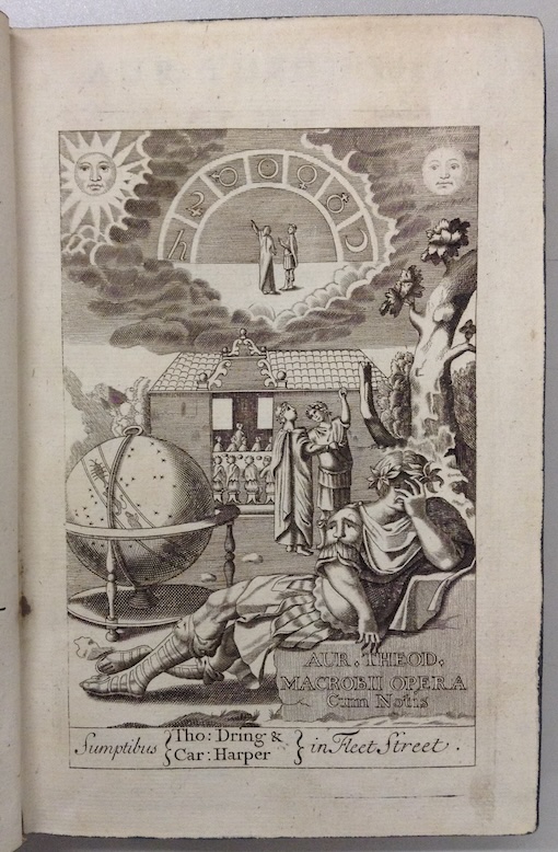
1694réf. 380352London, Dring & Harper, 1694. 15 Bl., 491 S., 28 nn. Bl. Mit gestochenem Titel u. 2 Textholzschnitten. Pergament d. Zeit (verstaubt, Rückenschild). [4 Warenabbildungen]
1997réf. SPN-1057Paris, Galerie Matignon, 1997. Broché in-4 (29x25cm), couverture noire illustrée couleur d'un tableau de Jansem, à grands rabats, 59 pages illustrées en noir et couleur, atelier / peintures récentes, catalogue, textes de Meret Meyer et Sylvie Salles. Envoi dessiné de l'artiste en page de titre à COLLOMB* (1997), faisant allusion aux personnages de Pierrot et Colombine.
réf. 686479Chez Gail Paris 1796 Grand in-8 ( 280 X 180 mm ) de VIII-68 pages, demi-basane fauve granitée, dos lisse avec pièce de tutre de basane noisette ( Reliure postérieure ). Edition originale de la meilleure traduction de cette oeuvre. Bel exemplaire, pur et non rogné.Il sagit des «Amours de Léandre et de Héro» ( «Ta kath Hêrô kai Leandron» ) *, poème de trois cent quarante vers, petit chef-dœuvre hellénistique qui se ressent de lépoque de décadence, et que Hermann Köchly définit comme «la dernière rose du jardin déclinant des lettres grecques»**. En effet, si un ton quelquefois simple, naïf et touchant élève ce poème jusquà ceux des anciens Grecs, ces peintres si vrais de la Nature, trop souvent aussi des images usées, des expressions rebattues et lérudition mise à la place du sentiment décèlent une composition du IVe-Ve siècle.Le lecteur connaît peut-être le sujet des «Amours de Léandre et de Héro». Léandre, jeune Grec dAbydos, était aimé de Héro, prêtresse à Sestos, ville placée en face dAbydos, sur les bords de lHellespont***. Pour aller voir Héro, Léandre traversait tous les soirs lHellespont à la nage un flambeau allumé par elle sur une tour élevée lui servait de phare. Léandre se noya pendant une tempête, et fut jeté par la mer au pied de la tour de Héro qui, le reconnaissant le lendemain matin, se précipita du haut de cet édifice, et se tua ainsi auprès de son amant. Tel est, en sa primitive simplicité, le fait divers sur lequel un poète nommé Musée et surnommé le Grammairien**** construisit son poème. Tel est aussi le fait divers auquel fait allusion cette jolie épigramme de Martial*****, si bien traduite par Voltaire:«Léandre conduit par lAmourEn nageant disait aux orages:Laissez-moi gagner les rivages,Ne me noyez quà mon retour»******.Il nexiste pas moins de dix traductions françaises des «Amours de Léandre et de Héro», mais sil fallait nen choisir quune seule, je choisirais celle de Jean-Baptiste Gail. ( Sources: Notes du Mont Royal Montréal - Canada ).
18112 volumi (238; 204, L, [2]) p.; 23 cm. Brossura muta coeva. La copertina del primo volume presenta macchie, quella del secondo è staccata ed è parzialmente slegato, ma l'interno è molto buono, carta forte in barbe. Molto raro
réf. LBW045dfcirca 1690 130 x 206 mm.
18362 voll. in 8, pp. 475, il secondo contiene 116 tavv. f.t. inc. all'acq. + 2 cartine. Legatura coeva in mz. tl. Esemplare completo delle tavole (nonostante la scorretta indicazione al frontespizio che ne cita 120). Edizione italiana nella collana 'L'Universo o storia e descrizione di tutti i popoli'.