18 211 résultats
1851réf. 200114AG1851. London Edinburgh & Dublin. J & F. Tallis 1851. Original steel engraving / Vintage map. Drawn and engraved by John Rapkin. Partly hand-coloured. Illustrations by A.H. Wray and engravings by J.b Allen. Plate Size: 30.5 cm x 25.3 cm. Sheet Size: 37.3 cm x 27.4 cm. Vintage 19th century map in very good condition. Published in the Illustrated Atlas And Modern History Of The World Geographical Political Commercial & Statistical Edited By R. Montgomery Martin. Beautiful map of Greece from the Victorian era. The marvelous vignettes may harken back to more ancient times but this was Greece of the mid-19th Century a recently independent modern kingdom the result of a successful war of independence in the 1820s waged by Greek revolutionaries against the Ottoman Empire that had ruled Greece for hundreds of years. The Turkish territory in the Blakans can still be seen near to the north as the Greek frontier runs across from the Gulf of Arta to the Gulf of Volo. The Greek regions are listed as Livadia and in the Peloponnese peninsula Morea. The large island Negropont is also shown. The many islands off the mainland are also included: islands such as; Andro; Tino; Naxia; Santorini; Milo; Cerigo; Zante and; Cephalonia to name but a few. The names of famous cities such as Corinth Athens and Sparta are also included on the map. The rugged and mountainous topography of the region is depicted through hachuring. The major rivers including the Aspropotamo Achelous are also shown on the map. A scale-bar is shown near the map's lower decorative border. John Tallis 7 November 1817 3 June 1876 was an English cartographic publisher. His company John Tallis and Company published views maps and atlases in London from roughly 1838 to 1851. Tallis set up as a publisher with Frederick Tallis in Cripplegate in 1842; the business moved to Smithfield in 1846 and was dissolved in 1849. From 1851 to 1854 Tallis operated as John Tallis and Company. He started The illustrated news of the world and national portrait gallery of eminent personages in 1858 selling it for £1370 in 1861; it folded in 1863. Wikipedia The most important project John Tallis undertook was the 'Illustrated Atlas' from 1851. The original map we offer here was part of this exceptional Atlas and all the maps it contained are still today considered as the last reminder of an era of lavish map production. Tallis worked the project together with John Rapkin 1815-1876 and it was Rapkin's style and talent that we have to thank for when we marvel at these maps today. What makes these maps so special is the detail of engraved vignettes that surround the map and often show indigenous scenes people in their environment and even more so historical buildings or historical views of towns and cities architecture and landscape. The project of 'The Illustrated Atlas' was designed to be finished just in time for the anxiously awaited "Great Exhibition of the Works of Industry of All Nations" or The Great Exhibition sometimes referred to as the Crystal Palace Exhibition in reference to the temporary structure in which it was held was an international exhibition that took place in Hyde Park London from 1 May to 11 October 1851. It was the first in a series of World's Fairs exhibitions of culture and industry that became popular in the 19th century and it was a much-anticipated event. The Great Exhibition was organized by Henry Cole and Prince Albert husband of the reigning monarch Queen Victoria. It was attended by numerous notable figures of the time including Charles Darwin Samuel Colt members of the Orléanist Royal Family and the writers Charlotte Brontë Charles Dickens Lewis Carroll George Eliot and Alfred Tennyson. Music for the opening was under the direction of Sir George Thomas Smart and the continuous music from the exhibited organs for the Queen's procession was "under the superintendence of William Sterndale Bennett". Wikipedia unknown
réf. Z1-I-026-01038World Scientific Pub Co Inc. Used - Good. Ships from UK in 48 hours or less usually same day. Your purchase helps support Sri Lankan Children's Charity 'The Rainbow Centre'. Ex-library so some stamps and wear but in good overall condition. 100% money back guarantee. We are a world class secondhand bookstore based in Hertfordshire United Kingdom and specialize in high quality textbooks across an enormous variety of subjects. We aim to provide a vast range of textbooks rare and collectible books at a great price. Our donations to The Rainbow Centre have helped provide an education and a safe haven to hundreds of children who live in appalling conditions. We provide a 100% money back guarantee and are dedicated to providing our customers with the highest standards of service in the bookselling industry. World Scientific Pub Co Inc unknown
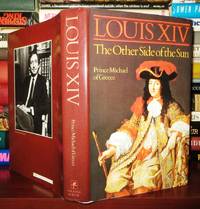
1984réf. 72083New York: Harper & Row 1984. First Edition; First Printing. Hardcover. Very Good in a Very Good dust jacket. Stated First U. S. Edition.; 9 X 6 X 1.40 inches; 447 pages. Harper & Row hardcover
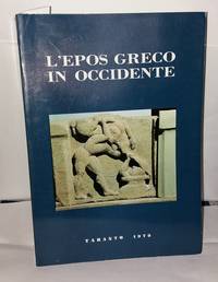
1980réf. 5177071980. Bon état légère usure de la couverture intérieur très bon. in8. 1980. Broché. 510 pages. unknown
réf. #[59162]With lot's of illustrations. In good condition. unknown
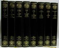
1976réf. 264369Rombaldi 1976. Très bon état de conservation très bonne tenue tranche sup. un peu jaunie intérieur frais. in8. 1976. Reliure editeur. 8 volumes dans ce lot: nous ne sommes pas les premiers à la recherche des extra-terrestre la Crète épave de l'atlantide les pierres levées portes de la vie Le secret de l'ile de pâques aku-aku les mondes du ciel les mystère du monde submergé --- illustrations en noir et blanc Rombaldi unknown
1798réf. 79606Paris: Bernard 1798. br. Bernard unknown
1798réf. 29121Paris: Bernard 1798. kart. Bernard unknown
réf. 22075115-nnew. unknown
réf. 6128825570VDM Verlag Dr. Mueller Aktiengesellschaft & Co. KG . Papeback. New. pp. 52 VDM Verlag Dr. Mueller Aktiengesellschaft & Co. KG unknown
2010réf. DADAX3838351789LAP Lambert Academic Publishing 2010-09-06. paperback. New. 5.91x0.12x8.66. Buy with confidence. Excellent Customer Service & Return policy. LAP Lambert Academic Publishing paperback
réf. DADAX006015201XHarper & Row Publishers 0000-00-00. First Edition. hardcover. New. 0.00x0.00x0.00. Buy with confidence. Excellent Customer Service & Return policy. Harper & Row, Publishers hardcover
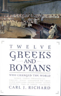
2006réf. DADAX0742534367Rowman & Littlefield Publishers 2006-09-27. 1st Pbk. paperback. New. 5.96x0.82x8.86. Buy with confidence. Excellent Customer Service & Return policy. Rowman & Littlefield Publishers paperback
2003réf. SONG0742527905Rowman & Littlefield Publishers 2003-04-02. Illustrated. hardcover. Used: Good. 6.10x0.84x9.34. Buy with confidence. Excellent Customer Service & Return policy. Rowman & Littlefield Publishers hardcover
2010réf. DADAX1169741258Kessinger Publishing 2010-09-10. hardcover. New. 8.50x0.56x11.00. Buy with confidence. Excellent Customer Service & Return policy. Kessinger Publishing hardcover
réf. 1638293996.Gpaperback. Good. Access codes and supplements are not guaranteed with used items. May be an ex-library book. paperback
réf. 22891showing the five children sitting on a doorstep in a row 5½" x 3½" no place no date c. unknown
2000réf. 32146Istoria di Romania is a chronicle initially written in Latin in the first half of the 14th century by the Venetian author Marino Sanudo Torsello. The original text has been lost and the work survives only in its Italian translation; it was identified by Ch. Hopf in a manuscript of the 18th century at the Marciana Library in Venice and published in the series Chroniques Greco-romanes. This edition contains the Italian text plus introduction translation and comments in modern Greek. Soft cover 24 cm XXVI339 pp. Edited by E. Papadopoulou. ISBN: 978-960-371-013-4. Istituto di Ricerche Bizantine paperback
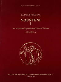
2024réf. 700095Soft cover 29 cm 760 pp. ill. Ministry of Culture paperback
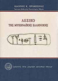
2024réf. 700107A Dictionary of the Mycenaean Greek Language. In Greek. Hard cover 24 cm 688 pp. hardcover
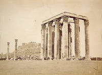
réf. 61525c.1880. . Large albumen print. Good tonal range and in good condition; Dimensions: 270 x 370mm. 10.5 x 14.5 inches. The Temple of Olympian Zeus is a former colossal Corinthian temple at the foot of the Acropolis in the centre of Athens. Construction began in the 6th century BC during the rule of the Athenian tyrants but was not completed until the reign of Roman Emperor Hadrian in the 2nd century AD taking a total of 638 years to complete. The temple was reduced to ruins just a century after its completion after being pillaged during a barbarian invasion in 267 AD. However a substantial part of the temple remains despite centuries of extensive quarrying for building materials after the fall of the Roman Empire. Pictured here are only 15 of the original 104 columns still standing with a sixteenth column lying on the ground where it fell during a storm in 1852. The Acropolis is visible behind. Chairs and benches have been laid out around the base of the temple for people to rest. The site remains virtually unchanged today. [c.1880]. unknown
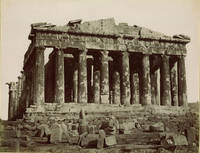
réf. 89105c.1880s. . Albumen print 21 x 26.5 cm. Good tonal range and in good condition pasted on original card number in negative title on card pencil inscription "Parthenon ouest" on the verso. [c.1880s]. unknown
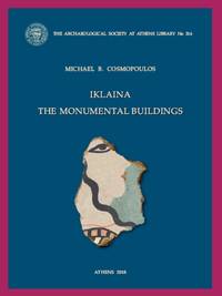
2018réf. BAE316Athens: Archaeological Society 2018. In English. Soft cover 28 cm 256 pp. 176 plates. ISBN: 978-618-5047-39-9. Read the table of contents at: www.academia.edu/38143545/2018-Iklaina._The_Monumental_Buildings CONTENTS: Preface Excavation methodology The Cyclopean Terace Building Topsoil and rubble The destruction layer North foundation trench The slabs Fill under the slabs 15 The burial THE SOUTH SIDE OF THE PLATFORM The Piazza and the Drains The South Road and the Pit The East Road THE HOROS Building X The Gate way and Building R Conclusions BIBLIOGRAPHY PLATES Archaeological Society paperback