18 324 résultats
Cm. 25; pp. (2), 108, (2). Brossura posteriore, una grande tabella più volte ripiegata: "Genealogia dei signori Terzerii di Negroponte". Ottimo esemplare 406
1966réf. 3455Bruxelles Culture et civilisation 1966 Un volume in-8, reliure de l'éditeur, XLVIII et 538 pages, texte en français, italien, grec. Impression anastaltique de l'édition de Paris, 1873. Quelques passages surlignés, sinon bon état.
1923Set in Romantic Greece, not Ruritania! Lord Wheatley, looking for adventure, decides to purchase an island, Neopalia, a Turkish possession in the Aegean Sea. But when he travels there to take it over, the natives don't want to give it up, and they insist that Phroso be its ruler. Complications ensue when Wheatley falls in love with Phroso and a Turk, Mouraki Pasha, kidnaps her. Wheatley has to fight a lot of battles before he can possess either Neopalia or Phroso, Vintage copy from 1923 with age-toned paper and some shelf wear especially at head and foot of spine. Library stamp on ffep, else a nice reading copy,. Ex-Library
1962An unabridged republication of a work originally published in1812 in 2 volumes as "Costumes of the Ancients" but now printed as a single volume. Carefully copied from ancient vases and statuary by Thomas Hope (1770-1831) a British collector and designer , these engravings combine unusual clarity of style with unquestioned authenticity.Over 700 illustrations depict all classes and occupations. xlvii.+ 300 plates. Book
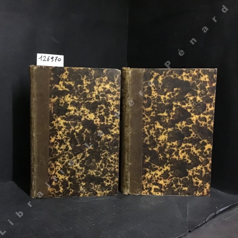
1839réf. 1269701839 Paris, Paulin, Editeur - 1839 - Complet en 2 volumes in-8 (16x23,5cm environ), demi-basane, dos lisse titré en doré, filets horizontaux en doré, toutes tranches mouchetées - 503 pages (Tome I) + 97 planches en N&B hors texte (Tome II)
1985Very faint stain to lower edges of boards. Else book is fine. DJ has some scuffing. ; 231pp, with 103 pls reproducing Hopes's drawings. ; Oblong Folio; 231 pages
1809réf. 035992London: William Miller 1809. Second Edition stated . Full Morocco. Very Good . 9 9/16" Tall. 200 Plates. Second Edition. 4 Vii 1 54 200 Plates At End. Full Red Polished Calf Elaborately Gilt Spine Almost Invisibly Reinforced Externally Cloth Hinges Internally Gilt Rules And Corner Embellishments With Three Interior Elaborate Blindstamped Designs Gilt Decorated Edges And Turns. Hinges Sound Reinforced. Edges Of Page Block Polished And Marbled. Contents Clean Near Fine Pages Square With Just A Line Of Rubbing At Two Lateral Edges Of Page Block. Heraldic Bookplate Of William Cecil Chambers. William Miller unknown
1985"although the legends of Anceint Greece have long been an important part of classical education, little attention has been paid to their deeper meaning or to their significance in magic. .... Subjects covered include : ancient oracles and how to reconstruct them, the magical meaning of the myths, Greek philosophy and logic, symbolism in Heroic magic, the nature and power of Pan. " 176p. illus bibliography. index. Book
1988Having been trained in supernatural knowledge, thirteen-year-old Medea finds herself in a unique position to help when the Greek hero Jason comes to her father's kingdom in search of the Golden Fleece.[Youth fiction] 24.]yOITH fICTIOMRemainder mark on bottom, else fine Book
1963Issues as supplement tVol X to "Greece & Rome" Nine articles by various scholars on the Parthenon and the Acropolis of Athens Contains : [1] Athena and the Early Acropolis by R.J. Hopper [2] The Goddess of the Golden Image by Edna M. Hooke [3] The Builders of the Parthenon by Alison Burford [4] The Political Implications of the Parthenon by Russell Meiggs [5] The Sculptures of the Parthenon by Martin Robertson [6] Athena in Athenian Literature and Cult by C.J. Herington [7] Parthenonis Ruinæ by C.S. Calverley [8] The Parthenon by John Heath-Stubbs [9] Acropolis and Parthenos: New Models in the Royal Ontario Museum by J.W. Graham.87p. illus ( B & W) Book
18768vo, original cloth worn, xvi) + 456pp. + 2pp. of publishers' ads and with 209 engravings. Original Green cloth with gilt engraving to front of a traveller in Arabia being offered ostrich eggs for sale Gilt lettering and engravings of a man on a camel and a ship at sea on the spine. Frontispiece engraving of 'The Land of the Pyramids' with tissue-guard. cloth quite worn, contents and engravings good, some foxing. Owner's name and date (May 15th 1876) neatly in ink to ffep. The adventures and observations of two American college graduates , touring the United States Far West and then to Japan, China, India, Arabia, Egypt, Italy, France, England and home again.
1974144p. illus (some col).bibliography.index. Book
1988"... a comprehensive survey of how the Aegean peoples expressed themselves during a period of some 5000 years after the end of the Bronze Age (circa 1100 BC), and before the rise of Greek art. Work produced in the ambience of the palaces of Crete (including the palace of Minos at Knossos) and of Mycenae on the mainland is fully described and illustrated. For purposes of clarity the arts are considered by function and material rather than by geographical region or chronological period; but the main political upheavals affecting them are kept in mind. Little wall-painting has survived, and the so-called minor arts are examined for the light they thow on it, as well as to assess artistic development in the Aegean as a whole." 311p. illus bibliography index. Text crisp and unmarked, slightly scuffed paper covers.. Book
Sequoia - Elsevier. 1969. In-8 Carré. Broché. Bon état. Couv. convenable. Dos satisfaisant. Intérieur frais. 144 pages. Photo en noir et blanc en frontispice. Illustré de nombreux dessins et photos en noir et blanc et en couleur, dans et hors texte. 'Les Premières civilisations'. Les chasseurs et agriculteurs de l'âge de la Pierre. Le Bronze ancien...
1969réf. RO40138626Sequoia - Elsevier. 1969. In-8. Broché. Bon état, Couv. convenable, Dos satisfaisant, Intérieur frais. 144 pages. Photo en noir et blanc en frontispice. Illustré de nombreux dessins et photos en noir et blanc et en couleur, dans et hors texte.. . . . Classification Dewey : 949.5-Grèce
1969réf. RO80010537SEQUOIA-ELSEVIER. 1969. In-12. Cartonné. Bon état, Couv. convenable, Dos satisfaisant, Intérieur frais. 144 pages. Nombreuses illustrations et photos en noir et blanc et en couleurs dans le texte et hors-texte.. . . . Classification Dewey : 949.5-Grèce
1957In-8° (cm. 27,2), pp. 21 (da p. 3 a p.. 23) + 18 ILLUSTRAZIONI in 3 TAVOLE fuori testo e con 19 ILLUSTRAZIONI nel testo b.n. Brossura provvisoria riproducente la cop. della rivista con rinforzo di graffe al dorso interno, segni a bitro in cop. Es. da studio.
1978réf. 102821Penguin Books, 1978, pt in-8°, 311 pp, 237 illustrations, 2 cartes et un plan, biblio, index, broché, état correct. Texte en anglais (Coll. The Pelican History of Art)
1961Discovery of the Minoan civilizatiojn by Arthur Evans - told for young people. illus. Ex-Library
195044pp., dans la série "Académie royale de Belgique. Classe des lettres et des sciences morales et politiques. Mémoires, in-8" Tome 46 fasc.2, exemplaire de la collection du prof. et byzantiniste belge Justin Mossay (avec cachet et ex-libris), brochure originale, bon état, K103225
1950réf. K103225Bruxelles, Palais des Académies 1950 44pp., dans la série "Académie royale de Belgique. Classe des lettres et des sciences morales et politiques. Mémoires, in-8" Tome 46 fasc.2, exemplaire de la collection du prof. et byzantiniste belge Justin Mossay (avec cachet et ex-libris), brochure originale, bon état, K103225
1616Carta geografica tratta dal Tabularum Geographicarum contractarum libri septem di Petrus Bertius, edizione latina del 1616. L'opera contiene 219 carte che illustrano questa nuova versione della geografia del Bertius, per la prima volta pubblicata nel 1612 con le carte di Barent Langenes. Le carte derivano dal grande atlante di Mercator/Hondius, delle quali molte rappresentano una semplice riduzione. "After the death of Cornelis Claesz in 1609, Jodocus Hondius II became the new publisher of the work, composed by 7 parts in 1, with engraved title-page and 220 full-page engraved maps in text. All the maps were newly engraved and slightly larger in size, because Hondius was not able to acquire the original plates. With the new plates the work was definitely improved and enjoyed a growing demand of the public, which at that time had the choice between the Atlas Minor by Mercator and Bertius' Tabularum Geographicarum. The 219 plates, with the oval world map appearing twice, were produced to illustrate a new version of the geography of Bertius, published in 1616. According to King, their correct attribution is by Hondius, after Mercator and Hondius, taken from Bertius, who was only responsible for revising his text again" [cfr. G. King, Miniature Antique Maps]. Incisione in rame, perfette condizioni. A superior rival to the pocket Ortelius atlas appeared about 1598, under the imprint of Barent Langenes and Cornelis Claesz. Claesz also published the Tabularum Geographicarum contractarum libri septem, edition with texy by Petrus Bertius, in 1600. After the death of Cornelis Claesz in 1609, Jodocus Hondius II became the new publisher of the work, composed by 7 parts in 1, with engraved title-page and 220 full-page engraved maps in text. All the maps were newly engraved and slightly larger in size, because Hondius was not able to acquire the original plates. With the new plates the work was definitely improved and enjoyed a growing demand of the public, which at that time had the choice between the Atlas Minor by Mercator and Bertius' Tabularum Geographicarum. The 219 plates, with the oval world map appearing twice, were produced to illustrate a new version of the geography of Bertius, published in 1616. According to King, their correct attribution is by Hondius, after Mercator and Hondius, taken from Bertius, who was only responsible for revising his text again. "After the death of Cornelis Claesz in 1609, Jodocus Hondius II became the new publisher of the work, composed by 7 parts in 1, with engraved title-page and 220 full-page engraved maps in text. All the maps were newly engraved and slightly larger in size, because Hondius was not able to acquire the original plates. With the new plates the work was definitely improved and enjoyed a growing demand of the public, which at that time had the choice between the Atlas Minor by Mercator and Bertius' Tabularum Geographicarum. The 219 plates, with the oval world map appearing twice, were produced to illustrate a new version of the geography of Bertius, published in 1616. According to King, their correct attribution is by Hondius, after Mercator and Hondius, taken from Bertius, who was only responsible for revising his text again" [cf. G. King, Miniature Antique Maps]. Copperplate, in very good conditions. Koeman p. 42; King p. 96/99. Zacharakis C. G. - A Catalogue of Printed Maps of Greece 1477 - 1800 (2009), n. 371.
1616Carta geografica tratta dal Tabularum Geographicarum contractarum libri septem di Petrus Bertius, edizione latina del 1616. L'opera contiene 219 carte che illustrano questa nuova versione della geografia del Bertius, per la prima volta pubblicata nel 1612 con le carte di Barent Langenes. Le carte derivano dal grande atlante di Mercator/Hondius, delle quali molte rappresentano una semplice riduzione. "After the death of Cornelis Claesz in 1609, Jodocus Hondius II became the new publisher of the work, composed by 7 parts in 1, with engraved title-page and 220 full-page engraved maps in text. All the maps were newly engraved and slightly larger in size, because Hondius was not able to acquire the original plates. With the new plates the work was definitely improved and enjoyed a growing demand of the public, which at that time had the choice between the Atlas Minor by Mercator and Bertius' Tabularum Geographicarum. The 219 plates, with the oval world map appearing twice, were produced to illustrate a new version of the geography of Bertius, published in 1616. According to King, their correct attribution is by Hondius, after Mercator and Hondius, taken from Bertius, who was only responsible for revising his text again" [cfr. G. King, Miniature Antique Maps]. Incisione in rame, perfette condizioni. A superior rival to the pocket Ortelius atlas appeared about 1598, under the imprint of Barent Langenes and Cornelis Claesz. Claesz also published the Tabularum Geographicarum contractarum libri septem, edition with texy by Petrus Bertius, in 1600. After the death of Cornelis Claesz in 1609, Jodocus Hondius II became the new publisher of the work, composed by 7 parts in 1, with engraved title-page and 220 full-page engraved maps in text. All the maps were newly engraved and slightly larger in size, because Hondius was not able to acquire the original plates. With the new plates the work was definitely improved and enjoyed a growing demand of the public, which at that time had the choice between the Atlas Minor by Mercator and Bertius' Tabularum Geographicarum. The 219 plates, with the oval world map appearing twice, were produced to illustrate a new version of the geography of Bertius, published in 1616. According to King, their correct attribution is by Hondius, after Mercator and Hondius, taken from Bertius, who was only responsible for revising his text again. "After the death of Cornelis Claesz in 1609, Jodocus Hondius II became the new publisher of the work, composed by 7 parts in 1, with engraved title-page and 220 full-page engraved maps in text. All the maps were newly engraved and slightly larger in size, because Hondius was not able to acquire the original plates. With the new plates the work was definitely improved and enjoyed a growing demand of the public, which at that time had the choice between the Atlas Minor by Mercator and Bertius' Tabularum Geographicarum. The 219 plates, with the oval world map appearing twice, were produced to illustrate a new version of the geography of Bertius, published in 1616. According to King, their correct attribution is by Hondius, after Mercator and Hondius, taken from Bertius, who was only responsible for revising his text again" [cf. G. King, Miniature Antique Maps]. Copperplate, in very good conditions. Koeman p. 42; King p. 96/99. Zacharakis C. G. - A Catalogue of Printed Maps of Greece 1477 - 1800 (2009), n. 368.
1616Carta geografica tratta dal Tabularum Geographicarum contractarum libri septem di Petrus Bertius, edizione latina del 1616. L'opera contiene 219 carte che illustrano questa nuova versione della geografia del Bertius, per la prima volta pubblicata nel 1612 con le carte di Barent Langenes. Le carte derivano dal grande atlante di Mercator/Hondius, delle quali molte rappresentano una semplice riduzione. "After the death of Cornelis Claesz in 1609, Jodocus Hondius II became the new publisher of the work, composed by 7 parts in 1, with engraved title-page and 220 full-page engraved maps in text. All the maps were newly engraved and slightly larger in size, because Hondius was not able to acquire the original plates. With the new plates the work was definitely improved and enjoyed a growing demand of the public, which at that time had the choice between the Atlas Minor by Mercator and Bertius' Tabularum Geographicarum. The 219 plates, with the oval world map appearing twice, were produced to illustrate a new version of the geography of Bertius, published in 1616. According to King, their correct attribution is by Hondius, after Mercator and Hondius, taken from Bertius, who was only responsible for revising his text again" [cfr. G. King, Miniature Antique Maps]. Incisione in rame, perfette condizioni. A superior rival to the pocket Ortelius atlas appeared about 1598, under the imprint of Barent Langenes and Cornelis Claesz. Claesz also published the Tabularum Geographicarum contractarum libri septem, edition with texy by Petrus Bertius, in 1600. After the death of Cornelis Claesz in 1609, Jodocus Hondius II became the new publisher of the work, composed by 7 parts in 1, with engraved title-page and 220 full-page engraved maps in text. All the maps were newly engraved and slightly larger in size, because Hondius was not able to acquire the original plates. With the new plates the work was definitely improved and enjoyed a growing demand of the public, which at that time had the choice between the Atlas Minor by Mercator and Bertius' Tabularum Geographicarum. The 219 plates, with the oval world map appearing twice, were produced to illustrate a new version of the geography of Bertius, published in 1616. According to King, their correct attribution is by Hondius, after Mercator and Hondius, taken from Bertius, who was only responsible for revising his text again. "After the death of Cornelis Claesz in 1609, Jodocus Hondius II became the new publisher of the work, composed by 7 parts in 1, with engraved title-page and 220 full-page engraved maps in text. All the maps were newly engraved and slightly larger in size, because Hondius was not able to acquire the original plates. With the new plates the work was definitely improved and enjoyed a growing demand of the public, which at that time had the choice between the Atlas Minor by Mercator and Bertius' Tabularum Geographicarum. The 219 plates, with the oval world map appearing twice, were produced to illustrate a new version of the geography of Bertius, published in 1616. According to King, their correct attribution is by Hondius, after Mercator and Hondius, taken from Bertius, who was only responsible for revising his text again" [cf. G. King, Miniature Antique Maps]. Copperplate, in very good conditions. Koeman p. 42; King p. 96/99.