1 Ergebnis
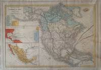
1870Best.-Nr. 338860Paris: Eugene Belin 1870. Map. Lithograph with hand coloring. Image measures 12 3/4" x 16 3/4". This detailed map of North America was published in the "Atlas Universel Et Classique De Geographie". Created by Claude-Joseph Drioux and Charles Leroy it features two prominent insets as well one depicting the voyages of Christopher Columbus and another focusing on Mexico. Below the title is an index listing 18 states with West Virginia also noted as "Kanawha." Texas Louisiana Mississippi Arkansas Oklahoma and California have their borders delineated. Montana is also labeled as "Shoshone" and "Mormons" is written over Utah. The Transcontinental Railroad is shown and the Gulf Stream and the South Equatorial Current are depicted.Toning at margins and on right side of image otherwise good condition. Eugene Belin unknown books