LUCHET de la Roche du MAINE (Marquis de)Livre Rare Book

5 126 résultats
1776réf. 319Ff1776 Sans lieu - 1776 - In8 - reliure demi veau moderne couverture d'attente de papier gris conservée - Rare édition originale de cette biographie de Jeanne d'Arc par le marquis de Luchet de La Roche du Maine. Cet ouvrage était déjà considéré comme rare en 1852 comme en témoigne Charles Brainne dans Les Hommes illustres de l'Orléanais. (T. 1, pp. 251-252) : "En 1776, M. de Luchet fit imprimer un in-8 de cent trente et une pages, très rare maintenant, et intitulé « Dissertation sur Jeanne d'Arc », il est sans nom d'imprimeur et sans permis d'imprimer. Plusieurs historiens de Jeanne d'Arc, et notamment M. Lebrun des Charmettes, le plus complet et le plus exact de tous, en ont eu connaissance". Ouvrage très rare donc -
réf. 245052Le Mans, Pellechat, Paris, Champion, 1877-1878 3 tomes en 1 vol. gr. in-8, XVI-286 pp., 356 pp. et 377 pp., demi-basane fauve, dos à nerfs orné Petits frottements au dos.
réf. 202774Le Mans, Monnoyer, 1876 in-8, [2]-52 pp., broché. Tâche marginale sur la couverture et les premiers feuillets.
réf. 190465Paris, Hachette et Cie, 1888 2 vol. in-8, XV-447 pp. et 409 pp., demi-chagrin rouge, dos lisse orné de fleurs de lys dorées (rel. de l'époque). Petit accroc aux coiffes, dos décoloré, qqs. rousseurs.
réf. 244968Au Mans, chez Fleuriot, 1811 2 vol. in-12, [2]-III-391 pp. et 375-[3] pp., basane fauve racinée, dos lisse orné, chaînette dorée en encadrement sur les plats, fleurons d'angles (rel. de l'époque). Dos un peu usé, petit manque à la coiffe supérieure du tome 2, qqs épid.
1802réf. 21643angers 1802 1 feuillet avec en-tête préimprimé en noir d'une grande vignette en noir (avec symboles révolutionnaires : marianne au bonnet Phrygien, faisceaux d'Armes etc...) avec imprimés de part et d'autre en noir : LIBERTE et EGALITE, manuscrit à l'encre brune sur papier vergé crème ligné filigrané, format 20 centimètres de large par 32,5 centimètres de haut, Quartier-Général d'Angers, le 29 THERMIDOR AN 10 (16 JUILLET 1802) de la République Française, une et indivisible, signature manuscrite de GIRARDON Antoine, GENERAL DE BRIGADE, COMMANDANT LA SUBDIVISION DU MAINE ET LOIRE + signature manuscrite du Capitaine Commandant de la Gendarmerie du département du Maine et loire : GALLIE + signature manuscrite du Maire de la commune de La Varenne : GAIGNEUX,
réf. 582000Le Mans, 1844. Petit. in-8, rel. post. pleine basane blonde, pièce de titre rouge, filets à froid encadrant les plats, couv. cons., 244 pp.
2016réf. x-1472579674Bloomsbury USA Academic 2016. Hardcover. New. translation edition. 210 pages. 8.00x5.50x0.75 inches. Bloomsbury USA Academic hardcover
1890réf. 52035Rockland Me.: First Maine Cavalry Association 1890-1892. A significant run of nine of fourteen total issues with two additional supplements of a periodical for Civil War veterans of the First Maine Cavalry. "Published four times a year and will contain the proceedings of the yearly reunions of the First Maine Cavalry matters of historic value to the regiment and items of personal interest to all the members." The volunteer cavalry regiment served with the Army of the Potomac for the duration of the war and participated in many of the critical battles including Brandy Station the largest cavalry engagement of the entire Civil War. Original printed wrappers mostly detached and chipping heavily. A few chips to initial leaves of one issue otherwise internally very good. unknown
1890réf. 52035Rockland Me.: First Maine Cavalry Association 1890-1892. A significant run of nine of fourteen total issues with two additional supplements of a periodical for Civil War veterans of the First Maine Cavalry. "Published four times a year and will contain the proceedings of the yearly reunions of the First Maine Cavalry matters of historic value to the regiment and items of personal interest to all the members." The volunteer cavalry regiment served with the Army of the Potomac for the duration of the war and participated in many of the critical battles including Brandy Station the largest cavalry engagement of the entire Civil War. Original printed wrappers mostly detached and chipping heavily. A few chips to initial leaves of one issue otherwise internally very good. unknown books
1920réf. 41289Washington D.C.: Published by the United States Coast and Geodetic Survey 1920. Large folding nautical chart printed on heavy paper stock. Colored. A rare original coastal survey of Maine and New Hampshire including Portsmouth York Ogunquit Kennebunkport Biddeford and Cape Elizabeth. Established by President Thomas Jefferson in 1807 as the Survey of the Coast the U.S. Coast and Geodetic Survey was the United States' first civilian scientific agency. This agency has followed its mission to survey the U.S. coastline create nautical charts of the coast and help increase maritime safety since its founding and has often played fascinating roles in significant chapters of U.S. history. It served in all theaters of the Civil War in the service of the Union Army and Navy pioneered acoustic exploration in the wake of the sinking of the Titanic and during WWI it worked to detect enemy submarines. In addition this agency worked to survey and produce detailed maps and renderings of the U.S. coast. These nautical survey maps commonly referred to as "T-sheets" provide fascinating insights into the history of the United States coastline which has and will continue to shift. These maps are the most important data source for understanding the physical and ecological characteristics of the U.S. shoreline. The present map is a highly detailed and accurate sea chart of the coasts of Maine and New Hampshire and an important historical view of the developing states. Published by the United States Coast and Geodetic Survey unknown
1920réf. 41289Washington D.C.: Published by the United States Coast and Geodetic Survey 1920. Large folding nautical chart printed on heavy paper stock. Colored. A rare original coastal survey of Maine and New Hampshire including Portsmouth York Ogunquit Kennebunkport Biddeford and Cape Elizabeth. Established by President Thomas Jefferson in 1807 as the Survey of the Coast the U.S. Coast and Geodetic Survey was the United States' first civilian scientific agency. This agency has followed its mission to survey the U.S. coastline create nautical charts of the coast and help increase maritime safety since its founding and has often played fascinating roles in significant chapters of U.S. history. It served in all theaters of the Civil War in the service of the Union Army and Navy pioneered acoustic exploration in the wake of the sinking of the Titanic and during WWI it worked to detect enemy submarines. In addition this agency worked to survey and produce detailed maps and renderings of the U.S. coast. These nautical survey maps commonly referred to as "T-sheets" provide fascinating insights into the history of the United States coastline which has and will continue to shift. These maps are the most important data source for understanding the physical and ecological characteristics of the U.S. shoreline. The present map is a highly detailed and accurate sea chart of the coasts of Maine and New Hampshire and an important historical view of the developing states. Published by the United States Coast and Geodetic Survey unknown books
1920réf. 41275Washington D.C.: Published by the United States Coast and Geodetic Survey 1920. Large folding nautical chart printed on heavy paper stock. Uncolored. A rare original coastal survey of the Fox Islands including Vinalhaven and North Haven. Established by President Thomas Jefferson in 1807 as the Survey of the Coast the U.S. Coast and Geodetic Survey was the United States' first civilian scientific agency. This agency has followed its mission to survey the U.S. coastline create nautical charts of the coast and help increase maritime safety since its founding and has often played fascinating roles in significant chapters of U.S. history. It served in all theaters of the Civil War in the service of the Union Army and Navy pioneered acoustic exploration in the wake of the sinking of the Titanic and during WWI it worked to detect enemy submarines. In addition this agency worked to survey and produce detailed maps and renderings of the U.S. coast. These nautical survey maps commonly referred to as "T-sheets" provide fascinating insights into the history of the United States coastline which has and will continue to shift. These maps are the most important data source for understanding the physical and ecological characteristics of the U.S. shoreline. The present map is a highly detailed and accurate sea chart of the Fox Islands and an important historical view of developing Maine. Published by the United States Coast and Geodetic Survey unknown
1920réf. 41275Washington D.C.: Published by the United States Coast and Geodetic Survey 1920. Large folding nautical chart printed on heavy paper stock. Uncolored. A rare original coastal survey of the Fox Islands including Vinalhaven and North Haven. Established by President Thomas Jefferson in 1807 as the Survey of the Coast the U.S. Coast and Geodetic Survey was the United States' first civilian scientific agency. This agency has followed its mission to survey the U.S. coastline create nautical charts of the coast and help increase maritime safety since its founding and has often played fascinating roles in significant chapters of U.S. history. It served in all theaters of the Civil War in the service of the Union Army and Navy pioneered acoustic exploration in the wake of the sinking of the Titanic and during WWI it worked to detect enemy submarines. In addition this agency worked to survey and produce detailed maps and renderings of the U.S. coast. These nautical survey maps commonly referred to as "T-sheets" provide fascinating insights into the history of the United States coastline which has and will continue to shift. These maps are the most important data source for understanding the physical and ecological characteristics of the U.S. shoreline. The present map is a highly detailed and accurate sea chart of the Fox Islands and an important historical view of developing Maine. Published by the United States Coast and Geodetic Survey unknown books
1920réf. 41269Washington D.C.: Published by the United States Coast and Geodetic Survey 1920. Large folding nautical chart printed on heavy paper stock. Colored. A rare original coastal survey of Maine from Nash Island to Schoodic Island including Gouldsboro Prospect Harbor Steuben Milbridge Cherryfield Addison and Harrington. Established by President Thomas Jefferson in 1807 as the Survey of the Coast the U.S. Coast and Geodetic Survey was the United States' first civilian scientific agency. This agency has followed its mission to survey the U.S. coastline create nautical charts of the coast and help increase maritime safety since its founding and has often played fascinating roles in significant chapters of U.S. history. It served in all theaters of the Civil War in the service of the Union Army and Navy pioneered acoustic exploration in the wake of the sinking of the Titanic and during WWI it worked to detect enemy submarines. In addition this agency worked to survey and produce detailed maps and renderings of the U.S. coast. These nautical survey maps commonly referred to as "T-sheets" provide fascinating insights into the history of the United States coastline which has and will continue to shift. These maps are the most important data source for understanding the physical and ecological characteristics of the U.S. shoreline. The present map is a highly detailed and accurate sea chart of coastal Maine and an important historical view of the developing state. Published by the United States Coast and Geodetic Survey unknown
1920réf. 41269Washington D.C.: Published by the United States Coast and Geodetic Survey 1920. Large folding nautical chart printed on heavy paper stock. Colored. A rare original coastal survey of Maine from Nash Island to Schoodic Island including Gouldsboro Prospect Harbor Steuben Milbridge Cherryfield Addison and Harrington. Established by President Thomas Jefferson in 1807 as the Survey of the Coast the U.S. Coast and Geodetic Survey was the United States' first civilian scientific agency. This agency has followed its mission to survey the U.S. coastline create nautical charts of the coast and help increase maritime safety since its founding and has often played fascinating roles in significant chapters of U.S. history. It served in all theaters of the Civil War in the service of the Union Army and Navy pioneered acoustic exploration in the wake of the sinking of the Titanic and during WWI it worked to detect enemy submarines. In addition this agency worked to survey and produce detailed maps and renderings of the U.S. coast. These nautical survey maps commonly referred to as "T-sheets" provide fascinating insights into the history of the United States coastline which has and will continue to shift. These maps are the most important data source for understanding the physical and ecological characteristics of the U.S. shoreline. The present map is a highly detailed and accurate sea chart of coastal Maine and an important historical view of the developing state. Published by the United States Coast and Geodetic Survey unknown books
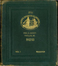
réf. 63-6143London: Lloyd's Register Of Shipping 1932-1933. 4to. Gilt Full Leather Boards ca. 2000 pp. Good with marginal tears some extremities worn to boards shelf wear. Includes bookplates and stamps of previous owner at back of volume SF Maritime Museum. Text in English & French.Very heavy volume will cost extra for shipping. London: Lloyd's Register Of Shipping, 1932-1933. hardcover
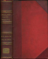
1901réf. 31931Portland: Commandery of the State of Maine 1901. First edition. Three quarter morocco over red boards four raised bands ruled in gilt gilt titles. A very good copy with shelf sticker on foot of backstrip. 8vo. The Military Order of the Loyal Legion of the United States begun in Philadelphia in 1865 was modeled on the Society of the Cincinnati and formed to protect the republic amid rumors of a plot to destroy the government after the assassination of Abraham Lincoln. Among its members were Presidents Ulysses S. Grant Rutherford B. Hayes Benjamin Harrison and William McKinley. By 1899 it had over 8000 members which included nearly every officer of note. This volume contains 155 Maine circulars 22-179 for the years 1881 to 1901 Contains circulars meeting notices black bordered "In Memoriam" notices biographies of the deceased. Many items annotated and signed by the recorders Eward M. Rand and Henry S. Burrage. A wealth of information. [Commandery of the State of Maine ] hardcover
1901réf. 31931Portland: Commandery of the State of Maine 1901. First edition. Three quarter morocco over red boards four raised bands ruled in gilt gilt titles. A very good copy with shelf sticker on foot of backstrip. 8vo. The Military Order of the Loyal Legion of the United States begun in Philadelphia in 1865 was modeled on the Society of the Cincinnati and formed to protect the republic amid rumors of a plot to destroy the government after the assassination of Abraham Lincoln. Among its members were Presidents Ulysses S. Grant Rutherford B. Hayes Benjamin Harrison and William McKinley. By 1899 it had over 8000 members which included nearly every officer of note. This volume contains 155 Maine circulars 22-179 for the years 1881 to 1901 Contains circulars meeting notices black bordered "In Memoriam" notices biographies of the deceased. Many items annotated and signed by the recorders Eward M. Rand and Henry S. Burrage. A wealth of information. [Commandery of the State of Maine ] hardcover books
réf. DADAX041572807XRoutledge 2015-03-19. 1. hardcover. New. 6.15x0.52x9.21. Buy with confidence. Excellent Customer Service & Return policy. Routledge hardcover
1867réf. 61-87Augusta: Stevens & Sayward 1867. 1867. 1210p. Gives name rank company regiment & corps for each individual. Large Wraps. Oversize/Heavy. Text pages OK: Binding broken. Large Paperback. Poor. Augusta: Stevens & Sayward, 1867. Paperback
1867réf. 80-169Augusta: Stevens & Sayward 1867. 1867. 1210p. Alphabetical roster of volunteers from Maine who served in the Union army during the Civil War. Gives name rank company regiment & corps for each individual. Heavy Oversize. Later green cloth binding. Near Fine Copy. Hardcover. Near Fine. Book. Augusta: Stevens & Sayward, 1867. Hardcover
1912réf. 28706bouaye 1912-14 8 LETTRES AUTOGRAPHES MANUSCRITES SIGNÉES, 5 sur bristol crème arrondi aux angles et doré sur tranche à l'emplacement des angles avec tampon préimprimé en noir en haut à gauche : "Le Bois de la Noë, Bouaye, Loire-inférieure", manuscrites à l'encre brune, format : 11,5 x 9 cm + 2 sur bristol bleu arrondi aux angles et doré sur tranche à l'emplacement des angles, à en-tete manuscrit "La Beuverie" par Liré, manuscrites à l'encre bleue, format : 11 x 8,7 cm + une lettre de 4 pages, sur papier vergé filigrané : "TONGIMED'S PAPER", avec tampon préimprimé en noir en haut à gauche : "Le Bois de la Noë, Bouaye, Loire-inférieure", manuscrite à l'encre brune, format : 17,7 x 11,4 cm + UNE CARTE DE VISITE IMPRIMÉE EN NOIR : "COMTE DE MELQUÉ, LE BOIS DE LA NOË PAR BOUAYE (L.-INF.)" ET AUTOGRAPHE MANUSCRITE à l'encre brune ou il indique à la main sa nouvelle adresse après le 15 Octobre(1913) : Chateau de la beuverie par Liré (Maine et Loire), carte sur bristol crème, format : 5,6 x 9,6 cm
réf. 663795Angers, Barassé, 1868-1877 2 tomes en 1 fort vol. in-8, XX-449 pp. et 332-69 pp., demi-percaline bordeaux, premiers plats de couv. cons. (reliure de l'époque).
réf. c4531A Angers, ches Jacques Petit 1945 ; 1 volume in-4° en feuilles, couverture rempliée de papier dominoté en couleurs reproduisant le papier de chez Portier au Mans, étiquette blanche avec titre en noir au 1er plat, étui de carton blanc; 157pp.,1f.nch. Etui sali, 1ère et dernière gardes blanches un peu jaunies, infime manque à la couverture en tête au dos( 2mm), ouvrage en très bon état.Très nombreuses illustrations en noir et en couleurs dans le texte ou à pleine page dont 15 planches hors texte en couleurs, et des vignettes en en noir couleurs contrecollées dans le texte ( coloris à la main au patron).