ref. 67830Paris, éd. Didier, 1851, EDITION ORIGINALE, demi-chagrin noir, plats percaline chagrinée brun clair avec filet doré entre le dos et les plats, encadrements, auteur, titre et initiales (F. H.) dorés sur dos à 4 nerfs, reliure d'époque, 648 pp., ill. par 12 planches lithographiées coul. dont 1 en frontispice et 20 planches en noir sur carton fort,sous serpente, 1 carte en coul., très nb. gravures en noir in-texte par A. LELEUX, O. PENGUILLY et de T. JOHANNOT, appendice, table des matières, EX-LIBRIS en vert et jaune de l'historien François FURET collé sur la première garde ainsi que son cachet violet sur la première blance, Pierre-Michel-François Chevalier dit « Pitre-Chevalier » est un auteur, historien et journaliste français né le 16 novembre 1812 à Paimbœuf (Loire-Inférieure) et mort à Paris le 15 juin 1863. Il a été rédacteur en chef du Figaro et directeur du Musée des familles. Comme le titre l'indique bien, ce livre est l'histoire de cette partie de la France restée loyaliste et combattant la Révolution et l'Empire. Très bon document avec de très nombreuses références pour bien comprendre cette période dans ces régions de l'Ouest. Ce livre faisait partie de la bibliothèque personnelle de François Furet, avec son ex-libris. François Furet, né le 27 mars 1927 à Paris, mort à Figeac le 12 juillet 1997, est un historien français, spécialiste de la Révolution française et de son héritage idéologique. Il appartenait à une génération d'intellectuels cherchant dans les faits les raisons de la faillite du projet marxiste. Pas courant en Edition Originale. Très bon état de la reliure; comme dans tous les exemplaires présence de rousseurs mais épargnant des planches couleurs.
1974ref. 21354Angers Atelier d'art P. Petit 1974 in-8 plein skivertex 3 volumes, reliure plein skivertex marron in-octavo(full binding imitation leather in-8) avec un etui toilé saumon editeur pour les 3 volumes, titre en doré sur pièce de titre de toile noire, toutes tranches lisses, Réédition en Fac-Similé intégral de l'édition Originale à laquelle il a été rajouité la reproduction des 101 gravures de Pierre VIDAL hors-texte en noir, ([8]-LII-812 p.-[45] p. de pl., 776 p.-[23] p. de pl., 761 p.-[33] p. de pl.) pages, 1974 à Angers : Atelier d'art P. Petit Editeur,
1804ref. 21251BEAUFORT-EN-VALLEE 1804 1 "bon de transport"- Facture, broché de 4 pages, sur papier vergé ligné et filigrané (Timbre National R.F.), manuscrite à l'encre brune sur une page, format : 35 x 25,4 cm, tampon Timbre Fiscal République Française à 1 franc en noir + cachet sec gauffré de l'Administration des Domaines de l'Enregistrement et du Timbre en haut de la première page, bon de transport désignant le voiturier par Eau, la marchandise transportée, le prix du transport, la facture de Vente et la destination finale : "MM BERSOLLE, LAMARTINIERE & FLOCK" Négociants à Brest et "Hèbre de Saint-Clément" négociant à Rochefort, FACTURE "BON DE TRANSPORT" adressée à Monsieur "LEBRETON Ainé" Négociant Rue Jean Jacques Rousseau à NANTES qui s'occupe de l'acheminement vers Brest et Rochefort et respectivement de la vente des Balles de Toiles à Voiles pour la MARINE IMPERIALE, BEAUFORT, LE 12 THERMIDOR AN 12 (30 JUIN 1804),
1810ref. 17241Sillé Deforge s.d. [vers 1810] in-12 demi-basane rouge, dos lisse orné de filets, pointillés et fleurons dirés, titre au dos: "Bibliothèque Bleue, 69" [rel. de la fin du XIXe s.],
ref. 587153Mayenne, Impr. Poirier-Bealu, 1901. Fort in-8, rel. de l'ép. demi-basane marron, dos à 5 nerfs orné de fleurons dorés, titre doré ; 567 pp., belle héliogr. sur double-page au front., qq. figures dans le texte, une gravure et un plan h.-t.
1889ref. 14137Angers, Imprimerie-librairie Germin et G. Grassin, 1889. In-4 de (4)-669-(2) pp., demi-veau tabac, dos orné à nerfs, couverture conservée.
1950ref. 024219Maine ATC 1950. Staple Wraps. Very Good. 4to - 11" Tall. The collection of hiking accounts by George H. Witherle renamed thus and mimeographed by the Maine ATC in 1950 this remains a very uncommon publication. Original typed titles on tanned wrappers stapled twice on the side with 43 pages mimeographed 1 side. Page ghost and original likely owners name to upper FC rear clean light edge wear. A nice example of an exceedingly scarce early AMC/MATC item. Maine ATC paperback
1873ref. 10250Boston: J.R. Osgood & Co 1873. First edition. Frontispiece and 12 plates. 1 vols. Oblong folio. Original tan pictorial boards black calf spine. Bottom half of spine perished some cover wear internally fine. 1873 Christmas gift inscription on title. First edition. Frontispiece and 12 plates. 1 vols. Oblong folio. An account of the adventures of a group of friends vacationing at Mt. Desert Maine recounted in humorous verse and equally humorous drawings evidently by two members of the party. Summer romances the hazards of the communal dining table days of genteel ennui and other activities with the first names of the participants indicated as a partial aid to social historians a few of them are named in pencil on the title page are described in double columns of rollicking verse narrative and accompanying plates. A charming period piece and a not insignificant bit of amusing Americana. J.R. Osgood & Co unknown books
1920ref. 41272Washington D.C.: Published by the United States Coast and Geodetic Survey 1920. Large folding nautical chart printed on heavy paper stock. Uncolored. A rare original coastal survey of Maine from Little River to Petit Manan including Milbridge Addison Great Wass Island Preserve Jonesport Machias and an inset map of Moose-a-Bec Bar and Pig Island in top left corner. Established by President Thomas Jefferson in 1807 as the Survey of the Coast the U.S. Coast and Geodetic Survey was the United States' first civilian scientific agency. This agency has followed its mission to survey the U.S. coastline create nautical charts of the coast and help increase maritime safety since its founding and has often played fascinating roles in significant chapters of U.S. history. It served in all theaters of the Civil War in the service of the Union Army and Navy pioneered acoustic exploration in the wake of the sinking of the Titanic and during WWI it worked to detect enemy submarines. In addition this agency worked to survey and produce detailed maps and renderings of the U.S. coast. These nautical survey maps commonly referred to as "T-sheets" provide fascinating insights into the history of the United States coastline which has and will continue to shift. These maps are the most important data source for understanding the physical and ecological characteristics of the U.S. shoreline. The present map is a highly detailed and accurate sea chart of coastal Maine and an important historical view of the developing state. Published by the United States Coast and Geodetic Survey unknown books
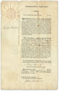
1799ref. 707161799. 1799 Document Appointed a Judge to the Kennebeck County Maine Court of Common Pleas Judges. Maine. Dummer Nathaniel 1755-1815. To All Unto Whom These Presents Shall Come Greeting. Boston February 28 1799. 17" x 11" part-printed document inscribed in neat hand docketed on verso large embossed Massachusetts seal to upper-left corner signed by Governor Increase Sumner countersigned by John Avery first Massachusetts Secretary of the Commonwealth. Light browning and edgewear light soiling and a few minor spots vertical and horizontal fold lines a few minor tears along folds with no loss to text. An interesting item. $350. Dummer resided in Hallowell Maine and was judge of the Kennebeck County Court from 1799 until his death in 1815. He was also Hallowell's postmaster from 1792 to 1802. The docket note witnessed by Joseph North and William Howard attests that Dummer took his oath of office on April 2 1799. unknown books
1873ref. 10250Boston: J.R. Osgood & Co 1873. First edition. Frontispiece and 12 plates. 1 vols. Oblong folio. Original tan pictorial boards black calf spine. Bottom half of spine perished some cover wear internally fine. 1873 Christmas gift inscription on title. First edition. Frontispiece and 12 plates. 1 vols. Oblong folio. An account of the adventures of a group of friends vacationing at Mt. Desert Maine recounted in humorous verse and equally humorous drawings evidently by two members of the party. Summer romances the hazards of the communal dining table days of genteel ennui and other activities with the first names of the participants indicated as a partial aid to social historians a few of them are named in pencil on the title page are described in double columns of rollicking verse narrative and accompanying plates. A charming period piece and a not insignificant bit of amusing Americana. J.R. Osgood & Co unknown
1920ref. 41272Washington D.C.: Published by the United States Coast and Geodetic Survey 1920. Large folding nautical chart printed on heavy paper stock. Uncolored. A rare original coastal survey of Maine from Little River to Petit Manan including Milbridge Addison Great Wass Island Preserve Jonesport Machias and an inset map of Moose-a-Bec Bar and Pig Island in top left corner. Established by President Thomas Jefferson in 1807 as the Survey of the Coast the U.S. Coast and Geodetic Survey was the United States' first civilian scientific agency. This agency has followed its mission to survey the U.S. coastline create nautical charts of the coast and help increase maritime safety since its founding and has often played fascinating roles in significant chapters of U.S. history. It served in all theaters of the Civil War in the service of the Union Army and Navy pioneered acoustic exploration in the wake of the sinking of the Titanic and during WWI it worked to detect enemy submarines. In addition this agency worked to survey and produce detailed maps and renderings of the U.S. coast. These nautical survey maps commonly referred to as "T-sheets" provide fascinating insights into the history of the United States coastline which has and will continue to shift. These maps are the most important data source for understanding the physical and ecological characteristics of the U.S. shoreline. The present map is a highly detailed and accurate sea chart of coastal Maine and an important historical view of the developing state. Published by the United States Coast and Geodetic Survey unknown
1799ref. 707161799. 1799 Document Appointed a Judge to the Kennebeck County Maine Court of Common Pleas Judges. Maine. Dummer Nathaniel 1755-1815. To All Unto Whom These Presents Shall Come Greeting. Boston February 28 1799. 17" x 11" part-printed document inscribed in neat hand docketed on verso large embossed Massachusetts seal to upper-left corner signed by Governor Increase Sumner countersigned by John Avery first Massachusetts Secretary of the Commonwealth. Light browning and edgewear light soiling and a few minor spots vertical and horizontal fold lines a few minor tears along folds with no loss to text. An interesting item. $350. Dummer resided in Hallowell Maine and was judge of the Kennebeck County Court from 1799 until his death in 1815. He was also Hallowell's postmaster from 1792 to 1802. The docket note witnessed by Joseph North and William Howard attests that Dummer took his oath of office on April 2 1799. unknown
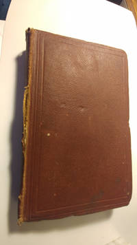
1861ref. 444615023cm by 14cm 415pp first edition full leather front cover has discolouration spine is faded and tear along one edge corners bumped hinges cracked but text block still square and firm no loose pages some pencil notes on front flyleaf light spotting throughout otherwise unmarked. John Murray hardcover
2015ref. x-041572807XRoutledge 2015. Hardcover. New. 136 pages. 9.25x6.25x0.50 inches. Routledge hardcover
2016ref. x-1138890715Routledge 2016. Hardcover. New. 232 pages. 9.25x6.25x0.75 inches. Routledge hardcover
2008ref. x-041596461XRoutledge 2008. Hardcover. New. 1st edition. 262 pages. 9.00x6.25x0.75 inches. Routledge hardcover
2023ref. SKU0637338Carolina Academic Press 2023-01-01. hardcover. New. 0x0x0. New Textbook Ships with Tracking Carolina Academic Press hardcover
2017ref. x-1138518867Taylor & Francis 2017. Hardcover. New. 460 pages. 9.02x5.98x9.00 inches. Taylor & Francis hardcover
TETE de COLLECTION N° 1 à 30 - Revue In-4 - Broché - illustrations en texte - Très bel ensemble, comme neuf. JOINT : Dans beaucoup de numéros coupures de presse. Le Groupe de recherche sur le mouvement social en Mayenne publie en 1980, la revue : L'Oribus. L'association a pour vocation d'accueillir, dans ses colonnes, tous ceux qui désirent faire part de leurs recherches, découvertes et témoignages ou souvenirs sur le mouvement social en Mayenne.
1812ref. 40713Weimar, Landes=Industrie=Comptoirs, 1812. Unbound, but stitched. X,(1),168 pp. and 1 large folded map ""Carte des Iles de Madagascar, de Bonaparte et de France de Comare et d'une partie des cotes D'Afrique Dressés par P. Lapie, 1812""
1812ref. 40713Weimar Landes=Industrie=Comptoirs 1812. Unbound but stitched. X1168 pp. and 1 large folded map "Carte des Iles de Madagascar de Bonaparte et de France de Comare et d'une partie des cotes D'Afrique Dressés par P. Lapie 1812" First German editions of these French travellers accounts of Madagascar. - Bibliothek der neuesten und wichtigsten Reisebeschreibungen.hrsg. von M.C. Sprengel fortgesetzt von T.F. Ehrmann Bd. 46:erster Theil. Also having the general titlepage this with a stamp. unknown
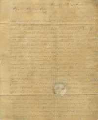
1828ref. BK0113Beverly Massachusetts 1828. Autograph letter signed 3 pp. measuring 8 x 9 ½ inches addressed to Charles Coffin Esq. Buxton Maine. Stampless folded letter with manuscript "Beverly Ms Nov 26" postmark and "18¾" rate. Separation reinforced with archival tape due to brittle paper; otherwise very good. A research letter from jurist and statesman Nathan Dane to Maine antiquarian Charles Coffin concerning the seven Narragansett townships granted to veterans and descendants of veterans of King Philip's War. Dane reports an effort to trace Narragansett No. 1 incorporated as Buxton in 1772 and discusses the difficulty created when the original grants acquired new names in proprietary and governmental records: "I have examined the doings of the legislature of Massachusetts as far as I have them for more than a century past. I find the name Narragansett No. 1 &c. mentioned but three times once in the year 1760 when in erecting the counties of Cumberland and Lincoln in describing the boundaries of them Narragansett No. 1 is mentioned; again in 1764 it is mentioned in the act incorporating the town of Gorham; again in 1772 Narragansett No. 1 was incorporated and made a town by the name of Buxton." Dane suggests reconstructing the history of the grants through a combination of legislative records proprietary papers and the memories of "aged persons" as he "sees no other way to trace back to their origin these seven grants or proprietaries." He also provides information on Major Samuel Appleton a military officer during King Philip's War and on the early Dane family in Ipswich carefully distinguishing the surnames Dane and Dean through deeds wills and signed documents. The recipient Charles Coffin later published historical work on the Narragansett townships. A record of early nineteenth-century antiquarian method showing Dane's methodology for reconstructing the colonial history of Maine and Massachusetts. . unknown books
1920ref. 41281Washington D.C.: Published by the United States Coast and Geodetic Survey 1920. Large folding nautical chart printed on heavy paper stock. Uncolored. A rare original coastal survey of Maine from Nash Island to Cross Island including Jonesport Jonesboro Great Wass Island Preserve and Bucks Harbor. Established by President Thomas Jefferson in 1807 as the Survey of the Coast the U.S. Coast and Geodetic Survey was the United States' first civilian scientific agency. This agency has followed its mission to survey the U.S. coastline create nautical charts of the coast and help increase maritime safety since its founding and has often played fascinating roles in significant chapters of U.S. history. It served in all theaters of the Civil War in the service of the Union Army and Navy pioneered acoustic exploration in the wake of the sinking of the Titanic and during WWI it worked to detect enemy submarines. In addition this agency worked to survey and produce detailed maps and renderings of the U.S. coast. These nautical survey maps commonly referred to as "T-sheets" provide fascinating insights into the history of the United States coastline which has and will continue to shift. These maps are the most important data source for understanding the physical and ecological characteristics of the U.S. shoreline. The present map is a highly detailed and accurate sea chart of coastal Maine from Cross Island to Nash Island and an important historical view of the developing state. Published by the United States Coast and Geodetic Survey unknown books
1921ref. 41280Washington D.C.: Published by the United States Coast and Geodetic Survey 1921. Large folding nautical chart printed on heavy paper stock. Colored. A rare original coastal survey of Maine from Petit Manan to Quoddy Roads including Harrington Addison Jonesport and Machias. Established by President Thomas Jefferson in 1807 as the Survey of the Coast the U.S. Coast and Geodetic Survey was the United States' first civilian scientific agency. This agency has followed its mission to survey the U.S. coastline create nautical charts of the coast and help increase maritime safety since its founding and has often played fascinating roles in significant chapters of U.S. history. It served in all theaters of the Civil War in the service of the Union Army and Navy pioneered acoustic exploration in the wake of the sinking of the Titanic and during WWI it worked to detect enemy submarines. In addition this agency worked to survey and produce detailed maps and renderings of the U.S. coast. These nautical survey maps commonly referred to as "T-sheets" provide fascinating insights into the history of the United States coastline which has and will continue to shift. These maps are the most important data source for understanding the physical and ecological characteristics of the U.S. shoreline. The present map is a highly detailed and accurate sea chart of coastal Maine from Quoddy Roads to Petit Manan and an important historical view of the developing state. Published by the United States Coast and Geodetic Survey unknown books