[Maine]ABAA

5.179 Ergebnisse
1921Best.-Nr. 41280Washington D.C.: Published by the United States Coast and Geodetic Survey 1921. Large folding nautical chart printed on heavy paper stock. Colored. A rare original coastal survey of Maine from Petit Manan to Quoddy Roads including Harrington Addison Jonesport and Machias. Established by President Thomas Jefferson in 1807 as the Survey of the Coast the U.S. Coast and Geodetic Survey was the United States' first civilian scientific agency. This agency has followed its mission to survey the U.S. coastline create nautical charts of the coast and help increase maritime safety since its founding and has often played fascinating roles in significant chapters of U.S. history. It served in all theaters of the Civil War in the service of the Union Army and Navy pioneered acoustic exploration in the wake of the sinking of the Titanic and during WWI it worked to detect enemy submarines. In addition this agency worked to survey and produce detailed maps and renderings of the U.S. coast. These nautical survey maps commonly referred to as "T-sheets" provide fascinating insights into the history of the United States coastline which has and will continue to shift. These maps are the most important data source for understanding the physical and ecological characteristics of the U.S. shoreline. The present map is a highly detailed and accurate sea chart of coastal Maine from Quoddy Roads to Petit Manan and an important historical view of the developing state. Published by the United States Coast and Geodetic Survey unknown books
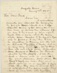
1855Best.-Nr. 45251Augusta House Augusta ME 1855. Very good folded small tear to one edge minor soiling and ink bleed through. 3 pp. Bifolium. 8 x 10 inches. Letter dated January 4th 1855 one day after the Maine elections from Maubec Mitchell Rawson newly elected Whig member of the Maine House of Representatives to fellow Whig party member and candidate for Governor Isaac Reed reporting on the efforts to fix the vote in favor of Reed's opponent Anson Morrill. Rawson had been appointed as a member of a gubernatorial committee that morning so was privy to the shenanigans: "Much talk is made about the course which some members of the Senate & House wish to pursue. I tell them I have no objections to throwing out the votes in the Hancock Plantation & thereby elect or in any way assist Mr. Milliken but to throw them all out & by so doing disfranchise some thousand & declare Mr. Morrill elected by the people. I tell them such a course will be suicidal to the great American party which Mr. Reed & myself are one." He goes on to report who is opposed to these moves and who might be witnesses: "When I see you I will inform you who are the men who are so conscientious about this matter. I am perfectly quiet & cool but I have been at work. most of the time for the last 24 hours. They the Committee propose to spend the night in the committee room so as to have it said that we are doing up business in shape but they are more anxious to declare Mr. Morill Gov by the dear people. I have heard nothing from you but I think my course is patriotic or an honest one & I shall pursue it unless you suggest otherwise. Don't show my letters to anyone. I shall be glad when this session shall close." Anson Morrill 1803-1887 was elected Maine's Governor in 1855 and served until 1856. He had been a candidate under the Know Nothing and then Republican parties. John F. Milliken however was not among the list of Representatives in 1855 but seems to have gotten himself appointed Postmaster in his hometown. Isaac Reed 1809-1887 was a merchant and shipbuilder. He served in the Maine Senate 1839-1840; 1850 1863; the Maine House of Representatives 1842-1843; 1846; 1870-1871; as State Treasurer 1856; and in the U.S. House of Representatives 1852-1853. Maubec Mitchell Rawson b. 1825 was from Waldoboro Maine. unknown
1855Best.-Nr. 45251Augusta House Augusta ME 1855. Very good folded small tear to one edge minor soiling and ink bleed through. 3 pp. Bifolium. 8 x 10 inches. Letter dated January 4th 1855 one day after the Maine elections from Maubec Mitchell Rawson newly elected Whig member of the Maine House of Representatives to fellow Whig party member and candidate for Governor Isaac Reed reporting on the efforts to fix the vote in favor of Reed's opponent Anson Morrill. Rawson had been appointed as a member of a gubernatorial committee that morning so was privy to the shenanigans: "Much talk is made about the course which some members of the Senate & House wish to pursue. I tell them I have no objections to throwing out the votes in the Hancock Plantation & thereby elect or in any way assist Mr. Milliken but to throw them all out & by so doing disfranchise some thousand & declare Mr. Morrill elected by the people. I tell them such a course will be suicidal to the great American party which Mr. Reed & myself are one." He goes on to report who is opposed to these moves and who might be witnesses: "When I see you I will inform you who are the men who are so conscientious about this matter. I am perfectly quiet & cool but I have been at work. most of the time for the last 24 hours. They the Committee propose to spend the night in the committee room so as to have it said that we are doing up business in shape but they are more anxious to declare Mr. Morill Gov by the dear people. I have heard nothing from you but I think my course is patriotic or an honest one & I shall pursue it unless you suggest otherwise. Don't show my letters to anyone. I shall be glad when this session shall close." Anson Morrill 1803-1887 was elected Maine's Governor in 1855 and served until 1856. He had been a candidate under the Know Nothing and then Republican parties. John F. Milliken however was not among the list of Representatives in 1855 but seems to have gotten himself appointed Postmaster in his hometown. Isaac Reed 1809-1887 was a merchant and shipbuilder. He served in the Maine Senate 1839-1840; 1850 1863; the Maine House of Representatives 1842-1843; 1846; 1870-1871; as State Treasurer 1856; and in the U.S. House of Representatives 1852-1853. Maubec Mitchell Rawson b. 1825 was from Waldoboro Maine. unknown books
Best.-Nr. 601665Le Mans, Impr. Monnoyer, Impr. M. Vilaire, 1942-1948. 3 vol. gr. in-8 br., vii-343 et vii-727 pp.
Best.-Nr. 2971auch imprimerie léonce cocharaux 1911-1913-1915 3 volumes in 8 broché 405/474/360 pages - photographies hors texte - ouvrage en très bon état
Best.-Nr. 207494Mamers, Fleury et Dangin, 1886 in-4, VIII-355 pp., frontispice, 4 planches, nbses ill. in-t., bradel papier marbré, couv. cons. (reliure moderne).
Best.-Nr. 576649Laval, L. Moreau, 1886. 3 tomes en 2 vol. in-8, rel. demi peau de truie fauve, pièces de titre vertes et rouge, couv. conservées, XXVII-407-395-122 pp., un plan dépliant, Index. Edition originale, limitée à 424 exemplaires.
Best.-Nr. 210827Le Mans, Leguicheux-Gallienne, 1880 in-8, XVI-370-[2] pp., front., index, bradel demi-percaline turquoise, dos orné (rel. de l'époque). Ex-libris du Vicomte de Broc.
1874Best.-Nr. 32398Paris et Angers Dumoulin, Lacheze 1874 3 volumes In-8 édition de 1878, trois volumes bien reliés, 770 + 760 pp, tome, I, II et III reliures uniformes mais le dos du tome 1 est plus clair - Il existe un volume de planches qui n'est pas présent ici
2008Best.-Nr. x-1846283787Springer-Verlag New York Inc 2008. Hardcover. New. 1st edition. 712 pages. 9.50x7.50x1.25 inches. Springer-Verlag New York Inc hardcover
2020Best.-Nr. __1788111141Edward Elgar Pub 2020. Hardcover. New. 529 pages. 9.75x7.00x1.25 inches. Edward Elgar Pub hardcover
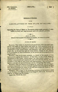
1844Best.-Nr. 36140Washington D.C.: n.p. 1844. First edition. Removed. A very good copy. 1 pp. 8vo. The Maine resolution was an attack on the heinous process of re-enslaving freed blacks: "Resolved. That we do most solemnly in behalf of the people of this State protest against the existence of any laws in any of the States of Territories of this Union which subject our free colored citizens to the liability to be arrested and imprisoned and to be sold into slavery for the payment of the costs of such arrest and imprisonment; that we do protest against such laws as unconstitutional and as endangering the Union." Maine approved this on March 22 1843 sent a copy to all members of the House and Senate and to all the governors of States and Territories. OCLC locates no copies. Not in Sabin Blockson Dumont Work LCP. Afro-Americana Clark: New England in U.S. Government Publications 1789-1849: 1145. n.p. unknown
1844Best.-Nr. 36140Washington D.C.: n.p. 1844. First edition. Removed. A very good copy. 1 pp. 8vo. The Maine resolution was an attack on the heinous process of re-enslaving freed blacks: "Resolved. That we do most solemnly in behalf of the people of this State protest against the existence of any laws in any of the States of Territories of this Union which subject our free colored citizens to the liability to be arrested and imprisoned and to be sold into slavery for the payment of the costs of such arrest and imprisonment; that we do protest against such laws as unconstitutional and as endangering the Union." Maine approved this on March 22 1843 sent a copy to all members of the House and Senate and to all the governors of States and Territories. OCLC locates no copies. Not in Sabin Blockson Dumont Work LCP. Afro-Americana Clark: New England in U.S. Government Publications 1789-1849: 1145. n.p. unknown books
1920Best.-Nr. 41288Washington D.C.: Published by the United States Coast and Geodetic Survey 1920. Large folding nautical chart printed on heavy paper stock. Colored. A rare original coastal survey of Portsmouth Harbor including Kittery Point New Castle Island and Portsmouth. Established by President Thomas Jefferson in 1807 as the Survey of the Coast the U.S. Coast and Geodetic Survey was the United States' first civilian scientific agency. This agency has followed its mission to survey the U.S. coastline create nautical charts of the coast and help increase maritime safety since its founding and has often played fascinating roles in significant chapters of U.S. history. It served in all theaters of the Civil War in the service of the Union Army and Navy pioneered acoustic exploration in the wake of the sinking of the Titanic and during WWI it worked to detect enemy submarines. In addition this agency worked to survey and produce detailed maps and renderings of the U.S. coast. These nautical survey maps commonly referred to as "T-sheets" provide fascinating insights into the history of the United States coastline which has and will continue to shift. These maps are the most important data source for understanding the physical and ecological characteristics of the U.S. shoreline. The present map is a highly detailed and accurate sea chart of Portsmouth Harbor and an important historical view of developing New Hampshire and Maine. Published by the United States Coast and Geodetic Survey unknown
1920Best.-Nr. 41288Washington D.C.: Published by the United States Coast and Geodetic Survey 1920. Large folding nautical chart printed on heavy paper stock. Colored. A rare original coastal survey of Portsmouth Harbor including Kittery Point New Castle Island and Portsmouth. Established by President Thomas Jefferson in 1807 as the Survey of the Coast the U.S. Coast and Geodetic Survey was the United States' first civilian scientific agency. This agency has followed its mission to survey the U.S. coastline create nautical charts of the coast and help increase maritime safety since its founding and has often played fascinating roles in significant chapters of U.S. history. It served in all theaters of the Civil War in the service of the Union Army and Navy pioneered acoustic exploration in the wake of the sinking of the Titanic and during WWI it worked to detect enemy submarines. In addition this agency worked to survey and produce detailed maps and renderings of the U.S. coast. These nautical survey maps commonly referred to as "T-sheets" provide fascinating insights into the history of the United States coastline which has and will continue to shift. These maps are the most important data source for understanding the physical and ecological characteristics of the U.S. shoreline. The present map is a highly detailed and accurate sea chart of Portsmouth Harbor and an important historical view of developing New Hampshire and Maine. Published by the United States Coast and Geodetic Survey unknown books
1922Best.-Nr. 41276Washington D.C.: Published by the United States Coast and Geodetic Survey 1922. Large folding nautical chart printed on heavy paper stock. Colored. Bisected into two maps. A rare original coastal survey of Maine including Boothbay Harbor Bath and Georgetown. Established by President Thomas Jefferson in 1807 as the Survey of the Coast the U.S. Coast and Geodetic Survey was the United States' first civilian scientific agency. This agency has followed its mission to survey the U.S. coastline create nautical charts of the coast and help increase maritime safety since its founding and has often played fascinating roles in significant chapters of U.S. history. It served in all theaters of the Civil War in the service of the Union Army and Navy pioneered acoustic exploration in the wake of the sinking of the Titanic and during WWI it worked to detect enemy submarines. In addition this agency worked to survey and produce detailed maps and renderings of the U.S. coast. These nautical survey maps commonly referred to as "T-sheets" provide fascinating insights into the history of the United States coastline which has and will continue to shift. These maps are the most important data source for understanding the physical and ecological characteristics of the U.S. shoreline. The present map is a highly detailed and accurate sea chart of coastal Maine from Boothbay Harbor to Bath and an important historical view of the developing state. Published by the United States Coast and Geodetic Survey unknown
1922Best.-Nr. 41276Washington D.C.: Published by the United States Coast and Geodetic Survey 1922. Large folding nautical chart printed on heavy paper stock. Colored. Bisected into two maps. A rare original coastal survey of Maine including Boothbay Harbor Bath and Georgetown. Established by President Thomas Jefferson in 1807 as the Survey of the Coast the U.S. Coast and Geodetic Survey was the United States' first civilian scientific agency. This agency has followed its mission to survey the U.S. coastline create nautical charts of the coast and help increase maritime safety since its founding and has often played fascinating roles in significant chapters of U.S. history. It served in all theaters of the Civil War in the service of the Union Army and Navy pioneered acoustic exploration in the wake of the sinking of the Titanic and during WWI it worked to detect enemy submarines. In addition this agency worked to survey and produce detailed maps and renderings of the U.S. coast. These nautical survey maps commonly referred to as "T-sheets" provide fascinating insights into the history of the United States coastline which has and will continue to shift. These maps are the most important data source for understanding the physical and ecological characteristics of the U.S. shoreline. The present map is a highly detailed and accurate sea chart of coastal Maine from Boothbay Harbor to Bath and an important historical view of the developing state. Published by the United States Coast and Geodetic Survey unknown books
1920Best.-Nr. 41287Washington D.C.: Published by the United States Coast and Geodetic Survey 1920. Large folding nautical chart printed on heavy paper stock. Colored. A rare original coastal survey of Maine at East Penobscot Bay including the Fox Islands Deer Isle Stonington and Isle Au Hunt. Established by President Thomas Jefferson in 1807 as the Survey of the Coast the U.S. Coast and Geodetic Survey was the United States' first civilian scientific agency. This agency has followed its mission to survey the U.S. coastline create nautical charts of the coast and help increase maritime safety since its founding and has often played fascinating roles in significant chapters of U.S. history. It served in all theaters of the Civil War in the service of the Union Army and Navy pioneered acoustic exploration in the wake of the sinking of the Titanic and during WWI it worked to detect enemy submarines. In addition this agency worked to survey and produce detailed maps and renderings of the U.S. coast. These nautical survey maps commonly referred to as "T-sheets" provide fascinating insights into the history of the United States coastline which has and will continue to shift. These maps are the most important data source for understanding the physical and ecological characteristics of the U.S. shoreline. The present map is a highly detailed and accurate sea chart of East Penobscot Bay and an important historical view of developing Maine. Published by the United States Coast and Geodetic Survey unknown
1920Best.-Nr. 41287Washington D.C.: Published by the United States Coast and Geodetic Survey 1920. Large folding nautical chart printed on heavy paper stock. Colored. A rare original coastal survey of Maine at East Penobscot Bay including the Fox Islands Deer Isle Stonington and Isle Au Hunt. Established by President Thomas Jefferson in 1807 as the Survey of the Coast the U.S. Coast and Geodetic Survey was the United States' first civilian scientific agency. This agency has followed its mission to survey the U.S. coastline create nautical charts of the coast and help increase maritime safety since its founding and has often played fascinating roles in significant chapters of U.S. history. It served in all theaters of the Civil War in the service of the Union Army and Navy pioneered acoustic exploration in the wake of the sinking of the Titanic and during WWI it worked to detect enemy submarines. In addition this agency worked to survey and produce detailed maps and renderings of the U.S. coast. These nautical survey maps commonly referred to as "T-sheets" provide fascinating insights into the history of the United States coastline which has and will continue to shift. These maps are the most important data source for understanding the physical and ecological characteristics of the U.S. shoreline. The present map is a highly detailed and accurate sea chart of East Penobscot Bay and an important historical view of developing Maine. Published by the United States Coast and Geodetic Survey unknown books
1920Best.-Nr. 41284Washington D.C.: Published by the United States Coast and Geodetic Survey 1920. Large folding nautical chart printed on heavy paper stock. Colored. A rare original coastal survey of the Kennebec and Sheepscot Rivers including Bath Georgetown Boothbay and Wiscasset. Established by President Thomas Jefferson in 1807 as the Survey of the Coast the U.S. Coast and Geodetic Survey was the United States' first civilian scientific agency. This agency has followed its mission to survey the U.S. coastline create nautical charts of the coast and help increase maritime safety since its founding and has often played fascinating roles in significant chapters of U.S. history. It served in all theaters of the Civil War in the service of the Union Army and Navy pioneered acoustic exploration in the wake of the sinking of the Titanic and during WWI it worked to detect enemy submarines. In addition this agency worked to survey and produce detailed maps and renderings of the U.S. coast. These nautical survey maps commonly referred to as "T-sheets" provide fascinating insights into the history of the United States coastline which has and will continue to shift. These maps are the most important data source for understanding the physical and ecological characteristics of the U.S. shoreline. The present map is a highly detailed and accurate sea chart of the Kennebec and Sheepscot Rivers and an important historical view of developing Maine. Published by the United States Coast and Geodetic Survey unknown
1920Best.-Nr. 41284Washington D.C.: Published by the United States Coast and Geodetic Survey 1920. Large folding nautical chart printed on heavy paper stock. Colored. A rare original coastal survey of the Kennebec and Sheepscot Rivers including Bath Georgetown Boothbay and Wiscasset. Established by President Thomas Jefferson in 1807 as the Survey of the Coast the U.S. Coast and Geodetic Survey was the United States' first civilian scientific agency. This agency has followed its mission to survey the U.S. coastline create nautical charts of the coast and help increase maritime safety since its founding and has often played fascinating roles in significant chapters of U.S. history. It served in all theaters of the Civil War in the service of the Union Army and Navy pioneered acoustic exploration in the wake of the sinking of the Titanic and during WWI it worked to detect enemy submarines. In addition this agency worked to survey and produce detailed maps and renderings of the U.S. coast. These nautical survey maps commonly referred to as "T-sheets" provide fascinating insights into the history of the United States coastline which has and will continue to shift. These maps are the most important data source for understanding the physical and ecological characteristics of the U.S. shoreline. The present map is a highly detailed and accurate sea chart of the Kennebec and Sheepscot Rivers and an important historical view of developing Maine. Published by the United States Coast and Geodetic Survey unknown books
1929Best.-Nr. 41282Washington D.C.: Published by the United States Coast and Geodetic Survey 1929. Large folding nautical chart printed on heavy paper stock. Colored. A rare original coastal survey of Maine from Monhegan Island to Cape Elizabeth including Bristol Damariscotta Wiscasset Boothbay Georgetown Harpswell Bath Brunswick Freeport Yarmouth and Portland. Established by President Thomas Jefferson in 1807 as the Survey of the Coast the U.S. Coast and Geodetic Survey was the United States' first civilian scientific agency. This agency has followed its mission to survey the U.S. coastline create nautical charts of the coast and help increase maritime safety since its founding and has often played fascinating roles in significant chapters of U.S. history. It served in all theaters of the Civil War in the service of the Union Army and Navy pioneered acoustic exploration in the wake of the sinking of the Titanic and during WWI it worked to detect enemy submarines. In addition this agency worked to survey and produce detailed maps and renderings of the U.S. coast. These nautical survey maps commonly referred to as "T-sheets" provide fascinating insights into the history of the United States coastline which has and will continue to shift. These maps are the most important data source for understanding the physical and ecological characteristics of the U.S. shoreline. The present map is a highly detailed and accurate sea chart of coastal Maine around Portland and an important historical view of the developing state. Published by the United States Coast and Geodetic Survey unknown
1929Best.-Nr. 41282Washington D.C.: Published by the United States Coast and Geodetic Survey 1929. Large folding nautical chart printed on heavy paper stock. Colored. A rare original coastal survey of Maine from Monhegan Island to Cape Elizabeth including Bristol Damariscotta Wiscasset Boothbay Georgetown Harpswell Bath Brunswick Freeport Yarmouth and Portland. Established by President Thomas Jefferson in 1807 as the Survey of the Coast the U.S. Coast and Geodetic Survey was the United States' first civilian scientific agency. This agency has followed its mission to survey the U.S. coastline create nautical charts of the coast and help increase maritime safety since its founding and has often played fascinating roles in significant chapters of U.S. history. It served in all theaters of the Civil War in the service of the Union Army and Navy pioneered acoustic exploration in the wake of the sinking of the Titanic and during WWI it worked to detect enemy submarines. In addition this agency worked to survey and produce detailed maps and renderings of the U.S. coast. These nautical survey maps commonly referred to as "T-sheets" provide fascinating insights into the history of the United States coastline which has and will continue to shift. These maps are the most important data source for understanding the physical and ecological characteristics of the U.S. shoreline. The present map is a highly detailed and accurate sea chart of coastal Maine around Portland and an important historical view of the developing state. Published by the United States Coast and Geodetic Survey unknown books
Best.-Nr. a90759Seventy original manuscript receipts. Most 3 or 4 x 8 a few larger a few smaller. A few with a bit of printed information store name location etc. Most concern sea Captains Michael Small David Haskell Frederick Spofford Thomas Spofford Jonathan Haskell Nathan Haskell. Schooner Olin is mentioned several times. Most concern taxes or purchase of supplies. Many give location as Deer Isle Maine A few Boston or nearby. Dates on documents range from 1815 to 1850. G to VG. Loose in folder. . unknown
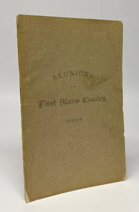
1879Best.-Nr. 11869Augusta ME: George E. Nason Printer 1879. First Edition. Softcover. Very good. Octavo 77pp. A clean sound very good copy in the publisher's printed wraps. Long tear and crease to the rear wrap with one small hole affecting the last leaf with no text. Two contemporary library labels internally not at all offensive. A vanishingly scarce volume recording the proceedings of some early reunions of the First Maine Cavalry regiment. Detailed reminiscences of the war make up much of the contents as well as some soldier-authored poetry and some administrative business. As with many cavalry regiments the First Maine saw significant action from the beginning to the end of the war at too many battles to list but including at Gettysburg and in Sheridan's final campaign through Virginia. OCLC notes a single holding at AAS. Ephemeral and considerably rarer than the two regularly published regimental histories of the regiment which both command strong prices in the rare book market. George E. Nason, Printer unknown