[Maine Democrats]Biblio.com
5126 risultati
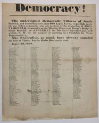
1840rif. 37337South Berwick ME 1840. Broadside 11-3/4" x 14-1/2." Text as recited above in bold type of various sizes. Beneath are the printed signatures in smaller type of about 200 local citizens endorsing the call for assembly. Old folds as usual with several small pinholes along the folds which do not affect text. Ink signature on blank verso "Micajah Grant" preceded by "Mrs" "Hon.". Good plus. South Berwick Democrats seek support for the re-election of Maine Governor John Fairfield 1797-1847. Elected in 1838 he beat his Whig i.e. "Federalist" opponent in the 1840 campaign. Not located on OCLC as of May 2024 or online AAS Bowdoin Colby U ME U So. ME sites. unknown
1840rif. 37337South Berwick ME 1840. Broadside 11-3/4" x 14-1/2." Text as recited above in bold type of various sizes. Beneath are the printed signatures in smaller type of about 200 local citizens endorsing the call for assembly. Old folds as usual with several small pinholes along the folds which do not affect text. Ink signature on blank verso "Micajah Grant" preceded by "Mrs" "Hon.". Good plus. South Berwick Democrats seek support for the re-election of Maine Governor John Fairfield 1797-1847. Elected in 1838 he beat his Whig i.e. "Federalist" opponent in the 1840 campaign. Not located on OCLC as of May 2024 or online AAS Bowdoin Colby U ME U So. ME sites. unknown books
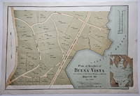
1888rif. 3832This attractively executed map/plan is for a proposed development by the Maine Central Railroad conveniently located "near terminus of the Mt. Desert Branch" of the railroad. The plan was "laid out by Joseph H. Curtis landscape engineer from surveys by J.G. Kelley." The completion of the Mt. Desert Branch in 1884 made possible an all-rail journey from Portland and points south to the Mt. Desert area. The proposed development apparently did not occur since a note on OCLC states: "Later maps show no evidence of the planned roads or lots." Scarce with OCLC locating examples at the University of Maine at Orono Yale and Columbia. The Osher Map Library also has an example. Condition: Litho in green blue and brown. Very good with a small smudge at the middle of the right blank margin and remnants of mounting tape on the reverse. ICN 7807.2 Heliotype Printing Co.
1921rif. 41274Washington D.C.: Published by the United States Coast and Geodetic Survey 1921. Large folding nautical chart printed on heavy paper stock. Colored. A rare original coastal survey of Maine around Casco Bay including Cape Elizabeth Portland Yarmouth Freeport and Harpswell. Established by President Thomas Jefferson in 1807 as the Survey of the Coast the U.S. Coast and Geodetic Survey was the United States' first civilian scientific agency. This agency has followed its mission to survey the U.S. coastline create nautical charts of the coast and help increase maritime safety since its founding and has often played fascinating roles in significant chapters of U.S. history. It served in all theaters of the Civil War in the service of the Union Army and Navy pioneered acoustic exploration in the wake of the sinking of the Titanic and during WWI it worked to detect enemy submarines. In addition this agency worked to survey and produce detailed maps and renderings of the U.S. coast. These nautical survey maps commonly referred to as "T-sheets" provide fascinating insights into the history of the United States coastline which has and will continue to shift. These maps are the most important data source for understanding the physical and ecological characteristics of the U.S. shoreline. The present map is a highly detailed and accurate sea chart of Casco Bay and an important historical view of developing Maine. Published by the United States Coast and Geodetic Survey unknown books
1921rif. 41274Washington D.C.: Published by the United States Coast and Geodetic Survey 1921. Large folding nautical chart printed on heavy paper stock. Colored. A rare original coastal survey of Maine around Casco Bay including Cape Elizabeth Portland Yarmouth Freeport and Harpswell. Established by President Thomas Jefferson in 1807 as the Survey of the Coast the U.S. Coast and Geodetic Survey was the United States' first civilian scientific agency. This agency has followed its mission to survey the U.S. coastline create nautical charts of the coast and help increase maritime safety since its founding and has often played fascinating roles in significant chapters of U.S. history. It served in all theaters of the Civil War in the service of the Union Army and Navy pioneered acoustic exploration in the wake of the sinking of the Titanic and during WWI it worked to detect enemy submarines. In addition this agency worked to survey and produce detailed maps and renderings of the U.S. coast. These nautical survey maps commonly referred to as "T-sheets" provide fascinating insights into the history of the United States coastline which has and will continue to shift. These maps are the most important data source for understanding the physical and ecological characteristics of the U.S. shoreline. The present map is a highly detailed and accurate sea chart of Casco Bay and an important historical view of developing Maine. Published by the United States Coast and Geodetic Survey unknown
1920rif. 41271Washington D.C.: Published by the United States Coast and Geodetic Survey 1920. Large folding nautical chart printed on heavy paper stock. Colored. A rare original coastal survey of Penobscot Bay including Belfast Isleboro Deer Isle Stonington North Haven Vinalhaven Rockland Camden and Rockport. Established by President Thomas Jefferson in 1807 as the Survey of the Coast the U.S. Coast and Geodetic Survey was the United States' first civilian scientific agency. This agency has followed its mission to survey the U.S. coastline create nautical charts of the coast and help increase maritime safety since its founding and has often played fascinating roles in significant chapters of U.S. history. It served in all theaters of the Civil War in the service of the Union Army and Navy pioneered acoustic exploration in the wake of the sinking of the Titanic and during WWI it worked to detect enemy submarines. In addition this agency worked to survey and produce detailed maps and renderings of the U.S. coast. These nautical survey maps commonly referred to as "T-sheets" provide fascinating insights into the history of the United States coastline which has and will continue to shift. These maps are the most important data source for understanding the physical and ecological characteristics of the U.S. shoreline. The present map is a highly detailed and accurate sea chart of Penobscot Bay and an important historical view of developing Maine. Published by the United States Coast and Geodetic Survey unknown
1920rif. 41271Washington D.C.: Published by the United States Coast and Geodetic Survey 1920. Large folding nautical chart printed on heavy paper stock. Colored. A rare original coastal survey of Penobscot Bay including Belfast Isleboro Deer Isle Stonington North Haven Vinalhaven Rockland Camden and Rockport. Established by President Thomas Jefferson in 1807 as the Survey of the Coast the U.S. Coast and Geodetic Survey was the United States' first civilian scientific agency. This agency has followed its mission to survey the U.S. coastline create nautical charts of the coast and help increase maritime safety since its founding and has often played fascinating roles in significant chapters of U.S. history. It served in all theaters of the Civil War in the service of the Union Army and Navy pioneered acoustic exploration in the wake of the sinking of the Titanic and during WWI it worked to detect enemy submarines. In addition this agency worked to survey and produce detailed maps and renderings of the U.S. coast. These nautical survey maps commonly referred to as "T-sheets" provide fascinating insights into the history of the United States coastline which has and will continue to shift. These maps are the most important data source for understanding the physical and ecological characteristics of the U.S. shoreline. The present map is a highly detailed and accurate sea chart of Penobscot Bay and an important historical view of developing Maine. Published by the United States Coast and Geodetic Survey unknown books
1920rif. 41279Washington D.C.: Published by the United States Coast and Geodetic Survey 1920. Large folding nautical chart printed on heavy paper stock. Colored. A rare original coastal survey of St. George River and the Muscle Ridge Channel including Thomaston Cushing and St. George. Established by President Thomas Jefferson in 1807 as the Survey of the Coast the U.S. Coast and Geodetic Survey was the United States' first civilian scientific agency. This agency has followed its mission to survey the U.S. coastline create nautical charts of the coast and help increase maritime safety since its founding and has often played fascinating roles in significant chapters of U.S. history. It served in all theaters of the Civil War in the service of the Union Army and Navy pioneered acoustic exploration in the wake of the sinking of the Titanic and during WWI it worked to detect enemy submarines. In addition this agency worked to survey and produce detailed maps and renderings of the U.S. coast. These nautical survey maps commonly referred to as "T-sheets" provide fascinating insights into the history of the United States coastline which has and will continue to shift. These maps are the most important data source for understanding the physical and ecological characteristics of the U.S. shoreline. The present map is a highly detailed and accurate sea chart of Maine and an important historical view of the developing state. Published by the United States Coast and Geodetic Survey unknown
1920rif. 41279Washington D.C.: Published by the United States Coast and Geodetic Survey 1920. Large folding nautical chart printed on heavy paper stock. Colored. A rare original coastal survey of St. George River and the Muscle Ridge Channel including Thomaston Cushing and St. George. Established by President Thomas Jefferson in 1807 as the Survey of the Coast the U.S. Coast and Geodetic Survey was the United States' first civilian scientific agency. This agency has followed its mission to survey the U.S. coastline create nautical charts of the coast and help increase maritime safety since its founding and has often played fascinating roles in significant chapters of U.S. history. It served in all theaters of the Civil War in the service of the Union Army and Navy pioneered acoustic exploration in the wake of the sinking of the Titanic and during WWI it worked to detect enemy submarines. In addition this agency worked to survey and produce detailed maps and renderings of the U.S. coast. These nautical survey maps commonly referred to as "T-sheets" provide fascinating insights into the history of the United States coastline which has and will continue to shift. These maps are the most important data source for understanding the physical and ecological characteristics of the U.S. shoreline. The present map is a highly detailed and accurate sea chart of Maine and an important historical view of the developing state. Published by the United States Coast and Geodetic Survey unknown books
1920rif. 41277Washington D.C.: Published by the United States Coast and Geodetic Survey 1920. Large folding nautical chart printed on heavy paper stock. Colored. A rare original coastal survey of West Penobscot Bay including Camden Rockport Rockland the Fox Islands and Islesboro. Established by President Thomas Jefferson in 1807 as the Survey of the Coast the U.S. Coast and Geodetic Survey was the United States' first civilian scientific agency. This agency has followed its mission to survey the U.S. coastline create nautical charts of the coast and help increase maritime safety since its founding and has often played fascinating roles in significant chapters of U.S. history. It served in all theaters of the Civil War in the service of the Union Army and Navy pioneered acoustic exploration in the wake of the sinking of the Titanic and during WWI it worked to detect enemy submarines. In addition this agency worked to survey and produce detailed maps and renderings of the U.S. coast. These nautical survey maps commonly referred to as "T-sheets" provide fascinating insights into the history of the United States coastline which has and will continue to shift. These maps are the most important data source for understanding the physical and ecological characteristics of the U.S. shoreline. The present map is a highly detailed and accurate sea chart of Penobscot Bay and an important historical view of developing Maine. Published by the United States Coast and Geodetic Survey unknown
1920rif. 41277Washington D.C.: Published by the United States Coast and Geodetic Survey 1920. Large folding nautical chart printed on heavy paper stock. Colored. A rare original coastal survey of West Penobscot Bay including Camden Rockport Rockland the Fox Islands and Islesboro. Established by President Thomas Jefferson in 1807 as the Survey of the Coast the U.S. Coast and Geodetic Survey was the United States' first civilian scientific agency. This agency has followed its mission to survey the U.S. coastline create nautical charts of the coast and help increase maritime safety since its founding and has often played fascinating roles in significant chapters of U.S. history. It served in all theaters of the Civil War in the service of the Union Army and Navy pioneered acoustic exploration in the wake of the sinking of the Titanic and during WWI it worked to detect enemy submarines. In addition this agency worked to survey and produce detailed maps and renderings of the U.S. coast. These nautical survey maps commonly referred to as "T-sheets" provide fascinating insights into the history of the United States coastline which has and will continue to shift. These maps are the most important data source for understanding the physical and ecological characteristics of the U.S. shoreline. The present map is a highly detailed and accurate sea chart of Penobscot Bay and an important historical view of developing Maine. Published by the United States Coast and Geodetic Survey unknown books
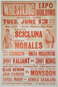
1972rif. BK0130Portland Maine: Expo Building 1972. Large printed wrestling poster 17 x 26 inches printed in orange on cream stock with photographic portraits of Pedro Morales and Baron Mikel Scicluna. Moderate toning and edge wear with strong color and printing; very good. A poster for a 1972 WWWF card at Portland's Expo Building headlined by a World Championship match between reigning champion Pedro Morales and Baron Mikel Scicluna. The undercard advertised Chief Jay Strongbow against Nikita Mulkovitch Jimmy Valiant against Sonny King and a two-against-one handicap match pitting the Black Demon and Juan Caruso against Gorilla Monsoon along with Tomas Marin against Arnold Skaaland. Contemporary wrestling records document an attendance of 1600 and preserve the results of the card. Morales retained his championship by pinning Scicluna at 20:11; Strongbow defeated Mulkovitch and Sonny King defeated Valiant. The advertised Gorilla Monsoon handicap match did not take place with the lower portion of the card rearranged into separate matches between Skaaland and Caruso and between the Black Demon and Tomas Marin.1 Morales was then in the middle of his nearly three-year WWWF championship reign having defeated Ivan Koloff for the title at Madison Square Garden in February 1971 and holding it until December 1973. The Puerto Rican-born wrestler became one of the promotion's largest draws during the period particularly among the Northeast's growing Latino audience.2 The poster is particularly appealing for the large portraits of both champion and challenger and for documenting an intact regional WWWF card during Morales's championship run. 1 Richard Land "WWWF - 1972 Results" The History of WWE accessed September 17 2026 https://thehistoryofwwe.com/wwwf-results-1972/. 2 "Pedro Morales" WWE accessed September 17 2026 https://www.wwe.com/superstars/pedromorales. . Expo Building unknown
1972rif. BK0130Portland Maine: Expo Building 1972. Large printed wrestling poster 17 x 26 inches printed in orange on cream stock with photographic portraits of Pedro Morales and Baron Mikel Scicluna. Moderate toning and edge wear with strong color and printing; very good. A poster for a 1972 WWWF card at Portland's Expo Building headlined by a World Championship match between reigning champion Pedro Morales and Baron Mikel Scicluna. The undercard advertised Chief Jay Strongbow against Nikita Mulkovitch Jimmy Valiant against Sonny King and a two-against-one handicap match pitting the Black Demon and Juan Caruso against Gorilla Monsoon along with Tomas Marin against Arnold Skaaland. Contemporary wrestling records document an attendance of 1600 and preserve the results of the card. Morales retained his championship by pinning Scicluna at 20:11; Strongbow defeated Mulkovitch and Sonny King defeated Valiant. The advertised Gorilla Monsoon handicap match did not take place with the lower portion of the card rearranged into separate matches between Skaaland and Caruso and between the Black Demon and Tomas Marin.1 Morales was then in the middle of his nearly three-year WWWF championship reign having defeated Ivan Koloff for the title at Madison Square Garden in February 1971 and holding it until December 1973. The Puerto Rican-born wrestler became one of the promotion's largest draws during the period particularly among the Northeast's growing Latino audience.2 The poster is particularly appealing for the large portraits of both champion and challenger and for documenting an intact regional WWWF card during Morales's championship run. 1 Richard Land "WWWF - 1972 Results" The History of WWE accessed September 17 2026 https://thehistoryofwwe.com/wwwf-results-1972/. 2 "Pedro Morales" WWE accessed September 17 2026 https://www.wwe.com/superstars/pedromorales. . Expo Building unknown books
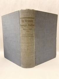
1911rif. 51933Atlanta Ga: Self Published 1911. First Edition. Hardcover. Very good. 680p quarto illustrated. "It was her husband's request that she should collect qnd publish the story of his Congressional and Legislative life as connected with Georgia politics from 1874 during more than 20 years of public service in State and National Legislature" Salley Eugenia Brown's copy with her ownership signature on the front fly leaf. Brown 1862-1942 Miss Brown the daughter of Joseph E Brown Civil War Governor of Georgia. Martha "Pat" Simmons Garroway of Sargentville Maine related the story of Sally as a little girl watching General Sherman's troops march through Atlanta. Later she summered in Sargentville Mine and had a house at the end of Caterpillar Hill Road where it intersects with Reach Road. Inner hinges cracked but a surprisingly very good copy. Self Published hardcover
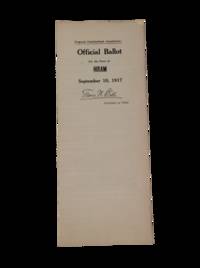
1917rif. 199681917. Maine Secretary of State Frank W. Ball. Hiram Maine ballot sheet is a 1917 election document recording a statewide vote on women's suffrage before ratification of the Nineteenth Amendment. Proposed Amendment No. 1 states "The right to vote or to hold office shall not be denied or abridged on account of sex" placing the sheet within Maine's contested suffrage campaign which was defeated by male voters by roughly a two-to-one margin on September 10 1917. The ballot supports research into women's voting rights state constitutional reform local election administration and suffrage politics during World War I. Proposed Constitutional Amendments Ballot. Issued by Frank W. Ball Secretary of State. Hiram Maine: State of Maine September 10 1917. Unfolded sheet measuring 25" x 9". The sheet presents five proposed amendments for local voters including Proposed Amendment No. 1 on women's suffrage and Proposed Amendment No. 4 concerning Article 7 of the Maine Constitution and the deployment of American troops during World War I. The recto bears Ball's facsimile signature identifying the document as an official election form used in the town of Hiram. The ballot's date gives it particular significance within Maine suffrage history: Maine rejected the 1917 state amendment then ratified the federal woman suffrage amendment in 1919 before national certification in 1920. Quarter-folded; very minor age-toning to extremities and creases. Overall very good. A local Maine voting document preserving the exact ballot language of a failed state suffrage referendum shortly before federal enfranchisement. unknown
1917rif. 199681917. Maine Secretary of State Frank W. Ball. Hiram Maine ballot sheet is a 1917 election document recording a statewide vote on women's suffrage before ratification of the Nineteenth Amendment. Proposed Amendment No. 1 states "The right to vote or to hold office shall not be denied or abridged on account of sex" placing the sheet within Maine's contested suffrage campaign which was defeated by male voters by roughly a two-to-one margin on September 10 1917. The ballot supports research into women's voting rights state constitutional reform local election administration and suffrage politics during World War I. Proposed Constitutional Amendments Ballot. Issued by Frank W. Ball Secretary of State. Hiram Maine: State of Maine September 10 1917. Unfolded sheet measuring 25" x 9". The sheet presents five proposed amendments for local voters including Proposed Amendment No. 1 on women's suffrage and Proposed Amendment No. 4 concerning Article 7 of the Maine Constitution and the deployment of American troops during World War I. The recto bears Ball's facsimile signature identifying the document as an official election form used in the town of Hiram. The ballot's date gives it particular significance within Maine suffrage history: Maine rejected the 1917 state amendment then ratified the federal woman suffrage amendment in 1919 before national certification in 1920. Quarter-folded; very minor age-toning to extremities and creases. Overall very good. A local Maine voting document preserving the exact ballot language of a failed state suffrage referendum shortly before federal enfranchisement. unknown books
1861rif. 755791861. First Edition of Maine's Ancient Law Maine Henry Sumner 1822-1888. Ancient Law: Its Connection with the Early History of Society and Its Relation to Modern Ideas. London: John Murray 1861. viii 415 1 pp. Octavo 8-1/4" x 5-1/4"; 21 x 13.3 cm. Contemporary three-quarter sheep over patterned cloth gilt-edged raised bands and gilt title to spine colored endpapers. Moderate rubbing to boards very slight bubbling and light wear to edges of cloth in places rubbing and light wear to extremities joints starting at ends chipping to head of spine corners bumped and worn hinges cracked faint offsetting to endpapers a few tears to front pastedown pencil annotations to rear free endpaper. Moderate toning a few partial cracks to text block all leaves secure early pencil annotations and marginal marks to a few leaves light soiling to title page. $450. First edition. "Maine indicates the place in the development of a legal system of such agencies as legal fictions and equity. He explains the history of the concept of a law of nature; and in his account of the contrast between primitive and modern society--between the place which the law of persons occupies in primitive and modern law--he comes to the famous conclusion that the government of progressive societies has been from status to contract" Holdsworth. Dauchy et al. The Formation and Transmission of Western Legal Culture: 150 Books that Made the Law in the Age of Printing 115. Holdsworth A History of English Law XV:363-4. unknown
1861rif. 755791861. First Edition of Maine's Ancient Law Maine Henry Sumner 1822-1888. Ancient Law: Its Connection with the Early History of Society and Its Relation to Modern Ideas. London: John Murray 1861. viii 415 1 pp. Octavo 8-1/4" x 5-1/4"; 21 x 13.3 cm. Contemporary three-quarter sheep over patterned cloth gilt-edged raised bands and gilt title to spine colored endpapers. Moderate rubbing to boards very slight bubbling and light wear to edges of cloth in places rubbing and light wear to extremities joints starting at ends chipping to head of spine corners bumped and worn hinges cracked faint offsetting to endpapers a few tears to front pastedown pencil annotations to rear free endpaper. Moderate toning a few partial cracks to text block all leaves secure early pencil annotations and marginal marks to a few leaves light soiling to title page. $450. First edition. "Maine indicates the place in the development of a legal system of such agencies as legal fictions and equity. He explains the history of the concept of a law of nature; and in his account of the contrast between primitive and modern society--between the place which the law of persons occupies in primitive and modern law--he comes to the famous conclusion that the government of progressive societies has been from status to contract" Holdsworth. Dauchy et al. The Formation and Transmission of Western Legal Culture: 150 Books that Made the Law in the Age of Printing 115. Holdsworth A History of English Law XV:363-4. unknown books
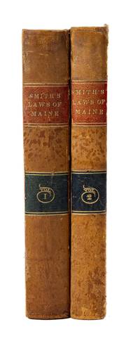
1834rif. 862421834. Set of 1834 Maine Statutes Compiled by Morse Telegraph Partner Francis O.J. Smith in a Handsome Contemporary Binding Maine. Smith Francis Ormond Jonathan 1806-1876 Compiler. Laws of the State of Maine Volumes 1 and 2; With the Constitution of the U. States and of Said State Prefixed. Also Notes and References Delineating the Additions and Modifications Thereof Which have Been Enacted by the Legislature of the State From 1821 to 1834. To Which are Appended In Notes and Comments A Full Synopsis of the Decisions Relating Thereto Contained in the 17 Volumes of Massachusetts Reports 10 Volumes Pickering's Reports And 7 Volumes of Greenleaf's Reports. Portland: Thomas Todd and Colman Holden & Co. 1834. Two volumes. iv 546 2 civ 2; iv 547-1048 2 pp. Octavo 9-1/2" x 5-3/4"; 24.1 x 14.6 cm. Contemporary sheep blind rules to boards blind fillets and red and black lettering pieces to spines. Minor stains and scuffs to boards moderate rubbing to extremities. Light toning to interiors negligible light foxing in places minor tears to edges of a few leaves. A very good set in a handsome contemporary binding. $450. This comprehensive 1834 compilation consolidates Maine's statutory laws alongside detailed cross-references to contemporary judicial interpretations. In an ambitious effort to democratize legal access the publisher's advertisement notes that this edition was: ".designed for the use of all classes of citizens and not for those exclusively who are engaged in the practice of Law." The volumes were meticulously designed to synthesize an entire legal library aiming to serve as a reliable single-source substitute for the thirty-four separate volumes of Law Reports from which its extensive notes were abstracted. The compiler Francis O.J. Smith was a prominent Maine attorney and politician who would later secure a unique place in American history as an early business partner of Samuel Morse helping to develop and promote the magnetic telegraph. An exceptional well-preserved copy of early New England legal history in a handsome contemporary binding. Williamson A Bibliography of Maine 9231. Babbitt Hand-List of Legislative Sessions and Session Laws 160. unknown
1834rif. 862421834. Set of 1834 Maine Statutes Compiled by Morse Telegraph Partner Francis O.J. Smith in a Handsome Contemporary Binding Maine. Smith Francis Ormond Jonathan 1806-1876 Compiler. Laws of the State of Maine Volumes 1 and 2; With the Constitution of the U. States and of Said State Prefixed. Also Notes and References Delineating the Additions and Modifications Thereof Which have Been Enacted by the Legislature of the State From 1821 to 1834. To Which are Appended In Notes and Comments A Full Synopsis of the Decisions Relating Thereto Contained in the 17 Volumes of Massachusetts Reports 10 Volumes Pickering's Reports And 7 Volumes of Greenleaf's Reports. Portland: Thomas Todd and Colman Holden & Co. 1834. Two volumes. iv 546 2 civ 2; iv 547-1048 2 pp. Octavo 9-1/2" x 5-3/4"; 24.1 x 14.6 cm. Contemporary sheep blind rules to boards blind fillets and red and black lettering pieces to spines. Minor stains and scuffs to boards moderate rubbing to extremities. Light toning to interiors negligible light foxing in places minor tears to edges of a few leaves. A very good set in a handsome contemporary binding. $450. This comprehensive 1834 compilation consolidates Maine's statutory laws alongside detailed cross-references to contemporary judicial interpretations. In an ambitious effort to democratize legal access the publisher's advertisement notes that this edition was: ".designed for the use of all classes of citizens and not for those exclusively who are engaged in the practice of Law." The volumes were meticulously designed to synthesize an entire legal library aiming to serve as a reliable single-source substitute for the thirty-four separate volumes of Law Reports from which its extensive notes were abstracted. The compiler Francis O.J. Smith was a prominent Maine attorney and politician who would later secure a unique place in American history as an early business partner of Samuel Morse helping to develop and promote the magnetic telegraph. An exceptional well-preserved copy of early New England legal history in a handsome contemporary binding. Williamson A Bibliography of Maine 9231. Babbitt Hand-List of Legislative Sessions and Session Laws 160. unknown books
rif. Z1-C-080-00625Murray. Used - Good. Hardcover Edition. Ships from UK in 48 hours or less usually same day. Your purchase helps support Sri Lankan Children's Charity 'The Rainbow Centre'. Ex-library so some stamps and wear but in good overall condition. 100% money back guarantee. We are a world class secondhand bookstore based in Hertfordshire United Kingdom and specialize in high quality textbooks across an enormous variety of subjects. We aim to provide a vast range of textbooks rare and collectible books at a great price. Our donations to The Rainbow Centre have helped provide an education and a safe haven to hundreds of children who live in appalling conditions. We provide a 100% money back guarantee and are dedicated to providing our customers with the highest standards of service in the bookselling industry. Murray hardcover
rif. Bloomsbury-9781350086197Bloomsbury Academic. Hardback. New. 184 pages Bloomsbury Academic hardcover
rif. Bloomsbury-9781350086197Bloomsbury Academic. Hardback. New. 184 pages Bloomsbury Academic hardcover
1920rif. 41290Washington D.C.: Published by the United States Coast and Geodetic Survey 1920. Large folding nautical chart printed on heavy paper stock. Colored. A rare original coastal survey of Portland Harbor including Cape Elizabeth Westbrook and Portland. Established by President Thomas Jefferson in 1807 as the Survey of the Coast the U.S. Coast and Geodetic Survey was the United States' first civilian scientific agency. This agency has followed its mission to survey the U.S. coastline create nautical charts of the coast and help increase maritime safety since its founding and has often played fascinating roles in significant chapters of U.S. history. It served in all theaters of the Civil War in the service of the Union Army and Navy pioneered acoustic exploration in the wake of the sinking of the Titanic and during WWI it worked to detect enemy submarines. In addition this agency worked to survey and produce detailed maps and renderings of the U.S. coast. These nautical survey maps commonly referred to as "T-sheets" provide fascinating insights into the history of the United States coastline which has and will continue to shift. These maps are the most important data source for understanding the physical and ecological characteristics of the U.S. shoreline. The present map is a highly detailed and accurate sea chart of Portland Harbor and an important historical view of developing Maine. Published by the United States Coast and Geodetic Survey unknown
1920rif. 41290Washington D.C.: Published by the United States Coast and Geodetic Survey 1920. Large folding nautical chart printed on heavy paper stock. Colored. A rare original coastal survey of Portland Harbor including Cape Elizabeth Westbrook and Portland. Established by President Thomas Jefferson in 1807 as the Survey of the Coast the U.S. Coast and Geodetic Survey was the United States' first civilian scientific agency. This agency has followed its mission to survey the U.S. coastline create nautical charts of the coast and help increase maritime safety since its founding and has often played fascinating roles in significant chapters of U.S. history. It served in all theaters of the Civil War in the service of the Union Army and Navy pioneered acoustic exploration in the wake of the sinking of the Titanic and during WWI it worked to detect enemy submarines. In addition this agency worked to survey and produce detailed maps and renderings of the U.S. coast. These nautical survey maps commonly referred to as "T-sheets" provide fascinating insights into the history of the United States coastline which has and will continue to shift. These maps are the most important data source for understanding the physical and ecological characteristics of the U.S. shoreline. The present map is a highly detailed and accurate sea chart of Portland Harbor and an important historical view of developing Maine. Published by the United States Coast and Geodetic Survey unknown books