5 126 résultats
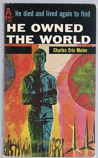
1960réf. 390157New York: Avon 1960. Softcover. Near Fine. First Avon edition. Mass market paperback. Nick at the top edge of the rear wrap slightest edgewear near fine. Avon unknown books
1886réf. 1395488New York: Henry Holt and Company 1886. Hardcover. Octavo xii 261 pages. In Fair plus condition. Spine is brown with gold print. Boards in brown coth. Light wear to spine caps and corners cocked spine. Text block has bookplate on front flyleaf intermittent spine breaks. NOTE: Shelved in Netdesk Column R. 1395488. FP New Rockville Stock. Henry Holt and Company hardcover books
1876réf. 1395490New York: Henry Holt and Company 1876. Third and enlarged edition; Author's edition. Hardcover. Octavo xii 413 pages. In Fair minus condition. Spine is brown with gold print. Boards in brown cloth. Fraying to spine caps and corners mild shelf wear. Text block has cracked hinges penciled name on title page uncut pages intermittent spine breaks light age-toning to paper. NOTE: Shelved in Netdesk Column R. 1395490. FP New Rockville Stock. Henry Holt and Company hardcover books
1876réf. 1395492New York: Henry Holt and Company 1876. Third and enlarged edition; Author's edition. Hardcover. Octavo xii 413 pages. In Fair plus condition. Spine is brown with gold print. Boards in brown cloth. Tattering to spine caps and corners mild shelf wear cocked spine. Text block has intermittent spine breaks. NOTE: Shelved in Netdesk Column R. 1395492. FP New Rockville Stock. Henry Holt and Company hardcover books
1878réf. 1395493New York: Henry Holt and Company 1878. Hardcover. Octavo viii 412 pages. In Good minus condition. Spine is brown with gold print. Boards in brown cloth. Wear to spine caps and corners toning to spine peripheral toning. Text block has stiff binding newer endpapers name in ink on front endpaper. NOTE: Shelved in Locked Annex Area ND-HV Section. 1395493. FP New Rockville Stock. Henry Holt and Company hardcover books
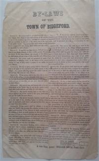
1850réf. 299Biddeford: N.p. 1850. Broadside 14" x 8" double column signed in type by three selectmen with attestation by town clerk at end. Folded in quarters with several tiny holes no loss a number of creases minor stains one short marginal tear etc. but overall quite sound. Comprised of 19 Articles proscribing certain types of behavior the unique broadside specifies fines or other punishments for lawbreakers. Most interesting is Article 4: "No boy or other person shall be allowed to play at the game of bat and ball in the public streets of the village. Any person offending against this article shall forfeit and pay fifty cents for each offence." In addition to the obvious like public drunkenness these include: riding horses at a gallop in town or more than a walk on the covered bridge; "any boy or other person" who hangs onto a sleigh or carriage; anyone "causing dogs or any other animals to fight" in the streets; "Any person wantonly exposing himself sic naked in sight of any dwelling house"; a person injuring an ornamental tree on any street; anyone mutilating or pulling down signs or public notices or throwing dirt or setting off firecrackers or sliding down hills in the public streets &c. &c. According to internet resources Biddeford Maine passed a city charter and adopted a mayoral form of government in 1855. Not recorded in OCLC. 299 . N.p. unknown books
1958réf. 231832PA: Lippincot 1958. Hardcover. Very Good/Very Good. Later. Very good in very good dust jacket. Dustwrapper price clipped. Corners slightly bent. Edges of spine lightly rubbed. Dustwrapper shelf rubbed. Couple tears on edges of dust jacket. Lippincot hardcover books
1988réf. 170687London: Routledge 1988. Hardcover. Near Fine. First edition. Near fine/hardcover. Name inside front cover. Pages clean. Blue cover clean. Solid condition. Routledge hardcover books
1972réf. 238425New York: Nelson Doubleday 1972. Hardcover. Very Good. Book club. Very good plus Hardcover has no dust jacket text edges smudged number inked on end page. Nelson Doubleday hardcover books
1957réf. 238419PA: J.B. Lippincott 1957. Hardcover. Very Good/Good. Book club. Very good in good dust jacket. Hardcover has general minor wear dust jacket chipped at edges. J.B. Lippincott hardcover books
1926réf. 114279London: Noel Douglas 1926. Hardcover. Good. First edition. Good. Hardcover rubbed at spine ends and corners cover and foredges soiled spine and pages browned bookplate. Noel Douglas hardcover books
1958réf. 247474Philadephia: Lippincott 1958. Hardcover. Very Good/Good. Very good in good dust jacket. Browned. Dustwrapper rubbed with creasing and small tearing along edges corners spine ends. Lippincott hardcover books
1921réf. 41274Washington D.C.: Published by the United States Coast and Geodetic Survey 1921. Large folding nautical chart printed on heavy paper stock. Colored. A rare original coastal survey of Maine around Casco Bay including Cape Elizabeth Portland Yarmouth Freeport and Harpswell. Established by President Thomas Jefferson in 1807 as the Survey of the Coast the U.S. Coast and Geodetic Survey was the United States' first civilian scientific agency. This agency has followed its mission to survey the U.S. coastline create nautical charts of the coast and help increase maritime safety since its founding and has often played fascinating roles in significant chapters of U.S. history. It served in all theaters of the Civil War in the service of the Union Army and Navy pioneered acoustic exploration in the wake of the sinking of the Titanic and during WWI it worked to detect enemy submarines. In addition this agency worked to survey and produce detailed maps and renderings of the U.S. coast. These nautical survey maps commonly referred to as "T-sheets" provide fascinating insights into the history of the United States coastline which has and will continue to shift. These maps are the most important data source for understanding the physical and ecological characteristics of the U.S. shoreline. The present map is a highly detailed and accurate sea chart of Casco Bay and an important historical view of developing Maine. Published by the United States Coast and Geodetic Survey unknown books
1919réf. 41297Washington D.C.: Published by the United States Coast and Geodetic Survey 1919. Large folding nautical chart printed on heavy paper stock. Uncolored. A rare original coastal survey of Bath and Boothbay Harbor including Bath Georgetown Boothbay and Westport and Southport Islands. Established by President Thomas Jefferson in 1807 as the Survey of the Coast the U.S. Coast and Geodetic Survey was the United States' first civilian scientific agency. This agency has followed its mission to survey the U.S. coastline create nautical charts of the coast and help increase maritime safety since its founding and has often played fascinating roles in significant chapters of U.S. history. It served in all theaters of the Civil War in the service of the Union Army and Navy pioneered acoustic exploration in the wake of the sinking of the Titanic and during WWI it worked to detect enemy submarines. In addition this agency worked to survey and produce detailed maps and renderings of the U.S. coast. These nautical survey maps commonly referred to as "T-sheets" provide fascinating insights into the history of the United States coastline which has and will continue to shift. These maps are the most important data source for understanding the physical and ecological characteristics of the U.S. shoreline. The present map is a highly detailed and accurate sea chart of Bath and Boothbay Harbor and an important historical view of developing Maine. Published by the United States Coast and Geodetic Survey unknown books
1920réf. 41277Washington D.C.: Published by the United States Coast and Geodetic Survey 1920. Large folding nautical chart printed on heavy paper stock. Colored. A rare original coastal survey of West Penobscot Bay including Camden Rockport Rockland the Fox Islands and Islesboro. Established by President Thomas Jefferson in 1807 as the Survey of the Coast the U.S. Coast and Geodetic Survey was the United States' first civilian scientific agency. This agency has followed its mission to survey the U.S. coastline create nautical charts of the coast and help increase maritime safety since its founding and has often played fascinating roles in significant chapters of U.S. history. It served in all theaters of the Civil War in the service of the Union Army and Navy pioneered acoustic exploration in the wake of the sinking of the Titanic and during WWI it worked to detect enemy submarines. In addition this agency worked to survey and produce detailed maps and renderings of the U.S. coast. These nautical survey maps commonly referred to as "T-sheets" provide fascinating insights into the history of the United States coastline which has and will continue to shift. These maps are the most important data source for understanding the physical and ecological characteristics of the U.S. shoreline. The present map is a highly detailed and accurate sea chart of Penobscot Bay and an important historical view of developing Maine. Published by the United States Coast and Geodetic Survey unknown books
1920réf. 41283Washington D.C.: Published by the United States Coast and Geodetic Survey 1920. Large folding nautical chart printed on heavy paper stock. Uncolored. A rare original coastal survey of New Hampshire and Maine including Portsmouth Exeter Dover and the Piscataqua River. Established by President Thomas Jefferson in 1807 as the Survey of the Coast the U.S. Coast and Geodetic Survey was the United States' first civilian scientific agency. This agency has followed its mission to survey the U.S. coastline create nautical charts of the coast and help increase maritime safety since its founding and has often played fascinating roles in significant chapters of U.S. history. It served in all theaters of the Civil War in the service of the Union Army and Navy pioneered acoustic exploration in the wake of the sinking of the Titanic and during WWI it worked to detect enemy submarines. In addition this agency worked to survey and produce detailed maps and renderings of the U.S. coast. These nautical survey maps commonly referred to as "T-sheets" provide fascinating insights into the history of the United States coastline which has and will continue to shift. These maps are the most important data source for understanding the physical and ecological characteristics of the U.S. shoreline. The present map is a highly detailed and accurate sea chart of coastal New Hampshire and Maine and an important historical view of the developing states. Published by the United States Coast and Geodetic Survey unknown books
1920réf. 41290Washington D.C.: Published by the United States Coast and Geodetic Survey 1920. Large folding nautical chart printed on heavy paper stock. Colored. A rare original coastal survey of Portland Harbor including Cape Elizabeth Westbrook and Portland. Established by President Thomas Jefferson in 1807 as the Survey of the Coast the U.S. Coast and Geodetic Survey was the United States' first civilian scientific agency. This agency has followed its mission to survey the U.S. coastline create nautical charts of the coast and help increase maritime safety since its founding and has often played fascinating roles in significant chapters of U.S. history. It served in all theaters of the Civil War in the service of the Union Army and Navy pioneered acoustic exploration in the wake of the sinking of the Titanic and during WWI it worked to detect enemy submarines. In addition this agency worked to survey and produce detailed maps and renderings of the U.S. coast. These nautical survey maps commonly referred to as "T-sheets" provide fascinating insights into the history of the United States coastline which has and will continue to shift. These maps are the most important data source for understanding the physical and ecological characteristics of the U.S. shoreline. The present map is a highly detailed and accurate sea chart of Portland Harbor and an important historical view of developing Maine. Published by the United States Coast and Geodetic Survey unknown books
1920réf. 41272Washington D.C.: Published by the United States Coast and Geodetic Survey 1920. Large folding nautical chart printed on heavy paper stock. Uncolored. A rare original coastal survey of Maine from Little River to Petit Manan including Milbridge Addison Great Wass Island Preserve Jonesport Machias and an inset map of Moose-a-Bec Bar and Pig Island in top left corner. Established by President Thomas Jefferson in 1807 as the Survey of the Coast the U.S. Coast and Geodetic Survey was the United States' first civilian scientific agency. This agency has followed its mission to survey the U.S. coastline create nautical charts of the coast and help increase maritime safety since its founding and has often played fascinating roles in significant chapters of U.S. history. It served in all theaters of the Civil War in the service of the Union Army and Navy pioneered acoustic exploration in the wake of the sinking of the Titanic and during WWI it worked to detect enemy submarines. In addition this agency worked to survey and produce detailed maps and renderings of the U.S. coast. These nautical survey maps commonly referred to as "T-sheets" provide fascinating insights into the history of the United States coastline which has and will continue to shift. These maps are the most important data source for understanding the physical and ecological characteristics of the U.S. shoreline. The present map is a highly detailed and accurate sea chart of coastal Maine and an important historical view of the developing state. Published by the United States Coast and Geodetic Survey unknown books
1920réf. 41293Washington D.C.: Published by the United States Coast and Geodetic Survey 1920. Large folding nautical chart printed on heavy paper stock. Colored. A rare original coastal survey of the approach to Penobscot Bay including Matinicus Island and an inset map of Matinicus Harbor in the bottom right corner. Established by President Thomas Jefferson in 1807 as the Survey of the Coast the U.S. Coast and Geodetic Survey was the United States' first civilian scientific agency. This agency has followed its mission to survey the U.S. coastline create nautical charts of the coast and help increase maritime safety since its founding and has often played fascinating roles in significant chapters of U.S. history. It served in all theaters of the Civil War in the service of the Union Army and Navy pioneered acoustic exploration in the wake of the sinking of the Titanic and during WWI it worked to detect enemy submarines. In addition this agency worked to survey and produce detailed maps and renderings of the U.S. coast. These nautical survey maps commonly referred to as "T-sheets" provide fascinating insights into the history of the United States coastline which has and will continue to shift. These maps are the most important data source for understanding the physical and ecological characteristics of the U.S. shoreline. The present map is a highly detailed and accurate sea chart of Penobscot Bay and an important historical view of developing Maine. Published by the United States Coast and Geodetic Survey unknown books
1922réf. 41276Washington D.C.: Published by the United States Coast and Geodetic Survey 1922. Large folding nautical chart printed on heavy paper stock. Colored. Bisected into two maps. A rare original coastal survey of Maine including Boothbay Harbor Bath and Georgetown. Established by President Thomas Jefferson in 1807 as the Survey of the Coast the U.S. Coast and Geodetic Survey was the United States' first civilian scientific agency. This agency has followed its mission to survey the U.S. coastline create nautical charts of the coast and help increase maritime safety since its founding and has often played fascinating roles in significant chapters of U.S. history. It served in all theaters of the Civil War in the service of the Union Army and Navy pioneered acoustic exploration in the wake of the sinking of the Titanic and during WWI it worked to detect enemy submarines. In addition this agency worked to survey and produce detailed maps and renderings of the U.S. coast. These nautical survey maps commonly referred to as "T-sheets" provide fascinating insights into the history of the United States coastline which has and will continue to shift. These maps are the most important data source for understanding the physical and ecological characteristics of the U.S. shoreline. The present map is a highly detailed and accurate sea chart of coastal Maine from Boothbay Harbor to Bath and an important historical view of the developing state. Published by the United States Coast and Geodetic Survey unknown books
1920réf. 41268Washington D.C.: Published by the United States Coast and Geodetic Survey 1920. Large folding nautical chart printed on heavy paper stock. Colored. A rare original coastal survey of Frenchman Bay including Acadia National Park Bar Harbor Lamoine Hancock Sullivan. Established by President Thomas Jefferson in 1807 as the Survey of the Coast the U.S. Coast and Geodetic Survey was the United States' first civilian scientific agency. This agency has followed its mission to survey the U.S. coastline create nautical charts of the coast and help increase maritime safety since its founding and has often played fascinating roles in significant chapters of U.S. history. It served in all theaters of the Civil War in the service of the Union Army and Navy pioneered acoustic exploration in the wake of the sinking of the Titanic and during WWI it worked to detect enemy submarines. In addition this agency worked to survey and produce detailed maps and renderings of the U.S. coast. These nautical survey maps commonly referred to as "T-sheets" provide fascinating insights into the history of the United States coastline which has and will continue to shift. These maps are the most important data source for understanding the physical and ecological characteristics of the U.S. shoreline. The present map is a highly detailed and accurate sea chart of Frenchman Bay and an important historical view of developing Maine. Published by the United States Coast and Geodetic Survey unknown books
1920réf. 41288Washington D.C.: Published by the United States Coast and Geodetic Survey 1920. Large folding nautical chart printed on heavy paper stock. Colored. A rare original coastal survey of Portsmouth Harbor including Kittery Point New Castle Island and Portsmouth. Established by President Thomas Jefferson in 1807 as the Survey of the Coast the U.S. Coast and Geodetic Survey was the United States' first civilian scientific agency. This agency has followed its mission to survey the U.S. coastline create nautical charts of the coast and help increase maritime safety since its founding and has often played fascinating roles in significant chapters of U.S. history. It served in all theaters of the Civil War in the service of the Union Army and Navy pioneered acoustic exploration in the wake of the sinking of the Titanic and during WWI it worked to detect enemy submarines. In addition this agency worked to survey and produce detailed maps and renderings of the U.S. coast. These nautical survey maps commonly referred to as "T-sheets" provide fascinating insights into the history of the United States coastline which has and will continue to shift. These maps are the most important data source for understanding the physical and ecological characteristics of the U.S. shoreline. The present map is a highly detailed and accurate sea chart of Portsmouth Harbor and an important historical view of developing New Hampshire and Maine. Published by the United States Coast and Geodetic Survey unknown books
1920réf. 41267Washington D.C.: Published by the United States Coast and Geodetic Survey 1920. Large folding nautical chart printed on heavy paper stock. Uncolored. A rare original coastal survey of Blue Hills Bay in Maine including Ellsworth Surry Tremont Southwest Harbor Swans Island Blue Hill and Acadia National Park. Established by President Thomas Jefferson in 1807 as the Survey of the Coast the U.S. Coast and Geodetic Survey was the United States' first civilian scientific agency. This agency has followed its mission to survey the U.S. coastline create nautical charts of the coast and help increase maritime safety since its founding and has often played fascinating roles in significant chapters of U.S. history. It served in all theaters of the Civil War in the service of the Union Army and Navy pioneered acoustic exploration in the wake of the sinking of the Titanic and during WWI it worked to detect enemy submarines. In addition this agency worked to survey and produce detailed maps and renderings of the U.S. coast. These nautical survey maps commonly referred to as "T-sheets" provide fascinating insights into the history of the United States coastline which has and will continue to shift. These maps are the most important data source for understanding the physical and ecological characteristics of the U.S. shoreline. The present map is a highly detailed and accurate sea chart of Blue Hills Bay and an important historical view of developing Maine. Published by the United States Coast and Geodetic Survey unknown books
réf. 41295Washington D.C.: Published by the United States Coast and Geodetic Survey. Nautical chart printed on heavy paper stock. Uncolored. A rare original coastal survey of Winter Harbor Maine. Established by President Thomas Jefferson in 1807 as the Survey of the Coast the U.S. Coast and Geodetic Survey was the United States' first civilian scientific agency. This agency has followed its mission to survey the U.S. coastline create nautical charts of the coast and help increase maritime safety since its founding and has often played fascinating roles in significant chapters of U.S. history. It served in all theaters of the Civil War in the service of the Union Army and Navy pioneered acoustic exploration in the wake of the sinking of the Titanic and during WWI it worked to detect enemy submarines. In addition this agency worked to survey and produce detailed maps and renderings of the U.S. coast. These nautical survey maps commonly referred to as "T-sheets" provide fascinating insights into the history of the United States coastline which has and will continue to shift. These maps are the most important data source for understanding the physical and ecological characteristics of the U.S. shoreline. The present map is a highly detailed and accurate sea chart of Winter Harbor and an important historical view of developing Maine. Published by the United States Coast and Geodetic Survey unknown books
1920réf. 41296Washington D.C.: Published by the United States Coast and Geodetic Survey 1920. Nautical chart printed on heavy paper stock. Uncolored. A rare original coastal survey of Maine including Camden and Rockport. Established by President Thomas Jefferson in 1807 as the Survey of the Coast the U.S. Coast and Geodetic Survey was the United States' first civilian scientific agency. This agency has followed its mission to survey the U.S. coastline create nautical charts of the coast and help increase maritime safety since its founding and has often played fascinating roles in significant chapters of U.S. history. It served in all theaters of the Civil War in the service of the Union Army and Navy pioneered acoustic exploration in the wake of the sinking of the Titanic and during WWI it worked to detect enemy submarines. In addition this agency worked to survey and produce detailed maps and renderings of the U.S. coast. These nautical survey maps commonly referred to as "T-sheets" provide fascinating insights into the history of the United States coastline which has and will continue to shift. These maps are the most important data source for understanding the physical and ecological characteristics of the U.S. shoreline. The present map is a highly detailed and accurate sea chart of the harbors of Camden and Rockport and an important historical view of developing Maine. Published by the United States Coast and Geodetic Survey unknown books