1903A very rare copy of this, the first appearance of chapter seven, The Crisis of 1878, of Ida Tarbell's ground-breaking History of the Standard Oil Company. This feature of 16 pages includes photos of: the company's tank farm at Olean, NY; John L. McKinney; Torpedoed oil wells with side-flow and upright flow; A.J. Cassatt; M.N. Allen; a 25,000 oil tank on fire; and a one-page illustration of the hanging in effigy of "Buck" McCandless. With this work, Tarbell invented what we know today as investigative journalism. She was motivated to expose the methods of J.D. Rockefeller's Standard Oil as she felt he had unfairly damaged her father's oil business. The New York University Department of Journalism ranked this study as the fifth best work of 20th-century American journalism. Also contained in this issue is a most scathing 15-page photo-illustrated article on the corruption pervasive in Pittsburgh, PA. Also included is a 9-page article entitled Waifs of the (New York) Street which describes, with illustrations, the heart-breaking life of children forced to work as 'newsboys, peddlers, messengers, and bootblacks that swarm by day and night through every crowded street of busy New York.' Binding intact. Unmarked. Above-average wear. This copy lacks: covers; backstrip; pages 1-2 (title page and first half of table of contents); Advertising pages 133-136. Book
1934250 pages. 10.75 x 8.5". Black boards with yellow lettering upon front. Printed upon glossy stock. Nine one-page colour illustrations. Profusely illustrated with wonderful black and white illustrations and photos of 1930's sample artwork. The twenty-nine chapters include: Poster Layout; Water Color Posters; Velour Posters; Transparent Posters; Pastel Posters; Air Brush Posters; Lithograph Posters; Linoleum Posters; Foreign Posters; Painting in Oil; "Aplakay" Posters; Lettering (fonts); Design; Figure Drawing; Backgrounds; Theatrical Fronts (featuring spectacular photos); Animated Displays; Theatre Decoration; Silk Screen Posters; Pen-and-Ink Work; Color; Animal Drawing; Costumes; Reference Material; Holiday Posters; Posters of the Future; Pencil Sketch Posters; Set-Pieces; and Elementary Poster Art. Author gained several years of sign display experience prior to WWI, following which his career as a poster artist began, ultimately leading him to New York where he organized the Publix Theatres Corporation's art department which provided poster art for approximately 1,600 theatres. In 1932 he opened his own Duke Wellington, Inc. studio and contracted to produce lobby displays for theatres in the metropolitan New York area. - from Introduction. Above-average but not excessive wear. Front free endpaper neatly removed. Front hinge starting. Back hinge half open. Faint remnants of calculations erased from title page. Theatre rubber stamp and bit of writing atop page 11. A worthy copy of this rare and treasured work. Book
1936Best.-Nr. 13134Houston: W.W. Zingery 1936. Blueline map 36.25 x 59 inches. Minor edge wear light spotting some uneven toning to left and right margins outer edges of map lined with protective plastic. Overall very good condition. Expansive and seemingly unrecorded map of the northern portion of Tyler County Texas which is located northeast of Houston near the Louisiana border. The county is bounded in the north and east by the Neches River. Ownership plots are individually delineated noting both the owner and often the acreage as well as the companies active within each plot. The map is noted throughout with active oil companies most notably the Houston Oil Company Sun Humble Magnolia Petroleum Allied Petroleum and Pure Oil. In addition a key in the upper right portion of the margin indicates the locations of rig ups drilling producing and gas wells dry holes and abandoned sites. Interestingly at the time lumber companies seemed to be just as prevalent in Tyler County as oil companies; this certainly changed as Tyler County is still a significant area for oil and gas production today. We find no record of this map in OCLC. W.W. Zingery unknown books
1936Best.-Nr. 13134Houston: W.W. Zingery 1936. Blueline map 36.25 x 59 inches. Minor edge wear light spotting some uneven toning to left and right margins outer edges of map lined with protective plastic. Overall very good condition. Expansive and seemingly unrecorded map of the northern portion of Tyler County Texas which is located northeast of Houston near the Louisiana border. The county is bounded in the north and east by the Neches River. Ownership plots are individually delineated noting both the owner and often the acreage as well as the companies active within each plot. The map is noted throughout with active oil companies most notably the Houston Oil Company Sun Humble Magnolia Petroleum Allied Petroleum and Pure Oil. In addition a key in the upper right portion of the margin indicates the locations of rig ups drilling producing and gas wells dry holes and abandoned sites. Interestingly at the time lumber companies seemed to be just as prevalent in Tyler County as oil companies; this certainly changed as Tyler County is still a significant area for oil and gas production today. We find no record of this map in OCLC. W.W. Zingery unknown
1930Best.-Nr. ALB-1091930. Photo album; Silver prints 25. A boldly designed promotional album for John Schmook's Gulf Service Station in Lancaster Pennsylvania. The album produced by Gulf and distributed to franchised gas stations displays printed slogans and handwritten captions consistent with the album's roadside aesthetic as well as prescribed placeholders for predetermined photographs to accompany the customer-service driven catchphrases and service descriptions. The images primarily depict station attendants performing basic services such as oil changes radiator checks and tire replacements all while adhering to the "Gulf Guide of Gulflex Service" alongside interior and exterior shots of Schmook's station. Come and get "That Good Gulf Gasoline." Images 2 1/4 x 3 1/4 to 8 x 10 inches mounted to 10 x 13 inch pages with graphically printed captions and slogans. unknown
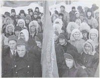
Best.-Nr. PD27Oblong Quarto album ca. 22x30 cm. 32 thick paper leaves. With 130 mounted original gelatin silver photographs with smaller ones from ca. 71x5 cm 2 ¾ x 2 in to ca. 36x3 cm 1 ½ x 1 ¼ in larger ones from ca. 163x103 cm 6 ½ x 4 in to 85x14 cm 3 ¼ x 5 ½ in and the rest of the photos ca. 76x11 cm 3 x 4 ½ in; with a mounted folding printed map showing the route of the expedition ca. 21x67 cm and a hand-drawn map of the expedition base camp ca. 20x282 cm. Most photos with period ink captions in Russian on the mounts. Several photographs with dates indicated. Period grey patterned full cloth album with blind-tooled decorations with industrial motif on the front board fastened with a string; dried flower specimens mounted to the inner side of the rear board. Binding slightly worn with mild damp stains on the right margin of the front board one page detached several photos age-toned and with mild silvering but overall a very good album with strong interesting photos. Historically significant album of rare original gelatin silver photographs taken and collected during the Nordvik-Khatanga Soviet Oil Exploration Expedition in 1939-1940. The compiler took part in the expedition together with his wife “Sonkes” who according to the photographs was head of a tailor's workshop at the expedition base camp in Nordvik. Neither reports nor official photographs from the expedition were found through our research of digital archives and libraries. The expedition organized by the USSR’s Main Directorate of the Northern Sea Route at the onset of WWII aimed to study the oil potential of Nordvik Bay. A team of polar explorers set sail from Arkhangelsk on a steamship accompanied by a cargo convoy and powerful icebreakers. Navigating through the Yugorsky Shar Strait the expedition made several stops at Dixon Melyuskin and Vstrechny Islands before establishing its base in Nordvik Bay. Despite extensive operations drilling at Nordvik over the next seasons proved largely unsuccessful revealing only small oil pockets with little commercial value. The album contains 130 lively vernacular photographs from the 1939-1940 expedition including eight well-executed photos of the expedition base camp and its premises the general view of the settlement main street local bathhouse and canteen. About ten photographs portray construction works as the team members attempted to build rotor No. 2. The images depict the site of the rotor “the beginning of the work” workers pulling out a tankette from snow digging and using special equipment. There are also about a dozen photographs showing the general view of rotor No. 1 - “the first in the world in Arctic conditions” “a boiler room for rotor No. 1” “a rotor drilling rig No. 1 with machinery room” “steam winch 250 hp for rotor No. 1” “oil drilling rigs” “general view of a coal mine” etc. At least forty lively candid photographs show the expedition members mostly the compiler and his wife sewing at a tailor’s workshop resting after work feeding dogs and posing by a tankette on sleds in tents at a meteorological station by the storage room near the assembly crane etc. Especially interesting are five photos of a fire at a local hospital documenting the funeral of deceased polar explorers and the compiler standing solemnly beside the victims’ camp. There are also about ten candid individual and group portraits of local Yakuts showing “Sonkes with a young Yakut woman” “Yakut Family and Sonkes” “Yakut Man with a Purchase” young Yakut women in a school reading books and Yakut fishermen posing by their camp. The other interesting photos portray the expedition members at the October and May rallies with “Sonkes” clearly visible in the crowd four and two-engine seaplanes at Cape Kosisty “bird market on Vstrechny Island” steamships “Stalingrad” “Dixon” etc. and icebreakers “Ermak” “Litke” etc. from the expedition etc. The album closes with the general views of the bank of the Khatanga River the town Igarka and the Krasnoyarsk pillars. Overall historically important collection of 130 original gelatin silver photographs documenting the 1939-1940 Soviet Oil Exploration Expedition to Nordvik Bay. hardcover
Best.-Nr. 59612BBo.J. James Juszczyk, geboren 1943 in Chicago, Illinois. Studium am Cleveland Institute of Art. 1995 erhielt Juszczyk ein Stip
Best.-Nr. 1443.1aaf54.5x72.5 cm cadre 64x82 cm
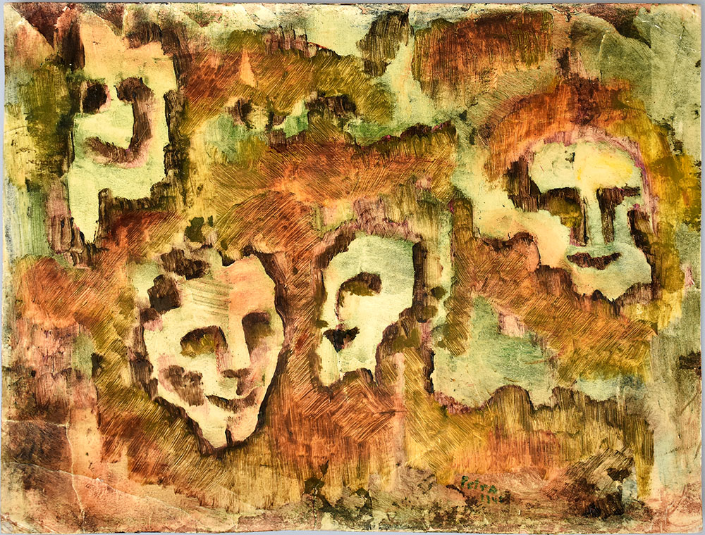
Best.-Nr. 60610BBo.J. [3 Warenabbildungen] (Petra Petitpierre, geborene Frieda Kessinger, geboren am 13. Mai 1905 in Zürich, gestorben am 23. Dezember 1959 in Murt
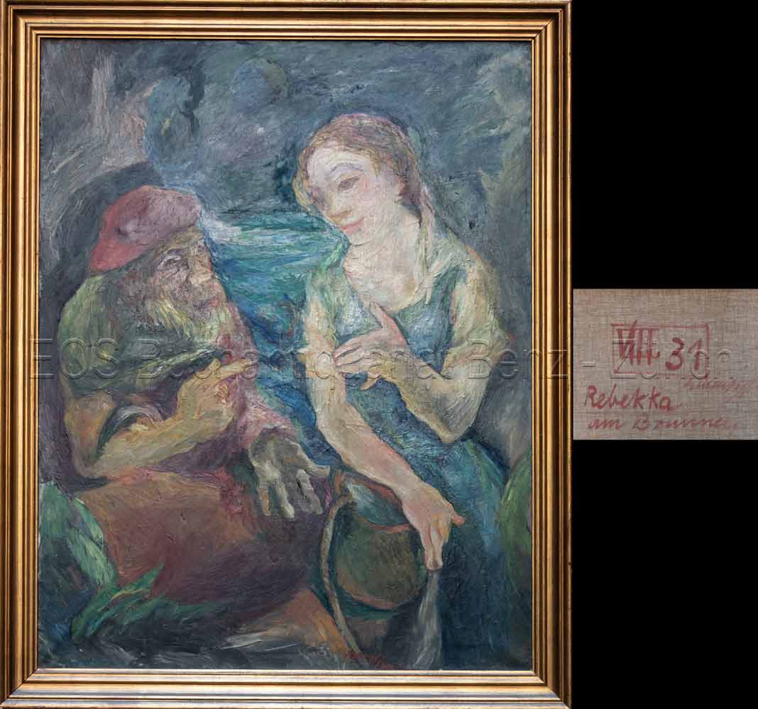
Best.-Nr. 708DGo.J. Bildausschnitt: 116 x 91 cm. + Wichtig: Für unsere Kunden in der EU erfolgt der Versand alle 14 Tage verzollt ab Deutschland / Postbank-Konto in Deutschland vorhanden +, Abb.
1920Best.-Nr. 666DGca. 1920. Oel auf Leinwand. Format: 88 x 113 cm. Mit Holzrahmen: 103 x 129 cm. + Wichtig: Für unsere Kunden in der EU erfolgt der Versand alle 14 Tage verzollt ab Deutschland / Postbank-Konto in Deutschland vorhanden +
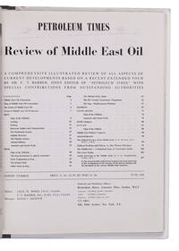
1948Best.-Nr. L2EG76GNBQ6GLondon: Brettenhem house 1948. Later cardboard binder. 30 x 23.5 cm. With many reproductions of photographs ground plans maps and cross-sections. Extract from the periodical The Petroleum Times containing an extensive article on oil in the Middle East. It opens with a list of Middle East oil companies and their concessions accompanied by a map showing their oil fields followed by a section on the future of Middle East oil. Individual chapters are devoted to the oil industry in Iran Iraq Bahrein Saudi Arabia Haifa Israel and Kuwait describing the area's geology oil fields reservoirs and more illustrated with photographs and cross-sections of the soil. The first 25 and last 16 pages consist of advertisements. Lacking the first 4 leaves of the preliminaries probably advertisements but the article itself complete some leaves slightly creased otherwise in very good condition. Brettenhem house, unknown
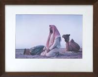
1958Best.-Nr. 163043Kuwait: 1958. A fitting gift for a veteran oil man This evocative image was likely captured at dawn and shows two Bedouin engaged in the daily Fajr prayer both wearing the traditional shemagh headdress . Although not marked as such this was presented to William K. Whiteford 1900-1968 president of Gulf Oil in 1958 - the 20th anniversary of the discovery of oil in Kuwait. In 1934 Gulf Oil formed an alliance with the Anglo-Persian Oil Company to create the Kuwait Oil Company. It received concession rights in 1934 started drilling in 1936 and discovered oil two years later in the massive Burgan oil field. In 1957 Whiteford was described by Time magazine as "burly aggressive Bill Whiteford who started as an oilfield roughneck out of Stanford University was brought into Gulf in 1951 from the presidency of Canada's British American Oil Co. Ltd. made chief administrative officer in 1953 under Sidney A. Swensrud who moved up from president to board chairman. Whiteford shook up Gulf's management strengthened its domestic and Western Hemisphere holdings firmly but unofficially took over much of the executive authority". 1958 was also the year in which Whiteford published a short in-house history Gulf and the World Oil Industry. The image of Bedouin at their sunrise prayers may be an intentional hommage to the dawn of the Kuwaiti oil industry. Original colour photograph measuring 232 x 347 mm; mounted and glazed in brown wood frame by the Kendrick Bellamy Company Denver overall 407 x 507 mm. Pencilled date below framer's label "5-14-57". Light damp staining to bottom edge of mount a few scratches to frame and minor loss to backing. Overall in excellent condition. Time 25 March 1957. unknown
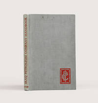
1948Best.-Nr. 183725London: Compiled in the Companies' Head Office 1948. An informative survey of the Middle East and its oil industry First edition of this excellent handbook for IPC employees outlining the operations and expanding importance of the petroleum industry and surveying the history and current condition of states in Arabia the Gulf and the Levant. Chapter 1 describes the IPC's formation the mechanisms for opening a new concession the history of its prospecting and extraction projects and the Mediterranean pipeline. A chapter on the culture of the Arab world is followed by regional breakdowns that draw on company and government reports. Concerning the Gulf the handbook emphasizes the potential of oil exploration to transform the region. In Qatar where an oil field was discovered in the late 1930s "the population is scanty and wretchedly poor. The Company's present operations supply almost the sole source of wealth. The building of necessary roads jetties dwellings offices workshops stores and the like has advanced simultaneously with drilling" pp. 15 & 69. Accompanying the text are valuable plates showing IPC operations in Kirkuk and near Tripoli views of Qatar and Bahrain from the air and a well with head fittings and flow lines. The folding regional map details oil fields refineries and pipelines both built and projected. A useful tabular appendix summarizes the present state of the IPC's concessions including the area they cover and the rights granted as well as current exploration licenses. Octavo. Halftone portrait frontispiece of King Faisal and 26 plates folding area map at rear maps in text. Original grey cloth spine lettered in red company logo in red on front board. Ownership inscription "L. B. Griffiths Tripoli 21.11.1948" on front free endpaper. Light sunning marking at head of front board top edge foxed: very good. hardcover
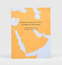
1954Best.-Nr. 170939New York: Standard Oil Company New Jersey 1954. A new era in Middle East oil Revised and updated edition following the first of 1947 of this glossy guide illustrated with three colour maps of the Arabian Peninsula showing oil fields and concessions pipelines and refineries. Recognizing the potential of Saudi Arabia's vast oil reserves in 1946 Standard Oil Company New Jersey acquired a 30 percent stake in the Arabian American Oil Company. A colour bar chart illustrates Saudi Arabia's rapid growth as an oil producer after 1946. The introduction stresses the region's importance to emerging Cold War geopolitics: "Middle Eastern oil is a major element in the economies of Europe and the East. It is essential to the defence of the free world" p. 5. Quarto. Colour reference maps in text as well as photographic halftones. Original wrappers front cover lettered in black against outline of Arabian Peninsula wire-stitched as issued. Front cover bright rear wrapper lightly soiled a little internal creasing from handling: a near-fine copy. unknown
1970Best.-Nr. ABC_50132Iran 1970. The collection is housed in a plastic file folder with each photograph also separately kept in a plastic folder. Various sizes. With 10 photographs. Collection of ten beautiful press photographs of the oil industry in Abadan Iran which was home to the largest oil refinery in the world at the time these photographs were taken. They show various parts of the industry such as the oil refinery oil tankers pipelines and fire department. The photographs were take by various French and German news agencies.With the stamps of various French and German news agencies on the back of each photograph. Some of the photographs are slightly creased. Otherwise in good condition. unknown
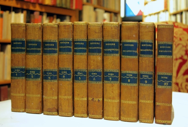
Best.-Nr. 11470Genève, sans nom (probablement Pellet), 1781 ; 10 tomes in-12 et Atlas in-4 (1780) ; demi-basane fauve, dos à faux-nerfs dorés, pièces de titre et de tomaison bleu-canard, tranches jaunes ; ON AJOUTE : Atlas : demi-veau glacé vert-Empire, dos décoré de fleurons dorés, titre doré (reliure début du XIXe siècle) ; XII, 452 ; VIII, 516 ; VIII, 471 ; VIII, 391 ; VIII, 352 ; VIII, 404 ; XII, 471 ; 426 ; VIII, 362 ; IV, 447 ; portrait de Raynal par F.G. Lardy en frontispice du tome Ier et 9 frontispices gravés, un à chaque tome, eux aussi par Lardy ; Atlas : (4), 22 pp., (1) f. blanc, 50 cartes dépliantes (49 + 17 bis).
Best.-Nr. 708DGBildausschnitt: 116 x 91 cm.
1920Best.-Nr. 666DGca. 1920 Oel auf Leinwand. Format: 88 x 113 cm. Mit Holzrahmen: 103 x 129 cm.
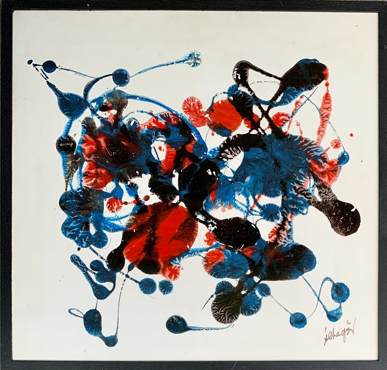
Best.-Nr. awd-1032Huile sur isorel signée en bas à droite et datée 1971 au dos (67/64,5 cm).
1869Best.-Nr. 665DG1869. Oel auf Leinwand. Format: 58 x 76 cm. Mit Holzrahmen: 75 x 96 cm. + Wichtig: Für unsere Kunden in der EU erfolgt der Versand alle 14 Tage verzollt ab Deutschland / Postbank-Konto in Deutschland vorhanden +
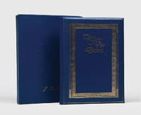
Best.-Nr. 159397Abu Dhabi: Abu Dhabi Oil Company for Onshore Oil Operations 1982. Celebrating the first oil shipments from a key port First and sole edition of this specially produced work published to commemorate the 20th anniversary of ADCO's first crude oil shipment from Jebel Dhanna. An online institutional search showing one copy only at Exeter University. Provenance: lid of box lettered in gilt J. Turnbull and loosely inserted compliments slip with typed name of the same; this is almost certainly John Turnbull BP's General Manager Production Overseas and later chief executive of BP Indonesia. Quarto. With colour illustrations throughout. Original presentation binding of moderate blue padded leatherette gilt-lettered on covers within gilt and blind ornamental borders bright blue watered silk endpapers. Housed in the original matching box. Box showing just light signs of handling light scratch to front cover of book. A very good copy bright and sharp. hardcover
1869Best.-Nr. 665DG1869 Oel auf Leinwand. Format: 58 x 76 cm. Mit Holzrahmen: 75 x 96 cm.
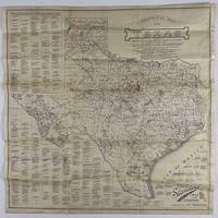
1920Best.-Nr. 12758Fort Worth: Standard Blue Print Map & Eng. Co 1920. Very good. Folding map 25.75 x 25.75 inches on thin paper. Old folds minor edge wear several short closed edge tears a couple of small areas of loss at crossfolds. Overall good condition and a wonderful display item. A rare and detailed Texas oil map produced by a Fort Worth firm just after World War I and here present in the larger 25-x-25-inch issue advertised in the promotional text on the map itself. The map shows the distribution of oil wells and derricks across the Lone Star State in 1920 prints the names of the most prominent oil fields and lists the names of Texas counties along with the oil companies active in each county. The map also shows the types of soil and rock deposits encountered throughout Texas counties with a legend of abbreviations for each at bottom right. The area of the map is crowded in places but still quite attractive and legible and is a good encapsulation of the rapidly developing oil industry in Texas at the time. Contemporary advertisements for the publisher of this map Standard Blue Print Map and Engineering promote the availability of over 200 oil maps of Texas Oklahoma New Mexico Louisiana and Arkansas from the firm. A rare map rarer still in this larger size; we locate just two copies at SMU one issued with a slightly later "May 1920" copyright notice with a larger "photocopy" reported at Denver Public Library and the Colorado School of Mines. Standard Blue Print Map & Eng. Co unknown books
1920Best.-Nr. 12758Fort Worth: Standard Blue Print Map & Eng. Co 1920. Very good. Folding map 25.75 x 25.75 inches on thin paper. Old folds minor edge wear several short closed edge tears a couple of small areas of loss at crossfolds. Overall good condition and a wonderful display item. A rare and detailed Texas oil map produced by a Fort Worth firm just after World War I and here present in the larger 25-x-25-inch issue advertised in the promotional text on the map itself. The map shows the distribution of oil wells and derricks across the Lone Star State in 1920 prints the names of the most prominent oil fields and lists the names of Texas counties along with the oil companies active in each county. The map also shows the types of soil and rock deposits encountered throughout Texas counties with a legend of abbreviations for each at bottom right. The area of the map is crowded in places but still quite attractive and legible and is a good encapsulation of the rapidly developing oil industry in Texas at the time. Contemporary advertisements for the publisher of this map Standard Blue Print Map and Engineering promote the availability of over 200 oil maps of Texas Oklahoma New Mexico Louisiana and Arkansas from the firm. A rare map rarer still in this larger size; we locate just two copies at SMU one issued with a slightly later "May 1920" copyright notice with a larger "photocopy" reported at Denver Public Library and the Colorado School of Mines. Standard Blue Print Map & Eng. Co unknown