1.428 resultados
1981ref. 13967Paris, Esprit, 1981 1 volume 15,5 x 24cm Broché sous couverture au 1er plat orné d'une vignette. 192p. Très bon état.
1977N°6 de la nouvelle série, juin 1977, de la revue fondée par Emmanuel Mounier et dirigée par Paul Thibaud. Au sommaire, 2 articles sur la science: de Georges THILL: "L'insularité scientifique" et de Walter MOSSMANN: "La science sur le terrain - L'Université populaire de Wyhlerwald"; poèmes de G.L. GODEAU et de Didier POBEL; "La paix au Moyen-Orient" par Jean-Jacques LENTZ; sur l'Inde par Gilbert ETIENNE, sur les "Chrétiens et socialistes anti-totalitaires" polonais d'Adam MICHNIK; etc. Français
1977ref. 13468Paris, Esprit, 1977 1 volume 16,3 x 25,7cm Broché sous couverture gris vert au 1er plat orné d'une vignette. 144p. Bon état.
2009ref. LFA-126719588Revue trimestrielle fondée par Raymond Aron : 288 pages, format 185 x 255 mm, brochée, bon état
2009ref. LFA-126719589Revue trimestrielle fondée par Raymond Aron : 280 pages, format 185 x 255 mm, brochée, bon état
1960ref. LFA-126742873Un ouvrage de 73 pages, format 175 x 210 mm, illustré, broché, publié en 1960, L'Edition Artistique, bon état
1997ref. 776571997 Paris, Transition, 1997, in 8° broché, 315 pages ; couverture illustrée.
1980ref. LFA-126733921Revue de 6 pages, format 210 x 295 mm, illustrée, brochée, NERSA, bon état
1982ref. LFA-126733922Revue de 6 pages, format 210 x 295 mm, illustrée, brochée, NERSA, bon état
1982ref. LFA-126733923Revue de 6 pages, format 210 x 295 mm, illustrée, brochée, NERSA, bon état
1976ref. LFA-126733920Revue de 4 pages, format 210 x 295 mm, illustrée, brochée, NERSA, bon état
1978ref. LFA-126733919Revue de 40 pages, format 150 x 210 mm, illustrée, brochée couverture couleurs, F.O.T., bon état
1995ref. LFA015d6Revue trimestrielle de l'Institut international de géopolitique : environ 100 pages, format 210 x 280 mm, illustrée, brochée couverture couleurs sous jacquette illustrée
ref. 15306At foot of final page: '1204 WT. 39620. number of copies: 22500 date of publication i.e. July 1955: 7/55 printer: D & G Ltd.'. 39pp. small 4to. Stud-bound in brown card printed wraps. In good condition lightly aged and worn with crease to front cover to which the enamel badge is also attached beside the ownership signature of 'E J Sayer' Downing Street secretary Elizabeth Sayer later Cooper. First page dated in pencil '8th Sept' and pencil note in text of the 'permitted dose' of radiation. At head of front cover: 'ESTACIDVOL Code 5-96-0' and at foot: 'RESTRICTED The information given in this document is not to be communicated either directly or indirectly to the Press or to any person not authorised to receive it.' Printed inside the front cover: 'The accompanying notes have been prepared for your guidance. Additional information is contained in the Home Office Civil Defence Training Manuals which may be obtained on loan through your Instructor.' Divided into the main sections: Civil Defence Organisation; Fire Fighting; High Explosive Missiles; Atomic Warfare; Biological Warfare; Chemical Warfare; Protective Measures. Also present is a full-page 'Civil Defence Report Form'. The first section begins: 'Civil Defence is the responsibility of the Central Government and needs the assistance of Local Authorities Industry and public bodies of many kinds. It includes all measures short of actual combat necessary to mitigate the effects of enemy attack.' The 'Atomic Warfare' section is divided into four subsections: Features of Atomic Explosion; Delayed Radiation Risks; Radiation Sickness; Individual Dosimeter. The enamel badge is roughly 2.5 x 2cm and features red and blue enamel on brass. It consists of a crown topping a circle the latter having an image of a lion surrounded by a blue border with 'I.C.D.S.' The pamphlet is scarce: no copy on OCLC WorldCat and the only copy on COPAC at the Imperial War Museum. At foot of final page: '(1204) WT. 39620. [number of copies:] 22,500 [date of publication, i.e. July 1955:] 7/55 [printer:] D & paperback
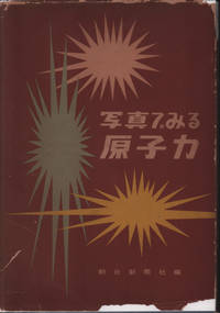
1955ref. 221443東京. Tokyo.: 朝日新聞社. Asahi Shinbunsha. Showa 30 1955. Black and white photographic illustrations maps 26.7 x 18.7cm 160pp. First and last leaves browned original blue cloth covered boards with decorative device and characters printed in white dustjacket worn and torn with loss on rear inside panel. A good copy. This fascinating book was published in 1955 ten years after Hiroshima and Nagasaki by the Asahi Newspaper. The editor claims that the book is the first publication to explain nuclear power visually by using many photographic illustrations. Starting with nuclear weapons and their outcomes in war and radiation it then explores research on nuclear power for industrial usage. It also covers radio isotopes and their possible usage in medicine and other scientific areas. The last section features nuclear power developments in Britain Russia France and Japan. Every page is filled with numerous photographic illustrations with detailed captions. The majority of photographs were sourced from the United States. A comprehensive study on nuclear power and its potential as of 1955. . 朝日新聞社. [Asahi Shinbunsha]. hardcover
ref. LFA-126750630Une plaquette de 80 pages, format 210 x 295 mm, illustrée, brochée couverture couleurs, s.d. (années 1980), NERSA, bon état
ref. 201705488S.l., Services du cabinet du prefet prefecture du bas rhin imprimeriue j girold , 1975 ; in-4, br. Plaquette du bas rhin.
ref. 200916099Paris, Fayard, 1995 ; in-8, 210 pp., broché.
ref. 201412237, Editions hirlé , 2007 ; in-4, 187 pp., cartonnage de l'éditeur.
ref. 201009807Paris, Editions galilée, 1977 ; in-8, 303 pp., br.
1974ref. 64130Portland OR & Burlingame CA: Shannon & Wilson Inc. November - December 1974. Thick 4to. 11.25 x 12 x 3.25 in. Approx. 400 leaves sections variously numbered. w/ thumb tab sections printed typed captions included at fore-edges w/ over 100 maps many large folding boring core sample printed photos on matte finish stock folding charts graphs diagrams; additional appendix envelope w/ 2 large folding appendix updated blueprint maps inserted at rear. Original green vinyl 19-ring binder silver lettering stamped on front cover & spine occasional interior age toning shelfwear rubbing still a VG copy from the library of Dr. Clive F. “Rick” Kienle 1942-2025 geologist and specialist in aerial photo mapping w/ ownership signature on title. First edition of this exceedingly rare geotechnical report for a Pacific Power & Light Co. proposed nuclear power plant to have been constructed at West Roosevelt Washington along the edge of Lake Umatilla in the Columbia River Gorge as part of a group of similar nuclear power plants with the proposed Trojan Nuclear Power plant licensed to run beginning in 1976 at 1100 Megawatts. PP&L together with PG&E had previously examined 2 sites near Arlington OR but then shifted to this site near the Columbia River down from the Hanford Sites later developed for the WPPSS projects. Included are five borings for subsurface conditions 3 borings in the landslide areas geophysical survey to depth of 229 feet geologic mapping of faults stratigraphy and assessment of ground motion. The Slope Stability and Aerial Geological survey results were included in a later separate report by Dr. Rick Kienle.Several nuclear power plants had been proposed and received geotechnical studies in the Pacific Northwest following up the Trojan Nuclear Power Plant constructed upon the site of the former Trojan Powder Co. plant site as well as adjacent properties beginning in 1967. Pitched to PGE as a means to solve the exploding power usage demand in the fast-growing Portland OR area in the Mid-20th-Century by Admiral Lewis Strauss of the Atomic Energy Commission PGE and 13 other utilities began planning in 1967 and construction began July 30 1968. PGE chose to build a pressurized water reactor plant and the enormous plant and huge construction cost were projected at the time to be cheaper than coal-fired power plants to supplement the massive hydropower presence in the PNW. Oregon Governor Tom McCall established the first Nuclear Siting Task Force of the Nuclear Development Coordinating Committee in 1969 in order to approve location of nuclear power plants consistent with Oregon’s environmental protections as well as comply with the forthcoming Clean Air Act passed in 1970. No copies in Worldcat or other collections; See: Timeline of Oregon’s Energy History Oregon Department of Energy 2026. Shannon & Wilson, Inc., unknown
1974ref. 64128Portland OR & Burlingame CA: Shannon & Wilson Inc. November - December 1974. Thick 4to. 11.25 x 12 x 3.25 in. Approx. 400 leaves sections variously numbered. w/ thumb tab sections printed typed captions included at fore-edges w/ over 100 maps many large folding boring core sample printed photos on matte finish stock folding charts graphs diagrams; additional appendix envelope w/ 4 large folding appendix updated blueprint maps inserted at rear. Original green vinyl 19-ring binder silver lettering stamped on front cover & spine occasional interior age toning shelfwear rubbing still a VG copy from the library of Dr. Clive F. “Rick” Kienle 1942-2025 geologist and specialist in aerial photo mapping w/ ownership signature on title. First edition of this exceedingly scarce geotechnical report for a Pacific Power & Light Co. proposed nuclear power plant to have been constructed on Calapooya Creek near Sutherlin Oregon as part of a group with the proposed Trojan Nuclear Power plant licensed to run beginning in 1976 at 1100 Megawatts. This report examined the borings for subsurface conditions and proposed companion dam site for the nuclear plant seismic refraction survey geological studies Side Looking Airborne Radar SLAR survey seismic faults ground water condition reviews and more. Regional geological studies consisted of surveying local similar geologic and mining literature an in-depth examination of the aerial photographs carried under the direction of Dr. Kienle as well as in-field reconnaissance of several faults and folds to define the major geologic structures in the area to determine feasibility for siting a nuclear power plant.Several nuclear power plants had been proposed and received geotechnical studies in the Pacific Northwest following up the Trojan Nuclear Power Plant constructed upon the site of the former Trojan Powder Co. plant site as well as adjacent properties beginning in 1967. Pitched to PGE as a means to solve the exploding power usage demand in the fast-growing Portland OR area in the Mid-20th-Century by Admiral Lewis Strauss of the Atomic Energy Commission PGE and 13 other utilities began planning in 1967 and construction began July 30 1968. PGE chose to build a pressurized water reactor plant and the enormous plant and huge construction cost were projected at the time to be cheaper than coal-fired power plants to supplement the massive hydropower presence in the PNW. Oregon Governor Tom McCall established the first Nuclear Siting Task Force of the Nuclear Development Coordinating Committee in 1969 in order to approve location of nuclear power plants consistent with Oregon’s environmental protections as well as comply with the forthcoming Clean Air Act passed in 1970. No copies in Worldcat or other collections; See: Timeline of Oregon’s Energy History Oregon Department of Energy 2026. Shannon & Wilson, Inc., unknown
1974ref. 64129Portland OR & Burlingame CA: Shannon & Wilson Inc. November - December 1974. Thick 4to. 11.25 x 12 x 3.25 in. Approx. 400 leaves sections variously numbered. w/ thumb tab sections printed typed captions included at fore-edges w/ over 100 maps many large folding boring core sample printed photos on matte finish stock folding charts graphs diagrams; additional appendix envelope w/ 2 large folding appendix updated blueprint maps inserted at rear. Original green vinyl 19-ring binder silver lettering stamped on front cover & spine occasional interior age toning shelfwear rubbing still a VG copy from the library of Dr. Clive F. “Rick” Kienle 1942-2025 geologist and specialist in aerial photo mapping. First edition of this exceedingly scarce geotechnical report for a Pacific Power & Light Co. proposed nuclear power plant to have been constructed at Lebanon Oregon as part of a group with the proposed Trojan Nuclear Power plant licensed to run beginning in 1976 at 1100 Megawatts. This report examined the site due to its very low historic seismic activity. Included are seven borings for subsurface conditions a laboratory test program measuring the dynamic and static engineering properties of the boring core samples seismic refraction survey geological studies Side Looking Airborne Radar SLAR survey seismic faults ground water condition reviews and more. Regional geological studies consisted of surveying local similar geologic and mining literature as well as a more abbreviated December 1973 report incorporated into this much larger in-depth examination OSU Professor Richard Couch serving as seismology consultant the aerial photographs carried under the direction of Dr. Kienle as well as in-field reconnaissance of several faults and folds to define the major geologic structures in the area to determine feasibility for siting a nuclear power plant.Several nuclear power plants had been proposed and received geotechnical studies in the Pacific Northwest following up the Trojan Nuclear Power Plant constructed upon the site of the former Trojan Powder Co. plant site as well as adjacent properties beginning in 1967. Pitched to PGE as a means to solve the exploding power usage demand in the fast-growing Portland OR area in the Mid-20th-Century by Admiral Lewis Strauss of the Atomic Energy Commission PGE and 13 other utilities began planning in 1967 and construction began July 30 1968. PGE chose to build a pressurized water reactor plant and the enormous plant and huge construction cost were projected at the time to be cheaper than coal-fired power plants to supplement the massive hydropower presence in the PNW. Oregon Governor Tom McCall established the first Nuclear Siting Task Force of the Nuclear Development Coordinating Committee in 1969 in order to approve location of nuclear power plants consistent with Oregon’s environmental protections as well as comply with the forthcoming Clean Air Act passed in 1970. No copies in Worldcat or other collections; See: Timeline of Oregon’s Energy History Oregon Department of Energy 2026. Shannon & Wilson, Inc., unknown
1974ref. 64132Portland OR: Portland General Electric Company 1974-1979. Two vols. hick 4to. 11.25 x 11.75 x 3.25 in. Approx. 1200 leaves sections variously numbered. w/ thumb tab sections printed affixed at fore-edges w/ over 100 maps many large folding most colour folding charts graphs diagrams; large folding site map in vol. 2. Original green vinyl 3-ring binders black lettering stamped on front covers & spines occasional interior age toning shelfwear rubbing still a VG set from the library of Dr. Clive F. “Rick” Kienle 1942-2025 geologist and specialist in aerial photo mapping . First edition of this very scarce original safety analyses reports for Portland General Electric’s pair of nuclear power plants to have been constructed at Pebble Springs in Gilliam County Oregon as part of a group with the proposed Trojan Nuclear Power plant licensed to run beginning in 1976 at 1100 Megawatts. These nuclear power plants had been proposed and begun development soon after construction began at the Trojan Nuclear Power Plant and by 1979 over $ 250 million had been spent by the State of Oregon and PGE on development costs. The two reactors would have been located 3 miles southeast of the Columbia River would have consisted of a Nuclear Steam System for each plant with a Reactor Coolant System supplied by Babcock & Wilcox square lattice reactor cores and abundant auxiliary systems. These reports include a myriad of updates carried out during the regulatory review of the project and the preliminary development work but after passage in 1980 of Ballot Measure 7 by Oregon voters no nuclear power plants could be considered for construction unless there was a Federal high-level waste repository and approval by Oregon voters. Several nuclear power plants had been proposed and received geotechnical studies in the Pacific Northwest following up the Trojan Nuclear Power Plant constructed upon the site of the former Trojan Powder Co. plant site as well as adjacent properties beginning in 1967. Pitched to PGE as a means to solve the exploding power usage demand in the fast-growing Portland OR area in the Mid-20th-Century by Admiral Lewis Strauss of the Atomic Energy Commission PGE and 13 other utilities began planning in 1967 and construction began July 30 1968. PGE chose to build a pressurized water reactor plant and the enormous plant and huge construction cost were projected at the time to be cheaper than coal-fired power plants to supplement the massive hydropower presence in the PNW. Oregon Governor Tom McCall established the first Nuclear Siting Task Force of the Nuclear Development Coordinating Committee in 1969 in order to approve location of nuclear power plants consistent with Oregon’s environmental protections as well as comply with the forthcoming Clean Air Act passed in 1970. Should be noted that the original Pebble Springs site is now the location of a massive 99 Megawatt Wind Farm. Worldcat locates 4 copies of similar reports divided into more volumes - Multnomah County PSU UO WA State Lib; See: Timeline of Oregon’s Energy History Oregon Department of Energy 2026; McTeague Renewable Energy Not Nuclear is the Oregon Way Oregon Capital Chronicle March 26 2026. Portland General Electric Company, unknown
1976ref. 64131Portland OR: Shannon & Wilson Inc. Northwest Geological Services Inc. February 1976. 4to. 11.25 x 12 in. Approx. 250 leaves sections variously numbered. w/ several maps many large folding hand-coloured folding charts graphs diagram 7 mounted colour photos folding maps inserted into rear pocket. Original green vinyl 19-ring binder silver lettering stamped on front cover & spine occasional interior age toning shelfwear rubbing still a VG copy from the library of Dr. Clive F. “Rick” Kienle 1942-2025 geologist and specialist in aerial photo mapping w/ business card mounted on front inner cover. First edition of this exceedingly rare slope stability report for a Pacific Power & Light Co.’s proposed nuclear power plant to have been constructed at West Roosevelt Washington along the edge of Lake Umatilla in the Columbia River Gorge as part of a group of similar nuclear power plants with the proposed Trojan Nuclear Power plant licensed to run beginning in 1976 at 1100 Megawatts. PP&L together with PG&E had previously examined 2 sites near Arlington OR but then shifted to this site near the Columbia River down from the Hanford Sites later developed for the WPPSS projects. This report focuses on the stability of the slopes to the north of the proposed site and estimate the effect of the design earthquake on slope stability and plant safety. This required nine additional borings geologic mapping of the area identification of basalt outrcops by chemical petrographic and remnant magnetism analyses lab studies liquefaction analyses along with construction of a 3-D model of the site. Several nuclear power plants had been proposed and received geotechnical studies in the Pacific Northwest following up the Trojan Nuclear Power Plant constructed upon the site of the former Trojan Powder Co. plant site as well as adjacent properties beginning in 1967. Pitched to PGE as a means to solve the exploding power usage demand in the fast-growing Portland OR area in the Mid-20th-Century by Admiral Lewis Strauss of the Atomic Energy Commission PGE and 13 other utilities began planning in 1967 and construction began July 30 1968. PGE chose to build a pressurized water reactor plant and the enormous plant and huge construction cost were projected at the time to be cheaper than coal-fired power plants to supplement the massive hydropower presence in the PNW. Oregon Governor Tom McCall established the first Nuclear Siting Task Force of the Nuclear Development Coordinating Committee in 1969 in order to approve location of nuclear power plants consistent with Oregon’s environmental protections as well as comply with the forthcoming Clean Air Act passed in 1970. No copies in Worldcat or other collections; See: Timeline of Oregon’s Energy History Oregon Department of Energy 2026. Shannon & Wilson, Inc., Northwest Geological Services, Inc., unknown