Us Census BureauBiblio.com

1.477 Ergebnisse
Best.-Nr. B9781598049718Paperback / softback. New. paperback
Best.-Nr. 1598048465.Ghardcover. Good. Access codes and supplements are not guaranteed with used items. May be an ex-library book. hardcover
Best.-Nr. DADAX1598048465Claitor's Publishing Division 2017-04-03. 2017 ed. hardcover. New. 6.00x2.00x9.00. Buy with confidence. Excellent Customer Service & Return policy. Claitor's Publishing Division hardcover
Best.-Nr. 40457965-6Used - Good. Former library copy. Pages intact with minimal writing/highlighting. The binding may be loose and creased. Dust jackets/supplements are not included. Includes library markings. Stock photo provided. Product includes identifying sticker. Better World Books: Buy Books. Do Good. unknown
Best.-Nr. 1598048457.Gpaperback. Good. Access codes and supplements are not guaranteed with used items. May be an ex-library book. paperback
1953Contents include: Number, area, value, tenure and size of occupied farms, live stock and machinery. The 1951 census, held two years after Newfoundland became part of Canada, marked Canada's first census as a nation of ten provinces and two territories. The content of the population and household questionnaire covered name, sex, age, marital status, relationship to "head" of household, and the structural type and tenure of dwelling. This census also provided information for small areas such as counties, municipalities, cities, towns, etc. Multi-paginations. 11.25" x 9" x 3". 3.7 kg. Forest green buckram with gilt lettering upon backstrips. Usual library markings. Average wear. Bindings sound. Quality copies. Book
1872Best.-Nr. 60577New York: G.W. & C.B. Colton & Co. No. 172 William Street 1872. 12mo. 4.5 x 7 in. 46 pp. plus 2 pp. publisher’s ads. With 1 large folding hand-coloured 3 colour map which folds out into 12.5 x 15 in. map as frontisp. w/ two inset profiles at 32 degrees & 42 degrees North from coast-to-coast. Embossed black publisher’s cloth decorations front & back cover gilt lettering rebacked recased & map folds neatly repaired on verso minor age toning former ex-lib stamp on title still G copy. First Colton edition of this 19th-century Ninth Census pocket map compactly informing travelers across the post-Civil War United States the total state & territorial populations as well as offering quick reference to individual important cities. Of particular interest is the scarce 1860 map by J.H. Colton lacking in most copies which includes the inset Continental Profiles as well as denoting the Dakota Territory as one Indian Territory tied into Arkansas along with the newly created Washington Idaho Montana Wyoming Utah Nevada Arizona & New Mexico territories. George Woolworth Colton 1827-1901 and brother Charles B. Colton 1832-1916 had reconstituted their father’s firm following the Civil War and riding the railroad building boom were active in continuing to update and issue pocket maps for eager travelers. Worldcat locates 2 copies with map Yale Univ. of IL another version w/o map was issued with 42 pp. See Newberry Library copy. G.W. & C.B. Colton & Co., No. 172 William Street, hardcover
Best.-Nr. 1334615780.Gpaperback. Good. Access codes and supplements are not guaranteed with used items. May be an ex-library book. paperback
Best.-Nr. 0366339680.Ghardcover. Good. Access codes and supplements are not guaranteed with used items. May be an ex-library book. hardcover
Best.-Nr. 0666653720.Ghardcover. Good. Access codes and supplements are not guaranteed with used items. May be an ex-library book. hardcover
Best.-Nr. 0331050927.Gpaperback. Good. Access codes and supplements are not guaranteed with used items. May be an ex-library book. paperback
Best.-Nr. 0331309858.Ghardcover. Good. Access codes and supplements are not guaranteed with used items. May be an ex-library book. hardcover
Best.-Nr. 0243596278.Gpaperback. Good. Access codes and supplements are not guaranteed with used items. May be an ex-library book. paperback
Best.-Nr. 0666772207.Ghardcover. Good. Access codes and supplements are not guaranteed with used items. May be an ex-library book. hardcover
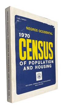
1974Best.-Nr. 85211Manila 1974. Paperback. Good. maps xxiv 589p. Softcover in original wrapper. 30 cm. Light stain on fore-edge. Name "whited-out" on front cover. At head of title: Final Report. Vol. I. paperback books
Best.-Nr. a19239Washington 1904 first edition. GPO. 4to 333pp. of statistics doublefold map in color proportion of Negro to Total Population in US wraps. Original front wrap panel remounted on later wraps. Good Plus. Pictures available on request. . paperback
Best.-Nr. 0666043035.Ghardcover. Good. Access codes and supplements are not guaranteed with used items. May be an ex-library book. hardcover
Best.-Nr. 0259104213.Gpaperback. Good. Access codes and supplements are not guaranteed with used items. May be an ex-library book. paperback
Best.-Nr. A9781343873070Hardback. New. hardcover
1920Best.-Nr. 20830021158006071st National Census Committee 1920. Soft Cover. Fine. Number of books: 1 book 1st National Census Committee paperback
1931Best.-Nr. 2111902160501126Not Available 1931. Soft Cover. Fine. Number of copies: Nagano Prefecture Statistical Association Not Available paperback
Best.-Nr. 0265845823.Ghardcover. Good. Access codes and supplements are not guaranteed with used items. May be an ex-library book. hardcover
Best.-Nr. 524658-nnew. unknown
1913Best.-Nr. 108363AWashington DC: Department of Commerce 1913. 611 pp. There are library numerals on the spine and a torn out stamp on the title page no other library markings. The navy cloth boards are scuffed with lightly rubbed edges back has a moderate dampstain. Inside hinges are just beginning to crack. The text pages are tanning in the margins with no markings. Book is oversize will require extra shipping for Priority or overseas mailing. . Hard Cover. Good/No Jacket. 4to - over 9¾" - 12" tall. Ex Library. Department of Commerce Hardcover
Best.-Nr. 0259103616.Gpaperback. Good. Access codes and supplements are not guaranteed with used items. May be an ex-library book. paperback