|
Mitchell, Clifford
Manual of urinary analysis containing a systematic course in didactic and laboratory instruction for students together with reference tables and clinical data for practitioners
paperback. Good. Access codes and supplements are not guaranteed with used items. May be an ex-library book. paperback
Referencia librero : 9353979870.G ISBN : 9353979870 9789353979874

|
|
|
Mitchell, John
Manual of Practical Assaying Intended for the use of Metallurgists Captains of Mines and Assayers in General .
paperback. Good. Access codes and supplements are not guaranteed with used items. May be an ex-library book. paperback
Referencia librero : 1016518269.G ISBN : 1016518269 9781016518260

|
|
|
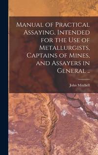
Mitchell, John
Manual of Practical Assaying Intended for the use of Metallurgists Captains of Mines and Assayers in General .
hardcover. Good. Access codes and supplements are not guaranteed with used items. May be an ex-library book. hardcover
Referencia librero : 1016513712.G ISBN : 1016513712 9781016513715
|
|
|
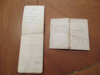
Mitchell, Edmund
Manuscript Notebooks and Bibliography of Edmund Mitchell 1861- 1917
Lansdowne Paignton Devon Circa 1886 -1898: Unpublished 1886. Original Manuscript . Hardcover. Good. Two Handwritten Notebooks Kept By Nineteenth Century Writer Edmund Mitchell Novelist Journalist Etc. With Logs Of His Numerous Magazine Publications Aphorisms Notes To Himself Sketches For Stories Etc. Mitchell Was A Prolific English Writer Who After A Prolonged Stay In British India Settled In Los Angeles Where He Worked As A Newspaper Editor. Some Of Mitchell's Writings Include Fantasy Mystery Adventure And Children's Books. <br/> <br/> Unpublished hardcover
Referencia librero : 058008
|
|
|
MITCHELL, S[ilas] Weir
MANUSCRIPT. Four notes in secretarial hand to Mitchell’s lawyer
Philadelphia 1881. FIRST EDITION. 1. LS to unknown woman. Philadelphia January 27 1903. 3 pages on single folded sheet 204 x 127 mm. Mitchell states that he is unable to answer all of his letters and relies on the hand of his secretary to write them. He also speaks of his trip to Japan and his presentation to the Emperor. 2. ALS to unknown man. 1332 Walnut St. nd. 1 page 205 x 128 mm. Small tear at fold 2 small puncture holes a bit browned.Mitchell speaks of a payment. 3. TLS to “Reverend Sir.†Bay Harbor Maine nd. Single sheet folded 200 x 123 mm. Mitchell thanks him for his “kind note†and expresses his regrets at not being able to provide more information about his friend Dr. Worcester. unknown
Referencia librero : 11766

|
|
|
MITCHELL, G G M
Maori Place Names in Buller County
A. H. & A. W. Reed 1948. Rare octavo illus heavy card boards 59pp illus folding map to rear VG moderate tanning & foxing to boards & page edges slight foxing to eps slight tanning to rear map A. H. & A. W. Reed 1948 hardcover
Referencia librero : 241229
|
|
|
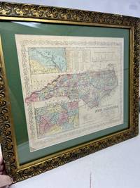
Mitchell, Samuel Augustus
Map A NEW MAP OF NTH. CAROLINA: with its Canals Roads and Distances from place to place along the Stage and Steam Boat Routes. North Carolina
Philadelphia: S. Augustus Mitchell 1850. 1st edition thus. Single sheet map. Very Good. 1850 ca. A Very good copy. Image size: 15 1/4 inches X 11 3/16 inches. In late 19th Century Frame: 18 1/2 x 14 5/16 inches. Scale 1: 2450000. Full color by county with table of distances and profile of the Dismal Swamp Canal. Two insets Gold Region and New Bern. Light toning to the map. A few minor blemishes. With two inset maps: the Newbern region and the Gold Region. Originally Published By S. Augustus Mitchell N.E. corner of Market & 7th Street Philada. 1846. Entered 1846 by H.N. Burroughs. Pennsylvania. Mitchell acquired the rights to this map and others in 1845 and issued his own Atlas's in 1846. They would be reissued every year for many decades. S. Augustus Mitchell unknown
Referencia librero : 36739
|
|
|
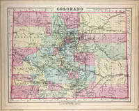
Mitchell, S Augustus, Jr
Map Colorado verso with Indian Territory
Philadelphia: W.M. Bradley & Bro. 1886. Very good light soiling. Hand colored map. Plate 89: Colorado. Copyright by S. Augustus Mitchell 1884. 15 x 12 inches.<br /> <br /> On verso Plate 90: Indian Territory. Copyright by S. Augustus Mitchell 1884. 14 x 11.5 inches.<br /> <br /> From: Mitchell's New General Atlas Containing Maps Of The Various Countries Of The World Plans Of Cities Etc. Embraced In Ninety-Three Quarto Maps Forming A Series Of One Hundred and Forty-seven Maps and Plans Together With Valuable Statistical Tables. Also A List Of Post-Offices Of The United States And Territories And Also Census Of 1880 For States Territories And Counties Also Of Cities Of Over 10000 Inhabitants. Philadelphia: Published By Wm. M. Bradley & Bro. No. 1026 Arch Street. 1886. [W.M. Bradley & Bro.] unknown
Referencia librero : 45723
|
|
|
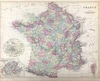
Mitchell, S Augustus, Jr
Map France with insets Environs of Paris and Switzerland in Cantons and Corsica
Philadelphia: W.M. Bradley & Bro. 1886. Very good closely cropped margins light soiling. Hand colored map. 15 x 11.5 inches. Plate 110. France with insets of Environs of Paris ; Switzerland in cantons; and Corsica. Copyright by S. Augustus Mitchell 1884<br /> <br /> From: Mitchell's New General Atlas Containing Maps Of The Various Countries Of The World Plans Of Cities Etc. Embraced In Ninety-Three Quarto Maps Forming A Series Of One Hundred and Forty-seven Maps and Plans Together With Valuable Statistical Tables. Also A List Of Post-Offices Of The United States And Territories And Also Census Of 1880 For States Territories And Counties Also Of Cities Of Over 10000 Inhabitants. Philadelphia: Published By Wm. M. Bradley & Bro. No. 1026 Arch Street. 1886. [W.M. Bradley & Bro.] unknown
Referencia librero : 45706
|
|
|
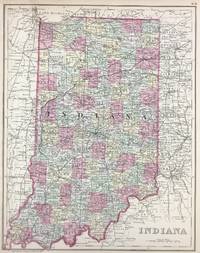
Mitchell, S Augustus, Jr
Map Indiana
Philadelphia: W.M. Bradley & Bro. 1886. Very good faint toning. Hand colored map. 11 x 14 inches. Plate 68: Indiana. Copyright by S. Augustus Mitchell 1884. <br /> <br /> From: Mitchell's New General Atlas Containing Maps Of The Various Countries Of The World Plans Of Cities Etc. Embraced In Ninety-Three Quarto Maps Forming A Series Of One Hundred and Forty-seven Maps and Plans Together With Valuable Statistical Tables. Also A List Of Post-Offices Of The United States And Territories And Also Census Of 1880 For States Territories And Counties Also Of Cities Of Over 10000 Inhabitants. Philadelphia: Published By Wm. M. Bradley & Bro. No. 1026 Arch Street. 1886. [W.M. Bradley & Bro.] unknown
Referencia librero : 45718
|
|
|
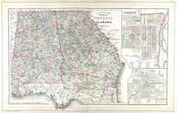
Mitchell, S Augustus, Jr
Map North and South Carolina with insets Plan of Charleston and Map of Charleston Harbor
Philadelphia: W.M. Bradley & Bro. 1886. Very good faint soiling and toning. Hand colored map. 14 x 11.5 inches. Plate 57: North and South Carolina with insets Plan of Charleston; and Map of Charleston Harbor. Copyright by S. Augustus Mitchell 1884.<br /> <br /> From: Mitchell's New General Atlas Containing Maps Of The Various Countries Of The World Plans Of Cities Etc. Embraced In Ninety-Three Quarto Maps Forming A Series Of One Hundred and Forty-seven Maps and Plans Together With Valuable Statistical Tables. Also A List Of Post-Offices Of The United States And Territories And Also Census Of 1880 For States Territories And Counties Also Of Cities Of Over 10000 Inhabitants. Philadelphia: Published By Wm. M. Bradley & Bro. No. 1026 Arch Street. 1886. [W.M. Bradley & Bro.] unknown
Referencia librero : 45714
|
|
|
Mitchell, Samuel Augustus Jr
Map of Africa
<p>Philadelphia: Bradley 1882. Unbound colored engraved map decorative border 14"x 11". Slight toning and aging a couple a minor chips to edges; overall bright and clear and in very good shape. Maps are wrapped with acid free board or in rigid sleeves. The Mitchell family started to produce atlases in 1846 and continued into the early 1890s. Around 1860 S. Augustus Mitchell Jr. took over and the atlas would be called Mitchell's New General Atlas. This is an attractive colored map of Africa from the 1882 installment of that atlas. The map shows a sizeable unknown territory and not surprisingly the map presents some very different political boundaries from more modern times. A small map of the Island of St. Helena is featured in an inset. May require extra postage. Ristow 311-313 Phillips 907</p> Bradley
Referencia librero : 101003
|
|
|
Mitchell, Samuel Augustus Jr
Map of Africa
Philadelphia 1865. Unbound colored engraved map decorative border 14"x 11". Slight toning and aging a couple a minor chips to left edge; overall bright and clear and in very good shape. Maps are wrapped with acid free board or in rigid sleeves. The Mitchell family started to produce atlases in 1846 and continued into the early 1890s. Around 1860 S. Augustus Mitchell Jr. took over and the atlas would be called Mitchell's New General Atlas. This is an attractive colored map of Africa from the 1861 installment of that atlas. The map shows a sizeable unknown territory and not surprisingly the map presents some very different political boundaries from more modern times. A small map of the Island of St. Helena is featured in an inset. Ristow 311-313 unknown
Referencia librero : 101001
|
|
|
Mitchell, Samuel Augustus Jr
Map of Africa
<p>Philadelphia 1869. Unbound colored engraved map decorative border 14"x 11". Slight toning and aging; overall bright and clear and in very good shape. Maps are wrapped with acid free board or in rigid sleeves. The Mitchell family started to produce atlases in 1846 and continued into the early 1890s. Around 1860 S. Augustus Mitchell Jr. took over and the atlas would be called Mitchell's New General Atlas. This is an attractive colored map of Africa from the 1869 installment of that atlas. The map shows a sizeable unknown territory and not surprisingly the map presents some very different political boundaries from more modern times. A small map of the Island of St. Helena is featured in an inset. Ristow 311-313</p>
Referencia librero : 101002
|
|
|
Mitchell, Samuel Augustus Jr
Map of Africa
Philadelphia 1861. Unbound colored engraved map decorative border 14"x 11". Slight toning and aging a couple a minor chips to edges; overall bright and clear and in very good shape. Maps are wrapped with acid free board or in rigid sleeves. The Mitchell family started to produce atlases in 1846 and continued into the early 1890s. Around 1860 S. Augustus Mitchell Jr. took over and the atlas would be called Mitchell's New General Atlas. This is an attractive colored map of Africa from the 1861 installment of that atlas. The map shows a sizeable unknown territory and not surprisingly the map presents some very different political boundaries from more modern times. A small map of the Island of St. Helena is featured in an inset. Ristow 311-313
Referencia librero : 101000
|
|
|
Mitchell, Samuel Augustus
MAP OF AFRICA SHOWING ITS MOST RECENT DISCOVERIES. 1860
Philadelphia: : S. Augustus Mitchell 1863. 10-3/4" x 13-1/2"- 27.3 x 34.2 cm. Lithograph with original hand colouring. Minor browning and chipping o margins else very good. A detailed and decorative map of Africa including parts of Arabia and Persia with scrolling foliate border. Inset map of the Island of St. Helena in the Atlantic Ocean. Shows towns cities topographical features etc. Some of the interior is still marked "unknown S. Augustus Mitchell, unknown
Referencia librero : 1457
|
|
|
Mitchell, Samuel Augustus Jr
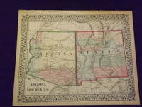
Map of Arizona and New Mexico
<p>Unbound colored engraved map decorative boarder 14 "x 11". Slight toning and aging a few small chips in margins; overall bright and clear and in very good shape. Maps are wrapped with acid free board or in rigid sleeves. The Mitchell family started to produce atlases in 1846 and continued into the early 1890s. Around 1860 S. Augustus Mitchell Jr. took over and the atlas would be called Mitchell's New General Atlas. This is a bright and attractive map of two western states from the 1870 installment of that atlas. A little of the Colorado river can be seen and the Apache Territory is featured in this map. Ristow 311-313</p>
Referencia librero : 101005
|
|
|
Mitchell, S Augustus, Jr
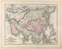
Map of Asia Showing its Gt. Political Divisions and also the Various Routes of Travel Between London & India China & Japan &c. verso with Map of Persia Arabia Turkey in Asia Afghanistan Beloochistan
Philadelphia: W.M. Bradley 1886. Very good light soiling primarily to margins. Hand colored map. Plate 115: Map of Asia Showing its Gt. Political Divisions and also the Various Routes of Travel Between London & India China & Japan &c constructed & engraved by W. Williams Philadelphia. Copyright by S. Augustus Mitchell 1884. 13.5 x 10.5 inches.<br /> <br /> On verso Plate 116: Map of Persia Arabia Turkey in Asia Afghanistan Beloochistan. Copyright by S. Augustus Mitchell 1884. 13.5 x 10.5 inches.<br /> <br /> From: Mitchell's New General Atlas Containing Maps Of The Various Countries Of The World Plans Of Cities Etc. Embraced In Ninety-Three Quarto Maps Forming A Series Of One Hundred and Forty-seven Maps and Plans Together With Valuable Statistical Tables. Also A List Of Post-Offices Of The United States And Territories And Also Census Of 1880 For States Territories And Counties Also Of Cities Of Over 10000 Inhabitants. Philadelphia: Published By Wm. M. Bradley & Bro. No. 1026 Arch Street. 1886. [W.M. Bradley] unknown
Referencia librero : 45703
|
|
|
Mitchell, S Augustus
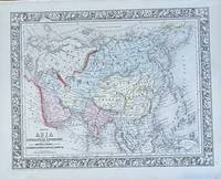
Map of Asia showing its Geopolitical Divisions
Philadelphia: Mitchell S. Augustus 1860. 1860. 13 1/2 x 10 5/8 inches. Very good. An attractive map of Asia in a single page format from Mitchell's "New General Atlas." The map is hand-colored with definitive border separation from Europe. The travel notations shows London to Madras at 8000 miles; London to Hong Kong at 10800 miles. The all water route from London to the Far East has a complementary land-water route. The water route shows the Suez land bridge being used. Suez Canal was under construction starting April 25 1859. It was completed on November 17 1869 at which time the map would show the same distance. Mitchell, S. Augustus unknown
Referencia librero : 97
|
|
|
Mitchell, Samuel Augustus
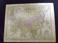
Map of Asia.
<p>Engraved colored map 9" x11 1/2" Box like cartouche with map information. Some slight soiling toning and browning right margin a little uneven small holes in upper margin where it was bound not affecting image; otherwise very good. Not a bad looking little map with plenty of detail and some decent color. Small insert box featuring a map of Palestine. From a school and family geography. </p> S. Augustus Mitchell,
Referencia librero : 106601
|
|
|
Mitchell, Samuel Augustus Jr
Map of Asia
Philadelphia 1865. Unbound colored engraved map decorative border 14"x 11". Slight toning and aging a little minor staining or soling in left margin; overall bright and clear and in very good shape. Maps are wrapped with acid free board or in rigid sleeves. The Mitchell family started to produce atlases in 1846 and continued into the early 1890s. Around 1860 S. Augustus Mitchell Jr. took over and the atlas would be called Mitchell's New General Atlas. This is an attractive single page colored map of Asia from the 1865 installment of that atlas. The map features China Hindostan Turkestan Persia and part of Arabia. Ristow 311-313 unknown
Referencia librero : 101007
|
|
|
Mitchell, Samuel Augustus Jr
Map of Asia.
<p>Philadelphia 1861. Unbound colored engraved map decorative border 14"x 11". Slight toning and aging; overall bright and clear and in very good shape. Maps are wrapped with acid free board or in rigid sleeves. The Mitchell family started to produce atlases in 1846 and continued into the early 1890s. Around 1860 S. Augustus Mitchell Jr. took over and the atlas would be called Mitchell's New General Atlas. This is a very attractive single page colored map of Asia from the 1861 installment of that atlas. A very brightly colored version of this map. The map features China Hindostan Turkestan Persia and Siberia. Extra postage may be required. Ristow 311-313</p>
Referencia librero : 101199
|
|
|
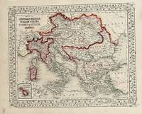
Mitchell, S Augustus
Map of Austrian Empire Italian States turkey in Europe and Greece
Philadelphia: Mitchell S. Augustus 1867. 1867 edition. 13 1/4 x 10 3/4. Very good. Mitchell S. Augustus. Contemporary hand colored atlas map recapping the complex political divisions of a monarchical Europe. This beautiful map is suitable for matting framing and hanging on the wall. Mitchell, S. Augustus unknown
Referencia librero : 16
|
|
|
Mitchell, Samuel Augustus Jr
Map of Brazil Bolivia Paraguay and Uruguay.
<p>Unbound colored engraved map decorative border 14" x 11". Slight toning and aging; otherwise bright and clear and very good. Maps are wrapped with acid free board or in rigid sleeves. The Mitchell family started to produce atlases in 1846 and continued into the early 1890s. Around 1860 S. Augustus Mitchell Jr. took over and the atlas would be called Mitchell's New General Atlas. This is a detailed single page map of Brazil Chilli and Bolivia from the 1864 installment of this atlas. Uncludes inset showing the harbor of Rio Janeiro. Colorful and attractive. Ristow 311-313.</p>
Referencia librero : 106096
|
|
|
Mitchell, Samuel Augustus Jr
Map of Brazil Bolivia Paraguay and Uruguay.
<p>Unbound colored engraved map decorative border 14" x 11". Slight toning and aging a few margin chips and folds; otherwise bright and clear and very good. Maps are wrapped with acid free board or in rigid sleeves. The Mitchell family started to produce atlases in 1846 and continued into the early 1890s. Around 1860 S. Augustus Mitchell Jr. took over and the atlas would be called Mitchell's New General Atlas. This is a detailed single page map of Brazil Chilli and Bolivia from the 1870 installment of this atlas. Uncludes inset showing the harbor of Rio Janeiro. Colorful and attractive. Ristow 311-313.</p>
Referencia librero : 106097
|
|
|
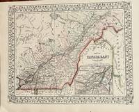
Mitchell, S .Auguastus
Map of Canada East and Counties
Philadelphia: Mitchell S. Augustus 1867. 1867 edition. 13 1/4 x 10 3/4 inches. Very good condition. Contemporary color graces this lithograph done two years after the close of the Civil War. The territory includes the lower and middle St. Lawrence River with an inset map of Montreal. Mitchell, S. Augustus unknown
Referencia librero : 19
|
|
|
Mitchell, Samuel Augustus Jr
Map of Chicago
Philadelphia 1869. Unbound colored engraved map decorative border 14"x 11". Slight toning and aging; overall bright and clean. Maps are wrapped with acid free board or in rigid sleeves. The Mitchell family started to produce atlases in 1846 and continued into the early 1890s. Around 1860 S. Augustus Mitchell Jr. took over and the atlas would be called Mitchell's New General Atlas. This is a nice map of Chicago from the 1869 installment of this atlas. A very good street map. Ristow 311-313 unknown
Referencia librero : 101014
|
|
|
Mitchell, Samuel Augustus Jr
Map of Chicago
Unbound colored engraved map decorative border 14"x 11". Slight toning and aging; overall bright and clean. Maps are wrapped with acid free board or in rigid sleeves. The Mitchell family started to produce atlases in 1846 and continued into the early 1890s. Around 1860 S. Augustus Mitchell Jr. took over and the atlas would be called Mitchell's New General Atlas. This is a nice colorful map of Chicago from the 1870 installment of this atlas. Ristow 311-313.
Referencia librero : 101015
|
|
|
Mitchell, Samuel Augustus Jr
Map of Chicago
Philadelphia: Bradley 1882. Unbound colored engraved map 23"x 15". Slight toning and aging a little staining or soiling in the margins a few chips at edge; still rather bright and clear and in very good shape. Maps are wrapped with acid free board or in rigid sleeves. The Mitchell family started to produce atlases in 1846 and continued into the early 1890s. Around 1860 S. Augustus Mitchell Jr. took over and the atlas would be called Mitchell's New General Atlas. This is a nice colorful double page map of Chicago from the 1882 installment of this atlas. The map includes Chicago street guide in the lower portion of the map. Ristow 311-313 Phillips 907 Bradley unknown
Referencia librero : 101016
|
|
|
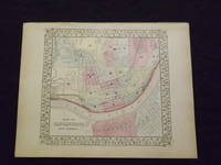
Mitchell, Samuel Augustus Jr
Map of Cincinnati.
Unbound colored engraved map decorative boarder 14" x 11". Slight browning and aging; otherwise bright and clean and in very good shape. Maps are wrapped with acid free board or in rigid sleeves. The Mitchell family started to produce atlases in 1846 and continued into the early 1890s. Around 1860 S. Augustus Mitchell Jr. took over and the atlas would be called Mitchell's New General Atlas. This is an attractive and rather early single page map of Cincinnati from the 1869 installment of this atlas. The map has nice color and good street detail. Part of Covington and Newport are also visible on the other side of the Ohio River. May require extra postage. Ristow 311-313.
Referencia librero : 103224
|
|
|
Mitchell, Samuel Augustus Jr
Map of Cincinnati.
Unbound colored engraved map decorative boarder 14" x 11". Slight browning and aging; otherwise bright and clean and in very good shape. Maps are wrapped with acid free board or in rigid sleeves. The Mitchell family started to produce atlases in 1846 and continued into the early 1890s. Around 1860 S. Augustus Mitchell Jr. took over and the atlas would be called Mitchell's New General Atlas. This is an attractive and rather early single page map of Cincinnati from the 1870 installment of this atlas. The map has nice color and good street detail. Part of Covington and Newport are also visible on the other side of the Ohio River. May require extra postage. Ristow 311-313.
Referencia librero : 103227
|
|
|
Mitchell, Samuel Augustus Jr
Map of Cincinnati
Philadelphia 1861. Unbound colored engraved map decorative boarder 13"x 11". Slight toning and aging a little light staining in the margins; still rather bright and clear and in very good shape. Maps are wrapped with acid free board or in rigid sleeves. The Mitchell family started to produce atlases in 1846 and continued into the early 1890s. Around 1860 S. Augustus Mitchell Jr. took over and the atlas would be called Mitchell's New General Atlas. This is an attractive and rather early single page map of Cincinnati from the 1861 installment of this atlas. Ristow 311-313 unknown
Referencia librero : 101018
|
|
|
Mitchell, Samuel Augustus Jr
Map of Cincinnati
Philadelphia 1861. Unbound colored engraved map decorative boarder 13"x 11". Slight toning and aging a little light staining in the margins; still rather bright and clear and in very good shape. Maps are wrapped with acid free board or in rigid sleeves. The Mitchell family started to produce atlases in 1846 and continued into the early 1890s. Around 1860 S. Augustus Mitchell Jr. took over and the atlas would be called Mitchell's New General Atlas. This is an attractive and rather early single page map of Cincinnati from the 1861 installment of this atlas. Ristow 311-313 unknown
Referencia librero : 101017
|
|
|
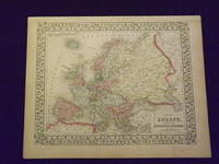
Mitchell, Samuel Augustus Jr
Map of Europe.
<p>Unbound colored engraved map decorative border 14"x 11". Slight toning and aging; overall bright and clear and in very good shape. Maps are wrapped with acid free board or in rigid sleeves. The Mitchell family started to produce atlases in 1846 and continued into the early 1890s. Around 1860 S. Augustus Mitchell Jr. took over and the atlas would be called Mitchell's New General Atlas. This is a nice map of Europe from the 1869 installment of that atlas. Despite the large area the map covers there is still a decent amount of detail. Extra postage may be required. Ristow 311-313. # 103234</p>
Referencia librero : 103234
|
|
|
Mitchell, Samuel Augustus Jr
Map of Europe.
<p>Unbound colored engraved map decorative border 14"x 11". Slight browning and aging a little foxing in margins; still overall bright and clear and in very good shape. Maps are wrapped with acid free board or in rigid sleeves. The Mitchell family started to produce atlases in 1846 and continued into the early 1890s. Around 1860 S. Augustus Mitchell Jr. took over and the atlas would be called Mitchell's New General Atlas. This is a nice map of Europe from the 1882 installment of that atlas. Despite the large area the map covers there is still a decent amount of detail. Extra postage may be required. Ristow 311-313. # 103242</p>
Referencia librero : 103242
|
|
|
Mitchell, Samuel Augustus Jr
Map of Europe
<p>Philadelphia 1861. Unbound colored engraved map decorative border 14"x 11". Slight toning and aging; overall bright and clear and in very good shape. Maps are wrapped with acid free board or in rigid sleeves. The Mitchell family started to produce atlases in 1846 and continued into the early 1890s. Around 1860 S. Augustus Mitchell Jr. took over and the atlas would be called Mitchell's New General Atlas. This is a nice map of Europe from the 1861 installment of that atlas. Despite the large area the map covers there is still a decent amount of detail. Ristow 311-313</p>
Referencia librero : 101203
|
|
|
Mitchell, Samuel Augustus Jr
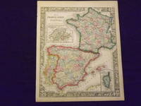
Map of France Spain and Portugal.
<p>Unbound colored engraved map decorative border 14" x 11". Slight toning and aging; overall bright and clean and in very good condition. Maps are wrapped with acid free board or in rigid sleeves. The Mitchell family started to produce atlases in 1846 and continued into the early 1890s. Around 1860 S. Augustus Mitchell Jr. took over and the atlas would be called Mitchell's New General Atlas. This is a very colorful map of France Spain and Portugal from the 1864 installment of that atlas. An inset illustrates Switzerland and the Island of Corsica. Extra postage may be required. Ristow 311-313.</p>
Referencia librero : 103237
|
|
|
Mitchell, Samuel Augustus Jr
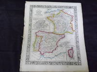
Map of France Spain and Portugal.
<p>Map of France Spain and Portugal. Philadelphia: 1861. Unbound colored engraved map decorative border 14" x 11". Slight browning and aging some chips and nicks at the left edge; overall bright and clean and in very good condition. Maps are wrapped with acid free board or in rigid sleeves. The Mitchell family started to produce atlases in 1846 and continued into the early 1890s. Around 1860 S. Augustus Mitchell Jr. took over and the atlas would be called Mitchell's New General Atlas. This is a very colorful map of France Spain and Portugal from the 1864 installment of that atlas. An inset illustrates Switzerland and the Island of Corsica. Extra postage may be required. Ristow 311-313.</p>
Referencia librero : 103243
|
|
|
Mitchell, Samuel Augustus Jr
Map of France Spain and Portugal.
<p>Philadelphia 1882. Unbound colored engraved map decorative border 14"x 11". Slight toning and aging; overall bright and clear and in very good shape. Maps are wrapped with acid free board or in rigid sleeves. The Mitchell family started to produce atlases in 1846 and continued into the early 1890s. Around 1860 S. Augustus Mitchell Jr. took over and the atlas would be called Mitchell's New General Atlas. This is a colorful map of France Spain and Portugal from the 1882 installment of that atlas. An inset illustrates Switzerland and the Island of Corsica. Extra postage may be required. Ristow 311-313</p>
Referencia librero : 101026
|
|
|
Mitchell, S Augustus
Map of France Spain and Portugal.
Unbound colored engraved map decorative boarder 14"x 11". Slight toning and aging some staining and soiling in margins; otherwise bright and clear and in very good shape. Maps are wrapped with acid free board or in rigid sleeves. The Mitchell family started to produce atlases in 1846 and continued into the early 1890s. Around 1860 S. Augustus Mitchell Jr. took over and the atlas would be called Mitchell's New General Atlas. This is colorful attractive map of France Spain and Portugal from the 1869 installment of that atlas. Nicely presented color and detail. Ristow 311-313 Phillips 907 S. Augustus Mitchell,
Referencia librero : 101304
|
|
|
Mitchell, Samuel Augustus
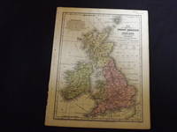
Map of Great Britain and Ireland.
<p>Engraved colored map 9" x11 1/2" Box like cartouche with map information. Some soiling perhaps a little margin foxing small holes in left margin where map was bound not affecting image some aging and browning otherwise very good. Attractive little map with plenty of detail and some decent color. From a school and family geography. </p> S. Augustus Mitchell,
Referencia librero : 106603
|
|
|
Mitchell, Samuel Augustus Jr
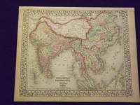
Map of Hindostan Farther India China and Tibet.
<p>Unbound colored engraved map decorative border 14" x 11". Slight browning and aging a few margin nicks; otherwise bright and clean. Maps are wrapped with acid free board or in rigid sleeves. The Mitchell family started to produce atlases in 1846 and continued into the early 1890s. Around 1860 S. Augustus Mitchell Jr. took over and the atlas would be called Mitchell's New General Atlas. This is a nice colorful map of India and parts of the Far East from the 1865 installment of that atlas. While this is not a large map there is still a considerable amount of detail. Extra postage may be required. Ristow 311-313.</p>
Referencia librero : 106767
|
|
|
Mitchell, Samuel Augustus Jr
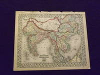
Map of Hindoostan Farther India China and Tibet.
<p>Unbound colored engraved map decorative border 14"x 11". Slight toning and aging a little browning at edges some finger soiling in margins some chips and tears along top edge; otherwise bright and clean. Maps are wrapped with acid free board or in rigid sleeves. The Mitchell family started to produce atlases in 1846 and continued into the early 1890s. Around 1860 S. Augustus Mitchell Jr. took over and the atlas would be called Mitchell's New General Atlas. This is a nice colorful map of India and parts of the far east from the 1870 installment of that atlas. The coloring is more dramatic than other editions of this map. While this is not a large map there is still a considerable amount of detail. Extra postage may be required. Ristow 311-313. # 103247</p>
Referencia librero : 103247
|
|
|
Mitchell, Samuel Augustus Jr
Map of Hindostan Farther India China and Tibet.
<p>Unbound colored engraved map decorative border 14" x 11". Slight browning and aging; otherwise bright and clean. Maps are wrapped with acid free board or in rigid sleeves. The Mitchell family started to produce atlases in 1846 and continued into the early 1890s. Around 1860 S. Augustus Mitchell Jr. took over and the atlas would be called Mitchell's New General Atlas. This is a nice colorful map of India and parts of the Far East from the 1869 installment of that atlas. While this is not a large map there is still a considerable amount of detail. Extra postage may be required. Ristow 311-313.</p>
Referencia librero : 103250
|
|
|
Mitchell, Samuel Augustus Jr
Map of Hindostan Farther India China and Tibet
<p>Philadelphia 1861. Unbound colored engraved map decorative border 14"x 11". Slight toning and aging a little browning at edges; overall bright and clear and in very good shape. Maps are wrapped with acid free board or in rigid sleeves. The Mitchell family started to produce atlases in 1846 and continued into the early 1890s. Around 1860 S. Augustus Mitchell Jr. took over and the atlas would be called Mitchell's New General Atlas. This is a nice colorful map of India and parts of the far east from the 1861 installment of that atlas. While this is not a large map there is still a considerable amount of detail. Ristow 311-313</p>
Referencia librero : 101027
|
|
|
Mitchell, Samuel Augustus Jr
Map of Illinois
<p>Unbound colored engraved map decorative border 11" x 14". Slight browning and aging; a couple of small nicks along edge otherwise bright and clean and very good. Maps are wrapped with acid free board or in rigid sleeves. The Mitchell family started to produce atlases in 1846 and continued into the early 1890s. Around 1860 S. Augustus Mitchell Jr. took over and the atlas would be called Mitchell's New General Atlas. This is a detailed single page map of Illinois from the 1865 installment of this atlas. There is an insert of Chicago on the map. The map shows a lot of detail with nice coloring. Extra postage may be required.</p>
Referencia librero : 106793
|
|
|
Mitchell, Samuel Augustus Jr
Map of Illinois.
Unbound colored engraved map decorative border 15" x 12". Slight browning and aging; a couple of small nicks along edge otherwise bright and clean and very good. Maps are wrapped with acid free board or in rigid sleeves. The Mitchell family started to produce atlases in 1846 and continued into the early 1890s. Around 1860 S. Augustus Mitchell Jr. took over and the atlas would be called Mitchell's New General Atlas. This is a detailed single page map of Illinois from the 1869 installment of this atlas. There is an insert of Chicago on the map. The map shows a lot of detail with nice coloring. Extra postage may be required.$85 S. Augustus Mitchell,
Referencia librero : 106726
|
|
|
Mitchell, Samuel Augustus Jr
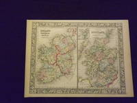
Map of Ireland and Scotland.
<p>Unbound colored engraved map decorative border 14" x 11". Slight toning and aging; overall generally bright and clean and in very good shape. Maps are wrapped with acid free board or in rigid sleeves. The Mitchell family started to produce atlases in 1846 and continued into the early 1890s. Around 1860 S. Augustus Mitchell Jr. took over and the atlas would be called Mitchell's New General Atlas. This is an attractive two panel map of Ireland and Scotland from the 1864 installment of that atlas. While the map presents two countries it does provide a fair amount of county level detail. Extra postage may be required. Ristow 311-313. </p>
Referencia librero : 103236
|
|
|
Mitchell, Samuel Augustus Jr
Map of Ireland and Scotland.
Unbound colored engraved map decorative border 14" x 11". Slight toning and aging. A few margin creases and chips; overall generally bright and clean and in very good shape. Maps are wrapped with acid free board or in rigid sleeves. The Mitchell family started to produce atlases in 1846 and continued into the early 1890s. Around 1860 S. Augustus Mitchell Jr. took over and the atlas would be called Mitchell's New General Atlas. This is an attractive two panel map of Ireland and Scotland from the 1870 installment of that atlas. While the map presents two countries it does provide a fair amount of county level detail. This is a very sharp and colorful impression. Extra psotage may be required. Ristow 311-313.
Referencia librero : 106133
|
|
|
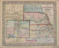
MITCHELL, Samuel Augustus Jr
Map of Kansas Nebraska and Colorado. Showing also the Southern Portion of the Dacotah
Philadelphia: Mitchell Samuel Augustus Jr. 1867. unbound. Map. Steel engraving with original hand coloring. Image measures 11.5" x 14".<br/> <br/> Classic 1867 map of the west with Kansas Nebraska Colorado part of the Dakotas and Wyoming just before statehood. Counties major towns and cities routes railroads waterways and Indian tribes and reservations are carefully noted. <Br> <br> Samuel Augustus Mitchell Sr. 1792-1868 was one of the leaders in American cartography of the 19th century and pioneered the conversion of engraved map plates to more affordable lithographic plates. His son Samuel Augustus Mitchell Jr. continued his father's successful mapmaking and publishing business and was one of the most prolific and renowned 19th century American publishers.<br/> <br/> Mitchell, Samuel Augustus Jr. unknown
Referencia librero : 308662
|
|

 Recibir por correo electrónico
 Descargar en documento PDF
 Flujo RSS
 Link permanente


