|
Samson, Julia
Nefertiti and Cleopatra : Queen-Monarchs of Ancient Egypt
Stacey Publishing. Used - Very Good. Used book that is in excellent condition. May show signs of wear or have minor defects. Stacey Publishing unknown
Referentie van de boekhandelaar : 41223589-6 ISBN : 0948695188 9780948695186

|
|
|
Samson, Julia.
Nefertiti and Cleopatra: Queen-Monarchs of Ancient Egypt. Introduction by H.S. Smith.
London The Rubicon Press 1985. xvi 149pp. 12 plates 37 text illus. 4to. Wraps. London (The Rubicon Press), 1985. paperback
Referentie van de boekhandelaar : B276513-2
|
|
|
Samson, Julia
Nefertiti And Cleopatra - Queen-Monarchs Of Ancient Egypt
London: The Rubicon Press 1997. Card covers in tidy condition spine a little sunned 150pp. Paperback. Very Good. 8vo - over 7¾" - 9¾" tall. The Rubicon Press Paperback
Referentie van de boekhandelaar : 072996 ISBN : 0948695188 9780948695186
|
|
|
Samson, Julia
Nefertiti and Cleopatra : queen-monarchs of Ancient Egypt / Julia Samson ; introduction by H. S. Smith
London : Rubicon 1997. Reprint. Softcover. Fine paperback copy. Particularly well-preserved; tight bright and clean. Physical description; xvi150p. : ill. 1 geneal tablemapsports. ; 24cm. Subjects; Nefertiti Queen of Egypt. Cleopatra Queen of Egypt 51-30 B.C. Egypt Queens Biography. Monarchs History. London : Rubicon paperback
Referentie van de boekhandelaar : 334312 ISBN : 0948695188 9780948695186
|
|
|
Samson, Julia
Nefertiti and Cleopatra: Queen-Monarchs Ancient Egypt
paperback. Good. Access codes and supplements are not guaranteed with used items. May be an ex-library book. paperback
Referentie van de boekhandelaar : 0948695188.G ISBN : 0948695188 9780948695186
|
|
|
Samson, Julia
Nefertiti and Cleopatra: Queen-Monarchs Ancient Egypt
Stacey International 1990-12-31. Paperback. New. In shrink wrap. Looks like an interesting title! Stacey International paperback
Referentie van de boekhandelaar : Q-0948695188 ISBN : 0948695188 9780948695186
|
|
|
SAMSON, JULIA & SMITH, PROFESSOR H. S. (intro)
Nefertiti and Cleopatra: Queen-Monarchs of Ancient Egypt
The Rubicon Press 1987. Imperial octavo hardcover VG in d/w VG; all our specials have minimal description to keep listing them viable. They are at least reading copies complete and in reasonable condition but usually secondhand; frequently they are superior examples.Ordering more than one book will reduce your overall postage cost The Rubicon Press 1987 hardcover
Referentie van de boekhandelaar : 247981
|
|
|
Samson, Julia
Nefertiti And Cleopatra Queen-Monarchs Of Ancient Egypt
Barnes And Noble 2002. First Edition. Hardcover. Very Good/Good. Pages Clean Binding Tight. Barnes And Noble hardcover
Referentie van de boekhandelaar : 206144 ISBN : 0760728372 9780760728376
|
|
|
Samson, Julia
Nefertiti and Cleopatra: Queen-monarchs of Ancient Egypt
Paperback. Very Good. paperback
Referentie van de boekhandelaar : GOR004045993 ISBN : 0948695188 9780948695186
|
|
|
SAMSON, Julia.
Nefertiti and Cleopatra. Queen-Monarchs of Ancient Egypt. Introduction by Professor H.S. Smith.
Rubicon Press London. 1987. DW. Black cloth gilt. 150pp. Colour frontis. Line drawings b/w photgraphs. Index. Nr. Fine ISBN 0 948695 00 5 hardcover
Referentie van de boekhandelaar : 31806 ISBN : 0948695005 9780948695001

|
|
|
Samson, Julia
Nefertiti and Cleopatra : Queen-Monarchs of Ancient Egypt
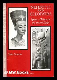
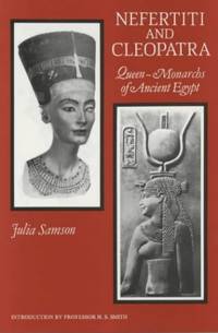
David Brown Book Co. Very Good. 1990. Revised. Paperback. 8vo 0948695188 Crease to front cover.150 pages clean and tight. This book gives .us a new and vivid account of the lives of two eminent Queen-Monarchs of Ancient Egypt - the beautiful Nefertiti 1367-1350 B.C. and the highly talented Cleopatra 51-30 B.C. Both politically adept they also distinguished themselves in their love for the greatest men of their day: Nefertiti for the sun-worshipping Pharaoh Akhenaten and Cleopatra for Julius Caesar and Mark Antony. Though far apart in time and culture a likeness in their situation existed - in their elegance their position of power their remarkable and unusual aims and their grief and ultimate tragedy. Julia Samson has graphically described their sophisticated environment in the Nile Valley and by using evidence from excavations and objects from the world's great museums has recreated life in Nefertiti's and Akhenaten's capital city at Amarna and from the Classical writers the dramatic history of Cleopatra. Nefertiti and Cleopatra has been written for the general reader but should be of interest to the student for it contains much original research. Julia Samson took the Academic Diploma in Archaeology under Professor S.R.K. Glanville Sir Flinders Petrie's successor in the Edwards Chair of Egyptology at University College London in the 1930s. While studying she began cataloguing and arranging the museum exhibition objects Petrie had found at Amarna. During this work John Pendlebury invited her to join his excavation at Amarna and to write a chapter for City of Akhenaten III. After a war-time and post-war career in the Civil Service she returned to the Petrie Museum in the 1960s where she completed her task of cataloguing the Amarna' collection. She is an Honorary Research Fellow there and has published Amarna City of Akhenaten and Nefertiti : Key pieces in the Petrie Museum in 1972. Subsequently she has written numerous articles in international journals on Amarna history and revised and expanded her original work to incorporate new discoveries and the second edition has a section on Nefertiti as Pharaoh . David Brown Book Co paperback
Referentie van de boekhandelaar : 124134 ISBN : 0948695188 9780948695186
|
|
|
Samson, Julia
Nefertiti and Cleopatra Queen-Monarchs of Ancient Egypt
London: Rubicon Press 1997. Revised Edition Reprinted. xvii 150p. b/w illus. original stiff wrappers. Rubicon Press unknown
Referentie van de boekhandelaar : 031917 ISBN : 0948695188 9780948695186
|
|
|
Samson, Julia
Nefertiti and Cleopatra: Queen Monarchs of Ancient Egypt
United Kingdom: Rubicon Pr 1990. Book. Very Good. Soft cover. trade paperback in very good condition. United Kingdom: Rubicon Pr Paperback
Referentie van de boekhandelaar : 127929 ISBN : 0948695188 9780948695186
|
|
|
Samson, Julia
Nefertiti and Cleopatra : Queen-Monarchs of Ancient Egypt
New York: Barnes & Noble. Very Good in Very Good dust jacket. 2002. Hardcover. 0760728372 . Nice clean copy.; Small 4to 9" - 11" tall; 150 pages . Barnes & Noble hardcover
Referentie van de boekhandelaar : 132965 ISBN : 0760728372 9780760728376
|
|
|
Samson, Julia
Nefertiti and Cleopatra : Queen Monarchs of Ancient Egypt
New York: Barnes & Noble 1985. Jacket has light wear. Boards have some shelfwear. Pages are clean & text is free from markings. All pages secure in binding. Third Printing. Hard Cover. Very Good/Very Good. 8vo - over 7¾" - 9¾" tall. Barnes & Noble Hardcover
Referentie van de boekhandelaar : 117549 ISBN : 0760728372 9780760728376
|
|
|
Samson, Judith
Sams Teach Yourself Red Hat Linux in 24 Hours Starter It
paperback. Good. Access codes and supplements are not guaranteed with used items. May be an ex-library book. paperback
Referentie van de boekhandelaar : 0672318458.G ISBN : 0672318458 9780672318450

|
|
|
Samson, Judith; Maryk, Denis
The Orient Family Library of World Travel
AGTpublishing/Octopus Books. Used - Very Good. Very Good condition. A copy that may have a few cosmetic defects. May also contain light spine creasing or a few markings such as an owner’s name short gifter’s inscription or light stamp. AGTpublishing/Octopus Books unknown
Referentie van de boekhandelaar : Q14F-01031 ISBN : 0933521189 9780933521186

|
|
|
Samson, Judith; Maryk, Dennis
The Orient Family Library of World Travel
paperback. Good. Access codes and supplements are not guaranteed with used items. May be an ex-library book. paperback
Referentie van de boekhandelaar : 0933521189.G ISBN : 0933521189 9780933521186
|
|
|
Samson, Judith; Maryk, Denis
The Orient Family Library of World Travel
A G T Publishing Incorporated 1985-01-01. Paperback. Good. 0.3000 in x 9.8000 in x 7.5000 in. 1985. Octopus Books. AGT Publishing. Paperback. 64 pages. Minor edge wear. Pages are in nice condition! A G T Publishing, Incorporated paperback
Referentie van de boekhandelaar : mon0000113794 ISBN : 0933521189 9780933521186
|
|
|
Samson, Judith; Maryk, Dennis
The Orient Family Library of World Travel
London: AGTpublishing/Octopus Books 1985. Wraps show no wear spine is unbent. Pages are clean with no markings in text. . Soft Cover. As New. 4to - over 9¾" - 12" tall. AGTpublishing/Octopus Books Paperback
Referentie van de boekhandelaar : 234865C ISBN : 0933521189 9780933521186
|
|
|
Samson, Jules
Une education dans la famille: Conseils pratiques d'une mere. -- French Edition
hardcover. Good. Access codes and supplements are not guaranteed with used items. May be an ex-library book. hardcover
Referentie van de boekhandelaar : 1385999411.G ISBN : 1385999411 9781385999417

|
|
|
Samson, Jules
UNE EDUCATION DANS LA FAMILLE: Conseils Pratiques D'une Mere
Paris: A. Hennuyer 1885. Hardcover. Good/None. 332 pages. Brown leather spine. Marbled boards. Raised bands. Gilt decorated and titled spine. Sticker on front paste down from previous owner. Some wear to boars. Record # 220745 A. Hennuyer hardcover
Referentie van de boekhandelaar : 220745
|
|
|
Samson, K
Classical Mechanics
hardcover. Good. Access codes and supplements are not guaranteed with used items. May be an ex-library book. hardcover
Referentie van de boekhandelaar : 8176256978.G ISBN : 8176256978 9788176256971
|
|
|
Samson, Karl
Arizona 2007
Wiley & Sons Incorporated John. Used - Very Good. Used book that is in excellent condition. May show signs of wear or have minor defects. Wiley & Sons, Incorporated, John unknown
Referentie van de boekhandelaar : 38826014-6 ISBN : 076458927x 9780764589270

|
|
|
Samson, Karl
Arizona 2010
Wiley & Sons Incorporated John. Used - Good. Used book that is in clean average condition without any missing pages. Wiley & Sons, Incorporated, John unknown
Referentie van de boekhandelaar : GRP66246574 ISBN : 0470497726 9780470497722

|
|
|
Samson, Karl
Arizona Frommer's Complete Guides
paperback. Good. Access codes and supplements are not guaranteed with used items. May be an ex-library book. paperback
Referentie van de boekhandelaar : 0028629612.G ISBN : 0028629612 9780028629612

|
|
|
Samson, Karl & Jane Aukshunas
Complete:nashville & Memphis 3rd Edition
Frommer's 1998. 3rd Edition. Paperback. Used: Good. Prompt shipment with tracking. we ship in CLEAN SECURE NEW boxes Guidebooksgood or better copy may contain creasing may contain minimal underlining call or email for more information Frommer's paperback
Referentie van de boekhandelaar : Ware729jlw025 ISBN : 0028621433 9780028621432

|
|
|
Samson, Katie
Cultural Accessibility Workbook: Implementing Access in the Cultural Arts
NEW. unknown
Referentie van de boekhandelaar : BIB-NOV-15-2025-150914 ISBN : 9798394238622 9798394238
|
|
|
Samson, Karl
Frommer's Arizona and the Grand Canyon 2011
Wiley & Sons Incorporated John. Used - Good. Used book that is in clean average condition without any missing pages. Wiley & Sons, Incorporated, John unknown
Referentie van de boekhandelaar : 4520982-6 ISBN : 0470607505 9780470607503
|
|
|
Samson, Karl; Christensen, Shane; Laine, Don; Laine, Barbara
Frommer's American Southwest Frommer's Complete Guides
Frommers 2003-10-24. paperback. Good. 5x1x8. Slight edge wear & slight page ripples. *Frommers paperback
Referentie van de boekhandelaar : 251114025 ISBN : 0764539310 9780764539312
|
|
|
Samson, Karl
Frommer's Seattle 2004
Wiley & Sons Incorporated John. Used - Very Good. Used book that is in excellent condition. May show signs of wear or have minor defects. Wiley & Sons, Incorporated, John unknown
Referentie van de boekhandelaar : 9187505-75 ISBN : 0764541277 9780764541278

|
|
|
Samson, Karl
Frommer's Northwest
Simon & Schuster Incorporated. Used - Good. Used book that is in clean average condition without any missing pages. Simon & Schuster, Incorporated unknown
Referentie van de boekhandelaar : 9862964-75 ISBN : 0671866613 9780671866617
|
|
|
Samson, Karl
Frommer's Portable Seattle
Frommers. Used - Good. A sound copy with only light wear. Overall a solid copy at a great price! *Frommers unknown
Referentie van de boekhandelaar : BOS-H-12g-01865 ISBN : 0764563483 9780764563485

|
|
|
Samson, Karl
Frommer's Washington State Frommer's Complete Guides
Frommers. Used - Good. A sound copy with only light wear. Overall a solid copy at a great price! *Frommers unknown
Referentie van de boekhandelaar : BOS-C-11h-01713 ISBN : 0764565532 9780764565533

|
|
|
Samson, Karl
Frommer's Oregon Frommer's Complete Guides
Frommers. 7. Very Good. It's a well-cared-for item that has seen limited use. The item may show minor signs of wear. All the text is legible with all pages included. It may have slight markings and/or highlighting. *Frommers unknown
Referentie van de boekhandelaar : 047053771X-8-1 ISBN : 047053771x 9780470537718

|
|
|
Samson, Karl
Frommer's Portable Portland
Frommers. Used - Very Good. Very Good condition. 5th edition. A copy that may have a few cosmetic defects. May also contain light spine creasing or a few markings such as an owner’s name short gifter’s inscription or light stamp. *Frommers unknown
Referentie van de boekhandelaar : I16G-01911 ISBN : 0470164131 9780470164136

|
|
|
Samson, Karl
Frommer's Arizona and the Grand Canyon 2011
Wiley & Sons Incorporated John. Used - Good. Former library book; may include library markings. Used book that is in clean average condition without any missing pages. Wiley & Sons, Incorporated, John unknown
Referentie van de boekhandelaar : 3931761-6 ISBN : 0470607505 9780470607503
|
|
|
Samson, Karl
Frommer's Arizona 2001
Wiley & Sons Incorporated John. Used - Very Good. Used book that is in excellent condition. May show signs of wear or have minor defects. Wiley & Sons, Incorporated, John unknown
Referentie van de boekhandelaar : 53551604-6 ISBN : 0764561154 9780764561153
|
|
|
Samson, Karl, Aukshunas, Jane
Frommer's Oregon Frommer's Complete Guides
Frommers. Used - Very Good. Very Good condition. 3rd edition. A copy that may have a few cosmetic defects. May also contain light spine creasing or a few markings such as an owner’s name short gifter’s inscription or light stamp. *Frommers unknown
Referentie van de boekhandelaar : K04A-04462 ISBN : 0764565559 9780764565557

|
|
|
Samson, Karl
Frommer's Portable Portland
Frommer's 4/30/2004 12:00:01 A. paperback. Good. 0.3898 in x 7.4213 in x 4.3189 in. There is a signature or handwriting on the inside front cover. Frommer's paperback
Referentie van de boekhandelaar : 5FSZKH000R1A ISBN : 0764557793 9780764557798

|
|
|
samson, karl
Frommer's Comprehensive travel guide Arizona '95
macmillan travel 1995. paperback. good. Prompt shipment with tracking. we ship in CLEAN SECURE NEW boxes good 8vo paperback pages 369 book in good condition and prompted for shipping. macmillan travel paperback
Referentie van de boekhandelaar : Ware457SM009
|
|
|
Samson, Karl
Frommer's Oregon Frommer's Complete Guides
Frommers 2012-05-01. paperback. Good. 5x0x8. *Frommers paperback
Referentie van de boekhandelaar : 111809624X-3-34414156 ISBN : 111809624X 9781118096246

|
|
|
Samson, Karl
Frommer's Washington State Frommer's Complete Guides
Frommer's. Used - Very Good. Very Good condition. A copy that may have a few cosmetic defects. May also contain light spine creasing or a few markings such as an owner’s name short gifter’s inscription or light stamp. Frommer's unknown
Referentie van de boekhandelaar : H09B-01213 ISBN : 0764544713 9780764544712

|
|
|
Samson, Karl
Frommer's Portable Portland
Frommer 2010-04-26. paperback. New. 4x0x7. Frommer paperback
Referentie van de boekhandelaar : 0470537701-11-28930838 ISBN : 0470537701 9780470537701

|
|
|
Samson, Karl
Frommer's Arizona 2009 Frommer's Complete Guides
Frommers. Used - Good. . Former Library book. All orders guaranteed and ship within 24 hours. Your purchase supports More Than Words a nonprofit job training program for youth empowering youth to take charge of their lives by taking charge of a business. *Frommers unknown
Referentie van de boekhandelaar : WAL-E-1c-002441 ISBN : 0470287764 9780470287767

|
|
|
Samson, Karl
Frommer's Portable Portland
Frommer's. Used - Good. Good condition. 3rd edition. A copy that has been read but remains intact. May contain markings such as bookplates stamps limited notes and highlighting or a few light stains. Frommer's unknown
Referentie van de boekhandelaar : I16G-00014 ISBN : 0764557793 9780764557798
|
|
|
Samson, Karl
Frommer's Portable Portland
Frommer 2010T. paperback. Very Good. 0.9000 in x 7.2000 in x 4.2000 in. All orders ship by next business day! This is a used book. Grade 3 out 5 points. Book has wear on cover and pages. May have personalized notes/names stickers/labels. Has no markings on pages. May not include extra materials like access codes CDs accessories etc. We are a small company and very thankful for your business! Frommer paperback
Referentie van de boekhandelaar : 4CNZE90005FC ISBN : 0470537701 9780470537701
|
|
|
Samson, Karl
Frommer's Washington State Frommer's Complete Guides
Frommers 2010-11-02. paperback. Acceptable. 5x0x7. *Frommers paperback
Referentie van de boekhandelaar : 0470607513-4-33741691 ISBN : 0470607513 9780470607510

|
|
|
Samson, Karl
Frommer's Arizona and the Grand Canyon 2012 Frommer's Color Complete
Frommers 2011-11-15. paperback. New. 5x1x7. ~ Cover has some minor shelf wear. ~ NEW inside and Out! Clean & Crisp Pages w/No markings. Email for more info./pics *Frommers paperback
Referentie van de boekhandelaar : 250518069 ISBN : 1118017277 9781118017272

|
|
|
Samson, Karl
Frommer's Oregon Frommer′s Complete Guides
John Wiley & Sons 2006-05-12. Paperback. New. 2.7919 in x 20.0508 in x 12.9442 in. John Wiley & Sons paperback
Referentie van de boekhandelaar : mon0000075827 ISBN : 0471763888 9780471763888

|
|
 De zoekresultaten per email ontvangen
 Zoekresultaten downloaden als PDF
 RSS feed


