|
Surveying and Mapping Press
China Super-detailed Road AtlasChinese Edition
paperback. New. Ship out in 2 business day And Fast shipping Free Tracking number will be provided after the shipment.Paperback. Language: Chinese. Pub. Date: 2011. for the majority of drivers to provide as much detail as road traffic information and geographic information. map publishing workers of our duties. Chinas ultra-detailed road atlas to unite our wisdom and hard work. Service for the driver to maximize the preparation of the atlas is the purpose. In editing the design process. we all start from the driver to map as much as possible to provide useful travel information to drivers. and strive to make. Satisfaction guaranteedor money back. paperback
Référence libraire : 098267 ISBN : 7503022140 9787503022142
|
|
|
Surveying and Mapping Press
China Super-detailed Road AtlasChinese Edition
paperback. New. Ship out in 2 business day And Fast shipping Free Tracking number will be provided after the shipment.Paperback. Language: Chinese. Pub. Date:2011. Contents : --------------- ----------------- Satisfaction guaranteedor money back. paperback
Référence libraire : 105968 ISBN : 7503022140 9787503022142
|
|
|
SURVEYING SCIENTIFIC INSTRUMENTS. BACHMANN F.
Die Theorie und Praxis des Nivellirens mit besonderer Rucksicht auf Libelleninstrumente. . . .
Weimar: Bernhard Friedrich Voigt 1838. 8vo. 239 1 pp. Numerous tables. Six large folding engraved plates some hand-coloured w/ instruments and cartographic details. Contemporary quarter-tree-calf over chppng ft of spine mnr splttng to hnges foxing to textblk mnr creasng to Plate VI still good reference copy. First edition of this exceedingly scarce work on surveying detailing the equipment and leveling instruments w/ details on cartography. Bernhard Friedrich Voigt, unknown
Référence libraire : 38922
|
|
|
Surveying Love John
Geossia: or The Art of Surveying and Measuring of Land Made Easy .
London: Printed for A Bettesworth and C. Hitch . and W. Innys 1731. The Fourth Edition. Diagrams. xx 196 16 4 36 8 pp. 1 vols. 8vo. Contemporary calf red leather spine label. Boards missing else clean. The Fourth Edition. Diagrams. xx 196 16 4 36 8 pp. 1 vols. 8vo. Printed for A Bettesworth and C. Hitch ... and W. Innys unknown
Référence libraire : 223283
|
|
|
Surveying and Mapping Press
Practical Version of the Atlas of China Road NetworkChinese EditionOld-Used
paperback. New. Ship out in 2 business day And Fast shipping Free Tracking number will be provided after the shipment.Surveying and Mapping Press. 2010. Soft cover. Book Condition: New. 185260mm. Satisfaction guaranteedor money back. paperback
Référence libraire : ZA3322 ISBN : 7503020377 9787503020377
|
|
|
Surveying The Harper & Row series in civil engineering Francis H Moffitt and Harry Bouchard Bouchard
Surveying The Harper & Row series in civil engineering Francis H Moffitt and Harry
Fine. Above Average Used Condition Book. Light highlighting within. Also a Used Bookstore stamp inside front cover. unknown
Référence libraire : BOOK_0060445599 ISBN : 0060445599 9780060445591
|
|
|
Surveying Military; Journal Mapping
Zui xin Zhongguo jiao tong lu you di tu ce = New traffic and tourist atlas of China
Golden Shield Press Beijing. PAPERBACK. In color. Very good. In English and Chinese. books carefully packed and shipped promptly . Very Good. 1991. Golden Shield Press, Beijing paperback
Référence libraire : WARE37BN054
|
|
|
SURVEYING BUREAU OF THE PEOPLE'S LIBERATION ARMY GENERAL STAFF DEPARTMENT. .
抗震救灾专用地图: 四川省全图./汶川县及周边地势图. Sichuan sheng quan tu./Wenchuan xian ji zhou bian di shi tu. Special Maps for Earthquake Disaster Relief: Map of Sichuan Province./ Map of Wencuan County and Its Vicinity.
北京.Beijing.: 星球地图出版社.Xing qiu di tu chu ban she. May2008. Two large coloured maps printed on double sided on a single sheet folded issued shortly after the devastating 2008 Wenchuan Earthquake which was occurred on 12 May 2008. Small tears along folds mended by both non-acidic tape and cello tape some creasing generally good. Text in Chinese. Sheet measures 84.9 x 119.7cm. <br> <br>Map of Sichuan Province: scale 1: 1100000 inset map lower right corner showing the provincial capital city Chengdu a statistical chart lower section listing counties within Sichuan Province their population and territory size. <br> <br>Map of Wenchuan County and Its Vicinity: 1: 300000 various colour representing altitude differences inset map showing the position Wenchuan County within Sichuan Province a mileage chart listing the distance between Wenchuan County to nearby cities. A brief introduction of Wenchuan on left section accompanying the images of the rescue forces. The Great Wenchuan Earthquake was the biggest earthquake in Chinese history with a casualty over 69000 people. . 星球地图出版社.[Xing qiu di tu chu ban she]. unknown
Référence libraire : 169215

|
|
|
Surveying Love John
Geossia: or The Art of Surveying and Measuring of Land Made Easy .
London: Printed for A Bettesworth and C. Hitch . and W. Innys 1731. The Fourth Edition. Diagrams. xx 196 16 4 36 8 pp. 1 vols. 8vo. Contemporary calf red leather spine label. Boards missing else clean. The Fourth Edition. Diagrams. xx 196 16 4 36 8 pp. 1 vols. 8vo. Printed for A Bettesworth and C. Hitch ... and W. Innys unknown books
Référence libraire : 223283
|
|
|
SURVEYING MANUSCRIPT IN FRENCH -
Levées des Villages à la Planchette (Survey of villages on a map-board).
France (Paris ?), Undated, around 1770. Folio. (42,5 x 28 cm.). Loose, sewn 4 by 4 leaves in portfolio with ties. Title-page and 9 pp. written in a fine, large legible hand, but unidentified, in brown ink. Having 5 (No 1-5) manuscript maps and plans in double folio with some hand-colouring. On good thick paper, clean and fine.
Référence libraire : 59178
|
|
|
SURVEYING. FLINT Abel & GILLET George.
A system of geometry and trigonometry: with a treatise on surveying in which the principles of rectangular surveying without plotting are explained. . . .
Hartford CT: Belknap and Hamersley 1844. 8vo. 160; 112 pp. Numerous woodcut engraved diagrams figures. Contemporary full speckled calf speckled fore-edges tan & gilt morocco spine label minor shelfwear slight rubbing occasional light foxing still an excellent copy. Third edition revised & expanded of this popular American treatise on surveying published originally in 1804 would continue to be updated and revised for over half a century. An edition of Abel Flint’s work was one of the two consulted by Abraham Lincoln while he studied to become a surveyor as it emphasized higher math including logarithms plane geometry and trigonometry. Belknap and Hamersley, unknown
Référence libraire : 55840
|
|
|
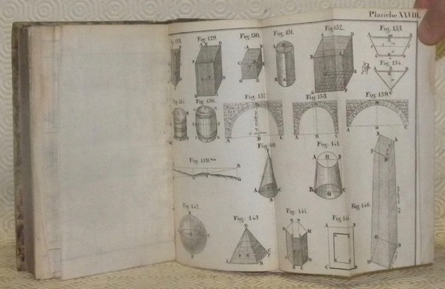
Taviel de Mastaing, J.-B.
L’art de lever les plans, et nouveau traité de l’arpentage et du nivellement, dans lequel on enseigne des méthodes courtes et faciles pour arpenter et calculer toutes sortes de surfaces; suivi d’un traité sur les solides, et d’un traité du lavis; avec 29 planches. Cinquième édition, revue et augmentée.
Paris - Dijon, Noellat - Douiller 1838, 180x110mm, 356pages, reliure demi-basane. Etiquette de titre et de cotation manuscrite au dos, cachet de bibliothèque.
Référence libraire : 45132
|
|
|
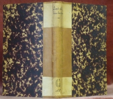
TAVIEL de MASTAING, J.-B.
L’art de lever les plans, et nouveau traité de l’arpentage et du nivellement, dans lequel on enseigne des Méthodes courtes et faciles, pour arpenter et calculer toutes sortes de surfaces; suivi d’un traité sur les solides, et d’un traité du Lavis; avec 30 planches. Ouvrage mis à la portée des Instituteurs, des Propriètaires, et des personnes de toutes clasees. Troisième édition, revue et augmentée par J.-B. Taviel de Mastaing.
Dijon, Noellat et Gaulard 1826, 175x110mm, XI - 381pages, reliure demi-toile. Plats papier marbré. Plats frottés, coiffes usées.
Référence libraire : 77912
|
|
|
TEYSSEDRE (A. Person de).
Nouveau manuel de l'arpenteur, contenant toutes les instructions nécessaires sur cet art, le lever des plans, le toisé, etc.
Paris, Au dépôt des Nouveaux manuels, "Bibliothèque de l'ouvrier, de l'artiste et de l'amateur", 1836 1 volume In-18 (9,6 x 15cm) Broché. 1 feuillet, 196p. (dont les VI premières paginées en chiffres romains); 1 frontispice. Couverture un peu salie, cornée; ancien cachet indéchiffrable sur le 1er plat; manque 1 planche de figures géométriques in fine.
Référence libraire : 19952
|
|
|
the Committee on Engineering Surveying of the Surveying Engineering Division of the American Society of Civil Engineers
Engineering Surveying Manual Asce Manual and Reports on Engineering Practice
Amer Society of Civil Engineers 1985-05. Paperback. Good. Amer Society of Civil Engineers paperback
Référence libraire : SONG0872624609 ISBN : 0872624609 9780872624603
|
|
|
the editorial group of Chinese Scientific Terms of Surveying and Mapping
Chinese Scientific Terms of Surveying and Mapping 1990 Oversea EditionChinese Edition
hardcover. New. Ship out in 2 business day And Fast shipping Free Tracking number will be provided after the shipment.China Science Press. Bei Jing. 1992. Hardcover. Book Condition: New. First Edition. 185x260 Mm. Language: Chinese and English bilingual 1992/141 pages. Satisfaction guaranteedor money back. hardcover
Référence libraire : ZA1762 ISBN : 7030032721 9787030032720
|
|
|
the editorial group of Chinese Scientific Terms of Surveying and Mapping
Chinese Scientific Terms of Surveying and Mapping 1990 Oversea EditionChinese Edition
hardcover. New. Ship out in 2 business day And Fast shipping Free Tracking number will be provided after the shipment.Science Press. 1992. Hardcover. Book Condition: New. 1st Edition. 185x260mm. Language: Chinese and English bilingual 1992/141 pages. Monograph. Satisfaction guaranteedor money back. hardcover
Référence libraire : 0901093

|
|
|
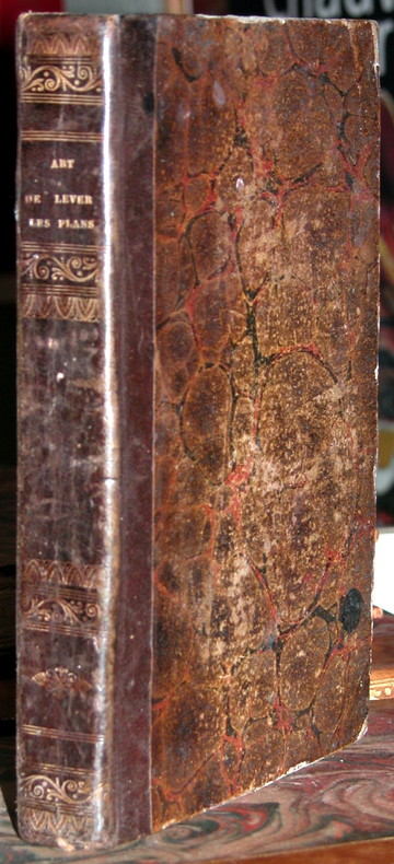
THIOLLET (François)
L'Art de lever les plans, arpentage, nivellement et lavis des plans, enseigné en 20 leçons, sans le secours des mathématiques.
Paris, Audin, 1834 1 volume In-8° (12,8 x 19,8cm) Reliure demi-basane marron; dos lisse à titre, fleuron et roulettes dorés. XII + 384p.; 19 planches dépliantes dont 1 en couleurs. Ors du dos passés, coins frottés; rousseurs; ex-libris manuscrits.
Référence libraire : 9316
|
|
|
Thomas Hale Streets 1873 75 United States North Pacific surveying ex Creator
Contributions To The Natural History Of The Hawaiian And Fanning Islands And Lower California: Made In Connection With The United States North Pacific Surveying Expedition 1873-75 Volume 13.
Nabu Press 2011-10-08. Paperback. Good. Nabu Press paperback
Référence libraire : SONG1247951499 ISBN : 1247951499 9781247951492

|
|
|
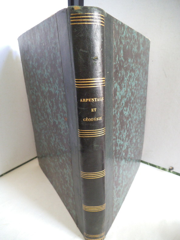
THOREL J.B.A
Arpentage et géodésie pratiques et Le comparateur de l’Oise
ouvrage à l’aide duquel on peut apprendre,le système métrique sans sa perfection, l’arpentage et la division des terres,avec instruments,ou sans autre instruments que le mètre;la trigonométrie rectiligne;la levée des plans par plusieurs méthodes différents.In 4 demi-cuir marron époque, titre et filets dorés. Faux-titre, titre,III,1 page d’errata ;228 pages,12 planches dépliantes,texte sur 2 colonnes,à la suite Le comparateur de l’Oise ou table générales de conversion de toutes les mesures anciennes du département de l’Oise,en nouvelles, et réciproquement, à l’usage de MM les avocats,huissiers, géomètres, arpenteurs, propriétaires,cultivateurs etc. par J.BA THOREL titre,1 page,226 pages,4 pages de table des matières,errata.Se vend à Formerie (Oise)chez l’auteur 1843-1845.Cuir légèrement cassant sinon bon exemplaire,peu courant
Référence libraire : 5606
|
|
|
THOREL Jean Baptiste Alexis
Arpentage et géodésie pratiques
à l’usage des personnes studieuses. Ouvrage à l’aide duquel on peut apprendre, sans le secours d’aucun maître : le système métrique dans sa perfection, l’arpentage et la division des terres, avec instrumens ou sans autres instrument que le mètre ; la trigonométrie rectiligne ; la levée des plans par plusieurs méthodes différentes, notamment par une méthode moderne, au moyen de laquelle on peut obtenir la contenance effective de tout polygone quelconque, par le secours des triangles et des quadrilatères formés dans ces polygones. On trouvera aussi dans cet ouvrage une division moderne appuyée sur les principes dont il vient d’être parlé ; la manière de faire et de calculer les triangulations par plusieurs procédés de gnomonique, et les tables des carrés précédées du binôme, etc. etc. A la suite le comparateur de l’Oise ou tables générales de conversion de toutes les mesures anciennes du département de l’Oise en nouvelles, et réciproquement, à l’usage des avocats, avoués, notaires, juges de pais, greffiers, huissiers, cultivateurs, propriétaires etc. etc. In 8 demi cuir vert, titre, filets, roulette dorés. Faux-titre, titre, 228 pages, III. Table des matières 1 page errata. . Titre, 224 pages, 1 page de table. En fin de volume : 202 figures en 12 planches dépliantes, lithographiées (une tache d’encre à la dernière). Se vend à Formerie (Oise) chez l’auteur 1843. Bon exemplaire
Référence libraire : 10960
|
|
|
TRADE CATALOGUE: Drafting & Surveying Supplies
Catalog of Eugene Dietzgen Co. Fourteenth Edition
Chicago: Dietzgen 1931. hardcover. very good-. Color frontispiece of Chicago factory; text illustrations. 520pp. 8vo green cloth rear cover lightly spotted. Chicago: Dietzgen. 1928. Samples of drawing & tracing papers affixed to inside front cover; price list in back envelope is missing. Dietzgen unknown
Référence libraire : 285642
|
|
|
TRADE CATALOGUE: Drafting & Surveying Supplies
Catalog of Eugene Dietzgen Co. Twelfth Edition
Chicago: Dietzgen 1928. hardcover. very good. Color frontispiece of Chicago factory; text illustrations. 489pp. 8vo green cloth spine ends a bit worn. Chicago: Dietzgen. 1928. Booklet with prices insert in envelope inside back cover; samples of drawing & tracing papers affixed to inside front cover. Dietzgen unknown
Référence libraire : 285641
|
|
|
TRADE CATALOGUE: Drafting & Surveying Supplies
Catalog of Eugene Dietzgen Co. Fourteenth Edition
Chicago: Dietzgen 1931. hardcover. very good-. Color frontispiece of Chicago factory; text illustrations. 520pp. 8vo green cloth rear cover lightly spotted. Chicago: Dietzgen. 1928.<br/><br/> Samples of drawing & tracing papers affixed to inside front cover; price list in back envelope is missing.<br/><br/> Dietzgen unknown books
Référence libraire : 285642
|
|
|
TRADE CATALOGUE: Drafting & Surveying Supplies
Catalog of Eugene Dietzgen Co. Twelfth Edition
Chicago: Dietzgen 1928. hardcover. very good. Color frontispiece of Chicago factory; text illustrations. 489pp. 8vo green cloth spine ends a bit worn. Chicago: Dietzgen. 1928.<br/><br/> Booklet with prices insert in envelope inside back cover; samples of drawing & tracing papers affixed to inside front cover.<br/><br/> Dietzgen unknown books
Référence libraire : 285641
|
|
|
TRIGONOMETRY and SURVEYING.
18TH C SURVEYING MANUSCRIPT WITH HAND-COLORED ILLUSTRATIONS <br> Géométrique pratique.
<p>Manuscript 4to. 23.5 x 17.5 cm 2 ff. pencil sketch of arms Marlborough and blank 196 ff. and with 27 drawn folding plates many of which are colored. Bound in contemporary French calf spine gilt in six decorative compartments with title on letterpiece. Excellent with all plates drawn and many some colored in a very professional hand.<br /><br /></p><p>Very attractive early 18th-century French illustrated manuscript of practical geometry in seven books including individual sections on longimetry planimetry and stereometry—the fundamentals of precision surveying and draftsmanship. The manuscript closely follows but is not identical to Jacques Ozanam's <i>Géométrie Pratique du sr Boulenger</i> Paris 1684 which itself was a revision of <i>La Géométrie pratique </i>Paris 1640 by the mathematician Jean Boulenger. Though the work was reprinted well into the 18th C the present volume seems to follow Ozanam's 1693 edition most closely. Ozanam's book however lacks the drawn and colored figures of the present volume many of which are quite elaborate. The facade of Notre Dame is shown in an exercise for calculating the height of a wall and a segment on proportion features detailed miniature maps of the Brittany coastline identifying towns such as St. Malo and Mont St. Michel. <br /></p><p>The manuscript exemplifies the early 18th C approach to applied trigonometry—a field that by the mid-17th C was starting to resemble an exact science. Book II defines the common functions sine cosine secant etc.; Book V treats longimetric puzzles such as determining the height of a mountain or a spire or measuring the length of bodies of water; the final two books treat planimetry and stereometry including applied trigonometry—calculating the volumes of real bodies i.e. barrels pipes etc. Those sections of the manuscript that do not appear in <i>Géométrie Pratique</i>—mainly a tract on logarithms and a discussion of surveying instruments—also fall within Ozanam's oeuvre as he published a monograph on compasses in 1673 and a book of logarithmic tables and trigonometric functions in 1685.</p><p>Jacques Ozanam 1640-1717 was best known for his <i>Récréations mathematiques</i> Paris 1694 which "may be regarded as the forerunner of modern books on mathematical recreations." In addition to Boulenger's work he also revised that of Adriaan Vlacq 1600-1667 and the Jesuit mathematician Claude-François Milliet Dechalles.</p> DSB.10 pp.263-265. [France, early 18th century]. books
Référence libraire : 2805

|
|
|
United States. Navy Dept Dolphin Surveying brig Lee Samuel Phillips
Report and charts of the cruise of the U.S. brig Dolphin made under direction of the Navy Department 1854 Leather Bound
2019. Leather Bound. New. Leather Binding on Spine and Corners with Golden Leaf Printing on round Spine. Reprinted in 2019 with the help of original edition published long back 1854. This book is printed in black & white sewing binding for longer life Printed on high quality Paper re-sized as per Current standards professionally processed without changing its contents. As these are old books we processed each page manually and make them readable but in some cases some pages which are blur or missing or black spots. If it is multi volume set then it is only single volume if you wish to order a specific or all the volumes you may contact us. We expect that you will understand our compulsion in these books. We found this book important for the readers who want to know more about our old treasure so we brought it back to the shelves. Hope you will like it and give your comments and suggestions. Lang: - eng Pages 406. EXTRA 10 DAYS APART FROM THE NORMAL SHIPPING PERIOD WILL BE REQUIRED FOR LEATHER BOUND BOOKS. FOLIO EDITION IS ALSO AVAILABLE. hardcover
Référence libraire : LB1111006969274
|
|
|
United States. Navy Dept Dolphin Surveying brig Lee Samuel Phillips
Report and charts of the cruise of the U.S. brig Dolphin made under direction of the Navy Department 1854 Hardcover
2020. Hardcover. New. Lang: - eng Pages 406. Reprinted in 2020 with the help of original edition published long back 1854. This book is Printed in black & white Hardcover sewing binding for longer life with Matt laminated multi-Colour Dust Cover Printed on high quality Paper re-sized as per Current standards professionally processed without changing its contents. As these are old books we processed each page manually and make them readable but in some cases some pages which are blur or missing or black spots. If it is multi volume set then it is only single volume if you wish to order a specific or all the volumes you may contact us. We expect that you will understand our compulsion in these books. We found this book important for the readers who want to know more about our old treasure so we brought it back to the shelves. Any type of Customisation is possible with extra charges. Hope you will like it and give your comments and suggestions. hardcover
Référence libraire : 1111006969274
|
|
|
United States. Navy Dept Creator Samuel Phillips Lee Creator Dolphin Surveying brig Creator
Report And Charts Of The Cruise Of The U.s. Brig Dolphin: Made Under Direction Of The Navy Department Volume 1
Nabu Press 2011-08-22. Paperback. Good. Nabu Press paperback
Référence libraire : SONG117592654X ISBN : 117592654X 9781175926548
|
|
|
United States. Navy Dept Creator Samuel Phillips Lee Creator Dolphin Surveying brig Creator
Report And Charts Of The Cruise Of The U.s. Brig Dolphin: Made Under Direction Of The Navy Department Volume 1.
Nabu Press 2012-03-16. Paperback. Good. Nabu Press paperback
Référence libraire : SONG1278196234 ISBN : 1278196234 9781278196237
|
|
|
United States. General Land Office United States. General Land Office. Manual of surveying instructions
Tables and formulas for the use of U.S. surveyors and engineers on public land surveys; 1910 Leather Bound
2019. Leather Bound. New. Leather Binding on Spine and Corners with Golden Leaf Printing on round Spine. Reprinted in 2019 with the help of original edition published long back 1910. This book is printed in black & white sewing binding for longer life Printed on high quality Paper re-sized as per Current standards professionally processed without changing its contents. As these are old books we processed each page manually and make them readable but in some cases some pages which are blur or missing or black spots. If it is multi volume set then it is only single volume if you wish to order a specific or all the volumes you may contact us. We expect that you will understand our compulsion in these books. We found this book important for the readers who want to know more about our old treasure so we brought it back to the shelves. Hope you will like it and give your comments and suggestions. Lang: - eng Pages 236. EXTRA 10 DAYS APART FROM THE NORMAL SHIPPING PERIOD WILL BE REQUIRED FOR LEATHER BOUND BOOKS. FOLIO EDITION IS ALSO AVAILABLE. hardcover
Référence libraire : LB1111001269982

|
|
|
United States. General Land Office United States. General Land Office. Manual of surveying instructions
Tables and formulas for the use of U.S. surveyors and engineers on public land surveys; 1910
2020. Paperback. New. Lang: - eng Pages 236. Reprinted in 2020 with the help of original edition published long back 1910. This book is Printed in black & white sewing binding for longer life with Matt laminated multi-Colour Soft Cover HARDCOVER EDITION IS ALSO AVAILABLE Printed on high quality Paper re-sized as per Current standards professionally processed without changing its contents. As these are old books we processed each page manually and make them readable but in some cases some pages which are blur or missing or black spots. If it is multi volume set then it is only single volume if you wish to order a specific or all the volumes you may contact us. We expect that you will understand our compulsion in these books. We found this book important for the readers who want to know more about our old treasure so we brought it back to the shelves. Any type of Customisation is possible with extra charges. Hope you will like it and give your comments and suggestions. paperback
Référence libraire : PB1111001269982
|
|
|
United States. General Land Office United States. General Land Office. Manual of surveying instructions
Tables and formulas for the use of U.S. surveyors and engineers on public land surveys; 1910 Hardcover
2020. Hardcover. New. Lang: - eng Pages 236. Reprinted in 2020 with the help of original edition published long back 1910. This book is Printed in black & white Hardcover sewing binding for longer life with Matt laminated multi-Colour Dust Cover Printed on high quality Paper re-sized as per Current standards professionally processed without changing its contents. As these are old books we processed each page manually and make them readable but in some cases some pages which are blur or missing or black spots. If it is multi volume set then it is only single volume if you wish to order a specific or all the volumes you may contact us. We expect that you will understand our compulsion in these books. We found this book important for the readers who want to know more about our old treasure so we brought it back to the shelves. Any type of Customisation is possible with extra charges. Hope you will like it and give your comments and suggestions. hardcover
Référence libraire : 1111001269982
|
|
|
V. Capoduoro - J. Dinner - C. Bernard
Guide pratique d'arpentage de nivellement et de stadimetrie a l'usage des preposes des eaux et forets ...
Nancy, 1933. Format 16x24 cm, broche, 333 pages.Bon etat (petits defauts d'usage, mais bien complet) .
Référence libraire : 15688
|
|
|
Via Appia - SECCHI, P. A. (Angelo)
Misura della base trigonometrica eseguita sulla Via Appia per ordine del Governo Pontificio nel 1854 - 55. Dal P. A. Secchi D. C. D,. G.
Roma. Tipografia della Rev. Camera Apostolica 1858. (6), 197, (1) pages and 6 (3 folded) plates in steel engraving. Harc cover binding with spine lettering. (A little rubbes. Paper partially spotted. Title with library stamp). 30x22 cm
Référence libraire : 135295

|
|
|
VINDRINET
GUIDE PRATIQUE POUR LE TRACE DES CHEMINS DE FER à l'usage des conducteurs, piqueurs etc.
A Chateauroux chez Salviac / A Paris chez Victor Dalmont 1858. In-8 151 IVpp 7ffn ch. Demi chagrin vert, dos lisse orné en place des nerfs de filets à froid et chaînettes dorées, rel époque. Illustré de nombreux tableaux pour calculer angles, courbes et nivellements, 21 planches hors texte dépliantes regroupant 59 figures. Bel exp.
Référence libraire : GIT00d86
|
|
|
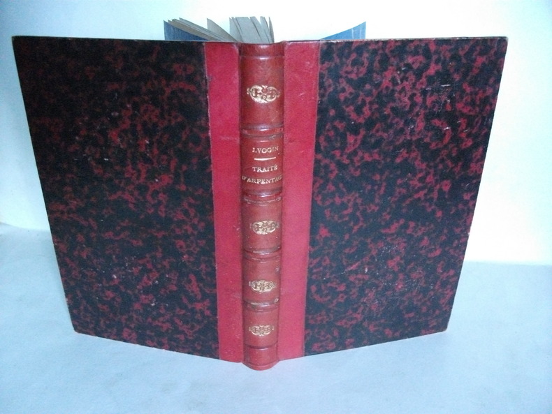
VOGIN J.
traité pratique d’arpentage à l’usage des cours d’adultes et des écoles primaires.
Contenant des surfaces et des volumes,le levé des plans, le partage des terrains, le nivellement In 12 demi-cuir rouge à nerfs,titre,fers dorés,filets à froid.Faux-titre,titre, 277 pages,313 figures dans le texte,complet des 4 planches dépliantes en fin de volume LEPAGNEZ libraire éditeur à Vesoul(Haute-Saône)1870.Rousseurs éparses habituelles,plus fortes en début et fin de volume
Référence libraire : 4914
|
|
|
W. & L.E. GURLEY (manufacturers)
Gurley's Manual - A Manual of the Principal Instruments used in American Engineering and Surveying
New-York, W. & L.E. Gurley, 1893. 30e année de parution. In-16 cartonné, 378 p. Edition en anglais. Très nombreuses illustrations. Très bon état.Catalogue publicitaire de présentation des produits mis en vente par cette société.
Référence libraire : 3768
|
|
|
W. H. Irvine
Surveying for Construction
<p>Very good throughout with minimal signs of use minor corner bumps to covers and corner crease front lower right cover. Name to inside front cover no other inscriptions or markings and not price clipped.</p> McGraw-Hill Book Company (UK) Limited paperback
Référence libraire : biblio1188

|
|
|
West Texas Electrical Log Service and Schlumberger Well Surveying Company.
Cree Drilling Company Inc. W. L. Witherspoon Estate # 1 Well Wildcat Nolan County Texas. Schlumberger Electrical Log SP and Resistivity.
Schlumberger Well Surveying Corporation. 1954. Print. Very Good. No Binding. Folded Well Log / Electrical Log SP and Resistivity; With Note - This is Not a Complete Reproduction of the Original Log; Depth Reached = 7501'; Feet Measured = 6059'; in very good condition. . Schlumberger Well Surveying Corporation. unknown
Référence libraire : 018661
|
|
|
West Texas Electrical Log Service and Schlumberger Well Surveying Company.
Ryan - Hays & Burke Honolulu Oil Corporation Fillingim # 1 Wildcat Yoakum County Texas. Schlumberger Electrical Log SP and Resistivity.
Schlumberger Well Surveying Corporation. 1952. Print. Very Good. No Binding. Folded Well Log / Electrical Log SP and Resistivity; With Note - This is Not a Complete Reproduction of the Original Log; Records 4 Runs 8/11/52 10/28/52 11/5/52 and 11/24/52; Depth Reached and Feet Measured on Each Run include # 1 4637'; 4184' # 2 10791'; 6154'; # 3 11008'; 217' and # 4 11506'; 498'; in very good condition. . Schlumberger Well Surveying Corporation. unknown
Référence libraire : 018660
|
|
|
West Texas Electrical Log Service and Schlumberger Well Surveying Company.
Sinclair Oil & Gas Company Vera Van # 1 Well Wildcat Yoakum County Texas. Schlumberger Induction - Electrical Log.
Schlumberger Well Surveying Corporation. 1963. Print. Very Good. No Binding. Folded Well Log / Induction - Electrical Log; Top Log Interval = 4623'; Bottom Log Interval = 1200'; in very good condition. . Schlumberger Well Surveying Corporation. unknown
Référence libraire : 019013
|
|
|
West Texas Electrical Log Service and Schlumberger Well Surveying Company.
Southern Minerals Corporation R. E. Althof No. 1 Well Wildcat Nolan County Texas. Schlumberger Borehole Compensated Sonic Log - Gamma Ray.
Schlumberger Well Surveying Corporation. 1967. Print. Very Good. No Binding. Folded Well Log / Borehole Compensated Sonic Log - Gamma Ray; Top Logged Interval = 408'; Bottom Logged Interval = 7201'; in very good condition. . Schlumberger Well Surveying Corporation. unknown
Référence libraire : 018658
|
|
|
West Texas Electrical Log Service and Schlumberger Well Surveying Company.
Southern Minerals Corporation R. E. Althof No. 1 Well Wildcat Nolan County Texas. Schlumberger Dual Induction - Laterolog.
Schlumberger Well Surveying Corporation. 1967. Print. Very Good. No Binding. Folded Well Log / Dual Induction - Laterolog; Top Logged Interval = 410'; Bottom Logged Interval = 7207'; in very good condition. . Schlumberger Well Surveying Corporation. unknown
Référence libraire : 018659
|
|
|
West Texas Electrical Log Service and Schlumberger Well Surveying Company.
Southern Minerals Corporation R. E. Althof No. 1 Well Wildcat Nolan County Texas. Schlumberger Microlog with Caliper.
Schlumberger Well Surveying Corporation. 1967. Print. Very Good. No Binding. Folded Well Log / Microlog with Caliper; Top Logged Interval = 4000'; Bottom Logged Interval = 7210'; in very good condition. . Schlumberger Well Surveying Corporation. unknown
Référence libraire : 018657
|
|
|
West Texas Electrical Log Service and Schlumberger Well Surveying Company.
Warren Petroleum Corp Oil Div. Mary O. Clayton # 1 Well Wildcat Yoakum County Texas. Schlumberger Electrical Log SP and Resistivity.
Schlumberger Well Surveying Corporation. 1956. Print. Very Good. No Binding. Folded Well Log / Electrical Log SP and Resistivity; With Note - This is Not a Complete Reproduction of the Original Log; Depth Reached = 11483'; Feet Measured = 6777'; in very good condition. . Schlumberger Well Surveying Corporation. unknown
Référence libraire : 018769
|
|
|
YUNNAN PROVINCIAL BUREAU OF SURVEYING..
昆明导游图. Kunming dao you tu. Kunming Tourist Map.
No place of publication.: 广东省地图出版社.Guangdong sheng di tu chu ban she. 2nd Edition 2nd Printing. 1988. Colour folding tourist maps and transportation maps of Kunming Yunnan Province printed double sided. One side includes: seven birds-eye view maps of tourist attractions in Kunming two small maps of Kunming including surrounding region and 仙桥溶洞 "Xianqiao Karst Cave" and one photograph of Kunming CBD. On reverse: "Map of Kunming Municipal Transportation" scale not given accompanied by timetables of buses running within the city and around neighbouring regions upper right section and phone numbers of public services lower right section. Stamp of a prior dealer in Guangzhou signs of little worn on folds and corners otherwise good. Text in Chinese. Sheet measures 36.7 x 51.5cm. . 广东省地图出版社.[Guangdong sheng di tu chu ban she]. unknown
Référence libraire : 137006
|
|
|
Zhejiang Surveying and Mapping and Geographic Information Bureau
Zhejiang Old AtlaChinese EditionOld-Used
hardcover. New. Ship out in 2 business day And Fast shipping Free Tracking number will be provided after the shipment.2011. Hardcover. Book Condition: New. 1st Edition. Language :Chinese. Satisfaction guaranteedor money back. hardcover
Référence libraire : ZA8136 ISBN : 7503158980 9787503158988
|
|
|
Zhejiang Surveying and Mapping and Geographic Information Bureau
Zhejiang Old AtlasChinese Edition
paperback. New. Ship out in 2 business day And Fast shipping Free Tracking number will be provided after the shipment.Paperback. Language: Chinese. Satisfaction guaranteedor money back. paperback
Référence libraire : 105979 ISBN : 7503158980 9787503158988
|
|
|
Zhejiang Surveying and Mapping and Geographic Information Bureau
Zhejiang Old AtlasChinese Edition
paperback. New. Ship out in 2 business day And Fast shipping Free Tracking number will be provided after the shipment.Paperback. Language: Chinese. Satisfaction guaranteedor money back. paperback
Référence libraire : 098278 ISBN : 7503158980 9787503158988
|
|
 Recevoir par e-mail
 Télécharger en PDF
 Flux RSS
