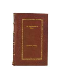
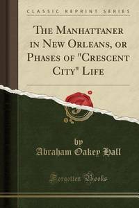
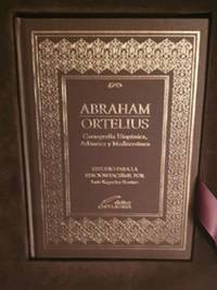
2018. Full Leather Bound. NEW. Size: 14.60 x 22.86 cms A Unique Premium Leather-Bound book for elite readers/collectors of old rare books. An Original Leather is being used for binding this book with Golden Leaf Printing and designing on Spine front and Back of the book with edge gilding. WE HAVE MULTIPLE OPTIONS IN COLOR OF LEATHER RED GREEN BLUE MAGENTA TAN PURPLE DEEP BROWN BLACK AND WITH DIFFERENT COLOR LABELS. YOU MAY CHOOSE ANY COLOR OF YOUR CHOICE AND MAIL US. This service is chargeable. Original edition was published in 1851 and this unique edition is Reprinted in 2018 with the help of original edition. Black & white printing on high quality natural shade paper with sewing binding for longer life professionally processed without changing its contents. As these are old books we processed each page manually on computer and make them readable. We give our best to give you the best book but in some cases we have to adjust few pages which are blur or missing or black spots. If it is multi volume set then it is only single volume. We hope that you understand these issues in these old treasure. This is an important book for the readers who want to know more about our old treasure. Our dedicated team is trying to bring these rare books back to the shelves. We are also giving service of printing the hard-to-find books which are not listed in our store. Hope you will like it and give your comments and suggestions. Lang: - English Pages 204. Product Disclaimer: Please be aware that because leather is a natural material slight discoloration or change in texture may be visible. FOLIO EDITION Size 12x19 Inches IS ALSO AVAILABLE ON REQUEST. hardcover
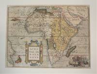
Antwerp Belgium 1570. Very Good age toning. Notes: Map of Africa Continent by Abraham Ortelius published in Theatrum Orbis Terrarum <br>Latin Text on verso. Size : 367x495 mm 14.45x19.49 Inches Coloring: Original Hand Coloring Reference: Marcel P. R. van den Broecke #8.<br><br> Category: Maps Africa Continent; unknown
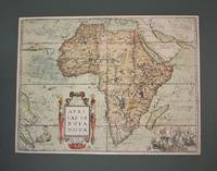
Antwerp Belgium 1570. Very Good age toning. . Notes: Map of Africa Continent by Abraham Ortelius published in Theatrum Orbis Terrarum<br>Latin Text on verso. Size : 378x507 mm 14.88x19.96 Inches Coloring: Original Hand Coloring Reference: Marcel P. R. van den Broecke #8. Category: Maps Africa Continent; unknown
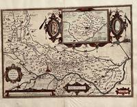
Antwerp: Abraham Ortelius 1584. 19 1/4. x 13 1/2 inches. Very good condition but for the scraped of nude of a woman leaving a thin paper with small hole. This is a 1584 map of the area around Cremona Italy. The map has a large cartouche. In this case the nude statue of a woman has been scraped of with the loss of paper. /It obviously offend the sensibilities of the clerics from which this map was sourced. A very nice map it has a high profile illustration of Cremona. The River Po is well illustrated in this map. There is a bounty of small towns proximate to this city. Abraham Ortelius unknown
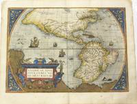
Antwerp 1592. Very Good. Notes: Latin text on verso. L5. <br><br>A highly decorative map of the Americas. It is considered as the most beautiful map of the Western Hemisphere of the 16th century with a bulge on the coast of South America.<br>This map of the Americas by Ortelius came to be one of the most influential maps of this area having a large impact on European perspectives of the new continent. Ortelius was able to obtain cartographic information from both Spanish and Portuguese sources. From the Theatrum Orbis Terrarum by Abraham Ortelius which was the first atlas produced that uniformly covered the world with similarly sized and styled maps. Burden 39.<br><br><br><br><br><br> Size : 362x500 mm 14.25x19.69 Inches Coloring: Original Hand Coloring Reference: Burden 39. Van Den Broecke #11. Category: Maps North America; Maps South America Continent; unknown
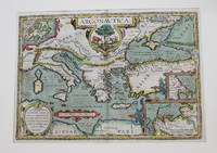
Antwerp c.1606. Very Good. Notes: English text on verso. Size : 341x495 mm 13.43x19.49 Inches Coloring: Original Hand Coloring Reference: Van den Broecke 226. Category: Maps Mediterranean Sea; Maps Asia Near East Turkey; Maps Europe Greece Macedonia; Maps Europe Italy; unknown
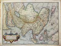
Antwerp 1575. Very Good with some expert restoration on the two corners of the lower margin not affecting the map. Notes: Latin Text on verso.<br>From Theatrum Orbis Terrarum Atlas Ortelius's influential map of continental Asia after Gastaldi. "While the Mediterranean coastline and the southern coastline of Asia are fairly accurate the eastern and northern coastlines are erroneous. Especially the north-western parts with the Japanese island group is quite mis-presented. Also many errors in placenames e.g. Meppo for Aleppo. . There is no doubt about the Italian source for this map viz. Gastaldi." Brandmair. Size : 372x492 mm 14.65x19.37 Inches Coloring: Original Hand Coloring Reference: Van Den Broecke #7. Category: Maps Asia Continent; unknown
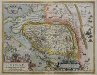
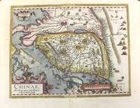
<p>hand-coloured copper engraving. verso: Spanish text. EXTREMELY RARE.</p><p>The first European map of China appeared in Abraham Ortelius's atlas " Theatrum Orbis Terrarum" showing the area of Canton Mindanao no Luzon some islands to the North but only CuboCebu is marked and part of Japan – Spanish edition. An extremely important map for the Philippines here in the first state: there is no indication yet of' 'Las Philippinas' as will be shown later in the second state on the long elongated island just north of Borneo in the position and orientation of Palawan but apparently not based on Spanish knowledge.<br />Ortelius was a notable Dutch cartographer and the publication of this atlas in 1570 marked an epoch in the history of cartography. It was the first uniformly sized systematic collection of maps of the countries of the world based only on contemporary knowledge since the days of Ptolemy & in that sense may be called the first modern atlas; although that term itself was not used until 20 years later by Mercator. The Theatrum was re-issued in 42 editions with 5 supplements with text in Latin Dutch German French Spanish Italian & English between the years 1570-1612. The protrusion of a Southern landmass initially called 'Beach' by Marco Polo is shown South of "Java Major" alluding to Australia. Reference: Tooley Mapmakers S.38; Koeman III Ort 29 B; Walter Japan Nr. 11F; Karrow Mapmakers Nr. 1/152; Landmarks of Mapmaking pict. p. 21; Phillips Atlases 396; OAG Japan a cartographic vision pl. 11F; Suárez: Early Mapping… p. 170-1; Karrow Mapmakers p. 479; Lietz Insulae Indiae Orientalis 36th IMCoS Symposium Manila 2018 Gallery of Prints & Ayala Museum p.12.</p><p>Condition: Very good.</p> published in Antwerp.
Antwerp 1612. Very Good. Notes: Italian text on verso wide margins. <br>The first map of China to appear in a Western atlas with decorative cartouches.<br>The map is based on the work of Jorge de Barbuda a Portuguese Jesuit also known as Ludovicus Georgius whose manuscript map reached Ortelius by way of Arias Montanus. <br><br> Size : 365x470 mm 14.37x18.50 Inches Coloring: Original Hand Coloring Reference: Marcel P. R. van den Broecke #164 Category: Maps Asia Far East China; unknown
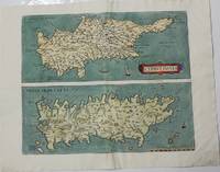
Netherlands c.1573. Very Good. Notes: Latin text on verso. Size : 362x433 mm 14.25x17.05 Inches Coloring: Hand Colored Category: Maps Mediterranean Islands; unknown
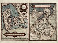
Antwerp: Abraham Ortelius 1584. 9 3/4 x 13 1/4 inces Oleburg is 9 3/4 x 13 1/4 inches total including gutter is 19 5/8 x 13 1/4 inches. Very good condition. There are two well composed maps for the viewer to behold. Denmark in its entiretyy. It fingers into the ocean with several islands to the East. Further east is the nation of Sweden. The map with Oldenburg is detailed given the proximity to simple Frisia Orien Pares. Prominently shown is Bremen Episcoc. with the town on the extreme right. This is the epitome of the map makers art. Abraham Ortelius unknown
Antwerp Belgium 1612. Very Good. Notes: Latin text on verso.<br>Antioch on the Orontes was a Hellenistic city by the Orontes River. Its ruins lie near the current city of Antakya Turkey to which the ancient city lends its name. Size : 366x486 mm 14.41x19.13 Inches Coloring: Hand Colored Reference: Marcel P. R. van den Broecke #232 Category: Maps Asia Near East Turkey; unknown
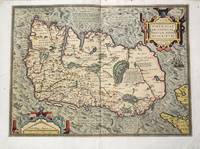
Antwerp c.1581. Very Good backed on old paper. Notes: First separate printed map of Ireland by Ortelius in his "Theatrum Orbis Terrarum".<br> Size : 350x478 mm 13.78x18.82 Inches Coloring: Original Hand Coloring Reference: Van den Broecke #22. Category: Maps Europe Ireland; unknown
St. Louis Mo: Roy Wenzlick & Co. 1951. Reprint . No Binding. Near Fine. Single Sheet 15 1/4" X 21 1/8" With Explanatory Text On Reverse About Abraham Ortelius Etc. Undated Facsimile But Wenzlick Copyrighted A Similar Reprint In 1951. <br/> <br/> Roy Wenzlick & Co. unknown
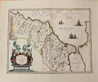
Amsterdam c.1636. Very Good. Notes: Decorative map of Morocco based on Abraham Ortelius map of Northwest Africa. It is oriented with north to the right and including the Strait of Gibraltar. Fine early map of Morocco showing large fortified towns of Marakesh Taradante and Fez.<br> Size : 388x502 mm 15.28x19.76 Inches Coloring: Original Hand Coloring Category: Maps Africa North; unknown

 Ricevere i risultati per e-mail
 Scaricare i risultati in PDF
 RSS feed
 Link
Link