|
|
|
ZAKARI MAIKOREMA
CONTRIBUTION A L'HISTOIRE DES POPULATIONS DU SUD-EST NIGERIEN, LE CAS DU MANGARI (XVIe-XIXe SIECLES)
Institut de Recherches en Sciences Humaines, Niamey. 1985. In-8. Broché. Bon état, Couv. convenable, Dos satisfaisant, Intérieur frais. 246 pages. Illustré de nombreux dessins et cartes en noir et blanc hors texte. Etiquette de code sur le dos. Annotations en pages de garde et de titre.. . . . Classification Dewey : 966-Afrique occidentale
Bookseller reference : RO40182542

|
|
|
ZAKARI MAIKOREMA
CONTRIBUTION A L'HISTOIRE DES POPULATIONS DU SUD-EST NIGERIEN, LE CAS DU MANGARI (XVIe-XIXe SIECLES)
ISBN : 2859210539. Institut de Recherches en Sciences Humaines, Niamey. 1985. In-8 Carré. Broché. Bon état. Couv. convenable. Dos satisfaisant. Intérieur frais. 246 pages. Illustré de nombreux dessins et cartes en noir et blanc hors texte. Etiquette de code sur le dos. Annotations en pages de garde et de titre. 'Etudes Nigériennes', n° 53. Les marches septentrionales du Bornu: Le peuplement. Entre le Bornu et les Twaregs: les marches septentrionales du Bornu pendant les XVIe-XVIIIe siècles...

|
|
|
ZALIO Michel
Bivouac africain.
Grauhlet (France, Tarn), Imprimerie Escoubiac, 2000. 31 x 25, 204 pp., très nombreuses illustrations en couleurs, reliure d'édition carton imprimé + jaquette, très bon état.
Bookseller reference : 97249
|
|
|
Zameenzad, Adam
Das 13. Haus.
Stuttgart., Klett-Cotta Verlag., 1991. Aus dem Englischen von Wolfgang Krege. 293 Seiten. Zustand: Die Ränder des Schutzumschlags sind leicht berieben, Das Buch ist in gutem Zustand. 8°. OPappband mit OUmschlag.
Bookseller reference : 056298
|
|
|
Zameenzad, Adam
My friend matt and hena the whore.
London, Fontana, 1989. Softcover, 270 pp. / Broschiert, kl. 8°, 270 S.; -light wear to cover, back and edges, inside very good condition / Einband, Buchrücken und Ecken leicht bestoßen und mit Knick, innen sehr guter Zustand.
Bookseller reference : 3118
|
|
|
ZAMIR Ali
Anguille sous roche
Le Tripode, 2017, 265 pp., broché, tranches jaunies, bon état.
|
|
|
ZAMMARANO Vittorio Tedesco
Azanagò non pianse. Romanzo d'Africa.
In 16°, brossura editoriale figurata a colori (Cisari), pp. 275 (1). Ediz. orig.
|
|
|
Zammarano Vittorio Tedesco
Hic Sunt Leones - un anno di esplorazioni e di caccia in Somalia
in 8° bella tela edit illustrata a colori, pp.402(2) - ritratto in antiporta dell' autore con 232 illustrazioni, 2 bicromie e 6 carte geografiche - viaggio sotto gli auspici della R. Società Geografica e del ministero delle colonie
|
|
|
Zammarano Vittorio Tedesco
Hic Sunt Leones. Un anno di esplorazione di caccia in Somalia. Viaggio compiuto sotto gli auspici della R. Società Geografica e del Ministero delle Colonie.
Bellissima leg. t. tela blu con ill.ne a vivaci colori, in-8 grande, pp. X-(2)-312-(2), 245 ill.ni, 2 bicromie e 3 carte geografiche. Uno dei capisaldi delle pubblicazioni di caccia grossa in Africa. All'angolo basso destro del vol. traccia evidente di aggressione da acqua, ma danno limitato a cm. 1x2 anche se su tutte le pp., l'interno è in ottime condizioni.
|
|
|
ZAMMARANO Vittorio Tedesco.
Alle sorgenti del Nilo Azzurro.
In-8°, legatura in cartonato editoriale, pp.356, con 208 illustrazioni intercalate al testo e 5 cartine geografiche fuori testo, ritratto fotografico dell'autore all'antiporta. Dorso parzialmente staccato ma senza perdite.

|
|
|
Zammarano, Vittorio Tedesco
Azanagò non pianse. Romanzo d'Africa.
<p>19 cm, brossura editoriale illustrata da Giulio Cisari, p. 275.</p>

|
|
|
ZAMPONI FLORIDO
Storia delle antiche monarchie e popoli d'Affrica e d'Asia con una breve notizia sui primitivi abitatori del Mondo. Volume unico illustrato da 40 figure
Cm. 19; pp. XV, 204. Brossura editoriale a stampa. Illustrazioni nel testo. Rinforzo al dorso e all'interno della copertina con striscia di carta adesiva. Dedica autografa dell'autore all'occhietto 16530
|
|
|
ZANABONI GIORGIO
LA FUGA DI TAFARI.
Prima edizione. In 16mo, cm. 12,5x18h; pag. 192, con numerose illustrazioni fotografiche fuori testo. Mezza tela coeva, buona la conservazione. Codice inv.1029388 5/5d
|
|
|
Zancon Pietro
L'Africa Settentrionale
RARITA’ CARTOGRAFICA Sconosciuta piccola carta geografica con imprint di Giacomo Zatta e data 1794, appartenente a un non documentato atlante in miniatura dal titolo “Atlante tascabile per le dame”, suddiviso in tre tomi, stampati “IN VENETIA Presso G. Zatta”, senza data ma circa 1795. Si tratta di carte da visita – con un apposito spazio bianco dove apporre il proprio nome – dove compare l’imprint o di Pietro Zancon (accompagnato dalla data 1794) o di Giacomo Zatta (con data 1794 o 1795), che, come si legge sul frontespizio, risulta l’editore dell’opera. Possiamo ipotizzare che la serie, iniziata da Zancon fu poi terminata dallo Zatta. Sulla carta dell’Italia – presumibilmente la prima tavola dell’opera – compare stampato il nome di Chiara Minelli Rota, nobildonna veneziana che sposò Antonio Rota nel 1794; tutte le restanti 65 carte recano lo spazio bianco privo di nome. In precedenza, le carte erano note solo attraverso una serie, priva di imprint editoriale, venduta 21 anni fa (1999) dall’Antiquariaat Haas di Bedburg Hau; parlando con Stephan Haas, la serie, priva di titolo e dati editoriali si componeva di 70 mappe. Le carte furono vendute separatamente sotto il nome di G. Bonatti, firma dell’incisore che si trova nella carta della Francia. In seguito, le tavole furono attribuite a Pietro Zaricen da Geoffrey King (cfr. Miniature Antique Maps, p. 181). Il nome dello Zaricen viene dedotto dalla carta della contea del Roussillon, che reca l’iscrizione “Venezia 1794 App.o P. Zancon”, letto erroneamente come Zaricen. Lajos Szantai include la carta dell’Ungheria nella sua cartobibliografia, traducendo il nome dell’autore in Zancen (cfr. Atlas Hungaricus 1528-1850). Sempre King, che non menziona nessuna carta firmata da Zatta, sostiene che “About the turn of the century a signed card of the first edition, with a map of the province of Roussillon in the south of France, was seen at an Ephemera Society Fair in London”. Questo esemplare sembrerebbe oggi quello conservato alla Yale University Library [1978 351], che lo descrive composto da 70 carte geografiche. Non sappiamo se sia il numero totale delle mappe, e l’assenza di un indice o dell’elenco non consente di stabilire l’esatto numero delle carte che lo compongono. http://hdl.handle.net/10079/bibid/3611852Confrontando le carte erroneamente attribuite allo Zaricen ci si accorge che la lastra è abrasa in corrispondenza della firma di Zancon o Zatta. Molto scarse sono le notizie sulle carte che possiamo ora definire “ex Zaricen”. Jason Hubbard nella sua bibliografia recente sulle carte del Giappone raffigura la carta priva dell’imprint “App.o G. Zatta” attribuendola - sulla base delle informazioni bibliografiche finora note – a Giuseppe Bonatti e Pietro Zaricen: “This is one of the 70-odd geographical cards, printed on one side only, acquired by the Haas brothers in 1999. The cards cover countries around the world and include detailed map of Italian provinces. The card with the map of France carries the inscription: G. Bonatti fece; and it is presumed that Bonatti engraved all of them although this is questioned by King” (cfr. J. Hubbard, Japoniae Insulae, n. 124). Il nostro esemplare della carta della Francia, che reca l’imprint “Venezia 1794, App.o P. Zancon” reca in basso a destra la firma di Bonatti sopra menzionata. Dunque, l’unica differenza tra questa serie di sconosciute carte sembra essere la presenza degli imprint editoriali di Zancon e Zatta, accompagnati dalla data 1794 o 1795. Giuseppe Bonatti è menzionato da V. Valerio nella qualità di incisore cresciuto alla scuola Remondini di Bassano, autore di alcune carte per l’atlante di Pazzini Carli (Siena, 1788-1800) e per l’Atlante Geografico di Carlo Antonio Barbiellini (Milano, 1807). Dal 1809 in poi lavorò come incisore per il Deposito della Guerra di Milano (cfr. V. Valerio, Cartografi Veneti, p. 153). Pietro Zancon era, assieme ... A GREAT RARITY Unknown small map with imprint by Giacomo Zatta and date 1794, belonging to an undocumented miniature atlas entitled “Atlante tascabile per le dame” (Pocket Atlas for ladies), divided into three volumes, printed "IN VENETIA Presso G. Zatta", undated but about 1795. A rare set of visiting cards published in Italy features pretty little maps of all parts of the world - with a special white space where to put your name - where the imprint appears or of Pietro Zancon (accompanied by the date 1794) or Giacomo Zatta (with the date 1794 or 1795), who, as can be read on the title page, is the publisher of the whole Atlas. We can speculate that the series, started by Zancon was later terminated by Zatta. On the map of Italy is printed - presumably the first map of the work - the name of Chiara Minelli Rota, Venetian noblewoman who married Antonio Rota in 1794; all remaining 65 maps bear the blank space without names. Previously, the maps were known only through a series, without editorial imprint, sold 21 years ago (1999) by the Antiquariaat Haas of Bedburg Hau; speaking with Stephan Haas, the series, without title and printing details, consisted of 70 maps. The maps were sold separately under the name of G. Bonatti, the engraver's signature found on the map of France. Later, the plates were attributed to Pietro Zaricen by Geoffrey King (see Miniature Antique Maps, p. 181). The name of Zaricen is derived from the Roussillon county map, which bears the inscription "Venice 1794 App.o P. Zancon", incorrectly read as Zaricen. Lajos Szantai includes the map of Hungary in his cartobibliography, translating the author's name into Zancen (see Atlas Hungaricus 1528-1850). Always King, who does not mention any map signed by Zatta, said: "About the turn of the century a signed card of the first edition, with a map of the province of Roussillon in the south of France, was seen at an Ephemera Society Fair in London ". This copy would seem to be the one preserved in the Yale University Library [call number 1978 351], which describes it as being composed of 70 maps. We do not know if it is the total number of maps, and the absence of an index or list does not allow to establish the exact number of maps. http://hdl.handle.net/10079/bibid/3611852 Comparing the maps erroneously attributed to Zaricen one realizes that the plate is erased in correspondence with the signature of Zancon or Zatta. There are very little information on the maps, that we can now define as "ex Zaricen". Jason Hubbard in his recent bibliography on the maps of Japan depicts the map without the imprint "App.o G. Zatta" attributing it - on the basis of the bibliographic information so far known - to Giuseppe Bonatti and Pietro Zaricen: “This is one of the 70-odd geographical cards, printed on one side only, acquired by the Haas brothers in 1999. The cards cover countries around the world and include detailed map of Italian provinces. The card with the map of France carries the inscription: G. Bonatti fece; and it is presumed that Bonatti engraved all of them although this is questioned by King” (cf. J. Hubbard, Japoniae Insulae, n. 124). Our copy of the map of France, which bears the imprint "Venice 1794, App.o P. Zancon", also shows the signature of Bonatti mentioned at the bottom right. Therefore, the only difference between this series of unknown maps seems to be the presence of the addresses of Zancon and Zatta, accompanied by the date 1794 or 1795. Giuseppe Bonatti is mentioned by V. Valerio as an engraver raised at the Remondini school in Bassano, author of some maps for the atlas of Pazzini Carli (Siena, 1788-1800) and for the geographical atlas of Carlo Antonio Barbiellini (Milan, 1807). From 1809 onwards he worked as an engraver for the Milan Deposito della Guerra (see V. Valerio, Cartografi Veneti, p. 153). Pietro Zancon was, together with the most famous brother Gaetano, a native engraver of Bassano del Grappa, who grew up at the Remondini prin...

|
|
|
Zancon Pietro
L'Egitto
RARITA’ CARTOGRAFICA Sconosciuta piccola carta geografica con imprint di Giacomo Zatta e data 1794, appartenente a un non documentato atlante in miniatura dal titolo “Atlante tascabile per le dame”, suddiviso in tre tomi, stampati “IN VENETIA Presso G. Zatta”, senza data ma circa 1795. Si tratta di carte da visita – con un apposito spazio bianco dove apporre il proprio nome – dove compare l’imprint o di Pietro Zancon (accompagnato dalla data 1794) o di Giacomo Zatta (con data 1794 o 1795), che, come si legge sul frontespizio, risulta l’editore dell’opera. Possiamo ipotizzare che la serie, iniziata da Zancon fu poi terminata dallo Zatta. Sulla carta dell’Italia – presumibilmente la prima tavola dell’opera – compare stampato il nome di Chiara Minelli Rota, nobildonna veneziana che sposò Antonio Rota nel 1794; tutte le restanti 65 carte recano lo spazio bianco privo di nome. In precedenza, le carte erano note solo attraverso una serie, priva di imprint editoriale, venduta 21 anni fa (1999) dall’Antiquariaat Haas di Bedburg Hau; parlando con Stephan Haas, la serie, priva di titolo e dati editoriali si componeva di 70 mappe. Le carte furono vendute separatamente sotto il nome di G. Bonatti, firma dell’incisore che si trova nella carta della Francia. In seguito, le tavole furono attribuite a Pietro Zaricen da Geoffrey King (cfr. Miniature Antique Maps, p. 181). Il nome dello Zaricen viene dedotto dalla carta della contea del Roussillon, che reca l’iscrizione “Venezia 1794 App.o P. Zancon”, letto erroneamente come Zaricen. Lajos Szantai include la carta dell’Ungheria nella sua cartobibliografia, traducendo il nome dell’autore in Zancen (cfr. Atlas Hungaricus 1528-1850). Sempre King, che non menziona nessuna carta firmata da Zatta, sostiene che “About the turn of the century a signed card of the first edition, with a map of the province of Roussillon in the south of France, was seen at an Ephemera Society Fair in London”. Questo esemplare sembrerebbe oggi quello conservato alla Yale University Library [1978 351], che lo descrive composto da 70 carte geografiche. Non sappiamo se sia il numero totale delle mappe, e l’assenza di un indice o dell’elenco non consente di stabilire l’esatto numero delle carte che lo compongono. http://hdl.handle.net/10079/bibid/3611852Confrontando le carte erroneamente attribuite allo Zaricen ci si accorge che la lastra è abrasa in corrispondenza della firma di Zancon o Zatta. Molto scarse sono le notizie sulle carte che possiamo ora definire “ex Zaricen”. Jason Hubbard nella sua bibliografia recente sulle carte del Giappone raffigura la carta priva dell’imprint “App.o G. Zatta” attribuendola - sulla base delle informazioni bibliografiche finora note – a Giuseppe Bonatti e Pietro Zaricen: “This is one of the 70-odd geographical cards, printed on one side only, acquired by the Haas brothers in 1999. The cards cover countries around the world and include detailed map of Italian provinces. The card with the map of France carries the inscription: G. Bonatti fece; and it is presumed that Bonatti engraved all of them although this is questioned by King” (cfr. J. Hubbard, Japoniae Insulae, n. 124). Il nostro esemplare della carta della Francia, che reca l’imprint “Venezia 1794, App.o P. Zancon” reca in basso a destra la firma di Bonatti sopra menzionata. Dunque, l’unica differenza tra questa serie di sconosciute carte sembra essere la presenza degli imprint editoriali di Zancon e Zatta, accompagnati dalla data 1794 o 1795. Giuseppe Bonatti è menzionato da V. Valerio nella qualità di incisore cresciuto alla scuola Remondini di Bassano, autore di alcune carte per l’atlante di Pazzini Carli (Siena, 1788-1800) e per l’Atlante Geografico di Carlo Antonio Barbiellini (Milano, 1807). Dal 1809 in poi lavorò come incisore per il Deposito della Guerra di Milano (cfr. V. Valerio, Cartografi Veneti, p. 153). Pietro Zancon era, assieme ... A GREAT RARITY Unknown small map with imprint by Giacomo Zatta and date 1794, belonging to an undocumented miniature atlas entitled “Atlante tascabile per le dame” (Pocket Atlas for ladies), divided into three volumes, printed "IN VENETIA Presso G. Zatta", undated but about 1795. A rare set of visiting cards published in Italy features pretty little maps of all parts of the world - with a special white space where to put your name - where the imprint appears or of Pietro Zancon (accompanied by the date 1794) or Giacomo Zatta (with the date 1794 or 1795), who, as can be read on the title page, is the publisher of the whole Atlas. We can speculate that the series, started by Zancon was later terminated by Zatta. On the map of Italy is printed - presumably the first map of the work - the name of Chiara Minelli Rota, Venetian noblewoman who married Antonio Rota in 1794; all remaining 65 maps bear the blank space without names. Previously, the maps were known only through a series, without editorial imprint, sold 21 years ago (1999) by the Antiquariaat Haas of Bedburg Hau; speaking with Stephan Haas, the series, without title and printing details, consisted of 70 maps. The maps were sold separately under the name of G. Bonatti, the engraver's signature found on the map of France. Later, the plates were attributed to Pietro Zaricen by Geoffrey King (see Miniature Antique Maps, p. 181). The name of Zaricen is derived from the Roussillon county map, which bears the inscription "Venice 1794 App.o P. Zancon", incorrectly read as Zaricen. Lajos Szantai includes the map of Hungary in his cartobibliography, translating the author's name into Zancen (see Atlas Hungaricus 1528-1850). Always King, who does not mention any map signed by Zatta, said: "About the turn of the century a signed card of the first edition, with a map of the province of Roussillon in the south of France, was seen at an Ephemera Society Fair in London ". This copy would seem to be the one preserved in the Yale University Library [call number 1978 351], which describes it as being composed of 70 maps. We do not know if it is the total number of maps, and the absence of an index or list does not allow to establish the exact number of maps. http://hdl.handle.net/10079/bibid/3611852 Comparing the maps erroneously attributed to Zaricen one realizes that the plate is erased in correspondence with the signature of Zancon or Zatta. There are very little information on the maps, that we can now define as "ex Zaricen". Jason Hubbard in his recent bibliography on the maps of Japan depicts the map without the imprint "App.o G. Zatta" attributing it - on the basis of the bibliographic information so far known - to Giuseppe Bonatti and Pietro Zaricen: “This is one of the 70-odd geographical cards, printed on one side only, acquired by the Haas brothers in 1999. The cards cover countries around the world and include detailed map of Italian provinces. The card with the map of France carries the inscription: G. Bonatti fece; and it is presumed that Bonatti engraved all of them although this is questioned by King” (cf. J. Hubbard, Japoniae Insulae, n. 124). Our copy of the map of France, which bears the imprint "Venice 1794, App.o P. Zancon", also shows the signature of Bonatti mentioned at the bottom right. Therefore, the only difference between this series of unknown maps seems to be the presence of the addresses of Zancon and Zatta, accompanied by the date 1794 or 1795. Giuseppe Bonatti is mentioned by V. Valerio as an engraver raised at the Remondini school in Bassano, author of some maps for the atlas of Pazzini Carli (Siena, 1788-1800) and for the geographical atlas of Carlo Antonio Barbiellini (Milan, 1807). From 1809 onwards he worked as an engraver for the Milan Deposito della Guerra (see V. Valerio, Cartografi Veneti, p. 153). Pietro Zancon was, together with the most famous brother Gaetano, a native engraver of Bassano del Grappa, who grew up at the Remondini prin...

|
|
|
Zancon Pietro
La Guinea Occidentale
RARITA’ CARTOGRAFICA Sconosciuta piccola carta geografica con imprint di Giacomo Zatta e data 1794, appartenente a un non documentato atlante in miniatura dal titolo “Atlante tascabile per le dame”, suddiviso in tre tomi, stampati “IN VENETIA Presso G. Zatta”, senza data ma circa 1795. Si tratta di carte da visita – con un apposito spazio bianco dove apporre il proprio nome – dove compare l’imprint o di Pietro Zancon (accompagnato dalla data 1794) o di Giacomo Zatta (con data 1794 o 1795), che, come si legge sul frontespizio, risulta l’editore dell’opera. Possiamo ipotizzare che la serie, iniziata da Zancon fu poi terminata dallo Zatta. Sulla carta dell’Italia – presumibilmente la prima tavola dell’opera – compare stampato il nome di Chiara Minelli Rota, nobildonna veneziana che sposò Antonio Rota nel 1794; tutte le restanti 65 carte recano lo spazio bianco privo di nome. In precedenza, le carte erano note solo attraverso una serie, priva di imprint editoriale, venduta 21 anni fa (1999) dall’Antiquariaat Haas di Bedburg Hau; parlando con Stephan Haas, la serie, priva di titolo e dati editoriali si componeva di 70 mappe. Le carte furono vendute separatamente sotto il nome di G. Bonatti, firma dell’incisore che si trova nella carta della Francia. In seguito, le tavole furono attribuite a Pietro Zaricen da Geoffrey King (cfr. Miniature Antique Maps, p. 181). Il nome dello Zaricen viene dedotto dalla carta della contea del Roussillon, che reca l’iscrizione “Venezia 1794 App.o P. Zancon”, letto erroneamente come Zaricen. Lajos Szantai include la carta dell’Ungheria nella sua cartobibliografia, traducendo il nome dell’autore in Zancen (cfr. Atlas Hungaricus 1528-1850). Sempre King, che non menziona nessuna carta firmata da Zatta, sostiene che “About the turn of the century a signed card of the first edition, with a map of the province of Roussillon in the south of France, was seen at an Ephemera Society Fair in London”. Questo esemplare sembrerebbe oggi quello conservato alla Yale University Library [1978 351], che lo descrive composto da 70 carte geografiche. Non sappiamo se sia il numero totale delle mappe, e l’assenza di un indice o dell’elenco non consente di stabilire l’esatto numero delle carte che lo compongono. http://hdl.handle.net/10079/bibid/3611852Confrontando le carte erroneamente attribuite allo Zaricen ci si accorge che la lastra è abrasa in corrispondenza della firma di Zancon o Zatta. Molto scarse sono le notizie sulle carte che possiamo ora definire “ex Zaricen”. Jason Hubbard nella sua bibliografia recente sulle carte del Giappone raffigura la carta priva dell’imprint “App.o G. Zatta” attribuendola - sulla base delle informazioni bibliografiche finora note – a Giuseppe Bonatti e Pietro Zaricen: “This is one of the 70-odd geographical cards, printed on one side only, acquired by the Haas brothers in 1999. The cards cover countries around the world and include detailed map of Italian provinces. The card with the map of France carries the inscription: G. Bonatti fece; and it is presumed that Bonatti engraved all of them although this is questioned by King” (cfr. J. Hubbard, Japoniae Insulae, n. 124). Il nostro esemplare della carta della Francia, che reca l’imprint “Venezia 1794, App.o P. Zancon” reca in basso a destra la firma di Bonatti sopra menzionata. Dunque, l’unica differenza tra questa serie di sconosciute carte sembra essere la presenza degli imprint editoriali di Zancon e Zatta, accompagnati dalla data 1794 o 1795. Giuseppe Bonatti è menzionato da V. Valerio nella qualità di incisore cresciuto alla scuola Remondini di Bassano, autore di alcune carte per l’atlante di Pazzini Carli (Siena, 1788-1800) e per l’Atlante Geografico di Carlo Antonio Barbiellini (Milano, 1807). Dal 1809 in poi lavorò come incisore per il Deposito della Guerra di Milano (cfr. V. Valerio, Cartografi Veneti, p. 153). Pietro Zancon era, assieme ... A GREAT RARITY Unknown small map with imprint by Giacomo Zatta and date 1794, belonging to an undocumented miniature atlas entitled “Atlante tascabile per le dame” (Pocket Atlas for ladies), divided into three volumes, printed "IN VENETIA Presso G. Zatta", undated but about 1795. A rare set of visiting cards published in Italy features pretty little maps of all parts of the world - with a special white space where to put your name - where the imprint appears or of Pietro Zancon (accompanied by the date 1794) or Giacomo Zatta (with the date 1794 or 1795), who, as can be read on the title page, is the publisher of the whole Atlas. We can speculate that the series, started by Zancon was later terminated by Zatta. On the map of Italy is printed - presumably the first map of the work - the name of Chiara Minelli Rota, Venetian noblewoman who married Antonio Rota in 1794; all remaining 65 maps bear the blank space without names. Previously, the maps were known only through a series, without editorial imprint, sold 21 years ago (1999) by the Antiquariaat Haas of Bedburg Hau; speaking with Stephan Haas, the series, without title and printing details, consisted of 70 maps. The maps were sold separately under the name of G. Bonatti, the engraver's signature found on the map of France. Later, the plates were attributed to Pietro Zaricen by Geoffrey King (see Miniature Antique Maps, p. 181). The name of Zaricen is derived from the Roussillon county map, which bears the inscription "Venice 1794 App.o P. Zancon", incorrectly read as Zaricen. Lajos Szantai includes the map of Hungary in his cartobibliography, translating the author's name into Zancen (see Atlas Hungaricus 1528-1850). Always King, who does not mention any map signed by Zatta, said: "About the turn of the century a signed card of the first edition, with a map of the province of Roussillon in the south of France, was seen at an Ephemera Society Fair in London ". This copy would seem to be the one preserved in the Yale University Library [call number 1978 351], which describes it as being composed of 70 maps. We do not know if it is the total number of maps, and the absence of an index or list does not allow to establish the exact number of maps. http://hdl.handle.net/10079/bibid/3611852 Comparing the maps erroneously attributed to Zaricen one realizes that the plate is erased in correspondence with the signature of Zancon or Zatta. There are very little information on the maps, that we can now define as "ex Zaricen". Jason Hubbard in his recent bibliography on the maps of Japan depicts the map without the imprint "App.o G. Zatta" attributing it - on the basis of the bibliographic information so far known - to Giuseppe Bonatti and Pietro Zaricen: “This is one of the 70-odd geographical cards, printed on one side only, acquired by the Haas brothers in 1999. The cards cover countries around the world and include detailed map of Italian provinces. The card with the map of France carries the inscription: G. Bonatti fece; and it is presumed that Bonatti engraved all of them although this is questioned by King” (cf. J. Hubbard, Japoniae Insulae, n. 124). Our copy of the map of France, which bears the imprint "Venice 1794, App.o P. Zancon", also shows the signature of Bonatti mentioned at the bottom right. Therefore, the only difference between this series of unknown maps seems to be the presence of the addresses of Zancon and Zatta, accompanied by the date 1794 or 1795. Giuseppe Bonatti is mentioned by V. Valerio as an engraver raised at the Remondini school in Bassano, author of some maps for the atlas of Pazzini Carli (Siena, 1788-1800) and for the geographical atlas of Carlo Antonio Barbiellini (Milan, 1807). From 1809 onwards he worked as an engraver for the Milan Deposito della Guerra (see V. Valerio, Cartografi Veneti, p. 153). Pietro Zancon was, together with the most famous brother Gaetano, a native engraver of Bassano del Grappa, who grew up at the Remondini prin...

|
|
|
Zancon Pietro
Le Coste di Barbaria
RARITA’ CARTOGRAFICA Sconosciuta piccola carta geografica con imprint di Giacomo Zatta e data 1794, appartenente a un non documentato atlante in miniatura dal titolo “Atlante tascabile per le dame”, suddiviso in tre tomi, stampati “IN VENETIA Presso G. Zatta”, senza data ma circa 1795. Si tratta di carte da visita – con un apposito spazio bianco dove apporre il proprio nome – dove compare l’imprint o di Pietro Zancon (accompagnato dalla data 1794) o di Giacomo Zatta (con data 1794 o 1795), che, come si legge sul frontespizio, risulta l’editore dell’opera. Possiamo ipotizzare che la serie, iniziata da Zancon fu poi terminata dallo Zatta. Sulla carta dell’Italia – presumibilmente la prima tavola dell’opera – compare stampato il nome di Chiara Minelli Rota, nobildonna veneziana che sposò Antonio Rota nel 1794; tutte le restanti 65 carte recano lo spazio bianco privo di nome. In precedenza, le carte erano note solo attraverso una serie, priva di imprint editoriale, venduta 21 anni fa (1999) dall’Antiquariaat Haas di Bedburg Hau; parlando con Stephan Haas, la serie, priva di titolo e dati editoriali si componeva di 70 mappe. Le carte furono vendute separatamente sotto il nome di G. Bonatti, firma dell’incisore che si trova nella carta della Francia. In seguito, le tavole furono attribuite a Pietro Zaricen da Geoffrey King (cfr. Miniature Antique Maps, p. 181). Il nome dello Zaricen viene dedotto dalla carta della contea del Roussillon, che reca l’iscrizione “Venezia 1794 App.o P. Zancon”, letto erroneamente come Zaricen. Lajos Szantai include la carta dell’Ungheria nella sua cartobibliografia, traducendo il nome dell’autore in Zancen (cfr. Atlas Hungaricus 1528-1850). Sempre King, che non menziona nessuna carta firmata da Zatta, sostiene che “About the turn of the century a signed card of the first edition, with a map of the province of Roussillon in the south of France, was seen at an Ephemera Society Fair in London”. Questo esemplare sembrerebbe oggi quello conservato alla Yale University Library [1978 351], che lo descrive composto da 70 carte geografiche. Non sappiamo se sia il numero totale delle mappe, e l’assenza di un indice o dell’elenco non consente di stabilire l’esatto numero delle carte che lo compongono. http://hdl.handle.net/10079/bibid/3611852Confrontando le carte erroneamente attribuite allo Zaricen ci si accorge che la lastra è abrasa in corrispondenza della firma di Zancon o Zatta. Molto scarse sono le notizie sulle carte che possiamo ora definire “ex Zaricen”. Jason Hubbard nella sua bibliografia recente sulle carte del Giappone raffigura la carta priva dell’imprint “App.o G. Zatta” attribuendola - sulla base delle informazioni bibliografiche finora note – a Giuseppe Bonatti e Pietro Zaricen: “This is one of the 70-odd geographical cards, printed on one side only, acquired by the Haas brothers in 1999. The cards cover countries around the world and include detailed map of Italian provinces. The card with the map of France carries the inscription: G. Bonatti fece; and it is presumed that Bonatti engraved all of them although this is questioned by King” (cfr. J. Hubbard, Japoniae Insulae, n. 124). Il nostro esemplare della carta della Francia, che reca l’imprint “Venezia 1794, App.o P. Zancon” reca in basso a destra la firma di Bonatti sopra menzionata. Dunque, l’unica differenza tra questa serie di sconosciute carte sembra essere la presenza degli imprint editoriali di Zancon e Zatta, accompagnati dalla data 1794 o 1795. Giuseppe Bonatti è menzionato da V. Valerio nella qualità di incisore cresciuto alla scuola Remondini di Bassano, autore di alcune carte per l’atlante di Pazzini Carli (Siena, 1788-1800) e per l’Atlante Geografico di Carlo Antonio Barbiellini (Milano, 1807). Dal 1809 in poi lavorò come incisore per il Deposito della Guerra di Milano (cfr. V. Valerio, Cartografi Veneti, p. 153). Pietro Zancon era, assieme ... A GREAT RARITY Unknown small map with imprint by Giacomo Zatta and date 1794, belonging to an undocumented miniature atlas entitled “Atlante tascabile per le dame” (Pocket Atlas for ladies), divided into three volumes, printed "IN VENETIA Presso G. Zatta", undated but about 1795. A rare set of visiting cards published in Italy features pretty little maps of all parts of the world - with a special white space where to put your name - where the imprint appears or of Pietro Zancon (accompanied by the date 1794) or Giacomo Zatta (with the date 1794 or 1795), who, as can be read on the title page, is the publisher of the whole Atlas. We can speculate that the series, started by Zancon was later terminated by Zatta. On the map of Italy is printed - presumably the first map of the work - the name of Chiara Minelli Rota, Venetian noblewoman who married Antonio Rota in 1794; all remaining 65 maps bear the blank space without names. Previously, the maps were known only through a series, without editorial imprint, sold 21 years ago (1999) by the Antiquariaat Haas of Bedburg Hau; speaking with Stephan Haas, the series, without title and printing details, consisted of 70 maps. The maps were sold separately under the name of G. Bonatti, the engraver's signature found on the map of France. Later, the plates were attributed to Pietro Zaricen by Geoffrey King (see Miniature Antique Maps, p. 181). The name of Zaricen is derived from the Roussillon county map, which bears the inscription "Venice 1794 App.o P. Zancon", incorrectly read as Zaricen. Lajos Szantai includes the map of Hungary in his cartobibliography, translating the author's name into Zancen (see Atlas Hungaricus 1528-1850). Always King, who does not mention any map signed by Zatta, said: "About the turn of the century a signed card of the first edition, with a map of the province of Roussillon in the south of France, was seen at an Ephemera Society Fair in London ". This copy would seem to be the one preserved in the Yale University Library [call number 1978 351], which describes it as being composed of 70 maps. We do not know if it is the total number of maps, and the absence of an index or list does not allow to establish the exact number of maps. http://hdl.handle.net/10079/bibid/3611852 Comparing the maps erroneously attributed to Zaricen one realizes that the plate is erased in correspondence with the signature of Zancon or Zatta. There are very little information on the maps, that we can now define as "ex Zaricen". Jason Hubbard in his recent bibliography on the maps of Japan depicts the map without the imprint "App.o G. Zatta" attributing it - on the basis of the bibliographic information so far known - to Giuseppe Bonatti and Pietro Zaricen: “This is one of the 70-odd geographical cards, printed on one side only, acquired by the Haas brothers in 1999. The cards cover countries around the world and include detailed map of Italian provinces. The card with the map of France carries the inscription: G. Bonatti fece; and it is presumed that Bonatti engraved all of them although this is questioned by King” (cf. J. Hubbard, Japoniae Insulae, n. 124). Our copy of the map of France, which bears the imprint "Venice 1794, App.o P. Zancon", also shows the signature of Bonatti mentioned at the bottom right. Therefore, the only difference between this series of unknown maps seems to be the presence of the addresses of Zancon and Zatta, accompanied by the date 1794 or 1795. Giuseppe Bonatti is mentioned by V. Valerio as an engraver raised at the Remondini school in Bassano, author of some maps for the atlas of Pazzini Carli (Siena, 1788-1800) and for the geographical atlas of Carlo Antonio Barbiellini (Milan, 1807). From 1809 onwards he worked as an engraver for the Milan Deposito della Guerra (see V. Valerio, Cartografi Veneti, p. 153). Pietro Zancon was, together with the most famous brother Gaetano, a native engraver of Bassano del Grappa, who grew up at the Remondini prin...

|
|
|
Zanetel Katrib, Rosaria; Hassan Katrib, Gihad.
Parliamo l'arabo. li-natakallam 'laarabiah. Manuale di vocaboli e conversazioni. Italiano-arabo.
<p>14 cm, brossura editoriale con titolo al piatto e dorso, p. 107. Esemplare ben conservato.</p>

|
|
|
ZANETTI -
Gli avvenimenti d'Africa. Entrata di ras Maconnen in Makallè.
Milano, 1899, gennaio 8, bella copertina litografica illustrata a colori in fascicolo originale completo di pp. 8 De “La Tribuna illustrata della Domenica”

|
|
|
ZANETTI -
Il Conte di Torino nell'Eritrea. L'ingresso ad Asmara.
Milano, 1899, ottobre 22, bella copertina litografica illustrata a colori in fascicolo originale completo di pp. 8 De “La Tribuna illustrata della Domenica”

|
|
|
ZANETTI -
Il viaggiatore inglese Lloyd incontra in Africa una popolazione di pigmei.
Milano, 1899, febbraio 26, bella copertina litografica illustrata a colori in fascicolo originale completo di pp. 8 De “La Tribuna illustrata della Domenica”

|
|
|
ZANETTI -
In Africa. Combattimento notturno fra le truppe di Ras Maconnen e quelle di Ras Mangascià.
Milano, 1899, gennaio 22, bella copertina litografica illustrata a colori in fascicolo originale completo di pp. 8 De “La Tribuna illustrata della Domenica”

|
|
|
Zanetti, Lodovico
I Pionieri del Giubaland. Avventure nell'Africa Equatoriale Italiana.
Br., cm14.5x20, pp 130; ill. ft di Calamida. Romanzo d'avventure ambientate nell'Oltregiuba, avente protagonisti il Cap. Enea Barni e il nipote Gianni, ‘appassionati colonialisti’ e ‘dotati di mezzi adeguati’ a viaggiare per l'Africa.

|
|
|
Zannoni, Mario & Fiorentino, Massimo
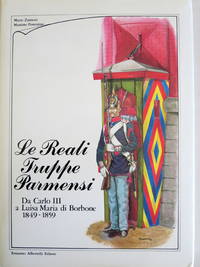
LE REALI TRUPPE PARMENSI DA CARLO III A LUISA MARIA DI BORBONE 1849-1859
Albertelli Editore 1984. First Edition . Hardcover. Very Good/Very Good. Folio - over 12" - 15" tall. 182pp; numerous b/w & col. illus. Text in Italian captions to illus. in Italian and English. Bookplate of a former owner on the blank second free front end paper otherwise an excellent copy. Due to the size/weight of this book an extra shipping charge will apply. <br/> <br/> Albertelli Editore hardcover
Bookseller reference : 172853
|
|
|
ZANON Fernando
Nella terra dell'ebano vivente
alcune macchioline alla brossura ed alla prima ed ultimapagina, per il resto in buonstato
|
|
|
ZANON FERNANDO
NELLA TERRA DELL'EBANO VIVENTE 1934
In 16o, pp. 332, br. Firma autografa dell'autore. Etichetta di estinta biblioteca. Minime fioriture. Ottimo (2871/AFRICA - VIAGGI - ESPLORAZIONI)
|
|
|
ZANON Fernando -
Nella terra dell'ebano vivente.
Trieste, Edizioni CELVI, 1934. 8vo brossura con copertina illustrata, pp. 332. Intonso.

|
|
|
ZANON Fernando.
Nella terra dell’ebano vivente. Trieste, C.E.L.V.I., 1934.
8° p., br. edit. ill. (fioriture ai piatti), pp. 332 - (2).
|
|
|
ZANOTELLI Alex -
Inno alla vita. Il grido dei poveri contro il vitello d'oro.
Bologna, Editrice Missionaria Italiana, 2000, 8vo brossura con copertina illustrata a colori, pp. 128 con un'illustrazione e 9 tavole fotografcihe nel testo.

|
|
|
Zanotelli Alex.
INNO ALLA VITA. Il grido dei poveri contro il vitello d'oro.
(Codice RE/7471) In 8° (21 cm) 128 pp. Brossura originale, come nuovo. ~~~ SPEDIZIONE IN ITALIA SEMPRE TRACCIATA

|
|
|
Zanuck, Darryl F
TUNIS EXPEDITON
DJ with light edgewear and light chipping; Introduction by Damon Runyon. Zanuck was sent with a film unit to document the battles in Northern Africa in the midst of WWII. ; B&W Photographs; 8vo; 160 pages
|
|
|
ZANUSO Arturo -
Il Sud Africa.
Milano, Garzanti, 1943, 8vo brossura con sovraccopertina illustrata, pp. 84 con una carta geografica e 66 tavole fotografiche fuori testo. Piccoli strappetti alla sovraccopertina.

|
|
|
ZANUSO, Arturo
Il Sud Africa
1 Vol. In-8 pag. 84 decine di ill. f.t Front. mancante. O. preziosa in quanto ricca di notizie e documentazione fotografica difficilmente reperibile altrove PROG 2050 CATT_ATT 20
|
|
|
Zanutto Silvio
Bibliografia dell'A.O.I (anni 1936 - 39)
In 8° grande, da pp. 1271 a pp. 1321. Brossura editoriale originale. Anno III/ volume II/ XVIII anno.
|
|
|
ZANUTTO Silvio -
Bibliografia dell'A.O.I. (Anni 1936-39).
Milano, Mondadori, 1940, 8vo grande, brossura, pp. 1271/1321.

|
|
|
ZANUTTO Silvio -
Bibliografia etiopica.
Roma, (1936) 8vo punto metllico, pp. 36

|
|
|
Zanutto Silvio.
Bibliografia Etiopica.
Roma, Arti Grafiche,1936.In 8°pp.54n.bross.edit. sopraccoperta,fioriture sparse.
|
|
|
Zanzani, Ivo
Attraverso l'Africa. Note di un viaggio di 24000 chilometri.
Br. c/sovr., cm17.5x24, pp 206 (2); alcune tavole in nero.

|
|
|
ZAPPA Paolo
I predoni del rio de oro
In-8°, bross,. edit. lievemente danneggiata, pp.322,1. Con ill. fotografiche
|
|
|
ZAPPA PAOLO
L'INTELLIGENCE SERVICE E L'ETIOPIA.
Seconda edizione. In 8vo, cm. 13x19h; pag. 290 (2). Brossura editoriale a due colori, ben conservato. Codice inv.1029285 5/3d
|
|
|
ZAPPA Paolo
La Legione Straniera. Tavole e disegni di P. A. Gariazzo
In-4° (32 x 24 cm), pp. 125, (3), copertina muta in cartoncino, con normali segni d'uso. Oltre alla copertina editoriale, mancano la sovraccoperta e la custodia editoriali. Con 16 tavole fuori testo protette da velina e molte illustrazioni nel testo, disegnate, in bianco e nero, da Pier Antonio Gariazzo. In stato di conservazione molto buono. Edizione di pregio, non comune. Suggestive le tavole, di grande effetto. Dell'opera vennero stampate 500 copie su carta Ingres delle cartiere Pietro Miliani di Fabriano, numerate da 1 a 500, 54 copie su carte di lusso diverse numerate in cifre romane e riservate all'autore e ai suoi amici, 16 copie su carte di lusso diverse con una serie delle tavole acquarellate dall'artista e un disegno originale, contraddistinte con lettere alfabetiche da A ad R. Il presente esemplare è il numero 31 della tiratura in 500 copie. Racconto di un viaggio compiuto dallo Zappa in Marocco, nel 1931, al seguito di una colonna della Legione Straniera, che muoveva verso la regione di Meknès-Tafilalet per stroncare la resistenza degli ultimi indipendentisti marocchini. Così l'autore "Come aiuto del vivandiere, mi fu possibile, alcuni anni or sono, seguire, per circa trecento chilometri lungo la strada del Sud, una colonna della Legione Straniera in marcia verso il Tafilalet". Indice: La strada del Sud; L'azienda della disperazione; Storia della Legione e storielle di legionari; Oi Marì! Oi Marì!; La regola del sette; Anna Maria; Una sera di festa; Teste calde; Disertori davanti alla malinconia; La vita nel "bled"; L'amore nel "bled"; I mercenari della gloria.

|
|
|
Zappa, Paolo
Die Legion marschiert. Als Barmann bei der französischen Fremdenlegion.
Horw (Luzern), Leipzig, 1933. Mit 8 Tafeln nach Originalphotographien. Berechtigte Übertragung aus dem Italienischen von H(elly) Hohenemser-Steglich. Kartonierter Einband mit festem illustrierten Umschlag, Fadenheftung, 196 Seiten, illustriert. Einband lichtgebräunt mit Gebrauchsspuren. Gutes Exemplar. 3. Aufl.
Bookseller reference : 116748

|
|
|
ZATTA Antonio (Venezia 1722 - 1804)
L'Egitto Antico e Moderno
Carta geografica tratta dall’Atlante novissimo, illustrato ed accresciuto sulle osservazioni e scoperte fatte dai più celebri e più recenti geografi. Stampato in quattro volumi da Antonio Zatta tra il 1779 ed il 1785. Atlante fra i più belli e completi mai pubblicati in Italia nel XVIII secolo, l'opera più famosa dello Zatta. L’Atlante Novissimo, come si specifica anche nel titolo, è “accresciuto sulle osservazioni scoperte fatte dai più celebri e più recenti geografi”. Tra le novità più significative vi è la comparsa delle nuove isole scoperte nell'Oceano Pacifico da James Cook e la prima carta italiana della Nuova Zelanda. Le illustrazioni furono ideate e disegnate dai suoi collaboratori Giovanni Marco Pitteri, Anton Friedrich Busching, Pietro Antonio Novelli ed incise da Giuliano Zuliani. Il primo tomo dell’atlante è introdotto da un breve saggio di geografia generale dove l’autore definisce in modo sintetico e preciso gli elementi che compongono i reticoli eclittico ed equatoriale usati nelle tavole. Interessante la sezione dove si sofferma a descrivere il fenomeno della precessione degli equinozi e quello della variazione ciclica dell'obliquità dell'eclittica. Acquaforte, stampata su carta vergata coeva, coloritura coeva dei contorni, in buone condizioni. Decorative map of Egypt from the Red Sea and Nubian Desert to the Mediterranean, showing the course of the Nile to Aswan.Highly detailed and interesting. Decorative title cartouche. Map from the Atlante novissimo, illustrato ed accresciuto sulle osservazioni e scoperte fatte dai più celebri e più recenti geografi. Printed in four volumes by Antonio Zatta between 1779 and 1785. Atlas among the most beautiful and complete ever published in Italy in the eighteenth century, the most famous work of Zatta. The Atlante Novissimo, as also specified in the title, is “increased on the observations made by the most famous and most recent geographers”. Among the most significant innovations there is the appearance of the new islands discovered in the Pacific Ocean by James Cook and the first Italian map of New Zealand. The illustrations were designed and drawn by his collaborators Giovanni Marco Pitteri, Anton Friedrich Busching, Pietro Antonio Novelli and engraved by Giuliano Zuliani. The first volume of the atlas is introduced by a brief essay of general geography where the author defines in a concise and precise way the elements that make up the ecliptic and equatorial grids used in the tables. Interesting is the section where he pauses to describe the phenomenon of precession of the equinoxes and the cyclical variation of the obliquity of the ecliptic. Etching, printed on contemporary laid paper, contemporary outline coloring, in good condition.

|
|
|
ZATTA Antonio (Venezia 1722 - 1804)
Le Coste di Barbaria ovvero i Regni di Marocco, di Fez, di Algeri, di Tunisi, di Tripoli ci Paesi Circonvicini
Carta geografica tratta dall’Atlante novissimo, illustrato ed accresciuto sulle osservazioni e scoperte fatte dai più celebri e più recenti geografi. Stampato in quattro volumi da Antonio Zatta tra il 1779 ed il 1785. Atlante fra i più belli e completi mai pubblicati in Italia nel XVIII secolo, l'opera più famosa dello Zatta. L’Atlante Novissimo, come si specifica anche nel titolo, è “accresciuto sulle osservazioni scoperte fatte dai più celebri e più recenti geografi”. Tra le novità più significative vi è la comparsa delle nuove isole scoperte nell'Oceano Pacifico da James Cook e la prima carta italiana della Nuova Zelanda. Le illustrazioni furono ideate e disegnate dai suoi collaboratori Giovanni Marco Pitteri, Anton Friedrich Busching, Pietro Antonio Novelli ed incise da Giuliano Zuliani. Il primo tomo dell’atlante è introdotto da un breve saggio di geografia generale dove l’autore definisce in modo sintetico e preciso gli elementi che compongono i reticoli eclittico ed equatoriale usati nelle tavole. Interessante la sezione dove si sofferma a descrivere il fenomeno della precessione degli equinozi e quello della variazione ciclica dell'obliquità dell'eclittica. Acquaforte, stampata su carta vergata coeva, coloritura coeva dei contorni, in buone condizioni. Decorative map of the Mediterranean and North Africa, from Gibraltar to Greece and Libya.Includes decorative title cartouche. Map from the Atlante novissimo, illustrato ed accresciuto sulle osservazioni e scoperte fatte dai più celebri e più recenti geografi. Printed in four volumes by Antonio Zatta between 1779 and 1785. Atlas among the most beautiful and complete ever published in Italy in the eighteenth century, the most famous work of Zatta. The Atlante Novissimo, as also specified in the title, is “increased on the observations made by the most famous and most recent geographers”. Among the most significant innovations there is the appearance of the new islands discovered in the Pacific Ocean by James Cook and the first Italian map of New Zealand. The illustrations were designed and drawn by his collaborators Giovanni Marco Pitteri, Anton Friedrich Busching, Pietro Antonio Novelli and engraved by Giuliano Zuliani. The first volume of the atlas is introduced by a brief essay of general geography where the author defines in a concise and precise way the elements that make up the ecliptic and equatorial grids used in the tables. Interesting is the section where he pauses to describe the phenomenon of precession of the equinoxes and the cyclical variation of the obliquity of the ecliptic. Etching, printed on contemporary laid paper, contemporary outline coloring, in good condition.

|
|
|
ZAVATTARI Edmondo -
Il Generale Antonio Baldissera. (Il costruttore della Colonia Eritrea)
Milano, Zucchi, 1935, 16mo mezza tela originale copertina illustrata, pp. 118 con tav. fot. ("La centuria di ferro", 65)

|
|
|
ZAVATTARI Edoardo -
Missione biologica nel paese dei Borana. Vol. I - Condizioni biogeografiche e antropiche.
Roma, Reale Accademia d’Italia, 1940, 8° mezza tela editoriale, pp. 537 con 152 + 15 illustrazioni nel testo e 1 carta ripiegata in fine.

|
|
|
ZAVATTARI Edoardo.
Dal Giuba al lago Rodolfo, missioni scientifiche del centro di studi A. O. I. della Reale Accademia d'Italia, conferenza tenuta alla Reale Accademia d'Italia l'11 Marzo 1940-18
Esemplare perfetto totalmente editoriale Brossura editoriale, pp. 34, in 8°
|
|
|
Zavattari Edoardo.
Nel Golfo di Guinea. Impressioni di viaggio.
Brossura con titolo a stampa, DEDICA dell'autore in copertina. Conferenza tenuta all'Università Popolare di Pavia il 26 febbraio 1926. Sc. A.

|
|
|
Zecchettin Lino.
QUESTIONI AFRICANE. (Tangeri, Tunisia, Confini Sud Tripolitani, Abissinia, I mandati, Transafricane Italiane)
(Codice VF/1048) In 16° 112 pp. Prefazione di P. Vinassa de Regny. Edizione prima e unica. Macchiette. Brossura editorile ingiallita, buono stato. ~~~ SPEDIZIONE IN ITALIA SEMPRE TRACCIATA

|
|
|
Zeeman, Aart
Tot zover Darfur. Pamflet.
Amsterdam/Antwerpen, Querido, 2007. 8°, 43 S., typogr. OBrosch.; (sehr) schönes Expl.
Bookseller reference : 20117AB
|
|
|

 Receive by email
 Download as PDF document
 RSS feed
 Permanent link


