|
SANDRI FETTARAPPA CARLO.
Il periplo dell'Affrica dopo la vittoria.
In 16° (mm 205x140); pagg. 250, con XXXVI illustrazioni fotografiche f.t. Brossura editoriale rossa illustrata. <BR>Suggestiva descrizione di una circumnavigazione del continente africano. Buon esemplare, ancora intonso, con piccole mende alla brossura. <BR>
|
|
|
SANDRI S.
Sei mesi di guerra sul fronte somalo
SANDRI S. Sei mesi di guerra sul fronte somalo. Milano - Roma, Arti Grafiche Bertarelli 1936, In 8°, bross. con mancanza al dorso, pp. 175, 150 foto e una cartina Buono (Good) . <br> <br> <br>
|
|
|
Sandri Sandro.
SEI MESI DI GUERRA SUL FRONTE SOMALO da Mogadiscio a Neghelli. Storia viva scritta combattendo. Fotografie prese dall'autore.
(Codice CO/0923) In 8° (22 cm) 210 pp. Edizione orginale con firma dell'Autore. Con una carta ripiegata e centinaia di foto su 92 tavole fuori testo. Brossura originale. Lieve ingiallitura, ma ottimo volume intonso. ~~~ SPEDIZIONE IN ITALIA SEMPRE TRACCIATA

|
|
|
SANDWIDE Epiphane C.
Histoire de l'Eglise au Burkino Faso : traditio, receptio et re-expressio : 1899-1979
xi + 579pp., 24cm., texte en français, Thèse de Doctorat (Dissertatio ad Doctoratum in Facultate Historiae Ecclesiasticae Pontificiae Universitatis Gregorianae), br.orig. (étiquette au dos), cachet au verso de la p.d.t., texte et intérieur sont frais, poids: 1kg., C110158
|
|
|
Sangare, Afrika
Chroniques du Mangari
paperback. Good. Access codes and supplements are not guaranteed with used items. May be an ex-library book. paperback
Bookseller reference : 9998263778.G ISBN : 9998263778 9789998263772

|
|
|
Sangare, Afrika
Chroniques du Mangari
new. unknown
Bookseller reference : 51056511-n ISBN : 9998263778 9789998263772
|
|
|
Sangare, Afrika
Chroniques du Mangari
like new. unknown
Bookseller reference : 51056511 ISBN : 9998263778 9789998263772
|
|
|
Sangare, Afrika
Le Jouet French Edition
paperback. Good. Access codes and supplements are not guaranteed with used items. May be an ex-library book. paperback
Bookseller reference : 6207813197.G ISBN : 6207813197 9786207813193

|
|
|
Sangare, Oumou
Worotan
World Circuit, 1996. WCD045 CD CD
Bookseller reference : 54331
|
|
|
SANGIORGIO Gaetano
Le colonie italiane in Africa nel passato e nel presente
In 16, pp. 24. Dedica autogr. dell'A. al fr. Intonso. Br. ed.
|
|
|
SANNER, K. W
Die Reise nach Westafrika.
Bargstedt, Sanner, 1986. 1. A. 172 S. Ill. Okt. - Sehr gutes Ex. 1
Bookseller reference : 268005BB
|
|
|
SANNES G.W.
Afrikaanse primitieven - fascinerend !
Amsterdam, Editions Rodopi, 1978, 95pp. (waarvan 50pp.zw/w illustraties)
|
|
|
Sanni, Omotayo (University Of Johannesburg, South Africa) Ukoba, Kingsley (Auckland Park Campus, South Africa) Ren, Jianwei (Uni
Sustainable Corrosion Inhibition Using Agricultural Waste: An Esg Strategy
Taylor & Francis Ltd 2026. Paperback. New. 204 pages. 6.14x0.46x9.21 inches. Taylor & Francis Ltd paperback
Bookseller reference : x-1032578181 ISBN : 1032578181 9781032578187

|
|
|
SANSON Nicolas D’Abeville (Abbeville 1600 - Parigi 1667)
Africa Vetus
Tratta dall'edizione del "Cartes Gènerales de toutes les parties du Monde" curata da Pierre Mariette, edita nel 1663. Sanson era il più famoso cartografo francese della storia moderna, cosmografo al servizio di Luigi XIV, re di Francia; dotò le sue mappe delle più recenti informazioni geografiche e delle incisioni più belle e acute del periodo. Il "Cartes Generales de Toutes les Parties du Monde" rappresenta il più importante prodotto della cartografia commerciale francese del diciassettesimo secolo.Le mappe furono compilate a partire dal 1630 e l'atlante edito per la prima volta nel 1654, stampato da Pierre Mariette. Map of the "Cartes Générales de toutes les parties du Monde"published by Melchior Tavernier & Pierre Mariette. Sanson's map covers Africa in full with adjacent parts of Europe and Arabia represented in part.The maps were compiled by Nicolas Sanson who published his atlas in 1654, with 100 maps, and printed by Pierre Mariette; they were issued progressively from 1630. Sanson was the most noted French cartographer in modern history. Mapmaker to Louis XIV, King of France, Sanson endowed his maps with the most recent geographical information as well as the finest and sharpest engraving of the period. His "Cartes Generales de Toutes les Parties du Monde" was the most important single product of French commercial cartography of the seventeenth century.Copperplate, good condition.Copper engraving, coloring contemporary contours, small tear at the bottom, otherwise in good condition. R. L. Betz "The Mapping of Africa…" (2007), map 79; O. I. Norwich, "Norwich's Maps of Africa", map 35

|
|
|
SANSON Nicolas D’Abeville (Abbeville 1600 - Parigi 1667)
Isle d'Auphine communement Nommèe par les Europeans Madagascar, et St. Laurens…
Mappa a larga scala del Madagascar e dele isole circostanti nell'Oceano Indiano al largo della costa sud-est dell'Africa, pubblicato a Parigi da Pierre Mariette.La mappa è piena di dettagli lungo le coste ed è decorata con una rosa dei venti, un veliero, e un cartiglio figurativo.La mappa si basa sulle prime due relazione dei francesi Etienne de Flacourt, governatore francese del Madagascar nel 1648 e François Cauche, che ha viaggiato in Madagascar nel 1638.Incisione in rame, coloritura coeva dei contorni, in buone condizioni. Rara. A large-scale map of Madagascar and the surrounding islands in the Indian Ocean off the southeast coast of Africa, published in Paris by Pierre Mariette.The map is filled with detail along the coasts and is decorated with an unusual compass rose, sailing ship and a figurative cartouche. The map is based on the report from two early French accounts of the islands; Etienne de Flacourt, a French governor of Madagascar in 1648 and Francois Cauche, who voyaged to Madagascar in 1638. Map taken from "Cartes Gènerales de toutes les parties du Monde" by Sanson.The maps were compiled by Nicolas Sanson who published his atlas in 1654, with 100 maps, and printed by Pierre Mariette; they were issued progressively from 1630. Sanson was the most noted French cartographer in modern history. Mapmaker to Louis XIV, King of France, Sanson endowed his maps with the most recent geographical information as well as the finest and sharpest engraving of the period. His "Cartes Generales de Toutes les Parties du Monde" was the most important single product of French commercial cartography of the seventeenth century.Copperplate, good condition.Etching on copperplate with original outline colour, in good conditions. Rare.

|
|
|
SANSON Nicolas D’Abeville (Abbeville 1600 - Parigi 1667)
Isles du Cap Verd Coste et Pays des Negres..
Carta geografica tratta da "L'Europe. Dediée a Monseigneur/ Monseigneur le Tellier Secret. d' Estat/ par N. Sanson le fils Geograph du Roy" stampatao a Parigi nel 1656.Incisione in rame,in ottimo stato di conservazione. Map taken from "L'Europe. Dediée a Monseigneur/ Monseigneur le Tellier Secret. d' Estat/ par N. Sanson le fils Geograph du Roy", printed in Paris in 1656.Copperplate, very good condition.

|
|
|
SANSON Nicolas D’Abeville (Abbeville 1600 - Parigi 1667)
L'Afrique ou Lybie ulterieure ou font Le Saara,uo Desert, le Pays des Negres La Guineee…
Tratta dall'edizione del "Cartes Gènerales de toutes les parties du Monde" curata da Pierre Mariette, edita nel 1663. Sanson era il più famoso cartografo francese della storia moderna, cosmografo al servizio di Luigi XIV, re di Francia; dotò le sue mappe delle più recenti informazioni geografiche e delle incisioni più belle e acute del periodo. Il "Cartes Generales de Toutes les Parties du Monde" rappresenta il più importante prodotto della cartografia commerciale francese del diciassettesimo secolo.Le mappe furono compilate a partire dal 1630 e l'atlante edito per la prima volta nel 1654, stampato da Pierre Mariette. Map taken from "Cartes Gènerales de toutes les parties du Monde" by Sanson.The maps were compiled by Nicolas Sanson who published his atlas in 1654, with 100 maps, and printed by Pierre Mariette; they were issued progressively from 1630. Sanson was the most noted French cartographer in modern history. Mapmaker to Louis XIV, King of France, Sanson endowed his maps with the most recent geographical information as well as the finest and sharpest engraving of the period. His "Cartes Generales de Toutes les Parties du Monde" was the most important single product of French commercial cartography of the seventeenth century.Copperplate, good condition.

|
|
|
SANSON Nicolas D’Abeville (Abbeville 1600 - Parigi 1667)
Partie de la Barbarie, ou est le Royaume d'Alger divise en ses Provinces…
Tratta dall'edizione del "Cartes Gènerales de toutes les parties du Monde" curata da Pierre Mariette, edita nel 1663. Sanson era il più famoso cartografo francese della storia moderna, cosmografo al servizio di Luigi XIV, re di Francia; dotò le sue mappe delle più recenti informazioni geografiche e delle incisioni più belle e acute del periodo. Il "Cartes Generales de Toutes les Parties du Monde" rappresenta il più importante prodotto della cartografia commerciale francese del diciassettesimo secolo.Le mappe furono compilate a partire dal 1630 e l'atlante edito per la prima volta nel 1654, stampato da Pierre Mariette. Standard map of the coast of northern Africa, with Algeria. Map taken from "Cartes Gènerales de toutes les parties du Monde" by Sanson.The maps were compiled by Nicolas Sanson who published his atlas in 1654, with 100 maps, and printed by Pierre Mariette; they were issued progressively from 1630. Sanson was the most noted French cartographer in modern history. Mapmaker to Louis XIV, King of France, Sanson endowed his maps with the most recent geographical information as well as the finest and sharpest engraving of the period. His "Cartes Generales de Toutes les Parties du Monde" was the most important single product of French commercial cartography of the seventeenth century.Copperplate, good condition.

|
|
|
SANSON Nicolas D’Abeville (Abbeville 1600 - Parigi 1667)
Royaume de Maroc divise en sept Provinces & e.
Carta geografica tratta da "L'Europe. Dediée a Monseigneur/ Monseigneur le Tellier Secret. d' Estat/ par N. Sanson le fils Geograph du Roy" stampatao a Parigi nel 1656.Sanson era il più famoso cartografo francese della storia moderna, cosmografo al servizio di Luigi XIV, re di Francia; dotò le sue mappe delle più recenti informazioni geografiche e delle incisioni più belle e acute del periodo. Il "Cartes Generales de Toutes les Parties du Monde" rappresenta il più importante prodotto della cartografia commerciale francese del diciassettesimo secolo.Le mappe furono compilate a partire dal 1630 e l'atlante edito per la prima volta nel 1654, stampato da Pierre Mariette. Published in an early edition of the small Sanson atlas L'Europe Dediée a Monseigneur . . . Le Tellier Secret. D'Estat &c."The atlas proved popular and the maps were imitated by Johann Zunners in Frankfurt (1679) and by Joannes Ribbius and François Halma (1682-1730s). The maps were compiled by Nicolas Sanson who published his atlas in 1654, with 100 maps, and printed by Pierre Mariette; they were issued progressively from 1630. Sanson was the most noted French cartographer in modern history. Mapmaker to Louis XIV, King of France, Sanson endowed his maps with the most recent geographical information as well as the finest and sharpest engraving of the period. His "Cartes Generales de Toutes les Parties du Monde" was the most important single product of French commercial cartography of the seventeenth century.Copperplate, good condition.

|
|
|
SANSUINI ANNA (CATALOGO A CURA DI)
A SUD DEL SAHARA. FOTOREPORTERS ITALIANI NELL'AFRICA NERA 1969/1979.
8°, BROSSURA CON FOTO B.N. (U. LUCAS), PG. 80 N.N., FOTO B.N. DI P. AGOSTI - R. CAGNONI - A. CONCHIGLIA - C. CISVENTI - M. DONDERO - F. GIACCONE - U. LUCAS - E. SALERNO, CATALOGO DELLA MOSTRA TENUTA A PALAZZO ISIMBARDI NEL MAGGIO 1980, BUONO STATO, PRIMA EDIZIONE. (SCASX)
|
|
|
Santa-Maria Luigi.
Per l’Inaugurazione della Scuola Coloniale Istituita dalla Società Africana.
Napoli,1885. In 4°pp.12n.br.or.
|
|
|
SANTAGATA Ferdinando
Problemi dell'esportazione in Africa
In 8, pp. 48. Intonso. Brossura editoriale.
|
|
|
SANTAGATA FERNANDO
L'HARAR. TERITORIO DI PACE E DI CIVILTA'.
Seconda Edizione. Prefazione del Gen. Guglielmo Nasi. In 8vo, cm. 15x22,5h; pag. 363 (1), con 13 tavole fotografiche fuori testo. Brossura editoriale con bandelle. Esemplare intonso, ottima la conservazione. Codice inv.1029483 6/4a
|
|
|
SANTANDREA S.
A tribal history of the Western Bahr El Ghazal
345pp. + 3 maps out of text, 22cm., softcover, dustwrapper (with few small defects), text in English, good condition, C105944
|
|
|
Santandrea Stefano
A tribal history of the western Bahr El Ghazal
Cm. 15x22, pp. 345 con 4 cartine di cui 2 ripiegate, legato in tela con titoli in oro al piatto e sovraccoperta illustrata. Ottimo.
|
|
|
SANTANDREA STEFANO
L'africano fotografato a casa sua. Impressioni etnografiche sul Bhar - el - Ghazal (Sudan).
Cm. 24; pp. 369. Brossura editoriale illustrata colorata. Ricca documentazione fotografica. "Vita familiare - Vita economica - Vita sociale, religiosa - Folklore - La Missione". Ottimo esemplare, come nuovo. (19 / 388)
|
|
|
Santandrea Stefano f. S. C. J. (P.)
L'Africano fotografato a casa sua - Impressioni etnografiche sul Bahr - El - Ghazal (Sudan)
Opera corredata da numerose ill. fot. in b.n. f.t.

|
|
|
Santandrea, Giorgetti
Aggiornamenti sul gruppo Ndogo del Bahr Ritmo e musica dei balli Bor e Bviri
Cm. 17x24, pp. 242 con una scheda ripiegata, cartoncino morbido editoriale. Nuovo.
|
|
|
Santandrea, Stefano P.
Bibliografia Di Studi Africani Della Missione Dell'africa Centrale
Mm 175x250 Museum Combonianum 1. Brossura editoriale di pagine XXVIII-167, una cartina della Missione dell'Africa Centrale a doppia pagina. Opera in buone condizioni. Spedizione in 24 ore dalla conferma dell'ordine.

|
|
|
Santarelli, Marco
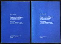
L'Apparecchio del Gusto 2 Volume Set
Macerata Italy : Quodlibet 2004. This is a very good softcover two volume set with just light wear. Completely clean. Text in ITALIAN. Illustrated in black & white with reproductions of the pages from documentary sources. 9" high X 6" wide 95 text pages 27 illus. & 209 text pages 12 illus. This set will be securely packed and shipped with tracking. First Edition. Soft Cover. Very Good. Quodlibet Paperback
Bookseller reference : 017702 ISBN : 8874620764 9788874620760
|
|
|
Sante, Luc
Low Life: Lures and Snares of Old New York
New York: Farrar Straus & Giroux 1991. This is a fine hardcover copy with a near fine dust jacket whose only flaw is the price-clipped front flap. There is a pasted on price sticker for $27.50 on the front flap. Completely clean. Stated first edition. Illustrated in black & white with photographs graphic ephemera etc. 9" high X 6" wide 414 pages. Heavy book foreign postage may be extra. This book will be securely wrapped and packed in a sturdy box and shipped with tracking. First Edition. Hard Cover. Fine/Near Fine. Farrar Straus & Giroux, Hardcover
Bookseller reference : 019064 ISBN : 0374194149 9780374194147

|
|
|
Santerre, Renaud, And Celine Mercier-Tremblay (Editors)
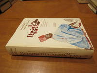
La Quete du savoir: Essais pour une anthropologie de l'education camerounaise French Edition
Montreal: Presses de l'Universite de Montreal 1982. 1st Edition . Hardcover. Near Fine. 687 Pp Catalog At Rear. Illustrated White Boards. Near Fine Slight Softness At Corners Ownership Signature Of Florida Professor William Rideout No Other Marks Or Damage. <br/> <br/> Presses de l'Universite de Montreal hardcover
Bookseller reference : 033547 ISBN : 2760605663 9782760605664
|
|
|
Santimano, Sergio
Sergio Santimano - Terra Incognita.
Uppsala, 2006. 4° (29,5 x 22,5 cm). 72 unpag. Seiten. Mit zahlr. teils farbigen und ganzseitigen Fotoabbildungen. Orig.-Pappband mit fotoillustr. Schutzumschlag., 10501ab Umschlag minimal berieben, sonst schönes Exemplar.
Bookseller reference : 10501AB

|
|
|
SANTINI, PAOLO.
Nuove Guinée. Carte de la Guinée contenant les Isles du Cap Verd, le Senegal, la Côte de Guinée proprement dite, les Royaumes de Loango, Congo, Angola, et Bengala. Avec les Pays voisins autant qu ils sont connus.
M. Remondini, Venezia, 1784. Dall' “Atlas Universel dressé sur des Meillieures Cartes Modernes”, incisione in rame, confini in colore d'epoca, cm 46 x 62 (alla lastra) più margini. Cartiglio sulla parte sinistra e sotto, in grande riquadro, la “Cote d'Or” par le S.t D'Anville. Redatta sulla cartografia di Bonne (1779), mappa della costa africana sud - occidentale, dalla Guinea al Congo. Paolo Santini, editore veneziano di opere cartografiche e cartografo lui stesso, è noto per il suo “Atlas Universel”. Una leggera abrasione al centro, peraltro in margini e in buono stato di conservazione.

|
|
|
Santo Alvaro.
L'UOMO MISTERO. Canti e Discorsi alla Nazione Africa.
(Codice VF/0319) In 8° (21 cm) 88 pp. Prima edizione. Brossura originale, ottimo volume. ~~~ SPEDIZIONE IN ITALIA SEMPRE TRACCIATA

|
|
|
Santo Alvaro.
MILLE GIORNI IN ANGOLA. Sulle orme della guerra. Volume I.
(Codice VF/1518) In 8º (21 cm) 120 pp. Prima edizione. Brossura editoriale, ottimo. ~~~ SPEDIZIONE IN ITALIA SEMPRE TRACCIATA

|
|
|
SANTOS, Arnoldo
Prosas.
Lisboa:, Edicoes 70 - Uniao dos Escritores Angolanos., (1977). 20 x 14 cm. 189 p. Original boards (softcover) with title to spine and to illustrated front cover. Slight signs of use, good condition.
Bookseller reference : 33226B

|
|
|
SANTOS, Arnoldo:
Prosas.
20 x 14 cm. 189 p. Original boards (softcover) with title to spine and to illustrated front cover. Slight signs of use, good condition. In Portuguese language.
|
|
|
Santos, P Luiz Feliciano dos
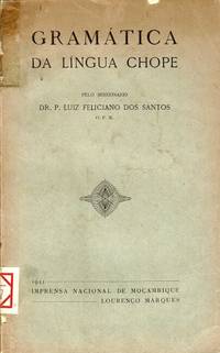
Gramatica da lingua Chope
Lourenco Marques Maputo: Imprensa Nacional de Mocambique 1941. 8vo pp. 306 2; text in Portuguese; printed paper wrappers; ex-library from the Biblioteca Popular de Lisboa spine split and chipped spine label library stamp on title page and one internal page corner bumped wrappers starting fair. The Chope language is a Bantu language spoken in Mozambique. Imprensa Nacional de Mocambique unknown
Bookseller reference : 67925
|
|
|
SANUTO Livio (Venezia 1520 - 1576 circa)
Africa Tabula XII
Rarissima carta geografica dell'Africa.La mappa è tratta dalla Geografia di M. Livio Sanuto : distinta in XII libri : ne quali, oltra l'esplicatione di molti luoghi di Tolomeo, e della Bussola, e dell'Aguglia, si dichiarano le Prouincie, Popoli, Regni... dell'Africa. Con XII tauole di esse Africa in dissegno di rame / aggiuntiui de piu tre Indici da M. Giouan Carlo Saraceni... ; [aiutato a ciò da Giulio suo fratello, che di propia mano tagliò tutti li Rami.Si tratta del primo atlante dedicato esclusivamente all'Africa, con le tavole disegnate da Livio Sanuto e finemente tradotte in rame dal fratello Giulio. L'opera venne pubblicata postuma a Venezia nel 1588, da Damiano Zenaro ed a cura di Carlo Saraceni. Le mappe sono state disegnate da Sanuto e finemente incise dal fratello Giulio. L'atlante è suddiviso in dodici libri, il primo contenente note sull'osservazione scientifica, la declinazione dell'ago magnetico e le correzioni all'opera, il secondo spiega le divisioni della descrizione prospettica del mondo di Sanuto, e gli altri dieci sull'Africa che fu l'unica sezione da lui completata prima della sua morte. Livio Sanuto (1520-1576 circa), era un cosmografo veneziano, matematico e costruttore di globi terrestri. Livio e suo fratello Giulio, progettarono un massiccio e completo atlante per includere mappe e descrizioni di tutto il mondo, che egli riteneva più accurate di qualsiasi altra pubblicazione precedente. Purtroppo morì nel 1576 dopo aver completato solo 12 mappe dell'Africa. A completamento di questa e delle altre carte africane, Sanuto si affidò alla carta di Gastaldi del 1564 e alle carte marine portoghesi per la mappatura delle coste e per le informazioni sull'interno, utilizzate da Duarte Barbosa e João de Barros. Dopo la sua pubblicazione nel 1588, quest'opera fu copiata da altri importanti cartografi per quasi un secolo. Incisione in rame, restauri perfettamente eseguiti alla piega centrale e a dei fori di tarlo presenti nella parte bianca superiore ed inferiore, per il resto in ottimo stato di conservazione. A very rare map of Africa.The map is taken form 'Geografia di M. Livio Sanuto : distinta in XII libri : ne quali, oltra l'esplicatione di molti luoghi di Tolomeo, e della Bussola, e dell'Aguglia, si dichiarano le Prouincie, Popoli, Regni... dell'Africa. Con XII tauole di esse Africa in dissegno di rame / aggiuntiui de piu tre Indici da M. Giouan Carlo Saraceni... ; [aiutato a ciò da Giulio suo fratello, che di propia mano tagliò tutti li Rami'.First printed atlas of Africa, published postumously by Sanuto's friend Saraceni who added the tables of contents and the preface on the life of the author.The maps were drawn by Sanuto and finely engraved by his brother Jules. The atlas is divided into twelve books, the first containing notes on scientific observation, the declination of the magnetic needle and corrections to the work, the second explains the divisions of Sanuto's prospective description of the world, and the other ten on Africa which was the only section he completed before his death.Livio Sanuto (c.1520-1576), was a Venetian cosmographer, mathematician and maker of terrestrial globes. Sanuto was one of the so-called Lafreri school of engravers, whose output signalled the transition between the maps of Ptolemy and the maps of Mercator and Ortelius. Livio and his brother Giulio, planned a massive and comprehensive atlas to include maps and descriptions of the whole world, which he believed would be more accurate than any previously published. Unfortunately, he died in 1576 having only completed 12 maps of Africa. The 12 maps were eventually published in 1588 by Livio's brother Giulio, under the title "Geografia Di M. Livio Sanuto..." . In the compliation of this and the other African maps, Sanuto relied on Gastaldi's 1564 map and Portuguese sea charts for the mapping of the coasts and for information about the interior, used accounts by Duarte Barbosa and João de Barros. After its publication in 1588, this work was copied by other leading map makers for nearly a century afterwards.Seas are decorated with contemporary sailing vessels and monsters.Etching with engraving, some expert repairs at the central folds and at worm holes along the upper and lower edge, otherwise in good condition. Betz n. 22; Norwich n. 15.

|
|
|
SANUTO Livio (Venezia 1520 - 1576 circa)
Africae Tabula I
Rarissima carta geografica dell'Africa Occidentale, con gli arcipelaghi delle Canarie e Azzore.La mappa è tratta dal 'Geografia di M. Livio Sanuto : distinta in XII libri : ne quali, oltra l'esplicatione di molti luoghi di Tolomeo, e della Bussola, e dell'Aguglia, si dichiarano le Prouincie, Popoli, Regni... dell'Africa. Con XII tauole di esse Africa in dissegno di rame / aggiuntiui de piu tre Indici da M. Giouan Carlo Saraceni... ; [aiutato a ciò da Giulio suo fratello, che di propia mano tagliò tutti li Rami'.Si tratta del primo atlante dedicato esclusivamnete all'Africa, con le tavole disegnate da Livio Sanuto e finemente tradotte in rame dal fratello Giulio. L'opera venne pubblicata postuma a Venezia nel 1588, da Damiano Zenaro ed a cura di Carlo Saraceni.Incisione in rame, restauri perfettamente eseguit alla piega centrale ed a dei fori di tarlo presenti nella parte superiore ed inferiore, per il resto in ottimo stato di conservazione.Rara ed affascinante mappa dell'Africa. A very rare map of Western Africa, showing the Canary Islands & Azores.The map is taken form 'Geografia di M. Livio Sanuto : distinta in XII libri : ne quali, oltra l'esplicatione di molti luoghi di Tolomeo, e della Bussola, e dell'Aguglia, si dichiarano le Prouincie, Popoli, Regni... dell'Africa. Con XII tauole di esse Africa in dissegno di rame / aggiuntiui de piu tre Indici da M. Giouan Carlo Saraceni... ; [aiutato a ciò da Giulio suo fratello, che di propia mano tagliò tutti li Rami'.First printed atlas of Africa, published postumously by Sanuto's friend Saraceni who added the tables of contents and the preface on the life of the author.The maps were drawn by Sanuto and finely engraved by his brother Jules. The atlas is divided into twelve books, the first containing notes on scientific observation, the declination of the magnetic needle and corrections to the work, the second explains the divisions of Sanuto's prospective description of the world, and the other ten on Africa which was the only section he completed before his death.Livio Sanuto (c.1520-1576), was a Venetian cosmographer, mathematician and maker of terrestrial globes. Sanuto was one of the so-called Lafreri school of engravers, whose output signalled the transition between the maps of Ptolemy and the maps of Mercator and Ortelius. Livio and his brother Giulio, planned a massive and comprehensive atlas to include maps and descriptions of the whole world, which he believed would be more accurate than any previously published. Unfortunately, he died in 1576 having only completed 12 maps of Africa. The 12 maps were eventually published in 1588 by Livio's brother Giulio, under the title "Geografia Di M. Livio Sanuto..." . In the compliation of this and the other African maps, Sanuto relied on Gastaldi's 1564 map and Portuguese sea charts for the mapping of the coasts and for information about the interior, used accounts by Duarte Barbosa and João de Barros. After its publication in 1588, this work was copied by other leading map makers for nearly a century afterwards.Seas are decorated with contemporary sailing vessels and monsters.Etching with engraving, some expert repairs at the central folds and at worm holes along the upper and lower edge, otherwise in good condition. Betz, The Mapping of Africa, p. 145; Norwich, 15; Almagià 1946.

|
|
|
SANUTO Livio (Venezia 1520 - 1576 circa)
Africae Tabula X
Rarissima carta geografica dell'Africa meridionale.La mappa è tratta dalla 'Geografia di M. Livio Sanuto : distinta in XII libri : ne quali, oltra l'esplicatione di molti luoghi di Tolomeo, e della Bussola, e dell'Aguglia, si dichiarano le Prouincie, Popoli, Regni... dell'Africa. Con XII tauole di esse Africa in dissegno di rame / aggiuntiui de piu tre Indici da M. Giouan Carlo Saraceni... ; [aiutato a ciò da Giulio suo fratello, che di propia mano tagliò tutti li Rami'.Si tratta del primo atlante dedicato esclusivamnete all'Africa, con le tavole disegnate da Livio Sanuto e finemente tradotte in rame dal fratello Giulio. L'opera venne pubblicata postuma a Venezia nel 1588, da Damiano Zenaro ed a cura di Carlo Saraceni.Incisione in rame, restauri perfettamente eseguiti alla piega centrale ed a dei fori di tarlo presenti nella parte superiore ed inferiore, per il resto in ottimo stato di conservazione.Rara ed affascinante mappa dell'Africa. A very rare map of Southern Africa.The map is taken from 'Geografia di M. Livio Sanuto : distinta in XII libri : ne quali, oltra l'esplicatione di molti luoghi di Tolomeo, e della Bussola, e dell'Aguglia, si dichiarano le Prouincie, Popoli, Regni... dell'Africa. Con XII tauole di esse Africa in dissegno di rame / aggiuntiui de piu tre Indici da M. Giouan Carlo Saraceni... ; [aiutato a ciò da Giulio suo fratello, che di propia mano tagliò tutti li Rami'.First printed atlas of Africa, published postumously by Sanuto's friend Saraceni who added the tables of contents and the preface on the life of the author.The maps were drawn by Sanuto and finely engraved by his brother Jules. The atlas is divided into twelve books, the first containing notes on scientific observation, the declination of the magnetic needle and corrections to the work, the second explains the divisions of Sanuto's prospective description of the world, and the other ten on Africa which was the only section he completed before his death.Livio Sanuto (c.1520-1576), was a Venetian cosmographer, mathematician and maker of terrestrial globes. Sanuto was one of the so-called Lafreri school of engravers, whose output signalled the transition between the maps of Ptolemy and the maps of Mercator and Ortelius. Livio and his brother Giulio, planned a massive and comprehensive atlas to include maps and descriptions of the whole world, which he believed would be more accurate than any previously published. Unfortunately, he died in 1576 having only completed 12 maps of Africa. The 12 maps were eventually published in 1588 by Livio's brother Giulio, under the title "Geografia Di M. Livio Sanuto..." . In the compliation of this and the other African maps, Sanuto relied on Gastaldi's 1564 map and Portuguese sea charts for the mapping of the coasts and for information about the interior, used accounts by Duarte Barbosa and João de Barros. After its publication in 1588, this work was copied by other leading map makers for nearly a century afterwards.Seas are decorated with contemporary sailing vessels and monsters.Etching with engraving, some expert repairs at the central folds and at worm holes along the upper and lower edge, otherwise in good condition. NORWICH: 152; see BETZ 22.

|
|
|
SAPIEHA, Teresa
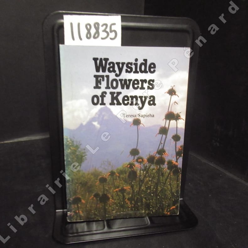
Wayside Flowers of Kenya
sd Editions Teresa Sapieha - Sans date - In-16, broché, couverture illustrée en couleurs - 103 p. - Nombreuses reproductions photographiques en couleurs in-texte - Ouvrage en anglais
Bookseller reference : 118835
|
|
|
Sapelli Camillo di Capriglia.
Nel Sudan Orientale.
Milano,Bocca,1942. In 8°picc.pp. 141n.+3nn.Ritratto in antip. bross.edit.intonso. (Angolo inferiore piatto anter. riparato).
|
|
|
Sapelli Di Capriglio Camillo
Nel Sudan Orientale
in 8° piccolo br edit., molto gorata, pp.XI-141-2 Ritratto dell' A. con prefazione di Luigi Solari
|
|
|
SAPETO Giuseppe.
Viaggio ai Mensa, ai Bogos e agli Habab A cura di R. Mazzucconi
con 3 tavole f.t. ed un panorama cromolitografato più volte ripiegato (Paesaggio tipico del Nord eritreo). Note e riferimenti bibliografici. Prima edizione.
|
|
|
SAPETO, Giuseppe
Viaggio ai Mensa,ai Bogos e agli Habab. A cura di Ridolfo Mazzucconi. Con 3 illustrazioni e una cromolitografia fuori testo
In 8°, pp. 258, (2). Brossura editoriale. Primo piatto della sovracoperta ritagliato e inserito all'interno del volume. Copia in ottimo stato. Con una grande cromolitografia più volte ripiegata.

|
|
|
SAPETO, Giuseppe
Viaggio ai Mensa,ai Bogos e agli Habab. A cura di R Mazzucconi. Con 30 illustrazioni e una cromolitografia f.t
1 Vol. In-8 pag. 260. Sovracopt.ill.Ben tenuto PROG 34395 CATT_ATT 46
|
|
|
Saphia Azzeddine
La Mecca-Phuket
bross. edit. ill. con bandelle - prima edizione it. - trad. di Ilaria Vitali

|
|
|
Sapir, Daniela ; Rinon, Yardena ; Rozenfeld, Bracha [Eds.]
Ethiopia, From All Aspects: History, Religion, Literature, Art, Languagr, Current Events - Ethiopian Jewry: Then, Now and Tomorrow [IN HEBREW WITH ENGLISH INTRODUCTION]
IN HEBREW WITH ENGLISH INTRODUCTION. 23.5x17 cm. 141+14 pages. Softcover. Ex-Library copy with the usual marks. Else in good condition.
|
|

 Receive by email
 Download as PDF document
 RSS feed
 Permanent link


