|
Ordnance Survey Ireland
Official Road Atlas Ireland
2004-02-08. New. Ships with Tracking Number! INTERNATIONAL WORLDWIDE Shipping available. May be re-issue. Buy with confidence excellent customer service! unknown
Bookseller reference : 1908852836n ISBN : 1908852836 9781908852830

|
|
|
Ordnance Survey Ireland
Official Road Atlas Ireland
2015-02-07. New. Ships with Tracking Number! INTERNATIONAL WORLDWIDE Shipping available. May be re-issue. Buy with confidence excellent customer service! unknown
Bookseller reference : 1908852410n ISBN : 1908852410 9781908852410

|
|
|
Ordnance Survey Ireland
Official Road Atlas Ireland 2012-2013
2011-03-05. Good. Ships with Tracking Number! INTERNATIONAL WORLDWIDE Shipping available. May not contain Access Codes or Supplements. May be re-issue. May be ex-library. Shipping & Handling by region. Buy with confidence excellent customer service! unknown
Bookseller reference : 1907122400 ISBN : 1907122400 9781907122408

|
|
|
Ordnance Survey Ireland
Official Road Atlas Ireland Irish Maps Atlases and Guides
2013-02-03. Good. Ships with Tracking Number! INTERNATIONAL WORLDWIDE Shipping available. May not contain Access Codes or Supplements. May be re-issue. May be ex-library. Shipping & Handling by region. Buy with confidence excellent customer service! unknown
Bookseller reference : 1908852232 ISBN : 1908852232 9781908852236

|
|
|
Ordnance Survey Ireland
Official Road Atlas Ireland 2010-2011
2010-08-05. Good. Ships with Tracking Number! INTERNATIONAL WORLDWIDE Shipping available. May not contain Access Codes or Supplements. May be re-issue. May be ex-library. Shipping & Handling by region. Buy with confidence excellent customer service! unknown
Bookseller reference : 1907122303 ISBN : 1907122303 9781907122309

|
|
|
Ordnance Survey Ireland
Official Road Atlas Ireland 2010-2011 Explorer Maps
2010-03-22. Good. Ships with Tracking Number! INTERNATIONAL WORLDWIDE Shipping available. May not contain Access Codes or Supplements. May be re-issue. May be ex-library. Shipping & Handling by region. Buy with confidence excellent customer service! unknown
Bookseller reference : 1907122044 ISBN : 1907122044 9781907122040

|
|
|
Ordnance Survey Ireland
Official Road Atlas Ireland 2012-2013: All Ireland Road Network. City Maps. Ideal for Tourists. Fully Indexed
Ordnance Survey Ireland. Spiral-bound. Used; Good. Simply Brit Shipped with Premium postal service within 24 hours from the UK with impressive delivery time. We have dispatched from our book depository; items of good condition to over ten million satisfied customers worldwide. We are committed to providing you with reliable and efficient service at all times. 07/22/2011 Ordnance Survey Ireland unknown
Bookseller reference : 1145899 ISBN : 1907122400 9781907122408

|
|
|
Ordnance Survey Ireland
Official Road Atlas Ireland 2012-2013
Ordnance Survey. Used - Good. Shows some signs of wear and may have some markings on the inside. Ordnance Survey unknown
Bookseller reference : GRP82596599 ISBN : 1907122400 9781907122408
|
|
|
Ordnance Survey Ireland
Official Road Atlas Ireland 2012-2013
Ordnance Survey 2011-07-01. Spiral-bound. Used:Good. Ordnance Survey unknown
Bookseller reference : DADAX1907122400 ISBN : 1907122400 9781907122408
|
|
|
Ordnance Survey of Ireland
Oileáin Árann / The Aran Islands
Ordnance Survey of Ireland 1993. Scale 1:25000. Folded map. V.g. Little used. Price sticker. Ordnance Survey of Ireland unknown
Bookseller reference : 23068 ISBN : 0904996689 9780904996685

|
|
|
Ordnance Survey of Ireland
Ordnance Survey of Ireland 1:250000 Sheet 5 South West
Dublin: Ordnance Survey of Ireland 1959. No marks or inscriptions. Clean not torn folded 1:250 000 map opens out to 28 x 35 inches. Tiny nicks/creasing to oversized part of slightly sunned covers. 1pp. Covers South West Ireland from Limerick in the north down to Cork and Killarney in the west across to Tipperary. Soft Cover. Very Good. 9.5 x 4.75 Inches. Ordnance Survey of Ireland Paperback
Bookseller reference : 023067

|
|
|
Ordnance Survey Ireland Colby Thomas Larcom Thomas A. Thomas Aiskew
Ordnance survey of the county of Londonderry 1837 Leather Bound
2019. Leather Bound. New. Leather Binding on Spine and Corners with Golden Leaf Printing on round Spine. Reprinted in 2019 with the help of original edition published long back 1837. This book is printed in black & white sewing binding for longer life Printed on high quality Paper re-sized as per Current standards professionally processed without changing its contents. As these are old books we processed each page manually and make them readable but in some cases some pages which are blur or missing or black spots. If it is multi volume set then it is only single volume if you wish to order a specific or all the volumes you may contact us. We expect that you will understand our compulsion in these books. We found this book important for the readers who want to know more about our old treasure so we brought it back to the shelves. Hope you will like it and give your comments and suggestions. Lang: - eng Pages 414. EXTRA 10 DAYS APART FROM THE NORMAL SHIPPING PERIOD WILL BE REQUIRED FOR LEATHER BOUND BOOKS. FOLIO EDITION IS ALSO AVAILABLE. hardcover
Bookseller reference : LB1111005121989
|
|
|
Ordnance Survey of Ireland. n Colby Thomas . n Larcom Thomas A. Thomas Aiskew . no Great Britain. Ordnance Survey. n
Ordnance survey of the county of Londonderry 1837 Leather Bound
2019. Leather Bound. New. Leather Binding on Spine and Corners with Golden Leaf Printing on round Spine. Reprinted in 2019 with the help of original edition published long back 1837. This book is printed in black & white sewing binding for longer life Printed on high quality Paper re-sized as per Current standards professionally processed without changing its contents. As these are old books we processed each page manually and make them readable but in some cases some pages which are blur or missing or black spots. If it is multi volume set then it is only single volume if you wish to order a specific or all the volumes you may contact us. We expect that you will understand our compulsion in these books. We found this book important for the readers who want to know more about our old treasure so we brought it back to the shelves. Hope you will like it and give your comments and suggestions. Lang: - eng Pages 416. EXTRA 10 DAYS APART FROM THE NORMAL SHIPPING PERIOD WILL BE REQUIRED FOR LEATHER BOUND BOOKS. FOLIO EDITION IS ALSO AVAILABLE. hardcover
Bookseller reference : LB1111007168816
|
|
|
Ordnance Survey Ireland
Ordnance Survey Ireland East
Ordnance Survey Ireland. Paperback. Used; Good. Simply Brit Shipped with Premium postal service within 24 hours from the UK with impressive delivery time. We have dispatched from our book depository; items of good condition to over ten million satisfied customers worldwide. We are committed to providing you with reliable and efficient service at all times. 05/01/2004 Ordnance Survey Ireland paperback
Bookseller reference : 2697463 ISBN : 1903974801 9781903974803
|
|
|
Ordnance Survey Ireland
Ordnance Survey road atlas of Ireland
1993-01-01. Good. Ships with Tracking Number! INTERNATIONAL WORLDWIDE Shipping available. May not contain Access Codes or Supplements. May be re-issue. May be ex-library. Shipping & Handling by region. Buy with confidence excellent customer service! unknown
Bookseller reference : 0904996417 ISBN : 0904996417 9780904996418

|
|
|
Ordnance Survey Ireland Colby Thomas Larcom Thomas A. Thomas Aiskew
Ordnance survey of the county of Londonderry 1837 Hardcover
2020. Hardcover. New. Lang: - eng Pages 414. Reprinted in 2020 with the help of original edition published long back 1837. This book is Printed in black & white Hardcover sewing binding for longer life with Matt laminated multi-Colour Dust Cover Printed on high quality Paper re-sized as per Current standards professionally processed without changing its contents. As these are old books we processed each page manually and make them readable but in some cases some pages which are blur or missing or black spots. If it is multi volume set then it is only single volume if you wish to order a specific or all the volumes you may contact us. We expect that you will understand our compulsion in these books. We found this book important for the readers who want to know more about our old treasure so we brought it back to the shelves. Any type of Customisation is possible with extra charges. Hope you will like it and give your comments and suggestions. hardcover
Bookseller reference : 1111005121989
|
|
|
Ordnance Survey of Ireland. n Colby Thomas . n Larcom Thomas A. Thomas Aiskew . no Great Britain. Ordnance Survey. n
Ordnance survey of the county of Londonderry 1837 Hardcover
2020. Hardcover. New. Lang: - eng Pages 416. Reprinted in 2020 with the help of original edition published long back 1837. This book is Printed in black & white Hardcover sewing binding for longer life with Matt laminated multi-Colour Dust Cover Printed on high quality Paper re-sized as per Current standards professionally processed without changing its contents. As these are old books we processed each page manually and make them readable but in some cases some pages which are blur or missing or black spots. If it is multi volume set then it is only single volume if you wish to order a specific or all the volumes you may contact us. We expect that you will understand our compulsion in these books. We found this book important for the readers who want to know more about our old treasure so we brought it back to the shelves. Any type of Customisation is possible with extra charges. Hope you will like it and give your comments and suggestions. hardcover
Bookseller reference : 1111007168816
|
|
|
Ordnance Survey Ireland Colby Thomas Larcom Thomas A. Thomas Aiskew
Ordnance survey of the county of Londonderry 1837
2020. Paperback. New. Lang: - eng Pages 414. Reprinted in 2020 with the help of original edition published long back 1837. This book is Printed in black & white sewing binding for longer life with Matt laminated multi-Colour Soft Cover HARDCOVER EDITION IS ALSO AVAILABLE Printed on high quality Paper re-sized as per Current standards professionally processed without changing its contents. As these are old books we processed each page manually and make them readable but in some cases some pages which are blur or missing or black spots. If it is multi volume set then it is only single volume if you wish to order a specific or all the volumes you may contact us. We expect that you will understand our compulsion in these books. We found this book important for the readers who want to know more about our old treasure so we brought it back to the shelves. Any type of Customisation is possible with extra charges. Hope you will like it and give your comments and suggestions. paperback
Bookseller reference : PB1111005121989
|
|
|
Ordnance Survey of Northern Ireland.
Ordnance Survey of Northern Ireland: Map Catalogue. June 1988.
Department of the Environment NI. 1988. 36pp. . Very Good. Department of the Environment (NI). unknown
Bookseller reference : 39453

|
|
|
Ordnance Survey Ireland
Ordnance Survey Ireland East
Ordnance Survey Ireland 05/01/2004. Paperback. Used; Good. WE SHIP WITHIN 24 HRS FROM LONDON UK 98% OF OUR ORDERS ARE RECEIVED WITHIN 7-10 DAYS. We believe you will be completely satisfied with our quick and reliable service. All orders are dispatched as swiftly as possible! Buy with confidence! Ordnance Survey Ireland paperback
Bookseller reference : 2073675 ISBN : 1903974801 9781903974803
|
|
|
Ordnance Survey Ireland
Ordnance Survey new road map Ireland: Scale 1:600 000 : your route guide complete with mileage chart and a comprehensive town index
Ordnance Survey. Used - Very Good. Great condition for a used book! Minimal wear. Ordnance Survey unknown
Bookseller reference : GRP63339570 ISBN : 1901496619 9781901496611

|
|
|
Ordnance Survey of Ireland / LasAarscasAiliocht asAireann
Sheet 155 Cashel
Ordnance Survey of Ireland 1949. Scale 1" to 1 mile. Folded map. Good/No Jacket. Small tear affecting one fold. Ordnance Survey of Ireland unknown
Bookseller reference : 19925
|
|
|
Ordnance Survey of Ireland
Sheet 25: South Cork
Ordnance Survey of Ireland 1978. Scale 1: 126720 half-inch to mile. Folded map. Good. Price label on front cover. Ordnance Survey of Ireland unknown
Bookseller reference : 17698
|
|
|
Ordnance Survey Ireland
Sligo east Leitrim Roscommon Irish Discovery Series
Ordnance Survey Ireland. Map. New. Ordnance Survey Ireland unknown
Bookseller reference : 2-1907122486 ISBN : 1907122486 9781907122484
|
|
|
Ordnance Survey Ireland
Sligo east Leitrim Roscommon Irish Discovery Series
2012-09-06. New. Ships with Tracking Number! INTERNATIONAL WORLDWIDE Shipping available. May be re-issue. Buy with confidence excellent customer service! unknown
Bookseller reference : 1907122486n ISBN : 1907122486 9781907122484

|
|
|
Ordnance Survey Ireland
Sligo east Leitrim Roscommon Irish Discovery Series
2012-09-06. Good. Ships with Tracking Number! INTERNATIONAL WORLDWIDE Shipping available. May not contain Access Codes or Supplements. May be re-issue. May be ex-library. Shipping & Handling by region. Buy with confidence excellent customer service! unknown
Bookseller reference : 1907122486 ISBN : 1907122486 9781907122484

|
|
|
Ordnance Survey of Northern Ireland
Strangford Lough Irish Activity Map
Ordnance Survey 05/01/1994. Map. Used; Good. WE SHIP WITHIN 24 HRS FROM LONDON UK 98% OF OUR ORDERS ARE RECEIVED WITHIN 7-10 DAYS. We believe you will be completely satisfied with our quick and reliable service. All orders are dispatched as swiftly as possible! Buy with confidence! Ordnance Survey unknown
Bookseller reference : 3434428 ISBN : 187381917x 9781873819173
|
|
|
Ordnance Survey of Northern Ireland
Strangford Lough Discoverer Maps N Ireland
Ordnance Survey 2005-02-28. C. Paperback. Good. Ordnance Survey paperback
Bookseller reference : SONG1873819951 ISBN : 1873819951 9781873819951
|
|
|
Ordnance Survey Ireland
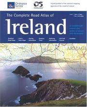
The Complete Road Atlas Of Ireland Irish Maps Atlases & Guides Irish Maps Atlases and Guides
2004-03-05. New. Ships with Tracking Number! INTERNATIONAL WORLDWIDE Shipping available. May be re-issue. Buy with confidence excellent customer service! unknown
Bookseller reference : 1903974704n ISBN : 1903974704 9781903974704

|
|
|
Ordnance Survey Ireland
The complete road atlas of Ireland scale 1:210 000
Ordnance Survey of Ireland. Spiral-bound. POOR. Noticeably used book. Heavy wear to cover. Pages contain marginal notes underlining and or highlighting. Possible ex library copy with all the markings/stickers of that library. Accessories such as CD codes toys and dust jackets may not be included. Ordnance Survey of Ireland unknown
Bookseller reference : 3185828055 ISBN : 1901496813 9781901496819
|
|
|
Ordnance Survey Ireland
The Complete Road Atlas Of Ireland Irish Maps Atlases & Guides
Ordnance Survey of Ireland. Spiral-bound. GOOD. Spine creases wear to binding and pages from reading. May contain limited notes underlining or highlighting that does affect the text. Possible ex library copy that’ll have the markings and stickers associated from the library. Accessories such as CD codes toys may not be included. Ordnance Survey of Ireland unknown
Bookseller reference : 3187543011 ISBN : 1903974704 9781903974704
|
|
|
Ordnance Survey Ireland
The Complete Road Atlas of Ireland
Ordnance Survey of Ireland. Paperback. POOR. Noticeably used book. Heavy wear to cover. Pages contain marginal notes underlining and or highlighting. Possible ex library copy with all the markings/stickers of that library. Accessories such as CD codes toys and dust jackets may not be included. Ordnance Survey of Ireland paperback
Bookseller reference : 3191834165 ISBN : 1901496872 9781901496871
|
|
|
Ordnance Survey Ireland
The Complete Road Atlas Of Ireland Irish Maps Atlases & Guides Irish Maps Atlases and Guides
2004-03-05. Good. Ships with Tracking Number! INTERNATIONAL WORLDWIDE Shipping available. May not contain Access Codes or Supplements. May be re-issue. May be ex-library. Shipping & Handling by region. Buy with confidence excellent customer service! unknown
Bookseller reference : 1903974704 ISBN : 1903974704 9781903974704

|
|
|
Ordnance Survey Ireland
The Complete Road Atlas of Ireland
2001-05-06. Good. Ships with Tracking Number! INTERNATIONAL WORLDWIDE Shipping available. May not contain Access Codes or Supplements. May be re-issue. May be ex-library. Shipping & Handling by region. Buy with confidence excellent customer service! unknown
Bookseller reference : 1901496872 ISBN : 1901496872 9781901496871

|
|
|
Ordnance Survey of Ireland
The Complete Road Atlas of Ireland
2003-08-01. Good. Ships with Tracking Number! INTERNATIONAL WORLDWIDE Shipping available. May not contain Access Codes or Supplements. May be re-issue. May be ex-library. Shipping & Handling by region. Buy with confidence excellent customer service! unknown
Bookseller reference : 1903974062 ISBN : 1903974062 9781903974063

|
|
|
Ordnance Survey Ireland
The Complete Road Atlas of Ireland
Ordnance Survey 04/01/2001. Paperback. Used; Good. WE SHIP WITHIN 24 HRS FROM LONDON UK 98% OF OUR ORDERS ARE RECEIVED WITHIN 7-10 DAYS. We believe you will be completely satisfied with our quick and reliable service. All orders are dispatched as swiftly as possible! Buy with confidence! Ordnance Survey paperback
Bookseller reference : mon0000625178 ISBN : 1901496872 9781901496871
|
|
|
Ordnance Survey Ireland
The Complete Road Atlas of Ireland
Ordnance Survey. Paperback. Used; Good. Simply Brit Shipped with Premium postal service within 24 hours from the UK with impressive delivery time. We have dispatched from our book depository; items of good condition to over ten million satisfied customers worldwide. We are committed to providing you with reliable and efficient service at all times. 04/01/2001 Ordnance Survey paperback
Bookseller reference : mon0001686448 ISBN : 1901496872 9781901496871
|
|
|
Ordnance Survey Ireland
The Complete Road Atlas Of Ireland Irish Maps Atlases & Guides O/S Road Atlas
Ordnance Survey of Ireland 2004-01-01. Spiral-bound. Used:Good. Ordnance Survey of Ireland unknown
Bookseller reference : DADAX1903974704 ISBN : 1903974704 9781903974704
|
|
|
Ordnance Survey Ireland
The Complete Road Atlas Of Ireland Irish Maps Atlases & Guides O/S Road Atlas
Ordnance Survey of Ireland 2004-01-01. Spiral-bound. Good. Ordnance Survey of Ireland unknown
Bookseller reference : SONG1903974704 ISBN : 1903974704 9781903974704
|
|
|
Ordnance Survey Ireland
The Hidden Park
Ordnance Survey Ireland. Used - Very Good. Ships from the UK. Former Library book. Great condition for a used book! Minimal wear. 100% Money Back Guarantee. Your purchase also supports literacy charities. Ordnance Survey Ireland unknown
Bookseller reference : GRP115151208 ISBN : 1907122761 9781907122767
|
|
|
Ordnance Survey Ireland
The Ireland Holiday Map - West Irish - Maps Atlases and Guides
Ordnance Survey Ireland 04/18/2011. 4th Revised edition. Paperback. Used; Good. WE SHIP WITHIN 24 HRS FROM LONDON UK 98% OF OUR ORDERS ARE RECEIVED WITHIN 7-10 DAYS. We believe you will be completely satisfied with our quick and reliable service. All orders are dispatched as swiftly as possible! Buy with confidence! Ordnance Survey Ireland paperback
Bookseller reference : 3199869 ISBN : 1907122370 9781907122378
|
|
|
Ordnance Survey Of Ireland
The Irish grid: A description of the co-ordinate reference system used in Ireland
O.S.I 1996. Paperback. Used; Good. Ex Library. <p><i><strong>Fast Dispatch. Expedited UK Delivery Available. Excellent Customer Service. </strong></i> <br/><br/>Bookbarn International Inventory #1343884</p> O.S.I paperback
Bookseller reference : 1343884
|
|
|
Ordnance Survey of Northern Ireland
The Mourne Mountains. One-Inch Popular Series. Sheet 11.
Belfast: Ordnance Survey 1958. Linen Backed. Good. 12mo Folded. Map itself is in very good condition covers have wear and small tears to edge. Ordnance Survey unknown
Bookseller reference : 500013607
|
|
|
Ordnance Survey of Northern Ireland
The Sperrins Irish Discoverer Series
Ordnance Survey of Northern Ireland 2002. C. Paperback. Used; Good. Ex Library. <p><i><strong>Fast Dispatch. Expedited UK Delivery Available. Excellent Customer Service. </strong></i> <br/><br/>Bookbarn International Inventory #3337618</p> Ordnance Survey of Northern Ireland paperback
Bookseller reference : 3337618 ISBN : 1873819773 9781873819777
|
|
|
Ordnance Survey of Northern Ireland
The Sperrins Irish Discoverer Maps Irish Discoverer Series
Ordnance Survey of Northern Ireland 2006. D. Paperback. Used; Good. Ex Library. Paperback copy. <p><i><strong>Fast Dispatch. Expedited UK Delivery Available. Excellent Customer Service. </strong></i> <br/><br/>Bookbarn International Inventory #3337625</p> Ordnance Survey of Northern Ireland paperback
Bookseller reference : 3337625 ISBN : 1905306059 9781905306053
|
|
|
Ordnance Survey Ireland
Tipperary Limerick
Sheet map folded. New. unknown
Bookseller reference : A9781907122613 ISBN : 1907122613 9781907122613

|
|
|
Ordnance Survey Ireland
Tipperary Limerick Irish Discovery Series
Ordnance Survey Ireland 2011. Map. New. 3rd revised edition edition. 7.48x4.45x0.31 inches. Ordnance Survey Ireland unknown
Bookseller reference : 2-1907122613 ISBN : 1907122613 9781907122613
|
|
|
Ordnance Survey Ireland
Tipperary Limerick Irish Discovery Series
Ordnance Survey Ireland 2011. Map. New. 3rd revised edition edition. 7.48x4.45x0.31 inches. Ordnance Survey Ireland unknown
Bookseller reference : __1907122613 ISBN : 1907122613 9781907122613
|
|
|
Ordnance Survey Ireland
Tipperary Limerick Irish Discovery Series
2011-12-12. New. Ships with Tracking Number! INTERNATIONAL WORLDWIDE Shipping available. May be re-issue. Buy with confidence excellent customer service! unknown
Bookseller reference : 1907122613n ISBN : 1907122613 9781907122613

|
|
|
Ordnance Survey Ireland
Tipperary Limerick Irish Discovery Series
2011-12-12. Good. Ships with Tracking Number! INTERNATIONAL WORLDWIDE Shipping available. May not contain Access Codes or Supplements. May be re-issue. May be ex-library. Shipping & Handling by region. Buy with confidence excellent customer service! unknown
Bookseller reference : 1907122613 ISBN : 1907122613 9781907122613

|
|
 Receive by email
 Download as PDF document
 RSS feed


