|
|
|
Hodge,Jane Aiken
Winding Stair
Romantic suspense set in Portigal during the Peninsula WarsTo Juana Brett the summons from her grandmother in Portugal appeared to be only an invitation to revisit the beloved scenes of her childhood. She did not know that the familiar castle on the lonely cliffs of Cabo Roca had become the secret meeting place of spies and terrorists. Nor that she herself was to be caught up in a fantastic web of intrigue that had wound itself around her family. From the moment Juana learned about the winding stair that led to the hidden rooms beneath the castle, she became part of the nightmare conspiracy that threatened everyone she loved. Book
|
|
|
HOLANDA, Francisco de (Francisco d'Olanda, 1517-1584).
Del sacar por el natural [Do tirar polo natural], según la traducción de Manuel Denis (1563). Edición de John B. Bury. Transcripción del manuscrito de José María Riello.
Madrid, 2008. 4ro. mayor; 111 pp. Ilustraciones. Encuadernación original en tela. Sobrecubiertas.

|
|
|
Holtus, Günter und Edgar Radtke (Hgg.)
Umgangssprache in der Iberoromania: Festschrift für Heinz Kröll. Tübinger Beiträge zur Linguistik, Bd. 235.
Tübingen: Gunter Narr Verlag, 1984. XXV, 445 S. Gewebe.
Bookseller reference : 1237693

|
|
|
Homann Iohannis Baptistae
Regnorum Hispaniae et Portugalliae
Carta geografica della Spagna e del Portogallo, raffigurante i principali reami. La carta è arricchita da un bel cartiglio con personaggi e imbarcazioni. Piega centrale editoriale, restauri

|
|
|
Homann, Johannes Baptist
Regnorum Hispaniae et Portugalliae Tabula generalis de l'Isliana, aucta ad Usum Scholarum novissime accommodata (Spanien, Portugal).
Nürnberg, Homann Erben, um 1730. Kupferstich, altkoloriert. Blattgröße: 53,5 x 63 cm, Druckspiegel: 51 x 61 cm [2 Warenabbildungen]
Bookseller reference : 12905

|
|
|
Honoré Daumier (1808-1879).
Sire! Lisbonne est prise - aaaah!!.....aussi j'ai revé que je me battais crânement.Lithographie originale.
1833 Planche 304 de La Caricature N° 145.La Caricature, August 15, 1833 1833. Lithographie originale sur Velin blanc. . Delteil 67. Belle épreuve en noir et pli horizontal,plis;lithographie en noir sur velin blanc,Delteil 67,tirage bien noir malgré l'image jaunie
Bookseller reference : 25064

|
|
|
HONDIUS Jodocus (Amsterdam 1563 - 1612)
Andaluzia
Carta tratta dalla prima edizione della "Cosmographia Universalis" di Paul Merula , stampata ad Amsterdam nel 1605. Le mappe usate per illustrare la prima edizione della Cosmografia di Merula sono realizzate nel 1598 da Jodocus Hondius e Pieter Van den Keere (Kaerius) e quidni utilizzate dall'editore Cornelis Claesz per illustrare lavori di Apian, Linschoten e Merula. Incisione in rame, inserita uin una pagina di testo, in perfette condizioni. Taken from the first edition of "Cosmographia Universalis" by Paul Merula, printed in Amsterdam in 1605.The map was first issued in 1598 by Cornelis Claesz and engraved and realized by Jodocus Hondius and Pietre vand den Keere (Kaerius). Claesz used the plate to illustrate various works he published by Peter Apian, Jan van Linschoten, Paul Merula and others. Copperplate, inset in a page text, very good conditions. King pp. 80/81

|
|
|
HONDIUS Jodocus (Amsterdam 1563 - 1612)
Castiliae Veteris et Novae Descriptio
Carta tratta dall'Atlas di Mercator e Hondius. Il grande Atlas del Mercator si compone di tre parti, tutte edite a Duisburg tra il 1585 ed il 1595 con il testo latino al verso. Successivamente le lastre furono acquisite da Jodocus e Hendrick Hondius e da Jan Jansson, i quali, tra il 1606 ed il 1666, diedero alla luce più edizioni dello stesso atlante con numerose aggiunte e varianti. Questo esemplare proviene da una delle edizioni a cura del Hondius, testo ltedesco. Incisione in rame, coloritura coeva con ritocchi, in ottimo stato di conservazione. Very attractive map of Castillia with Madrid and Toledo in the center of the map. Mercator's sons and grandsons, were all cartographers and made their contributions in various ways to his atlas. Rumold, in particular, was responsible for the complete edition in 1595. The map plates were bought in 1604 by Jodocus Hondius who, with his sons, Jodocus II and Henricus, published enlarged editions which dominated the map market for the following twenty to thirty years. German text on verso.

|
|
|
HONDIUS Jodocus (Amsterdam 1563 - 1612)
Hispania
Carta tratta dalla prima edizione della "Cosmographia Universalis" di Paul Merula , stampata ad Amsterdam nel 1605. Le mappe usate per illustrare la prima edizione della Cosmografia di Merula sono realizzate nel 1598 da Jodocus Hondius e Pieter Van den Keere (Kaerius) e quidni utilizzate dall'editore Cornelis Claesz per illustrare lavori di Apian, Linschoten e Merula. Incisione in rame, inserita uin una pagina di testo, in perfette condizioni. Taken from the first edition of "Cosmographia Universalis" by Paul Merula, printed in Amsterdam in 1605.The map was first issued in 1598 by Cornelis Claesz and engraved and realized by Jodocus Hondius and Pietre vand den Keere (Kaerius). Claesz used the plate to illustrate various works he published by Peter Apian, Jan van Linschoten, Paul Merula and others. Copperplate, inset in a page text, very good conditions. King pp. 80/81

|
|
|
HONDIUS Jodocus (Amsterdam 1563 - 1612)
Portugallia
Carta tratta dalla prima edizione della "Cosmographia Universalis" di Paul Merula , stampata ad Amsterdam nel 1605. Le mappe usate per illustrare la prima edizione della Cosmografia di Merula sono realizzate nel 1598 da Jodocus Hondius e Pieter Van den Keere (Kaerius) e quidni utilizzate dall'editore Cornelis Claesz per illustrare lavori di Apian, Linschoten e Merula. Incisione in rame, inserita uin una pagina di testo, in perfette condizioni. Taken from the first edition of "Cosmographia Universalis" by Paul Merula, printed in Amsterdam in 1605.The map was first issued in 1598 by Cornelis Claesz and engraved and realized by Jodocus Hondius and Pietre vand den Keere (Kaerius). Claesz used the plate to illustrate various works he published by Peter Apian, Jan van Linschoten, Paul Merula and others. Copperplate, inset in a page text, very good conditions. King pp. 80/81

|
|
|
HONDIUS Jodocus (Amsterdam 1563 - 1612)
Valentia
Carta tratta dalla prima edizione della "Cosmographia Universalis" di Paul Merula , stampata ad Amsterdam nel 1605. Le mappe usate per illustrare la prima edizione della Cosmografia di Merula sono realizzate nel 1598 da Jodocus Hondius e Pieter Van den Keere (Kaerius) e quidni utilizzate dall'editore Cornelis Claesz per illustrare lavori di Apian, Linschoten e Merula. Incisione in rame, inserita uin una pagina di testo, in perfette condizioni. Taken from the first edition of "Cosmographia Universalis" by Paul Merula, printed in Amsterdam in 1605.The map was first issued in 1598 by Cornelis Claesz and engraved and realized by Jodocus Hondius and Pietre vand den Keere (Kaerius). Claesz used the plate to illustrate various works he published by Peter Apian, Jan van Linschoten, Paul Merula and others. Copperplate, inset in a page text, very good conditions. King pp. 80/81

|
|
|
HONDIUS Jr. Jodocus (Amsterdam 1594 -1629)
Baia de Cadis
Carta geografica tratta dal Tabularum Geographicarum contractarum libri septem di Petrus Bertius, edizione latina del 1616. L'opera contiene 219 carte che illustrano questa nuova versione della geografia del Bertius, per la prima volta pubblicata nel 1612 con le carte di Barent Langenes. Le carte derivano dal grande atlante di Mercator/Hondius, delle quali molte rappresentano una semplice riduzione. "After the death of Cornelis Claesz in 1609, Jodocus Hondius II became the new publisher of the work, composed by 7 parts in 1, with engraved title-page and 220 full-page engraved maps in text. All the maps were newly engraved and slightly larger in size, because Hondius was not able to acquire the original plates. With the new plates the work was definitely improved and enjoyed a growing demand of the public, which at that time had the choice between the Atlas Minor by Mercator and Bertius' Tabularum Geographicarum. The 219 plates, with the oval world map appearing twice, were produced to illustrate a new version of the geography of Bertius, published in 1616. According to King, their correct attribution is by Hondius, after Mercator and Hondius, taken from Bertius, who was only responsible for revising his text again" [cfr. G. King, Miniature Antique Maps]. Incisione in rame, perfette condizioni. A superior rival to the pocket Ortelius atlas appeared about 1598, under the imprint of Barent Langenes and Cornelis Claesz. Claesz also published the Tabularum Geographicarum contractarum libri septem, edition with texy by Petrus Bertius, in 1600. After the death of Cornelis Claesz in 1609, Jodocus Hondius II became the new publisher of the work, composed by 7 parts in 1, with engraved title-page and 220 full-page engraved maps in text. All the maps were newly engraved and slightly larger in size, because Hondius was not able to acquire the original plates. With the new plates the work was definitely improved and enjoyed a growing demand of the public, which at that time had the choice between the Atlas Minor by Mercator and Bertius' Tabularum Geographicarum. The 219 plates, with the oval world map appearing twice, were produced to illustrate a new version of the geography of Bertius, published in 1616. According to King, their correct attribution is by Hondius, after Mercator and Hondius, taken from Bertius, who was only responsible for revising his text again. "After the death of Cornelis Claesz in 1609, Jodocus Hondius II became the new publisher of the work, composed by 7 parts in 1, with engraved title-page and 220 full-page engraved maps in text. All the maps were newly engraved and slightly larger in size, because Hondius was not able to acquire the original plates. With the new plates the work was definitely improved and enjoyed a growing demand of the public, which at that time had the choice between the Atlas Minor by Mercator and Bertius' Tabularum Geographicarum. The 219 plates, with the oval world map appearing twice, were produced to illustrate a new version of the geography of Bertius, published in 1616. According to King, their correct attribution is by Hondius, after Mercator and Hondius, taken from Bertius, who was only responsible for revising his text again" [cf. G. King, Miniature Antique Maps]. Copperplate, in very good conditions. Koeman p. 42; King p. 96/99.

|
|
|
HONDIUS Jr. Jodocus (Amsterdam 1594 -1629)
Castilia Vetus et Nova
Carta geografica tratta dal Tabularum Geographicarum contractarum libri septem di Petrus Bertius, edizione latina del 1616. L'opera contiene 219 carte che illustrano questa nuova versione della geografia del Bertius, per la prima volta pubblicata nel 1612 con le carte di Barent Langenes. Le carte derivano dal grande atlante di Mercator/Hondius, delle quali molte rappresentano una semplice riduzione. "After the death of Cornelis Claesz in 1609, Jodocus Hondius II became the new publisher of the work, composed by 7 parts in 1, with engraved title-page and 220 full-page engraved maps in text. All the maps were newly engraved and slightly larger in size, because Hondius was not able to acquire the original plates. With the new plates the work was definitely improved and enjoyed a growing demand of the public, which at that time had the choice between the Atlas Minor by Mercator and Bertius' Tabularum Geographicarum. The 219 plates, with the oval world map appearing twice, were produced to illustrate a new version of the geography of Bertius, published in 1616. According to King, their correct attribution is by Hondius, after Mercator and Hondius, taken from Bertius, who was only responsible for revising his text again" [cfr. G. King, Miniature Antique Maps]. Incisione in rame, perfette condizioni. A superior rival to the pocket Ortelius atlas appeared about 1598, under the imprint of Barent Langenes and Cornelis Claesz. Claesz also published the Tabularum Geographicarum contractarum libri septem, edition with texy by Petrus Bertius, in 1600. After the death of Cornelis Claesz in 1609, Jodocus Hondius II became the new publisher of the work, composed by 7 parts in 1, with engraved title-page and 220 full-page engraved maps in text. All the maps were newly engraved and slightly larger in size, because Hondius was not able to acquire the original plates. With the new plates the work was definitely improved and enjoyed a growing demand of the public, which at that time had the choice between the Atlas Minor by Mercator and Bertius' Tabularum Geographicarum. The 219 plates, with the oval world map appearing twice, were produced to illustrate a new version of the geography of Bertius, published in 1616. According to King, their correct attribution is by Hondius, after Mercator and Hondius, taken from Bertius, who was only responsible for revising his text again. "After the death of Cornelis Claesz in 1609, Jodocus Hondius II became the new publisher of the work, composed by 7 parts in 1, with engraved title-page and 220 full-page engraved maps in text. All the maps were newly engraved and slightly larger in size, because Hondius was not able to acquire the original plates. With the new plates the work was definitely improved and enjoyed a growing demand of the public, which at that time had the choice between the Atlas Minor by Mercator and Bertius' Tabularum Geographicarum. The 219 plates, with the oval world map appearing twice, were produced to illustrate a new version of the geography of Bertius, published in 1616. According to King, their correct attribution is by Hondius, after Mercator and Hondius, taken from Bertius, who was only responsible for revising his text again" [cf. G. King, Miniature Antique Maps]. Copperplate, in very good conditions. Koeman p. 42; King p. 96/99.

|
|
|
HONDIUS Jr. Jodocus (Amsterdam 1594 -1629)
Estrema Dura
Carta geografica tratta dal Tabularum Geographicarum contractarum libri septem di Petrus Bertius, edizione latina del 1616. L'opera contiene 219 carte che illustrano questa nuova versione della geografia del Bertius, per la prima volta pubblicata nel 1612 con le carte di Barent Langenes. Le carte derivano dal grande atlante di Mercator/Hondius, delle quali molte rappresentano una semplice riduzione. "After the death of Cornelis Claesz in 1609, Jodocus Hondius II became the new publisher of the work, composed by 7 parts in 1, with engraved title-page and 220 full-page engraved maps in text. All the maps were newly engraved and slightly larger in size, because Hondius was not able to acquire the original plates. With the new plates the work was definitely improved and enjoyed a growing demand of the public, which at that time had the choice between the Atlas Minor by Mercator and Bertius' Tabularum Geographicarum. The 219 plates, with the oval world map appearing twice, were produced to illustrate a new version of the geography of Bertius, published in 1616. According to King, their correct attribution is by Hondius, after Mercator and Hondius, taken from Bertius, who was only responsible for revising his text again" [cfr. G. King, Miniature Antique Maps]. Incisione in rame, perfette condizioni. A superior rival to the pocket Ortelius atlas appeared about 1598, under the imprint of Barent Langenes and Cornelis Claesz. Claesz also published the Tabularum Geographicarum contractarum libri septem, edition with texy by Petrus Bertius, in 1600. After the death of Cornelis Claesz in 1609, Jodocus Hondius II became the new publisher of the work, composed by 7 parts in 1, with engraved title-page and 220 full-page engraved maps in text. All the maps were newly engraved and slightly larger in size, because Hondius was not able to acquire the original plates. With the new plates the work was definitely improved and enjoyed a growing demand of the public, which at that time had the choice between the Atlas Minor by Mercator and Bertius' Tabularum Geographicarum. The 219 plates, with the oval world map appearing twice, were produced to illustrate a new version of the geography of Bertius, published in 1616. According to King, their correct attribution is by Hondius, after Mercator and Hondius, taken from Bertius, who was only responsible for revising his text again. "After the death of Cornelis Claesz in 1609, Jodocus Hondius II became the new publisher of the work, composed by 7 parts in 1, with engraved title-page and 220 full-page engraved maps in text. All the maps were newly engraved and slightly larger in size, because Hondius was not able to acquire the original plates. With the new plates the work was definitely improved and enjoyed a growing demand of the public, which at that time had the choice between the Atlas Minor by Mercator and Bertius' Tabularum Geographicarum. The 219 plates, with the oval world map appearing twice, were produced to illustrate a new version of the geography of Bertius, published in 1616. According to King, their correct attribution is by Hondius, after Mercator and Hondius, taken from Bertius, who was only responsible for revising his text again" [cf. G. King, Miniature Antique Maps]. Copperplate, in very good conditions. Koeman p. 42; King p. 96/99.

|
|
|
HONDIUS Jr. Jodocus (Amsterdam 1594 -1629)
Guipuscola et Biscaia
Carta geografica tratta dal Tabularum Geographicarum contractarum libri septem di Petrus Bertius, edizione latina del 1616. L'opera contiene 219 carte che illustrano questa nuova versione della geografia del Bertius, per la prima volta pubblicata nel 1612 con le carte di Barent Langenes. Le carte derivano dal grande atlante di Mercator/Hondius, delle quali molte rappresentano una semplice riduzione. "After the death of Cornelis Claesz in 1609, Jodocus Hondius II became the new publisher of the work, composed by 7 parts in 1, with engraved title-page and 220 full-page engraved maps in text. All the maps were newly engraved and slightly larger in size, because Hondius was not able to acquire the original plates. With the new plates the work was definitely improved and enjoyed a growing demand of the public, which at that time had the choice between the Atlas Minor by Mercator and Bertius' Tabularum Geographicarum. The 219 plates, with the oval world map appearing twice, were produced to illustrate a new version of the geography of Bertius, published in 1616. According to King, their correct attribution is by Hondius, after Mercator and Hondius, taken from Bertius, who was only responsible for revising his text again" [cfr. G. King, Miniature Antique Maps]. Incisione in rame, perfette condizioni. A superior rival to the pocket Ortelius atlas appeared about 1598, under the imprint of Barent Langenes and Cornelis Claesz. Claesz also published the Tabularum Geographicarum contractarum libri septem, edition with texy by Petrus Bertius, in 1600. After the death of Cornelis Claesz in 1609, Jodocus Hondius II became the new publisher of the work, composed by 7 parts in 1, with engraved title-page and 220 full-page engraved maps in text. All the maps were newly engraved and slightly larger in size, because Hondius was not able to acquire the original plates. With the new plates the work was definitely improved and enjoyed a growing demand of the public, which at that time had the choice between the Atlas Minor by Mercator and Bertius' Tabularum Geographicarum. The 219 plates, with the oval world map appearing twice, were produced to illustrate a new version of the geography of Bertius, published in 1616. According to King, their correct attribution is by Hondius, after Mercator and Hondius, taken from Bertius, who was only responsible for revising his text again. "After the death of Cornelis Claesz in 1609, Jodocus Hondius II became the new publisher of the work, composed by 7 parts in 1, with engraved title-page and 220 full-page engraved maps in text. All the maps were newly engraved and slightly larger in size, because Hondius was not able to acquire the original plates. With the new plates the work was definitely improved and enjoyed a growing demand of the public, which at that time had the choice between the Atlas Minor by Mercator and Bertius' Tabularum Geographicarum. The 219 plates, with the oval world map appearing twice, were produced to illustrate a new version of the geography of Bertius, published in 1616. According to King, their correct attribution is by Hondius, after Mercator and Hondius, taken from Bertius, who was only responsible for revising his text again" [cf. G. King, Miniature Antique Maps]. Copperplate, in very good conditions. Koeman p. 42; King p. 96/99.

|
|
|
HONDIUS Jr. Jodocus (Amsterdam 1594 -1629)
Legio
Carta geografica tratta dal Tabularum Geographicarum contractarum libri septem di Petrus Bertius, edizione latina del 1616. L'opera contiene 219 carte che illustrano questa nuova versione della geografia del Bertius, per la prima volta pubblicata nel 1612 con le carte di Barent Langenes. Le carte derivano dal grande atlante di Mercator/Hondius, delle quali molte rappresentano una semplice riduzione. "After the death of Cornelis Claesz in 1609, Jodocus Hondius II became the new publisher of the work, composed by 7 parts in 1, with engraved title-page and 220 full-page engraved maps in text. All the maps were newly engraved and slightly larger in size, because Hondius was not able to acquire the original plates. With the new plates the work was definitely improved and enjoyed a growing demand of the public, which at that time had the choice between the Atlas Minor by Mercator and Bertius' Tabularum Geographicarum. The 219 plates, with the oval world map appearing twice, were produced to illustrate a new version of the geography of Bertius, published in 1616. According to King, their correct attribution is by Hondius, after Mercator and Hondius, taken from Bertius, who was only responsible for revising his text again" [cfr. G. King, Miniature Antique Maps]. Incisione in rame, perfette condizioni. A superior rival to the pocket Ortelius atlas appeared about 1598, under the imprint of Barent Langenes and Cornelis Claesz. Claesz also published the Tabularum Geographicarum contractarum libri septem, edition with texy by Petrus Bertius, in 1600. After the death of Cornelis Claesz in 1609, Jodocus Hondius II became the new publisher of the work, composed by 7 parts in 1, with engraved title-page and 220 full-page engraved maps in text. All the maps were newly engraved and slightly larger in size, because Hondius was not able to acquire the original plates. With the new plates the work was definitely improved and enjoyed a growing demand of the public, which at that time had the choice between the Atlas Minor by Mercator and Bertius' Tabularum Geographicarum. The 219 plates, with the oval world map appearing twice, were produced to illustrate a new version of the geography of Bertius, published in 1616. According to King, their correct attribution is by Hondius, after Mercator and Hondius, taken from Bertius, who was only responsible for revising his text again. "After the death of Cornelis Claesz in 1609, Jodocus Hondius II became the new publisher of the work, composed by 7 parts in 1, with engraved title-page and 220 full-page engraved maps in text. All the maps were newly engraved and slightly larger in size, because Hondius was not able to acquire the original plates. With the new plates the work was definitely improved and enjoyed a growing demand of the public, which at that time had the choice between the Atlas Minor by Mercator and Bertius' Tabularum Geographicarum. The 219 plates, with the oval world map appearing twice, were produced to illustrate a new version of the geography of Bertius, published in 1616. According to King, their correct attribution is by Hondius, after Mercator and Hondius, taken from Bertius, who was only responsible for revising his text again" [cf. G. King, Miniature Antique Maps]. Copperplate, in very good conditions. Koeman p. 42; King p. 96/99.

|
|
|
HONDIUS Jr. Jodocus (Amsterdam 1594 -1629)
Navarra
Carta geografica tratta dal Tabularum Geographicarum contractarum libri septem di Petrus Bertius, edizione latina del 1616. L'opera contiene 219 carte che illustrano questa nuova versione della geografia del Bertius, per la prima volta pubblicata nel 1612 con le carte di Barent Langenes. Le carte derivano dal grande atlante di Mercator/Hondius, delle quali molte rappresentano una semplice riduzione. "After the death of Cornelis Claesz in 1609, Jodocus Hondius II became the new publisher of the work, composed by 7 parts in 1, with engraved title-page and 220 full-page engraved maps in text. All the maps were newly engraved and slightly larger in size, because Hondius was not able to acquire the original plates. With the new plates the work was definitely improved and enjoyed a growing demand of the public, which at that time had the choice between the Atlas Minor by Mercator and Bertius' Tabularum Geographicarum. The 219 plates, with the oval world map appearing twice, were produced to illustrate a new version of the geography of Bertius, published in 1616. According to King, their correct attribution is by Hondius, after Mercator and Hondius, taken from Bertius, who was only responsible for revising his text again" [cfr. G. King, Miniature Antique Maps]. Incisione in rame, perfette condizioni. A superior rival to the pocket Ortelius atlas appeared about 1598, under the imprint of Barent Langenes and Cornelis Claesz. Claesz also published the Tabularum Geographicarum contractarum libri septem, edition with texy by Petrus Bertius, in 1600. After the death of Cornelis Claesz in 1609, Jodocus Hondius II became the new publisher of the work, composed by 7 parts in 1, with engraved title-page and 220 full-page engraved maps in text. All the maps were newly engraved and slightly larger in size, because Hondius was not able to acquire the original plates. With the new plates the work was definitely improved and enjoyed a growing demand of the public, which at that time had the choice between the Atlas Minor by Mercator and Bertius' Tabularum Geographicarum. The 219 plates, with the oval world map appearing twice, were produced to illustrate a new version of the geography of Bertius, published in 1616. According to King, their correct attribution is by Hondius, after Mercator and Hondius, taken from Bertius, who was only responsible for revising his text again. "After the death of Cornelis Claesz in 1609, Jodocus Hondius II became the new publisher of the work, composed by 7 parts in 1, with engraved title-page and 220 full-page engraved maps in text. All the maps were newly engraved and slightly larger in size, because Hondius was not able to acquire the original plates. With the new plates the work was definitely improved and enjoyed a growing demand of the public, which at that time had the choice between the Atlas Minor by Mercator and Bertius' Tabularum Geographicarum. The 219 plates, with the oval world map appearing twice, were produced to illustrate a new version of the geography of Bertius, published in 1616. According to King, their correct attribution is by Hondius, after Mercator and Hondius, taken from Bertius, who was only responsible for revising his text again" [cf. G. King, Miniature Antique Maps]. Copperplate, in very good conditions. Koeman p. 42; King p. 96/99.

|
|
|
HONDIUS Jr. Jodocus (Amsterdam 1594 -1629)
Portugallia
Carta geografica tratta dal Tabularum Geographicarum contractarum libri septem di Petrus Bertius, edizione latina del 1616. L'opera contiene 219 carte che illustrano questa nuova versione della geografia del Bertius, per la prima volta pubblicata nel 1612 con le carte di Barent Langenes. Le carte derivano dal grande atlante di Mercator/Hondius, delle quali molte rappresentano una semplice riduzione. "After the death of Cornelis Claesz in 1609, Jodocus Hondius II became the new publisher of the work, composed by 7 parts in 1, with engraved title-page and 220 full-page engraved maps in text. All the maps were newly engraved and slightly larger in size, because Hondius was not able to acquire the original plates. With the new plates the work was definitely improved and enjoyed a growing demand of the public, which at that time had the choice between the Atlas Minor by Mercator and Bertius' Tabularum Geographicarum. The 219 plates, with the oval world map appearing twice, were produced to illustrate a new version of the geography of Bertius, published in 1616. According to King, their correct attribution is by Hondius, after Mercator and Hondius, taken from Bertius, who was only responsible for revising his text again" [cfr. G. King, Miniature Antique Maps]. Incisione in rame, perfette condizioni. A superior rival to the pocket Ortelius atlas appeared about 1598, under the imprint of Barent Langenes and Cornelis Claesz. Claesz also published the Tabularum Geographicarum contractarum libri septem, edition with texy by Petrus Bertius, in 1600. After the death of Cornelis Claesz in 1609, Jodocus Hondius II became the new publisher of the work, composed by 7 parts in 1, with engraved title-page and 220 full-page engraved maps in text. All the maps were newly engraved and slightly larger in size, because Hondius was not able to acquire the original plates. With the new plates the work was definitely improved and enjoyed a growing demand of the public, which at that time had the choice between the Atlas Minor by Mercator and Bertius' Tabularum Geographicarum. The 219 plates, with the oval world map appearing twice, were produced to illustrate a new version of the geography of Bertius, published in 1616. According to King, their correct attribution is by Hondius, after Mercator and Hondius, taken from Bertius, who was only responsible for revising his text again. "After the death of Cornelis Claesz in 1609, Jodocus Hondius II became the new publisher of the work, composed by 7 parts in 1, with engraved title-page and 220 full-page engraved maps in text. All the maps were newly engraved and slightly larger in size, because Hondius was not able to acquire the original plates. With the new plates the work was definitely improved and enjoyed a growing demand of the public, which at that time had the choice between the Atlas Minor by Mercator and Bertius' Tabularum Geographicarum. The 219 plates, with the oval world map appearing twice, were produced to illustrate a new version of the geography of Bertius, published in 1616. According to King, their correct attribution is by Hondius, after Mercator and Hondius, taken from Bertius, who was only responsible for revising his text again" [cf. G. King, Miniature Antique Maps]. Copperplate, in very good conditions. Koeman p. 42; King p. 96/99.

|
|
|
HONDIUS Jr. Jodocus (Amsterdam 1594 -1629)
Tercera
Carta geografica tratta dal Tabularum Geographicarum contractarum libri septem di Petrus Bertius, edizione latina del 1616. L'opera contiene 219 carte che illustrano questa nuova versione della geografia del Bertius, per la prima volta pubblicata nel 1612 con le carte di Barent Langenes. Le carte derivano dal grande atlante di Mercator/Hondius, delle quali molte rappresentano una semplice riduzione. "After the death of Cornelis Claesz in 1609, Jodocus Hondius II became the new publisher of the work, composed by 7 parts in 1, with engraved title-page and 220 full-page engraved maps in text. All the maps were newly engraved and slightly larger in size, because Hondius was not able to acquire the original plates. With the new plates the work was definitely improved and enjoyed a growing demand of the public, which at that time had the choice between the Atlas Minor by Mercator and Bertius' Tabularum Geographicarum. The 219 plates, with the oval world map appearing twice, were produced to illustrate a new version of the geography of Bertius, published in 1616. According to King, their correct attribution is by Hondius, after Mercator and Hondius, taken from Bertius, who was only responsible for revising his text again" [cfr. G. King, Miniature Antique Maps]. Incisione in rame, perfette condizioni. A superior rival to the pocket Ortelius atlas appeared about 1598, under the imprint of Barent Langenes and Cornelis Claesz. Claesz also published the Tabularum Geographicarum contractarum libri septem, edition with texy by Petrus Bertius, in 1600. After the death of Cornelis Claesz in 1609, Jodocus Hondius II became the new publisher of the work, composed by 7 parts in 1, with engraved title-page and 220 full-page engraved maps in text. All the maps were newly engraved and slightly larger in size, because Hondius was not able to acquire the original plates. With the new plates the work was definitely improved and enjoyed a growing demand of the public, which at that time had the choice between the Atlas Minor by Mercator and Bertius' Tabularum Geographicarum. The 219 plates, with the oval world map appearing twice, were produced to illustrate a new version of the geography of Bertius, published in 1616. According to King, their correct attribution is by Hondius, after Mercator and Hondius, taken from Bertius, who was only responsible for revising his text again. "After the death of Cornelis Claesz in 1609, Jodocus Hondius II became the new publisher of the work, composed by 7 parts in 1, with engraved title-page and 220 full-page engraved maps in text. All the maps were newly engraved and slightly larger in size, because Hondius was not able to acquire the original plates. With the new plates the work was definitely improved and enjoyed a growing demand of the public, which at that time had the choice between the Atlas Minor by Mercator and Bertius' Tabularum Geographicarum. The 219 plates, with the oval world map appearing twice, were produced to illustrate a new version of the geography of Bertius, published in 1616. According to King, their correct attribution is by Hondius, after Mercator and Hondius, taken from Bertius, who was only responsible for revising his text again" [cf. G. King, Miniature Antique Maps]. Copperplate, in very good conditions. Koeman p. 42; King p. 96/99.

|
|
|
HONDIUS Jr. Jodocus (Amsterdam 1594 -1629)
Valentia
Carta geografica tratta dal Tabularum Geographicarum contractarum libri septem di Petrus Bertius, edizione latina del 1616. L'opera contiene 219 carte che illustrano questa nuova versione della geografia del Bertius, per la prima volta pubblicata nel 1612 con le carte di Barent Langenes. Le carte derivano dal grande atlante di Mercator/Hondius, delle quali molte rappresentano una semplice riduzione. "After the death of Cornelis Claesz in 1609, Jodocus Hondius II became the new publisher of the work, composed by 7 parts in 1, with engraved title-page and 220 full-page engraved maps in text. All the maps were newly engraved and slightly larger in size, because Hondius was not able to acquire the original plates. With the new plates the work was definitely improved and enjoyed a growing demand of the public, which at that time had the choice between the Atlas Minor by Mercator and Bertius' Tabularum Geographicarum. The 219 plates, with the oval world map appearing twice, were produced to illustrate a new version of the geography of Bertius, published in 1616. According to King, their correct attribution is by Hondius, after Mercator and Hondius, taken from Bertius, who was only responsible for revising his text again" [cfr. G. King, Miniature Antique Maps]. Incisione in rame, perfette condizioni. A superior rival to the pocket Ortelius atlas appeared about 1598, under the imprint of Barent Langenes and Cornelis Claesz. Claesz also published the Tabularum Geographicarum contractarum libri septem, edition with texy by Petrus Bertius, in 1600. After the death of Cornelis Claesz in 1609, Jodocus Hondius II became the new publisher of the work, composed by 7 parts in 1, with engraved title-page and 220 full-page engraved maps in text. All the maps were newly engraved and slightly larger in size, because Hondius was not able to acquire the original plates. With the new plates the work was definitely improved and enjoyed a growing demand of the public, which at that time had the choice between the Atlas Minor by Mercator and Bertius' Tabularum Geographicarum. The 219 plates, with the oval world map appearing twice, were produced to illustrate a new version of the geography of Bertius, published in 1616. According to King, their correct attribution is by Hondius, after Mercator and Hondius, taken from Bertius, who was only responsible for revising his text again. "After the death of Cornelis Claesz in 1609, Jodocus Hondius II became the new publisher of the work, composed by 7 parts in 1, with engraved title-page and 220 full-page engraved maps in text. All the maps were newly engraved and slightly larger in size, because Hondius was not able to acquire the original plates. With the new plates the work was definitely improved and enjoyed a growing demand of the public, which at that time had the choice between the Atlas Minor by Mercator and Bertius' Tabularum Geographicarum. The 219 plates, with the oval world map appearing twice, were produced to illustrate a new version of the geography of Bertius, published in 1616. According to King, their correct attribution is by Hondius, after Mercator and Hondius, taken from Bertius, who was only responsible for revising his text again" [cf. G. King, Miniature Antique Maps]. Copperplate, in very good conditions. Koeman p. 42; King p. 96/99.

|
|
|
HOUDON M.L.
Connaissez-vous dans Barcelone
Audin. 1947. In-12. Broché. Etat d'usage, Couv. défraîchie, Dos plié, Intérieur acceptable. 188 pages. quelques illustrations en noir et blanc hors texte. . . . Classification Dewey : 946-Espagne, Portugal
Bookseller reference : ROD0013716

|
|
|
HOUGHTON Claude
Les origines de la Restauration des Bourbons en Espagne.
PLON, NOURRIT et Cie. Non daté. In-8. Broché. Etat passable, Livré sans Couverture, Dos satisfaisant, Intérieur acceptable. 403 pages. Manque la page de titre et les pages de garde. Dos renforcé par une bande, avec code de bibliothèque sur la coiffe en-tête. Tampons de bibliothèque sur la page de titre et dans quelques marges.. . . . Classification Dewey : 946-Espagne, Portugal
Bookseller reference : RO80107471

|
|
|
HOUWENS POST, H.
Het Portugees van Brazilië.
Groningen-Djakarta, J.B. Wolters, 1957. 4to. mayor; 24 pp. Cubiertas originales.

|
|
|
HOWARD MICHAEL
ALGARVE - UMA PEQUENA RECORDACAO - A SOUVENIR BOOK OF PHOTOS.
A COMPTE D'AUTEUR. 2009. In-12. Relié. Très bon état, Couv. convenable, Dos satisfaisant, Intérieur frais. 64 pages - Nombreuses photos en couleurs hors-texte - Pas de texte.. . . A l'italienne. Classification Dewey : 946-Espagne, Portugal
Bookseller reference : RO80191488
|
|
|
Howse, Christopher
The Train in Spain.
London:, Bloomsbury Publishing, 2013. 8°. 263 S., Illustrationen, Farbabbildungen, Karten, Pappband (gut erhalten)
Bookseller reference : 44483BB
|
|
|
Hoyos, Max (von)
Pedros y Pablos. Fliegen, erleben, kämpfen in Spanien. München, Bruckmann, (1939). 135 S. mit 1 Karte. 66 Abb. auf Tafeln. OHLwd. (leicht gebräunt, kl. Gebrssprn.).
o.J.
Bookseller reference : 1077
|
|
|
Huber Jurg Peter
Iles canaries
Silva. Non daté. In-4. Relié. Bon état, Couv. convenable, Dos satisfaisant, Intérieur frais. 175 pages.Nombreuses photos en couleurs.. Avec Jaquette. . . Classification Dewey : 946-Espagne, Portugal
Bookseller reference : RO40031978

|
|
|
Huetz de Lemps Alain
L'économie de l'Espagne - Collection Géographie.
Masson. 1989. In-8. Broché. Bon état, Couv. convenable, Dos satisfaisant, Intérieur frais. 278 pages - nombreuses cartes, nombreux graphiques et tableaux en noir et blanc dans et hors texte - une étiquette collée sur le 2ème plat.. . . . Classification Dewey : 946-Espagne, Portugal
Bookseller reference : R100076818

|
|
|
Hugues Didier
Fantomes d'Islam & de Chine - Le voyage de Bento de Gois s.j ( 1603-1607)
Paris Chandeigne 2003 In8 - broché avec jaquette - une carte dépliante - 351 pages
Bookseller reference : 139Cu

|
|
|
Hugues Didier
Fantomes d'Islam & de Chine - Le voyage de Bento de Gois s.j ( 1603-1607)
Paris Chandeigne 2003 In8 - broché avec jaquette - une carte dépliante - 351 pages
Bookseller reference : 139Cu
|
|
|
HUGUES DEMEUDE
GRANDS VOYAGEURS - LE PORTUGAL
EDITIONS DU CHENE. 1998. In-4. Relié. Très bon état, Couv. remarquable, Dos impeccable, Intérieur frais. 159 pages - nombreuses photos en couleur dans texte et hors texte - jaquette en bon état + 2 cartes postales (1 couleur et 1 noir et blanc) et revue de presses. Avec Jaquette. . . Classification Dewey : 946-Espagne, Portugal
Bookseller reference : R200058746
|
|
|
HUGO (Abel).
Histoire de la campagne d'Espagne en 1823.
Paris Lefuel 1824-1825 2 vol. reliés 2 vol. in-8, demi-cuir de Russie chocolat à petits coins bordés de pointillés dorés, dos à nerfs ornés de caissons et filets dorés, tranches marbrées, IV + 442 et III + 399 pp. Édition originale de cette relation de l'expédition des Cent-mille fils de Saint-Louis (« Los Cien Mil Hijos de San Luis ») envoyée par la France en 1823 pour restaurer Ferdinand VII sur le trône d'Espagne. L'auteur n'est autre que le frère aîné (1798-1855) de Victor Hugo. Adèle Hugo rapporte dans son Journal que son père était émerveillé des visites d’Abel en uniforme chamarré de page pendant la guerre d’Espagne. L'ouvrage est illustré de 22 scènes de bataille hors-texte dessinées et gravées par Couché fils. Bel exemplaire, dans une fine reliure de l'époque, en excellente condition.
Bookseller reference : 123405

|
|
|
HUGO (Abel).
Histoire de la campagne d'Espagne en 1823.
Paris Lefuel 1824-1825 2 vol. reliés 2 vol. in-8, demi-cuir de Russie chocolat à petits coins bordés de pointillés dorés, dos à nerfs ornés de caissons et filets dorés, tranches marbrées, IV + 442 et III + 399 pp. Édition originale de cette relation de l'expédition des Cent-mille fils de Saint-Louis (« Los Cien Mil Hijos de San Luis ») envoyée par la France en 1823 pour restaurer Ferdinand VII sur le trône d'Espagne. L'auteur n'est autre que le frère aîné (1798-1855) de Victor Hugo. Adèle Hugo rapporte dans son Journal que son père était émerveillé des visites d’Abel en uniforme chamarré de page pendant la guerre d’Espagne. L'ouvrage est illustré de 22 scènes de bataille hors-texte dessinées et gravées par Couché fils. Bel exemplaire, dans une fine reliure de l'époque, en excellente condition.
Bookseller reference : 123405
|
|
|
HUGHES, E.J.
L'Espagne de Franco.
Temps Présent. 1948. In-12. Broché. Bon état, Couv. convenable, Dos satisfaisant, Intérieur frais. Paris, Temps Présent, 1948, in 12, broché, 366 pp.. . . . Classification Dewey : 946-Espagne, Portugal
Bookseller reference : R300261994

|
|
|
Hurlimann Martin
"Espagne (Collection : ""Atlantis"")"
Braun & Cie. Non daté. In-4. Relié toilé. Bon état, Couv. convenable, Dos satisfaisant, Intérieur frais. 236 pages augmentées de nombreuses photos en noir et blanc hors texte et d'une en couleurs. Contre-plats illustrés en noir et blanc.. . . . Classification Dewey : 946-Espagne, Portugal
Bookseller reference : RO20224108
|
|
|
HURLIMANN Martin
Espagne.
BRAUN & Cie. 1955. In-4. Relié toilé. Bon état, Couv. convenable, Dos satisfaisant, Intérieur frais. 236 pages. Nombreuses photos en héliogravures en hors-texte. Quelques photos en couleurs, en hors-texte. Jaquette légèrement usée.. Avec Jaquette. . . Classification Dewey : 946-Espagne, Portugal
Bookseller reference : RO80043644
|
|
|
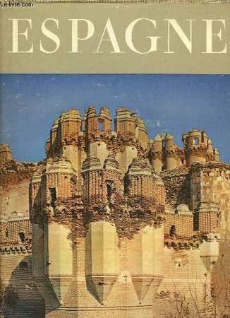
HURLIMANN MARTIN
ESPAGNE / COLLECTION ATLANTIS
BRAUN & CIE. 1954. In-4. Relié toilé. Etat d'usage, Couv. convenable, Dos satisfaisant, Intérieur frais. XIX + 236 pages - nombreuses photos en noir et blanc hors texte - 1 carte sur les contre-plats.. . . . Classification Dewey : 946-Espagne, Portugal
Bookseller reference : RO20176477
|
|
|
HURLIMANN MARTIN
ESPAGNE - COLLECTION ATLANTIS.
LES EDITIONS BRAUN & CIE. 1954. In-4. Relié. Bon état, Couv. convenable, Dos satisfaisant, Intérieur frais. XIX + 236 pages - jaquette en bon état - nombreuses photographies en noir et blanc hors texte.. Avec Jaquette. . . Classification Dewey : 946-Espagne, Portugal
Bookseller reference : R240089402
|
|
|
HURLIMANN MARTIN
ESPAGNE- COLLECTION ATLANTIS
BRAUN ET CIE. 1965. In-4. Relié. Bon état, Couv. convenable, Dos satisfaisant, Intérieur frais. 234 pages- nombreuses illustrations en noir et blanc hors texte- légères rousseurs sur les pages de garde et tranches. Avec Jaquette. . . Classification Dewey : 946-Espagne, Portugal
Bookseller reference : R200055437
|
|
|
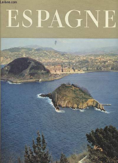
Hurlimann Martin
Espagne -
Braun & Cie. 1955. In-4. Relié. Bon état, Couv. convenable, Dos satisfaisant, Intérieur frais. XVII +21 + 235 pages de planches de photographies en noir et blanc. Texte sur 2 colonnes.Contre plats illustrés. Jaquette avec petite déchirure à l'arrière .. Avec Jaquette. Sous Emboitage. . Classification Dewey : 946-Espagne, Portugal
Bookseller reference : R160207845
|
|
|
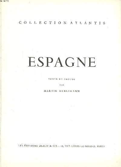
Hurlimann Martin
Espagne Collection Atlantis
Braun & Cie. 1954. In-4. Relié. Bon état, Couv. convenable, Dos satisfaisant, Intérieur frais. 236 pages augmentées de nombreuses photos en noir et blanc dans et hors texte.. . . . Classification Dewey : 946-Espagne, Portugal
Bookseller reference : R260267923
|
|
|
HUREAU JEAN
L' ESPAGNE AUJOURD'HUI
Arthaud. 1971. In-12. Broché. Bon état, Couv. convenable, Dos satisfaisant, Intérieur frais. 249 pages. Nombreuses photos en couleurs dans et hors texte + 16 cartes et itinéraires.. . . . Classification Dewey : 946-Espagne, Portugal
Bookseller reference : RO70114831
|
|
|
HUREAU Jean
L'Espagne aujourd'hui.
ARTHAUD. 2nde édition. 1971. In-4. Broché. Bon état, Couv. convenable, Dos satisfaisant, Intérieur frais. 249 pages. Nombreuses photos en couleurs dans le texte et hors-texte. Quelques cartes en couleurs dans le texte.. . . . Classification Dewey : 946-Espagne, Portugal
Bookseller reference : RO80015358
|
|
|
HURLIMANN MARTIN
ESPAGNE
Braun & Cie. 1954. In-4 Carré. Relié toilé. Etat d'usage. Tâchée. Dos fané. Intérieur acceptable. 237 pages. Illustré de nombreuses photos héliogravées en noir et blanc hors texte, et de quelques photos en couleur hors texte. Annotations en page de garde. Collection 'Atlantis'.

|
|
|
HUSSON Pierre (1678 - 1733)
Carte General des Royaumes d'Espagne et de Portugal, avec Leurs Principales Division & C.
Mappa rara di Spagna e Portogallo, pubblicata da Perre Husson all'Aia (Den Haag), che identifica una serie di battaglie significative combattute durante la guerra di successione spagnola.Esemplare del secondo stato, pubblicato da Rainer & Joshua Ottens, Amsterdam intorno al 1750.La mappa include una serie di battaglie, tra cui una rappresentazione grafica della battaglia navale di Velez-Malaga (24 agosto 1704), la più grande battaglia navale combattuta durante la guerra di successione spagnola, insieme a una rappresentazione di una più grande battaglia navale al largo la costa catalana, rappresentante dell'assedio di Barcellona da parte degli inglesi sotto il conte di Peterborough. Altre battaglie notate includono la Baia di Vigo (23 ottobre 1702) e l'assedio di Gibilterra (24 luglio 1704).Il dettaglio nella mappa è eccellente, inclusa una rappresentazione delle strade in tutta la penisola iberica.La mappa comprende 16 stemmi, montati su un cartiglio elegantemente inciso.Incisione in rame, bella coloritura coeva, in ottimo stato di conservazione. Rare map of Spain and Portugal, published by Perre Husson in the Hague (Den Haag), identifying a number of the significant battles fought duing the war of Spanish Succession.Example of the second state, published by Rainer & Joshua Ottens, Amsterdam circa 1750.The map includes a number of battles, including a graphic depiction of the naval Battle of Velez-Malaga (August 24, 1704), the largest naval battle fought during the War of the Spanish Succession, along with a representation of a larger naval battle off the Catalan Coast, representative of the Siege of Barcelona by the British under the Earl of Peterborough. Other battles noted include the Bay of Vigo (October 23, 1702) and the Siege of Gibraltar (July 24, 1704).The detail in the map is excellent, including a depiction of the roads throughout the Iberian Peninsula.The map includes 16 coats of arms, mounted on an elegantly engraved cartouche. A fine example of this rare and highly detailed map.Copperpalte with fine original colour, very good condition.

|
|
|
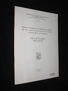
Hut de B. Gonçalves Antonio A.,Lurdes Reis Maria de
Estudo mineralogico de elementos de adorno de cor verde provenientes de estaçoes arqueologicas portuguesas
Instituto de Antropologia Dr. Mendes Corrêa Dos agrafé 1982 In-8, (17.5x24.5 cm), dos agrafé, 18 pages, texte en portugais, planches dépliantes, ex-libris de Giot ; plats légèrement jaunis, bon état. Livraison a domicile (La Poste) ou en Mondial Relay sur simple demande.
Bookseller reference : ql809
|
|
|
Hutchinson, Walter: Editor
Hutchinson's Pictorial History of the War, Series 10, Number 6, February 26 - March 4, 1941
32 pages. Printed on glossy stock. Profusely illustrated with black and white photos and illustrations. Features: Wonderful full-page photo of shell leaving the muzzle of a 12" rail-mounted Howitzer 'somewhere in England'; Enemy activities in pictures - crashed German bomber in Portugal, Field-Marshal von Brauchitsch, Commander-in-Chief of the German armed forces inspects a massive rail-mounted gun, German troops prepare for a British invasion by attempting to haul a small gun up a steep bank; Photo-illustrated text of a broadcast by Vernon Bartlett, M.P. entitled "The Position in the Balkans"; Map of Bulgariaentitled "Nazi Threat to Greek and Turkish Frontiers; Photos of Bulgaria; New U.S. Ambassador John G. Winant is welcomed by the King; Belgian troops training in England; Illustration by S. Drigin recounts the amazing story of how a wing-damaged Sunderland was taxied home for five hours after a bombing run to Norway - crewmembers took turns holding onto the end of the opposite wing to compensate for the damage in the intense cold; Interesting scenes in the Western Desert; Great photo of British artillery pounding the Italians out of Derna, another one of their Libyan strongholds, plus the infantry moving into Derna; Photos of the occupation of Bengazi; Centerfold illustration by Montague B. Black shows a successful engagement near Keren in Eritrea; Italian POWs in their camp; British POWs of the Italians in Addis Adaba; Aerial photo taken during R.A.F. attack on Massawa; Aerial photo of Italian S.79s burning near Kismayu; Aerial photo lf S.79 Italian bombers burning in Gobwen aerodrome, near Kismayu; Arctic War in Albania - photo of Greek troops using light tanks abandoned by the Italians; Photo of Italian colonel and his A.D.C. captured in Albania; Various winter photos of Greek troops in Albania; Photo-illustrated text of broadcast by Middle East Air Commodore R.B. Goddard entitled "Strategy of the Air"; Photo of Wellington bomber gunners putting on their 'hot suits' - electrically heated clothing, boots and gloves; Photo of dozens of Australian radio mechanics arriving in England; Photos of men of the Suffolk Regiment preparing for the second round; Photos of coastal watch in Northern Ireland; Commentary on the war this week; Photos aboard the Polish destroyer Piorun, including a fantasting full-page shot of a torpedo in mid air as it is shot from the deck of the vessel; Summary of the chief events in the war this week. Clean and unmarked with moderate wear. Binding tight. A quality copy. Book

|
|
|
Huzel, Erhard / Löber, Burckhardt / Wollmann, Ines
Erben und Vererben in Portugal. Handbuch für Erben und Erblasser.
Frankfurt. Edition für internationale Wirtschaft. 2009. 226 S. Hardcover. Register. Viele Immobilienbesitzer in Portugal fragen sich, wie ihr dortiger Besitz vererbt werden kann. Gilt portugiesisches oder deutsches Erbrecht? Werden Erbschaftssteuern vom portugiesischen oder deutschen Fiskus oder von beiden erhoben? Wie ist die Situation in Bezug auf in Deutschland errichtete Testamente? Das von den drei in Deutschland und Portugal residierenden Autoren vorgelegte Werk gibt umfassend Antwort auf diese und viele andere Fragen. In gleicher Weise wird der Erbe von in Portugal belegenen Immobilien oder Bankvermögen deutscher Erblasser umfassend über seine Rechte und Möglichkeiten informiert. / Verständliche Anleitung für deutsch-portugiesische Erbfälle / Checkliste für Erben und Erblasser / Die deutsch-portugiesische Erbschaftssteuersituation / Das Kompendium für deutsch-portugiesische Nachlassfragen. Das hier vorgelegte Werk ist die erste Monographie zur deutsch-portugiesischen Erbrechtssituation. Minimal berieben, sonst sehr gut erhalten.
Bookseller reference : PTG17226
|
|
|
Huzel, Erhard / Löber, Burckhardt / Wollmann, Ines
Erben und Vererben in Portugal. Handbuch für Erben und Erblasser.
Frankfurt. Edition für internationale Wirtschaft. 2009. 226 S. Hardcover. Register. Viele Immobilienbesitzer in Portugal fragen sich, wie ihr dortiger Besitz vererbt werden kann. Gilt portugiesisches oder deutsches Erbrecht? Werden Erbschaftssteuern vom portugiesischen oder deutschen Fiskus oder von beiden erhoben? Wie ist die Situation in Bezug auf in Deutschland errichtete Testamente? Das von den drei in Deutschland und Portugal residierenden Autoren vorgelegte Werk gibt umfassend Antwort auf diese und viele andere Fragen. In gleicher Weise wird der Erbe von in Portugal belegenen Immobilien oder Bankvermögen deutscher Erblasser umfassend über seine Rechte und Möglichkeiten informiert. / Verständliche Anleitung für deutsch-portugiesische Erbfälle / Checkliste für Erben und Erblasser / Die deutsch-portugiesische Erbschaftssteuersituation / Das Kompendium für deutsch-portugiesische Nachlassfragen. Das hier vorgelegte Werk ist die erste Monographie zur deutsch-portugiesischen Erbrechtssituation. Minimal berieben, sonst sehr gut erhalten.
Bookseller reference : PTG17196
|
|
|
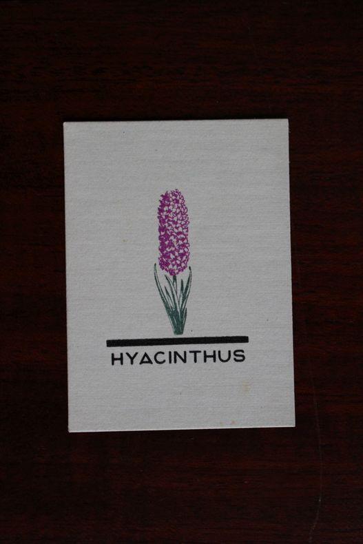
Hyacinthus, Portugal (propriétaire), Ex-libris.
Ex-libris.
Hyacinthus, Portugal (propriétaire), Ex-libris. Ex libris (55*40 mm).
Bookseller reference : 004677
|
|
|

 Receive by email
 Download as PDF document
 RSS feed
 Permanent link


