|
|
|
HONDIUS Jr. Jodocus (Amsterdam 1594 -1629)
Baia de Cadis
Carta geografica tratta dal Tabularum Geographicarum contractarum libri septem di Petrus Bertius, edizione latina del 1616. L'opera contiene 219 carte che illustrano questa nuova versione della geografia del Bertius, per la prima volta pubblicata nel 1612 con le carte di Barent Langenes. Le carte derivano dal grande atlante di Mercator/Hondius, delle quali molte rappresentano una semplice riduzione. "After the death of Cornelis Claesz in 1609, Jodocus Hondius II became the new publisher of the work, composed by 7 parts in 1, with engraved title-page and 220 full-page engraved maps in text. All the maps were newly engraved and slightly larger in size, because Hondius was not able to acquire the original plates. With the new plates the work was definitely improved and enjoyed a growing demand of the public, which at that time had the choice between the Atlas Minor by Mercator and Bertius' Tabularum Geographicarum. The 219 plates, with the oval world map appearing twice, were produced to illustrate a new version of the geography of Bertius, published in 1616. According to King, their correct attribution is by Hondius, after Mercator and Hondius, taken from Bertius, who was only responsible for revising his text again" [cfr. G. King, Miniature Antique Maps]. Incisione in rame, perfette condizioni. A superior rival to the pocket Ortelius atlas appeared about 1598, under the imprint of Barent Langenes and Cornelis Claesz. Claesz also published the Tabularum Geographicarum contractarum libri septem, edition with texy by Petrus Bertius, in 1600. After the death of Cornelis Claesz in 1609, Jodocus Hondius II became the new publisher of the work, composed by 7 parts in 1, with engraved title-page and 220 full-page engraved maps in text. All the maps were newly engraved and slightly larger in size, because Hondius was not able to acquire the original plates. With the new plates the work was definitely improved and enjoyed a growing demand of the public, which at that time had the choice between the Atlas Minor by Mercator and Bertius' Tabularum Geographicarum. The 219 plates, with the oval world map appearing twice, were produced to illustrate a new version of the geography of Bertius, published in 1616. According to King, their correct attribution is by Hondius, after Mercator and Hondius, taken from Bertius, who was only responsible for revising his text again. "After the death of Cornelis Claesz in 1609, Jodocus Hondius II became the new publisher of the work, composed by 7 parts in 1, with engraved title-page and 220 full-page engraved maps in text. All the maps were newly engraved and slightly larger in size, because Hondius was not able to acquire the original plates. With the new plates the work was definitely improved and enjoyed a growing demand of the public, which at that time had the choice between the Atlas Minor by Mercator and Bertius' Tabularum Geographicarum. The 219 plates, with the oval world map appearing twice, were produced to illustrate a new version of the geography of Bertius, published in 1616. According to King, their correct attribution is by Hondius, after Mercator and Hondius, taken from Bertius, who was only responsible for revising his text again" [cf. G. King, Miniature Antique Maps]. Copperplate, in very good conditions. Koeman p. 42; King p. 96/99.

|
|
|
HONDIUS Jr. Jodocus (Amsterdam 1594 -1629)
Castilia Vetus et Nova
Carta geografica tratta dal Tabularum Geographicarum contractarum libri septem di Petrus Bertius, edizione latina del 1616. L'opera contiene 219 carte che illustrano questa nuova versione della geografia del Bertius, per la prima volta pubblicata nel 1612 con le carte di Barent Langenes. Le carte derivano dal grande atlante di Mercator/Hondius, delle quali molte rappresentano una semplice riduzione. "After the death of Cornelis Claesz in 1609, Jodocus Hondius II became the new publisher of the work, composed by 7 parts in 1, with engraved title-page and 220 full-page engraved maps in text. All the maps were newly engraved and slightly larger in size, because Hondius was not able to acquire the original plates. With the new plates the work was definitely improved and enjoyed a growing demand of the public, which at that time had the choice between the Atlas Minor by Mercator and Bertius' Tabularum Geographicarum. The 219 plates, with the oval world map appearing twice, were produced to illustrate a new version of the geography of Bertius, published in 1616. According to King, their correct attribution is by Hondius, after Mercator and Hondius, taken from Bertius, who was only responsible for revising his text again" [cfr. G. King, Miniature Antique Maps]. Incisione in rame, perfette condizioni. A superior rival to the pocket Ortelius atlas appeared about 1598, under the imprint of Barent Langenes and Cornelis Claesz. Claesz also published the Tabularum Geographicarum contractarum libri septem, edition with texy by Petrus Bertius, in 1600. After the death of Cornelis Claesz in 1609, Jodocus Hondius II became the new publisher of the work, composed by 7 parts in 1, with engraved title-page and 220 full-page engraved maps in text. All the maps were newly engraved and slightly larger in size, because Hondius was not able to acquire the original plates. With the new plates the work was definitely improved and enjoyed a growing demand of the public, which at that time had the choice between the Atlas Minor by Mercator and Bertius' Tabularum Geographicarum. The 219 plates, with the oval world map appearing twice, were produced to illustrate a new version of the geography of Bertius, published in 1616. According to King, their correct attribution is by Hondius, after Mercator and Hondius, taken from Bertius, who was only responsible for revising his text again. "After the death of Cornelis Claesz in 1609, Jodocus Hondius II became the new publisher of the work, composed by 7 parts in 1, with engraved title-page and 220 full-page engraved maps in text. All the maps were newly engraved and slightly larger in size, because Hondius was not able to acquire the original plates. With the new plates the work was definitely improved and enjoyed a growing demand of the public, which at that time had the choice between the Atlas Minor by Mercator and Bertius' Tabularum Geographicarum. The 219 plates, with the oval world map appearing twice, were produced to illustrate a new version of the geography of Bertius, published in 1616. According to King, their correct attribution is by Hondius, after Mercator and Hondius, taken from Bertius, who was only responsible for revising his text again" [cf. G. King, Miniature Antique Maps]. Copperplate, in very good conditions. Koeman p. 42; King p. 96/99.

|
|
|
HONDIUS Jr. Jodocus (Amsterdam 1594 -1629)
Estrema Dura
Carta geografica tratta dal Tabularum Geographicarum contractarum libri septem di Petrus Bertius, edizione latina del 1616. L'opera contiene 219 carte che illustrano questa nuova versione della geografia del Bertius, per la prima volta pubblicata nel 1612 con le carte di Barent Langenes. Le carte derivano dal grande atlante di Mercator/Hondius, delle quali molte rappresentano una semplice riduzione. "After the death of Cornelis Claesz in 1609, Jodocus Hondius II became the new publisher of the work, composed by 7 parts in 1, with engraved title-page and 220 full-page engraved maps in text. All the maps were newly engraved and slightly larger in size, because Hondius was not able to acquire the original plates. With the new plates the work was definitely improved and enjoyed a growing demand of the public, which at that time had the choice between the Atlas Minor by Mercator and Bertius' Tabularum Geographicarum. The 219 plates, with the oval world map appearing twice, were produced to illustrate a new version of the geography of Bertius, published in 1616. According to King, their correct attribution is by Hondius, after Mercator and Hondius, taken from Bertius, who was only responsible for revising his text again" [cfr. G. King, Miniature Antique Maps]. Incisione in rame, perfette condizioni. A superior rival to the pocket Ortelius atlas appeared about 1598, under the imprint of Barent Langenes and Cornelis Claesz. Claesz also published the Tabularum Geographicarum contractarum libri septem, edition with texy by Petrus Bertius, in 1600. After the death of Cornelis Claesz in 1609, Jodocus Hondius II became the new publisher of the work, composed by 7 parts in 1, with engraved title-page and 220 full-page engraved maps in text. All the maps were newly engraved and slightly larger in size, because Hondius was not able to acquire the original plates. With the new plates the work was definitely improved and enjoyed a growing demand of the public, which at that time had the choice between the Atlas Minor by Mercator and Bertius' Tabularum Geographicarum. The 219 plates, with the oval world map appearing twice, were produced to illustrate a new version of the geography of Bertius, published in 1616. According to King, their correct attribution is by Hondius, after Mercator and Hondius, taken from Bertius, who was only responsible for revising his text again. "After the death of Cornelis Claesz in 1609, Jodocus Hondius II became the new publisher of the work, composed by 7 parts in 1, with engraved title-page and 220 full-page engraved maps in text. All the maps were newly engraved and slightly larger in size, because Hondius was not able to acquire the original plates. With the new plates the work was definitely improved and enjoyed a growing demand of the public, which at that time had the choice between the Atlas Minor by Mercator and Bertius' Tabularum Geographicarum. The 219 plates, with the oval world map appearing twice, were produced to illustrate a new version of the geography of Bertius, published in 1616. According to King, their correct attribution is by Hondius, after Mercator and Hondius, taken from Bertius, who was only responsible for revising his text again" [cf. G. King, Miniature Antique Maps]. Copperplate, in very good conditions. Koeman p. 42; King p. 96/99.

|
|
|
HONDIUS Jr. Jodocus (Amsterdam 1594 -1629)
Guipuscola et Biscaia
Carta geografica tratta dal Tabularum Geographicarum contractarum libri septem di Petrus Bertius, edizione latina del 1616. L'opera contiene 219 carte che illustrano questa nuova versione della geografia del Bertius, per la prima volta pubblicata nel 1612 con le carte di Barent Langenes. Le carte derivano dal grande atlante di Mercator/Hondius, delle quali molte rappresentano una semplice riduzione. "After the death of Cornelis Claesz in 1609, Jodocus Hondius II became the new publisher of the work, composed by 7 parts in 1, with engraved title-page and 220 full-page engraved maps in text. All the maps were newly engraved and slightly larger in size, because Hondius was not able to acquire the original plates. With the new plates the work was definitely improved and enjoyed a growing demand of the public, which at that time had the choice between the Atlas Minor by Mercator and Bertius' Tabularum Geographicarum. The 219 plates, with the oval world map appearing twice, were produced to illustrate a new version of the geography of Bertius, published in 1616. According to King, their correct attribution is by Hondius, after Mercator and Hondius, taken from Bertius, who was only responsible for revising his text again" [cfr. G. King, Miniature Antique Maps]. Incisione in rame, perfette condizioni. A superior rival to the pocket Ortelius atlas appeared about 1598, under the imprint of Barent Langenes and Cornelis Claesz. Claesz also published the Tabularum Geographicarum contractarum libri septem, edition with texy by Petrus Bertius, in 1600. After the death of Cornelis Claesz in 1609, Jodocus Hondius II became the new publisher of the work, composed by 7 parts in 1, with engraved title-page and 220 full-page engraved maps in text. All the maps were newly engraved and slightly larger in size, because Hondius was not able to acquire the original plates. With the new plates the work was definitely improved and enjoyed a growing demand of the public, which at that time had the choice between the Atlas Minor by Mercator and Bertius' Tabularum Geographicarum. The 219 plates, with the oval world map appearing twice, were produced to illustrate a new version of the geography of Bertius, published in 1616. According to King, their correct attribution is by Hondius, after Mercator and Hondius, taken from Bertius, who was only responsible for revising his text again. "After the death of Cornelis Claesz in 1609, Jodocus Hondius II became the new publisher of the work, composed by 7 parts in 1, with engraved title-page and 220 full-page engraved maps in text. All the maps were newly engraved and slightly larger in size, because Hondius was not able to acquire the original plates. With the new plates the work was definitely improved and enjoyed a growing demand of the public, which at that time had the choice between the Atlas Minor by Mercator and Bertius' Tabularum Geographicarum. The 219 plates, with the oval world map appearing twice, were produced to illustrate a new version of the geography of Bertius, published in 1616. According to King, their correct attribution is by Hondius, after Mercator and Hondius, taken from Bertius, who was only responsible for revising his text again" [cf. G. King, Miniature Antique Maps]. Copperplate, in very good conditions. Koeman p. 42; King p. 96/99.

|
|
|
HONDIUS Jr. Jodocus (Amsterdam 1594 -1629)
Legio
Carta geografica tratta dal Tabularum Geographicarum contractarum libri septem di Petrus Bertius, edizione latina del 1616. L'opera contiene 219 carte che illustrano questa nuova versione della geografia del Bertius, per la prima volta pubblicata nel 1612 con le carte di Barent Langenes. Le carte derivano dal grande atlante di Mercator/Hondius, delle quali molte rappresentano una semplice riduzione. "After the death of Cornelis Claesz in 1609, Jodocus Hondius II became the new publisher of the work, composed by 7 parts in 1, with engraved title-page and 220 full-page engraved maps in text. All the maps were newly engraved and slightly larger in size, because Hondius was not able to acquire the original plates. With the new plates the work was definitely improved and enjoyed a growing demand of the public, which at that time had the choice between the Atlas Minor by Mercator and Bertius' Tabularum Geographicarum. The 219 plates, with the oval world map appearing twice, were produced to illustrate a new version of the geography of Bertius, published in 1616. According to King, their correct attribution is by Hondius, after Mercator and Hondius, taken from Bertius, who was only responsible for revising his text again" [cfr. G. King, Miniature Antique Maps]. Incisione in rame, perfette condizioni. A superior rival to the pocket Ortelius atlas appeared about 1598, under the imprint of Barent Langenes and Cornelis Claesz. Claesz also published the Tabularum Geographicarum contractarum libri septem, edition with texy by Petrus Bertius, in 1600. After the death of Cornelis Claesz in 1609, Jodocus Hondius II became the new publisher of the work, composed by 7 parts in 1, with engraved title-page and 220 full-page engraved maps in text. All the maps were newly engraved and slightly larger in size, because Hondius was not able to acquire the original plates. With the new plates the work was definitely improved and enjoyed a growing demand of the public, which at that time had the choice between the Atlas Minor by Mercator and Bertius' Tabularum Geographicarum. The 219 plates, with the oval world map appearing twice, were produced to illustrate a new version of the geography of Bertius, published in 1616. According to King, their correct attribution is by Hondius, after Mercator and Hondius, taken from Bertius, who was only responsible for revising his text again. "After the death of Cornelis Claesz in 1609, Jodocus Hondius II became the new publisher of the work, composed by 7 parts in 1, with engraved title-page and 220 full-page engraved maps in text. All the maps were newly engraved and slightly larger in size, because Hondius was not able to acquire the original plates. With the new plates the work was definitely improved and enjoyed a growing demand of the public, which at that time had the choice between the Atlas Minor by Mercator and Bertius' Tabularum Geographicarum. The 219 plates, with the oval world map appearing twice, were produced to illustrate a new version of the geography of Bertius, published in 1616. According to King, their correct attribution is by Hondius, after Mercator and Hondius, taken from Bertius, who was only responsible for revising his text again" [cf. G. King, Miniature Antique Maps]. Copperplate, in very good conditions. Koeman p. 42; King p. 96/99.

|
|
|
HONDIUS Jr. Jodocus (Amsterdam 1594 -1629)
Navarra
Carta geografica tratta dal Tabularum Geographicarum contractarum libri septem di Petrus Bertius, edizione latina del 1616. L'opera contiene 219 carte che illustrano questa nuova versione della geografia del Bertius, per la prima volta pubblicata nel 1612 con le carte di Barent Langenes. Le carte derivano dal grande atlante di Mercator/Hondius, delle quali molte rappresentano una semplice riduzione. "After the death of Cornelis Claesz in 1609, Jodocus Hondius II became the new publisher of the work, composed by 7 parts in 1, with engraved title-page and 220 full-page engraved maps in text. All the maps were newly engraved and slightly larger in size, because Hondius was not able to acquire the original plates. With the new plates the work was definitely improved and enjoyed a growing demand of the public, which at that time had the choice between the Atlas Minor by Mercator and Bertius' Tabularum Geographicarum. The 219 plates, with the oval world map appearing twice, were produced to illustrate a new version of the geography of Bertius, published in 1616. According to King, their correct attribution is by Hondius, after Mercator and Hondius, taken from Bertius, who was only responsible for revising his text again" [cfr. G. King, Miniature Antique Maps]. Incisione in rame, perfette condizioni. A superior rival to the pocket Ortelius atlas appeared about 1598, under the imprint of Barent Langenes and Cornelis Claesz. Claesz also published the Tabularum Geographicarum contractarum libri septem, edition with texy by Petrus Bertius, in 1600. After the death of Cornelis Claesz in 1609, Jodocus Hondius II became the new publisher of the work, composed by 7 parts in 1, with engraved title-page and 220 full-page engraved maps in text. All the maps were newly engraved and slightly larger in size, because Hondius was not able to acquire the original plates. With the new plates the work was definitely improved and enjoyed a growing demand of the public, which at that time had the choice between the Atlas Minor by Mercator and Bertius' Tabularum Geographicarum. The 219 plates, with the oval world map appearing twice, were produced to illustrate a new version of the geography of Bertius, published in 1616. According to King, their correct attribution is by Hondius, after Mercator and Hondius, taken from Bertius, who was only responsible for revising his text again. "After the death of Cornelis Claesz in 1609, Jodocus Hondius II became the new publisher of the work, composed by 7 parts in 1, with engraved title-page and 220 full-page engraved maps in text. All the maps were newly engraved and slightly larger in size, because Hondius was not able to acquire the original plates. With the new plates the work was definitely improved and enjoyed a growing demand of the public, which at that time had the choice between the Atlas Minor by Mercator and Bertius' Tabularum Geographicarum. The 219 plates, with the oval world map appearing twice, were produced to illustrate a new version of the geography of Bertius, published in 1616. According to King, their correct attribution is by Hondius, after Mercator and Hondius, taken from Bertius, who was only responsible for revising his text again" [cf. G. King, Miniature Antique Maps]. Copperplate, in very good conditions. Koeman p. 42; King p. 96/99.

|
|
|
HONDIUS Jr. Jodocus (Amsterdam 1594 -1629)
Portugallia
Carta geografica tratta dal Tabularum Geographicarum contractarum libri septem di Petrus Bertius, edizione latina del 1616. L'opera contiene 219 carte che illustrano questa nuova versione della geografia del Bertius, per la prima volta pubblicata nel 1612 con le carte di Barent Langenes. Le carte derivano dal grande atlante di Mercator/Hondius, delle quali molte rappresentano una semplice riduzione. "After the death of Cornelis Claesz in 1609, Jodocus Hondius II became the new publisher of the work, composed by 7 parts in 1, with engraved title-page and 220 full-page engraved maps in text. All the maps were newly engraved and slightly larger in size, because Hondius was not able to acquire the original plates. With the new plates the work was definitely improved and enjoyed a growing demand of the public, which at that time had the choice between the Atlas Minor by Mercator and Bertius' Tabularum Geographicarum. The 219 plates, with the oval world map appearing twice, were produced to illustrate a new version of the geography of Bertius, published in 1616. According to King, their correct attribution is by Hondius, after Mercator and Hondius, taken from Bertius, who was only responsible for revising his text again" [cfr. G. King, Miniature Antique Maps]. Incisione in rame, perfette condizioni. A superior rival to the pocket Ortelius atlas appeared about 1598, under the imprint of Barent Langenes and Cornelis Claesz. Claesz also published the Tabularum Geographicarum contractarum libri septem, edition with texy by Petrus Bertius, in 1600. After the death of Cornelis Claesz in 1609, Jodocus Hondius II became the new publisher of the work, composed by 7 parts in 1, with engraved title-page and 220 full-page engraved maps in text. All the maps were newly engraved and slightly larger in size, because Hondius was not able to acquire the original plates. With the new plates the work was definitely improved and enjoyed a growing demand of the public, which at that time had the choice between the Atlas Minor by Mercator and Bertius' Tabularum Geographicarum. The 219 plates, with the oval world map appearing twice, were produced to illustrate a new version of the geography of Bertius, published in 1616. According to King, their correct attribution is by Hondius, after Mercator and Hondius, taken from Bertius, who was only responsible for revising his text again. "After the death of Cornelis Claesz in 1609, Jodocus Hondius II became the new publisher of the work, composed by 7 parts in 1, with engraved title-page and 220 full-page engraved maps in text. All the maps were newly engraved and slightly larger in size, because Hondius was not able to acquire the original plates. With the new plates the work was definitely improved and enjoyed a growing demand of the public, which at that time had the choice between the Atlas Minor by Mercator and Bertius' Tabularum Geographicarum. The 219 plates, with the oval world map appearing twice, were produced to illustrate a new version of the geography of Bertius, published in 1616. According to King, their correct attribution is by Hondius, after Mercator and Hondius, taken from Bertius, who was only responsible for revising his text again" [cf. G. King, Miniature Antique Maps]. Copperplate, in very good conditions. Koeman p. 42; King p. 96/99.

|
|
|
HONDIUS Jr. Jodocus (Amsterdam 1594 -1629)
Tercera
Carta geografica tratta dal Tabularum Geographicarum contractarum libri septem di Petrus Bertius, edizione latina del 1616. L'opera contiene 219 carte che illustrano questa nuova versione della geografia del Bertius, per la prima volta pubblicata nel 1612 con le carte di Barent Langenes. Le carte derivano dal grande atlante di Mercator/Hondius, delle quali molte rappresentano una semplice riduzione. "After the death of Cornelis Claesz in 1609, Jodocus Hondius II became the new publisher of the work, composed by 7 parts in 1, with engraved title-page and 220 full-page engraved maps in text. All the maps were newly engraved and slightly larger in size, because Hondius was not able to acquire the original plates. With the new plates the work was definitely improved and enjoyed a growing demand of the public, which at that time had the choice between the Atlas Minor by Mercator and Bertius' Tabularum Geographicarum. The 219 plates, with the oval world map appearing twice, were produced to illustrate a new version of the geography of Bertius, published in 1616. According to King, their correct attribution is by Hondius, after Mercator and Hondius, taken from Bertius, who was only responsible for revising his text again" [cfr. G. King, Miniature Antique Maps]. Incisione in rame, perfette condizioni. A superior rival to the pocket Ortelius atlas appeared about 1598, under the imprint of Barent Langenes and Cornelis Claesz. Claesz also published the Tabularum Geographicarum contractarum libri septem, edition with texy by Petrus Bertius, in 1600. After the death of Cornelis Claesz in 1609, Jodocus Hondius II became the new publisher of the work, composed by 7 parts in 1, with engraved title-page and 220 full-page engraved maps in text. All the maps were newly engraved and slightly larger in size, because Hondius was not able to acquire the original plates. With the new plates the work was definitely improved and enjoyed a growing demand of the public, which at that time had the choice between the Atlas Minor by Mercator and Bertius' Tabularum Geographicarum. The 219 plates, with the oval world map appearing twice, were produced to illustrate a new version of the geography of Bertius, published in 1616. According to King, their correct attribution is by Hondius, after Mercator and Hondius, taken from Bertius, who was only responsible for revising his text again. "After the death of Cornelis Claesz in 1609, Jodocus Hondius II became the new publisher of the work, composed by 7 parts in 1, with engraved title-page and 220 full-page engraved maps in text. All the maps were newly engraved and slightly larger in size, because Hondius was not able to acquire the original plates. With the new plates the work was definitely improved and enjoyed a growing demand of the public, which at that time had the choice between the Atlas Minor by Mercator and Bertius' Tabularum Geographicarum. The 219 plates, with the oval world map appearing twice, were produced to illustrate a new version of the geography of Bertius, published in 1616. According to King, their correct attribution is by Hondius, after Mercator and Hondius, taken from Bertius, who was only responsible for revising his text again" [cf. G. King, Miniature Antique Maps]. Copperplate, in very good conditions. Koeman p. 42; King p. 96/99.

|
|
|
HONDIUS Jr. Jodocus (Amsterdam 1594 -1629)
Valentia
Carta geografica tratta dal Tabularum Geographicarum contractarum libri septem di Petrus Bertius, edizione latina del 1616. L'opera contiene 219 carte che illustrano questa nuova versione della geografia del Bertius, per la prima volta pubblicata nel 1612 con le carte di Barent Langenes. Le carte derivano dal grande atlante di Mercator/Hondius, delle quali molte rappresentano una semplice riduzione. "After the death of Cornelis Claesz in 1609, Jodocus Hondius II became the new publisher of the work, composed by 7 parts in 1, with engraved title-page and 220 full-page engraved maps in text. All the maps were newly engraved and slightly larger in size, because Hondius was not able to acquire the original plates. With the new plates the work was definitely improved and enjoyed a growing demand of the public, which at that time had the choice between the Atlas Minor by Mercator and Bertius' Tabularum Geographicarum. The 219 plates, with the oval world map appearing twice, were produced to illustrate a new version of the geography of Bertius, published in 1616. According to King, their correct attribution is by Hondius, after Mercator and Hondius, taken from Bertius, who was only responsible for revising his text again" [cfr. G. King, Miniature Antique Maps]. Incisione in rame, perfette condizioni. A superior rival to the pocket Ortelius atlas appeared about 1598, under the imprint of Barent Langenes and Cornelis Claesz. Claesz also published the Tabularum Geographicarum contractarum libri septem, edition with texy by Petrus Bertius, in 1600. After the death of Cornelis Claesz in 1609, Jodocus Hondius II became the new publisher of the work, composed by 7 parts in 1, with engraved title-page and 220 full-page engraved maps in text. All the maps were newly engraved and slightly larger in size, because Hondius was not able to acquire the original plates. With the new plates the work was definitely improved and enjoyed a growing demand of the public, which at that time had the choice between the Atlas Minor by Mercator and Bertius' Tabularum Geographicarum. The 219 plates, with the oval world map appearing twice, were produced to illustrate a new version of the geography of Bertius, published in 1616. According to King, their correct attribution is by Hondius, after Mercator and Hondius, taken from Bertius, who was only responsible for revising his text again. "After the death of Cornelis Claesz in 1609, Jodocus Hondius II became the new publisher of the work, composed by 7 parts in 1, with engraved title-page and 220 full-page engraved maps in text. All the maps were newly engraved and slightly larger in size, because Hondius was not able to acquire the original plates. With the new plates the work was definitely improved and enjoyed a growing demand of the public, which at that time had the choice between the Atlas Minor by Mercator and Bertius' Tabularum Geographicarum. The 219 plates, with the oval world map appearing twice, were produced to illustrate a new version of the geography of Bertius, published in 1616. According to King, their correct attribution is by Hondius, after Mercator and Hondius, taken from Bertius, who was only responsible for revising his text again" [cf. G. King, Miniature Antique Maps]. Copperplate, in very good conditions. Koeman p. 42; King p. 96/99.

|
|
|
Horta JoseI Maria da Ponte Portugal. Treaties etc. Louis I
Tratado de LourencI§o Marques; sua historia parlamentar seu valor technico e social sua conclusaIƒo 1882 FULL LEATHER BOUND
2019. SUPER DELUXE EDITION. New. Antique look with Golden Leaf Printing and embossing with round Spine completely handmade bindingextra customization on request like Color Leather Colored book special gold leaf printing etc. Reprinted in 2019 with the help of original edition published long back 1882. This book is printed in black & white sewing binding for longer life Printed on high quality Paper re-sized as per Current standards professionally processed without changing its contents. As these are old books we processed each page manually and make them readable but in some cases some pages which are blur or missing or black spots. If it is multi volume set then it is only single volume if you wish to order a specific or all the volumes you may contact us. We expect that you will understand our compulsion in these books. We found this book important for the readers who want to know more about our old treasure in old look so we brought it back to the shelves. Hope you will like it and give your comments and suggestions. Lang: - por Pages 62. EXTRA 10 DAYS APART FROM THE NORMAL SHIPPING PERIOD WILL BE REQUIRED. Normal Hardbound Edition is also available on request. unknown
Bookseller reference : SD1111007001515
|
|
|
Horta JoseI Maria da Ponte Portugal. Treaties etc. Louis I
Tratado de LourencI§o Marques; sua historia parlamentar seu valor technico e social sua conclusaIƒo 1882 Leather Bound
2019. Leather Bound. New. Leather Binding on Spine and Corners with Golden Leaf Printing on round Spine. Reprinted in 2019 with the help of original edition published long back 1882. This book is printed in black & white sewing binding for longer life Printed on high quality Paper re-sized as per Current standards professionally processed without changing its contents. As these are old books we processed each page manually and make them readable but in some cases some pages which are blur or missing or black spots. If it is multi volume set then it is only single volume if you wish to order a specific or all the volumes you may contact us. We expect that you will understand our compulsion in these books. We found this book important for the readers who want to know more about our old treasure so we brought it back to the shelves. Hope you will like it and give your comments and suggestions. Lang: - por Pages 62. EXTRA 10 DAYS APART FROM THE NORMAL SHIPPING PERIOD WILL BE REQUIRED FOR LEATHER BOUND BOOKS. FOLIO EDITION IS ALSO AVAILABLE. hardcover
Bookseller reference : LB1111007001515
|
|
|
Horta JoseI Maria da Ponte Portugal. Treaties etc. Louis I
Tratado de LourencI§o Marques; sua historia parlamentar seu valor technico e social sua conclusaIƒo 1882 Hardcover
2020. Hardcover. New. Lang: - por Pages 62. Reprinted in 2020 with the help of original edition published long back 1882. This book is Printed in black & white Hardcover sewing binding for longer life with Matt laminated multi-Colour Dust Cover Printed on high quality Paper re-sized as per Current standards professionally processed without changing its contents. As these are old books we processed each page manually and make them readable but in some cases some pages which are blur or missing or black spots. If it is multi volume set then it is only single volume if you wish to order a specific or all the volumes you may contact us. We expect that you will understand our compulsion in these books. We found this book important for the readers who want to know more about our old treasure so we brought it back to the shelves. Any type of Customisation is possible with extra charges. Hope you will like it and give your comments and suggestions. hardcover
Bookseller reference : 1111007001515
|
|
|
Hospital de S. Jose Lisbon Portugal n
Formulario geral medico-cirurgico para o Hospital Real de S. Joz� de cidade de Lisboa 1828 Hardcover
2020. Hardcover. New. Lang: - por Pages 192. Reprinted in 2020 with the help of original edition published long back 1828. This book is Printed in black & white Hardcover sewing binding for longer life with Matt laminated multi-Colour Dust Cover Printed on high quality Paper re-sized as per Current standards professionally processed without changing its contents. As these are old books we processed each page manually and make them readable but in some cases some pages which are blur or missing or black spots. If it is multi volume set then it is only single volume if you wish to order a specific or all the volumes you may contact us. We expect that you will understand our compulsion in these books. We found this book important for the readers who want to know more about our old treasure so we brought it back to the shelves. Any type of Customisation is possible with extra charges. Hope you will like it and give your comments and suggestions. hardcover
Bookseller reference : 1111016902012
|
|
|
Hospital de S. Jose Lisbon Portugal n
Formulario dos medicamentos para o Hospital N. e R. de S. Jos� de Lisboa 1845 Hardcover
2020. Hardcover. New. Lang: - por Pages 106. Reprinted in 2020 with the help of original edition published long back 1845. This book is Printed in black & white Hardcover sewing binding for longer life with Matt laminated multi-Colour Dust Cover Printed on high quality Paper re-sized as per Current standards professionally processed without changing its contents. As these are old books we processed each page manually and make them readable but in some cases some pages which are blur or missing or black spots. If it is multi volume set then it is only single volume if you wish to order a specific or all the volumes you may contact us. We expect that you will understand our compulsion in these books. We found this book important for the readers who want to know more about our old treasure so we brought it back to the shelves. Any type of Customisation is possible with extra charges. Hope you will like it and give your comments and suggestions. hardcover
Bookseller reference : 1111016902013
|
|
|
HOUDON M.L.
Connaissez-vous Barcelone
Audin. 1947. In-12. Broché. Bon état, Couv. convenable, Dos plié, Intérieur frais. 188 pages. Dos et plats un peu frotté, rousseurs sur couverture.. . . . Classification Dewey : 946-Espagne, Portugal
Bookseller reference : ROD0013716
|
|
|
HOUGHTON Claude
Les origines de la Restauration des Bourbons en Espagne.
PLON, NOURRIT et Cie. Non daté. In-8. Broché. Etat passable, Livré sans Couverture, Dos satisfaisant, Intérieur acceptable. 403 pages. Manque la page de titre et les pages de garde. Dos renforcé par une bande, avec code de bibliothèque sur la coiffe en-tête. Tampons de bibliothèque sur la page de titre et dans quelques marges.. . . . Classification Dewey : 946-Espagne, Portugal
Bookseller reference : RO80107471

|
|
|
HOUWENS POST, H.
Het Portugees van Brazilië.
Groningen-Djakarta, J.B. Wolters, 1957. 4to. mayor; 24 pp. Cubiertas originales.

|
|
|
HOWARD MICHAEL
ALGARVE - UMA PEQUENA RECORDACAO - A SOUVENIR BOOK OF PHOTOS.
A COMPTE D'AUTEUR. 2009. In-12. Relié. Très bon état, Couv. convenable, Dos satisfaisant, Intérieur frais. 64 pages - Nombreuses photos en couleurs hors-texte - Pas de texte.. . . A l'italienne. Classification Dewey : 946-Espagne, Portugal
Bookseller reference : RO80191488
|
|
|
Howe Maud
Sun and Shadow in Spain
Boston: Little Brown 1908. With pictures from photographs and illustrations in color. pages. 22.3 cm. Hardcover. Condition: Very Good/none. . Catalogs: SPAIN. Boston: Little, Brown, 1908 hardcover
Bookseller reference : 7112
|
|
|
Howells William Dean
Familiar Spanish Travels
New York: Harper & Brothers 1913. First Edition. Hardcover. Fine. Octavo 326 pages green cloth top edge gilt as well as gilt lettering on the spine and cover design. <br/><br/>Plates. BAL: 9826 Harper & Brothers hardcover
Bookseller reference : 004077
|
|
|
Howes H. W.
The Story of Gibraltar
London: PhiIip & Tacey 1946 95p. plates maps on endpapers. First Edition. Hardcover. Fine/Very Good Slight Chips. PhiIip & Tacey hardcover
Bookseller reference : 18345
|
|
|
Howse, Christopher
The Train in Spain.
London:, Bloomsbury Publishing, 2013. 8°. 263 S., Illustrationen, Farbabbildungen, Karten, Pappband (gut erhalten)
Bookseller reference : 44483BB
|
|
|
Howson Gerald
Arms for Spain: The Untold Story of the Spanish Civil War
Gordonsville Virginia U.S.A.: St Martins Press 1999. Book. Near Fine. Hardcover. First American Edition - First Printing. St Martins Press Hardcover
Bookseller reference : 004512 ISBN : 0312241771 9780312241773

|
|
|
Hoyos, Max (von)
Pedros y Pablos. Fliegen, erleben, kämpfen in Spanien. München, Bruckmann, (1939). 135 S. mit 1 Karte. 66 Abb. auf Tafeln. OHLwd. (leicht gebräunt, kl. Gebrssprn.).
o.J.
Bookseller reference : 1077
|
|
|
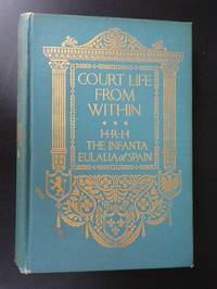
HRH. The Infanta Eulalia of Spain H. R.
Court Life from Within
New York: Dodd Mead and Company 1916. Hardcover. Good. HRH The Infanta Eulalia of Spain Court Life from Within New York Dodd Mead and Company 1916. Teal blue-green cloth with a sheen to it gold design on front and spine 8vo 280 rought-cut pages about 14 bw photographic plates including photo of author as frontispiece. Good/no DJ: Spine and corners bumped and lightly scuffed minor foxing and a few small water marks on cover erased pencil on ffep vintage bookseller sticker on front pastedown interior clean plates bright. <br/><br/> Dodd, Mead and Company hardcover
Bookseller reference : 392
|
|
|
Huber Jurg Peter
Iles canaries
Silva. Non daté. In-4. Relié. Bon état, Couv. convenable, Dos satisfaisant, Intérieur frais. 175 pages.Nombreuses photos en couleurs.. Avec Jaquette. . . Classification Dewey : 946-Espagne, Portugal
Bookseller reference : RO40031978

|
|
|
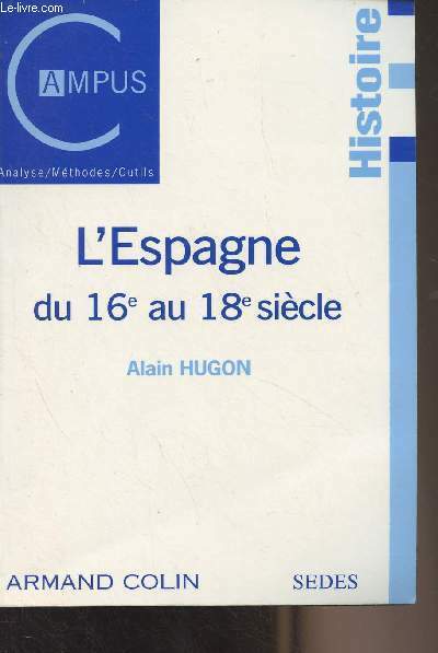
Hugon Alain
"L'Espagne du 16e au 18e siècle - ""Campus/Histoire"""
Armand Colin/SEDES. 2000. In-8. Broché. Bon état, Couv. convenable, Dos satisfaisant, Intérieur frais. 190 pages.. . . . Classification Dewey : 946-Espagne, Portugal
Bookseller reference : R300284460
|
|
|
Hugues Didier
Fantomes d'Islam & de Chine - Le voyage de Bento de Gois s.j ( 1603-1607)
Paris Chandeigne 2003 In8 - broché avec jaquette - une carte dépliante - 351 pages
Bookseller reference : 139Cu
|
|
|
Hugues Didier
Fantomes d'Islam & de Chine - Le voyage de Bento de Gois s.j ( 1603-1607)
Paris Chandeigne 2003 In8 - broché avec jaquette - une carte dépliante - 351 pages
Bookseller reference : 139Cu
|
|
|
HUGUES DEMEUDE
GRANDS VOYAGEURS - LE PORTUGAL
EDITIONS DU CHENE. 1998. In-4. Relié. Très bon état, Couv. remarquable, Dos impeccable, Intérieur frais. 159 pages - nombreuses photos en couleur dans texte et hors texte - jaquette en bon état + 2 cartes postales (1 couleur et 1 noir et blanc) et revue de presses. Avec Jaquette. . . Classification Dewey : 946-Espagne, Portugal
Bookseller reference : R200058746
|
|
|
HUGHES, E.J.
L'Espagne de Franco.
Temps Présent. 1948. In-12. Broché. Bon état, Couv. convenable, Dos satisfaisant, Intérieur frais. Paris, Temps Présent, 1948, in 12, broché, 366 pp.. . . . Classification Dewey : 946-Espagne, Portugal
Bookseller reference : R300261994
|
|
|
HUGHES ROBERT
Barcelona
Alfred A. Knopf New York: 1992. Hardcover with dustjacket. Good condition. Binding is about to be broken. ISBN: 0394580273. Alfred A. Knopf, New York: 1992 hardcover
Bookseller reference : 41754X1 ISBN : 0394580273 9780394580272

|
|
|
Hughey John David Jr
RELIGIOUS FREEDOM IN SPAIN: ITS EBB AND FLOW
Nashville:: Broadman Pr. Ink sc. on 7 pp.; else G HB;no DJ. 1955. ISBN: 211. Catalogs: SPAIN. Keywords: RELIGIOUS FREEDOM. Broadman Pr. unknown
Bookseller reference : BOOKS009672I
|
|
|
Hume Martin A. S.
MODERN SPAIN 1788 - 1898
NY: Putnams. Very Good with no dust jacket. 1900. First American Edition. Hardcover. Small rubs at spine ends and corners; Numerous plates; . Putnams hardcover
Bookseller reference : 23416
|
|
|
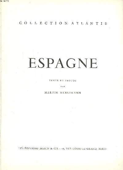
Hurlimann Martin
"Espagne (Collection : ""Atlantis"")"
Braun & Cie. Non daté. In-4. Relié toilé. Bon état, Couv. convenable, Dos satisfaisant, Intérieur frais. 236 pages augmentées de nombreuses photos en noir et blanc hors texte et d'une en couleurs. Contre-plats illustrés en noir et blanc.. . . . Classification Dewey : 946-Espagne, Portugal
Bookseller reference : RO20224108
|
|
|
HURLIMANN Martin
Espagne.
BRAUN & Cie. 1955. In-4. Relié toilé. Bon état, Couv. convenable, Dos satisfaisant, Intérieur frais. 236 pages. Nombreuses photos en héliogravures en hors-texte. Quelques photos en couleurs, en hors-texte. Jaquette légèrement usée.. Avec Jaquette. . . Classification Dewey : 946-Espagne, Portugal
Bookseller reference : RO80043644
|
|
|
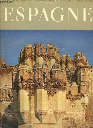
HURLIMANN MARTIN
ESPAGNE / COLLECTION ATLANTIS
BRAUN & CIE. 1954. In-4. Relié toilé. Etat d'usage, Couv. convenable, Dos satisfaisant, Intérieur frais. XIX + 236 pages - nombreuses photos en noir et blanc hors texte - 1 carte sur les contre-plats.. . . . Classification Dewey : 946-Espagne, Portugal
Bookseller reference : RO20176477
|
|
|
HURLIMANN MARTIN
ESPAGNE - COLLECTION ATLANTIS.
LES EDITIONS BRAUN & CIE. 1954. In-4. Relié. Bon état, Couv. convenable, Dos satisfaisant, Intérieur frais. XIX + 236 pages - jaquette en bon état - nombreuses photographies en noir et blanc hors texte.. Avec Jaquette. . . Classification Dewey : 946-Espagne, Portugal
Bookseller reference : R240089402
|
|
|
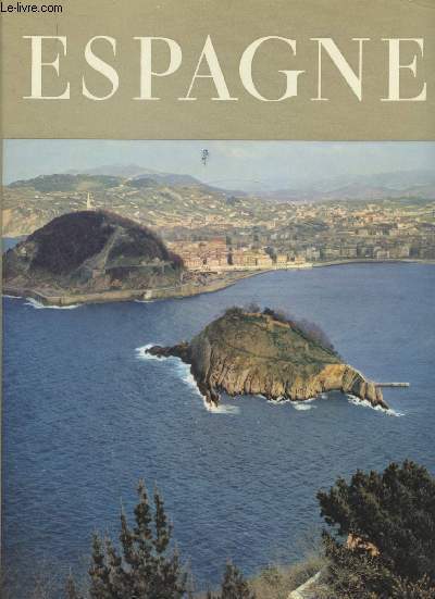
HURLIMANN MARTIN
ESPAGNE- COLLECTION ATLANTIS
BRAUN ET CIE. 1965. In-4. Relié. Bon état, Couv. convenable, Dos satisfaisant, Intérieur frais. 234 pages- nombreuses illustrations en noir et blanc hors texte- légères rousseurs sur les pages de garde et tranches. Avec Jaquette. . . Classification Dewey : 946-Espagne, Portugal
Bookseller reference : R200055437
|
|
|
Hurlimann Martin
Espagne -
Braun & Cie. 1955. In-4. Relié. Bon état, Couv. convenable, Dos satisfaisant, Intérieur frais. XVII +21 + 235 pages de planches de photographies en noir et blanc. Texte sur 2 colonnes.Contre plats illustrés. Jaquette avec petite déchirure à l'arrière .. Avec Jaquette. Sous Emboitage. . Classification Dewey : 946-Espagne, Portugal
Bookseller reference : R160207845
|
|
|
Hurlimann Martin
Espagne Collection Atlantis
Braun & Cie. 1954. In-4. Relié. Bon état, Couv. convenable, Dos satisfaisant, Intérieur frais. 236 pages augmentées de nombreuses photos en noir et blanc dans et hors texte.. . . . Classification Dewey : 946-Espagne, Portugal
Bookseller reference : R260267923
|
|
|
HUREAU JEAN
L' ESPAGNE AUJOURD'HUI
Arthaud. 1971. In-12. Broché. Bon état, Couv. convenable, Dos satisfaisant, Intérieur frais. 249 pages. Nombreuses photos en couleurs dans et hors texte + 16 cartes et itinéraires.. . . . Classification Dewey : 946-Espagne, Portugal
Bookseller reference : RO70114831
|
|
|
HUREAU Jean
L'Espagne aujourd'hui.
ARTHAUD. 2nde édition. 1971. In-4. Broché. Bon état, Couv. convenable, Dos satisfaisant, Intérieur frais. 249 pages. Nombreuses photos en couleurs dans le texte et hors-texte. Quelques cartes en couleurs dans le texte.. . . . Classification Dewey : 946-Espagne, Portugal
Bookseller reference : RO80015358
|
|
|
HURLIMANN MARTIN
ESPAGNE
Braun & Cie. 1954. In-4 Carré. Relié toilé. Etat d'usage. Tâchée. Dos fané. Intérieur acceptable. 237 pages. Illustré de nombreuses photos héliogravées en noir et blanc hors texte, et de quelques photos en couleur hors texte. Annotations en page de garde. Collection 'Atlantis'.

|
|
|
HUSSON Pierre (1678 - 1733)
Carte General des Royaumes d'Espagne et de Portugal, avec Leurs Principales Division & C.
Mappa rara di Spagna e Portogallo, pubblicata da Perre Husson all'Aia (Den Haag), che identifica una serie di battaglie significative combattute durante la guerra di successione spagnola.Esemplare del secondo stato, pubblicato da Rainer & Joshua Ottens, Amsterdam intorno al 1750.La mappa include una serie di battaglie, tra cui una rappresentazione grafica della battaglia navale di Velez-Malaga (24 agosto 1704), la più grande battaglia navale combattuta durante la guerra di successione spagnola, insieme a una rappresentazione di una più grande battaglia navale al largo la costa catalana, rappresentante dell'assedio di Barcellona da parte degli inglesi sotto il conte di Peterborough. Altre battaglie notate includono la Baia di Vigo (23 ottobre 1702) e l'assedio di Gibilterra (24 luglio 1704).Il dettaglio nella mappa è eccellente, inclusa una rappresentazione delle strade in tutta la penisola iberica.La mappa comprende 16 stemmi, montati su un cartiglio elegantemente inciso.Incisione in rame, bella coloritura coeva, in ottimo stato di conservazione. Rare map of Spain and Portugal, published by Perre Husson in the Hague (Den Haag), identifying a number of the significant battles fought duing the war of Spanish Succession.Example of the second state, published by Rainer & Joshua Ottens, Amsterdam circa 1750.The map includes a number of battles, including a graphic depiction of the naval Battle of Velez-Malaga (August 24, 1704), the largest naval battle fought during the War of the Spanish Succession, along with a representation of a larger naval battle off the Catalan Coast, representative of the Siege of Barcelona by the British under the Earl of Peterborough. Other battles noted include the Bay of Vigo (October 23, 1702) and the Siege of Gibraltar (July 24, 1704).The detail in the map is excellent, including a depiction of the roads throughout the Iberian Peninsula.The map includes 16 coats of arms, mounted on an elegantly engraved cartouche. A fine example of this rare and highly detailed map.Copperpalte with fine original colour, very good condition.

|
|
|
Hut de B. Gonçalves Antonio A.,Lurdes Reis Maria de
Estudo mineralogico de elementos de adorno de cor verde provenientes de estaçoes arqueologicas portuguesas
Instituto de Antropologia Dr. Mendes Corrêa Dos agrafé 1982 In-8, (17.5x24.5 cm), dos agrafé, 18 pages, texte en portugais, planches dépliantes, ex-libris de Giot ; plats légèrement jaunis, bon état. Livraison a domicile (La Poste) ou en Mondial Relay sur simple demande.
Bookseller reference : ql809
|
|
|
Hutchinson, Walter: Editor
Hutchinson's Pictorial History of the War, Series 10, Number 6, February 26 - March 4, 1941
32 pages. Printed on glossy stock. Profusely illustrated with black and white photos and illustrations. Features: Wonderful full-page photo of shell leaving the muzzle of a 12" rail-mounted Howitzer 'somewhere in England'; Enemy activities in pictures - crashed German bomber in Portugal, Field-Marshal von Brauchitsch, Commander-in-Chief of the German armed forces inspects a massive rail-mounted gun, German troops prepare for a British invasion by attempting to haul a small gun up a steep bank; Photo-illustrated text of a broadcast by Vernon Bartlett, M.P. entitled "The Position in the Balkans"; Map of Bulgariaentitled "Nazi Threat to Greek and Turkish Frontiers; Photos of Bulgaria; New U.S. Ambassador John G. Winant is welcomed by the King; Belgian troops training in England; Illustration by S. Drigin recounts the amazing story of how a wing-damaged Sunderland was taxied home for five hours after a bombing run to Norway - crewmembers took turns holding onto the end of the opposite wing to compensate for the damage in the intense cold; Interesting scenes in the Western Desert; Great photo of British artillery pounding the Italians out of Derna, another one of their Libyan strongholds, plus the infantry moving into Derna; Photos of the occupation of Bengazi; Centerfold illustration by Montague B. Black shows a successful engagement near Keren in Eritrea; Italian POWs in their camp; British POWs of the Italians in Addis Adaba; Aerial photo taken during R.A.F. attack on Massawa; Aerial photo of Italian S.79s burning near Kismayu; Aerial photo lf S.79 Italian bombers burning in Gobwen aerodrome, near Kismayu; Arctic War in Albania - photo of Greek troops using light tanks abandoned by the Italians; Photo of Italian colonel and his A.D.C. captured in Albania; Various winter photos of Greek troops in Albania; Photo-illustrated text of broadcast by Middle East Air Commodore R.B. Goddard entitled "Strategy of the Air"; Photo of Wellington bomber gunners putting on their 'hot suits' - electrically heated clothing, boots and gloves; Photo of dozens of Australian radio mechanics arriving in England; Photos of men of the Suffolk Regiment preparing for the second round; Photos of coastal watch in Northern Ireland; Commentary on the war this week; Photos aboard the Polish destroyer Piorun, including a fantasting full-page shot of a torpedo in mid air as it is shot from the deck of the vessel; Summary of the chief events in the war this week. Clean and unmarked with moderate wear. Binding tight. A quality copy. Book

|
|
|
Huzel, Erhard / Löber, Burckhardt / Wollmann, Ines
Erben und Vererben in Portugal. Handbuch für Erben und Erblasser.
Frankfurt. Edition für internationale Wirtschaft. 2009. 226 S. Hardcover. Register. Viele Immobilienbesitzer in Portugal fragen sich, wie ihr dortiger Besitz vererbt werden kann. Gilt portugiesisches oder deutsches Erbrecht? Werden Erbschaftssteuern vom portugiesischen oder deutschen Fiskus oder von beiden erhoben? Wie ist die Situation in Bezug auf in Deutschland errichtete Testamente? Das von den drei in Deutschland und Portugal residierenden Autoren vorgelegte Werk gibt umfassend Antwort auf diese und viele andere Fragen. In gleicher Weise wird der Erbe von in Portugal belegenen Immobilien oder Bankvermögen deutscher Erblasser umfassend über seine Rechte und Möglichkeiten informiert. / Verständliche Anleitung für deutsch-portugiesische Erbfälle / Checkliste für Erben und Erblasser / Die deutsch-portugiesische Erbschaftssteuersituation / Das Kompendium für deutsch-portugiesische Nachlassfragen. Das hier vorgelegte Werk ist die erste Monographie zur deutsch-portugiesischen Erbrechtssituation. Minimal berieben, sonst sehr gut erhalten.
Bookseller reference : PTG17226
|
|
|
Huzel, Erhard / Löber, Burckhardt / Wollmann, Ines
Erben und Vererben in Portugal. Handbuch für Erben und Erblasser.
Frankfurt. Edition für internationale Wirtschaft. 2009. 226 S. Hardcover. Register. Viele Immobilienbesitzer in Portugal fragen sich, wie ihr dortiger Besitz vererbt werden kann. Gilt portugiesisches oder deutsches Erbrecht? Werden Erbschaftssteuern vom portugiesischen oder deutschen Fiskus oder von beiden erhoben? Wie ist die Situation in Bezug auf in Deutschland errichtete Testamente? Das von den drei in Deutschland und Portugal residierenden Autoren vorgelegte Werk gibt umfassend Antwort auf diese und viele andere Fragen. In gleicher Weise wird der Erbe von in Portugal belegenen Immobilien oder Bankvermögen deutscher Erblasser umfassend über seine Rechte und Möglichkeiten informiert. / Verständliche Anleitung für deutsch-portugiesische Erbfälle / Checkliste für Erben und Erblasser / Die deutsch-portugiesische Erbschaftssteuersituation / Das Kompendium für deutsch-portugiesische Nachlassfragen. Das hier vorgelegte Werk ist die erste Monographie zur deutsch-portugiesischen Erbrechtssituation. Minimal berieben, sonst sehr gut erhalten.
Bookseller reference : PTG17196
|
|
|
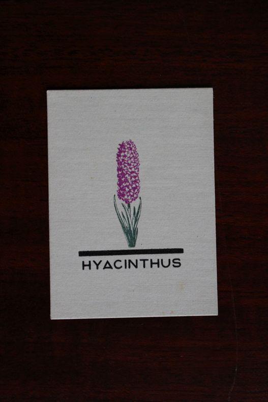
Hyacinthus, Portugal (propriétaire), Ex-libris.
Ex-libris.
Hyacinthus, Portugal (propriétaire), Ex-libris. Ex libris (55*40 mm).
Bookseller reference : 004677
|
|
|
 Receive by email
 Download as PDF document
 RSS feed


