|
|
|
Payne Stanley G.
"Phalange - Histoire du fascisme espagnol - collection ""L'Espagne contemporaine"""
Editions ruedo ibérico. 1965. In-8. Broché. Bon état, Couv. convenable, Dos satisfaisant, Intérieur frais. 256 pages. Jaquette convenable.. Avec Jaquette. . . Classification Dewey : 946-Espagne, Portugal
Bookseller reference : R240146275

|
|
|
Paz Abel
Barcelone 1936 un adolescent au coeur de la révolution espagnole.
La Digitale. 2001. In-8. Broché. Etat d'usage, Couv. légèrement passée, Dos satisfaisant, Intérieur frais. 250 pages - couverture contrepliée - rousseurs sur les plats.. . . . Classification Dewey : 946-Espagne, Portugal
Bookseller reference : R320155687

|
|
|
Paz Abel
Guerre d'Espagne - Collection lumières n°3.
Hazan. 1997. In-16. Broché. Bon état, Couv. convenable, Dos satisfaisant, Intérieur frais. 197 pages - nombreuses photographies en noir et blanc hors texte.. . . . Classification Dewey : 946-Espagne, Portugal
Bookseller reference : R100075437

|
|
|
PAZ BARROSO EDUARDO
SAVEURS DE PORTO - VAGABONDAGES DANS UNE VILLE DE CULTURE
L'ESCAMPETTE. 2003. In-8. Broché. Bon état, Couv. convenable, Dos satisfaisant, Intérieur frais. 156 pages - nombreuses photos en noir et blanc dans et hors texte - texte en 2 colonnes.. . . . Classification Dewey : 946-Espagne, Portugal
Bookseller reference : RO20191908
|
|
|
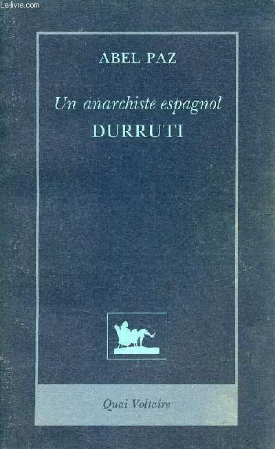
Paz Abel
Un anarchiste espagnol Durruti.
Quai Voltaire. 1993. In-8. Broché. Etat d'usage, Coins frottés, Dos satisfaisant, Intérieur frais. 498 pages - couverture contrepliée - quelques planches en noir et blanc - plats tranches de gouttières et plats salis.. . . . Classification Dewey : 946-Espagne, Portugal
Bookseller reference : R320154734
|
|
|
PAZZINI CARLI Vincenzo (Siena ? - 1769)
I Regni di Siviglia, Cordova e Jaen compresi nell'antica Andalusia, ed il Regno di Granata
Carta tratta dalla rara raccolta di carte geografiche denominata Atlante Geografico, prima stesura delle opera dell’abate Bartolomeo Borghi, pubblicata in Siena dal Pazzini Carli. Molte delle carte, datate tra il 1788 ed il 1800, sono incise da Agostino Costa e poi successivamente inserite nell’opera Atlante generale dell'ab. Bartolommeo Borghi, pubblicato a Firenze nel 1819.Bartolomeo Borghi, che Vermiglioli (Biografia degli scrittori perugini, 1829) definisce "uno dei migliori geografi dell'Europa", nacque nel 1750 a Monte del Lago, piccola frazione del comune di Magione, in provincia di Perugia, sulle rive del Trasimeno. Ordinato sacerdote nel 1774, trascorse i primi anni del suo mandato nel paese natale, poi a Magione e quindi a Sorbello (Cortona).Appassionato studioso di geografia, applicò dapprima le sue conoscenze all'analisi delle terre a lui più familiari: nel 1770 scrisse Descrizione geografica, fisica e naturale del Lago Trasimeno (che sarà tuttavia data alle stampe per la prima volta solo nel 1821), e nel 1791 pubblicò negli atti dell'Accademia etrusca di Cortona una Dissertazione sopra l'antica geografia dell'Etruria, Umbria e Piceno, arricchendo entrambe le opere di una carta delle regioni descritte. Intanto la sua fama di cartografo, oltre che di geografo, cresceva, tanto da fargli ottenere le nomine a membro delle Accademie Cortonese e Reale di Firenze, e procurargli l'incarico, da parte di Pietro Leopoldo, di delineare la carta del catasto pubblico di Cortona e del contado di Castiglione.Nello stesso tempo gli orizzonti geografici della sua attività si allargavano sensibilmente, e se nell'Atlante Novissimo, illustrato ed accresciuto sulle osservazioni, e scoperte fatte dai più celebri e più recenti cartografi di Antonio Zatta (Venezia 1779-1785) il suo contributo fu ancora legato all'area toscana, nell'Atlante geografico che si pubblicò a Siena da Pazzini Carli tra il 1798 ed il 1800 il Borghi tracciò la maggior parte delle carte e spaziò dalle province del Sud-Est dell'Inghilterra, al Regno di Danimarca, alla Romania.Una sorta di prova generale, quest'ultima, della sua opera più importante, quell'Atlante generale dell'ab. Bartolommeo Borghi, pubblicato a Firenze nel 1819. L'Atlante, corredato da brevi descrizioni storiche, politiche, civili e naturali che introducono le carte relative ai territori afferenti a ciascun Impero o Regno illustrato, rispecchia il nuovo assetto geo-politico attuato dal Congresso di Vienna. Incisione in rame, in buone condizioni. Map taken form the very rare Atlante Geografico, the first draft of the abbot Bartolomeo Borghi, published in Siena by Pazzini Carli. Many of the mapss, dated between 1788 and 1800, are engraved by Agostino Costa and then later incorporated in the work of AB Atlante Generale di Bartolomeo Borghi, published in Florence in 1819.Bartolomeo Borghi, who Vermiglioli (Biography of writers Perugini, 1829) calls "one of the best geographers of Europe", was born in 1750 in Monte del Lago, a small fraction of the town of Mansfield, in the province of Perugia, on the shores of Lake Trasimeno. Ordained in 1774, spent the first years of his term in his hometown, then to Mansfield and then Sorbello (Cortona).A passionate student of geography, first applied his knowledge to the analysis of land more familiar to him: he wrote in 1770 Description geographical, physical and natural Lake Trasimeno (which will however be given to the press for the first time only in 1821), and 1791 published in the Proceedings of Etruscan Cortona a dissertation on the geography of ancient Etruria, Umbria and Piceno, enriching both the works of a map of the regions described. Meanwhile, his fame as a cartographer, as well as a geographer, was growing, so that he get the nomination as a member of the Royal Academies of Florence and Cortona, and give him the job, by Pietro Leopoldo, to outline the paper's public land Cortona and the county of Castiglione.At the same time the geographical horizons of its activities widened considerably, and if in the Atlas Novissimo, illustrated and amplified the observations and discoveries made by the most recent and most famous cartographer Antonio Zatta (Venice 1779-1785) his contribution was still related area of Tuscany, in the Atlas geographic monthly published in Siena by Pazzini Carli between 1798 and 1800 the villages drew most of the cards and spaced from the provinces of South-East of England, the Kingdom of Denmark, Romania.A sort of dress rehearsal, the latter, his most important work, quell'Atlante General of AB. Bartolomeo Borghi, published in Florence in 1819. The Atlas, accompanied by brief descriptions of historical, political, civil and natural to introduce the papers relating to the territories belonging to each United Empire or illustrated, reflects the new geo-political structure implemented by the Congress of Vienna.

|
|
|
PAZZINI CARLI Vincenzo (Siena ? - 1769)
La Provincia di Cuenca compresa nella parte orientale della Castiglia nuova e le provioncie di Murcia, e Valenza
Carta tratta dalla rara raccolta di carte geografiche denominata Atlante Geografico, prima stesura delle opera dell’abate Bartolomeo Borghi, pubblicata in Siena dal Pazzini Carli. Molte delle carte, datate tra il 1788 ed il 1800, sono incise da Agostino Costa e poi successivamente inserite nell’opera Atlante generale dell'ab. Bartolommeo Borghi, pubblicato a Firenze nel 1819.Bartolomeo Borghi, che Vermiglioli (Biografia degli scrittori perugini, 1829) definisce "uno dei migliori geografi dell'Europa", nacque nel 1750 a Monte del Lago, piccola frazione del comune di Magione, in provincia di Perugia, sulle rive del Trasimeno. Ordinato sacerdote nel 1774, trascorse i primi anni del suo mandato nel paese natale, poi a Magione e quindi a Sorbello (Cortona).Appassionato studioso di geografia, applicò dapprima le sue conoscenze all'analisi delle terre a lui più familiari: nel 1770 scrisse Descrizione geografica, fisica e naturale del Lago Trasimeno (che sarà tuttavia data alle stampe per la prima volta solo nel 1821), e nel 1791 pubblicò negli atti dell'Accademia etrusca di Cortona una Dissertazione sopra l'antica geografia dell'Etruria, Umbria e Piceno, arricchendo entrambe le opere di una carta delle regioni descritte. Intanto la sua fama di cartografo, oltre che di geografo, cresceva, tanto da fargli ottenere le nomine a membro delle Accademie Cortonese e Reale di Firenze, e procurargli l'incarico, da parte di Pietro Leopoldo, di delineare la carta del catasto pubblico di Cortona e del contado di Castiglione.Nello stesso tempo gli orizzonti geografici della sua attività si allargavano sensibilmente, e se nell'Atlante Novissimo, illustrato ed accresciuto sulle osservazioni, e scoperte fatte dai più celebri e più recenti cartografi di Antonio Zatta (Venezia 1779-1785) il suo contributo fu ancora legato all'area toscana, nell'Atlante geografico che si pubblicò a Siena da Pazzini Carli tra il 1798 ed il 1800 il Borghi tracciò la maggior parte delle carte e spaziò dalle province del Sud-Est dell'Inghilterra, al Regno di Danimarca, alla Romania.Una sorta di prova generale, quest'ultima, della sua opera più importante, quell'Atlante generale dell'ab. Bartolommeo Borghi, pubblicato a Firenze nel 1819. L'Atlante, corredato da brevi descrizioni storiche, politiche, civili e naturali che introducono le carte relative ai territori afferenti a ciascun Impero o Regno illustrato, rispecchia il nuovo assetto geo-politico attuato dal Congresso di Vienna. Incisione in rame, in buone condizioni. Map taken form the very rare Atlante Geografico, the first draft of the abbot Bartolomeo Borghi, published in Siena by Pazzini Carli. Many of the mapss, dated between 1788 and 1800, are engraved by Agostino Costa and then later incorporated in the work of AB Atlante Generale di Bartolomeo Borghi, published in Florence in 1819.Bartolomeo Borghi, who Vermiglioli (Biography of writers Perugini, 1829) calls "one of the best geographers of Europe", was born in 1750 in Monte del Lago, a small fraction of the town of Mansfield, in the province of Perugia, on the shores of Lake Trasimeno. Ordained in 1774, spent the first years of his term in his hometown, then to Mansfield and then Sorbello (Cortona).A passionate student of geography, first applied his knowledge to the analysis of land more familiar to him: he wrote in 1770 Description geographical, physical and natural Lake Trasimeno (which will however be given to the press for the first time only in 1821), and 1791 published in the Proceedings of Etruscan Cortona a dissertation on the geography of ancient Etruria, Umbria and Piceno, enriching both the works of a map of the regions described. Meanwhile, his fame as a cartographer, as well as a geographer, was growing, so that he get the nomination as a member of the Royal Academies of Florence and Cortona, and give him the job, by Pietro Leopoldo, to outline the paper's public land Cortona and the county of Castiglione.At the same time the geographical horizons of its activities widened considerably, and if in the Atlas Novissimo, illustrated and amplified the observations and discoveries made by the most recent and most famous cartographer Antonio Zatta (Venice 1779-1785) his contribution was still related area of Tuscany, in the Atlas geographic monthly published in Siena by Pazzini Carli between 1798 and 1800 the villages drew most of the cards and spaced from the provinces of South-East of England, the Kingdom of Denmark, Romania.A sort of dress rehearsal, the latter, his most important work, quell'Atlante General of AB. Bartolomeo Borghi, published in Florence in 1819. The Atlas, accompanied by brief descriptions of historical, political, civil and natural to introduce the papers relating to the territories belonging to each United Empire or illustrated, reflects the new geo-political structure implemented by the Congress of Vienna.

|
|
|
PAZZINI CARLI Vincenzo (Siena ? - 1769)
Le Isole di Majorca Minorca ed Ivica
Carta tratta dalla rara raccolta di carte geografiche denominata Atlante Geografico, prima stesura delle opera dell’abate Bartolomeo Borghi, pubblicata in Siena dal Pazzini Carli. Molte delle carte, datate tra il 1788 ed il 1800, sono incise da Agostino Costa e poi successivamente inserite nell’opera Atlante generale dell'ab. Bartolommeo Borghi, pubblicato a Firenze nel 1819.Bartolomeo Borghi, che Vermiglioli (Biografia degli scrittori perugini, 1829) definisce "uno dei migliori geografi dell'Europa", nacque nel 1750 a Monte del Lago, piccola frazione del comune di Magione, in provincia di Perugia, sulle rive del Trasimeno. Ordinato sacerdote nel 1774, trascorse i primi anni del suo mandato nel paese natale, poi a Magione e quindi a Sorbello (Cortona).Appassionato studioso di geografia, applicò dapprima le sue conoscenze all'analisi delle terre a lui più familiari: nel 1770 scrisse Descrizione geografica, fisica e naturale del Lago Trasimeno (che sarà tuttavia data alle stampe per la prima volta solo nel 1821), e nel 1791 pubblicò negli atti dell'Accademia etrusca di Cortona una Dissertazione sopra l'antica geografia dell'Etruria, Umbria e Piceno, arricchendo entrambe le opere di una carta delle regioni descritte. Intanto la sua fama di cartografo, oltre che di geografo, cresceva, tanto da fargli ottenere le nomine a membro delle Accademie Cortonese e Reale di Firenze, e procurargli l'incarico, da parte di Pietro Leopoldo, di delineare la carta del catasto pubblico di Cortona e del contado di Castiglione.Nello stesso tempo gli orizzonti geografici della sua attività si allargavano sensibilmente, e se nell'Atlante Novissimo, illustrato ed accresciuto sulle osservazioni, e scoperte fatte dai più celebri e più recenti cartografi di Antonio Zatta (Venezia 1779-1785) il suo contributo fu ancora legato all'area toscana, nell'Atlante geografico che si pubblicò a Siena da Pazzini Carli tra il 1798 ed il 1800 il Borghi tracciò la maggior parte delle carte e spaziò dalle province del Sud-Est dell'Inghilterra, al Regno di Danimarca, alla Romania.Una sorta di prova generale, quest'ultima, della sua opera più importante, quell'Atlante generale dell'ab. Bartolommeo Borghi, pubblicato a Firenze nel 1819. L'Atlante, corredato da brevi descrizioni storiche, politiche, civili e naturali che introducono le carte relative ai territori afferenti a ciascun Impero o Regno illustrato, rispecchia il nuovo assetto geo-politico attuato dal Congresso di Vienna. Incisione in rame, in buone condizioni. Map taken form the very rare Atlante Geografico, the first draft of the abbot Bartolomeo Borghi, published in Siena by Pazzini Carli. Many of the mapss, dated between 1788 and 1800, are engraved by Agostino Costa and then later incorporated in the work of AB Atlante Generale di Bartolomeo Borghi, published in Florence in 1819.Bartolomeo Borghi, who Vermiglioli (Biography of writers Perugini, 1829) calls "one of the best geographers of Europe", was born in 1750 in Monte del Lago, a small fraction of the town of Mansfield, in the province of Perugia, on the shores of Lake Trasimeno. Ordained in 1774, spent the first years of his term in his hometown, then to Mansfield and then Sorbello (Cortona).A passionate student of geography, first applied his knowledge to the analysis of land more familiar to him: he wrote in 1770 Description geographical, physical and natural Lake Trasimeno (which will however be given to the press for the first time only in 1821), and 1791 published in the Proceedings of Etruscan Cortona a dissertation on the geography of ancient Etruria, Umbria and Piceno, enriching both the works of a map of the regions described. Meanwhile, his fame as a cartographer, as well as a geographer, was growing, so that he get the nomination as a member of the Royal Academies of Florence and Cortona, and give him the job, by Pietro Leopoldo, to outline the paper's public land Cortona and the county of Castiglione.At the same time the geographical horizons of its activities widened considerably, and if in the Atlas Novissimo, illustrated and amplified the observations and discoveries made by the most recent and most famous cartographer Antonio Zatta (Venice 1779-1785) his contribution was still related area of Tuscany, in the Atlas geographic monthly published in Siena by Pazzini Carli between 1798 and 1800 the villages drew most of the cards and spaced from the provinces of South-East of England, the Kingdom of Denmark, Romania.A sort of dress rehearsal, the latter, his most important work, quell'Atlante General of AB. Bartolomeo Borghi, published in Florence in 1819. The Atlas, accompanied by brief descriptions of historical, political, civil and natural to introduce the papers relating to the territories belonging to each United Empire or illustrated, reflects the new geo-political structure implemented by the Congress of Vienna.

|
|
|
PAZZINI CARLI Vincenzo (Siena ? - 1769)
Le Provincie della Spagna situate al Nord-Ovest oggi giorno comprese nella Galizia nella parte Settentrionale del Regno di L
Carta tratta dalla rara raccolta di carte geografiche denominata Atlante Geografico, prima stesura delle opera dell’abate Bartolomeo Borghi, pubblicata in Siena dal Pazzini Carli. Molte delle carte, datate tra il 1788 ed il 1800, sono incise da Agostino Costa e poi successivamente inserite nell’opera Atlante generale dell'ab. Bartolommeo Borghi, pubblicato a Firenze nel 1819.Bartolomeo Borghi, che Vermiglioli (Biografia degli scrittori perugini, 1829) definisce "uno dei migliori geografi dell'Europa", nacque nel 1750 a Monte del Lago, piccola frazione del comune di Magione, in provincia di Perugia, sulle rive del Trasimeno. Ordinato sacerdote nel 1774, trascorse i primi anni del suo mandato nel paese natale, poi a Magione e quindi a Sorbello (Cortona).Appassionato studioso di geografia, applicò dapprima le sue conoscenze all'analisi delle terre a lui più familiari: nel 1770 scrisse Descrizione geografica, fisica e naturale del Lago Trasimeno (che sarà tuttavia data alle stampe per la prima volta solo nel 1821), e nel 1791 pubblicò negli atti dell'Accademia etrusca di Cortona una Dissertazione sopra l'antica geografia dell'Etruria, Umbria e Piceno, arricchendo entrambe le opere di una carta delle regioni descritte. Intanto la sua fama di cartografo, oltre che di geografo, cresceva, tanto da fargli ottenere le nomine a membro delle Accademie Cortonese e Reale di Firenze, e procurargli l'incarico, da parte di Pietro Leopoldo, di delineare la carta del catasto pubblico di Cortona e del contado di Castiglione.Nello stesso tempo gli orizzonti geografici della sua attività si allargavano sensibilmente, e se nell'Atlante Novissimo, illustrato ed accresciuto sulle osservazioni, e scoperte fatte dai più celebri e più recenti cartografi di Antonio Zatta (Venezia 1779-1785) il suo contributo fu ancora legato all'area toscana, nell'Atlante geografico che si pubblicò a Siena da Pazzini Carli tra il 1798 ed il 1800 il Borghi tracciò la maggior parte delle carte e spaziò dalle province del Sud-Est dell'Inghilterra, al Regno di Danimarca, alla Romania.Una sorta di prova generale, quest'ultima, della sua opera più importante, quell'Atlante generale dell'ab. Bartolommeo Borghi, pubblicato a Firenze nel 1819. L'Atlante, corredato da brevi descrizioni storiche, politiche, civili e naturali che introducono le carte relative ai territori afferenti a ciascun Impero o Regno illustrato, rispecchia il nuovo assetto geo-politico attuato dal Congresso di Vienna. Incisione in rame, in buone condizioni. Map taken form the very rare Atlante Geografico, the first draft of the abbot Bartolomeo Borghi, published in Siena by Pazzini Carli. Many of the mapss, dated between 1788 and 1800, are engraved by Agostino Costa and then later incorporated in the work of AB Atlante Generale di Bartolomeo Borghi, published in Florence in 1819.Bartolomeo Borghi, who Vermiglioli (Biography of writers Perugini, 1829) calls "one of the best geographers of Europe", was born in 1750 in Monte del Lago, a small fraction of the town of Mansfield, in the province of Perugia, on the shores of Lake Trasimeno. Ordained in 1774, spent the first years of his term in his hometown, then to Mansfield and then Sorbello (Cortona).A passionate student of geography, first applied his knowledge to the analysis of land more familiar to him: he wrote in 1770 Description geographical, physical and natural Lake Trasimeno (which will however be given to the press for the first time only in 1821), and 1791 published in the Proceedings of Etruscan Cortona a dissertation on the geography of ancient Etruria, Umbria and Piceno, enriching both the works of a map of the regions described. Meanwhile, his fame as a cartographer, as well as a geographer, was growing, so that he get the nomination as a member of the Royal Academies of Florence and Cortona, and give him the job, by Pietro Leopoldo, to outline the paper's public land Cortona and the county of Castiglione.At the same time the geographical horizons of its activities widened considerably, and if in the Atlas Novissimo, illustrated and amplified the observations and discoveries made by the most recent and most famous cartographer Antonio Zatta (Venice 1779-1785) his contribution was still related area of Tuscany, in the Atlas geographic monthly published in Siena by Pazzini Carli between 1798 and 1800 the villages drew most of the cards and spaced from the provinces of South-East of England, the Kingdom of Denmark, Romania.A sort of dress rehearsal, the latter, his most important work, quell'Atlante General of AB. Bartolomeo Borghi, published in Florence in 1819. The Atlas, accompanied by brief descriptions of historical, political, civil and natural to introduce the papers relating to the territories belonging to each United Empire or illustrated, reflects the new geo-political structure implemented by the Congress of Vienna.

|
|
|
PAZZINI CARLI Vincenzo (Siena ? - 1769)
Le Provincie di Salamanca costituente la parte merid.e del Reg. di Leone di Avila, e di Segovia che sono la parte merd.e del
Carta tratta dalla rara raccolta di carte geografiche denominata Atlante Geografico, prima stesura delle opera dell’abate Bartolomeo Borghi, pubblicata in Siena dal Pazzini Carli. Molte delle carte, datate tra il 1788 ed il 1800, sono incise da Agostino Costa e poi successivamente inserite nell’opera Atlante generale dell'ab. Bartolommeo Borghi, pubblicato a Firenze nel 1819.Bartolomeo Borghi, che Vermiglioli (Biografia degli scrittori perugini, 1829) definisce "uno dei migliori geografi dell'Europa", nacque nel 1750 a Monte del Lago, piccola frazione del comune di Magione, in provincia di Perugia, sulle rive del Trasimeno. Ordinato sacerdote nel 1774, trascorse i primi anni del suo mandato nel paese natale, poi a Magione e quindi a Sorbello (Cortona).Appassionato studioso di geografia, applicò dapprima le sue conoscenze all'analisi delle terre a lui più familiari: nel 1770 scrisse Descrizione geografica, fisica e naturale del Lago Trasimeno (che sarà tuttavia data alle stampe per la prima volta solo nel 1821), e nel 1791 pubblicò negli atti dell'Accademia etrusca di Cortona una Dissertazione sopra l'antica geografia dell'Etruria, Umbria e Piceno, arricchendo entrambe le opere di una carta delle regioni descritte. Intanto la sua fama di cartografo, oltre che di geografo, cresceva, tanto da fargli ottenere le nomine a membro delle Accademie Cortonese e Reale di Firenze, e procurargli l'incarico, da parte di Pietro Leopoldo, di delineare la carta del catasto pubblico di Cortona e del contado di Castiglione.Nello stesso tempo gli orizzonti geografici della sua attività si allargavano sensibilmente, e se nell'Atlante Novissimo, illustrato ed accresciuto sulle osservazioni, e scoperte fatte dai più celebri e più recenti cartografi di Antonio Zatta (Venezia 1779-1785) il suo contributo fu ancora legato all'area toscana, nell'Atlante geografico che si pubblicò a Siena da Pazzini Carli tra il 1798 ed il 1800 il Borghi tracciò la maggior parte delle carte e spaziò dalle province del Sud-Est dell'Inghilterra, al Regno di Danimarca, alla Romania.Una sorta di prova generale, quest'ultima, della sua opera più importante, quell'Atlante generale dell'ab. Bartolommeo Borghi, pubblicato a Firenze nel 1819. L'Atlante, corredato da brevi descrizioni storiche, politiche, civili e naturali che introducono le carte relative ai territori afferenti a ciascun Impero o Regno illustrato, rispecchia il nuovo assetto geo-politico attuato dal Congresso di Vienna. Incisione in rame, in buone condizioni. Map taken form the very rare Atlante Geografico, the first draft of the abbot Bartolomeo Borghi, published in Siena by Pazzini Carli. Many of the mapss, dated between 1788 and 1800, are engraved by Agostino Costa and then later incorporated in the work of AB Atlante Generale di Bartolomeo Borghi, published in Florence in 1819.Bartolomeo Borghi, who Vermiglioli (Biography of writers Perugini, 1829) calls "one of the best geographers of Europe", was born in 1750 in Monte del Lago, a small fraction of the town of Mansfield, in the province of Perugia, on the shores of Lake Trasimeno. Ordained in 1774, spent the first years of his term in his hometown, then to Mansfield and then Sorbello (Cortona).A passionate student of geography, first applied his knowledge to the analysis of land more familiar to him: he wrote in 1770 Description geographical, physical and natural Lake Trasimeno (which will however be given to the press for the first time only in 1821), and 1791 published in the Proceedings of Etruscan Cortona a dissertation on the geography of ancient Etruria, Umbria and Piceno, enriching both the works of a map of the regions described. Meanwhile, his fame as a cartographer, as well as a geographer, was growing, so that he get the nomination as a member of the Royal Academies of Florence and Cortona, and give him the job, by Pietro Leopoldo, to outline the paper's public land Cortona and the county of Castiglione.At the same time the geographical horizons of its activities widened considerably, and if in the Atlas Novissimo, illustrated and amplified the observations and discoveries made by the most recent and most famous cartographer Antonio Zatta (Venice 1779-1785) his contribution was still related area of Tuscany, in the Atlas geographic monthly published in Siena by Pazzini Carli between 1798 and 1800 the villages drew most of the cards and spaced from the provinces of South-East of England, the Kingdom of Denmark, Romania.A sort of dress rehearsal, the latter, his most important work, quell'Atlante General of AB. Bartolomeo Borghi, published in Florence in 1819. The Atlas, accompanied by brief descriptions of historical, political, civil and natural to introduce the papers relating to the territories belonging to each United Empire or illustrated, reflects the new geo-political structure implemented by the Congress of Vienna.

|
|
|
PAZZINI CARLI Vincenzo (Siena ? - 1769)
Le provincie di Soria compresa nella parte orientale della Castiglia vecchia e le provincie di Guipuzcoa Navarra Aragona e C
Carta tratta dalla rara raccolta di carte geografiche denominata Atlante Geografico, prima stesura delle opera dell’abate Bartolomeo Borghi, pubblicata in Siena dal Pazzini Carli. Molte delle carte, datate tra il 1788 ed il 1800, sono incise da Agostino Costa e poi successivamente inserite nell’opera Atlante generale dell'ab. Bartolommeo Borghi, pubblicato a Firenze nel 1819.Bartolomeo Borghi, che Vermiglioli (Biografia degli scrittori perugini, 1829) definisce "uno dei migliori geografi dell'Europa", nacque nel 1750 a Monte del Lago, piccola frazione del comune di Magione, in provincia di Perugia, sulle rive del Trasimeno. Ordinato sacerdote nel 1774, trascorse i primi anni del suo mandato nel paese natale, poi a Magione e quindi a Sorbello (Cortona).Appassionato studioso di geografia, applicò dapprima le sue conoscenze all'analisi delle terre a lui più familiari: nel 1770 scrisse Descrizione geografica, fisica e naturale del Lago Trasimeno (che sarà tuttavia data alle stampe per la prima volta solo nel 1821), e nel 1791 pubblicò negli atti dell'Accademia etrusca di Cortona una Dissertazione sopra l'antica geografia dell'Etruria, Umbria e Piceno, arricchendo entrambe le opere di una carta delle regioni descritte. Intanto la sua fama di cartografo, oltre che di geografo, cresceva, tanto da fargli ottenere le nomine a membro delle Accademie Cortonese e Reale di Firenze, e procurargli l'incarico, da parte di Pietro Leopoldo, di delineare la carta del catasto pubblico di Cortona e del contado di Castiglione.Nello stesso tempo gli orizzonti geografici della sua attività si allargavano sensibilmente, e se nell'Atlante Novissimo, illustrato ed accresciuto sulle osservazioni, e scoperte fatte dai più celebri e più recenti cartografi di Antonio Zatta (Venezia 1779-1785) il suo contributo fu ancora legato all'area toscana, nell'Atlante geografico che si pubblicò a Siena da Pazzini Carli tra il 1798 ed il 1800 il Borghi tracciò la maggior parte delle carte e spaziò dalle province del Sud-Est dell'Inghilterra, al Regno di Danimarca, alla Romania.Una sorta di prova generale, quest'ultima, della sua opera più importante, quell'Atlante generale dell'ab. Bartolommeo Borghi, pubblicato a Firenze nel 1819. L'Atlante, corredato da brevi descrizioni storiche, politiche, civili e naturali che introducono le carte relative ai territori afferenti a ciascun Impero o Regno illustrato, rispecchia il nuovo assetto geo-politico attuato dal Congresso di Vienna. Incisione in rame, in buone condizioni. Map taken form the very rare Atlante Geografico, the first draft of the abbot Bartolomeo Borghi, published in Siena by Pazzini Carli. Many of the mapss, dated between 1788 and 1800, are engraved by Agostino Costa and then later incorporated in the work of AB Atlante Generale di Bartolomeo Borghi, published in Florence in 1819.Bartolomeo Borghi, who Vermiglioli (Biography of writers Perugini, 1829) calls "one of the best geographers of Europe", was born in 1750 in Monte del Lago, a small fraction of the town of Mansfield, in the province of Perugia, on the shores of Lake Trasimeno. Ordained in 1774, spent the first years of his term in his hometown, then to Mansfield and then Sorbello (Cortona).A passionate student of geography, first applied his knowledge to the analysis of land more familiar to him: he wrote in 1770 Description geographical, physical and natural Lake Trasimeno (which will however be given to the press for the first time only in 1821), and 1791 published in the Proceedings of Etruscan Cortona a dissertation on the geography of ancient Etruria, Umbria and Piceno, enriching both the works of a map of the regions described. Meanwhile, his fame as a cartographer, as well as a geographer, was growing, so that he get the nomination as a member of the Royal Academies of Florence and Cortona, and give him the job, by Pietro Leopoldo, to outline the paper's public land Cortona and the county of Castiglione.At the same time the geographical horizons of its activities widened considerably, and if in the Atlas Novissimo, illustrated and amplified the observations and discoveries made by the most recent and most famous cartographer Antonio Zatta (Venice 1779-1785) his contribution was still related area of Tuscany, in the Atlas geographic monthly published in Siena by Pazzini Carli between 1798 and 1800 the villages drew most of the cards and spaced from the provinces of South-East of England, the Kingdom of Denmark, Romania.A sort of dress rehearsal, the latter, his most important work, quell'Atlante General of AB. Bartolomeo Borghi, published in Florence in 1819. The Atlas, accompanied by brief descriptions of historical, political, civil and natural to introduce the papers relating to the territories belonging to each United Empire or illustrated, reflects the new geo-political structure implemented by the Congress of Vienna.

|
|
|
PAÇO Alfonso do.
SANDALIAS DE ALAPRAYA.
|
|
|
PAÇO D'ARCOS, J.
EL ANTICUARIO DE SAO PAULO.
19x14. 293p. Trad. M. Casado Nieto. Enc. Tela ed.

|
|
|
PAÇO D'ARCOS, J.
UNA MUJER DE LISBOA. (ANA PAULA).
19x13. 268p. Firma anterior poseedor. Trad. J. G. De Luaces. Enc. tela ed.

|
|
|
PAÇO D'ARCOS, Joaquim.
ANA PAULA. PERFIL DUMA LISBOETA.
19x12. 298p. Intonso.

|
|
|
PAÇO D´ARCOS, Joaquim [Joaquim Belford Corrêa da Silva].
Una mujer de Lisboa. [Ana Paula]. Taducción del portugués por Juan G. de Luaces.
Barcelona, Luis Miracle, Editor, 1942. 4to.; 268 pp. Encuadernación original en tela.

|
|
|
PCP (R)
1er Congrès du parti communiste portugais (Reconstruit).
Couverture souple. Broché. 96 pages.
Bookseller reference : 86540
|
|
|
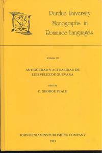
Peale, C George, ed ; Blue, William R
Antigüedad y actualidad de Luis Vélez de Guevara : estudios críticos editado por C. George Peale ; en colaboración con William R. Blue . Purdue University monographs in Romance languages; v. 10; Luis Vélez de Guevara and Court Life
Amsterdam Philadelphia : John Benjamin 1983. 1983. Hardcover. Very Good/No Jacket. xii 298 pp. ISBN: 9027217203; 9789027217202 Series ISSN: 0165-8743 ; LC: PQ6497; Dewey: 862.3 ; OCLC: 17551455 ; Papers in English and Spanish ; Purdue University Monographs in Romance Languages vol.10 MARIA GRAZIA PROFETI Emisor y receptores: Luis Vélez de Guevara y el enfoque critico 1 19 GARETH A. DAVIES Luis Vélez de Guevara and Court Life 20 19 A. VALBUENA BRIONES Una incursión en las comedias novelescas de Luis Vélez de Guevara y su relación con Calderón 39 13 RUTH LUNDELIUS Vélez de Guevara's El Caballero del Sol and Calderón de la Barca's El castillo de Lindabridis A Response to Professor Valbuena Briones 52 6 MICHAEL D. McGAHA La Luna de la Sierra: A Nonviolent Honor Play. 58 7 CHARLOTTE STERN Convention and Innovation in La Luna de la Sierra 65 24 TERESA M. ROSSI El lenguaje paremiológico de los campesinos en La serrana de la Vera de Luis Vélez de Guevara 89 15 MARGHERITA MORREALE Apuntaciones para el estudio del tema de la serrana en dos comedias de Vélez de Guevara 104 7 MATTHEW D. STROUD The Resocialization of the Mujer Varonil in Three Plays by Vélez 111 16 WILLIAM M. WHITBY Some Thoughts on Vélez as a Tragedian 127 10 JAMES A. PARK Some Remarks on Tragedy and on Vélez as a Tragedian A Response to Professor Whitby 137 7 HENRY W. SULLIVAN Vélez de Guevara's Reinar después de morir as a Model of Classical Spanish Tragedy 144 21 J.E. VAREY Reinar después de morir: Imagery Themes and their Relation to Staging 165 17 ANN L. MACKENZIE Vélez de Guevara as Dramatic Collaborator with Specific Reference to También la afrenta es veneno I. Vélez II. Coello III. Rojas Zorrilla 182 21 SHIRLEY B. WHITAKER La Baltasara in Performance 1634-35: Reports from the Tuscan Embassy 203 4 MARGARITA LEVISI Los aspectos teatrales de El Diablo Cojuelo 207 12 HANNAH E. BERGMAN A "History of Spanish Literature" by Luis Vélez de Guevara 219 14 C. GEORGE PEALE Ingenio y cortesania en El Diablo Cojuelo Dos notas sobre el haz y envés de Vélez de Guevara 233 21 MARY G. HAUER An Addendum to Luis Vélez de Guevara: A Critical Bibliography ; yellow cloth nick in upper left corner of front cover some markings VG <br/> <br/> Amsterdam, Philadelphia : John Benjamin, 1983. hardcover
Bookseller reference : 012A ISBN : 9027217203 9789027217202
|
|
|
PECCHIO (Giuseppe).
Trois mois en Portugal, en 1822. Lettres à Lady J. O., traduites de l'italien par Léonard Gallois
Paris, chez les marchands de nouveautés [Imprimerie de Guiraudet], 1822 in-8, 93 pp., dérelié.
Bookseller reference : 232124

|
|
|
PECCHIO Giuseppe
Trois mois en Portugal en 1822. Lettre de M. Joseph Pecchio a Lady J. O. traduites de l'italien par Leonard Gallois
In 8, pp. 93 + (1b). D. rifatto. Macchioline al p. ant. Sporadiche bruniture alle cc. Br. ed. con cornicette tip. ai p. Traduzione francese, dall'orig. italiano uscito lo stesso anno, relativo al soggiorno di tre mesi di Pecchio in Portogallo. Giuseppe Pecchio (Milano, 1785 - Brighton, 1835), economista, giurista e patriota, fece parte del movimento dei romantici milanesi riuniti attorno al foglio Il Conciliatore. Dopo il fallimento dei moti piemontesi del marzo 1821, Pecchio fu costretto ad abbandonare l'Italia e, dopo lungo viaggiare (fu in Svizzera, Spagna, Portogallo, Grecia) si stabili' in Inghilterra. Legato alla tradizione del Caffe' e dei Verri, e' noto anche come autore di una biografia di Ugo Foscolo.
|
|
|
PEDRO ALTARES
L'ESPAGNE MONUMENTALE
ARTES GRAFICAS GRIJELMO. 1979. In-8. Broché. Bon état, Couv. convenable, Dos satisfaisant, Intérieur frais. 26 pages. Nombreuses illustrations en couleurs. . . . Classification Dewey : 946-Espagne, Portugal
Bookseller reference : R160117145

|
|
|
PEDRO VOLTES
NUEVA HISTORIA DE ESPANA. Superando la historia del Estado, surge la historia de los pueblos de España.
PLAZA & JANES. 1989. In-8. Cartonné. Bon état, Couv. convenable, Dos satisfaisant, Intérieur frais. 656 pages. Jaquette illustrée en couleurs. Nombreuses planches d'illustrations en noir et blanc. Texte en espagnol.. Avec Jaquette. . . Classification Dewey : 946-Espagne, Portugal
Bookseller reference : R260117206
|
|
|
Pedrayo, Ramon Otero
Santiago de Compostela
around 70 pages, illustrated, plan, hinges repaired, English translation by Doireann Mac Dermott, photographs by Eugen Haas. eng
|
|
|
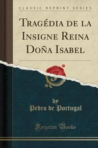
Pedro de Portugal
Tragédia de la Insigne Reina Doña Isabel
paperback. Good. Access codes and supplements are not guaranteed with used items. May be an ex-library book. paperback
Bookseller reference : 0365135577.G ISBN : 0365135577 9780365135579
|
|
|
Pedro de Portugal
Tragédia de la Insigne Reina Doña Isabel Classic Reprint Spanish Edition
hardcover. Good. Access codes and supplements are not guaranteed with used items. May be an ex-library book. hardcover
Bookseller reference : 036513564X.G ISBN : 036513564X 9780365135647

|
|
|
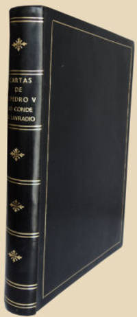
PEDRO V (Rei de Portugal)
CARTAS DE
AO CONDE DO LAVRADIO.
<p>Com uma introdução de Ruben Andresen Leitão. Portucalense Editora S. A. R. L. Pôrto. 1945. De 23x19 cm. Com 320 pags. Encadernação inteira de pele. Ilustrado com reprodução de retratos do Conde do Lavradio e da Família Real portuguesa em várias épocas. Obra contendo as cartas particulares e confidenciais entre o rei de Portugal com 19 anos e o seu embaixador com 60 anos por ele nomeado em Londres em 1851 no qual confiava e confidenciava todos os problemas relativos ao seu contrato de casamento à política externa e à política interna de Portugal. Obra publicada com o apoio do Instituto Britânico em Portugal.</p> I-17-E-3 unknown
Bookseller reference : 1104JC088
|
|
|
PEDRO V (Rei de Portugal)
CARTAS DE
AO CONDE DO LAVRADIO.
<p>Com uma introdução de Ruben Andresen Leitão. Portucalense Editora S. A. R. L. Pôrto. 1945. De 23x19 cm. Com 320 pags. Encadernação recente em percalina verde preservando capas de brochura no final da obra. Ilustrado com reprodução de retratos do Conde do Lavradio e da Família Real portuguesa em várias épocas. Obra contendo as cartas particulares e confidenciais entre o rei de Portugal com 19 anos e o seu embaixador com 60 anos por ele nomeado em Londres em 1851 no qual confiava e confidenciava todos os problemas relativos ao seu contrato de casamento à política externa e à política interna de Portugal. Obra publicada com o apoio do Instituto Britânico em Portugal.</p> I-12-B-9 unknown
Bookseller reference : 1103JC033

|
|
|
PEDRO, (D) Condestavel de Portugal
TRAGÉDIA DE LA INSIGNE REINA DOÑA ISABEL.
<p>2.ª edição. Revista e prefaciada por D. Carolina Michaëlis de Vasconcelos. Imprensa da Universidade. Coimbra. 1922.</p>_x000d_<p>De 24x17 cm. Com 167 pags.</p>_x000d_<p>Encadernação da época com lombada e cantos em pele com finos ferros a ouro e ferros rolados a seco nas pastas.</p>_x000d_<p>Estudo elaborado na análise da obra escrita por um prÃncipe da Ãnclita Geração e apenas dada à luz em 1899.</p> I-46-A-9 unknown
Bookseller reference : 1207JC022
|
|
|
Pedrosa, Inês
In deinen Händen : Roman. Aus dem Portug. von Maralde Meyer-Minnemann / btb ; 73220 1. Aufl., genehmigte Taschenbuchausg.
[München] : btb, 2004. 318 Seiten 8° , Broschiert
Bookseller reference : 138112

|
|
|
PEETERS Rudy
Analise comparativa estrutural e textual dos dois primeiros actos de Nise Lastimosa (J.Bermudez) tragedia muy sentida e elegante de dona Ines de Castro (anonima) e Castro, tragedia 'atribuida a Antonio Ferreira)
Louvain-la-Neuve, 1986 178pp., in-4, bel état, [Etude inédite: Mémoire présenté en vue de l'obtention de Diplôme d'études portugaises et brésiliennes, Louvain-la-Neuve 1986], [texte en portugais]
Bookseller reference : T41394
|
|
|
PEETERS Rudy
Analise comparativa estrutural e textual dos dois primeiros actos de Nise Lastimosa (J.Bermudez) tragedia muy sentida e elegante de dona Ines de Castro (anonima) e Castro, tragedia 'atribuida a Antonio Ferreira)
178pp., in-4, bel état, [Etude inédite: Mémoire présenté en vue de l'obtention de Diplôme d'études portugaises et brésiliennes, Louvain-la-Neuve 1986], [texte en portugais]
|
|
|
PEIXOTO Gouvea
Consideracoes sobre a arte de provar
Porto, Instituto do Vinho do Porto 1943 65pp. avec 5 ills.dans-le-texte, suplemento ao caderno nr.48 (dezembro 1943) do Instituto do Vinho do Porto, br.orig., non coupé, 21cm., texte en Portugais, bel état, V42807
Bookseller reference : V42807
|
|
|
PEIXOTO Jorge
CORRESPONDENCIA DE JOAQUIN BENSAUDE PARA CANDIDO NAZARE. Chefe das oficinas imprensa da universdade de Coimbra
Lisbonne Fundaçao Calouste Gulbenkian. Centro Cultural Portugues 1980 in 4 (27,5x19,5) 1 volume broché, couverture à rabats, XVI et 143 pages |3]. Bel exemplaire ( Photographies sur demande / We can send pictures of this book on simple request )
Bookseller reference : 056219
|
|
|
PEIXOTO Gouvea
Consideracoes sobre a arte de provar
65pp. avec 5 ills.dans-le-texte, suplemento ao caderno nr.48 (dezembro 1943) do Instituto do Vinho do Porto, br.orig., non coupé, 21cm., texte en Portugais, bel état, V42807
|
|
|
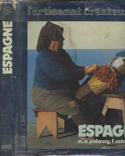
PELUAZY/CATALA ROCA
Espagne artisanat créateur.
Dessain et Tolra. 1978. In-4. Relié toilé. Bon état, Couv. convenable, Dos satisfaisant, Intérieur frais. 238p, tres illlustré de photos couleurs et noir et blanc dans le texte, relié toilé bleu, jaquette illustrée, rousseurs sur pages de garde.. Avec Jaquette. . . Classification Dewey : 946-Espagne, Portugal
Bookseller reference : RO20016717
|
|
|
PELAUZY - CATALA ROCA
ESPAGNE - L'ARTISANAT CREATEUR
DESSAIN ET TOLRA. 1978. In-4. Relié. Etat d'usage, Couv. convenable, Dos satisfaisant, Intérieur frais. 239 Pages. Nombreuses photos en couleur et en noir et blanc dans et hors texte. Jaquette abimée.. Avec Jaquette. . . Classification Dewey : 946-Espagne, Portugal
Bookseller reference : RO80185292
|
|
|
Pelauzy M.A. - Català Roca F.
Espagne - L'artisanat créateur
Dessain et Tolra. 1978. In-4. Relié. Etat d'usage, Couv. convenable, Dos satisfaisant, Quelques rousseurs. 239 pages augmentées de nombreuses photos et une carte en noir et blanc et en couleurs dans et hors texte. TExte sur 3 colonnes. Jaquette légèrement déchirée.. . . . Classification Dewey : 946-Espagne, Portugal
Bookseller reference : R240156246
|
|
|
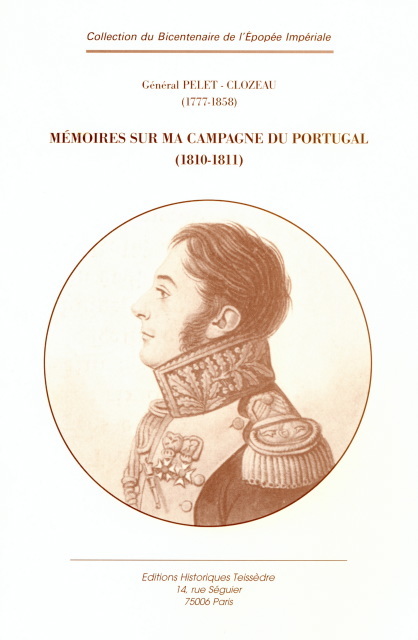
PELET-CLOZEAU (Jean-Jacques-Germain)
Mémoires sur ma campagne du Portugal (1810-1811).
Paris, Éditions Historiques Teissèdre, 2003 16 x 24 cm, 706 pp., 8 cartes, broché.
Bookseller reference : 100054
|
|
|
PELET-CLOZEAU (Jean-Jacques-Germain)
Mémoires sur ma campagne du Portugal (1810-1811). Édition établie par Christian Schneider
Paris, Éditions Historiques Teissèdre, 2003 16 x 24 cm, 706 pp., 8 cartes, broché.
Bookseller reference : 100055
|
|
|
PEMÁN, José María.
De Madrid a Oviedo pasando por las Azores.
Zaragoza, Talleres El Noticiero, 1935. 4to. menor; 256 pp. Ejemplar sin encuadernación.

|
|
|
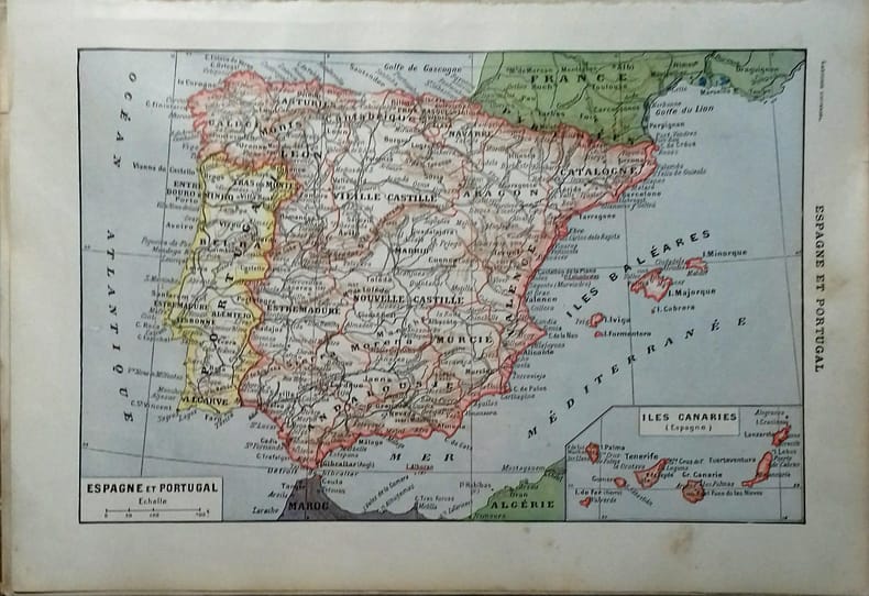
PENINSULE IBERIQUE
Carte en couleurs de l'Espagne et du Portugal. Carte extraite du Larousse universel en 2 volumes.
- Une feuille 20 x 29 cm.
Bookseller reference : 53850
|
|
|
PENROSE, Boies.
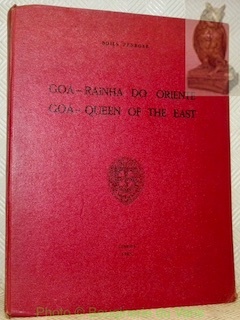
Goa-Rainha do Oriente. Goa-Queen of the east.Comemoraçoes do V centenario da morte do infante D. Henrique. Comissao Ultramarina.
Lisboa, 1960, 280x215mm, 119páginas, encadernação de editor. Buen estado.
Bookseller reference : 31694
|
|
|
PEPIN PATRICK
HISTOIRES INTIMES DE LA GUERRE D'ESPAGNE - 1936-2006 LA MEMOIRE DES VAINCUS
NOUVEAU MONDE. 2008. In-8. Broché. Bon état, Couv. convenable, Dos satisfaisant, Intérieur frais. 207 pages.. . . . Classification Dewey : 946-Espagne, Portugal
Bookseller reference : RO20183573
|
|
|
PERICOT LUIS DR.
"EVOCATION DE LA VILLE ""IBERIQUE"" D ULLASTRET"
EXCMA DIPUTACION PROVINCIAL DE GERONA. 1966. In-4. Broché. Bon état, Couv. convenable, Dos satisfaisant, Intérieur frais. 15 pages environ augmentées de nombreuses illustrations en noir et blanc dans le texte. La pagede titre est découpée en haut en coin droit.. . . . Classification Dewey : 946-Espagne, Portugal
Bookseller reference : RO80173170
|
|
|
PERRIER VIVIANE- ANTONIO CENDAN MELIS- COLLECTIF
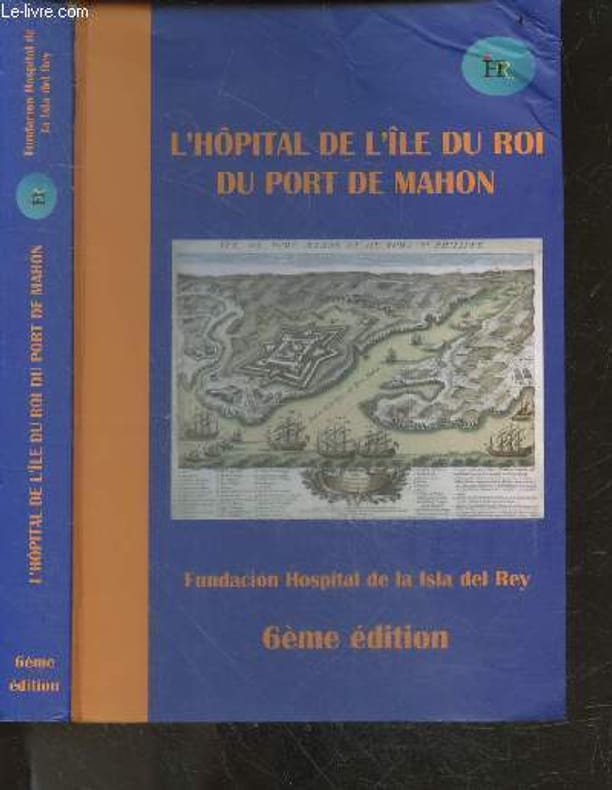
"L'hopital de l'ile du roi du port de Mahon- 6e edition- la basilique chretienne, alfonso ""le liberal"" III d'aragon, hopital naval anglais pionnier a minorque, manuel rodriguez y caramazana, escadre hollandaise dans le port de mahon, chapelle anglicane..."
Fundacion hospital de la isla del rey / jacques PAQUET. 2020. In-8. Broché. Etat d'usage, Couv. légèrement passée, Coiffe en tête abîmée, Intérieur frais. 333 PAGES illustrées en noir/blanc et couleur - page de garde manquante - couverture rempliée : rabats illustrés en couleur - pliures sur les plats - quelques traces d'humidités en coins de certaines pages, sans conséquence sur la lecture. . . . Classification Dewey : 946-Espagne, Portugal
Bookseller reference : RO20256546
|
|
|
PERRIN (Maurice).
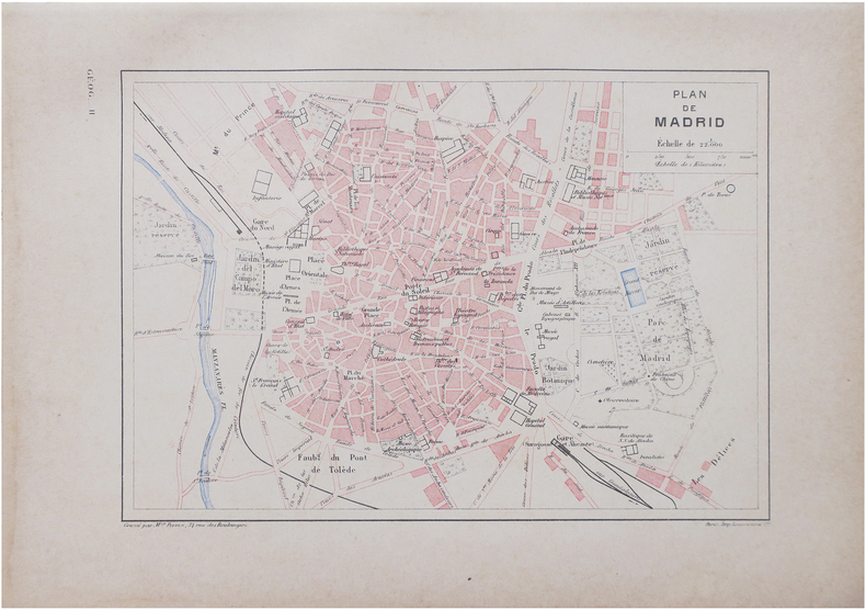
[MADRID] Plan de Madrid.
Paris, [1890]. 160 x 226 mm.
Bookseller reference : LBW-8642
|
|
|
PERELLO Ripoll
Ampurias. Description des Ruines et Musée Monographique.
BARCELONE. 1982. In-12. Broché. Bon état, Couv. convenable, Dos satisfaisant, Intérieur frais. 79 pages. Nombreuses planches de photos en noir et blanc et en couleurs. Quelques plans en noir et blanc, hors-texte. Couvertures rempliées.. . . . Classification Dewey : 946-Espagne, Portugal
Bookseller reference : RO80079698
|
|
|
PERTHES Justus
Carte de l'Espagne et du Portugal.
- 1 carte 30 x 23 cm, pliée en deux.
Bookseller reference : 84461
|
|
|
PEREZ MUR FRANCISCO.
DE LA VOLTIGE AERIENNE A LA GUERRE D'ESPAGNE.
FRANCE-EMPIRE.. 1978.. In-12. Broché. Bon état, Couv. convenable, Dos satisfaisant, Intérieur frais. 285 pages. 1ère de couverture illustrée en couleurs. Nombreuses photographies en noir et blanc, hors texte.. . . . Classification Dewey : 946-Espagne, Portugal
Bookseller reference : R150081478
|
|
|
PEREZ GONZALEZ Alfredo
Doctrina internacionalista de Serafin de Freitas +1633, Mercedaria Portugués, Profesor en Valladolid
Madrid, 1963 222pp., 24cm., text in Spanish, Doctoral Dissertatrion (Tesis doctoral en la facultad de Derecho de la Universidad Pontificia de Salamanca), stamp at verso of title page, text is clean and bright, J111958
Bookseller reference : J111958
|
|
|

 Receive by email
 Download as PDF document
 RSS feed
 Permanent link


