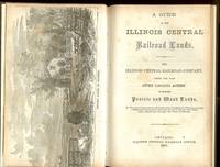
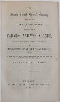
Chicago: Illinois Central Railroad Office 1859. 1859. ILLINOIS RAILROAD. First edition. 9" x 6" original pictorial wrappers 4 60 pp. engraved illustrations two frontis. maps one of Illinois showing the lines and stations of the ICR and the other a system map plus a frontispiece of a Prairie Scene in Illinois. Information is provided on the area and extent classification of soils the composition of the soils water crops stock raising etc. Also information on the Illinois Central Railroad and how and why buy their lands inducements to settle in Illinois statistics of towns on the ICR etc. Light wear to the spine ends interior clean overall a very good copy. Illinois Central Railroad Office, 1859. unknown
Chicago: Illinois Central Railroad Office 1861. First Edition . Hardcover. Very Good. 8vo - over 7¾" - 9¾" tall. ANDREW John. In modern brown cloth title to spine in gilt. Internally new endpapers has an outline map of Illinois with map of the Rail Road Lines to verso frontis of Prairie scene in Illinois 3 4-60 pp 2 maps from Appletons Railway Guide 1 pl 6 illustrations within text all B&W some light edge browning & spotting bookseller label to epd. Has articles on Inducements to Emigrate Progress of Development Soil and Productions of Illinois etc. An interesting and informative little read. <br/> <br/> Illinois Central Railroad Office hardcover
New York: Illinois Central Railroad Company 1961. Folio. Single page printed both sides. Very Good. Mounted on gold colored card. 100 shares issued to Hirs & Harney. Dated 10/23/61. New York: Illinois Central Railroad Company, 1961. unknown
New York: John W. Amerman Printer 1855. Paperback. Used-Very Good. Orig. wraps 32 pp. Double page map precedes text. Wraps edgeworn and soiled with some loss at corners. Internally complete and sound except for some water damage in margins. New York: John W. Amerman, Printer paperback
Chicago: Illinois Central Rail Road Office 1858. 1858. ILLINOIS. First edition. 8vo. Yellow pictorial wrappers 5 5 - 80 pp. full page map of Illinois double-page map of the guide to the Illinois Central Railroad Lands wood-engraved frontispiece. six wood-engraved illustrations in the text. The lands are situated on each side of the Railroad between Dunleith and Cairo on the main line and Chicago and Centralia on the Chicago branch. Traversing the entire state from north to south it therefore passes through a great variety of climates and purchasers are enabled to suit their inclinations in their selections. The road passes immediately over some of the lands; others vary in distance from it from one to fifteen miles. A little wear to the bottom corner of all pages and light wear to the fore-edges of the front cover cover and first three leaves else a very good bright copy. Illinois Central Rail Road Office, 1858. unknown
Chicago: Illinois Central Rail Road Office 1858. 80pp stitched into modern plain wrappers. Frontis maps and plate: Outline Map of Illinois; double-page map entitled Railway Guide to the Illinois Central Railroad Lands; engraving entitled 'Prairie Scene in Illinois.' Very Good. <br /> <br /> "The work is in effect a guidebook to Illinois" Eberstadt. Chicago imprints had previously issued in 1855 and 1857 the 1855 offering 2000000 acres. <br /> This one as Byrd notes contains some material not printed in those editions. The "pamphlets deal with such topics as the value of Illinois lands for farming purposes; advantages of settling in Illinois; cost of moving to Chicago; prices of products; fuel and fencing. They contain statistics of towns on the line of the road and letters from Illinois farmers giving their experiences and opinions" Buck. <br /> Ante-Fire Imprints 331. Byrd 2932. Buck 559. Illinois Central Rail Road Office unknown
Chicago: Illinois Central Rail Road Office Chicago Daily Press Print 45 Clark St. 1857. 80pp stitched into original printed and illustrated yellow wrappers. Frontis maps and plate: Outline Map of Illinois; double-page map entitled Railway Guide to the Illinois Central Railroad Lands; engravings in text. LACKS the frontis engraving entitled 'Prairie Scene in Illinois.' Else Very Good. <br /> <br /> "The work is in effect a guidebook to Illinois." Eberstadt. Chicago imprints had previously issued in 1855 and 1857 the 1855 offering 2000000 acres. This one does as Byrd notes contain some material not printed in those editions. The "pamphlets deal with such topics as the value of Illinois lands for farming purposes; advantages of settling in Illinois; cost of moving to Chicago; prices of products; fuel and fencing. They contain statistics of towns on the line of the road and letters from Illinois farmers giving their experiences and opinions." Buck. <br /> Ante-Fire Imprints 263. Byrd 2683. Illinois Central Rail Road Office [Chicago Daily Press, Print, 45 Clark St.] unknown
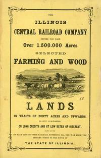
Chicago: Illinois Central Rail Road Office 1857. First Edition. Softcover. Very Good. 80pp. Bound in at front: Outline Map of Illinois; Railway Guide to the Illinois Central Rail Road Lands double-page map; woodcut frontispiece "Prairie Scene in Illinois." Six woodcuts in the text. Bound in at back: four pages of broadside-style ads printed in diaplay type on lavender stock. 1 "Passengers for St. Louis Jacksonville Naples Kansas and Nebraska should procure their tickets via Illinois Central R. Road." 2 "Great Western and Michigan Central Railway Line only direct route via Niagara Falls and Suspension Bridge." 3 Great Reduction of Fare! For St. Paul! Great Western Mail Route. Galena and Chicago Union Rail Road." 4 "Passengers for St. Paul should be particular and call for tickets via Dunleith . Having Twelve Splendid Steamers." Bound in printed wrappers with prairie scene on cover. 9" x 5.5" Byrd Illinois Imprints 2683. Buck Travel and Description 559. Illinois Central Rail Road Office unknown
New-York: Isaac J. Oliver Printer 1856. First edition thus. Softcover. Very Good. 64pp sewn. Self-wrappers string tied; faint foxing to first and last few leaves. 8.5" x 5.5" Sabin 34317--more acreage was offered in 1854 and 1855. Buck Travel & Description locates five copies with this variant imprint by Oliver. Isaac J. Oliver, Printer unknown
Boston: Geo. C. Rand & Avery Printers 1857. 1857. ILLINOIS. First edition. 8vo. 9" x 6" pictorial wrappers 80 pp. illustrated maps frontispiece prairie scene in Illinois back cover is an advertisement for the railroad. The two maps are on stiffer paper at the front of the booklet one is an outline map of Illinois showing progress of the railroad and the other is a double-page map of the eastern portion of the United States showing railway connections from the Mississippi River to the East Coast and the available lands offered for sale in Illinois. "The lands are situated on each side of the Railroad between Dunleith and Cairo on the main line and Chicago and Centralia on the Chicago branch. Traversing the entire state from north to south it therefore passes through a great variety of climates and purchasers are enabled to suit their inclinations in their selections. The road passes immediately over some of the lands; others vary in distance from it from one to fifteen miles." Light wear to the spine ends from cover is lightly soiled small corner chip to bottom of the rear panel and pages 71 through 80 else a very good serviceable copy. Geo. C. Rand & Avery, Printers, 1857. unknown
Chicago IL: Illinois Central Railroad 1967. 1st printings. Buff paper printed with black ink stapled. Light age-toning and wear to paper faint creasing. A VG set. 46 pp. each. Charts housed within. 9-3/4" x 8-3/4" <br/><br/>Includes: 2 time tables Nos. 5 & 61 detailing the scheduling of the Chicago Division lines in the 1960s. Illinois Central Railroad unknown books
Chicago: Illinois Central Rail Road Office 1857. First Edition. Softcover. Very Good. 80pp. Bound in at front: Outline Map of Illinois; Railway Guide to the Illinois Central Rail Road Lands double-page map; woodcut frontispiece "Prairie Scene in Illinois." Six woodcuts in the text. Bound in at back: four pages of broadside-style ads printed in diaplay type on lavender stock. 1 "Passengers for St. Louis Jacksonville Naples Kansas and Nebraska should procure their tickets via Illinois Central R. Road." 2 "Great Western and Michigan Central Railway Line only direct route via Niagara Falls and Suspension Bridge." 3 Great Reduction of Fare! For St. Paul! Great Western Mail Route. Galena and Chicago Union Rail Road." 4 "Passengers for St. Paul should be particular and call for tickets via Dunleith . Having Twelve Splendid Steamers." Bound in printed wrappers with prairie scene on cover. 9" x 5.5" Byrd Illinois Imprints 2683. Buck Travel and Description 559. <br/><br/> Illinois Central Rail Road Office paperback books
Chicago: Illinois Central Rail Road Office 1858. 8vo 5 p.l. pp. 5-80; full-page map of Illinois double-page map of the guide to the Illinois Central Railroad Lands wood-engraved frontispiece 6 wood-engraved illustrations in the text; slight nibble out of the fore-margin of the first 3 leaves else a near fine copy in original yellow pictorial wrappers. Another edition with same text has imprint: Boston G.C. Rand & Avery printers 1857. Byrd 2683; Ante-Fire Imprints 263. <br/><br/> Illinois Central Rail Road Office unknown books

 検索結果のメールを受信する
 PDFファイルの検索結果をダウンロード
 RSSフィード
 パーマネントリンク