|
|
|
[Turkey and the Middle East].
Der Nahe Osten. Tornisterschrift des NS.-Führungsstabes der Wehrmacht. Heft 97. Berlin, Deutscher Verlag, 1944.
580 x 850 mm. 1 topographic and 4 political colour-printed folding maps on one sheet. Scale: 1:4,000,000; 1:10,000,000; 1:1,500,000. Published by the German Wehrmacht for use in the field: a large map of Asia Minor, reaching from Eastern Europe in the west to Iran in the east, showing the whole of Turkey, parts of Russia, the Caspian Sea, and the far north of the Arabian Gulf, identifying Kuwait city. The northern parts of Libya, Egypt, and Palestine are visible, including cities such as Cairo, Jerusalem, Jaffa, and Tel-Aviv. The furthest point to the west is the Italian town of Brindisi. The captions include translations of common Arabic, Persian, Russian and Turkish geographical terms into German, as well as instructions for the pronunciation of Turkish letters. - Smaller maps of the Gulf, including parts of Russia and India, as well as of the Mediterranean, Rhodes and the Dodecanese, and Cyprus verso. - Very well preserved. Cf. Biester/Wurm, Archiv für Geschichte des Buchwesens Bd. 70, 196.
|
|
|
[Turkey].
Asie ouest 1:2.000.000e Flle. 1. Beirut, Bureau Topographique des Troupes du Levant, 1939.
Colour-printed map. Ca. 84 x 63 cm. Constant ratio linear horizontal scale: 1:2,000,000. Relief shown as gradient tints and spot heights. - With: Lembke, Herbert. Jährliche Niederschlagsmenge im westlichen Vorderasien. Gotha, Justus Perthes, 1940 (Petermanns Georg. Mitteilungen, 86. Jg., Tafel 26). Colour-printed map, scale 1:3,700,000. Ca. 66 x 42 cm. French-produced map of the western portion of Turkey, showing the eastern tip of Bulgaria, the Aegean, Crete, Cyprus, the northern coast of Africa, and Asia Minor to Ankara. Issued by the French military just prior to the Second World War. - Folded, some tears to margins. Formerly in the collections of the Geographical Institute of the University of Berlin, accessioned during wartime as part of the German military' spoils, with requisite stamp and shelfmarks. - Includes a German wartime map of Turkey, also removed from the University of Berlin, showing the average annual rainfall. OCLC 497879161, 495083198.
|
|
|
[Turkish Wars in Hungary].
Hungarisch-Türkische Chronik. Das ist: Curieuse un[d] dabey kurzgefaßte Beschreibung alles desjenigen, was sich vom ersten grausamen Kriegs-Zug der Türken, wider das Königreich Hungarn, und derselben Könige, bis auf gegenwärtige Zeit, Merk- und Denkwürdiges zugetragen. Frankfurt, Leipzig & Nuremberg, Loschge & Froberg[er], 1684.
12mo. (2), 956 pp. With double-page-sized folding frontispiece, 15 (3 folding) engr. plates, and folding engr. map. Contemp vellum. This lavishly illustrated chronicle of the Turkish wars shows numerous views of cities and battles, including Constantinople and the 1683 siege of Vienna, as well as various scenes of torture and several portraits of military leaders. A second edition was published in 1685, with larger maps and plates. A second and third volume were produced in 1686-88. - Evenly browned throughout, as common: insignificant worming near end. Formerly in the Ottoman collection of the Swiss industrialist Herry W. Schaefer. VD 17, 75:699267S. Sturminger 972. Kelenyi 216. Cf. Apponyi 2705. Gugitz 569a. Not in STC or Horvath.

|
|
|
[Type specimens].
Regi Gustavo regis federici filio Suecis Gothis Vandalis Imperanti praesides et alumni Collegii Christiano nomini propagando quod linguarum experimenta publicantibus indulgentissime adfuerit interumque ad officinae librariae cognitionem lyceo successerit honoris ergo litterarium formarum omnigenarum specimen laeti libentes dedicant [...]. [Rome], (typis Sacrae Congregationis de Propaganda Fide, March 1784).
Small folio (252 x 336 mm). (1), 23, (1) ff. (lacking first blank). With engraved medallion headpiece to first leaf. Modern marbled boards with giltstamped green title label to upper cover. Only edition. - A set of congratulatory poems in forty-six languages to honour the visit of Gustaf III of Sweden to Rome. This multilingual album of type specimens is a remarkable showcase for the typographical versatility of the Propaganda Press in the later 18th century, shortly before the printing-house was "despoiled unmercifully" (Updike I, 183) in 1798 by the French Directory. Includes versions in Arabic, Armenian, Chaldaic, Chinese, Croatian, Classical and Modern Greek, Hebrew, Malabar, Persian, Serbian, Syrian, Tibetan, and Turkish. - Some browning and foxing throughout; a few edge flaws (with occasional loss of corner) repaired. A wide-margined copy. Rare; OCLC lists eight copies worldwide (six in U.S. research libraries). OCLC 20273705.

|
|
|
[U.S. Navy Middle East Force]. (Brown, J. C. [ed.]).
A Record of the Cruise of the U.S.S. Greenwich Bay April 30, 1949 to November 1, 1949. No place, [1950].
Small folio (220 x 276 mm). 99, (1) pp. Illustrated throughout. Original blue cloth with gilt title "GB AVP 41" stamped to upper cover. Commemorative publication "written, compiled and produced by [the] officers and men" of the U.S.S. Greenwich Bay after the ship's first tour of duty to the Persian (Arabian) Gulf as flagship for the Commander of the U.S. Navy Middle East Force. In the foreword, Commander K. G. Hensel acknowledges the Gulf as "one of the oldest yet least known parts of the world", a historic region that has "served for thousands of years as pathway of commerce by caravan and by dhow. Today, these areas are strategically among the most important that exist anywhere on the surface of the globe" (p. 3). - The small seaplane tender "Greenwich Bay" departed Norfolk on 30 April 1949 for a six-month mission, four months of which were spent in the Gulf area based at Bahrein, calling at Kuwait, Ras al Misha'ab, Ras Tanura, Sharjah, and Muscat before returning to Norfolk on 1 November. Every year thereafter the ship would repeat this duty, sailing through the Mediterranean to operate as flagship in the Red Sea, Gulf, and Indian Ocean for 4 to 6 months. In total, the "Greenwich Bay" made 15 Mediterranean deployments. This fully illustrated record contains rare images of a fire at Aramco's Ras Tanura oilfield that scorched the ship's hull, scenes from Manama, Bahrein, the "distinguished guests" who visited aboard (dignitaries of the Gulf countries visited, including a portrait of HRH Faisal al Saud on board the "Greenwich Bay"), etc. In addition to operating with foreign naval units in the Mediterranean, Red Sea, Gulf, and Indian Ocean, the "Greenwich Bay" performed extensive work in the People-to-People programme, particularly in carrying drugs and other medical supplies to Arab and African nations, and operated as an important tool of diplomacy in the region. - Light brownstaining to endpapers, otherwise a fine copy of a rare, privately printed work whose press-run likely did not exceed the number of the crew: 20 officers and 206 men. Inserted are a 3-page assessment form "Military requirements for all men in the Navy" and a Bombay port receipt from the ship's call at Bombay in July 1949.
|
|
|
[Umar Sheikh Mirza].
Portrait of Sultan Umar Sheikh Mirza. Prob. North India, second half of 19th century.
Gouache on paper with floral borders in gilt and red title within cartouche. C. 170 x 120 mm. Framed and glazed. Very decorative, high-quality miniature portrait of Sultan Umar (Omar) Mirza (1456-93), a Timuride prince from the Fergana valley. He is revered as father of Babur (1483-1530), founder of the Indian Moghul empire. The Arabic captions translates as: "The blessed portrait of Sultan Umar Sheikh Mirza". - Very clean. A comparable portrait is in the Brooklyn Museum (accession no. 59.205.9).

|
|
|
[United Arab Airlines].
Fly United Arab Airlines Jets. Egypt. London, H. Clarke & Co., 1960s.
Vintage lithographed poster backed on linen. 1060 x 762 mm. Rare travel poster showing the Nefertiti Bust, designed by Assem Ismail for the United Arab Airlines (formerly Misr Airlines and MisrAir, now Egypt Air). Affiches Air-France-2006, p. 149.
|
|
|
[United Arab Emirates - HRH Sheikh Zayed bin Sultan al Nahyan].
A trove of photographs. Mostly Abu Dhabi and Dubai, 1970s to early 2000s.
229 original photographs, 1 portrait reproduced from a painting, and 2 portraits printed on thin cardboard (one round-shaped). Various sizes (ca. 74 x 110 to 201 x 282 mm), printed both in colour and black-and-white. Some photographs with handwritten Arabic captions in pen on verso; a few with pasted mimeograph typescript captions in English. Stored in 5 display books. A large private photo archive, apparently assembled by a professional Middle Eastern journalist or press photographer, illustrating the reign of HRH Sheikh Zayed bin Sultan Al Nahyan (1918-2004), Father of the Nation and the ruler of Abu Dhabi for more than 30 years. Some pictures show HRH Sheikh Zayed welcoming foreign dignitaries such as the Syrian president Hafez Al Assad, Egyptian president Hosni Mubarak and French president Valery Giscard d'Estaing; others display industrial and cultural aspects of the Emirates, ranging from oil production in the desert to camel races and falconry. Another part of the set shows off prominent landmarks, including the Al Badiyah mosque, the oldest mosque of the Emirates, the forts of Al Hayl, Al Bithnah, and Al Jahili, the Blue Souq market hall in Sharjah, as well as Earth Park and the Zayed Sports City Stadium in Abu Dhabi. In addition, several images record National Day celebrations at the foot of Volcano Fountain in Abu Dhabi, demolished in 2004, but also show the Dubai skyline, military parades, and sailing vessels. A picture of an Iranian Phantom fighter-bomber flying over the Tunb islands shortly before Iranian forces occupied them in 1971 is a rare asset to this archive. - Mostly stamped and/or annotated in Arabic (and some in English) on versos for possibly use by the press, but not traced in the UAEhistory, Keystone or Hulton/Getty press photo archives. A few images have marginal tears or creases; one with a portion whited out for reproduction. Impressive in its extent and its wide variety of motifs, this uncommon set of not widely circulated photographs documents Abu Dhabi's transformation into a modern metropolis since the early 1970s.
|
|
|
[United Arab Emirates - Oman].
Sharjah - Salala. No place, [probably 1960s].
Diazoprint map, 111.5 x 75.4 cm. Scale 1:1,000,000. Folded. Highly detailed map of the Arabian Peninsula's coast from Abu Dhabi (Abu Al Abyad island) and Ras al-Khaimah in today's United Arab Emirates to Ras al-Hadd and south to Salala in Dhofar, Oman. The legend identifies wells, towns and villages, wadis, scarps, edges of sand, quicksand, and tracks. Political boundaries are omitted. The latest surveys incorporated are those undertaken by Nick Fallon, Douglas Michael Morton and René Wetzel in the mid- and later 1950s, suggesting that the present map - identified as "TP_773 (Revised)" in the lower left corner but not traced in any institutional collection worldwide - was one of a very small number produced for the internal use of a geological exploration team in the 1960s, when the first discoveries of oil in commercial quantities intensified exploration efforts both in the soon-to-be-independent Trucial States and in Oman. - Light staining and wear; a few minor tears professionally repaired.
|
|
|
[United Arab Emirates].
Al Sharjah. Series K563 (GSGS 4851) NG-40-9 & 10, Edition 1. [London], D. Survey, War Office and Air Ministry, 1957.
Colour-printed map, ca. 600 x 835. Scale 1:250,000. An extremely detailed map of what are today the northernmost six Emirates of the UAE (at the time of issue, the Trucial States): Dubai, Sharjah, Ajman, Umm al Quwain, Ras al Khaimah, and Fujairah, also marking the names of all the tribes holding power in the various areas. Issued by the Geographical Section, General Staff (GSGS) as part of their 1:250,000 scale map series of Arabia. The GSGS, also known as MI 4, operated under the Director of Military Operations and Intelligence. Its role was to supply maps to the British armed forces, collect data on foreign survey networks, provide training, and prepare survey data for Expeditionary Force mobilisation. - Old folds, some staining. Numerous pin-holes to corners from former wall mounting; an old ballpoint penstroke. Otherwise well preserved.
|
|
|
[United Arab Emirates].
S.E. Arabia. Series GSGS 4802, Sheet 1 [Trucial Coast]. Edition 2-GSGS. [London], D Survey War Office and Air Ministry, 1956.
Large colour-printed map, ca. 113 x 84 cm. Scale 1:500,000. A highly detailed large scale British military map, showing the coast from Doha (Qatar) to Ras Al-Khaimah (modern-day UAE). - Old folds, some creasing to bottom margin, and one small closed tear to left margin, otherwise very good.
|
|
|
[United Arab Emirates].
S.E. Arabia. Series GSGS 4802, Sheet 1 [Trucial Coast]. Edition 2-GSGS. [London], D Survey War Office and Air Ministry, 1956.
Large colour-printed map, ca. 113 x 84 cm. Scale 1:500,000. A highly detailed large scale British military map, showing the coast from Doha (Qatar) to Ras Al Khaimah (modern-day UAE). - Old folds, some creasing to margins and corners, 10 cm closed tear to bottom margin, a few other small closed tears, otherwise good. With "Additions drawn by: - Sgt Newman 17:11:61. 1 Troop 19 Topo Sqn R.E.", marking additional camps, old oil camps, place names and airstrips (old, extant and "possible"), mainly in the desert areas of Abu Dhabi.
|
|
|
[United Arab Emirates].
Strait of Hormuz (548). GSGS 4695. Edition 2. London, War Office, 1955.
Coloured R.A.F. aeronautical chart. 738 by 573 mm. Scale 1:1,000,000. An excellent official British aeronautical chart of the Strait of Hormuz, covering part of Oman, a large section of the coastline of the United Arab Emirates (including Abu Dhabi, Dubai, Sharjah and Ras al Khaimah) and Hormuz Island. It was issued by the Geographical Section, General Staff (GSGS) as part of their 4695 series of 1:1,000,000 scale maps. The GSGS supplied maps to the British Armed Forces (in this case the R.A.F.), collected data on foreign survey networks and prepared survey data for Expeditionary Force mobilisation. - Light weakening and edge flaws to folds, but generally well preserved.
|
|
|
[United Arab Emirates].
USAF Pilotage Chart. Ash Sharigah (548 D). Trucial Oman. Washington, DC, Aeronautical Chart Service, U.S. Air Force, 1948-1950.
Colour-printed map, 554 x 733 mm. Constant ratio linear horizontal scale 1:500,000., Lambert Conformal Conic Projection. Relief shown by contours, shading, gradient tints, and spot heights. Key printed on verso. Rare, advanced first edition of this U.S. Air Force aeronautical chart of what would be, within less than a quarter of a century, the bulk of the United Arab Emirates: Sharjah, Dubai, Ajman, Umm Al Quwain, and the city of Abu Dhabi to the south, based on aerial photography. "This chart is prepared for use at night under white, ultra-violet, red, and amber lights" (note). Released November 1948, with additions to February 1950 (advance edition). - Blindstamp of the American Geographical Society. Stamps to corners, not affecting the image ("Map Room Copy", "Obsolete", "Gift From Publisher"). Folded; in very good condition.
|
|
|
[United Arab Republic].
Kharitat al-Jumhuriyah al-'Arabiyah al-Muttahidah (Map of the United Arab Republic). Damascus, Matba'at al-hukumiat bi Dimashq, [ca. 1958].
Colour-printed political and physical map, ca. 134 x 94 cm. Scale 1:2,000,000. Mounted on cloth. Rare, detailed Syrian-printed map of the short-lived United Arab Republic, which aimed to unite Egypt and Syria politically in 1958. Although it effectively ceased to exist with the Syrian coup of 1961, Egypt continued to use the name until 1971. - Cartography by Niqola Zariq and Izzat Saydawi. Shows borders, rivers, valleys, principal, secondary and desert roads, railways, oil pipelines, capitals, provinces and centres, important cities and villages. The areas, population, railway length, cultivated lands and provinces of Syria and Egypt are specified separately. The Red Sea coast of Saudi Arabia is shown as far as Al Lith, south of Jeddah. - The declaration of the United Arab Republic bolstered the trend towards Pan-Arabism, and confrontational attitudes toward neighbouring states increased. The province of Hatay, on the Turkish border, is shown on Syrian territory, reflecting ongoing disputes over claims on Hatay beginning after the end of the First World War. Similarly, Israel is designated "Palestine" in the Palestinian territories. - Some stains; wrinkled with several edge tears and chips. Folded.
|
|
|
[United States Geological Survey of the Kingdom of Saudi Arabia]. Bramkamp, Richard A. / Ramirez, Leon F.
Geographic Map of the Central Persian Gulf Quadrangle Kingdom of Saudi Arabia. Miscellaneous Geologic Investigations Map I-209 A [and] B. Washington, D.C., U.S. Geological Survey, [1959-1961 CE =] 1378-1380 H.
2 sheets (A, combined map of geography and geology; and B, geography only) in full colour, both covering the same section the Arabian Peninsula. Ca. 103 x 103 and 83 x 100 cm, folded. In original printed envelope. English and Arabic. Scale 1:500,000; relief shown by hachures and spot heights. The only two sheets of the groundbreaking series covering today's UAE - the remaining parts of the Emirates were skipped in the survey prepared by the U.S. Geological Survey and Aramco and were therefore never published. The first to produce a full series of geological and geographical maps of the Kingdom of Saudi Arabia, the venture was instrumental in establishing the country as a major global force in the production of natural resources and must count as "a unique experiment in geological cooperation among several governments, petroleum companies, and individuals" (Seager/Johnston). - The area here covered is the eastern portion of Qatar and the westernmost area of Abu Dhabi, including the island of Sir Bani Yas and the adjoining border territory of Saudi Arabia. Indeed, this is the only map in the series to show any portion of today's United Arab Emirates: the land to the eastward was still beyond the focus of oil exploration in the mid-1950s and was omitted from the mapping project. - The importance of the present map within the series is underscored by the fact that its joint authors, R. A. Bramkamp and L. F. Ramirez, were Aramco's foremost geologists. Together with Glen F. Brown, a veteran of the industry who also had been in the region since the 1940s and who would oversee the venture, Bramkamp had in February 1955 planned the entire programme, laying down everything from the scales of maps, the areas of responsibility, and types of terrain representation to the bilingual names. As Aramco's chief geologist, Bramkamp was responsible for the compilation of the areas within Arabia where the sediments crop out. This responsibility fell to Ramirez following Bramkamp's early death in September 1958. - The surveyors divided the Peninsula into 21 quadrangular sections (numbered I-200 through I-220), each to cover an area 3 degrees of longitude and 4 degrees of latitude. All maps were produced on a 1:500,000 scale and issued in two series: a combined map of geography and geology (marked by the appendix 'A') and a map of geography only ('B'). "High altitude photography [...] was [...] completed in 1959 [...] This controlled photography resulted in highly accurate geographic maps at the publication scale which then served as a base for the geologic overlay. The topography of the sedimentary areas was depicted by hachuring and that of the shield region by shaded relief utilizing the airbrush technique. The first geographic quadrangle was published in July 1956 and the last in September 1962 [...] The first of the geologic map series was published in July 1956 and the final sheet in early 1964" (Seager/J.). - Although it was the search for oil, gas and minerals that "was ultimately to drive geological survey work across the region [...], in its early years it was the need for water that was the catalyst for Saudi Arabia's resource exploration. In 1944 King 'Abd al-'Aziz approached the United States for a technical expert who could assist with the identification and plotting of the kingdom's natural resources, particularly its groundwater reserves [...] By 1954 the Saudi Ministry of Finance, USGS and Aramco were working together to produce the first full series of geographic and geologic maps of the country. The first of their type in the Peninsula, these were published [...] in both Arabic and English versions, and the information they contained formed the basis of subsequent Saudi national development plans" (Parry). The project was considered highly important by Ibn Saud, and its aims encompassed all aspects of cartography. It was to enable not only the search for natural resources but also aid in advances for agriculture, civil and military engineering and general infrastructure projects. The results were seminal for the mapping of the region: "To this day, all modern maps of the kingdom trace their roots back to these first publications" (ibid.). - Lower left corner of 'B' map chipped (no loss to text or image); printed sleeve somewhat rubbed with a 1960s few pencil annotations, otherwise a very clean set in excellent state of preservation. A single map of the quadrangle to the immediate west of this, I-208 (the 1958 'A' sheet only), showing Dhahran and Ras Tanura, is currently being offered on the market at £25,000. James V. Parry, "Mapping Arabia", in: Saudi Aramco World 2004/1, p. 20ff. O. A. Seager/W. D. Johnston, Foreword to the Geology of the Arabian Peninsula series (U.S. Geological Survey Professional Paper 560-A-D, 1966).
|
|
|
[United States Geological Survey of the Kingdom of Saudi Arabia].
Saudi Arabia Geologic Maps (GM) series. 6 maps. [Reston, VA] / Jiddah, Ministry of Petroleum and Mineral Resources, Deputy Ministry for Mineral Resources, 1975-1991.
6 maps, colour printed. Scales: 1:100,000; 1:250,000; 1:2,500,000. All in their original printed orange and green envelopes, all but one with accompanying booklets. Six maps from the USGS's premier Geologic and Geoscience series (English and Arabic text), focusing on the west of the Arabian Peninsula. Originally compiled from field mapping carried out at the 1:100,000 scale, though scales here vary. Maps include keys and cross-sections, and sometimes an accompanying booklet of detailed explanatory notes. Comprises individually: - 1) GM-22 (IR 182; Vranas p. 17): Geology of the Jabal Ibrahim Quadrangle, Sheet 20 / 41C, by W. R. Greenwood, with a Section on Economic Geology, by R. G. Worl and W. R. Greenwood, 82 x 74 cm, 1:100,000, 1975 (1976). Based on mapping done Dec. 1970-Jan. 1971. With 18 pp. staple-bound illustrated notes as called for. - 2) GM-28: Geology of the Nuqrah Quadrangle, sheet 25E, by J. Delfour, 106 x 62 cm, 1:250,000, 1977. Includes 18 pp. staple-bound illustrated notes by J. Delfour. This area lies a little to the north of Medina. Original mapping is credited to the Bureau de Recherches Geologiques et des Minieres. - 3) GM-66 - Plate 2: Mineral locality maps of Saudi Arabia, by Hans van Daalhoff, 71 x 96 cm, 1:2,500,000, 1982. This map is a reduction of the Anglo-American / USGS Map I-270-B2 (1963) and includes a large stretch of the Red Sea coast including the Holy Sites, part of Qatar, and the major oil producing locations on the Arabian Gulf. - 4) GM-78A (IR 383; Vranas p. 33): Geologic map of the Najran quadrangle, Sheet 17G (with Landsat base), by Edward G. Sable, 109 x 64 cm, 1:250,000, 1985. Includes 18 pp. staple-bound illustrated "Explanatory Notes" by Sable as called for (though Vranas confusingly indicates this should also include an additional geographic map, and the booklet be 35 pp.). - 5) GM-122: Industrial mineral resources map of Jiddah, by C. H. Spencer, Alain Cartier, and Pierre Louis Vincent, in two sheets, 1988. 1:100,000. 2 sheets (Jiddah East; Jiddah West), each 102 x 76 cm. Includes 15 pp. staple-bound illustrated notes by Spencer, Cartier and Vincent. - 6) GM-132: Geologic map of the Cenozoic Lava field of Harrat Kishb, by M. John Roobol and Victor E. Camp, 86 x 76 cm, 1:250,000, 1991. Includes 34 pp. staple-bound illustrated notes by Roobol and Camp. - Very well preserved in general. G. J. Vranas, List of Interagency Reports submitted by the US Geological Survey Saudi Arabian Mission to the Saudi Arabian Directorate General of Mineral Resources from 1965 to the beginning of 1992 (Open File Report USGS-OF-92-2. Interagency Report 844 (Jiddah: Ministry of Petroleum and Mineral Resources Directorate General of Mineral Resources, 1412 AH/1992 AD), pp. 17, 33.
|
|
|
[United States Geological Survey of the Kingdom of Saudi Arabia].
Saudi Arabia Index Maps (1:4,000,000). 6 maps. [Reston, VA] / Jiddah, Ministry of Petroleum and Mineral Resources, Deputy Ministry for Mineral Resources, 1980-1981.
6 maps, 70 x 61 cm to ca. 75 x 65 cm. Printed in black and white. Constant ratio linear horizontal scale 1:4,000,000 scale. All in their original printed orange envelopes. Of the eight index maps produced during 1980-81, six are included here (wanting 100 [IR 400] and 107 [IR 407]). They feature the Arabian Peninsula, with labels for Mecca, Medina, Jeddah, Riyadh, Dammam, Sharjah, Masqat, Kuwayt etc. Comprises individually: - 101 (IR 401): Index Map of 1:250,000 scale quadrangle maps; 102 (IR 402): Index map of Landsat imagery of the Arabian Peninsula: Path 169 through 189, Row 38 through 51; 103 (IR 403): Index map of 1:50,000 scale mosaics, SAG and GSMO photography 1950-53; 104 (IR 404): Index map of 1:100,000 scale mosaics and photo maps, SAG and GSMO photography 1950-53; 105 (IR 405): Index map of 1:100,000 scale mosaics, WSA photography 1955-57; 106 (IR 406): Index map of 1:50,000 scale mosaics, WSA photography 1955-57. - In excellent condition throughout. G. J. Vranas, List of Interagency Reports submitted by the US Geological Survey Saudi Arabian Mission to the Saudi Arabian Directorate General of Mineral Resources from 1965 to the beginning of 1992 (Open File Report USGS-OF-92-2. Interagency Report 844 (Jiddah: Ministry of Petroleum and Mineral Resources Directorate General of Mineral Resources, 1412 AH/1992 AD), pp. 71, 35f.
|
|
|
[United States Geological Survey of the Kingdom of Saudi Arabia].
Saudi Arabia Landsat Image Maps (1:250,000). 20 maps. [Reston, VA] / Jiddah, Ministry of Petroleum and Mineral Resources, Deputy Ministry for Mineral Resources, 1979-1981.
20 maps, 84 x 53 cm or larger. Printed in brown tones. Transverse Mercator projection, constant ratio linear horizontal scale 1:250,000 scale. All but two in their original printed orange envelopes. The joint NASA/USGS Landsat Programme started in the early 1970s, providing the longest continuous space-based record of the Earth’s surface. Of the 25 maps in 1:250,000 scale produced during 1979-81, 20 are included here (wanting 2, 3, 4 [IR 301, 302, 303], 13 [IR 312], 16 [IR 315]). They cover the stretch of the Red Sea coast from just below the Gulf of Aqaba to just below Jeddah, and inland from Jeddah towards Dammam via Riyadh. Comprises individually: - 1 (IR 300): Jabal Al Hasir Quadrangle, Sheet 19F, 1979; 5 (IR 304): Jibal Hayil Quadrangle, Sheet 17E, 1980; 6 (IR 305): Al Qunfudhah Quadrangle, Sheet 19E, 1980; 7 (IR 306): Wadi Hali Quadrangle, Sheet 18E, 1980; 8 (IR 307): Jizan Quadrangle, Sheet 16F, 1980; 9 (IR 308): Jibal Al Qahr Quadrangle, Sheet 19G, 1981; 10 (IR 309): Bi’r Idimah Quadrangle, Sheet 18G, 1981; 11 (IR 310): Jaza’ir Farasan Quadrangle, Sheet 16E, 1980; 12 (IR 311): Wadi Bishah Quadrangle, Sheet 20F, 1981; 14 (IR 313): Al Lith Quadrangle, Sheet 20D, 1981; 15 (IR 314): Wadi Tathlith Quadrangle, Sheet 20G, 1981; 17 (IR 316): Turabah Quadrangle, Sheet 21E, 1981; 18 (IR 317): Ar Rawdah Quadrangle, Sheet 21F, 1981; 19 (IR 318): Jabal Tarban Quadrangle, Sheet 21G, 1981; 20 (IR 319): Rabigh Quadrangle, Sheet 22D, 1981; 21 (IR 320): Al Muwayh Quadrangle, Sheet 22E, 1981; 22 (IR 321): Zalim Quadrangle, Sheet 22F, 1981; 23 (IR 322): Wadi Ar Rika’ Quadrangle, Sheet 22G, 1981; 24 (IR 323): Al Mulayh Quadrangle, Sheet 22H, 1981; 25 (IR 324): Al Ji’lan Quadrangle, Sheet 21H, 1981. - Envelope and map of no. 10 stamped with initials and date (TRU May 1981) and a couple of nicks to map edge, otherwise excellent throughout. G. J. Vranas, List of Interagency Reports submitted by the US Geological Survey Saudi Arabian Mission to the Saudi Arabian Directorate General of Mineral Resources from 1965 to the beginning of 1992 (Open File Report USGS-OF-92-2. Interagency Report 844 (Jiddah: Ministry of Petroleum and Mineral Resources Directorate General of Mineral Resources, 1412 AH/1992 AD), pp. 71, 26-29.
|
|
|
[United States Geological Survey of the Kingdom of Saudi Arabia].
Saudi Arabia Landsat Image Maps (1:500,000). 4 maps. [Reston, VA] / Jiddah, Ministry of Petroleum and Mineral Resources, Deputy Ministry for Mineral Resources, 1980.
4 maps, 86 x 98 cm to 104 x 102 cm. Printed in brown tones. Transverse Mercator projection, constant ratio linear horizontal scale 1:500,000 scale. All maps but one (32) in their original printed orange envelopes. The joint NASA/USGS Landsat Programme started in the early 1970s, providing the longest continuous space-based record of the Earth’s surface. Of the five produced in 1:500,000 scale, all but one (no. 34 [IR 333]) are included here. (As Vranas notes, numbers 26-31 and 35-37 were never produced.) They focus on the southwestern portion of the Peninsula; map 32 shows Mecca and Jeddah, though they are not marked. Comprises individually: - 32 (IR 331): Southern Hijaz Quadrangle; 33 (IR 332): Southern Najd Quadrangle; 38 (IR 337): Tihamat Ash Sham Quadrangle; 39 (IR 338): ‘Asir Quadrangle. - In excellent condition throughout. G. J. Vranas, List of Interagency Reports submitted by the US Geological Survey Saudi Arabian Mission to the Saudi Arabian Directorate General of Mineral Resources from 1965 to the beginning of 1992 (Open File Report USGS-OF-92-2. Interagency Report 844 (Jiddah: Ministry of Petroleum and Mineral Resources Directorate General of Mineral Resources, 1412 AH/1992 AD), pp. 71, 26-29.
|
|
|
[United States Geological Survey of the Kingdom of Saudi Arabia].
Saudi Arabia Landsat Image Maps, OF-02 series (1:250,000 and 1:500,000). 27 maps. [Reston, VA] / Jiddah, Ministry of Petroleum and Mineral Resources, Deputy Ministry for Mineral Resources, 1982.
27 maps, ca. 54 x 84 cm to 104 x 98 cm. Printed in brown tones. Transverse Mercator projection, constant ratio linear horizontal scale 1:250,000 scale (except for OF-02-32 through 02-35, which are on a scale of 1:500,000). All in their original printed orange envelopes. The joint NASA/USGS Landsat Programme started in the early 1970s, providing the longest continuous space-based record of the Earth’s surface. Its "OF" (Open File reports) series was designed to publish urgent interim or preliminary information edited with only a single peer review. As of 1992, 11 sets had been produced, which included a mixture of maps and other documents, prefixed OF-01 through OF-10 and OF-92. The present set comprises 27 maps from the 91 documents that made up the OF-02 set. Comprises individually: - OF-02-12 (IR 325): Halaban Quadrangle, Sheet 23G; OF-02-14 (IR 327): Al Hawtah Quadrangle, Sheet 23I; OF-02-15 (IR 328): Yabrin Quadrangle, Sheet 23J; OF-02-16 (IR 329): Ad Dawadimi Quadrangle, Sheet 24G; OF-02-17 (IR 330): Durma Quadrangle, Sheet 24H; OF-02-19 (IR 335): Harad Quadrangle, Sheet 24J; OF-02-20 (IR 336): Aban Al Ahmar Quadrangle, Sheet 25F; OF-02-21 (IR 339): Al Faydah Quadrangle, Sheet 25G; OF-02-22 (IR 340): Shaqra Quadrangle, Sheet 25H; OF-02-23 (IR 341): Rumah Quadrangle, Sheet 25I; OF-02-24 (IR 419): Jabal Habashi quadrangle, Sheet 26F; OF-02-25 (IR 420): Buraydah Quadrangle, Sheet 26G; OF-02-26 (IR 421): Qiba Quadrangle, Sheet 27G; OF-02-27 (IR 422): Mahd Adh Dhahab Quadrangle, Sheet 23E; OF-02-28 (IR 423): 'Afif Quadrangle, Sheet 23F; OF-02-29 (IR 424): Al Hissu Quadrangle, Sheet 24E; OF-02-31 (IR 426): Baq'A' Quadrangle, Sheet 27F; OF-02-32 (IR 427): Wadi As Sirhan Quadrangle; OF-02-33 (IR 428): Northwestern Hijaz Quadrangle, 104 x 98 cm; OF-02-34 (IR 429): Northeastern Hijaz Quadrangle, 80 x 100cm, OF-02-35 (IR 430): Wadi Ar Rimah Quadrangle, 83 x 100 cm; OF-02-72 (IR 476): Sahl Al Matran Quadrangle, Sheet 26C; OF-02-73 (IR 477): Harrat Ithnayn Quadrangle, Sheet 26D; OF-02-74 (IR 478): Wadi Ash Sha'bah Quadrangle, Sheet 26E; OF-02-75 (IR 479): Al Muwaylih Quadrangle, Sheet 27A; OF-02-76 (IR 480): Shaghab Quadrangle, Sheet 27B; OF-02-79 (IR 483): Ha'il Quadrangle, Sheet 27E. - In excellent condition throughout. G. J. Vranas, List of Interagency Reports submitted by the US Geological Survey Saudi Arabian Mission to the Saudi Arabian Directorate General of Mineral Resources from 1965 to the beginning of 1992 (Open File Report USGS-OF-92-2. Interagency Report 844 (Jiddah: Ministry of Petroleum and Mineral Resources Directorate General of Mineral Resources, 1412 AH/1992 AD), pp. 75f., 28-42.
|
|
|
[Urquhart, David].
Turkey and its resources: its municipal organization and free trade; the state and prospects of English commerce in the East, the new administration of Greece, its revenue and national possessions. London, Saunders and Otley, 1833.
8vo. First edition. XV, (1), 328 pp. With lithographic map bound as frontispiece. First edition; flyleaf inscribed by the author to "Mr A. Regnaudin". Important overview of Turkish trade, resources, infrastructure and municipal organisation by the diplomat David Urquhart (1805-77). After two and a half years fighting in the Greek war of independence, Urquhart was invited to accompany Sir Stratford Canning to Constantinople in November 1831 as an advisor during negotiations to settle the Greek boundary. In 1832 Urquhart was sent to Albania to cultivate the support of Rechid Pasha, leading advisor to the Turkish sultan. Urquhart became a great supporter of Turkey, spending most of 1834 in the country, and encouraged the British government to ally itself with Turkey against Egypt. This substantial book was written to inform the British political class of the possible commercial benefits of an Anglo-Turkish alliance. - Some negligible toning to first few leaves. Very good, uncut in original grey paper-covered boards, spine with original printed label, light wear to extremities. Scarce, particularly in original condition as here. Goldsmiths’ 27883. OCLC 65261681.

|
|
|
[Van Ess, John, et al.].
Historical Mesopotamia. (Basrah, Times Press, 1922].
4to (170 x 202 mm). (6), 58 pp. With 8 photographic plates and one map. Original pictorial grey wrappers. Ten excellent short essays on Mesopotamia (modern-day Iraq), printed at the Times offices in Basra. According to the preface, the pamphlet was published in response to growing curiosity about the country, sparked by British involvement post-WWI. Most of the essays, as per the title, focus on the distant past, taking the reader to the founding of Baghdad in the eighth century, Basra in the Middle Ages and the construction of the Ctesiphon Arch (Taq Kasra). The latter is one of the finer pieces, providing a brief but detailed account of the creation of the structure and its completed finery, drawing on Gertrude Bell's musical translation of al-Tabari's description of the famous carpet "woven in the pattern of a garden" (Amurath to Amurath). - Other essays turn to the early twentieth century and contemporary life. The piece on Mandaeism, in addition to outlining its history, features a short interview with a group of Mandaeans from the Mesopotamian Marshes, in which they discuss their beliefs and religious practices. The final essay, by the missionary John Van Ess (the only contributor to give his full name), reflects on his time in Mesopotamia among certain rural tribes, highlighting episodes of kindness and hospitality. Van Ess (1878-1949) is notable for the time he spent in Mesopotamia (nearly fifty years), his role as an advisor to British officials and, in that capacity, for his opposition to making Faisal King. - With contemporary ink ownership of A. H. Lee on the front cover. Remnants of postage stamps on rear wrapper, slight repair to spine. Exceedingly rare: only two intact copies known, in the British Library Reference Collections and in the National Library of Scotland; the Munich University Library appears to own an incomplete copy. OCLC 562435427.
|
|
|
[VAN HAMME] - BECKFORD (William).-
Vathek. Préface de Stéphane Mallarmé. Illustrations de Van Hamme.
1971 Grenoble, Roissart, 1971, in 8° broché, XXX-124 pages ; couverture rempliée, sous double emboîtage de toile marron de l'éditeur.
書籍販売業者の参照番号
: 84864
|
|
|
[View - Middle East].
Mountainous landscape with Middle Eastern and classical Roman ruins, 6 shepherds with their flocks, several figures riding dromedaries and one riding a donkey, (date?) palms, lakes, etc. [Palestine?, ca. 1910?].
An enormous panoramic view drawn in coloured gouaches on a single, continuous roll of unwatermarked wove paper (70 x 583 cm), the drawing running to the edges of the paper. Rolled and stored in a cardboard tube. A panoramic view of what appears to be a fantasy Middle Eastern landscape, with spectacular mountains in the background, a body of water near each end, and a wide variety of buildings and ruins, some clearly classical Roman and others Middle Eastern. The combination of classical Roman architecture with dromedaries and other Middle Eastern features places it very likely in Palestine, but we have not been able to identify specific buildings. The most distinctive ruin, a round Roman temple with five columns on the viewer's side (perhaps a third of the circle), an entablature above them and a vertical base below them, looks more like the Temple of the Vesta at Tivoli than like any known temple in the Middle East (the columns are not rendered in sufficient detail to determine their order, but they are almost certainly not Ionic and are probably Corinthian). There are also classical Roman aqueducts. The six shepherds with their flocks all wear broad-brimmed hats and have staffs, and two are blowing long, slightly curved horns. Several additional figures with broad-brimmed hats and staffs might be pilgrims, one together with what is presumably his wife. - With a 33 cm tear into the left edge, slightly affecting a mountain and the top of a tree, a few insignificant and much smaller tears and with pin holes about 1 cm from the edges from mounting on a wall, but otherwise in very good condition and with the colours fresh and bright. A spectacular panoramic view of the Middle East, including many classical Roman ruins.
|
|
|
[View - Optics - Mecca].
Vue du Port et de la Ville de Lamekk dans Larabie heureuse a 5 lieues de la Mer Rouge. [Paris, Louis Mondhare, 1750].
Optica-print view of Mecca on laid paper (32 x 46 cm), with some parts highlighted in contemporary hand colour. An imaginary view of the port of Mecca, showing the supposed harbour connected to the Red Sea, published by Louis Mondhare, a well-known publisher of so-called optica prints. The print, meant for viewing through a "zograscope" - a viewer with a large lens and mirror giving an illusion of depth - emphasizes perspective and shows the straight lines characteristic of optica prints. In good condition, crudely hand-coloured.
|
|
|
[War Office - General Staff].
Persian Gulf. Sheet 32. London, Field Survey Company, 1941.
990 x 760 mm. Scale 1 : 4000000. Third edition. Topographical map of the Arabian Gulf and surrounding area showing international boundaries, main cities and towns, roads, railways, islands, rivers, lakes, wetlands and other vegetation and terrain features. Extends from the Caspian Sea south to Mecca and from Cairo east to Meshed. Relief shown by contours, altitude tints and spot heights. Includes legend, index to adjoining sheets, administrative index, and bibliographical references. - Slightly creased.
|
|
|
[Wasf al-Rusul].
Kitab wasf al-Rusul wa al-Imama. [Near East, no date, but apparently ca. 1820 / early 19th century].
Small folio (ca. 210 x 300 mm). 74 pp. Arabic manuscript in black Naskh, headings and key words in red, ruled in red (often to form tables and geometric patterns). Several diagrams, 2 ff. with circular diagrams, some ruled leaves blank. Contemporary limp leather. A theological manuscript entitled "The book of description (or attributes) of the Prophet and the Leader". - Binding a little rubbed, spine chipped. A few leaves loosened. Some light staining and finger-soiling throughout; a few ink smudges; a number of edge tears (some professionally repaired).

|
|
|
[Wellsted, James Raymond].
Reiseskizzen aus Arabien. Oman und die Küste des persischen Golfs (Nach Wellstedt). In: Meyer's Volksbibliothek für Länder-, Völker- und Naturkunde. 76. Band. Hildburghausen & New York, Bibliographisches Institut / Hermann J. Meyer, [1855].
12mo. 161-197 pp.; entire work: 221, (3) pp. With 3 folding engr. plates. Original printed wrappers. Rare German translation of Wellsted's account of Oman. J. R. Wellsted's short career was almost entirely devoted to the surveying of the Red Sea, Arabia and Oman, undertaken on a number of expeditions between 1830 and 1837. On board the surveying ship Palinurus he was the first European to set foot in the interior of Oman. Starting late in 1835 from the easternmost point of Oman, Wellsted made his way westward through the Ja`alan region to the Wahibah Sands and then struck north up the Wadi Batha to Samad. There he was joined by Lieutenant F. Whitelock, also of the Indian Navy, who had set out from Muscat later. Together they reached Nazwa, the ancient capital of Oman, and climbed the lower slopes of the Jabal al-Akhdhar, in central Oman. In January 1836 they arrived on the Al-Batinah coast and then turned west, recrossing the Hajar mountains and emerging on the edge of the Dhaharah, the rocky steppe that stretches west toward the Rub` al-Khali. - Somewhat foxed throughout. Uncut, untrimmed copy. OCLC 162829268.

|
|
|
[Wilson, Arnold Talbot].
A Sketch of the Political History of Persia, Iraq and Arabia, With Special Reference to the Present Campaign. Calcutta, Government Press, 1917.
Small 8vo. (6), 43, (1) pp. Stiff green cloth wrappers titled in black. Extremely rare manual, marked "For Official use only" and prepared for the troops of the Indian Expeditionary Force "D", giving an account of the political and historical context of the British Mesopotamian campaign of World War I. - Expeditionary Force "D" was made up of Indian and British troops and is infamous for its doomed defense of the siege of Kut, where disease and starvation forced a surrender in April 1916. However, the pamphlet does not limit itself to Iraq, but crucially provides an entire chapter on the history of, and British interest in, the Arabian Peninsula, titled "Arabia - Our Left Flank", including an entire section on Abdulaziz Ibn Saud (1875-1953). The author summarizes the history of British presence in the Gulf, noting the sack of Ras-al-Khaimah in retribution for alleged pirate activity, after which "the climate forced [the British] to evacuate that position". The book further refers to the "maritime truce" imposed by Britain upon the Arabian Coast from "Masandam to Kuwait" in 1836 and notes that the suppression of the arms trade in Muscat was successful thanks to the regulations put in place by Faisal bin Turki, Sultan of Muscat and Oman (1864-1913), the direct ancestor of Sultan Haitham. In more general terms the author describes "The rich oases of the Qasim, with their population of enterprizing merchants" and "the Hasa, coveted for its date groves and its ports on the Persian Gulf" which "was finally wrested from the Ottoman Government by Ibn Sa'ud in 1913". The author lists British treaties along the Gulf Coast, including with "the Shaikh of Bahrain" (Abdullah bin Ahmad Al Khalifa, 1769-1849) in 1820 "and in 1798 with the chiefs of the Trucial Coast". - Cloth gently rubbed. Interior shows a hint of foxing, otherwise in very good condition. A single copy is listed in auction records, and that volume included a pencil note attributing authorship to Sir Arnold Talbot Wilson (1884-1940), a captain in the British Indian Army. As then-acting civil commissioner for Mesopotamia who later became known for his strong opinions on the postwar fate of Iraq, he is not an unlikely candidate.
|
|
|
[World Map - Islamic Manuscript].
Map of the world centred on the Arabian Gulf, showing seven mosques or minarets. Northern India or Kashmir?, ca. 1790 / late 18th century copy of a 16th century (?) original.
500 x 420 mm. Oval manuscript map in ink and watercolour (blue, brown, green and red; map image including water 295 x 380 mm, the land alone 220 x 305 mm) on a half sheet of extremely large Dutch laid paper (watermark: D&C Blauw IV), with dozens of features labelled in Persian (written in black ink in the nastaliq script) and with animals (including elephants and a dragon), people and 4 European ships. Framed and matted. An 18th century manuscript copy, in colour, of a lost map in the Islamic tradition, with dozens of inscriptions in Persian and extensive pictorial imagery showing numerous mosques, elephants in southern Africa, eastern India and what may be northern Bengal or part of Southeast Asia, snakes and a dragon (with four feet and two pair of wings) in East Asia, birds north of the Caucasus and people in Europe north of the Alps. The regions with people and animals (excluding the dragon and snakes) are also the only regions shown wooded. The oval land is surrounded by oceans with a European ship at each of the four cardinal compass directions: three 3-masted ships flying flags with St George's cross (used by the crusaders, Knights Templar and English and French troops from the 12th century and by the Genoese and others from the 13th century: while it is not St George come to slay the dragon, these European ships in an Islamic map remain a puzzle), and at the south a 2-masted ship with no rectangular flag, all four ships accompanied by rowboats. Inlets can be identified as the Arabian Gulf, the Gulf of Oman, the Red Sea, the Mediterranean, the Black Sea (?) and another in the Far East. A wide straight band of mountains runs west to east from coast to coast, apparently representing the Alps, the Caucasus and the Himalayas, with a few additional mountains in southern India and elsewhere. One can clearly see the Tigris and Euphrates rivers as well as the rivers of the Indus and Ganges valleys. After one passes beyond Bengal it becomes more difficult to identify the topographic features that ought to represent Southeast and East Asia: there is no island to represent Japan, and the peninsula that faintly resembles Korea seems more likely to be China. While some pictorial elements and lettering are designed to be viewed from various sides as one turns the map, there is a distinct bias in the lettering and some of the pictures for west at the head, which is quite unusual (most Islamic maps have south at the head). - We have found no record of any closely similar map, but the topography certainly owes something to the traditional Islamic world maps, perhaps by the 10th-century Abu al-Hasan al-Harrani or his followers such as the 15th-century Ibn al-Wardi. Like most maps in the Islamic tradition (including those of al-Bakri and al-Istakhri), these follow the Greek tradition of Anaximander (6th century BC) in depicting the world as an almost perfectly geometric circle surrounded by the great river or sea Oceanus, and also representing other features with abstract forms. They show the Nile running into the Mediterranean and (almost as its continuation north of the Mediterranean) a channel leading to the Black Sea, which continues via the river Phasis to the northern coast, forming a boundary between Europe and Asia. The present map is much more naturalistic, with an oval form and irregular coastlines. The inlets and rivers also have more naturalistic forms, and the map shows much more detail than do the traditional Greek and Islamic maps (one can recognize Qatar and Ceylon/Sri Lanka, and one of the two islands in the Mediterranean probably represents Crete (is the other Ceylon, Sicily, an oversized Malta, or something else?). Yet in spite of its greater detail and naturalism, its geography is in some ways less accurate than that of its more abstract ancestors. Like the al-Harrani and al-Wardi maps, the Nile has an L shape (though not rigidly geometric like theirs), but the southern end connects to the Red Sea and the northern end passes east of the Mediterranean, continuing directly into the channel leading to the northern coast (with no graphic distinction between the Black Sea and the channel to Oceanus). The Nile also appears to contain an enormous island, but the tower at its northern end might possibly represent the 13th-century minaret at Luxor. The Mediterranean appears as a triangular inlet without even a bulge to suggest Greece or Italy, which many Islamic and Greek maps show clearly. Africa and India extend no farther south than the Arabian Peninsula, with only the Red Sea and the Gulfs separating them. Some Mughal maps, such as that of Sadiq Isfahani (ca. 1647), share the more naturalistic depiction, and Isfahani also depicts Ceylon similarly, but his map shows few geographic or topographic similarities. - Perhaps the most remarkable feature of the present map is the depiction of mosques and minarets, which are so detailed that many can be identified even without recourse to the Persian inscriptions. The rectangular wall of the Great Mosque at Mecca appears clearly with the Ka'bah in the centre and four minarets, one at each corner. This also suggests a latest possible date for the lost original, for three more minarets were added in quick succession, apparently between 1603 and 1629. A recent study suggests that the Ka'bah began to appear in Islamic maps only ca. 1450 (Karen Pinto, "Medieval Islamic maps", 2016, not seen, but cf. Arnoud Vrolijk in Mols & Buitelaar, eds., "Hajj: global interactions through pilgrimage", 2015, p. 216), suggesting that the lost model for the present map with many mosques, some shown in detail, was at least several decades later. This evidence for a date, combined with the naturalistic depiction, suggests the lost model for the present map might have originated in the Islamic realms of 16th-century India. The Great Mosque at Medina is also clearly depicted. Pending more information about the Persian inscriptions (which apparently name regions, cities, mosques, topographic features and curiosities), we can only guess at the other mosques or minarets. We noted one perhaps at Luxor. Two on the eastern side of the Euphrates might be at Basra and Aleppo (with some pyramids in between), while one in North Africa looks like the Great Mosque at Taza and the other might be at Fez. There may some buildings in East Asia, by the mountains near the dragon, but they may merely be smoke or flames from what appear to be burning rocks. A couple of other sites show fortress-like walls (in red in the northern parts of the Arabian Peninsula and India) without a mosque or minaret. - The map is stunning as a work of art, a fusion of age-old tradition with modern techniques of illustration and figural representation, executed in pastel colours with the mountains and ships in several shades of brown, Oceanus and the inlets light blue, the rivers grey, the forests and dragon green and occasional small details in red or pink. In spite of its large size, the map is drawn on a half sheet, so that the whole sheet would measure at least 84 x 50 cm, considerably larger than Imperial and one of the largest sheet sizes produced in the 18th century. The chainlines are about 28.5 mm apart. The watermark or countermark would fall in the middle of the map image, so that it is not identifiable in the framed map. One can make out only some diagonal lines that might belong to a letter W. The map is numbered "No 95" in an 18th-century hand at the upper left, so it may have once been part of a manuscript atlas. - Formerly folded once horizontally and vertically. In very good condition. An 18th century copy of a lost 16th century (?) Islamic map of the world, showing seven mosques or minarets, unlike any other map known to us.
|
|
|
[World map].
Ottoman map of the world. N. p., ca. 1868.
Colour lithograph and stencil hand-colour. 335 x 420 mm. This uncommon Ottoman map, printed in black and blue, with original hand colour, shows the world in Mercator projection. The Ottoman Turkish alphabet was used until 1928. - Small tears in margins, with a soft fold, but in very good condition.
|
|
|
[World War I - Baghdad and Mesopotamia].
Archive relating to the British transport corps ("Remount Depot", and "Mule Column") based at Baghdad. Baghdad, ca. 1917-1922].
Comprising Lt. Ralph Smith's diary for 1918; his manuscript account fund book for "No. 3 Mule Column" (1917-20); his letterbook (Mesopotamia, May 1919 - June, 1920), with related telegrams, photographs, and ephemera; small group of official correspondence relating to Gunner Harry Dryburgh of the Remount Depot, Baghdad (mostly relating to travel permissions), ca. 1918-19; three programmes for theatrical performances held at the M.T. Depot Theatre (1918-19), and cinema programme for the Olympia Cinema, 31 May - 4 June 1919. Diary disbound, others in original bindings. Ephemera loose, the theatrical programmes printed on coloured paper, various sizes. Archive relating to the British transport corps ("Remount Depot", and "Mule Column") centred at Baghdad. An evocative diary kept by Lt. Smith captures both the horror and beauty of his daily life: "Never shall I forget the pain & terror in that poor little thing's face. I had nothing to help it & they were miles from any habitation [...] without food and medicine" (13 May, near Qara Tappah). The diary was written whilst he was serving with the No. 3 Mule Column, a section of the Transport Corps stationed in Mesopotamia, to which he was assigned in June 1917. It includes mentions of Qara Tappah, Baguba, Abu Jisra, Hillah (March 3, visiting "the house built by the German excavators who have done so much here" and the Babylonian remains, which Gertrude Bell had visited in January), Abu Saida (31 March, "I killed 1000 flies in my tent"; April 5, "Changed into my light underwear"; April 17, "Saw streams of Kurds & Arabs on the road [...] on the trek with camels"; April 23, "held a court martial [...] of Hazzat Shah [...] for theft from a mail bag, found him guilty & sentenced him to 30 lashes"), Table Mountain (trip with his orderly, Mohammed Qasim, whose photograph is included), Kifri and environs of Baghdad (29 April, "Tuz Khurmatli [Khurma] was taken today and nearly the whole of the Turkish force killed or taken prisoners"; 2 May, "Passed the 2 lots of Turkish prisoners [...] one prisoner of the first lot died on the way [...] they are evidently hungry and tired"). - The majority of Smith's letter book correspondence relates to his ordering books on India from Mudie's Select Library, Higginbotham in Madras (from where he purchased his Lett's Diary) and elsewhere, or selling others (12 April 1920, placing an advert in the Baghdad Times, "For Sale. Palmer's Arabic Grammar"). Smith's record of the No. 3 Mule Column Fund records Receipts ("Sale of a consignment of cigarettes for the column", "Proceeds of the sale of parts of two Turkish carts") and Expenditure ("Football, 2 bladders & one tube cement", "Sweets for the the Peace celebrations"). The entertainment programmes include pantomimes ("Red Riding Hood", "A Gipsy Romance" by the Advaxeliers at the Baghdad Depot Theatre), and an Olympia Cinema listing printed by the Dangor Press, Baghdad. - A unique ensemble, well preserved.
|
|
|
[WWI - Gulf Operations].
Despatches Regarding Operations in the Persian Gulf and in Mesopotamia. London, Darling & Son, 1915.
Folio. 54 pp. Sewn. Military reports from the Mesopotamian theatre, issued by Generals W. S. Delamain, A. A. Barrett, and J. E. Nixon between 1914 and 1915, in the early months of the British Empire's Mesopotamian campaign against the Ottoman Empire. Includes the despatches regarding the Battle of Shaiba (12-14 April 1915), in which the British infantry successfully defended Basra from the Ottoman forces. Significantly, this was the last time the Ottomans would threaten Basra, and after the battle it would be the British who generally held the initiative in Mesopotamia. It also changed attitudes among the Arabs, who subsequently began to distance themselves from the Ottomans. - Perfectly preserved. OCLC 44868586.

|
|
|
[Yemen & Egypt].
Two glass paintings for a laterna magica, showing Aden and Alexandria. No place, mid-19th century.
Ca. 8 cms diamater each, encased in wooden frame (ca. 18 x 10 cms).
|
|
|
[Yemen and Egypt].
Photograph album. Yemen, Egypt and other places, c. 1889.
An album of 25 albumen prints (vintage), measurements usually c. 200 x 270 mm, one a double-page spread, many captioned in English. Bound in contemporary giltstamped auburn full calf (378 x 280 mm; spine rebacked). All edges gilt. Photographic record of a journey begun in Australia and taken, via Aden, through the Suez canal and to the Mediterranean (and then on to England). While the first image shows the steamship R.M.S. Ormuz in the port of Sydney, three images (including a double-page spread) show the port of Aden in Yemen, the famous water tanks, and a native of the Southern Arabian region in a studio portrait. The majority of the album is dedicated to Egypt, showing Arabs on their camels, the Khedive's Ismailia Palace, the Suez Canal, Port Said, and members the local population, as well as the famous pyramids. The last few photographs show the final leg of the journey: Naples, and ultimately Gibraltar. Among the studios identified in the photographs are those of Hippolyte Arnoux and the Zangaki brothers, based at Port Said. A slightly later inscription on the flyleaf identifies this album as that of Edith Elkington: "Aunt Edith's voyage home to England about 1889". - Some foxing and waterstaining, but prints largely clean.

|
|
|
[Yemen] - Jacob, Harold Fenton, British army officer and Political Agent (1866-1936).
A collection of papers from the Yemen Residency. Mostly Aden, mainly 1911-1917, with additional material to 1925.
Correspondence, memoranda, and notes in English and Arabic. 2 typescript pp. in-folio, 15 handwritten pp. in-4to, 32 handwritten pp. in-8vo. A collection of prewar and wartime notes and correspondence, some labelled "secret", from the desk of the longtime First Assistant Resident in Aden, Lt. Col. Harold F. Jacob, who served in this capacity from 1910 to 1917 (and, once the War started, was also Chief Political Officer to the Aden Field Force). - In a classified report to a superior concerning tribal allegiances in Yemen and the threat of an Ottoman incursion, dated 30 June 1915, he writes: "Interviewed the Abdali Sultan at Lahej yesterday and the following is what I have been able to elicit. 1. The Sheikh Ibn Nasir Mukbil appears to be particularly anxious to secure our armed presence on the Haushabi border and Sheikh Husen Saleh the Azraki (our stipendiary) and Ali Ba Saleh the Haushabi Sultan's Minister seem to be willing tools in his hand to effect that purpose. It must be remembered that Ibn Nasir Mukbil is still friendly to us or rather his unfriendliness is not proved. [...] It is hard to prophesy correctly in Arabia, and from a distance, since Arab politics change in so kaleidoscopic a fashion, but I am inclined to believe, even if there be certain hostile Turks and Arabs at Al Dareja, that the situation is not so critical as our friend the Abdali Sultan would have us believe. [...] [A]s the Sultan of Lahej is able to procure at this stage 600 camels in 2 days I am strongly in favour of our engaging them since, if hostilities open, he will find it extremely difficult to raise these numbers [...]". - A telegram draft of 10 January 1917 to the General Officer Commanding Aden, likewise "secret", Jacob writes: "Idrisi quite ready conclude supplementary agreement as outlined by Secretary of State (stop) [...] Says Farasan is part & parcel his sea-board and expects British protection from all outside interference (stop) Says British flag, however, as repugnant on Farasan as would be at Jizan and likely draw Turkish vengeance as implying cession of Islands to us; further will preclude future favours qua arms from France and Italy (stop) I fully sympathize with both agreements and believe presence of flag will place Farasan in category of annexation subject to 'post-bellum' adjudication (stop) [...]". - Also, several items of Arabic correspondence, often with Jacob's handwritten translation into English underneath. Also, a quantity of 8vo pencil notes in English and Arabic, some in the hand of another officer (possibly the Aden Resident) and as early as 1911, often not easily legible, apparently referring among other subjects to "Philby", "How Turks lost the Yemen", etc. - Jacob spoke Arabic fluently and knew the Qur'an intimately. As Political Agent in Aden and in the Hinterland he served on Lord Allenby's staff as an advisor on South West Arabia, where he became acquainted with Lawrence of Arabia. In 1915 he published a book on Southern Arabia, "Perfumes of Araby. Silhouettes of Al Yemen". - Edges brittle; some browning and folds, but altogether a well-preserved survival.
|
|
|
[Yemen] - Reimer, Dietrich.
Jemen. Hadramaut. Versuch einer Darstellung vom glücklichen oder südöstlichen Arabien zu C. Ritter's Erdkunde (Drittes Buch West Asien Band VI) von Carl Zimmermann, Second-Lieutenant im 21ten Infanterie Regiment. (Zum Atlas von Vorder Asien gehörig). Berlin, G. Reimer, 1846.
Engraved map. 1245 x 690 mm (if joined). Fine large-format map of the southern portion of the Arabian Peninsula. Includes a large inset plan of Aden and smaller inset maps of the island of Socotra and a smaller map of the routes to Mecca. Illustrates the indigenous peoples, towns, topography and trade routes in the region. - 2 sheets, unjoined.
|
|
|
[Yemen].
Bahr as Safi. Asia North E-39. [London], War Office, 1949.
890 x 620 mm. Scale: 1:1,000,000. First edition. Map of the western part of Yemen, including parts of Oman. - Stamped "Sales copy".
|
|
|
[Yusuf and Zulaikha].
Yusuf ve-Zulaikha. Mughal Empire, [ca. 1780 / 18th century].
4to (170 x 266 mm). Persian and Chagatay Turkish manuscript on polished laid paper. 158 ff. 14 lines of black Naskhi script, set in two columns within gilt borders and black, blue, and red rules; chapter headings in red ink. Prettily illustrated throughout with 28 coloured gouaches (of which 11 are half- to full-page-sized). Margins decorated with gilt scrollwork. Near-contemporary full brown binding with blind-tooled borders and medallion stamps to both covers. Highly rare, charmingly illustrated 18th century manuscript of the story of Yusuf and Zulaikha, which forms the medieval Islamic version of the narrative of the prophet Yusuf and Potiphar's wife. In the Muslim world for centuries, it is found in many languages such as Arabic, Persian, Bengali, Turkish and Urdu, but was given its best-known expression in Persian, by Jami, in the 15th century. - Edges brittle with some tears and chipping, quite extensive remarginings (no loss to text, but obscuring some of the gilt scrollwork borders), occasional light waterstaining. Ownership seals and stamps of Ya Cabbar and Habib Allah.
|
|
|
[Zangaki Brothers].
Deux femmes d'Abissinie. [Ethiopian Empire, ca. 1880].
Albumen print, 279 x 218 mm.
|
|
|
[Zanzibar].
[Five photographs of sultans of Zanzibar]. [London, Cape Town, and other places, ca. 1875-1937].
5 photographs, comprising 2 albumen photograph cartes-de-visite (90 x 62 mm) and 3 silver gelatin and albumen photographs (137 x 184 mm). Two with press release captions on the reverse. A rare set of photographs from the Sultanate of Zanzibar, including two cartes-de-visite of Sultan Barghash bin Said al-Busaidi (1836-88) and three photographs of Sultan Khalifa II bin Harub Al-Said (1879-1960). - The Sultanate of Zanzibar was created in 1856 following the death of Saïd bin Sultan al-Busaidi (1791-1856), who had ruled both Oman and Zanzibar as the sultan of Oman since 1804. The Sultans of Zanzibar were of a cadet branch of the Al Said Dynasty of Oman and retained close ties. Sultan Barghash was the son of Saïd bin Sultan and was the second sultan of Zanzibar, ruling from 1870 until his death in 1888. Sultan Barghash is shown both in photo portrait (by A. Liebert of Paris) and seated together with five members of his retinue (by Maull & Co. of London). The other three photographs comprise a photo portrait of Sultan Khalifa taken in about 1911, and two press photographs of Khalifa on diplomatic visits. The first shows a visit to the Government House in Cape Town in 1929, where the Sultan Khalifa is accompanied by his son and future successor, Abdullah bin Khalifa Al-Said (1911-63). The second was taken in 1937 when Sultan Khalifa travelled to London for the coronation of Britain's George VI. - A hint of fading on the albumen photographs, otherwise well preserved.
|
|
|
[Zanzibar].
Panoramic view of Zanzibar. Zanzibar, c. 1900.
In 5 parts, ca. 39 x 13.5 cms each. Silver gelatin prints, mounted on cardboard. Rare set of original vintage photographs, taken from an elevation, showing the coastline of Zanzibar with various steamers as well as dock facilities. - Occasional slight fading, but very well preserved on the whole.

|
|
|
[ZEB (Aureng)] - BOUVIER (René) et MAYNIAL (Edouard).-
Le dernier des grands Mogols. Vie d'Aureng Zeb.
P., Albin Michel, 1947, in 8° broché, 317 pages ; 16 illustrations hors-texte ; couverture illustrée.
書籍販売業者の参照番号
: 34256
|
|
|
[Zionism]. Tenu'at ha-no'ar ha-lomed be-Erets Yisra'el, ha-Mahanot ha-'olim.
Bi-veritekha. Le-sikum mahaneh ha-shikhvah ha-mitbageret bi-Gevat, Kayits 697. Tel Aviv, Akhdot Press, 1937/1938.
8vo. 66, (2) pp. Original printed wrappers. Scarce Zionist youth movement booklet describing the experience of a summer camp in British Mandate era Palestine, likely to a kibbutz. The kibbutz movement had a long connection with European Jewish youth groups, and such visits would have been encouraged. Such kibbutzim - largely in the form of communal agricultural settlements, though they would later include other industries such as factories - would go on to play a large role in the Zionist movement and the partition of Palestine a decade later. - The booklet is illustrated with four maps, titled "Map of our trip to the sources of the Jordan and the Naftali Mountains", "the Land of Israel in the days of the First Temple", "the Land of Israel in the days of the Second Temple", and one which labels the "mandate area" and "the territory of the proposed Jewish state". - Wrappers somewhat worn, otherwise in good condition. OCLC 53243596.
|
|
|
[Zrecin, J.].
Beschreibung der Kaiserstadt Constantinopel, ihrer Umgebungen, Sitten und Gebräuche. Nebst einem Anhang, die türkische Festungsstadt Schumla darstellend. Koblenz, Wilhelm Mainzer, 1829.
8vo. VI, 41, (1), 8 pp. With 4 folding lithographed maps and 3 plates (2 folding). 19th century half cloth. Second edition of this German description of Constantinople, its environs and local customs, expanded by two plates. "The author, Zrecin, is mentioned in the Mainz edition [...], but the wirk seems to have been edited by C. V. Sommerlatt whose name occurs at the end of the preface in this edition. An enlarged edition appeared at Coblenz in 1829" (Atabey). Contains a map and a view of Constantinople, a map of European Turkey, a view of the fortress of Shumen, one portrait of Sultan Mahmud II, a "copy of a Turkish firman", and a letterpress plate enumerating the "Muslim articles of faith". - Occasional slight foxing; with faint marginal waterstains to final leaves. Ownership stamp of Walter Seydel (1946) on verso of title page. Blackmer 1872; Atabey 1356 (note).
|
|
|
`Ali Zay`ur
al-Tahlil al-Nafsi li-l-Dhat al-`Arabiyya
Beirut: Dar al-Tali`ah 1987. In Arabic. Fourth printing. 236 pages. 23.9 cm. Wrappers Softcover. Condition: Very Good/none. . Catalogs: MIDDLE EAST. Beirut: Dar al-Tali`ah, (1987) paperback
書籍販売業者の参照番号
: 8126
|
|
|
`Alwaji, Abd al-Hamid.
[Al-Shaykh Dari qatil al-Kulunil Lichman fi Khan al-Nuqtah]. Sheik Dhari, Assassin of Lieut-Col. G. E. Leachman at Khan El-Nuqta. Baghdad, Maktab al-`Alwaji wa-al-Hijjiyah, 1968.
8vo. 158, (2) pp., with bibliographical references on pp. 141-143. With 16 black and white photographic illustrations on 5 leaves. Original lime green printed wrappers. First edition. A fascinating apology of Sheikh Dhari, who killed the British intelligence officer Gerard Leachman on 12 August 1920. It includes brief but detailed biographies of both men (that of Leachman includes his travels to Arabia and Iraq), an exposition of the acts leading up to the event, and an account of the day itself. Though the book links Sheikh Dhari's act to the Iraqi revolt of 1920, records of his trial signal that the killing was not politically motivated in the wider sense, but was instead committed in response to abuse suffered at the hands of Leachman (see Abbas Kadhim, Reclaiming Iraq, University of Texas Press [2012], p. 80). Leachman's legacy, like those of so many British Officials operating in the Middle East at the time, is complicated: multiple descriptions tend toward painting "a courageous and devoted servant of empire" (ODNB), whereas recent assessments rightly factor in the evidence of his abuses. - Arabic text throughout save for English title to recto of final leaf and lower wrapper. Occasional tiny edge chips; wrappers a little dusty and fingerstained showing minor wear to head and tail of spine, otherwise very good. Rare: Copac/Jisc locates a single copy in the UK (Oxford); WorldCat adds two further holdings at the Bavarian State Library and the University of Haifa. No copies in North American institutions (Harvard and Princeton have microfilm copies in their Arabic collections). OCLC 24963037.
|
|
|
A. C. Bhaktivedanta
Beyond Illusion I Doubt -
The Bhaktivedanta Publishing - 1999. Hardcover/pub.199/Gd.condition/269 pages - A Vedic perspective on Western Philosophy is discussed in this text. HA237589. Hardcover. Good. The Bhaktivedanta Publishing - hardcover
書籍販売業者の参照番号
: 37589
|
|
|
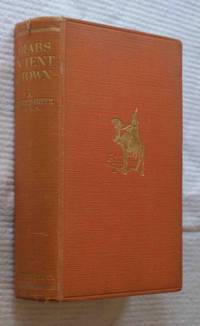
A. Goodrich Freer
Arabs in Tent and Town
<p>Inscribed by the publisher In memory of Ada Seeley from F.P Seeley 9 March 1929. 325 pp. 22 x 14.5 cmz. 780 grams. 1.5 cm tear in middle of top spine. photo loose opposite page 48.</p><p>The title reads in full: "An intimate account of the family life of the Arabs of Syria their manner of living in desert & town their hospitality customs & mental attitude with a description of the animals birds flowers & plants of their country."</p><p>Adela Monica Goodrich-Freer Spoer 1870-1931 was an author who initially wrote under her maiden name of A. Goodrich-Freer and then under her married name of A. M. Spoer.</p> Seeley Service & Co. Ltd hardcover
書籍販売業者の参照番号
: biblio61
|
|
|
 検索結果のメールを受信する
 PDFファイルの検索結果をダウンロード
 RSSフィード


