|
Vadon, Bernard
Antibes C'était hier Chronique du temps passe à travers les cartes postales.
Editions Alp' Azur, 1978, un volume in 4 reliure toile et jaquette illustree editeur, non paginé, très nombreuses photographies et très nombreuses reproductions de cartes postales anciennes, en noir et blanc ou en sépia. Jaquette un peu défraîchie avec 1 petites fente sans manques, sinon bon état.
Référence libraire : 6604
|
|
|
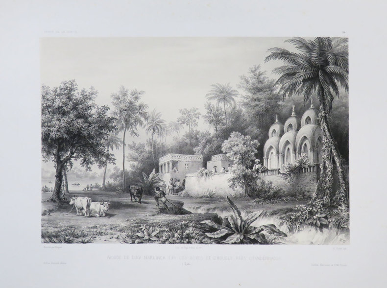
VAILLANT (Auguste-Nicolas).
[BENGALE] Pagode de Dina Marlinga sur les bords de l'Hougly près Chandernagor. (Inde).
[1840]. 223 x 291 mm.
Référence libraire : LBW-3682
|
|
|
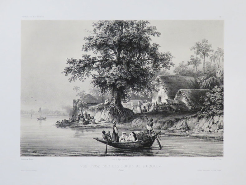
VAILLANT (Auguste-Nicolas).
[BENGALE] Vue prise sur les bords de l'Hougly. (Inde).
[1840]. 212 x 279 mm.
Référence libraire : LBW-3681
|
|
|
VAILLANT (Auguste-Nicolas).
[BOLIVIE] Rade de Cobija. Bolivie.
[1840]. 233 x 306 mm.
Référence libraire : LBW-3674

|
|
|
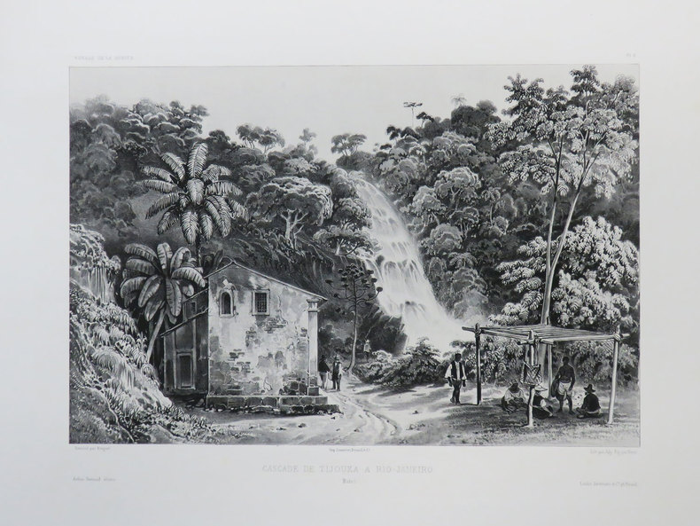
VAILLANT (Auguste-Nicolas).
[BRESIL] Cascade de Tijouka à Rio-Janeiro. Brésil.
[1840]. 227 x 298 mm.
Référence libraire : LBW-3437
|
|
|
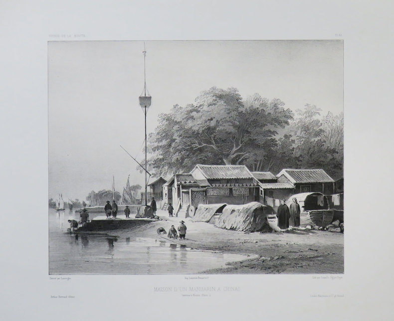
VAILLANT (Auguste-Nicolas).
[CANTON] Maison d'un mandarin à Chinao. (Environs de Canton, Chine).
[1840]. 235 x 263 mm.
Référence libraire : LBW-3679
|
|
|
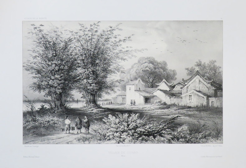
VAILLANT (Auguste-Nicolas).
[CANTON] Village de Chinao. Chine.
[1840]. 219 x 314 mm.
Référence libraire : LBW-3680
|
|
|
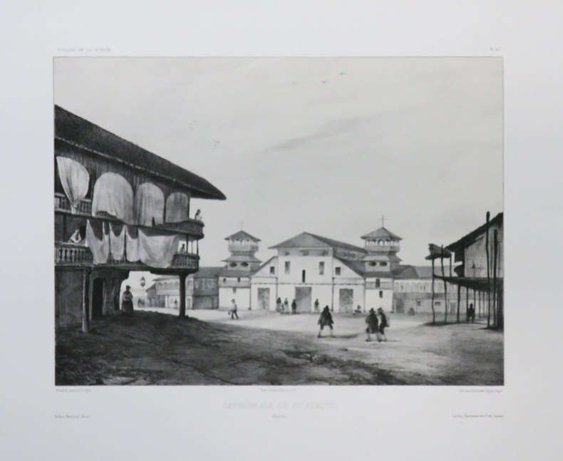
VAILLANT (Auguste-Nicolas).
[EQUATEUR] Cathédrale de Guayaquil. Colombie.
[1840]. 238 x 289 mm.
Référence libraire : LBW-3677
|
|
|
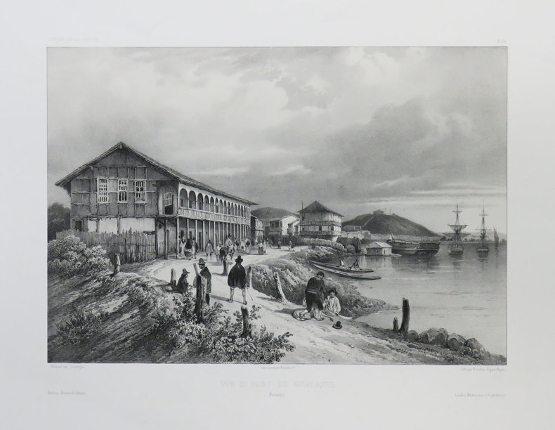
VAILLANT (Auguste-Nicolas).
[EQUATEUR] Vue du port de Guayaquil. Colombie.
[1840]. 222 x 294 mm.
Référence libraire : LBW-3676
|
|
|
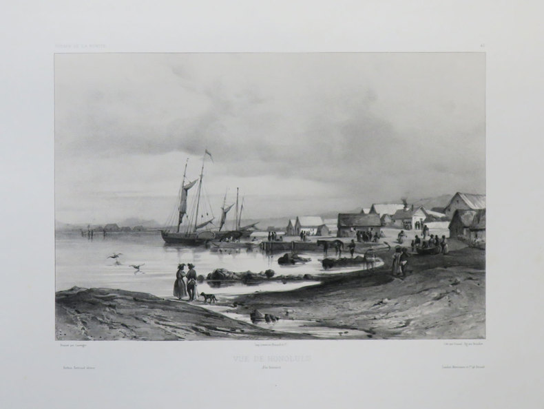
VAILLANT (Auguste-Nicolas).
[HAWAII] Vue de Honolulu. Îles Sandwich.
[1840]. 220 x 291 mm.
Référence libraire : LBW-3642
|
|
|
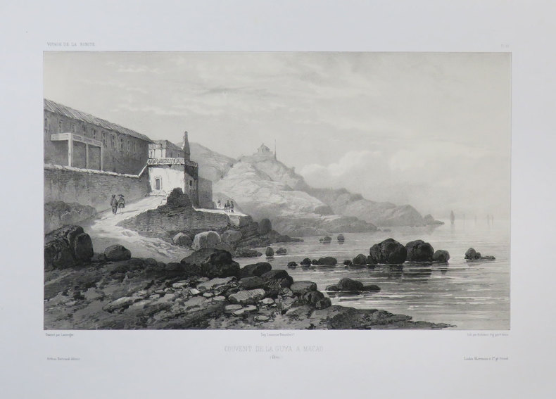
VAILLANT (Auguste-Nicolas).
[MACAO] Couvent de la Guya a Macao. (Chine).
[1840]. 219 x 322 mm.
Référence libraire : LBW-3678
|
|
|
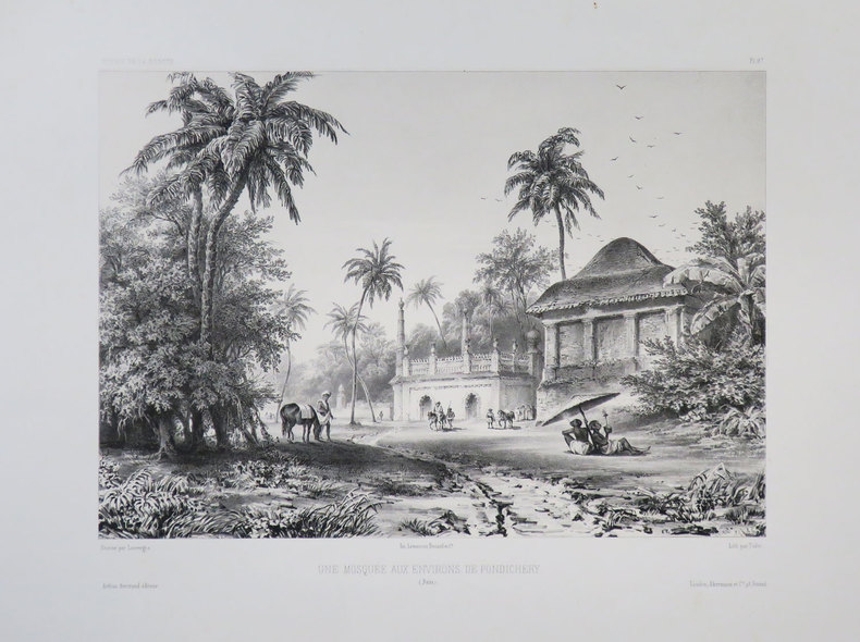
VAILLANT (Auguste-Nicolas).
[PONDICHERY] Une mosquée aux environs de Pondichéry. (Inde).
[1840]. 230 x 287 mm.
Référence libraire : LBW-3683
|
|
|
Valck, Gerard
Tabula Ducatuum Livoniae et Curlandiae recentior: incisa editaque per Gerardum Valck. Kupferstichkarte von Gerard Valk [Valck] (1650/51-1720) in altem Kolorit.
Amsterdam, [ca. 1680]. Plattenmaß: 59,5 x 48 cm [Blattmaß: 62,5 x 52,5 cm]. Mit kolorierter barocker Titelkartusche (oben links) u. zweifachem Maßstab.
Référence libraire : 52698

|
|
|
VALENCIENNES. . .
Carte au 1/200 000e. Sans date.
Une feuille 32x50 cm.
|
|
|
VALENCIENNES. MANUSCRIT.
[Valenciennes].
circa 1760 498 x 1070 mm.
Référence libraire : LBW00283

|
|
|
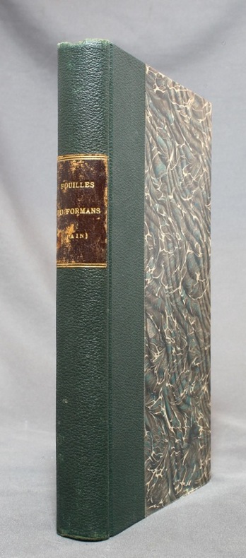
VALENTIN-SMITH J.-E.:
Fouilles dans la vallée du Formans (Ain) en 1862. Documents pour servir à l'histoire de la campagne de Jules César contre les Helvètes [relié avec] Les fouilles dans la vallée du Formans d'après un compte-rendu allemand.
Lyon, Librairie ancienne d'Auguste Brun / Imprimerie Mougin-Rusand, 1888. Grand in-8 de VII-153-[3]; [2]-4-[2] pages, demi-percaline verte, pièce de titre marron au dos, toutes les couvertures conservées.
Référence libraire : 14664
|
|
|
Valentine D H Edited By Illustrated By Phots Maps Drawings
The Natural History Of Upper Teesdale
Tyne Printing Works Ltd. Used - Good. Ships from the UK. Former Library book. Shows some signs of wear and may have some markings on the inside. 100% Money Back Guarantee. Your purchase also supports literacy charities. Tyne Printing Works Ltd unknown
Référence libraire : GRP112008822
|
|
|
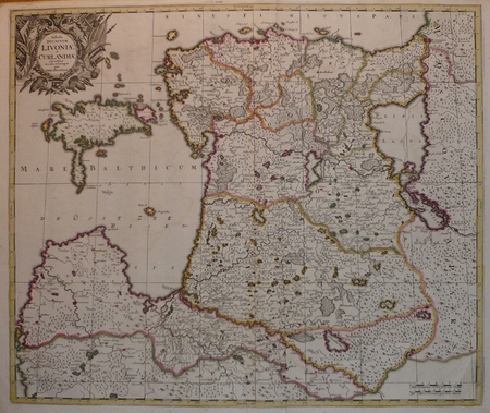
VALK (Gerard).
[LETTONIE/ESTONIE] Tabula ducatuum Livoniae et Curlandiae.
Amsterdam, [circa 1700]. 487 x 578 mm.
Référence libraire : LBW04172
|
|
|
VALK (Gerard).
L'Asie divisée en ses principales régions et où se peuvent voir l'estendüe des empires, monarchies, royaumes & estats qui partagent présentement l'Asie.
Amsterdam, Gerard Valck, [circa 1700]. 482 x 582 mm.
Référence libraire : LBW-8038

|
|
|
VALLAUD Pierre
La Seconde Guerre Mondiale. Collection : Témoins de l'histoire.
Paris, France Loisirs, 2002. 18 x 25, 703 pp., très nombreuses illustrations en N/B et en couleurs, cartonnage d'édition + jaquette, état neuf.
Référence libraire : 30590
|
|
|
VALLEE (Léon)
Bibliothèque Nationale. Notice des documents exposés à la section des cartes. 2° édition revue et augmentée.
Paris, Champion, 1912. In-8, 65 pp., broché.
Référence libraire : B491
|
|
|
VALLET
Carte couleurs au 1/50 000?.
Une feuille 70x60 cm.
|
|
|
VALLOT Ch.:
Autour du Mont-Blanc. Choix d'excursions.
Paris, Girard, Barrère et Thomas, 1947. In-12 broché de 115-[15] pages, dos de toile bleue avec étiquette de titre (incomplète).
Référence libraire : 14347

|
|
|
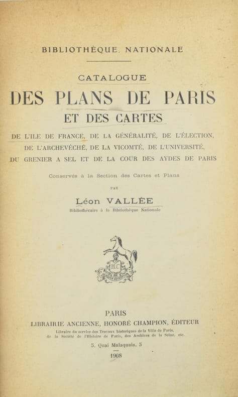
Vallée (Léon).
Catalogue des plans de Paris et des cartes de l'Île-de-France de la généralité, de l'élection, de l'archevêché, de la vicomté, de l'Université, du grenier à sel et de la Cour des aydes de Paris, conservés à la Section des cartes et plans.
Paris, Honoré Champion, 1908. In-8 de II-576 pp., index, demi-maroquin prune, dos à nerfs, tête dorée, couverture et dos conservés (Honnelaître).
Référence libraire : 42603
|
|
|
VALVERDE Y ÁLVAREZ, Emilio (1848-1894).
Atlas de la Península Ibérica, islas adyacentes y posesiones de ultramar. Provincia de Madrid.
Madrid, Litografía A. Foruny, s.a. (1880). Un mapa de 56 x 39 cm., Escala 1:750000, plegado y contenido en carpeta de cartón.

|
|
|
VAN CHI-BONNARDELLE R?gine
Grand atlas du continent africain, sous la direction de R. Van-Chi-Bonnardelle.
Reliure toile de l'?diteur. 335 pages. 30x40 cm.
|
|
|
VAN DEN HAUTE, Robert.
Woluwe en cartes postales anciennes.- Woluwe in oude prentkaarten.
Petit in-8 oblong, 76 cartes en n&b., reliure cartonnage editeur illustrée.- RARE Tres bon état. [BU-11]
|
|
|
VAN DEN HAUTE, Robert.
Woluwe en cartes postales anciennes.- Woluwe in oude prentkaarten.
Zaltbommel, Bibliotheque Europeenne, 1972. Petit in-8 oblong, 76 cartes en n&b., reliure cartonnage editeur illustrée.- RARE
Référence libraire : 34140
|
|
|
Van Den Keere Pieter
Barkshire and Buckinghamshire
Nice coloured two-sided reproductions of maps of " Barkshire and Buckinghamshire" Images the same size 12.2cms by 8.5cms as those in " England Wales Scotland and Ireland Described and Abridged. from a Farr Larger Voulume Done by John Speed." published by George Humble in 1627. Known as 'Miniature Speeds' Page size 18x12cm. See also listings describing other sheets in this series. Facsimile Reprint. Map. Near Fine. paperback
Référence libraire : 35160
|
|
|
Van Den Keere Pieter
Cornwaile Westmoreland & Comberland
Nice coloured two-sided reproductions of maps of "Westmoreland and Comberland"and"Cornwaile" Images the same size 12.2cms by 8.5cms as those in " England Wales Scotland and Ireland Described and Abridged. from a Farr Larger Voulume Done by John Speed." published by George Humble in 1627. Known as 'Miniature Speeds' Page size 18x12cm. See also listings describing other sheets in this series. Facsimile Reprint. Map. Near Fine. paperback
Référence libraire : 35158
|
|
|
Van Den Keere Pieter
Hartfordeshire and Huntingdonshire
Nice coloured two-sided reproductions of maps of "Hartfordeshire and Huntingdonshire" Images the same size 12.2cms by 8.5cms as those in " England Wales Scotland and Ireland Described and Abridged. from a Farr Larger Voulume Done by John Speed." published by George Humble in 1627. Known as 'Miniature Speeds' Page size 18x12cm. See also listings describing other sheets in this series. Facsimile Reprint. Map. Near Fine. paperback
Référence libraire : 35162
|
|
|
Van Den Keere Pieter
Kent and Lancaster
Nice coloured two-sided reproductions of maps of "Kent and Lancaster" Images the same size 12.2cms by 8.5cms as those in " England Wales Scotland and Ireland Described and Abridged. from a Farr Larger Voulume Done by John Speed." published by George Humble in 1627. Known as 'Miniature Speeds' Page size 18x12cm. See also listings describing other sheets in this series . Facsimile Reprint. Map. Near Fine. paperback
Référence libraire : 35161
|
|
|
Van Den Keere Pieter
Wilt Shire and Worcestershir
Nice coloured two-sided reproductions of maps of " Wilt Shire and Worcestershir" Images the same size 12.2cms by 8.5cms as those in " England Wales Scotland and Ireland Described and Abridged. from a Farr Larger Voulume Done by John Speed." published by George Humble in 1627. Known as 'Miniature Speeds' Page size 18x12cm. See also listings describing other sheets in this series. Facsimile Reprint. Map. Near Fine. paperback
Référence libraire : 35159
|
|
|
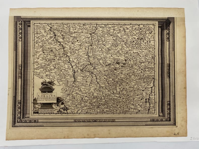
VAN DER AA.
Carte de Lorraine. suivant les Nouvelles Observations de Messieurs de l'Académie Royale des Sciences, etc. Augmentées de Nouveau.
(c.1729), 26.5 x 39.5 cm - feuille : 31 x 42 cm , contrecollée sous passe-partout volant Marge supérieure découpée et restaurée.
Référence libraire : 231860
|
|
|
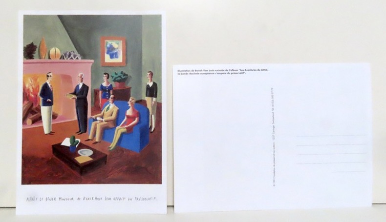
Van Innis Benoît:
Après le dîner Monsieur de Kerckhuve leur offrit un préservatif.
Carouge, Fondation du présent et les auteurs, 1991. Grande carte postale (16x22), représentant une illustration extraite de l'album "Les aventures du latex, la bande dessinée européenne s'empare du préservatif".
Référence libraire : 14343
|
|
|
VAN TENAC Charles
Traité du jeu de piquet. Lois, règles, conventions et maximes pour le bien jouer
Paris Passard s.d. [1877] in-12 br. couv. impr. jaune
Référence libraire : 11946
|
|
|
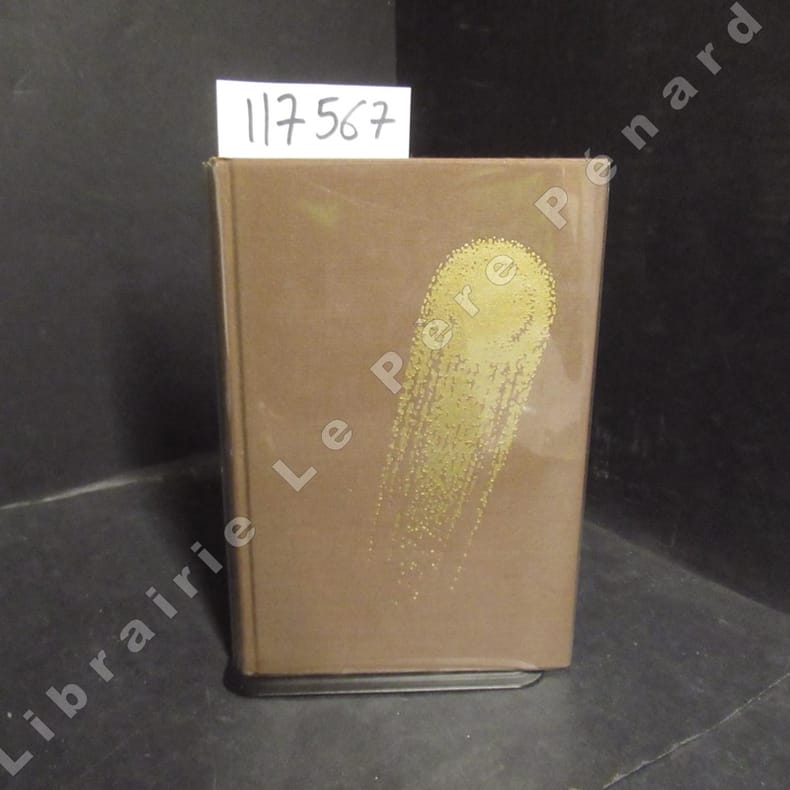
VANCE, Jack - Illustrations de Caza - Traduit par Michel Deutsch - Introduction par Jacques Chambon et Jean-Pierre Fontana
Tschaï 2
1971 Editions Opta, collection "Club du Livre d'Anticipation" (CLA) N° 34 - 1971 - In-8, reliures toilée marron avec titre doré au dos et décor (comète) doré sur le premier plat, sous rhodoïd - VII + 337 pages - Avec sa carte dépliante - Illustré de dessins originaux de Caza - Exemplaire numéroté N° 5486 / 6000
Référence libraire : 117567
|
|
|
VANCOUVER (George).
Voyage de découvertes à l'océan pacifique du Nord et autour du monde; dans lequel la côte Nord-Ouest de l'Amérique a été soigneusement reconnue et exactement relevée … et exécuté en 1790, 1791, 1792, 1793, 1794 et 1795 par le capitaine George Vancouver. Traduit de l'anglais.
Paris, Imprimerie de la République, An X , 5 volume in-8 (sur 6), viii-340pp.-384pp.-381pp.-368pp.-438pp. , brochage d’attente ,non coupé , frottements , dos usés ,manque la page de titre (tome 3), cahiers déreliés .
Référence libraire : PHO-1295
|
|
|
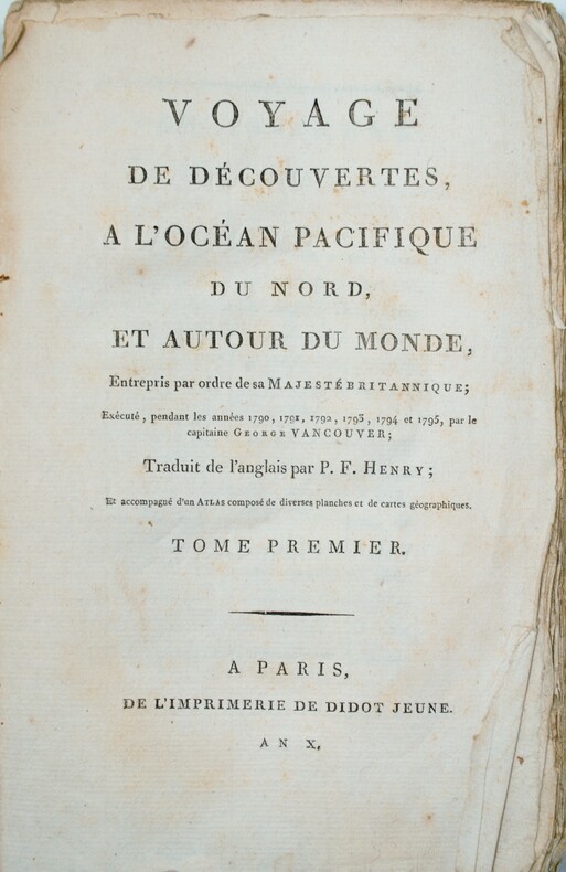
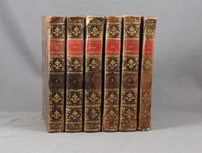
VANCOUVER George:
Voyage de découvertes, à l'océan Pacifique du nord, et autour du monde, entrepris par ordre de sa Majesté Britannique, exécuté, pendant les années 1790, 1791, 1792, 93, 1794 et 1795, par le capitaine George Vancouver. Traduits de l'anglais par P. F. Henry.
Paris, Didot jeune, an X. 6 volumes in-8 de [4]-VIII-341p., [4]-384p., [4]-381p., [4]-368p., [4]-438p., et un atlas de [4]p., 17 vues et 9 cartes, plein veau moucheté, dos lisses ornés de filets et fleurons dorés, pièces de titre rouge. Reliures un peu malmenées, coiffes frottées, mors un peu fendus, épidermures, auréoles pales à trois volumes, plus présentes dans l'atlas. Chaque première page est frappée d'un large tampon non identifié par votre serviteur.
Référence libraire : 6293
|
|
|
Vandiver Frank E./Long Barbara maps
Their Tattered Flags: the Epic of the Confederacy Military History series #5
College Station: Texas A&M University Press 1989. 3rd paperback printing. VG. xii 362 p. maps notes biblio index 8vo paperback; Texas A&M University Press paperback
Référence libraire : 18304 ISBN : 089096355X 9780890963555

|
|
|
VANNINI (Ulisse).
[CANAL de SUEZ] Carta generale delle vie ferrate d'Europa e delle marittime relative all'istmo di Suez.
Firenze, Litografia Toscana, [vers 1870]. En quatre feuilles pouvant être jointes pour former une carte de 0,79 x 1,05 m.
Référence libraire : LBW-7144
|
|
|
VAR
Carte d?partementale couleurs au 1/200 000?me. Sans date.
Une feuille. 78x60 cm.
|
|
|
VAR
Carte d?partementale couleurs au 1/200 000e. Sans date.
Une feuille 60x80 cm.
|
|
|
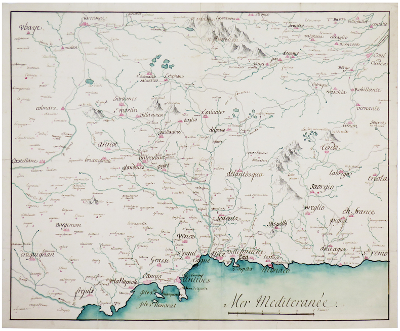
VAR. MANUSCRIT.
Costes de Provence. Fréjus, Antibes, Nice, Monaco.
[circa 1750]. 366 x 444 mm.
Référence libraire : LBW-4141
|
|
|
Varganov, Alexei
Suzdal / Souzdal / Susdal
No marks or inscriptions. A very clean very tight copy with bright unmarked boards, bump to spine foot and no bumping to corners. Dust jacket not price clipped or marked with small nicks/tears to edges and crease to front dust flap. 175pp. The history, buildings, archtecture and people of the ancient Russian town of Suzdal. Mostly captioned colour and black & white photographs. Text in Russian, English, French and German. Very scarce in the UK.

|
|
|
VARIGNY C(de)
Nouvelle géographie moderne des cinq parties du Monde. Premier volume ASIE
in 4 pleine toile rouge éditeur,titre doré,au dos et sur le premier plat.Faux-titre, frontispice,titre avec vignette, 322 pages,tranches dorées,illustrations hors-texte certaines par FRAIPONT dont une en couleurs,cartes en couleurs,A la librairie illustrée sans date Asie Mahométane:La Turquie d'Asie,Arménie et la Mésopotamie La Syrie et Palestine,Sinaï,Arabie,Perse,Asie Anglaise : L'Afghanistan,le Baloutchistan,L'Empire des Indes,Asie Russe:La Caucasie,Turkestan Le),Sibérie(la),L'Asie Bouddhiste:Empire de Chine,Tibet(Le),Turkestan Chinois, Mongolie,La Corée,L'empire du Japon,Indo-Chine,L'Annam,Le Tonkin,La Cochinchine,La Birmanie.
Référence libraire : 5179
|
|
|
Various
REFERENCE LIBRARY A Set of 12 books Finely Bound in Half Vellum Housed in a bespoke bookcase: J.C.Vicery Atlas of the World; Dictionary of Dates English -German French-English English Political Quotations Daily Reckoner Gazetteer Etc.
London: J.C. Vickery 1910. Other titles include English - French and German - English. All 12 volumes are housed in the original polished mahogany bookcase. No date but c. 1910 foreword to Atlas dated 1910. All edges gilt and all endpapers blue marbled. The dictionary of Dates and the World Atlas are a larger format and housed in thier own trays beneath the other volumes. The Dictionary of dates is missing its ribbon to ease removal from the tray. The smaller volumes are flanked by the slightly larger translation dictionaries on a single shelf. The Atlas is complete with 72 coloured plates mostly double paged. this J. C. Vickery vellum edition was probably designed to appeal to the "wedding present market". The bindings are all in very good condition with just a little general wear and rubbing the blue cloth is very slightly marked and shows slight signs of handling the vellum is very clean with bright gilt to the spines. Contents are good and tight. The display shelf is in very good condition with a little damage to the rear of the casing where a few additional pins have been added the surface is nicely polished. A handsome set. Bibliographic note: J. C. Vickery now no longer trading renowned for high quality objects in a similar vein to Liberty Aspreys etc. Almost certainly this set was produced in different liveries to meet the specifications of the retailer. Several years ago we sold a similar but different reference library with Asprey title pages; however this is the finest set we have seen. First Edition. Hardback. Fine/No Jacket. 12mo. J.C. Vickery Hardcover
Référence libraire : 025715

|
|
|
Various Contributors
The Illustrated London News, 12 August 1944
Cover: Our Royal Field-Marshal (King George VI) Viewing the Fighting in Italy. Features include: Our Notebook; Book Review: "Excellenz X: The Leader of To-Morrow's Germans" by R.G. Waldeck; The Great World War: What Next on the Eastern Front? (inc maps); Books of the Day; and The World of Science: Summer's Emptying Nests. Pictorial Journals include: The King (George VI) in Italy: His Majesty Awards Honours and Decorations; Obstacles in the Path of Our Normandy Advance: German Defensive Methods in a Compact Countryside (illustrated by Captain Bryan de Grineau); Britain's 17-Pounder: More than a Match for German Tanks (illustrated by G.H. Davis); The Armour Against Us: Some Details of Germany's Modern Armoured Vehicles in Use in Normandy To-Day (illustrated by G.H. Davis); Blazing the Trail: Bulldozers Carving Roads Through Debris in Normandy; The Allied Offensive in Normandy: Montgomery's Great Drive; Scenes of Action at Caumont and Other Sites; Advance in Normandy: The Type of Landscape Our Forces Experience; The Devastation of Modern War: St. Lo Cathedral and Other Ruined Sites; Three Famous Places in Brittany - Now in the War News; The Scene of an Invasion Rehearsal - The Invasion Staged in Reality; The 14th Army's Success in Burma Amid Arduous Conditions; Warsaw Yesterday: Poland's Capital Under Nazi Domination; The War From Varied Angles: Topicalities Recorded by the Camera; Flying Our Wounded Home From the Battlefields of Normandy (Illus. by Flight Lieut. H.W. Hailstone); Dover-Photographed by the Enemy for His Cross-Channel Guns; and A Puzzle Posed by High-Speed Photographs of a Bullet in Flight. Prior owners ink stamp with some writing centre front cover. Some ink smudges to back cover. Contents clean and unmarked. Moderate wear. Book

|
|
|
Various Contributors
The Illustrated London News, 22 July 1944
Cover: The First Entry of Canadians into Caen. Features include: Our Notebook; Book Review: "The Bank of England: 1694 - 1944" by Reginald Saw; The Great World War: Moving on in Italy (inc maps); Books of the Day; and The World of Science: Wood Comes of Age. Pictorial Journals include: In Liberated Caen: The Mayor Hoisting the Tricolour; Caen After the Battle: The Key City of Lower Normandy, whose Capture Marked a Valorous British Victory; Two Aerial Photos: German Atlantic Wall, Eastern Section of the Cherbourg Peninsula; On the Western Front (Battle of Normandy): War and Its Aftermath; On the Western Front: Scenes From the Battle Zones of British and American Armies in Normandy; The Red Army Surges On: Important Cities in the Path of Battle; A Lancashire Fusilier's V.C.: Fusilier (Francis Arthur) Jefferson, Single-Handed, Breaking Up an Enemy Tank Attack (illustrated by Captain Bryan de Grineau); The Onward Advance of Gen. Alexander's Armies: War Scenes at Castiglione, Lake Trasimeno, The French Entry into Siena; Mediaeval San Gimignano and Its Towers; The War in Burma: The Clearing of the Kohima-Imphal Road; The Japanese Main Fleet Caught Napping - Another U.S. Sea Victory (Battle of Philippine Sea); New Additions to our Fighting Power: Flying Bombs from Start to Finish; A Threatened View - Durham Cathedral from River and Railway (illustrated by Sir Muirhead Bone); and War's Trail of Devastation in Normandy: Historic Buildings Wrecked in Fierce Armoured Battles on the Allied Front. Binding sound. Clean and unmarked with minimal wear. A quality copy. Book

|
|
|
Various Contributors
The Illustrated London News, 23 September 1944: The Invasion of Holland
Cover: Le Touquet, France Canadian Soldiers Walking Along Promenade. Features include: Our Notebook; Book Review: "Norfolk Portraits" by R.W. Ketton-Cremer; The Great World War: Is This the Final Round? (inc maps); Books of the Day; and The World of Science: The Problem of Migrating Birds. Pictorial Journals include: Stubborn Resistance - American Troops in Moving Up for the Final Assault; The Greatest of Airborne Operations - The Invasion of Holland; Canals and Rivers of the Netherlands, Scene of a Vital Battle (inc map); Le Havre: The British Capture of the Important Enemy-Held Port; Infantry and Flame-Throwers in Action: Some of the Prisoners; The Triumphant Advance of the Allies: Scenes of Liberated France and Belgium; The Dutch Landscape Covered with Grounded and Falling Allied Parachutes; The First Penetration By U.S. Troops of the Siegfried Line; The A.V.R.E.: A British Mortar Tank Designed for Breaching Fortifications; The Battle of Britain Commemoration Service in Westminster Abbey on Sunday, September17, 1944; Secrets of the Flying Bomb: Constructional Details Revealed; The Mystery Structure Near St. Omer - Believed a Long-Range V-2 Base; The Quebec Conference, 1944; War Items of Interest; Pencil Studies of Gandhi and Jinnah, Who Recently Met in Bombay (illus. by Feliks Topolski); and Norman Wilkinson's Exhibition of "War at Sea" Paintings in London. Advertising cover: moderate to excessive wear, with prior owners ink stamp with some writing centre front cover. Page 339/340 missing. Page 361/362 loose but present. Covers loose and taped at fold. Contents clean and unmarked. A worthy reading copy. Book

|
|
 Recevoir par e-mail
 Télécharger en PDF
 Flux RSS


