|
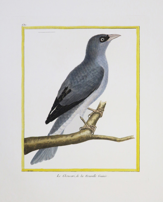
MARTINET (François-Nicolas) & BUFFON (Georges Louis Leclerc, comte de).
[NOUVELLE-GUINÉE] Le Choucari, de la Nouvelle Guinée.
[Paris, 1771-1786]. 231 x 177 mm.
Bookseller reference : LBW-4344
|
|
|
MARTINET (François-Nicolas) & BUFFON (Georges Louis Leclerc, comte de).
[SAINT-DOMINGUE] 1. Le Rocou, de St. Domingue. 2 et 3. Le Nacré, de St. Domingue. 3. Le Quinteraye, de St. Domingue.
[Paris, 1771-1786]. 237 x 179 mm.
Bookseller reference : LBW-4391

|
|
|
MARTINET (François-Nicolas) & BUFFON (Georges Louis Leclerc, comte de).
[SURINAM] 1 et 2. Le Parasol de Surinam. 3 et 4. Le Guidon de Surinam.
[Paris, 1771-1786]. 233 x 182 mm.
Bookseller reference : LBW-4388

|
|
|
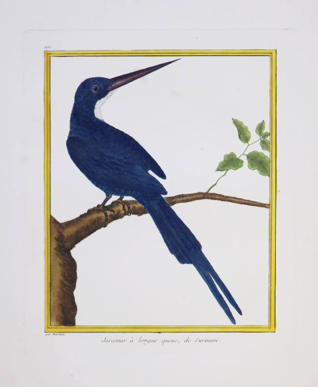
MARTINET (François-Nicolas) & BUFFON (Georges Louis Leclerc, comte de).
[SURINAM] Jacamar à longue queue, de Surinam.
[Paris, 1771-1786]. 232 x 179 mm.
Bookseller reference : LBW-4350
|
|
|
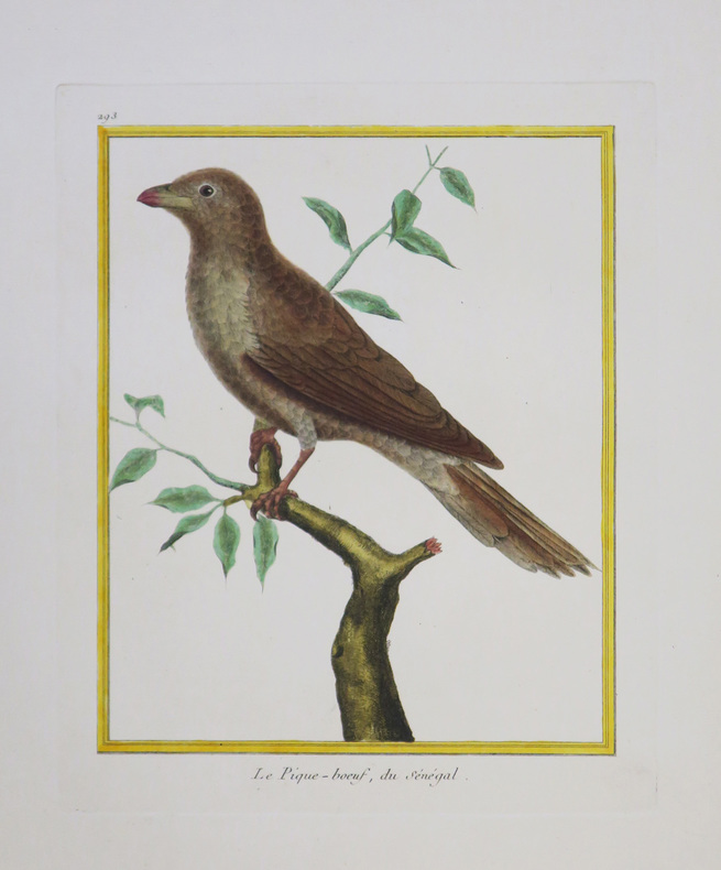
MARTINET (François-Nicolas) & BUFFON (Georges Louis Leclerc, comte de).
[SÉNÉGAL] Le Pique-bœuf, du Sénégal.
[Paris, 1771-1786]. 229 x 180 mm.
Bookseller reference : LBW-4345
|
|
|
MARTINET (François-Nicolas) & BUFFON (Georges Louis Leclerc, comte de).
[SÉNÉGAL] Perdrix du Sénégal.
[Paris, 1771-1786]. 229 x 176 mm.
Bookseller reference : LBW-4341

|
|
|
MARTINET Fils.
[LE HAVRE] I.RE Vue de la ville du Havre de Grâce.
[Paris, 1786]. 340 x 596 mm.
Bookseller reference : LBW-6804

|
|
|
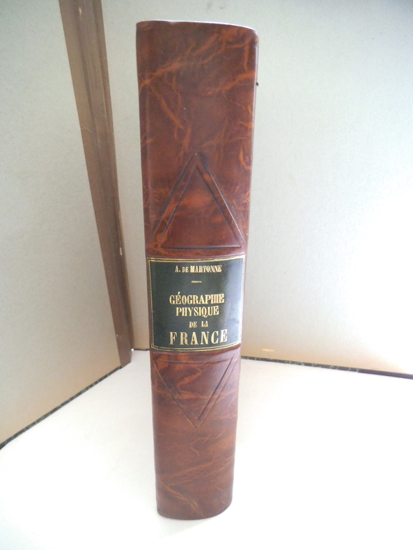
MARTONE A de
Géographie physique de la France.
In 4 demi- cuir marron raciné, pièce de titre cuir vert, filets à froid. Faux-titre, titre, 463 pages, nombreuses illustrations 167 cartes, figures, dans le texte144 photographies et une carte en couleurs hors-texte ; Librairie Armand Colin 1942. Très bon état
Bookseller reference : 13333
|
|
|
Martres, Laurent
Photographing the Soutwest : Volume 1 - A Guide to the Natural Landmarks of Southern Utah
No marks or inscriptions. No creasing to covers or to spine. A very clean very tight copy with bright unmarked boards and no bumping to corners. 320pp. A travel guide to the natural landmarks of Southern Utah including Grand Circle, Red Rock Country and Dinosaur National Monument with emphasis on the opportunities for spectacular photography and with over 240 full-color photographs.
|
|
|
Mary March MA. Jenny Lona PhD Alti Editor Elibeth Haidle Illustrator Paul Haidle Illustrator Maps by National Geographic I
Instant Immersion Ingles Manual Edicion Superior Spanish Edition
Topics Entertainment 2008-05-01. 2nd. Paperback. Used:Good. Topics Entertainment paperback
Bookseller reference : DADAX1600774032 ISBN : 1600774032 9781600774034
|
|
|
Mary March; MA.; Jenny Lona PhD; Editor Alti; Illustrator Elibeth Haidle; Illustrator Paul Haidle; Illustrator Maps by National
Instant Immersion Ingles Manual Edicion Superior Spanish Edition
Topics Entertainment 2008-05-01. Paperback. Good. Topics Entertainment paperback
Bookseller reference : SONG1600774032 ISBN : 1600774032 9781600774034
|
|
|
Mary Pedley on land company mapping in North America Catherine Delano Smith on maps in 16th c. bibles Susan Gone; others
Imago Mundi The Journal of the International Society for the History of Cartography Volume 42
Imago Mundi Ltd. London. Collectible - Very Good. Very good book. Volume 42. Maps illustrations. Inquire if you need further information. Imago Mundi, Ltd., London unknown
Bookseller reference : O06B-00509 ISBN : 0905776143 9780905776149
|
|
|
MaryGrace Dansereau MAPS
Journey to Emmaus
CreateSpace Independent Publishing Platform. Paperback. GOOD. Spine creases wear to binding and pages from reading. May contain limited notes underlining or highlighting that does affect the text. Possible ex library copy that’ll have the markings and stickers associated from the library. Accessories such as CD codes toys may not be included. CreateSpace Independent Publishing Platform paperback
Bookseller reference : 3189990123 ISBN : 1530407427 9781530407422
|
|
|
MARZOLLA Benedetto (Brindisi, 1801 - Napoli, 1858)
Impero di Alessandro
Carta storica raffigurante i territori dell'Impero di Alessandro Magno intorno al 323 a.C. Tratta dall’ Atlante geografico. Corredato di notizie relative alla geografia fisica politica, ed in generale alla statistica delle varie regioni del Globo. Compilato ed eseguito in litografia per cura e sotto la direzione di Benedetto Marzolla edito a Napoli nel 1858. Marzolla, autore di importanti atlanti sulle provincie del Regno di Napoli, è anche autore di diverse carte sulle Circoscrizioni Ecclesiastiche nel Regno delle Due Sicilie, pubblicate postume, nello stesso anno della morte (1858) a Napoli nello Stabilimento Geografico diretto da Luigi Manzella. Benedetto Marzolla fu disegnatore topografo e litografo; geografo e cartografo; membro della Commissione di statistica presso il Ministero dell'Interno. Personaggio di grandissimo rilievo nella cartografia napoletana ed italiana del XIX secolo, Marzolla ottenne in vita pubblici riconoscimenti ed attestati per la produzione cartografica di altissima qualità. La sua notorietà si è lentamente dissolta dopo la morte; va tuttavia osservato che solo la mancanza di uno spiccato coinvolgimento politico in senso risorgimentale e di una valenza letteraria nella sua opera non lo hanno reso famoso come i contemporanei Francesco Costantino Marmocchi (1805-1858) e Attilio Zuccagni-Orlandini (1783-1872), con i quali può certamente confrontarsi. I progetti culturali didattici e editoriali di Marzolla furono e rimangono di straordinaria modernità; egli inventò, è il caso di dire, un nuovo modo di intendere e di disegnare la carta geografica, fornendo una visione assolutamente originale della comunicazione dei dati geografici attraverso la combinazione di testo e immagine. Con tale operazione, egli riuscì a fondere in un'unica opera, storia, geografia, economia, statistica e cartografia, raggiungendo un equilibrio grafico di rara efficacia (cfr. V. Valerio, Benedetto Marzolla Brindisino, Geografo e Cartografo dell'800 Europeo, Brindisi 2008). Bell’esemplare con coloritura coeva dei contorni, in ottimo stato di conservazione. Bibliografia V. Valerio, Benedetto Marzolla Brindisino, Geografo e Cartografo dell’800 Europeo (2008). Historical map depicting the territories of Alexander the Great's empire, around 323 BC. Taken from the Atlante geografico. Corredato di notizie relative alla geografia fisica politica, ed in generale alla statistica delle varie regioni del Globo. Compilato ed eseguito in litografia per cura e sotto la direzione di Benedetto Marzolla published in Naples in 1858. Marzolla, author of important atlases on the provinces of the Kingdom of Naples, is also the author of several maps on the Ecclesiastical Circumscriptions in the Kingdom of the Two Sicilies, published posthumously in the same year of his death (1858) in Naples in the Stabilimento Geografico directed by Luigi Manzella. Benedetto Marzolla was draftsman topographer and lithographer, geographer and cartographer. Character of great importance in the Neapolitan and Italian cartography of the nineteenth century, Marzolla obtained during his life public recognition and certificates for the production of high quality cartography. His notoriety slowly faded after his death; it should be noted, however, that only the lack of a strong political involvement in the sense of the Risorgimento and of a literary value in his work did not make him as famous as his contemporaries Francesco Costantino Marmocchi (1805-1858) and Attilio Zuccagni-Orlandini (1783-1872), with whom he can certainly compare himself. Marzolla's cultural, didactic and editorial projects were, and remain, extraordinarily modern; he invented a new way of understanding and drawing maps, providing an absolutely original vision of the communication of geographical data through the combination of text and image. With this operation, he was able to merge in a single work, history, geography, economics, statistics and cartography, achieving a graphic balance of rare effectiveness. Benedetto Marzolla is famous for being among the most important cartographers of the XIX century, for being the one to print geographic maps using high quality lithographies.His Atlante Geografico, made of 58 maps, presents finely sketched works. Six maps depict North America, among them famous map of gold diggers in California, deriving from Hippolite Ferry. Extremely relevant are also the maps of Antarctic, South Africa with the plan of Cape Town and those about Australia.Though the maps are dated between 1843 and 1856, this 1858 edition, printed in Naples at the Stabilimento Geografico Strada San Carlo (founded by Marzolla himself), represents the final version of his atlas, the last one before his death. A posthumous edition will be published in 1865.The atlas is pretty rare, is not actually listed in Phillips, British Library e OCLC. Beautiful specimen with contemporary coloring of the contours, in excellent condition. Bibliografia V. Valerio, Benedetto Marzolla Brindisino, Geografo e Cartografo dell’800 Europeo (2008).

|
|
|
Maslow Jonathan/Thompson Victor maps
Footsteps in the Jungle: Adventures in the Scientific Exploration of the American Tropics
Chicago: Ivan R. Dee 1996. 1st printing. Fine/Fine dust jacket. x 309 p. photos maps biblio index 8vo; Ivan R. Dee hardcover
Bookseller reference : 21102 ISBN : 1566631378 9781566631372

|
|
|
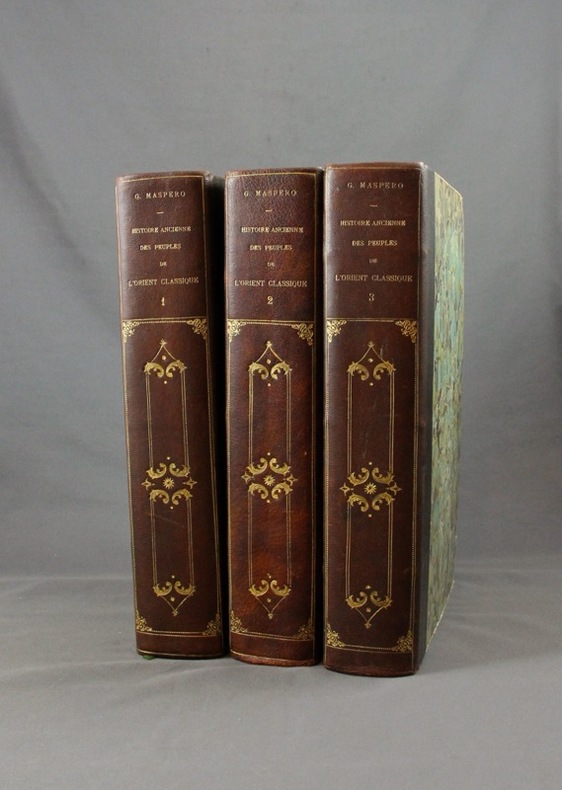
MASPERO G:
Histoire ancienne des peuples de l’Orient classique.
Paris, Lib. Hachette, 1895-1899. 3 vol. in-4 de 804 + 798 + 826 pp. demi-maroquin noir, dos lisse orné de fers d’inspiration romantiques, couv. d’origine cons. Bel état.
Bookseller reference : 1570
|
|
|
Massachusetts Bay Colony Tercentenary Commission; Illustrated by Period photos drawings maps Illustrator
Massachusetts on the Sea 1630-1930
Mass. Bay Colony Ter Com 1930-01-01. Hardcover. Good. 1930 hardback no marks and is in good condition cover shows wearAND AS ALWAYS SHIPPED IN 24 HOURS; and emailed to you a USPS tracking number on all orders; all books are sanitized and cleaned for your protection before mailing Mass. Bay Colony Ter, Com hardcover
Bookseller reference : 130125011
|
|
|
MASSIP Catherine - Emmanuel Le Roy Ladurie (préface) - Avec la participation des Départements ds Cartes et Plans, des Estampes, des Livres imprimés, des Manuscrits occidentaux et orientaux, des Médailles, et de la Musique de la Bibliothèque Nationale
Le chant d'Euterpe, l'aventure de la musique
1991 Hervas, collection Banque Nationale de Paris - 1991 - In-4 couverture cartonnée noire décorée - 188 pages - nombreuses reproductions photographiques
Bookseller reference : 98357
|
|
|
MASSUET P(ierre )
HISTOIRE DE LA DERNIERE GUERRE ET DES NEGOCIATIONS POUR LA PAIX Enrichie des cartes nécessaires Pour servir de suite à l ' Histoire de la guerre présente . Avec LA VIE DU PRINCE EUGENE DE SAVOYE Première Partie
Amsterdam chez François L ' Honoré 1736 ( E. O. ? ) 1/2 ou 3 vol. ( ? ) in - 8 ( 16 x 9,5 cm ) fx. t., frontisp., t., XXXVI , 355 pp., 7 cartes dépliantes HP En frontispice , gravure légendée d ' après J. Punt. Avec Préface de l ' auteur . Bandeau , lettrine . Plein veau marbré de l 'époque . Dos à cinq nerfs , p. de titre et de tomaison maroquin rouges , caissons dorés ornés de fers spéciaux : armes surmontées d ' une couronne de marquis et fleur de lys en queue . Toutes tranches rouges . Gardes marbrées .Titre en rouge et noir orné d' une gravure signée ( signature illisible ) . Manque une grande partie de la coiffe supérieure. Dos légèrement abîmé . Mors inférieur fendu avec des manques . Intérieur frais . Erreur de pagination à la fin : p. 321 chiffrée 351 , p. 322 chiffrée 352 et ainsi de suite ... Une carte dépliante dépasse de la gouttière .1 seul vol. sur 2 ou 3 ?
Bookseller reference : 165

|
|
|
Masters Journal 1992 McDermott John R. Ed; Glossy Color Photos MAPS Illustrator
Masters Journal 1992
Events Pub; Golf Digest 1992-01-01. Unknown Binding. Like New. Appears unused with no marks or inscriptions. Light general shelf wear. Events Pub; Golf Digest unknown
Bookseller reference : 004105
|
|
|
Mathews, W.H. (compiler); et al
Geology of the Cordilleran Orogen in Canada - Geology of North America, Volume G-2/Geology of Canada No. 4
Large slipcase contains the following maps: 1701A - Physiographic Map of the Canadian Cordillera; 17.1 Structural cross-sections of the Canadian Cordillera; 1714A Metamorphic Map of the Canadian Cordillera; 15.1 Distribution of Proterozoic to Miocene plutonic suites; 19.1A to I; 1713A Terrane Map of the Canadian Cordillera (sheets 1 and 2); Correlation chart for Canadian Cordillera (3 sheets). Minor reference markings to slipcase and each map. Please note: we are offering the map set only. Book not included. Book

|
|
|
Mathioulakis Christos Z
Crete : Tourist Guide to Crete With Tourist Map Scale 1:300000
Athens: Mathioulakis 1985 Locally produced guidebookincluding good street maps of Heraklion and other towns. Pbk. 96 p. 50 .plates col. Large scale fold-out map of Crete at the back. 15th ed. Soft Cover. Very Good. Illus. by Trans. David Hardy. Mathioulakis paperback
Bookseller reference : 14739
|
|
|
Mathioulakis Christos Z Trans Davis Hardy
Crete : Tourist Guide to Crete With Tourist Map Scale 1:300000
Athens: Mathioulakis 1978 Locally produced guidebookincluding good street maps of Heraklion and other towns. Pbk. 112 p. Large scale fold-out map of Crete at the back. 10th ed. Soft Cover. Very Good. Illus. by Trans. David Hardy. Mathioulakis paperback
Bookseller reference : 14740
|
|
|
Mathioulakis Christos Z
Crete : Tourist Guide to Crete With Tourist Map Scale 1:300000
Athens: Mathioulakis 1978 Locally produced guidebookincluding good street maps of Heraklion and other towns. Pbk. 112 p. Large scale fold-out map of Crete at the back. 10th ed. Soft Cover. Very Good. Illus. by Trans. David Hardy. Mathioulakis paperback
Bookseller reference : 14738
|
|
|
Mathioulakis,Christos Z
Crete : Tourist Guide to Crete (With Tourist Map , Scale 1:300,000)
Locally produced vintge guidebook, including good street maps of Heraklion and other towns. 96p,+ colored plsted, illus, maps and diagrams. Large scale fold-out map of Crete at the back. Book
|
|
|
Mathioulakis,Christos Z
Crete : Tourist Guide to Crete (With Tourist Map , Scale 1:300,000)
Locally produced guidebook to Crete, ,including good street maps of Heraklion and other towns. Pbk. 96p.illus + coloured plates, Maps Crisp tight unmarked copy copy, but fold-out map is missing [3 copies of this edition found in WorldCat Book
|
|
|
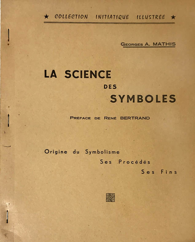
Mathis (Georges A.) :
Science (La) des Symboles. Préface de René Bertrand. Origine du Symbolisme, ses Procédés, ses Fins.
Rueil-Malmaison, Marcel Spaeth, "Collection Initiatique Illustrée", 1961 ; in-4 polycopié ; (2), IV, 105, (1) ff. recto seul.
Bookseller reference : 14766
|
|
|
Matkin, Robert B.
Map Reading
Name/date to front end paper. No other marks or inscriptions. No creasing to covers. A very clean very tight copy with bright unmarked boards and no bumping to corners. 32pp. A guide to understanding maps and map reading. Illustrated.

|
|
|
Matthew Henry; Illustrator Maps And Pictures
Matthew Henry's Commentary: Exposition Of The New Testament
William Mackenzie 1900. Hardcover. Good. Hardback book no dust jacket in good condition. William Mackenzie hardcover
Bookseller reference : 067566
|
|
|
Matthew Henry; Illustrator Maps And Pictures
Matthew Henry's Commentary: Exposition Of The New Testament
William Mackenzie 1900. Hardcover. Good. Hardback book without dust jacket in good condition. William Mackenzie hardcover
Bookseller reference : 066382
|
|
|
Matthew Henry; Illustrator Maps And Pictures
Matthew Henry's Commentary: Exposition Of The New Testament
William Mackenzie 1900. Hardcover. Good. Hardback book without dust jacket in good condition. William Mackenzie hardcover
Bookseller reference : 066380
|
|
|
Matthews Professor IG. Illustrated by Maps I. G.
Old Testament Life and Literature
MacMillan 1934 Book. Good. Hardcover. New & revised. top spine edge frayed in fair dj mylar; owner pencil notes ffep. MacMillan hardcover
Bookseller reference : 004774
|
|
|
Matthews, Brian R.[Signed]
A History of Pointe Claire
324 pages. Index. Bibliography. Black and white illustrations. Author's signature upon front free endpaper. "Traces the development of the town of Pointe Claire from its beginnings as a stretch of lonely farms to its present as a major municipality. Covers three hundred years of Canadian history as it affected the people of the West Island community. Old maps, photos and the words of contemporary observers take the reader into a past where the pioneer farmers struggled to defeat Indians, the land, the climate and foreign invaders... This is the only complete history of the town." - from dust jacket. Gift greetings atop title page else book clean, bright and unmarked with negligible wear. Very light wear to dust jacket which has touches of yellowing to flaps, and is now preserved in a glossy new Brodart cover. A premium copy. Book

|
|
|
Matthiae, Karl / Thiel, Winfried
Biblische Zeittafeln Geschichtliche Abrisse, chronologische Übersichten, Überblickstafeln und Landkarten zur alt- und neutestamentlichen Zeit
8' in a worn yellow hard slipcase and in a white soft slipcase. softocover booklet and numerous tables and maps. else in good condition.
|
|
|
Matvejevitch Predrag
Bréviaire méditerranéen
Fayard 1992 In-8 broché 23 cm sur 15. 264 pages. Très bon état d’occasion.
Bookseller reference : 107863
|
|
|
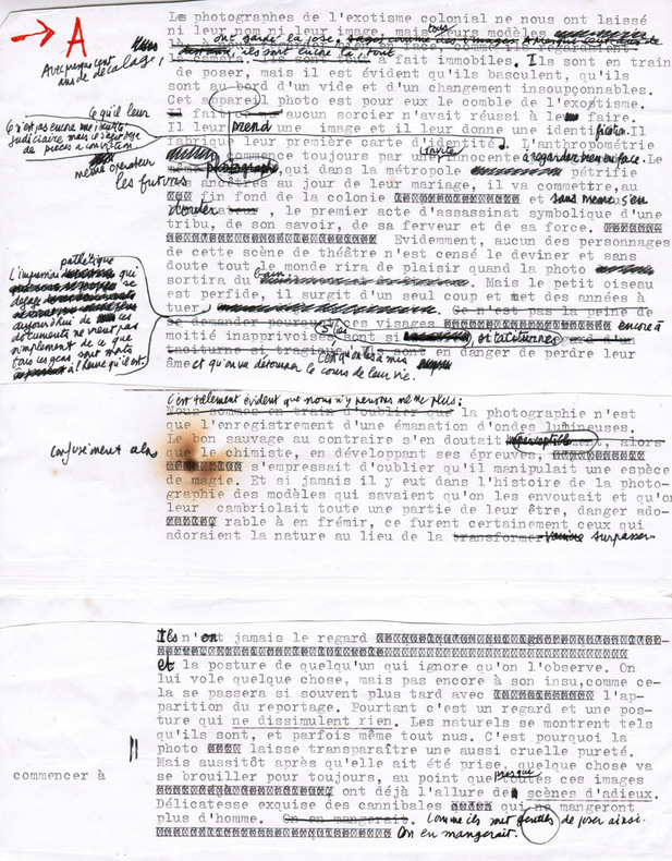
Maurel, Christian (1931-2011, écrivain et journaliste)
Tapuscrit de L'Exotisme colonial
1980 Ensemble comprenant : 1) Le tapuscrit de premier jet avec de nombreuses corrections autographes : environ 16 ff. in-4 assemblés ; 2) Le tapuscrit définitif, y compris tables, crédits photographiques, 4e de couverture... : 29 ff. in-4 souvent reconstitués ; 3) Instructions pour les retouches de photos : 3 pp. tapuscrites in-4 avec corrections autographes, 2 pp. manuscrites in-12.
Bookseller reference : 2665
|
|
|
MAURIAC
Carte d'?tat-major ? l'?chelle 1/80 000?.
1 feuille entoil?e (repli?e). 60x84 cm. Mouillure en marge.
|
|
|
Maurice Colbeck
Village Yorkshire
No marks or inscriptions. A very clean very tight copy with bright unmarked boards and no bumping to corners. Dust jacket price clipped but not marked or torn or creased with minor traces of storage. 160pp. A tour around scores of Yorkshire villages. Well illustrated.

|
|
|
Maurice Dodion, Wasily Pedjko
Prentkaarten Van Hoegaarden
Hoegaarden, Hoegaards Erfgoed VZW, 2024 Hardcover, 65 pagina's, 31 x 22 cm. talrijke afbeeldingen in kleur en z/w nieuwstaat
Bookseller reference : 64622
|
|
|
MAURITANIE par Odette de PUIGAUDEAU.
La grande foire des dattes. Adrar mauritanien. Illustré (héliogravures, cartes).
Paris, éd. Plon 1937. Bon exemplaire broché, couverture décorée d'éd., in-8, 281 pages + planches.
Bookseller reference : AUB-4024
|
|
|
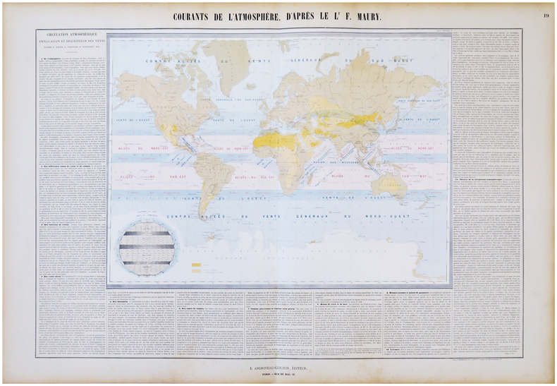
MAURY (Matthew Fontaine) & ANDRIVEAU-GOUJON (Eugène).
Courants de l'atmosphère, d'après le L.t F. Maury.
Paris, E. Andriveau-Goujon, 1864. En deux feuilles jointes de 665 x 887 mm.
Bookseller reference : LBW-6843
|
|
|
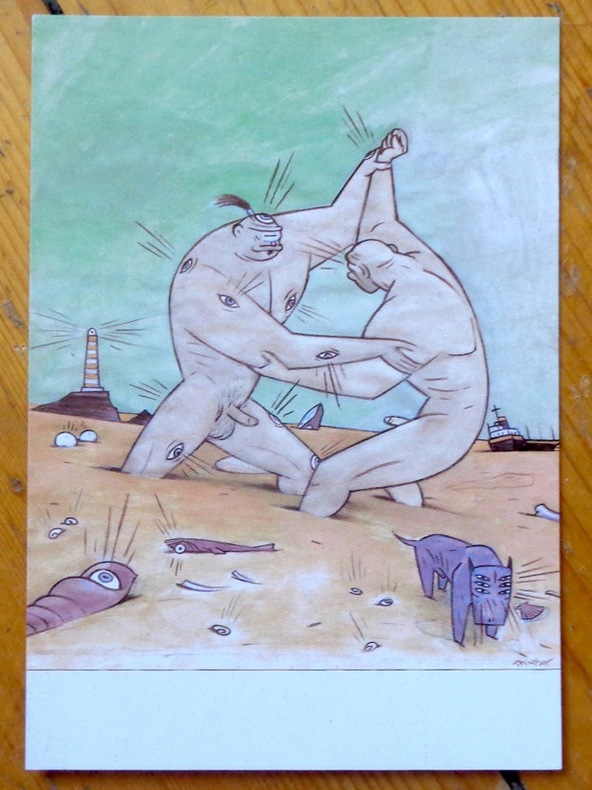
Max:
Argos and Cyclops playing on the beach.
Chez l'auteur, 1997. Avis de changement d'adresse du dessinateur, au format carte postale.
Bookseller reference : 9047
|
|
|
Maxwell R.; Photos Fold out Maps Illustrator
Geologic and Historic Guide to the State Parks of Texas
University of Texas 1970-01-01. Paperback. Good. Trade Paperback. Good. General used condition. Evident wear. Initials on cover. Text block clean and unmarked. Tight binding. Book has a "wave" from not being stored flat. University of Texas paperback
Bookseller reference : UTA1731012

|
|
|
MAY Helmut - MILLER Henry
Hans Reichel. 1892-1958. Ein eutscher maler in Paris
Köln Wallraf-Richartz-Museum 1960 plaquette in-8 Agrafé, couverture illustrée
Bookseller reference : 014320
|
|
|
May, Dr Jacques M.
Thailand, Around the World Program; American Geographical Society
No marks or inscriptions. Tiny crease to lower corner of rear cover. A very clean very tight copy with very slightly dusty boards, rusty staples and no bumping to corners. All twenty-five coloured stickers present and attached. 64pp. An introduction to Thailand in the 1960s and earlier. Very well illustrated. We do not use stock photos, the picture displayed is of the actual book for sale. Every one of our books is in stock in the UK ready for immediate delivery.

|
|
|
May, Jutta
The Visitor's Guide to Corsica
Ex library book with usual marks and stamps. Clean tight pages with bright unmarked tape-free red cloth boards and no bumping to corners. Dust jacket not price clipped or marked or torn with creasing. 231pp. An ideal detailed guide for the independent motoring traveller in Corsica.

|
|
|
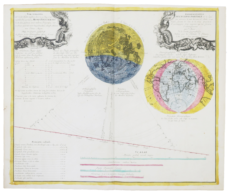
MAYER (Tobias).
[ÉCLIPSES] Représentation de l'éclipse partiale de la Lune, qui arrivera dans la nuit du 8 au 9 d'août 1748.
Nuremberg, Héritiers de Homann, 1748. 485 x 570 mm.
Bookseller reference : LBW-4858
|
|
|
MAYER, TOBIAS & HOMANN - POLAND.
Mappa Geographica Regni Poloniae ex novissimis quotquot sunt mappis specialibus composita at ad LL stereographica projectionis revocata a Tob. Mayero...
Nürnberg, Homannianos Heredes, 1773. 48,5x53,5 cm. Engraved and original hancoloured map of Poland and neighbouring areas. A tear in upper margin just touching the coloured image area. A very small hole in lower part of map in the folding.
Bookseller reference : 32941
|
|
|
MAYER, TOBIAS & HOMANN - POLAND.
Mappa Geographica Regni Poloniae ex novissimis quotquot sunt mappis specialibus composita at ad LL stereographica projectionis revocata a Tob. Mayero...
Nürnberg, Homannianos Heredes, 1773. 48,5x53,5 cm. Engraved and original hancoloured map of Poland and neighbouring areas. A tear in upper margin just touching the coloured image area. A very small hole in lower part of map in the folding.
|
|
|
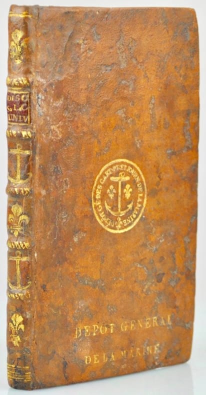
Mayerne Turquet (Louis de).
Discours sur la Carte universelle, en laquelle le Globe terrestre est entièrement réduit et représenté dans un seul cercle sans aucune division de ses parties, où il est traicté des défauts de toutes les autres cartes universelles, des advantages que celle-cy a sur elles et enfin respondu aux objections que l'on peut faire contre cette nouvelle manière de figurer le Globe.
Paris, l'Autheur, 1648. In-16 de (14)-83 pp., veau granité, dos à nerfs orné alternativement de fleur de lys et d'ancres marines, super libris à l'ancre fleudelisée sur le plat supérieur "Dépôt Général de la Marine”, tranches rouges (reliure du XVIIIe siècle).
Bookseller reference : 42339
|
|
 Receive by email
 Download as PDF document
 RSS feed


