|
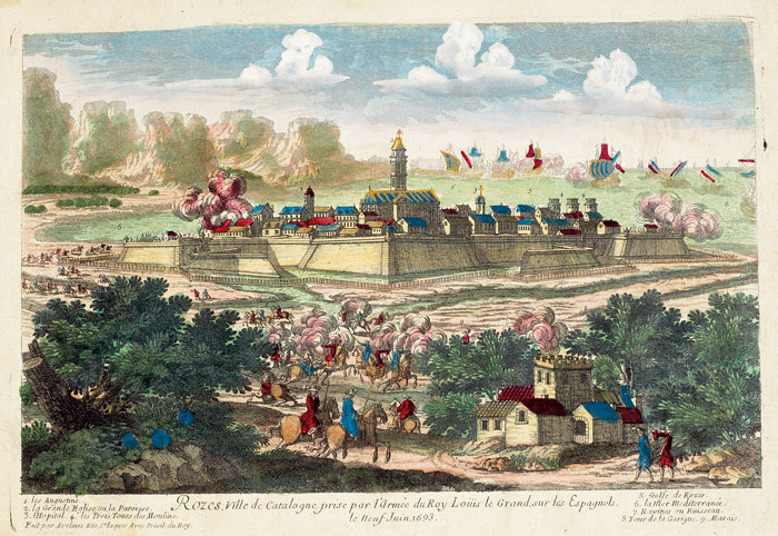
AVELINE (Pierre).
Rozes, ville de Catalogne prise par l’armée du roy Loüis le Grand, sur les Espagnols.
[circa 1695]. 207 x 303 mm.
Referenz des Buchhändlers : LBW-790
|
|
|
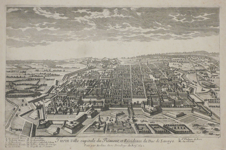
AVELINE (Pierre).
Turin ville capitale du Piémont, et résidence du duc de Savoye.
[1692]. 205 x 312 mm.
Referenz des Buchhändlers : LBW-1190
|
|
|
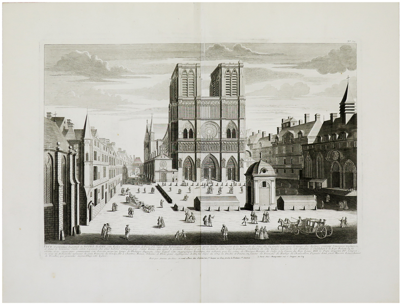
AVELINE (Antoine) & CHÉREAU (Jacques).
Veûe et perpectives du portail de Notre Dame.
Paris, Chéreau, [circa 1740]. 352 x 508 mm.
Referenz des Buchhändlers : LBW-962
|
|
|
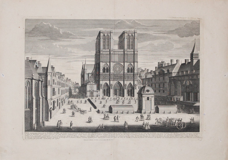
AVELINE (Antoine).
Veûe et perspectives du portail de Notre Dame.
[circa 1740]. 352 x 511 mm.
Referenz des Buchhändlers : LBW-3228
|
|
|
AVELINE "il vecchio" Pierre (Pargi 1656 circa - 1722)
Profil de la Ville de Rome
Panorama di Roma preso dal Gianicolo, firmata "Aveline fecit et excudit", edita a Parigi presso Charpentier."La veduta panoramica di Roma è presa dal Gianicolo e raffigura sulla sinistra il complesso del Vaticano e Castel Sant'Angelo. AL centro il fitto tessuto urbano cittadino dal quale emergono torri e cupole non sempre riconoscibili. L'intera veduta è infatti condotta con grafia molto essenziale e immediata di non grande impatto visivo" (cfr. Barbara Jatta in "Roma Veduta" p. 193). La veduta viene attribuita dalla Jatta - soprattutto per motivi temporali legati all'editore Charpentier crediamo - ad Antoine Aveline "il giovane". La famiglia Aveline, appartenente alla borghesia parigina, lavorò per oltre due secoli nel campo artistico ed incisorio; visto il ripetersi dei nomi di battesimo e il fatto che apponevano la generica firma Aveline, si è spesso fatta confusione fra i sui vari componenti. Tuttavia l'imprint Aveline fecit et excudit lascia credere che l'edizione Charpentier sia il secondo stato (di tre) della lastra, che in seguito fu ristampata anche da Chereau. Quindi riteniamo più probabile - anche per lo stile grafico - attribuirla a Pierre Aveline e la data di stampa posta a circa il 1720 circa. Particolare curioso, la veduta non include il Colosseo. Nel margine inferiore, legenda di 47 numeri. Acquaforte, con ampli margini, consueta piega centrale, sporadiche e piccole ossidazioni nei margini bianchi nel complesso in ottimo stato di conservazione. Panorama of Rome taken from the Janiculum Hill, signed "Aveline fecit et excudit", published in Paris at Charpentier. The panoramic view of Rome is taken from the Janiculum Hill and depicts on the left the Vatican complex and Castel Sant'Angelo. At the center the dense urban fabric from which towers and domes emerge not always recognizable. The entire view is in fact conducted with very essential and immediate handwriting of not great visual impact (see Barbara Jatta in "Roma Veduta" p. 193). The view is attributed by Jatta to Antoine Aveline "the young". The Aveline family worked for over two centuries in the field of art and engraving; given the repetition of first names and the fact that they affixed the generic signature Aveline, there has often been confusion among the various members. However, the imprint Aveline fecit et excudit leads us to believe that the Charpentier edition is the second state (of three) of the plate, which was later reprinted also by Chereau. Therefore we think it more probable - also for the graphic style - to attribute it to Pierre Aveline and the date of printing placed at about 1720. Curious detail: the view does not include the Colosseum. In the lower margin, legend of 47 numbers. Etching, with wide margins, usual central fold, sporadic and small oxidations in the white margins, on the whole in very good condition. Arrigoni Bertarelli (1939): p. 20, n. 154; B. Jatta in "Roma Veduta", p. 193, n. 45; Marigiiani (2007), p. 262, n. 175.

|
|
|
Aviation:
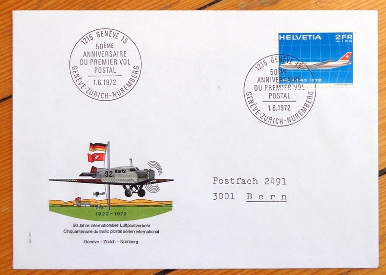
Cinquantenaire du trafic postal aérien. Genève-Zürich-Nürnberg. Enveloppe commémorative.
1972. Enveloppe au format 11,5 x 16, timbre et vignette couleurs, affranchissement philatélique, au 1er juin 1972 à Genève, à la même date à Nürnberg au dos.
Referenz des Buchhändlers : 4858
|
|
|
Avi Yonah, Michael [Ed.]
Sepher Yerushalayim (The Book of Jerusalem): Jerusalem, its Natural Conditions, History and Development from the Origins to the Present Day- in Two Volumes [THIS VOLUME ONLY]
29x20 cm. 431 pages. Gilt hardcover. Contains black & white plates and folded maps. Cover is slightly worn. Spine of book is worn. Spine is visible between a few pages. Slight discoloring of the upper, external part of pages. Else in good condition. PLEASE NOTE: This item is overweight. We may ask for extra shipping costs.
|
|
|
AXELMAN
Incarnations
1994 Editions Fleuve Noir, Collection "Angoisses" dirigée par Juliette Raabe N° 9 - 1994 - In-12 broché, couverture illustrée - Illustration Marc Demoulin
Referenz des Buchhändlers : 92336
|
|
|
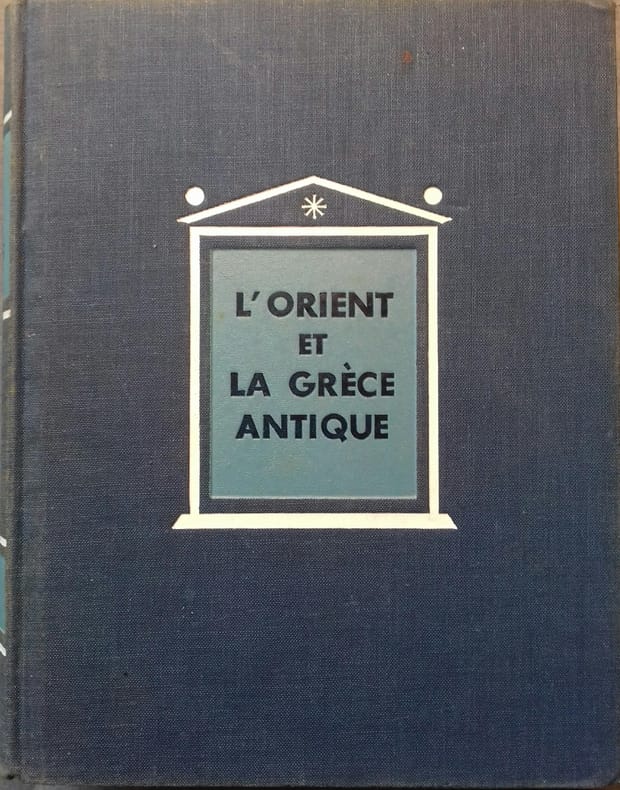
AYMARD André - AUBOYER Jeannine Illustrations en noir et blanc. Cartes, plans.
L'Orient et la Grèce antique.
Couverture rigide. Reliure de l'éditeur en toile bleue. 18 x23 cm. 701 pages.
Referenz des Buchhändlers : 133134
|
|
|
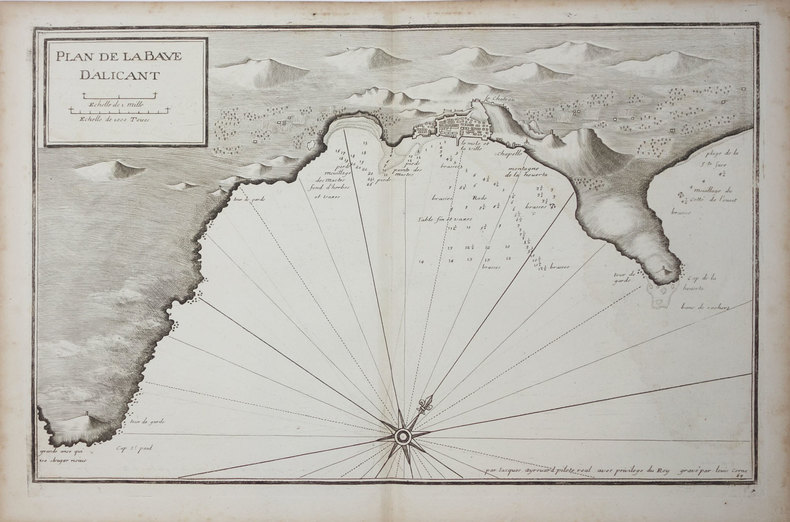
AYROUARD (Jacques).
[ALICANTE] Plan de la baye d'Alicant.
[circa 1730]. 291 x 454 mm.
Referenz des Buchhändlers : LBW024fc
|
|
|
AYROUARD (Jacques).
[ANZIO] Plan du port d'Ancio.
[circa 1730]. 298 x 456 mm.
Referenz des Buchhändlers : LBW0029d

|
|
|
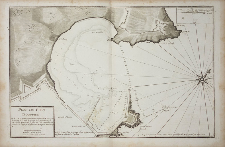
AYROUARD (Jacques).
[ANTIBES] Plan du port d'Antibe.
[circa 1730]. 297 x 452 mm.
Referenz des Buchhändlers : LBW-3328
|
|
|
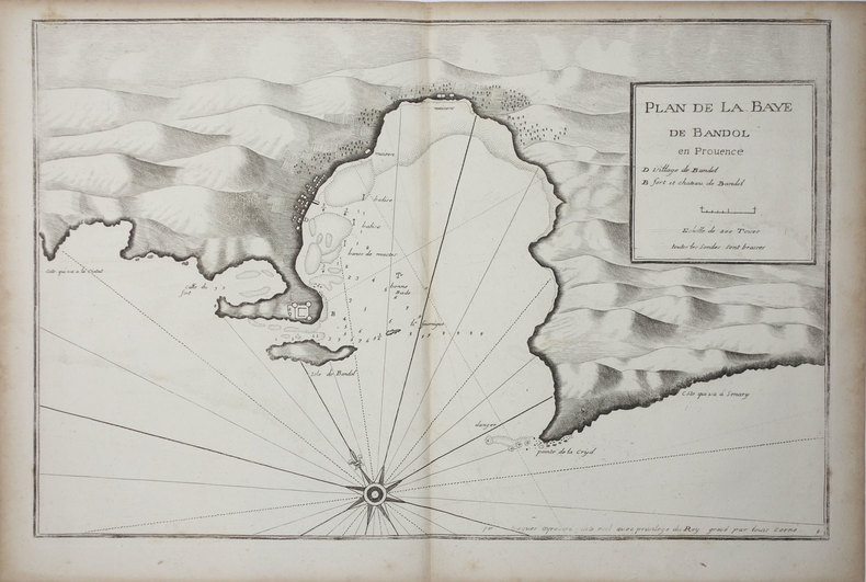
AYROUARD (Jacques).
[BANDOL] Plan de la baye de Bandol en Provence.
[circa 1730]. 297 x 455 mm.
Referenz des Buchhändlers : LBW004e7
|
|
|
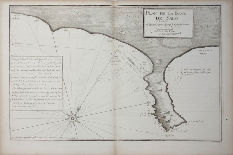
AYROUARD (Jacques).
[CATALOGNE/SALOU] Plan de la baye de Salo en Catalogne.
[circa 1730]. 290 x 447 mm.
Referenz des Buchhändlers : LBW024ee
|
|
|
AYROUARD (Jacques).
[CATALOGNE/SANT FELIU] Plan de la baye de St. Philiou en Catalogne.
[circa 1730]. 285 x 442 mm.
Referenz des Buchhändlers : LBW024ef

|
|
|
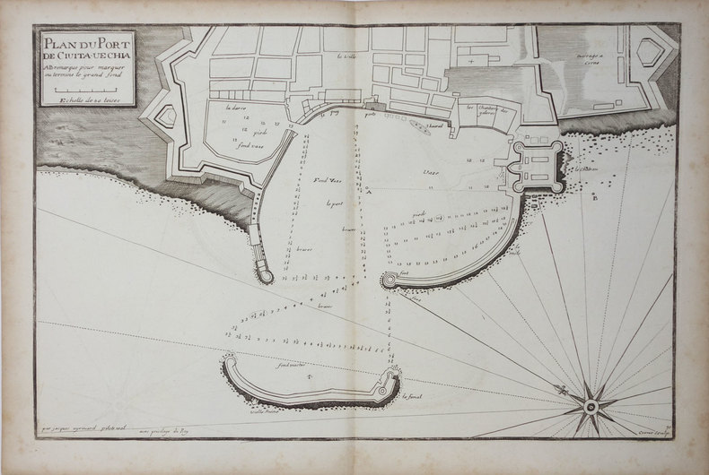
AYROUARD (Jacques).
[CIVITAVECCHIA] Plan du port de Civita-Vechia.
[circa 1730]. 290 x 456 mm.
Referenz des Buchhändlers : LBW0027e
|
|
|
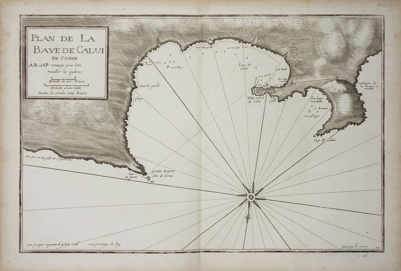
AYROUARD (Jacques).
[CORSE/CALVI] Plan de la baye de Calvi en Corse.
[circa 1730]. 287 x 450 mm.
Referenz des Buchhändlers : LBW002c0
|
|
|
AYROUARD (Jacques).
[CORSE/SAINT-FLORENT] Plan du golfe de St. Fiorenzo en lisle de Corse.
[circa 1730]. 298 x 456 mm.
Referenz des Buchhändlers : LBW-3329

|
|
|
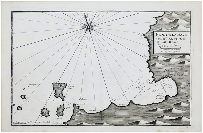
AYROUARD (Jacques).
[IBIZA] Plan de la baye de S.t Antoine en lisle d'Ivice.
[circa 1730]. 289 x 450 mm.
Referenz des Buchhändlers : LBW-6149
|
|
|
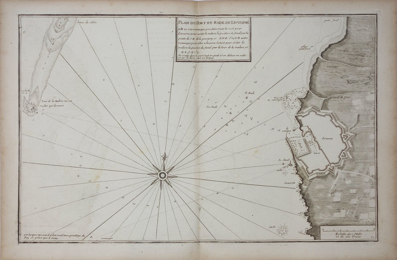
AYROUARD (Jacques).
[LIVOURNE] Plan du port et rade de Livourne.
[circa 1730]. 290 x 450 mm.
Referenz des Buchhändlers : LBW0025b
|
|
|
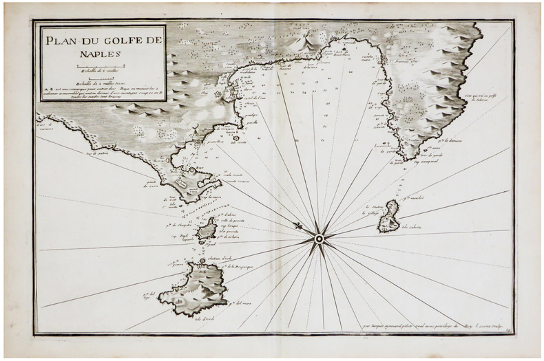
AYROUARD (Jacques).
[NAPLES] Plan du golfe de Naples.
[circa 1730]. 290 x 445 mm.
Referenz des Buchhändlers : LBW-6850
|
|
|
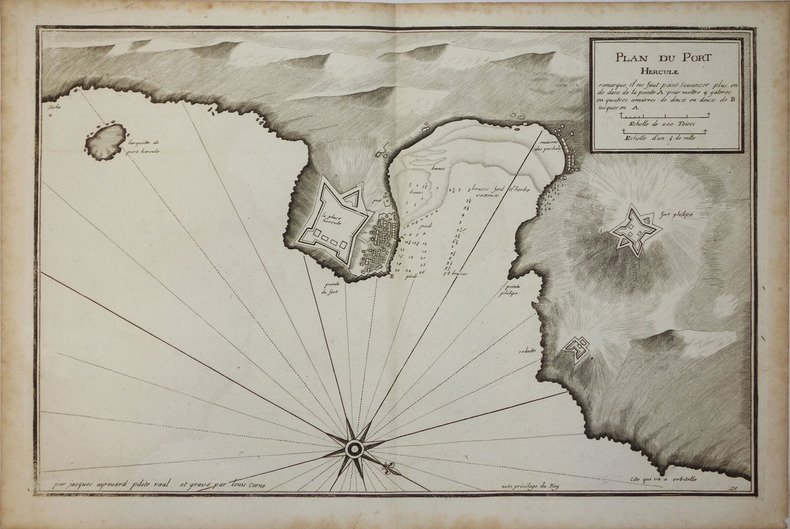
AYROUARD (Jacques);
[PORTO ERCOLE] Plan du Port Hercule.
circa 1730 296 x 458 mm.
Referenz des Buchhändlers : LBW00259
|
|
|
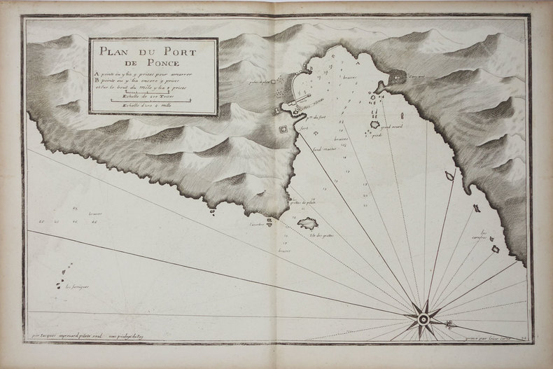
AYROUARD (Jacques).
[PONZA] Plan du port de Ponce.
[circa 1730]. 299 x 457 mm.
Referenz des Buchhändlers : LBW002c9
|
|
|
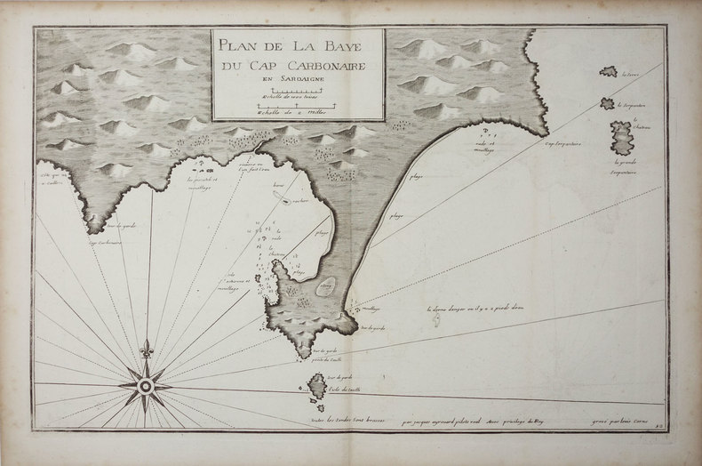
AYROUARD (Jacques).
[SARDAIGNE] Plan de la baye du cap Carbonaire en Sardaigne.
[circa 1730]. 290 x 450 mm.
Referenz des Buchhändlers : LBW0025a
|
|
|
AYROUARD (Jacques).
[SARDAIGNE] Plan du passage entre lisle Azinara et le cap Azinara de Sardaigne.
[circa 1730]. 291 x 452 mm.
Referenz des Buchhändlers : LBW0025f

|
|
|
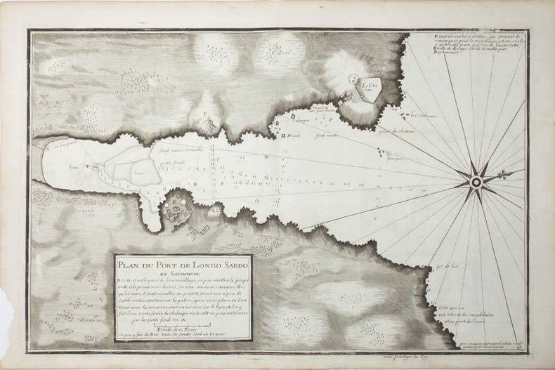
AYROUARD (Jacques).
[SARDAIGNE] Plan du port de Longo Sardo en Sardaigne.
[circa 1730]. 292 x 452 mm.
Referenz des Buchhändlers : LBW00267
|
|
|
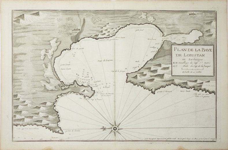
AYROUARD (Jacques).
[SARDAIGNE] Plan de la baye de Loristan.
[circa 1730]. 290 x 450 mm.
Referenz des Buchhändlers : LBW00269
|
|
|
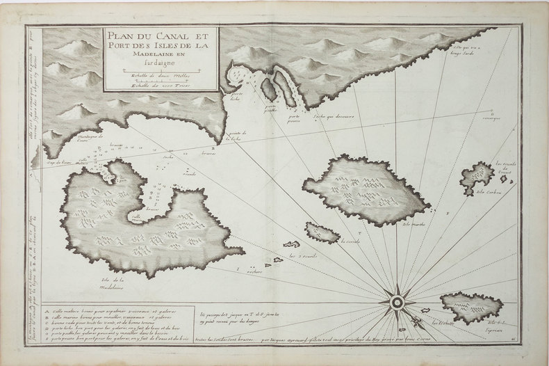
AYROUARD (Jacques).
[SARDAIGNE] Plan du canal et port des isles de la Madelaine en Sardaigne.
[circa 1730]. 293 x 454 mm.
Referenz des Buchhändlers : LBW-3327
|
|
|
AYROUARD (Jacques).
[ST-TROPEZ] Plan du golfe et des caps de St. Tropez.
[circa 1730]. 299 x 457 mm.
Referenz des Buchhändlers : LBW004e9

|
|
|
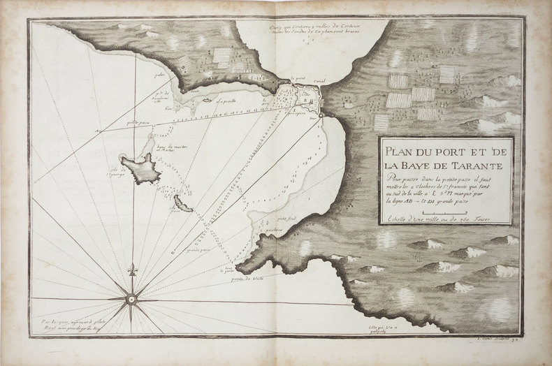
AYROUARD (Jacques).
[TARANTO] Plan du port et de la baye de Tarante.
[circa 1730]. 290 x 452 mm.
Referenz des Buchhändlers : LBW0027f
|
|
|
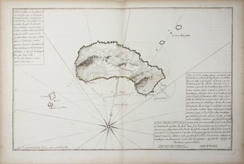
AYROUARD (Jacques).
[TUNISIE] Isle Galita.
[circa 1730]. 299 x 457 mm.
Referenz des Buchhändlers : LBW01b45
|
|
|
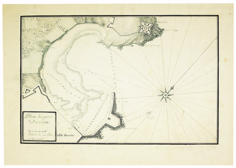
AYROUARD (Jacques). MANUSCRIT.
Plan du port d’Antibe.
[circa 1750]. 304 x 458, monté sur papier fort.
Referenz des Buchhändlers : LBW-4142
|
|
|
AZ maps
Blackpool A-Z Pocket Street Map
Geographers’ A-Z Map Co Ltd 2020. Map. New. 2 pages. 5.70x3.70x0.50 inches. Geographers’ A-Z Map Co Ltd unknown
Referenz des Buchhändlers : __0008388040 ISBN : 0008388040 9780008388041

|
|
|
AZ maps
Brighton A-Z Pocket Street Map
Geographers’ A-Z Map Co Ltd 2020. Map. New. 2 pages. 5.51x3.54x0.39 inches. Geographers’ A-Z Map Co Ltd unknown
Referenz des Buchhändlers : __0008388067 ISBN : 0008388067 9780008388065

|
|
|
AZ maps
Cardiff A-Z Pocket Street Map
Geographers’ A-Z Map Co Ltd 2020. Map. New. 2 pages. 5.51x3.54x0.16 inches. Geographers’ A-Z Map Co Ltd unknown
Referenz des Buchhändlers : __0008388105 ISBN : 0008388105 9780008388102

|
|
|
AZ maps
Chichester A-Z Pocket Street Map
Geographers’ A-Z Map Co Ltd 2020. Map. New. 2 pages. 5.51x3.54x0.16 inches. Geographers’ A-Z Map Co Ltd unknown
Referenz des Buchhändlers : __0008388113 ISBN : 0008388113 9780008388119

|
|
|
AZ maps
Cornwall A-Z Visitors’ Map
Geographers’ A-Z Map Co Ltd 2020. Paperback. New. 1 pages. 9.13x5.28x0.39 inches. Geographers’ A-Z Map Co Ltd paperback
Referenz des Buchhändlers : __000838813X ISBN : 000838813X 9780008388133

|
|
|
AZ maps
East Anglia A-Z Visitors’ Map
Geographers’ A-Z Map Co Ltd 2020. Paperback. New. 1 pages. 9.21x5.43x0.55 inches. Geographers’ A-Z Map Co Ltd paperback
Referenz des Buchhändlers : __0008388156 ISBN : 0008388156 9780008388157

|
|
|
AZ maps
Exeter A-Z Pocket Street Map
Geographers’ A-Z Map Co Ltd 2020. Map. New. 2 pages. 5.51x3.54x0.39 inches. Geographers’ A-Z Map Co Ltd unknown
Referenz des Buchhändlers : __0008388075 ISBN : 0008388075 9780008388072

|
|
|
AZ maps
Lake District A-Z Visitors’ Map
Geographers’ A-Z Map Co Ltd 2020. Paperback. New. 1 pages. 9.21x5.28x0.63 inches. Geographers’ A-Z Map Co Ltd paperback
Referenz des Buchhändlers : __0008388121 ISBN : 0008388121 9780008388126

|
|
|
AZ maps
Leeds A-Z Pocket Street Map
Geographers’ A-Z Map Co Ltd 2020. Map. New. 2 pages. 5.51x3.54x0.16 inches. Geographers’ A-Z Map Co Ltd unknown
Referenz des Buchhändlers : __0008388083 ISBN : 0008388083 9780008388089

|
|
|
AZ maps
Newcastle upon Tyne A-Z Pocket Street Map
Geographers’ A-Z Map Co Ltd 2020. Map. New. 2 pages. 5.51x3.54x0.16 inches. Geographers’ A-Z Map Co Ltd unknown
Referenz des Buchhändlers : __0008391076 ISBN : 0008391076 9780008391072

|
|
|
AZ maps
Oxford A-Z Pocket Street Map
Geographers’ A-Z Map Co Ltd 2020. Map. New. 2 pages. 5.51x3.54x0.39 inches. Geographers’ A-Z Map Co Ltd unknown
Referenz des Buchhändlers : __0008388059 ISBN : 0008388059 9780008388058

|
|
|
AZ maps
Sheffield A-Z Pocket Street Map
Geographers’ A-Z Map Co Ltd 2020. Paperback. New. 2 pages. 5.51x3.54x0.16 inches. Geographers’ A-Z Map Co Ltd paperback
Referenz des Buchhändlers : __0008388091 ISBN : 0008388091 9780008388096

|
|
|
AZ maps
Wales A-Z Visitors’ Map
Geographers’ A-Z Map Co Ltd 2020. Paperback. New. 1 pages. 9.13x4.96x0.39 inches. Geographers’ A-Z Map Co Ltd paperback
Referenz des Buchhändlers : __0008388148 ISBN : 0008388148 9780008388140

|
|
|
AZ maps
York A-Z Pocket Street Map
Geographers’ A-Z Map Co Ltd 2020. Map. New. 2 pages. 5.51x3.54x0.16 inches. Geographers’ A-Z Map Co Ltd unknown
Referenz des Buchhändlers : __0008391092 ISBN : 0008391092 9780008391096

|
|
|
Azelt Johann (1654 -?)
Barhaste abbildung de unnergleichlichen statt Rom…
Rarissima veduta panoramica della città da Monte Mario, edita a Francoforte da Johann Azelt verso la fine del XVII secolo. "In questa stampa gli edifici sono ben poco riconoscibili ed il Tevere segue un errato percorso sotto Trinità dei Monti, riproponendo un errore comune a molti panorami di quest'epoca editi nel nord Europa ed evidentemente copiati uno dall'altro.. Il prototipo iniziale per questa tipologia di panorami è identificabile nel panorama inciso da Israel Silvestre nel 1642" (cfr. Marigliani p. 199). Incisione in rame, in perfetto stato di conservazione. Rarissima. A very rare panoramic view of the city from Monte Mario, published in Frankfurt by Johann Azelt towards the end of the 17th century. In this print the buildings are hardly recognisable and the Tiber follows a wrong path under Trinità dei Monti, repeating an error common to many panoramas of this period published in northern Europe and evidently copied from one another. The initial prototype for this type of panorama can be identified in the panorama engraved by Israel Silvestre in 1642"(cf. Marigliani p. 199). Copper engraving, in perfect condition. Very rare. Marigliani, "Le Piante di Roma nelle collezioni private" p. 199, 104 (erroneamente attibuita).

|
|
|
AZIZ OGAN, (One of the first Turkish archaeologists andthe founder of the Izmir Archaeological Museum and the director of Istanbul Archaeological Museums), (1888-1956).
Typescript document signed 'Aziz Ogan'.
Very Good Turkish Original TLS document signed 'Aziz Ogan' as 'the general director of Istanbul Archaeological Museums'. 32,5x21 cm. In Turkish. 1 p. Full. Typescript document with autograph corrections and signature. Including request of the photographs of listed 25 Seljuk and Ottoman architectural buildings such as mosques, fountains, hans, tombs etc. Dated 12-9-1939. Addressed to Nuri [Ebussuudoglu from the member board of the Turkish Antiquities Protection Council. Letterhead 'TC Istanbul Müzeleri Genel Direktörlügü' [i.e. The General Directory of Istanbul Museums]. Ogan was a Turkish archaeologist and museologist. He was the one of the earliest archaeologists of the Turkish Republic. He founded Izmir Archeology Museum and was the director of Istanbul Archeology Museums. He is the father of the first Turkish female archaeologist Jale Inan.
|
|
|
B H Humble; Illustrator Maps Illustrations
Tramping In Skye
Grant & Murray 1933. Hardcover. Acceptable. 1933. 142 pages. No dust jacket. Blue boards. Binding is firm with frontispiece and photographs. Light tanning staining and thumb marking throughout. Heavy foxing mainly affecting the endpapers and page edges. Boards have mild shelf wear with light rubbing scuffing and corner bumping. Some light marking and sunning. Grant & Murray hardcover
Referenz des Buchhändlers : 1538480742BJS

|
|
|
B. Traven Wyatt Will maps by Rafael Palacios Dust Wrapper design by Lewis Friedman
THE SECRET OF THE SIERRA MADRE: THE MAN WHO WAS B. TRAVEN previously published in the UK as THE MAN WHO WAS B. TRAVEN
Garden City: Doubleday & Company Inc. Very Good in Very Good dust jacket. 1980. First Edition Thus. Hardcover. 0385156006 . First US edition. 369 pages illustrated select bibliography. Remainder spray else VG copy lower corners bumped in VG Dust Wrapper some creasing/light wear to the corners scattered light soiling/staining to the rear panel. .holly5 Doubleday & Company Inc hardcover
Referenz des Buchhändlers : 28441 ISBN : 0385156006 9780385156004

|
|
 Per e-mail erhalten
 Als pdf-Dokument herunterladen
 RSS feed


