|
B. Traven Wyatt Will maps by Rafael Palacios Dust Wrapper design by Lewis Friedman
THE SECRET OF THE SIERRA MADRE: THE MAN WHO WAS B. TRAVEN previously published in the UK as THE MAN WHO WAS B. TRAVEN
Garden City: Doubleday & Company Inc. Near Fine in Good dust jacket. 1980. First Edition Thus. Hardcover. 0385156006 . First US edition. 369 pages illustrated select bibliography. Remainder spray else Near Fine copy in otherwise VG Dust Wrapper with a small sticker pull to the front panel and creasing/tearing to the upper portion of the rear panel. . Doubleday & Company Inc hardcover
书商的参考编号 : 27881 ???????? : 0385156006 9780385156004

|
|
|
B. Traven Wyatt Will Maps by Rafael Palacios Dust Wrapper Design by Lewis Friedman
The Secret of the Sierra Madre the Man Who Was B. Traven Previously Published in the UK As the Man Who Was B. Traven.
Garden City: Doubleday & Company Inc. Near Fine in Near Fine dust jacket. 1980. First Edition Thus. Hardcover. 0385156006 . Remainder spray else Fine copy in Fine Dust Wrapper with minor spine rubbing. ; First US edition. Illustrated select bibliography. ; 8vo 8" - 9" tall; 369 pages; Ps 156 . Doubleday & Company Inc hardcover
书商的参考编号 : 24401 ???????? : 0385156006 9780385156004

|
|
|
B.C. Hydro and Power Authority Gas Engineering Division
Corridor and Route Nomination for Vancouver Island Natural Gas System
22 pages plus 6 large, detailed fold-out maps. Summary volume of a report entitled 'Corridor and Route Nomination for Vancouver Island Natural Gas System' which described B.C. Hydro's proposed project to provide natural gas service to Vancouver Island residents and industry. Explains the reasons for nomination of a preferred corridor, and preferred route within that corridor, for a natural gas pipeline to and on Vancouver Island. This summary provides basic technical, environmental, and land use information on the routing B.C. Hydro nominated. Contents include: Introduction - Natural Gas for Vancouver Island; Reasons for the Project; Initial Route Studies; Corridor Nomination; Route Nomination; Public Consultation. Maps entitle: Existing Natural Gas Fields and Transmission Lines in B.C.; Major options for Gas Transmission System to Serve Southwestern B.C.; Bathymetry of Georgia Strait and Other Features Affecting Location of Submarine Pipelines; Factors Affecting Corridor Location; Proposed Gas Distribution Areas; Important Environmental Concerns with Nominated Corridor and Route. Unmarked. Very light wear. Excellent copy. Book
|
|
|
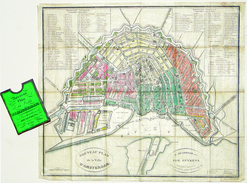
BAARSEL (Willem Cornelis van).
[AMSTERDAM] Nouveau plan de la ville d'Amsterdam.
Amsterdam, Joh. Guykens, 1839. 335 x 385 mm, imprimé sur soie et replié dans son étui d'éditeur.
书商的参考编号 : LBW-2777
|
|
|
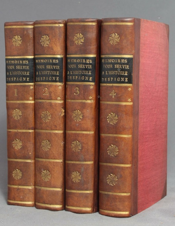
BACALLAR Y SANNA Vincent, Marquis de Saint-Philippe; [MEDAVE Louis Laurent de Féderbe comte de (trad.)]:
Mémoires pour servir à l'histoire d'Espagne, sous le règne de Philippe V. Traduits de l'espagnol.
A Amsterdam, Chez Zacharie Chatelain, 1756. 4 volumes in-12 de [8]-XXXIV-405; [2]-IV-483; [4]-437 et [4]-495 pages, demi-veau brun à coins, dos lisses ornés de fleurons, filets, étoiles et tomaison dorés, étiquettes de titre noires, tranches jaunes. Tout petit choc au dos du tome 2, rares rousseurs. Le relieur a inversé les faux-titres des volumes 3 et 4.
书商的参考编号 : 9756
|
|
|
Bachelier Charles Claude
Rome Vue Prise du Monte-Pincio/Roma Vista tomada del Monte-Pincio
Stampa litografica originale eseguita alla matita, impressa in nero e ocra, dalla bella acquerellatura coeva e con rialzi di vernice à la gomme. Sotto la parte figurata didascalie degli edifici principali della raffigurazione, indicazione dello stampatore e del litografo, nonché titolo in francese e in spagnolo. Al di sopra dell'immagine, titolo della serie di cui il foglio fa parte. Ampia veduta prospettica di Roma, colta dal Pincio, con un'accurata descrizione di Piazza del Popolo in primo piano e con la cupola di San Pietro sull sfondo. La tavola è edita a Parigi da Turgis nel 1860 circa.Charles Claude Bachelier abile artista francese paesaggista e litografo, attivo a Parigi dove espose ai Salons del 1834, 1836 e 1852. Esemplare in ottimo stato conservativo, con bellissima coloritura d'epoca. Original lithograph executed in pencil, engraved in black and ocher, in original colors.Under the image, some captions of the of the main buildings represented; the name of the printer and the lithographer, and title in French and Spanish. On top of the image, the title of the series. Large perspective view of Rome, captured from the Pincio, with an accurate description of the Piazza del Popolo in the foreground, and the St. Peter dome in the background. The plate was published in Paris by Turgis in about 1860.Charles Claude Bachelier, a French landscape artist and litograpgher, active in Paris where he exhibited at the Salons of 1834, 1836 and 1852.Example in very good condition.

|
|
|
Bacheller Martin; Editor; Black & White Illustrations with colored maps Illustrator
Presented By Time the 1980 Hammond Almanac Hardcover Jan 01 1979 Bacheller Martin; Editor and Black & White Illustrations with colored maps
Hammond Almanac Inc 1979-01-01. Hardcover. Good. Publisher: Hammond Almanac Inc. Date of Publication: 1979 Binding: Hardcover Condition: Good Description: 8vo - over 7 Hammond Almanac, Inc hardcover
书商的参考编号 : 707820
|
|
|
BACHMANN (John).
[VERSAILLES] Palais et jardins de Versailles.
Paris, Lemiere, [1840]. 460 x 560 mm.
书商的参考编号 : LBW-6516

|
|
|
BACON G.W.
Bacon's New Map of Central London. Divided into Half Mile Squares and Circles. Scale: Four Inches to the Mile. A RARE SURVIVAL
Folding engraved map printed on fine ivory linen, size: 21 x 28 ins (approx. 53.0 x 71.0 cms) folding in 36 panels to 6 x 3 ins (approx. 15.o x 7.5 cms), printed surface very lightly browned (rather more heavily so along central fold), a few locations marked with red ink ; original green cloth slip-case framed in blind and lettered in black 'Flexible Map of London' with deckled thumb-hole, a very good, bright copy. Covers the area from Islington (north) to Oval (south); Notting Hill (west) to Stepney (east). IN THIS CONDITION A RARE SURVIVAL. Hyde, 'Printed Maps of Victorian London', no. 201.

|
|
|
Bacon's Maps
Bacon's Country Map and Guide. Lincoln with parts of adjoining Counties.
G. W. Bacon & Co. . Folding map with a pictorial cover 19 pages booklet and adverts attached to inner cover. A few darkened marks to cover and also some normal wear and light creasing around corners etc. Staples are rusty but sound. Size 47cm x 68 cm. Slight tear to one fold of map see image from Winghale Books. no date but census used for statics is 1901 so Edwardian. . Good. Soft cover. 1911. G. W. Bacon & Co. paperback
书商的参考编号 : 052519

|
|
|
Bad Bentheim (Grafschaft):
Kolorierte Kupferstichkarte nach Johannes Westenberg "Comitatus Bentheim et Steinfurt".
37,5 x 49,5 cm. Blattgröße: 46 x 59 cm. *Schön koloriertes Exemplar mit dekorativen Kartuschen (mit 2 Wappen), - Zeigt die Grafschaften Bentheim und Steinfurt. - Sauber und sehr gut erhalten, breitrandiges Exemplar. Landkarten de
|
|
|
Baedeker Karl; 12 maps 36 Plans Illustrator
Paris & Environs With Routes From London to Paris/ Handbook for Travellers
Baedeker Pub 1/1/1900. 14th Revis Ed. Hardcover. Very Good. Red cloth. lvi 420 p. maps part fold. plans part fold. 16 cm. Clean unmarked pages. Colored fold-out maps in good condition. Good binding and cover. <br><br>Founded in 1827 Baedeker guides gained popularity during the second half of the 19th century so much so that Baedekering became part of everyday language. They were an invaluable and essential part of civilized travel in the fin-de-siecle. Baedeker guides were known for both their accuracy and attention to detail. Included in each are intricate colored fold-out maps and floor plans. Baedekers comments and recommendations open a fascinating window into the mores of a world now past. <br><br> with 12 maps and 36 plans. Appended 36 p. fold. plans: Index of streets and plans of Paris. Baedeker Pub hardcover
书商的参考编号 : 1304240105
|
|
|
Baedeker Karl; Foldout maps and Other Maps Illustrator
Switzerland and the Adjacent Portions of Italy Savoy and Tyrol
Karl Baederker Publisher 1/1/1913. Twenty-fifth Edition. Hardcover. Good. Red cloth. xl 604 p. illus. fold. plates part col. maps part fold. plans part fold. 16 cm. Clean unmarked pages. Colored fold-out maps have some edge wear. Good binding and cover. <br><br>Founded in 1827 Baedeker guides gained popularity during the second half of the 19th century so much so that Baedekering became part of everyday language. They were an invaluable and essential part of civilized travel in the fin-de-siecle. Baedeker guides were known for both their accuracy and attention to detail. Included in each are intricate colored fold-out maps and floor plans. Baedekers comments and recommendations open a fascinating window into the mores of a world now past. <br><br> With 77 maps 21 plans and 14 panoramas. Karl Baederker, Publisher hardcover
书商的参考编号 : 1304240093
|
|
|
BAEDEKER K.:
Italie. Manuel du voyageur. Première partie : Italie septentrionale jusqu'à Livourne, Florence et Ravenne et les routes menant de France, de Suisse et d'Autriche en Italie.
Leipzig & Paris, Karl Baedeker & Paul Ollendorff, 1884. 1 vol. in-8 de LIV-432 p., pleine percaline saumon d’éditeur (tachée) orné de filets à froid, titre doré, dos lisse, orné à froid avec titres dorés, tranches marbrées, signet. Charnières intérieures fatiguées.
书商的参考编号 : 6117
|
|
|
BAEDEKER K.:
La Suisse et les parties limitrophes de l'Italie, de la Savoie et du Tyrol. Manuel du voyageur. Quinzième édition revue et corrigée.
Lepzig, Karl Baedeker, 1885. In-12 de XXVIII-504 pages, pleine percaline rouge, titre doré au dos et au premier plat. Mors fendus, reliure tachée et frottée, 1ère charnière faible, petite déchirure sans perte aux premiers feuillets.
书商的参考编号 : 10223
|
|
|
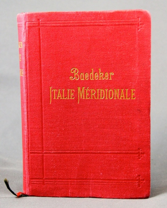
BAEDEKER K:
Italie méridionale. Sicile, Sardaigne et excursions à Malte, Tunis et Corfou. Manuel du voyageur.
Leipzig & Paris, Karl Baedeker & Paul Ollendorff, 1903. 1 vol. in-8 de L-440 pages, pleine percaline rouge d’éditeur ornée de filets à froid, titre doré, dos lisse, orné à froid avec titres dorés, tranches marbrées, 2 signets. Tampon de possesseur sur page de titre.
书商的参考编号 : 6116
|
|
|
BAEDEKER K:
Italie septentrionale jusqu'à Livourne, Florence et Ravenne. Manuel du voyageur.
Leipzig & Paris, Karl Baedeker & Paul Ollendorff, 1904. 1 vol. in-8 de LX-580 p., pleine percaline rouge d’éditeur orné de filets à froid, titre doré, dos lisse, orné à froid avec titres dorés, tranches marbrées, 2 signets. Nom de possesseur sur garde.
书商的参考编号 : 6115
|
|
|
BAEDEKER K:
Italie septentrionale jusqu’à Livourne, Florence et Ravenne. Manuel du voyageur.
Leipzig, Karl Baedeker, 1899. In-8 de LVI-516 pages, pleine percaline rouge d’éditeur, dos lisse orné à froid. Légers accrocs aux extrémités du mors du 1er plat, quelques notes dans les marges.
书商的参考编号 : 2303
|
|
|
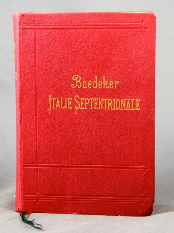
BAEDEKER Karl
Italie Septentrionale jusqu'à Livourne , Florence et Ravenne : Manuel Du Voyageur
Reliure en percaline bordeaux , frappée en creux en lettres dorées . Tranches jaspées . Collection " Guides Baedeker " . 14ème édition avec 24 cartes et 27 plans de villes , 23 plans en couleurs . Une introduction donne un aperçu des uses et coutumes du pays , des mesures d'hygiène , des transports , et présente les arts en Italie . Les cartes et plans dont certains dépliants sont en très bon état . ( Pour les autres guides de cette collection taper l'éditeur en mot clé ) . - 478 p. , 550 gr.

|
|
|
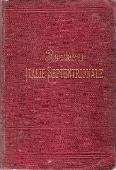
BAEDEKER Karl
Italie Septentrionale jusqu'à Livourne , Florence et Ravenne : Manuel Du Voyageur
Leipzig / Paris Karl Baedeker 1895 In 16 Reliure en percaline bordeaux , frappée en creux en lettres dorées . Tranches jaspées . Collection " Guides Baedeker " . 14ème édition avec 24 cartes et 27 plans de villes , 23 plans en couleurs . Une introduction donne un aperçu des uses et coutumes du pays , des mesures d'hygiène , des transports , et présente les arts en Italie . Les cartes et plans dont certains dépliants sont en très bon état . ( Pour les autres guides de cette collection taper l'éditeur en mot clé ) . - 478 p. , 550 gr.
书商的参考编号 : 015238
|
|
|
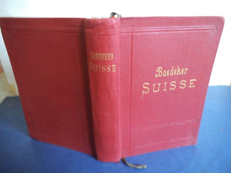
BAEDEKER Karl
La Suisse
et les paries limitrophes de la Savoie et de l’Italie. Manuel du voyageur. In 12 pleine toile rouge de l’éditeur, titre doré, au dos et sur le premeir plat. Faux-titre, titre, carte dépliante, dela Suisse, en couleurs, en frontispice, titre, 577 pages, tranches marbrées, nombreuses cartes, plans et panoramas, la plupart dépliants.Leipzig-Paris 1909. Bon exempalaire
书商的参考编号 : 8423
|
|
|
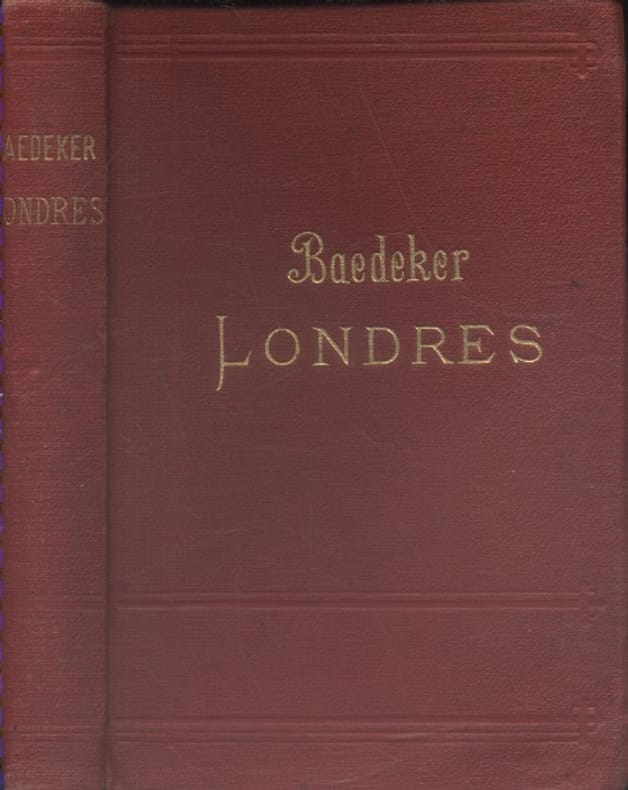
BAEDEKER Karl Avec 4 cartes et 38 plans.
Londres et ses environs. Manuel du voyageur. 11e édition.
Couverture rigide. Reliure toile de l'éditeur. 372 pages.
书商的参考编号 : 133841
|
|
|
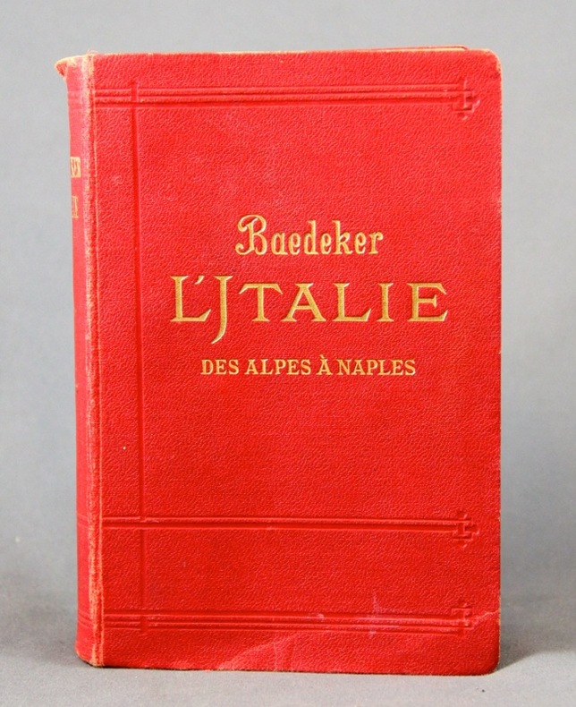
BAEDEKER Karl:
L’ Italie. Des Alpes à Naples. Manuel abrégé du voyageur.
Leipzig, Karl Baedeker, 1909. 1 vol. in-8 de XLIV, 455 p. pleine percaline rouge d’éd., dos lisse, orné à froid, tranches marbrées. Petits accrocs aux coiffes.
书商的参考编号 : 2305
|
|
|
BAEDEKER Karl:
Südbayern, Tirol, Salzburg, Ober- und Nieder-Österreich, Steiermark, Kärnten und Krain. Handbuch für Reisende. Fünfunddreissigste Auflage.
Leipzig, Karl Baedeker, 1912. In-12 de XXVI-682 pages, couverture souple de percaline rouge ornée de filets à froid, titre doré au dos et au premier plat, tranches marbrées. Nom de possesseur au titre.
书商的参考编号 : 10247

|
|
|
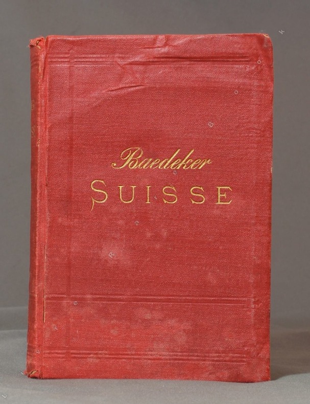
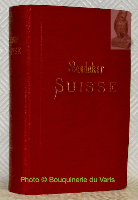
BAEDEKER, Carl:
La Suisse et les parties limitrophes de la Savoie et de l'Italie. Manuel du voyageur. 29ème édition.
Leipzig & Paris, 1921, in-8vo, XXXII + 568 p., avec 63 cartes, 17 plans et 11 panoramas, reliure en toile originale.bon exemplaire
书商的参考编号 : 54972aaf
|
|
|
BAEDEKER, Carl:
La Suisse et les parties limitrophes de la Savoie et de l'Italie. Manuel du voyageur. 25ème édition.
Leipzig & Paris, 1907, in-8vo, XXXIV + 572 p., avec 69 cartes, 18 plans et 11 panoramas, (la grande carte de la suisse avec déchirure restaurée avec du papier collant (scotch), la dern. p. déchirée sans perte, reliure en cuir d’amateur.
书商的参考编号 : 137695aaf
|
|
|
BAEDEKER, Carl:
La Suisse et les parties limitrophes de la Savoie et de l'Italie. Manuel du voyageur. 27ème édition.
Leipzig & Paris, 1921, in-8vo, XXXIV + 588 p., avec 75 cartes, 20 plans et 12 panoramas, reliure en toile originale. Bel exemplaire
书商的参考编号 : 137132aaf
|
|
|
Baedeker, Karl
Baedeker's Great Britain 1890
Neat name/date to front end paper. No other marks or inscriptions. A very clean very tight copy with bright unmarked boards and no bumping to corners. Dust jacket not price clipped or torn or creased with very tiny spot mark to rear. Large fold-out map at front in excellent condition. 609pp. Facsimile edition of the Baedeker guide of 1890 with seventy-two tours to guide the traveller from the Scilly Isles to Shetland at the the end of the 19th century with advice on money, travel, hotels etc , coloured maps, street plans and a large double-sided fold-out map of the entire railway network.

|
|
|
Baedeker, Karl G.
SCHWEDEN UND NORWEGEN Nebst den wichtigsten Reiserouten durch Danemark. Handbuch fur Reisende.
pp. LXVI, 489 + 40 p. Phrase Book ["Danisch-Norwegische und Schwedische Sprachlehre zum Reisegebrauch"] + Plus 37 Maps and 22 Plans, mostly in color. Some light damp staining. Some maps trimmed close, loose or carelessly folded, with slight tears. All edges marbled. 16mo. 160 mm. Original full flexible rose cloth binding, gilt lettered. Name on title page. Overall, a good copy. TRAVEL/3
|
|
|
BAEDEKER, Karl.
La Suisse et les parties limitrophes de la Savoie et de l’Italie. Manuel du voyageur. Avec 81 cartes, 30 plans et 15 panoramas. Trentième édition, refondue et mise a jour.
Leipzig, Karl Baedeker 1928, 160x110mm, LVI - 632pages, reliure d'éditeur. Bel exemplaire.
书商的参考编号 : 98509
|
|
|
Baedeker, Karl.
THE RHINE FROM ROTTERDAM TO CONSTANCE. Handbook for Travellers. With 36 Maps and 22 Plans. Eleventh Revised Edition.
pp. xxxiv, 386 + Plus 36 folding maps and 22 plans. All edges marbled. 16mo. Original full flexible rose cloth binding, gold lettered. TRAVEL/3
|
|
|
Baer, Edith; Wightman, Margaret
Signposts: German
No marks or inscriptions. No creasing to covers or to spine. A very clean very tight copy with bright unmarked boards and no bumping to corners. 104pp. Guide for visitors to Germany. How to understand the street/road signs.

|
|
|
Bagrow Leo / Skelton Raleigh Ashlin.
Meister der Kartographie. 6. Aufl.
Berlin Gebr. Mann 1994. . Von den Karten primitiver Völker bis ins 18. Jhdt. Mit Erläuterungen zu den Abbildungen von Heinrich Winter Anmerkungen Verzeichnis der abgebildeten Karten Verzeichnis der Kartographen u. ihrer Werke Literaturverzeichnis u. Sachregister mit ca. 1500 Stichworten. - Gutes sauberes Exempöar Berlin, Gebr. Mann, (1994). unknown
书商的参考编号 : 52158
|
|
|
Bailey Albert Edward & Kent Charles Foster; Illustrated by Nice Fold out & Maps Illustrator
History of the Hebrew Commonwealth
Charles Scribner's Son 1920-01-01. Hardcover. Used: Good/No DJ. Dark red cloth over boards & faded gilt lettering on spine. Rubbing to cloth on boards & slight stain on front & on edge at rear. 9 cm tear to front board at hinge from lower edge. Bumping to corners. Slight fraying to cloth at head & heel of spine. Clean copy no interior marks. Binding tight. Spine square. Foxing to inside boards & age toning to pages. Previous owners' name & name plate on inside cover. Note on Preface page "Gift of Rev. Willis P. Gerbart." Pull-out map at front intact. 396 pp plus map section. No DJ. 1920 ED. Item ships within two business days. Most packaging fully recyclable please recycle! Charles Scribner's Son hardcover
书商的参考编号 : HT-1022
|
|
|
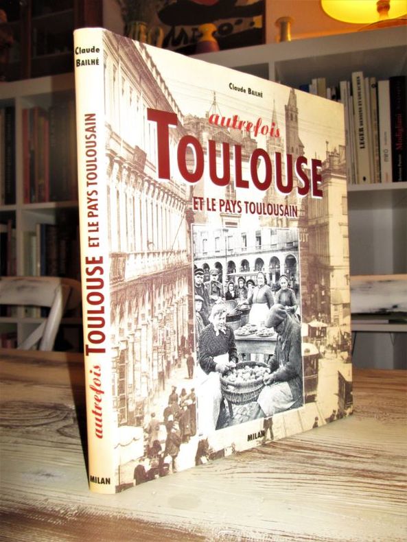
BAILHE Claude
Autrefois, Toulouse et le Pays toulousain
Editions Milan (septembre 1994). In-4 relié (29 x 24,5 cm), 196 pages, richement illustré. illustrations d'aprés cartes postales et photos anciennes. Parfait état. -1265g.L. - Excellent état, comme neuf.
书商的参考编号 : 26843
|
|
|
BAILHE Claude / SACRISTE Alain
Paris au temps des marchands de Coco.
Milan, Portraits Scènes et Petits Métiers, 1989, 131 p., cartonnage éditeur oblong, bon état.
书商的参考编号 : 86403
|
|
|
BAILLE (Hervé).
Planisphère terrestre. Quelques voyages récents de bâtiments de guerre.
Paris, G. Barbarin et Cie, [circa 1955]. 695 x 990 mm, monté sur toile.
书商的参考编号 : LBW-7920

|
|
|
BAILLEUL (Gaspard de).
Nouveau plan de la ville et fauxbourgs de Paris divisé en vingt quartiers.
Paris, chez le Sieur Gaspard de Baillieul, 1738. En 4 feuilles jointes de 0,99 x 1,44 m, sous cadre et verre.
书商的参考编号 : LBW-4012
|
|
|
BAILLEUL (Nicolas);
Évêché de Dijon.
Dijon F. Desventes 1746 438 x 613 mm.
书商的参考编号 : LBW-570
|
|
|
Baillie, Kate and Salmon, Tim
The Rough Guide to Paris
No inscriptions or marks. No creasing to covers or to spine. A lovely clean crisp very tight copy with bright unmarked boards and no bumping to corners. Appears unread and unused. 478pp. Eighth edition. plus maps.

|
|
|
BAILLIEUL (Gaspard).
[FORÊT de COMPIÈGNE] Carte de la forest de Compiègne et ses environs.
Paris, Sr. Baillieul, 1728. 675 x 631 mm.
书商的参考编号 : LBW-6525

|
|
|
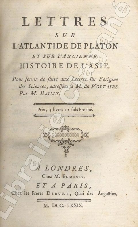
Bailly (Jean Sylvain ; 1736-1793) :
Lettres sur l'Atlantide de Platon et sur l'ancienne histoire de l'Asie. Pour servir de suite aux Lettres sur l'origine des Sciences, adressées à M. de Voltaire par M. Bailly.
Londres, chez M. Elmesly et Paris, Debure, 1779 ; in-8, demi veau marbré, dos à nerfs décoré et doré, titre doré, tranches rouges (reliure de l'époque) ; (4), 480 pp. , carte dépliante de l'Europe, Asie et l'Afrique du Nord, gravée sur cuivre par De la Gardette.
书商的参考编号 : 17625
|
|
|
Bain David Haward endpaper maps by David Lindroth Dust Wrapper photography by Jim Richardson
THE OLD IRON ROAD: AN EPIC OF RAILS ROADS AND THE URGE TO GO WEST
New York: Viking 2004. Near Fine in Fine dust jacket. 2004. First Edition. Hardcover. 0670033081 . First edition. 434 pages illustrated including map endpapers references index. Near Fine copy light spine end bumping in Fine Dust Wrapper. . Viking [2004] hardcover
书商的参考编号 : 66373 ???????? : 0670033081 9780670033089

|
|
|
Bain J. H. editor & maps
Odysseus '87: an accomodations& travel guide for the gay community USA/International; 3rd edition
Flushing: Odysseus Enterprises 1986. Paperback. xiv 386p. foreword maps drawings a very good 3rd edition trade paperback gay travel guide in white pictorial wraps. Now for gay men and lesbians! Odysseus Enterprises paperback
书商的参考编号 : 240472 ???????? : 0961426624 9780961426620

|
|
|
BAINS par le dr A. JUNOD ...
Stations balnéaires suisses et leurs sources minérales. Richement illustré de gouaches de Paul KUTSCHA. 2 cartes.
Association des stations balnéaires suisses ... s.d. (vers 1930). Bel exemplaire broché, couverture ornée d'éd., gd in-8, 66 pages.
书商的参考编号 : AUB-6009
|
|
|
Bakalinsky Adah; illus by Trudie Douglas maps by Bill Chase
Stairway Walks in San Francisco
San Francisco: Lexikos 1984. 3rd printing. Trade Paperback in color illus wraps. VeryGood unmarked no spine creases. More than 200 stairway walks described. Solid clean tight copy. <br/><br/>5-1/2 x 8-1/2 111 pp appendix b/w maps & dwgs. Lexikos paperback
书商的参考编号 : 26988
|
|
|
Baker, SK
Rail Atlas of Great Britain & Ireland
No inscriptions or marks. A lovely clean crisp very tight copy with bright unmarked boards and no bumping to corners. Dust jacket not price clipped or torn with faint creasing to some edges. 119pp. This fully revised fifth edition details all operational railways - British Rail, London Transport, Tyne & Wear Metro, Irish rail, Northern Ireland Railways and the numerous independant preserved/tourist railways and tramways, standard gauge and narrow gauge.

|
|
|
BALBI, Adriano y MALTE - BRUN, Conrad.
Novísimo Atlas Geográfico Universal para la Escuela de Geografía.
Madrid-Barcelona, Librería de Locadio López-Librería de Juan Llordachs, 1879. 4to. mayor; 2 hs. y 17 mapas dobles coloreados. Pérdida de la mitad del mapa de América Latina. Encuadernación en tela estampada.

|
|
|
Baldwin Hanson W./Tremblay Jean Paul maps
Strategy for Tomorrow
NY: Harper & Row 1970. reprint. VG/VG dust jacket. vi 378 p. maps map on endpapers appendices notes index 8vo; Harper & Row hardcover
书商的参考编号 : 23260 ???????? : 0060101857 9780060101855

|
|
|
Baldwin, H.W.; Weller, J.; Loomis, D.G.; Williams, Samuel T.; Howell, D.W.; Carrington, G.W. Jr.; Brube, F.E.
Marine Corps Gazette - Professional Magazine for United States Marines, October (Oct.) 1962, Number 10, Volume 46 - Counter-Insurgent Operations in Indonesia, 1958
68 pages. Features: Photo ad for the Sikorsky S-61 helicopter; Excellent two-page photo ad for the Vigilant tank killing system by the British Aircraft Corporation, which is mounted on scout cars; Biological Agents in Future War; Small Unit Operations - Counterguerrilla War - Part 5 of a series; Nice photo ad for FMC's new LCA; No Need for Despair (part 1 of 2) - argues WWI combatants hurt each other more than in any war since; Russian Small Arms and Tactics - major photo-illustrated article (part 1 of 2); Counter-Insurgent Operations in Indonesia in 1958 - how Sukharno's government crushed the rebellion is a textbook example of counter-insurgency - major article with photos and maps; Reflections on Leadership; Let's Teach Discipline; Rawin - Our Electronic Weather Eye; Wheels, Tracks and Officer Mechs - making the case that all tank officers should be qualified mechanics; Transfers and Promotions; Back cover photo ad for the Kaman Huskie VMO helicopter; and more. Average wear. Unmarked. A sound vintage copy. Magazine

|
|
 ?????????
 ?????PDF???
 RSS feed


