|
JANSSONIUS Johannes (1588-1664)
Tabula Itineris decies mille Graecorum sub Cyro contra fratem suum Artaxerxem Regem Persarum, …
Bella carta storico-geografica che riporta il percorso dei Diecimila secondo l’Anabasi di Senofonte, ovvero la marcia da Sardi a Cunassa, e il ritorno da Cunassa in Grecia, dei mercenari greci assoldati da Ciro il giovane per usurpare il trono di Persia al fratello Artaserse.Senofonte era uno dei Diecimila.La battaglia tra i due esericti fu combattuta a Cunassa, nel 401 a.C.Anche se l'armata dei mercenari fu vittoriosa nella battaglia sostenuta a Cunassa contro l'esercito dell'imperatore, Ciro non sopravvisse allo scontro, e la sua morte privò la spedizione di ogni senso: i Greci, penetrati troppo a fondo nel territorio nemico, dovettero così ritirarsi verso un porto sicuro, in un ripiegamento che si preannunciava lunghissimo e pieno di insidie.Esemplare tratto da Accuratissima Orbis antiqui delineatio ... L'atlante del Mondo Antico di J. Janssonius, che ebbe diverse edizioni dal 1652 al 1741. Joannes Janssonius, figlio dell'editore di Arnhem Jan Janssen, sposò Elisabeth Hondius, figlia di Jodocus Hondius, ad Amsterdam nel 1612. Dopo il suo matrimonio, si stabilì in questa città come libraio ed editore di materiale cartografico. Nel 1618 si stabilì ad Amsterdam accanto alla libreria di Willem Jansz. Blaeu, entrando in una seria competizione. Le sue attività non riguardavano solo la pubblicazione di atlanti e libri, ma anche di mappe singole e un vasto commercio di libri con filiali a Francoforte, Danzica, Stoccolma, Copenaghen, Berlino, Koningsbergen, Ginevra e Lione. Nel 1631 iniziò a pubblicare atlanti insieme a Henricus Hondius. Nei primi anni 1640 Henricus Hondius lasciò l'attività di pubblicazione di atlanti completamente a Janssonius. La concorrenza con Joan Blaeu, figlio e successore di Willem, nella produzione di atlanti spinse Janssonius ad ampliare il suo Atlas Novus finalmente in un'opera di sei volumi, in cui furono inseriti un atlante marino e un atlante del Vecchio Mondo. Dopo la morte di Joannes Janssonius, il negozio e la casa editrice furono continuati dagli eredi sotto la direzione di Johannes van Waesbergen (c. 1616-1681), genero di Joannes Janssonius. Le matrici degli atlanti di Janssonius furono in seguito vendute a Schenk e Valck. Acquaforte, impressa su carta vergata coeva, finemente acquarellata, in ottimo stato di conservazione. A map of Persia, indicating major settlements, regions, and mountain ranges, as well as the march of the Ten Thousand . The Ten Thousand were a group of mercenary units, mainly Greek, drawn up by Cyrus the Younger to attempt to wrest the throne of the Persian Empire from his brother, Artaxerxes II. Their march to the Battle of Cunaxa and back to Greece (401 BC-399 BC) was recorded by Xenophon (one of its leaders) in his work, The Anabasis. This map was compliled by the French cartographer Pierre du Val, and published in Jansson's Atlas of the Antique World , Accuratissima Orbis antiqui delineatio... which went through several editions 1652-1741. Joannes Janssonius (Arnhem, 1588-1664), son of the Arnhem publisher Jan Janssen, married Elisabeth Hondius, daughter of Jodocus Hondius, in Amsterdam in 1612. After his marriage, he settled down in this town as a bookseller and publisher of cartographic material. In 1618 he established himself in Amsterdam next door to Blaeu’s book shop. He entered into serious competition with Willem Jansz. Blaeu.. His activities not only concerned the publication of atlases and books, but also of single maps and an extensive book trade with branches in Frankfurt, Danzig, Stockholm, Copenhagen, Berlin, Koningsbergen, Geneva, and Lyon. In 1631 he began publishing atlases together with Henricus Hondius. In the early 1640s Henricus Hondius left the atlas publishing business completely to Janssonius. Competition with Joan Blaeu, Willem’s son and successor, in atlas production prompted Janssonius to enlarge his Atlas Novus finally into a work of six volumes, into which a sea atlas and an atlas of the Old World were inserted. After the death of Joannes Janssonius, the shop and publishing firm were continued by the heirs under the direction of Johannes van Waesbergen (c. 1616-1681), son-in-law of Joannes Janssonius. The copperplates from Janssonius’s atlases were afterwards sold to Schenk and Valck. Koeman, C. Atlantes Neerlandici, Ja 2.

|
|
|
Janssonius, Johann
Brandenburgum Marchionatus cum Ducatibus Pomeraniae et Meklenburgi (um 1633). [Altkolorierter Kupferstich, gerahmt / handcoloured copper engraving, framed].
o.J. (Johann Janssonius, geb. 1588 in Arnhem, gest. vor dem 11. Juli 1664 in Amsterdam, eigentlich Jan Janszoon, weitere Schr
Référence libraire : 66675CB
|
|
|
JANTON Henri
Les emplois non postaux des timbres-poste des territoires français
Le Monde des Philathélistes 1956 1956, Le Monde des Philatélistes, in-12 agrafé de 8 pages, quelques figures noir et blanc exemplaire sur papier ordinaire n°232/500. | Etat : Bon état général (Ref.: J4097)
Référence libraire : 6787
|
|
|
JANVIER GÉOGRAPHE
CARTE DU ROYAUME DE HONGRIE DIVISÉ EN HAUTE ET BASSE HONGRIE,TRANSILVANIE, ESCLAVONIE ET CROATIE, dressé par le Sieur JANVIER GÉOGRAPHE - 1771
Paris Lattré 1771 carte ancienne colorée d'époque en vert , rouge et jaune, cartouche non coloré, gravée par Arrivet. Format total : 50 centimètres de haut par 39 centimètres de large, 1771 Paris Lattré Editeur,
Référence libraire : 27418
|
|
|
Japan
Landkarte im Maßstab 1:3,168.000.
Ldn., Edward Stanford o. J. (um 1890). Flächenkol., lithogr. Landkarte in 20 Teile zerschnitt. u. auf Leinen aufgezogen, in Leporellofaltung, Ln.-Mappe m. aufkasch. Deckelbildchen der Fa. George Philip & Son, London, eine Teilkartenrückseite u. Innendeckel m. gefedertem Vorsatzpapier beklebt, am Einbd. geringe Gebrauchsspuren, am re. Kartenrand Klebeet. d. Fa. George Philip & Son, Map, Chart, and Geographical Depot London, Karte in sehr gutem Zustand.
Référence libraire : KART0060

|
|
|
Jason, David with Edworthy, Niall
David Jason - In His Element
No marks or inscriptions. No creasing to covers or to spine. A lovely clean crisp very tight copy with bright unmarked boards and no bumping to corners. Dust jacket not price clipped or torn or creased. 160pp. David Jason takes the reader to some of the most exotic locations on the planet as he indulges in his passion for diving.

|
|
|
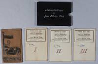
JAVA MOTOR CLUB - [THREE FOLDING LITHOGRAPH MAPS OF JAVA].
Automobielkaart van Java en Madoera Samengesteld en Uitgegeven Door de Koninklijke Vereeniging.
Semarang.: Hoofdkantoor. Circa1935. 3 folding colour lithographed maps on linen in a cloth covered slipcase lettered in white on the upper cover. Scale 1:500000. Each map has been numbered 1 to 3 by a prior owner on the reverse of the map with their signature. Sheets measure 55.5 x 83.4cm; 56 x 90cm and 56 x 82.3cm. The first map is a little stained on the reverse but the stains are not visible on the map itself. Very good copies in like slipcase. TOGETHER WITH Afstands Tabellen 1928 a separate 62pp booklet accompanies the folder of maps spine repaired with washi tissue. . Hoofdkantoor. hardcover
Référence libraire : 219096
|
|
|
JAÏS Pierre et LAHANA Henri
"Bridge simple et moderne; enfin l'espéranto du bridge : la méthode de la longue d'abord."
Paris, René Julliard, 1970. 14 x 21, 277 pp., cartonnage d'édition + jaquette, bon état.
Référence libraire : 34019
|
|
|
JAÏS Pierre et LEBEL Michel
La majeure cinquième, la nouvelle bible du bridge. Collection les bases du bridge moderne.
Editions du Rocher, 1976. 13 x 20, 409 pp., très nombreux exemples, broché, bon état.
Référence libraire : 21215
|
|
|
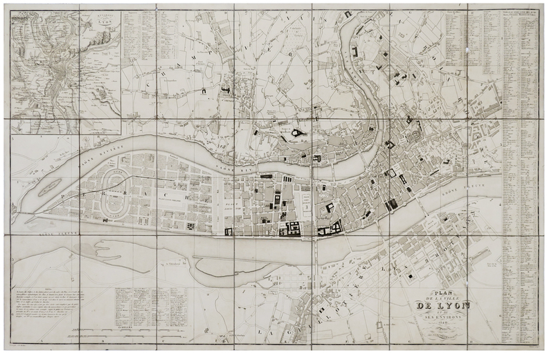
JEAN (Pierre).
[LYON] Plan de la ville de Lyon et de ses environs.
Paris, Jean, 1840. En 21 sections montées sur toile et pliées, formant un plan de 582 x 905 mm ; étiquette au dos avec titre manuscrit.
Référence libraire : LBW-6111
|
|
|
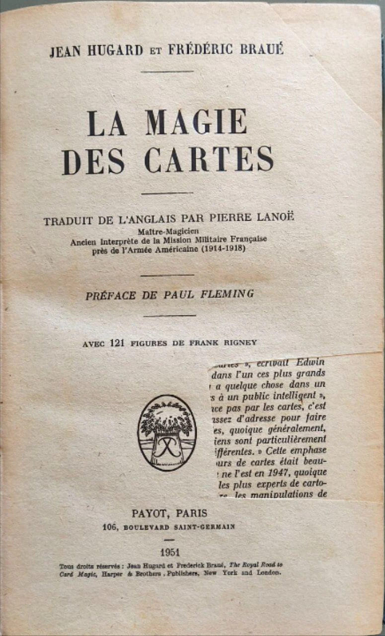
Jean Hugard et Frédéric Braué
La magie des cartes - 121 figures de frank rigney
Payot 1951 262 pages in8. 1951. reliure editeur. 262 pages. Ouvrage classique de prestidigitation consacré à la magie des cartes publié dans la collection Payot. Il présente des techniques de manipulation notamment le mélange usuel la position du jeu en main et le contrôle des cartes illustré par 121 figures. L'édition de 1970 compte 262 pages et a été traduite par Pierre Lanoë
Référence libraire : 18413
|
|
|
Jean-Marie LHOTE
Les TAROTS
Un ouvrage de 89 pages, format 200 x 295 mm, illustré, relié cartonnage couleurs, publié en 1978, Editions Atlas, bon état
Référence libraire : LFA01368
|
|
|
Jean-Pierre Seguin et Cécile de Jandin (Catalogue rédigé par) ; Julien Cain et Jean Adhémar (introduction de)
Cinq siècles de cartes à jouer en France. Bibliothèque nationale Galerie Mansart Septembre- Octobre 1963
Paris, bulletin du Vieux Papier / Fascicule 205 , 1963 0 un fascicule in-4°, 93 pp., couverture illustrée. (pages légèrement cornées). 423 n° décrits. Quelques illustrations en noir. Complet du feuillet d'errata. Peu courant.
Référence libraire : 024951
|
|
|
Jean-René Vernes
Le Bridge
Hatier 1982 1982. L'ouvrage 'Le Bridge' de Jean-René Vernes et Henri Samouiloff publié chez Hatier en 1982 présente une méthode d'évaluation des mains au bridge basée sur une étude statistique rigoureuse des donnes de compétition. Ce livre technique s'adresse aux bridgeurs cherchant à appliquer une approche systématique et théorique au jeu
Référence libraire : 500318405

|
|
|
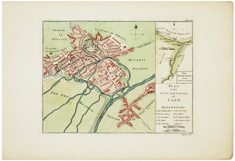
JEFFERYS (Thomas).
[CAEN] Plan of the city and castle of Caen.
[London, 1774]. 187 x 251 mm.
Référence libraire : LBW03d3d
|
|
|
JEFFERYS (Thomas).
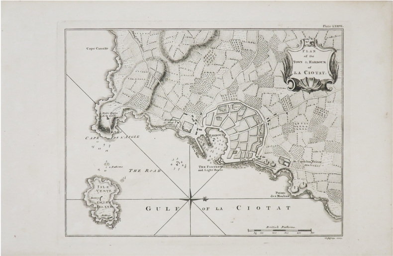
[LA CIOTAT] Plan of the town & harbour of La Ciotat.
[Londres, Thomas Jefferys, 1761]. 188 x 245 mm.
Référence libraire : LBW-8976
|
|
|
JEFFERYS (Thomas).
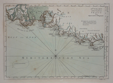
[PROVENCE] 15th chart of the coast of France from Aigues Mortes to Brégançon.
London, 1774. 180 x 248 mm.
Référence libraire : LBW03d44
|
|
|
JEFFERYS (Thomas);
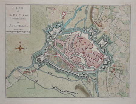
[ABBEVILLE] Plan of the city and fortifications of Abbeville.
London 1774 187 x 251 mm.
Référence libraire : LBW03d46
|
|
|
JEFFERYS (Thomas);
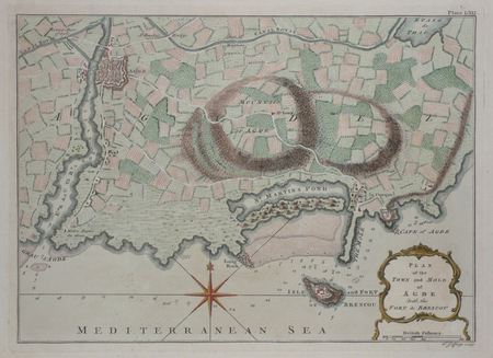
[AGDE] Plan of the town and mole of Agde with the fort de Brescou.
London 1774 197 x 276 mm.
Référence libraire : LBW03d43
|
|
|
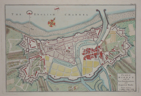
JEFFERYS (Thomas);
[DIEPPE] Plan of Dieppe with the new fortifications and projected works.
London 1774 209 x 312 mm.
Référence libraire : LBW03d47
|
|
|
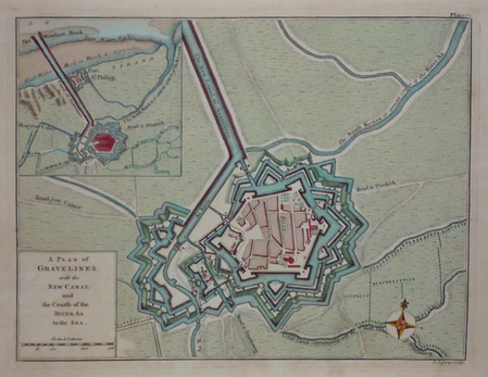
JEFFERYS (Thomas);
[GRAVELINES] A plan of Gravelines, with the new canal and the course of the river Aa to the sea.
London 1774 189 x 250 mm.
Référence libraire : LBW03d42
|
|
|
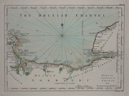
JEFFERYS (Thomas);
[NORMANDIE] 5th chart of the coast of France, from Fécamp to Cape Barfleur.
London 1774 180 x 248 mm.
Référence libraire : LBW03d48
|
|
|
Jefford, Andrew
Peat Smoke and Spirit : A Portrait of Islay and Its Whiskies
No marks or inscriptions. A very clean very tight copy with unmarked black cloth boards and no bumping to corners. Dust jacket not price clipped or marked or torn or creased with minor traces of storage. 406pp. History of the Scottish Isle of Islay and its whisky. The Island is home to seven of the world's most widely admired malt whisky distilleries on its shores and this study provides a most detailed analysis of Scotch malt whisky production. Maps on end papers.

|
|
|
Jenichen Balthasar (attivo dal 1560, morto nel 1599)
Roma
La rarissima veduta aerea di Roma di Balthasar Jenichen, pubblicata a Norimberga. La veduta di Jenichen deriva a sua volta da una xilografia della Cosmographia di Sebastian Münster (Basilea, 1550), che raffigura Roma così com'era intorno al 1490 (Per la veduta di Münster si veda A. Frutaz, Le piante di Roma, XCVIII)."Orientata con nord in basso. A proiezione obliqua; veduta prospettica. È una ripetizione del panorama comparso la prima volta col Bergomensis (1490) e, con lievi modificazioni, ripetuto poi nello Schedel, nel Munster e in altre edizioni tutte inspirate al panorama, detto di Mantova, e che rappresenta Roma sotto il Pontificato di Alessandro VI. Forse lo Jenicken ricalca un vecchio rame senza mai aver visto Roma, sicché non riesce ad interpretare la linea della cupola del Pantheon, colloca l'Aventino presso la Porta del Popolo e qua e là dissemina altri errori topografici. L'assenza del Colosseo ricollega la presente pianta più direttamente al Munster" (cfr. Scaccia Scarafoni, p. 74)."In alto a sinistra legenda con lettere di rimando in veduta (A-Z). È noto un solo altro esemplare con iscrizioni in caratteri gotici conservato al Paul Getty Museum ed un altro con iscrizioni in caratteri romani conservato presso la BVE. Si tratta pertanto di una pianta di estrema rarità e peraltro graficamente assai raffinata" (cfr. Marigliani p. 121, che erroneamente raffigura e attribuisce la copia con caratteri gotici allo Jenichen).Il lettering del nostro esemplare è in latino, mentre esiste una copia con caratteri gotici, di dimensioni ridotte. Un esempio (ex collezione Pecci-Blunt) si trova al Getty Museum, un altro è pubblicato su Marigliani, altro ancora è descritto da Scaccia Scarafoni alla Biblioteca Nazionale di Roma.La veduta dello Jenichen è sconosciuta a Frutaz, mentre Hollstein ne descrive solo 2 esemplari nelle collezioni dei gabinetti delle stampe di Berlino e Monaco. Scaccia Scarafoni descrive l'esemplare presso la Biblioteca Nazionale di Roma; Jenichen è stato il principale editore tedesco di carte topografiche. Insieme al connazionale Matthias Zündt si interessarono particolarmente alle cosiddette carte d'occasione - nate per documentare avvenimenti - e ne produssero diverse sulla scia e nella tradizione di quelle dei loro omologhi editori italiani. Data la loro natura effimera, sono tutte rare o introvabili.La veduta di Roma, priva di data, può essere ricondotta la periodo 1562-1590 in base alle informazioni sul periodo di attività dell'artista. Una datazione intorno al 1570 ci sembra più compatibile con alcuni dei lavori topografici - datati - dell'artista.Acquaforte e bulino, impressa su carta vergata coeva priva di filigrana, con margini, in perfetto stato di conservazione. Rarissima.BibliografiaScaccia Scarafoni, Le Piante di Roma, pp. 74-75, n. 129; Marigliani, Le piante di Roma nelle collezioni private, p. 121, n. 17; Hollstein XL B, p. 54, n. 150; G.K. Nagler, Lexicon, VI, p. 439, n. 2; Andresen II, Nr. 279; Passavant IV, p. 429, n. 27; Le Blanc, II, p. 429, n. 27. The very rare Balthasar Jenichen's etched bird's-eye view of Rome, published in Nuremberg. Jenichen's view in turn derived from a woodcut in Sebastian Münster's Cosmographia (Basel, 1550), which depicts Rome as it was about 1490 (For Münster's view, see A. Frutaz, Le piante di Roma, XCVIII).Münster's table with lettered names keyed to buildings and monuments on the view has been shifted from the foot to the upper left-hand corner in Jenichen and the present view. In its place at foot are eight quatrains of German verse on the rulers of Rome, the last line of which reads: Das spricht Balthasar Jenichen. Lettering in the present view is Latin, while there is a copy with Gothic lettering, reduced in size. One example (ex Pecci-Blunt collection's) is at the Getty Museum, another one is published in Marigliani - who erroneously attributes the copy with Gothic characters to Jenichen. Unknown by Frutaz; Hollstein describes only 2 example of this very rare work. Scaccia Scarafoni listed the further example at the Biblioteca Nazionale di Roma (that own also the copy with Gothic text).Jenichen was the leading German publisher of news-sheet maps. Jenichen and compatriot Matthias Zündt took particular interest in the conflict and produced views and maps of it that equaled and surpassed those of their Italian counterparts. Given their ephemeral nature, all are rare and desirable.The view of Rome, undated, can be traced back to the period 1562-1590 according to the artist's period of activity. A dating around 1570 seems to us to be more compatible with some of the artist's topographical and dated works.Etching and engraving, printed on contemporary laid paper, with margins, perfect condition.LiteratureScaccia Scarafoni, Le Piante di Roma, pp. 74-75, n. 129; Marigliani, Le piante di Roma nelle collezioni private, p. 121, n. 17; Hollstein XL B, p. 54, n. 150; G.K. Nagler, Lexicon, VI, p. 439, n. 2; Andresen II, Nr. 279; Passavant IV, p. 429, n. 27; Le Blanc, II, p. 429, n. 27.

|
|
|
JERUSALEMS TEMPEL -
Jerusalems tempel Såsom thet syntes öster uth Medh alla sine Föreårdar eller Chorer, efter Ben. Ariae Montani Afritning.
(Stockholm, 1703). (33 x 42 cm.). Kobberstukket kort over Tempelgården i perspektiv. En ganske lille reparation nederste i midterfolden. I passpartou.
|
|
|
JERUSALEMS TEMPEL -
Jerusalems tempel Såsom thet syntes öster uth Medh alla sine Föreårdar eller Chorer, efter Ben. Ariae Montani Afritning.
(Stockholm, 1703). (33 x 42 cm.). Kobberstukket kort over Tempelgården i perspektiv. En ganske lille reparation nederste i midterfolden. I passpartou.
Référence libraire : 53195
|
|
|
JESSUP Frank W.
A History of Kent. with Maps and Pictures. BRIGHT, CLEAN COPY IN UNCLIPPED DUSTWRAPPER
8vo., First Edition, with 30 plates on 16 and 15 maps in the text; green cloth, gilt back, a very good, bright, clean copy in unclipped dustwrapper, the latter lightly frayed at extremities. Bennett p.184.

|
|
|
JEU DE 60 CARTES
APPRENDRE TABLES MULTIPLICA GRACE HUMOUR
LIBERTE ED. (METHODE
Référence libraire : SLIVCN-9782956912859
|
|
|
JEU DE 60 CARTES
LETTRES DE L ALPHABET -LES-
LIBERTE ED. (METHODE
Référence libraire : SLIVCN-3770017268003
|
|
|
JEU DE CARTES
1 A 10
KEROZENN
Référence libraire : SLIVCN-3770007879912
|
|
|
JEU DE CARTES
4 ROUES ET UN MOTEUR
KEROZENN
Référence libraire : SLIVCN-3770007879295
|
|
|
JEU DE CARTES
7 & MAT
JEUX D'ENFANTS S.A.
Référence libraire : SLIVCN-7649988536915
|
|
|
JEU DE CARTES
ACTIONS EN PATISSERIE
KEROZENN
Référence libraire : SLIVCN-3770007879387
|
|
|
JEU DE CARTES
ADJECTIFS FEMININS EN IMAGES
PASSE-TEMPS EDITIONS
Référence libraire : SLIVCN-9830096007994
|
|
|
JEU DE CARTES
ANIMAUX DE LA FERME
KEROZENN
Référence libraire : SLIVCN-3760361290904
|
|
|
JEU DE CARTES
ANIMAUX DE LA SAVANE
KEROZENN
Référence libraire : SLIVCN-3770007879783
|
|
|
JEU DE CARTES
ANIMAUX DOMESTIQUES
KEROZENN
Référence libraire : SLIVCN-3760361290232
|
|
|
JEU DE CARTES
APPAREILS ELECTRIQUES
KEROZENN
Référence libraire : SLIVCN-3770007879875
|
|
|
JEU DE CARTES
AS DE L ALPHABET -L-
PASSE-TEMPS EDITIONS
Référence libraire : SLIVCN-9830096001084
|
|
|
JEU DE CARTES
AS DES ACCENTS -L-
PASSE-TEMPS EDITIONS
Référence libraire : SLIVCN-9830096001183
|
|
|
JEU DE CARTES
AS DES CONSONNES DOUBLES -L-
PASSE-TEMPS EDITIONS
Référence libraire : SLIVCN-9830096001022
|
|
|
JEU DE CARTES
AS DES LETTRES B ET D -L-
PASSE-TEMPS EDITIONS
Référence libraire : SLIVCN-9830096001107
|
|
|
JEU DE CARTES
AS DES LETTRES MUETTES -L-
PASSE-TEMPS EDITIONS
Référence libraire : SLIVCN-9830096001015
|
|
|
JEU DE CARTES
AS DES MOTS FREQUENTS -L-
PASSE-TEMPS EDITIONS
Référence libraire : SLIVCN-9830096005433
|
|
|
JEU DE CARTES
AS DES MOTS IRREGULIERS -L-
PASSE-TEMPS EDITIONS
Référence libraire : SLIVCN-9830096005440
|
|
|
JEU DE CARTES
AS DES PHONEMES CH ET J
PASSE-TEMPS EDITIONS
Référence libraire : SLIVCN-9830096001121
|
|
|
JEU DE CARTES
AS DES PHONEMES F ET V -L-
PASSE-TEMPS EDITIONS
Référence libraire : SLIVCN-9830096001114
|
|
|
JEU DE CARTES
AS DES PHONEMES K ET G -L-
PASSE-TEMPS EDITIONS
Référence libraire : SLIVCN-9830096001138
|
|
|
JEU DE CARTES
AS DES PHONEMES M ET N -L-
PASSE-TEMPS EDITIONS
Référence libraire : SLIVCN-9830096001169
|
|
|
JEU DE CARTES
AS DES PHONEMES P ET B -L-
PASSE-TEMPS EDITIONS
Référence libraire : SLIVCN-9830096001145
|
|

 Recevoir par e-mail
 Télécharger en PDF
 Flux RSS
 Lien permanent


