|
LE MAÎTRE.
[JEU de l'OIE] L'Histoire Romaine depuis Constantin jusqu'à Charles-Magne réduite en jeu pour l'instruction de la jeunesse.
Paris, Crépy, [1773]. 506 x 716 mm.
Referentie van de boekhandelaar : LBW-8533

|
|
|
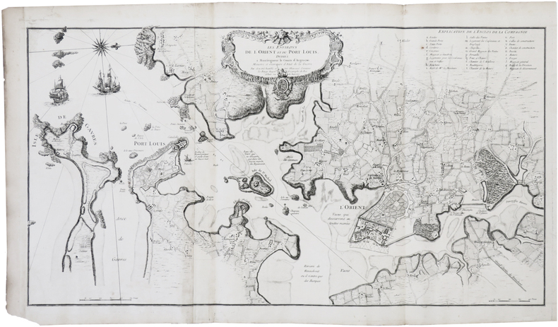
LE ROUGE (Georges-Louis).
[LORIENT & PORT-LOUIS] Les Environs de l'Orient et du Port Louis.
Paris, Le Rouge, [1752]. En deux feuilles jointes formant une carte de 473 x 880 mm.
Referentie van de boekhandelaar : LBW-7391
|
|
|
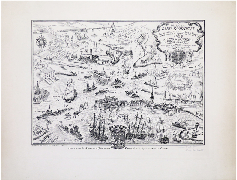
LE CONTE (Pierre).
[LORIENT] Plan du lieu d'Orient qui fut fondé en 1666 dans la lande du Faouédic par Messieurs de la Compagnie des Indes Or.les. Gravé en l'honneur du 250e anniversaire de l'accession de Mgr le Marquis de Seignelay à la Présidence du Conseil d'Administration, avec la citadelle de Port-Louis, la rade de Pen-Mané et toute la région avoisinante.
Cherbourg, chez l'auteur, 1933. 335 x 446 mm.
Referentie van de boekhandelaar : LBW-8026
|
|
|
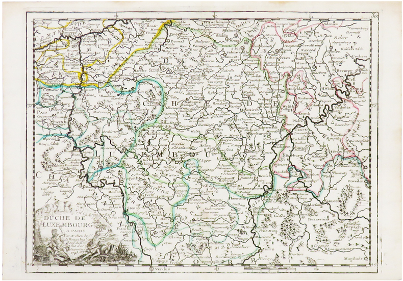
LE ROUGE (Georges-Louis).
[LUXEMBOURG] Duché de Luxembourg.
[1756]. 203 x 274 mm.
Referentie van de boekhandelaar : LBW-1195
|
|
|
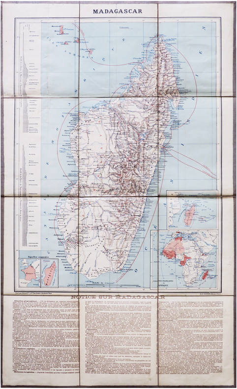
LE SOUDIER (Henri).
[MADAGASCAR] Madagascar.
Paris, H. Le Soudier, [1894]. En 12 sections montées sur toile et repliées, formant une carte de 644 x 387 mm ; étiquette au dos portant le titre.
Referentie van de boekhandelaar : LBW-7871
|
|
|
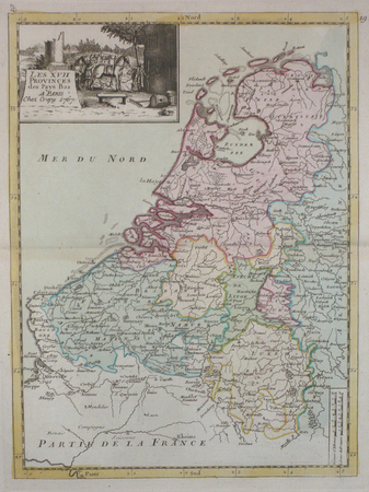
LE ROUGE (Georges-Louis);
[PAYS-BAS] Les XVII provinces des Pays-Bas.
Paris Crépy 1767 271 x 200 mm.
Referentie van de boekhandelaar : LBW04185
|
|
|
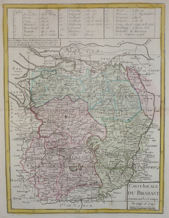
LE ROUGE (Georges-Louis);
[PAYS-BAS/BRABANT] Carte idéale du Brabant contenant les camps de 1746 et 1747.
Paris Crépy 1767 276 x 209 mm.
Referentie van de boekhandelaar : LBW04187
|
|
|
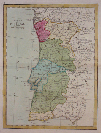
LE ROUGE (Georges-Louis).
[PORTUGAL] Royaume de Portugal.
[Paris, Crépy, 1767]. 275 x 207 mm.
Referentie van de boekhandelaar : LBW03d89
|
|
|
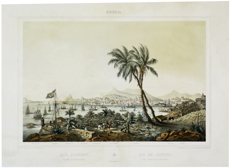
LE BRETON (Louis).
[RIO de JANEIRO] Rio Janeiro. Vue prise de l'île das Cobras - Rio de Janeiro. Vista tomada da ilha das Cobras.
Paris, S. Stampa fils, Lisboa, Manuel Costenla, [circa 1850]. 390 x 494 mm.
Referentie van de boekhandelaar : LBW-5648
|
|
|
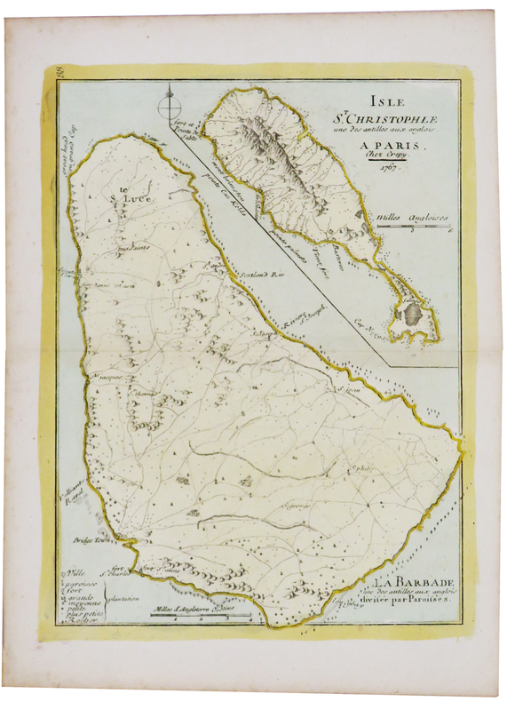
LE ROUGE (Georges-Louis).
[SAINT KITTS/BARBADE] Isle St. Christophle une des Antilles aux Anglois - La Barbade une des Antilles aux Anglois divisée par paroisses.
[1746]. 271 x 202 mm.
Referentie van de boekhandelaar : LBW02493
|
|
|
LE ROUGE (Georges-Louis).
[SAINT-DOMINGUE] Isle de St. Domingue.
[1743]. 206 x 276 mm.
Referentie van de boekhandelaar : LBW024a6

|
|
|
LE ROUGE (Georges-Louis).
[SAVOIE] Le Duché de Savoye suivant les nouvelles observations.
Paris, Basset, 1777. 620 x 497 mm ; repliée sous couverture cartonnée recouverte de papier bleu de l'époque (203 x 127mm) ; étiquette sur le premier plat portant le titre manuscrit à l'encre.
Referentie van de boekhandelaar : LBW-8448

|
|
|
LE ROUGE (Georges-Louis);
[SILESIE] Le duché de Silésie divisé en XVII principautées.
Paris Sr. Le Rouge 1743 202 x 263 mm.
Referentie van de boekhandelaar : LBW0252a

|
|
|
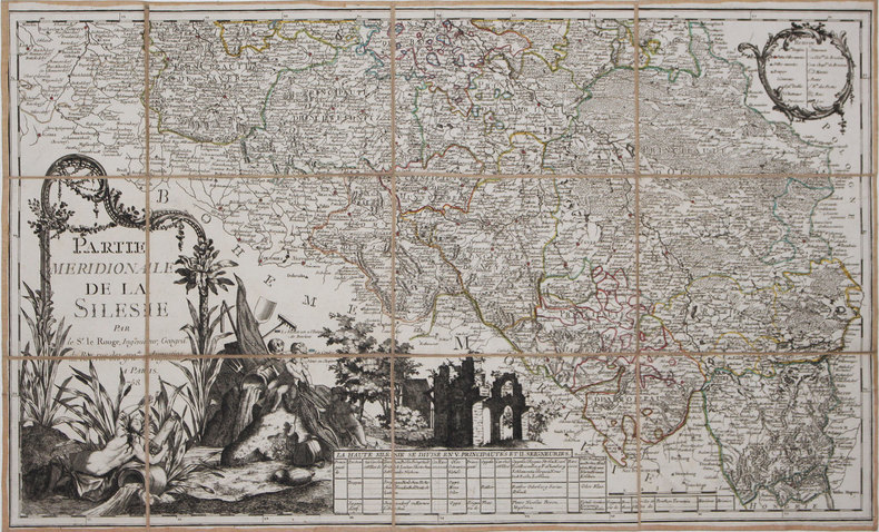
LE ROUGE (Georges-Louis).
[SILESIE] Partie méridionale de la Silésie.
1758. En 12 sections montées sur toile et pliées, formant une carte de 464 x 764 mm.
Referentie van de boekhandelaar : LBW-3149
|
|
|
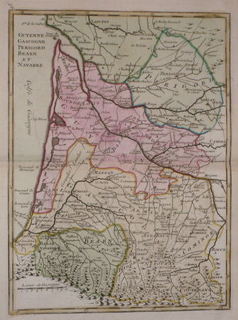
LE ROUGE (Georges-Louis).
[SUD-OUEST] Guyenne, Gascogne, Périgord, Béarn et Navarre.
[Paris, Crépy, 1767]. 277 x 205 mm.
Referentie van de boekhandelaar : LBW03d82
|
|
|
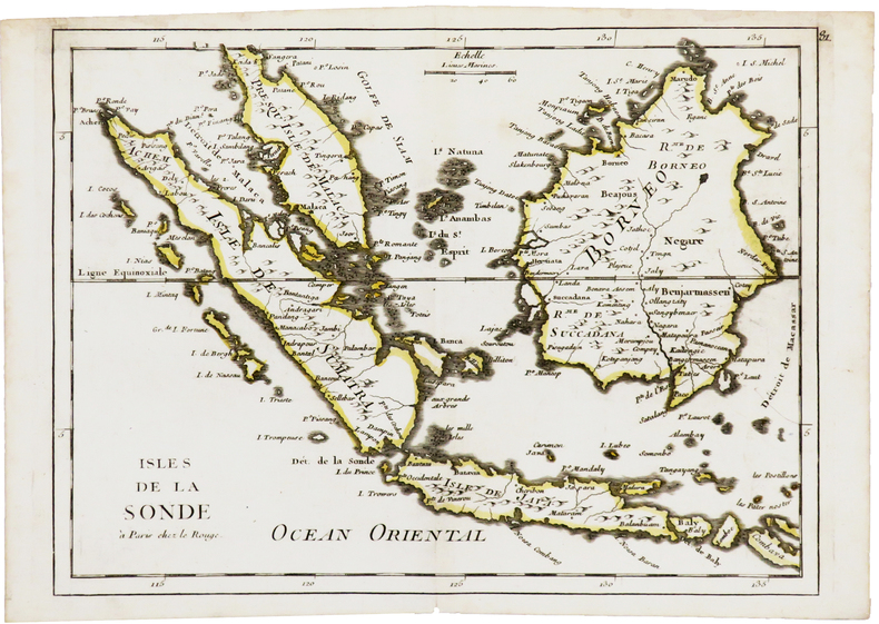
LE ROUGE (Georges-Louis).
[SUMATRA/JAVA/BORNEO] Isles de la Sonde.
Paris, Le Rouge, [1746]. 218 x 286 mm.
Referentie van de boekhandelaar : LBW03d87
|
|
|
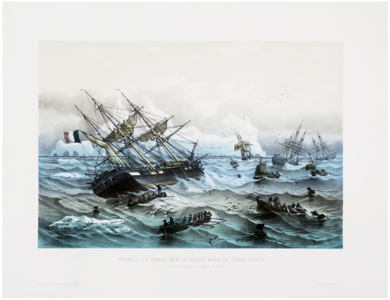
LE BRETON (Louis).
[TERRE-NEUVE] Pêche à la morue sur le Grand Banc de Terre-Neuve. Les embarcations élongeant les lignes.
Paris, F. Sinnett, [circa 1845]. 370 x 501 mm.
Referentie van de boekhandelaar : LBW-8047
|
|
|
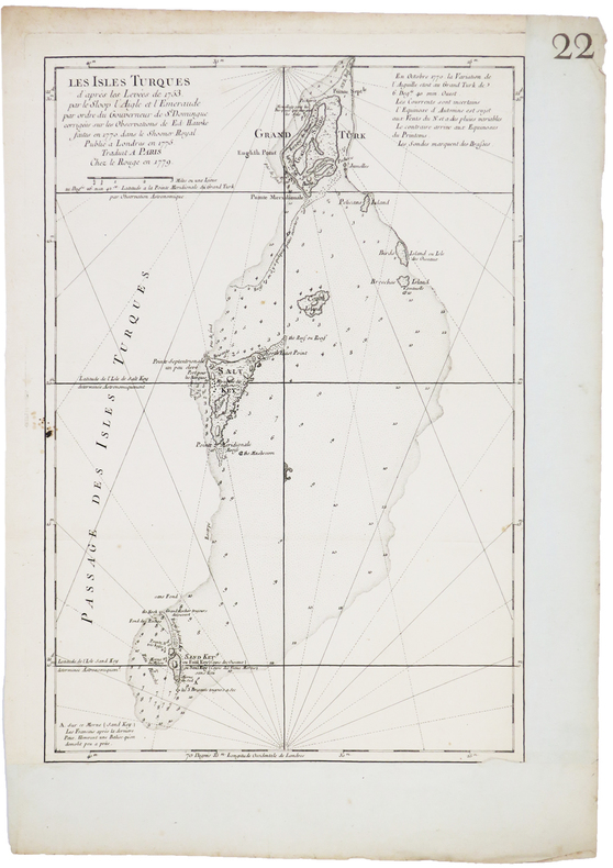
LE ROUGE (Georges-Louis).
[ÎLES TURKS] Les Îles Turques d'après les levées de 1753 par le sloop l'Aigle et l'Émeraude par ordre du gouverneur de St. Domingue corrigées sur les observations de Ed. Hawke faites en 1770 dans le shooner royal. Publié à Londres en 1775. Traduit à Paris.
Paris, Le Rouge, 1779. 450 x 304 mm.
Referentie van de boekhandelaar : LBW-5241
|
|
|
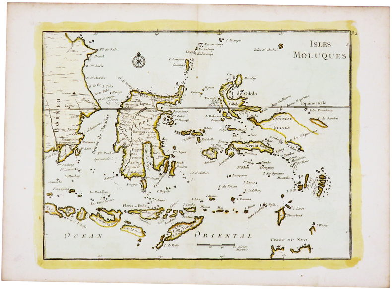
LE ROUGE (Georges-Louis).
[ÎLES MOLUQUES] Isles Moluques.
[1746]. 218 x 286 mm.
Referentie van de boekhandelaar : LBW-5440
|
|
|
LE ROUGE (Georges-Louis).
Amérique méridionale.
1743. 207 x 275 mm.
Referentie van de boekhandelaar : LBW02489
|
|
|
LE ROUGE (Georges-Louis).
ARTOIS, PICARDIE.
[Paris, Crépy, 1767]. 211 x 279 mm.
Referentie van de boekhandelaar : LBW03d7c
|
|
|
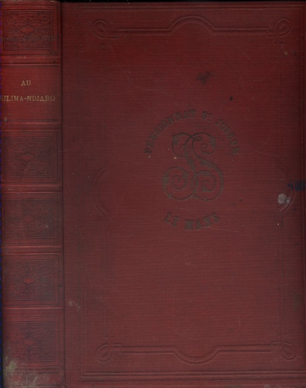
LE ROY A. (Monseigneur) 6 cartes et 89 gravures dessinées par l'auteur.
Au Kilima-Ndjaro (Afrique orientale).
Couverture rigide. Reliure toile rouge d'époque défraîchie. 19 x 28 cm. Quelques rousseurs. Quelques rousseurs. 469 pages.
Referentie van de boekhandelaar : 45209
|
|
|
Le Vieux Papier - Bulletin de la Société Archéologique, Historique et Artistique pour l’étude de la vie et des mœurs d’autrefois - imagerie et jeux 9
Bibliophilie - Documents sur le papier et imagerie populaire / Le cirque et le ballet - cartes d’adresses d’hôtel
N° 248 de avril 1973 - Broché
Referentie van de boekhandelaar : 7497
|
|
|
LE HAVRE. MANUSCRIT.
Bombardement du Havre le 4 juillet 1759.
[circa 1780]. 300 x 450 mm, sur papier calque.
Referentie van de boekhandelaar : LBW-4171

|
|
|
LE DENTU José
Bridge facile. Les enchères naturelles et le jeu de la carte.
Paris, Fayard, 1973 14 x 20, 446 pp., cartonnage + jaquette, très bon état
Referentie van de boekhandelaar : 3451
|
|
|
LE DENTU José
Bridge : 100 questions, 100 réponses. Collection : Marabout service, MS 345.
Verviers, Les Nouvelles Editions Marabout, 1979. 11 x 18, 185 pp., broché, très bon état.
Referentie van de boekhandelaar : 85092
|
|
|
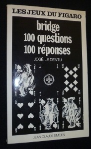
Le Dentu José
Bridge, 100 questions 100 réponses
Simoën Jean Claude Les jeux du Figaro Broché 1977 In-8, (21x13 cm), broché, couverture illustrée, 181 pages, livre qui s'adresse à ceux qui savent déjà jouer et veulent progresser ; plats légèrement jaunis, assez bon état. Livraison a domicile (La Poste) ou en Mondial Relay sur simple demande.
Referentie van de boekhandelaar : nf182
|
|
|
LE MOEL, Michel / ROCHAT, Claude-France:
Catalogue général des cartes, plans et dessins d’architecture. Tome III, Série N.
Paris, Imprimerie Nationale, 1972, gr. in-8vo, 612 p., richement ill. d’ env. 15 planches dépliantes n./b. et couleur hors texte, brochure originale.
Referentie van de boekhandelaar : 112964aaf
|
|
|
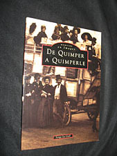
Le Gall Serge
De Quimper à Quimperlé
Editions Alan Sutton Mémoire en Images Broché 1996 In-8, (23,5x16,5 cm), broché, couverture illustrée sepia, 128 pages, riche iconographie en noir et blanc (cartes postales et photographies) ; plats à peine défraîchis, bon état. Livraison a domicile (La Poste) ou en Mondial Relay sur simple demande.
Referentie van de boekhandelaar : ql660
|
|
|
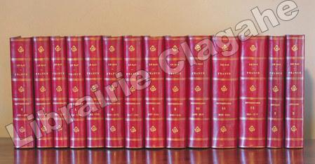
Le Bas, Philippe :
France. Dictionnaire encyclopédique.
Paris, Firmin Didot, 1840 - 1845, 12 volumes in-8 ; suivi de Annales de France, 1840 - 1843, deux volumes ; soit en tout 14 volumes in-8 en reliure uniforme ; demi-chagrin rouge-cerise, dos à faux-nerfs dorés, fleurons, titre et tomaison dorés, tranches mouchetées (reliure de l'époque) ; 560, (2), 18, 15, (1 bl.), 22 pp. ; 576 ; 576 ; 576 ; 588 ; 851 ; 802, (2) ; 844 ; 880 ; 892 ; 908 ; IV, 1015 pp. et 496 ; 744 pp. et 33 cartes coloriées et en tout 616 gravures hors-texte (exemplaire collationné, bien complet des 616 gravures et non 620 comme annoncé). Texte imprimé sur deux colonnes.
Referentie van de boekhandelaar : 6355
|
|
|
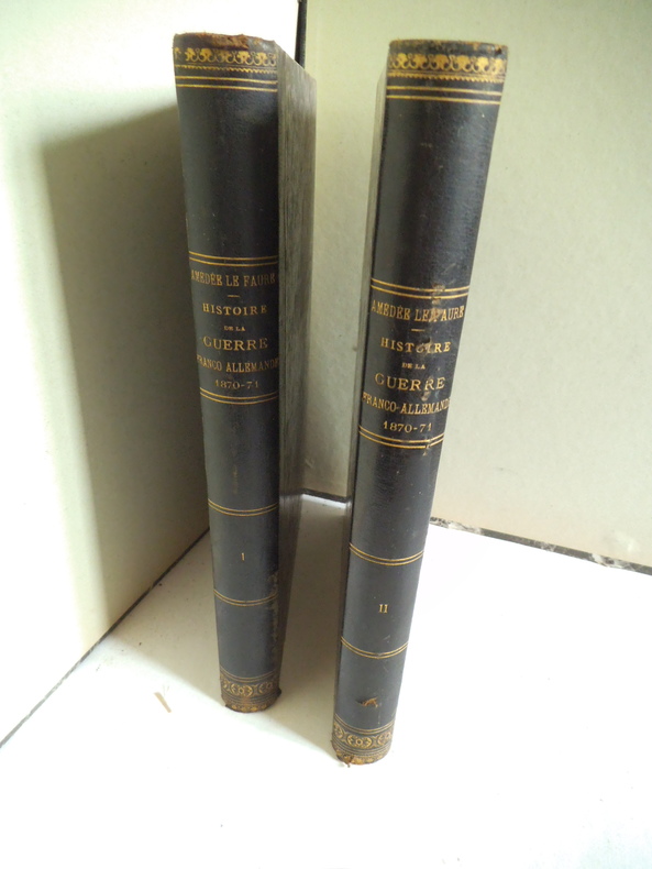
LE FAURE Amédée
Histoire de la guerre Franco allemande 1870-1871
illustrée de 19 cartes et plans, de portraits, vues épisodes de batailles etc. 2 tomes en 2 volumes in 4 demi-chagrin foncé, titre tomaison, roulette, filets dorés. Tome 1 : faux-titre, titre, 442 pages, 1 page de table des cartes Tome 2 : page de titre absente, 458 pages. Garnier frères libraires éditeurs 1875
Referentie van de boekhandelaar : 11448
|
|
|
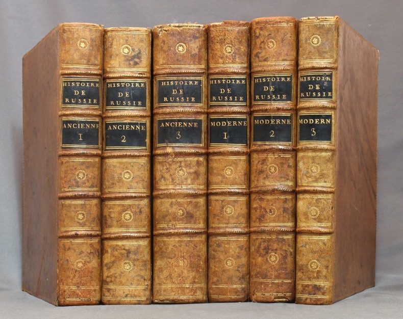
LE CLERC Nicolas-Gabriel:
Histoire physique, morale, civile et politique de la Russie ancienne [-moderne].
A Paris et à Versailles, Chez Froullé, Maradan et Chez Blaizot, 1783-1794. 6 volumes in-4 de [4]-VII-[1]-XX-510-[2]; [4]-XXIV-560-[2]; [4]-VI-[2]-748; [4]-536-VIII; [4]-619; VIII-424 pages. Pleine basane racinée du temps, dos à nerfs ornés de filets et petits fleurons dorés, roulette dorée sur les plats, tranches marbrées. Coins tapés et accrocs à quelques coiffes.
Referentie van de boekhandelaar : 15434
|
|
|
LE TOUMELIN
Kurun autour du monde (1949-1952). Richement illustré (héliogravures, cartes, dessins).
Paris, éd Flammarion 1953. Bel exemplaire broché, jquette ornée d'éd., in-8, 341 pages avec cartes, croquis et table + planches.
Referentie van de boekhandelaar : AUB-3946
|
|
|
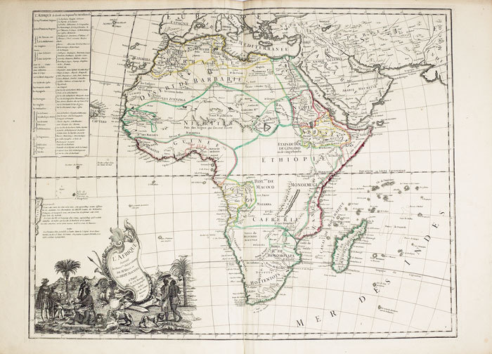
LE ROUGE (Georges-Louis).
L'Afrique suivant les dern.res observations de Mr. Hass et des R.R.P.P. Jésuites.
Paris, Sr. Le Rouge, 1747. 494 x 636 mm.
Referentie van de boekhandelaar : LBW-762
|
|
|
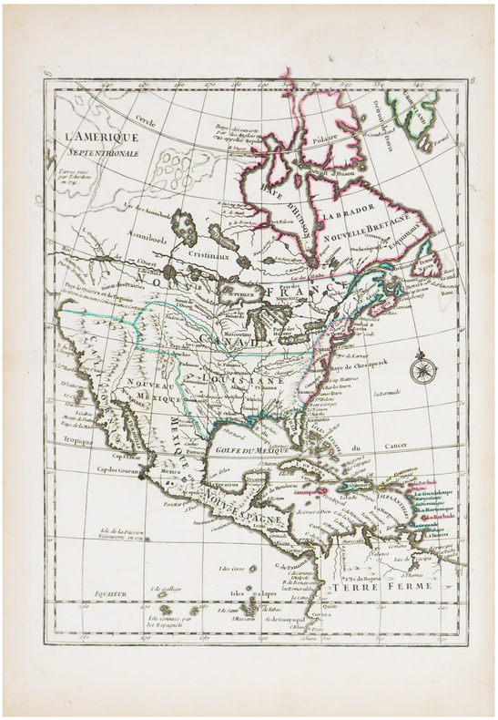
LE ROUGE (Georges-Louis).
L'Amérique septentrionale.
[1743]. 275 x 210 mm.
Referentie van de boekhandelaar : LBW-1239
|
|
|
LE ROUGE (Georges-Louis).
L'Europe suivant les nouvelles observations de Mr. de Cassini et de Mr. Hass.
Paris, Le Rouge, 1747. 503 x 652 mm.
Referentie van de boekhandelaar : LBW-4945

|
|
|
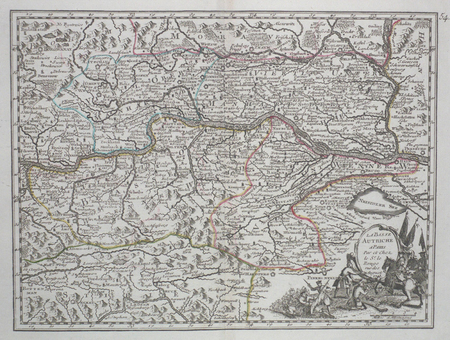
LE ROUGE (Georges-Louis);
La Basse Autriche.
1743 193 x 256 mm.
Referentie van de boekhandelaar : LBW027a8
|
|
|
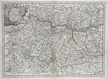
LE ROUGE (Georges-Louis);
La Haute Autriche.
1743 198 x 271 mm.
Referentie van de boekhandelaar : LBW027a9
|
|
|
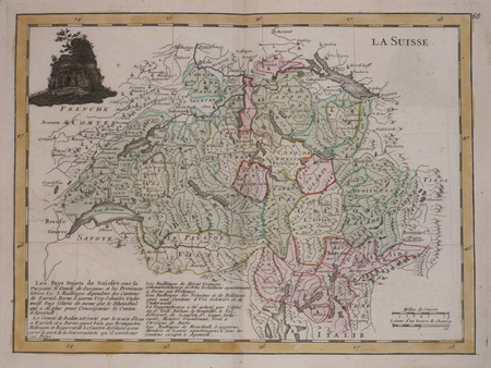
LE ROUGE (Georges-Louis);
La Suisse.
Paris Crépy 1767 202 x 273 mm.
Referentie van de boekhandelaar : LBW03d83
|
|
|
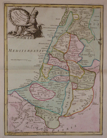
LE ROUGE (Georges-Louis);
La Palestine ou la Terre Sainte divisée en dix tribus.
Paris Crépy 1767 277 x 208 mm.
Referentie van de boekhandelaar : LBW03d86
|
|
|
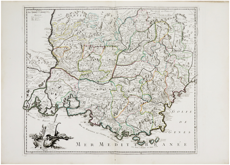
LE ROUGE (Georges-Louis).
La Provence suivant les nouvelles observations.
Paris, Sr. Le Rouge, 1747. 486 x 572 mm.
Referentie van de boekhandelaar : LBW-759
|
|
|
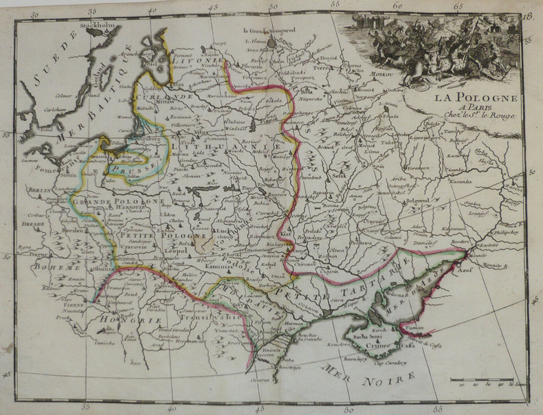
LE ROUGE (Georges-Louis);
La Pologne.
1756 213 x 286 mm.
Referentie van de boekhandelaar : LBW-1200
|
|
|
LE ROUGE (Georges-Louis).
La Moscovie.
[1756]. 275 x 210 mm.
Referentie van de boekhandelaar : LBW-1214

|
|
|
LE ROUGE, Georges Louis
La Champagne divisée par Elections suivant les dernières Observations [ Carte ]
Par et Chez le Sr. Le Rouge, Ingr. Géographe du Roy, carte au format 58 x 80, frontières rehaussées en couleur, Paris, rue des grands Augustins vis à vis le Panier Fleury, 1744
Referentie van de boekhandelaar : 26473
|
|
|
LE ROUGE (Georges-Louis);
Le Cercle d'Autriche.
1743 198 x 262 mm.
Referentie van de boekhandelaar : LBW027aa
|
|
|
LE ROUGE (Georges-Louis);
Le Tirol.
1743 211 x 276 mm.
Referentie van de boekhandelaar : LBW027ad

|
|
|
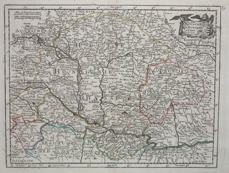
LE ROUGE (Georges-Louis);
Le royaume de Hongrie.
1743 203 x 266 mm.
Referentie van de boekhandelaar : LBW027b2
|
|
|
LE ROUGE (Georges-Louis).
Le Royaume d'Ecosse.
[1756]. 266 x 203 mm.
Referentie van de boekhandelaar : LBW-1201

|
|
|
LE DESSOUS DES CARTES
Le dessous des cartes. Coffret de 6 DVD. Géopolitique et religion - Une planète en sursis - L'Europe, une alternative? - Moyen-Orient pivot géopolitique - Etats-Unis, une géographie impériale -De l'unité de la Chine.
Couverture souple. Coffret de 6 DVD.
Referentie van de boekhandelaar : 146357
|
|
|
LE ROUGE
Le cours du Rhin de Bâle à Hert près Philisbourg contenant l'Alsace et partie du Brisgau suivant les dernières observations de Mrs de l'Accademie des Sciences…
1745 4 cartes /5 comprenant 20 sections montées sur toile et pliés (sauf la 4e qui n'en comporte que 16), 2005 x 720 mm. P. Rue des Grands Augustins 1745
Referentie van de boekhandelaar : 16333
|
|
 De zoekresultaten per email ontvangen
 Zoekresultaten downloaden als PDF
 RSS feed


