|
Cartes géographiques: Bourgogne, Picardie, Champagne-Ardenne. 5 pièces: 1) St. Quentin, Laon / 2) Cosne, Clamecy (avec quelques galeries de vers) / 3) Soissons / 4) Auxerre / 5) Sedan..
XVIIIe siècle, 60 x 92 cm (la carte), montées sur toile, conservées dans un emboitage d’époque usé.
書籍販売業者の参照番号
: 91692aaf
|
|
|
CARTOGRAFIA RARA. ANTICHE CARTE GEOGRAFICHE, TOPOGRAFICHE E STORICHE DALLA COLLEZIONE FRANCO NOVACCO.
In-4 (cm. 33), tela editoriale, sovracoperta, pp. 160, con illustrazioni in bianco e nero nel testo. In ottimo stato (nice copy).

|
|
|
Cartographie et frontières des Alpes Occidentales du II° siècle au XX° siècle.
Exposition Aoste, 1988. In-4 carré, 142 pp., broché.
書籍販売業者の参照番号
: 112219
|
|
|
Catalogo : IX esposizione internazionale d'arte della città di Venezia
In-16°, cm 16, pp. 254, con 144 tavole, brossura editoriale con fregio in oro raffigurante il leone. Timbro del Touring al piatto, brossura scollata, peraltro eccellente esemplare.

|
|
|
CATALOGUS MAPPARUM GEOGRAPHICARUM. ad historiam pertinentium quae curante collegio. historico-geographorum adiuvantibus viris congressui ordinando in polytechnico Varsoviensi exponuntur.
Warschau, 1933. 15, (1), 296 S. OBroschur (gebräunt, mehrere Bibl.-Stempel u. -Sign. innen u. außen).
書籍販売業者の参照番号
: 1320737
|
|
|
Catalouge 40: Fine Antique Maps Atlases Martayan Lan
280X210 mm. 90pp. Soft cover. Cover slightly worn at corners. Else, copy as new.
|
|
|
CHIERI.
Quadro d'unione della gran carta degli Stati Sardi in terraferma, divisa in fogli 91 alla scala di 1.50.000. Pubblicata dal Corpo Reale di Stato Maggiore. (Maggi), Torino, s.d. (1870). Carta geografica (cm. 54 x 73), montata su tela, divisa in 18 riquadri e ripiegata, raffigurante la zona del Piemonte cha va da Chieri a Poirino e da Baldichieri a Montechiaro. Costituisce il foglio LIIIEsemplare ben conservato.
書籍販売業者の参照番号
: 63964
|
|
|
CHIERI. Quadro d’unione della gran carta degli Stati Sardi in terraferma, divisa in fogli 91 alla scala di 1.50.000. Pubblicata dal Corpo Reale di Stato Maggiore.
Carta geografica (cm. 54 x 73), montata su tela, divisa in 18 riquadri e ripiegata, raffigurante la zona del Piemonte cha va da Chieri a Poirino e da Baldichieri a Montechiaro. Costituisce il foglio LIII Esemplare ben conservato.

|
|
|
Chieti
carta topografica telata cm. 55 x 45, litografia in scala 1:500.000 delle zone di Chieti, Fermo, Macerata, Avezzano Vasto. Ottimo es.
|
|
|
Chorographica descriptio.
Cartella edit. con 2 tasche contenenti un vol. in 4°, br. edit. ill., pp. 80, con num. ill. b.n. n.t., e in allegato 5 carte geografiche della Lombardia più volte rip.; ottimo es.. (x003)
|
|
|
Comune di Firenze. Atlante di Firenze. La forma del centro storico in scala 1:1000 nel fotopiano e nella carta numerica. Compagnia Generale Ripreseaeree Selca.
In 4°, carré, t.t. edit. con sovrac. ill. e cofanetto ill., pp. 383,(1), prevalentemente ill. a col. e b/n n.t.; piccolo taglio al d. della sovracc., per il resto copia molto buona. (x201)
|
|
|
Corografia dei distretti di Cividale e S. Pietro al Natisone. Disegno originale su foglio di cm. 42x52, con annotazione marginale circa la dislocazione dei ponti in pietra e in legno, dell’ing. Marzio Portis. (1869).
Normali segni di piegatura ma ottimo es. Si unisce lettera originale su carta intestata del Sindaco di Cividale, ad un anonimo corrispondente: “in relazione alla promessa fattale le unisco un lucido della corografia delli Distretti di Cividale e San Pietro: dovetti far fare il lucido perchè non ne potei trovar di litografate. In questo lucido si sono segnate anche le strade in progetto e in costruzione... Cividale, 2 / 6 / 1869.” Interessante e rara testimonianza cartografica friulana.
|
|
|
De Geographia. Aosta nella cartografia dei Secoli XVI-XVII. Exposition Aoste, 1993.
In-4 oblong, 106 pp., broché.
書籍販売業者の参照番号
: 112229
|
|
|
Der Canton Zürich nebst einem Theil der angränzenden Cantonen, eingetheilt in 11 Ober-Aemter.
Zürich, Füssli, 1816. 2 Kupferstichkarten. 44 x 70 cm. + Wichtig: Für unsere Kunden in der EU erfolgt der Versand alle 14 Tage verzollt ab Deutschland / Postbank-Konto in Deutschland vorhanden +, A|B [2 Warenabbildungen]
書籍販売業者の参照番号
: 1047CG

|
|
|
Der Karten-Freund oder Anzeige u. Beurtheilung neu erschienener Land- u. See-Karten u. Grundrisse. In zwanglosen Lieferungen hrsg. v. C.W.v. Oesfeld. Heft 1 (= 12 Nrn.) u. H. 2 (= Nr. 1-5).
Berlin, Heymann, 1840-1842. VIII, 96, 40 S. Hldr. m. Rsch. u. Rsign. Einbd. berieben. Buchbl. gebrochen. M. mehr. St. u. Sign. Gebräunt, teils braunfl. M. wenigen Anstreich.
書籍販売業者の参照番号
: 183098
|
|
|
Deutscher Planungsatlas. Bd. 7 (m. Schlüssel), 9-10.
Hannover, Jänecke-Vlg. 1965. Fol. (7) u. Quer-Fol. Zahlr. farb. Ktn. OLwd.-Schraub-Mappe. Kanten teils beschabt. M. Rsign. St. a. Tit.
書籍販売業者の参照番号
: 136631
|
|
|
Die Fixpunkte des schweizerischen Präcisionsnivellements. Hrsg. durch Eidgenössische totographische Bureau. Lieferung 3.Les repères du nivellement de précision de la Suisse. Publication du Bureau topographique fédéral. 3e Livraison.
Bern, 1895, 350x230mm, cartonnage.
書籍販売業者の参照番号
: 45428
|
|
|
Die Fixpunkte des schweizerischen Präcisionsnivellements. Hrsg. durch Eidgenössische totographische Bureau. Lieferung 9.Les repères du nivellement de précision de la Suisse. Publication du Bureau topographique fédéral. 9e Livraison. Lausanne - Villeneuve - St. Gingolph - Villeneuve-Sion - Brigue.
Bern, 1899, 350x230mm, broché.
書籍販売業者の参照番号
: 49853

|
|
|
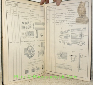
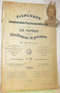
Die Fixpunkte des schweizerischen Präcisionsnivellements. Hrsg. durch Eidgenössische totographische Bureau. Lieferung 1-15.Les repères du nivellement de précision de la Suisse. Publication du Bureau topographique fédéral. Livraisons 1-15.
Bern, 1903, 350x230mm, broché. Déchirures à la couverture.
書籍販売業者の参照番号
: 49854
|
|
|
DIE KARTE ALS KUNSTWERK. Dekorative Landkarten aus Mittelalter und Neuzeit. Bayerische Staatsbibliothek - Ausstellung Sept. - Nov. 1979.
Unterschneidheim, A. Uhl, 1979. 4to. 159 S. m. meist ganzseitigen Abb. OKart. (Umschlag etwas gebräunt).
書籍販売業者の参照番号
: 1320812
|
|
|
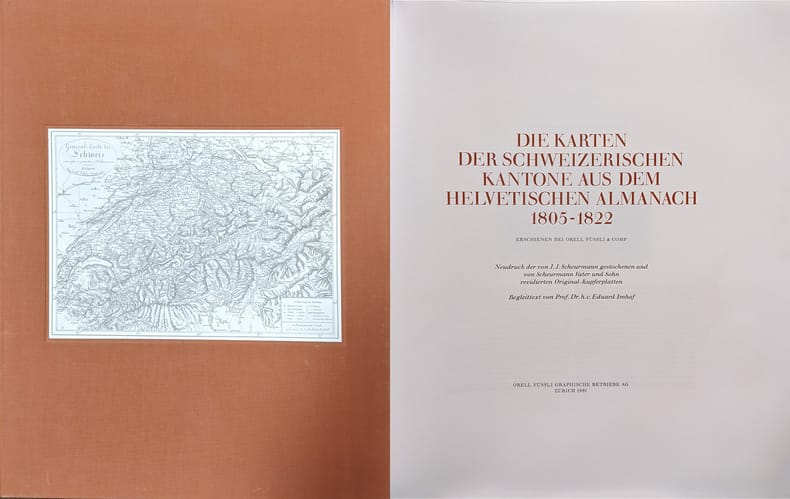
Die Karten der schweizerischen Kantone aus dem Helvetischen Almanach 1805-1822. erschienen bei Orell Füssli & Comp.
Neudruck der von J.J. Scheurmann gestochenen und von Scheurmann Vater und Sohn r Zürich, Orell Füssli Graphische Betriebe, 1981. Folio. Mit 19 Karten schwarz-weiss. In Orig.-Leinenschuber.
書籍販売業者の参照番号
: 6976CB
|
|
|
Die Karten der schweizerischen Kantone aus dem Helvetischen Almanach 1805-1822. erschienen bei Orell Füssli & Comp.
Zürich, Orell Füssli Graphische Betriebe, 1981. Folio. Mit 19 Karten schwarz-weiss. In Orig.-Leinenschuber. + Wichtig: Für unsere Kunden in der EU erfolgt der Versand alle 14 Tage verzollt ab Deutschland / Postbank-Konto in Deutschland vorhanden +, A|B [2 Warenabbildungen] Neudruck der von J.J. Scheurmann gestochenen und v
書籍販売業者の参照番号
: 6976CB

|
|
|
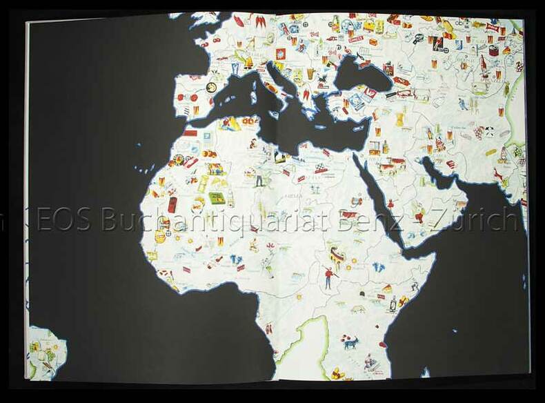
Die neue Weltordnung.
Zürich, Wolfsberg, (2006). Klein-Folio. (1) S., (2) S. Mit 9 doppelblattgr. Lithographien u. 1 Tafel (Offset). Orig.-Leinenbd.
書籍販売業者の参照番号
: 6129BB
|
|
|
Die neue Weltordnung.
Zürich, Wolfsberg, (2006). Klein-Folio. (1) S., (2) S. Mit 9 doppelblattgr. Lithographien u. 1 Tafel (Offset). Orig.-Leinenbd. + Wichtig: Für unsere Kunden in der EU erfolgt der Versand alle 14 Tage verzollt ab Deutschland / Postbank-Konto in Deutschland vorhanden +, 6129B
書籍販売業者の参照番号
: 6129BB

|
|
|
Die Radialschlitz-Triangulation, eine neue Ausführungsform der Radialtriangulation.
Berlin, 1944. 107 S. (Luftbild u. Luftbildmessung 29).
書籍販売業者の参照番号
: 247798
|
|
|
Die Schweizerische Landesvermessung. 1832-1864. (Geschichte der Dufourkarte). Herausgegeben vom Eidg. topographischen Bureau.
Bern, Stämpfli, 1896. 8°. VIII, 268 S. Mit 1 Portrait u. 9 (dv. 2 farb., doppelblattgr. u. 1 doppelblattgr.) Karten. Orig.-Leinenband.
書籍販売業者の参照番号
: 4913BB
|
|
|
Die Schweizerische Landesvermessung. 1832-1864. (Geschichte der Dufourkarte). Herausgegeben vom Eidg. topographischen Bureau.
Bern, Stämpfli, 1896. 8°. VIII, 268 S. Mit 1 Portrait u. 9 (dv. 2 farb., doppelblattgr. u. 1 doppelblattgr.) Karten. Orig.-Leinenband. + Wichtig: Für unsere Kunden in der EU erfolgt der Versand alle 14 Tage verzollt ab Deutschland / Postbank-Konto in Deutschland vorhanden +
書籍販売業者の参照番号
: 4913BB
|
|
|
Die schönste Sammlung alter deutscher Landkarten u. Städteansichten.
(Gütersloh, Bertelsmann Mohn, 1969). Quer-Fol. 40 (v. 42) Städteansichten u. 10 (teils farb.) Ktn. 24 S. in Begleitheft. In Lwd.-Mappe
書籍販売業者の参照番号
: 417050
|
|
|
Die schönste Sammlung alter europäischer Landkarten u. Städteansichten.
(Gütersloh, Bertelsmann Mohn, 1970). Quer-Fol. 39 Städteansichten u. 13 (teils farb.) Ktn. 16 S. in Begleitheft. In Lwd.-Mappe u. Schutzkarton.
書籍販売業者の参照番号
: 409718
|
|
|
Die Vereinigten Staaten von Nordamerika. (Östlicher Theil). Bearb. von C. Gräf.
Weimar, Geograph. Inst. o. J. (um 1860). Grenzkol. Stahlst., mit Erläut. u. Glossar sowie einer Nebenkarte, 62 x 55 cm. Mittelfaltung. Mittelfalz hinterlegt. Einige kleinere Randläs. Im w. Rand einige Braunfl. Eine schwache Knitterspur im Kartenbild. Rücks. etwas verstaubt u. schwach braunfl. Insges. guter Zustand. Nebenkarte: New York und seine Umgebungen.
書籍販売業者の参照番号
: KART0042

|
|
|
Dispositions générales relatives aux cartes de l' hydrographie française. Signes conventionnels et abréviations.
Couverture rigide P, Imprimerie nationale, 1949, in4° cartonnée, 49p, 29 planches hors texte à pleine page Langue: Français
書籍販売業者の参照番号
: M3507
|
|
|
Documenti geocartografici nelle biblioteche e negli archivi privati e pubblici della Toscana. Volume I°: Le piante dell'Ufficio fiumi e fossi di Pisa. A cura di D. Barsanti.
Firenze, Olschki, 1987, in-8, br. Con 15 illustrazioni nel t. e 16 tavole f.t. a colori.
|
|
|
DUE MONDI A CONFRONTO 1492-1728. CRISTOFORO COLOMBO E L'APERTURA DEGLI SPAZI.
Mostra storico-cartografica. Due volumi in 4to (24x31,5 cm) di XII-528 pp; 535-1115 pagine, 6 carte ripiegate, decine di illustrazioni a colori di documenti, carte geografiche, manoscritti, ecc. Brossura editoriale illustrata. Ottime condizioni. Direzione scientifica Guglielmo Cavallo. Mostra e studi in occasione del V centenario della scoperta dell'America. Capitoli: Il reale e l'immaginario geografico dall'antichità al medioevo. Genova, la Liguria, il Mediterraneo. La cultura di Colombo fra Mediterraneo e Atlantico. Il Nuovo Mondo. Il teatro del mondo: dall'universale al particolare. Cristoforo Colombo: dall'uomo al mito. NB- Spedizione in Paccocelere. Extra postage cost.
|
|
|
Département de l'Isère.
Carta di cm. 54 x 70. Grande carta topografica in litografia con confini colorati e belle veduta di Grenoble incisa all'angolo alto. Applicata su tela ed in ottimo stato di conservazione. Incisa da: fréres Malo su disegno di Alexis Donnet.

|
|
|
Département de l'Orne. Extrait de la carte de France levée par les officiers d'Etat Major. Publié par le Dépôt de la Guerre, à l'échelle de 1 mètre pour 80,000.
1852 1852, chez Kaeppelin, Paris. Carte topographique en 22 planches, réunies en un vol. in-folio à l'italienne, demi veau rouge, comprenant 1 tableau d'assemblage, concernant Falaise, Bernay, Coutances, Avranches, Alençon, Mayenne, Mortagne et Nogent-le-Routrou. Bel exemplaire, intérieur frais.
書籍販売業者の参照番号
: 4265
|
|
|
EISENBAHN-ATLAS IN XV KARTEN. GRATIS-ZUGABE ZU DIEZ REISERKARTE [Original ediition: not a reprint]
(Codice OS/0275) Atlas in 8° (22,5x15,5 cm): 12 double-plates, 15 litho maps mounted in a folder: Germany railway lines encompassing parts of Czeckoslovakia, Poland, Switzerland, Austria, the Netherlands, Belgium, France and Italy. Original black cloth covers, gilted title, blind stamped frame. The table of content (2 pp., some marks of use) is present; totally scraped out the final page tipped in to the inside of the back cover. A very good exemplar. ~~~ SPEDIZIONE IN ITALIA SEMPRE TRACCIATA

|
|
|
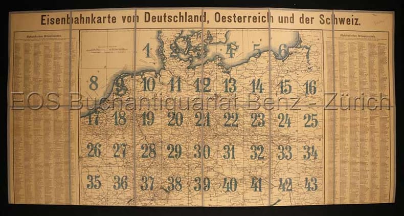
Eisenbahnkarte von Deutschland, Oesterreich und der Schweiz.
Stuttgart, Verlag W. Spemann, o.J. (um1890). 57 x 75,5 cm. Teilweise farb. Gedruckte Karte. Gefaltet und auf Leinen aufgezogen.
書籍販売業者の参照番号
: 1555DB
|
|
|
Eisenbahnkarte von Deutschland, Oesterreich und der Schweiz.
Stuttgart, Verlag W. Spemann, o.J. (um1890). 57 x 75,5 cm. Teilweise farb. Gedruckte Karte. Gefaltet und auf Leinen aufgezogen. + Wichtig: Für unsere Kunden in der EU erfolgt der Versand alle 14 Tage verzollt ab Deutschland / Postbank-Konto in Deutschland vorhanden +, Karte
書籍販売業者の参照番号
: 1555DB

|
|
|
Elite de Bons mots, Pensées choisies, Histoires singulières, & autres petites Piéces, tant en prose qu'en vers; recueillies des meilleurs Auteurs, & particulierement des Livres en ANA. Nouvelle Edition, augmentée de plusieurs Pièces nouvelles, ou qui n'ont jamais paru dans de pareils Recueils. Tome II.
Amsterdam, chez Pierre Mortier, 1745, vol. 1 (su 2), in-12, p. pelle marmorizzata coeva, dorso a 5 nervi con doppio tassello rosso, titolo e ricchi fregi oro, tagli rossi, labbri decorati in oro, sguardie marmorizzate, nastrino segnapagine, pp. (4), 513, (1). Frontespizio in rosso e nero. Fregi xilografici. Minima mancanza al piatto ant., ma ottime condizioni. (Pieter) Mortier (Leida 1661 - Amsterdam 1711) è più noto come illustratore ed incisore di vedute panoramiche a volo d'uccello.
|
|
|
Empoli, novecento anni. Nascita e formazione di un gra
La celebrazione dei novecento anni dalla stipula dell’atto con cui i conti Guidi sancirono l’incastellamento dell’antica pieve di Sant’Andrea a Empoli (1119) è stata occasione per un team di studiosi di tornare a riflettere sui primi due secoli della storia empolese. Gli approfondimenti offerti dagli autori prendono spunto dalla peculiarità di questo castello, ossia la sua posizione baricentrica r <br/> STATO: NUOVO.<br/> TITOLO: Empoli, novecento anni. Nascita e formazione di un grande castello medievale (1119-2019).<br/> CURATORE: A cura di Francesco Salvestrini.<br/> EDITORE: Olschki Ed.<br/> DATA ED.: 2020,<br/> COLLANA: Studi sulle abbazie storiche e ordini religiosi della Toscana,6.<br/> EAN: 9788822267160

|
|
|
ENCICLOPEDIA GEOGRAFICA DE AGOSTINI - Compact.
(Codice CW/2789) In 8º 1536 pp. Volume di agile consultazione da tenere a portata di mano: 24.000 voci, 530 immagini. In fine 192 pagine di atlante a colori. Cartone editoriale. Ottimo stato. ~~~ SPEDIZIONE IN ITALIA SEMPRE TRACCIATA

|
|
|
England. Unter Redact. v. H. Kiepert, gez. v. C. Gräf u. rev. 1856. Maßstab 1:1 200 000.
Weimar, Geograph. Inst. o. J. (um 1856). Stahlst. mit hs. Grenzziehung, 63 x 50 cm, mit Meilenzählung in graph. Form. Breitrand. Mittelfaltung. Im re. w. Rand kleinere Läsuren, tlw. hinterlegt und 2 Knickspuren. Mittelfalz hinterlegt, beidseitig Einrisse. Schwach angestaubt u. etwas fl. Rücks. etwas verstaubt u. gering fl. Zeigt England mit einem Teil des angrenzenden Schottland, die Insel Man, das östliche Irland und eine Nebenkarte London mit seinen nächsten Umgebungen sowie Zeichenerklärung u. Glossar.
書籍販売業者の参照番号
: KART0039

|
|
|
Etablissement des schémas des réseaux de triangulation. Die Herstellung d. Netzbuilder zur Neuausgleichung d. europäischen Hauptdreiecksnetze.
Paris; München, 1958. 4°. M. 2 beilieg. Ktn. u. einigen Anlagen. 8 S. Text. OBr. Umschl. m. St. u. etwas randverblichen. (Association internat. de Géodésie 1/1).
書籍販売業者の参照番号
: 163296
|
|
|
Europa Medii Aevi. Europa im Mittelalter.
o. O. u. J. (um 1830). Kupferst.-Karte, 23 x 23 cm. Titel in Kartenmitte oben. Mit Meilenzeiger. Größere ausgeschnitt. Stelle (ca 3 x 9,5 cm) im li. w. Rand. Einige schwache Stockfl.
書籍販売業者の参照番号
: KART0033

|
|
|
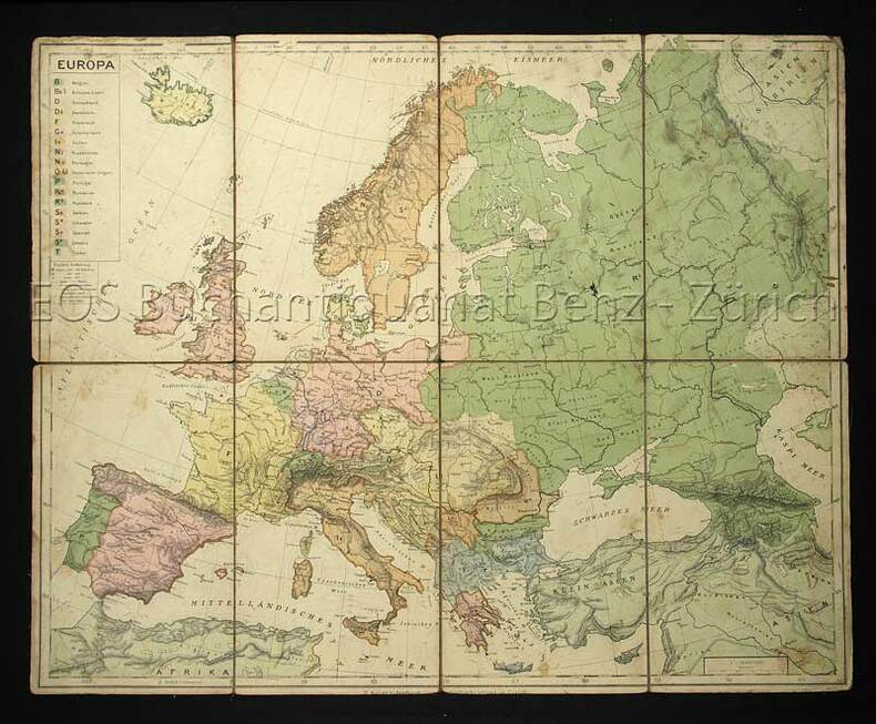
Europakarte.
Zürich, Kellers geogr. Verlag und Kartenhandlung, o.J. (um 1880). Farb. Lithographie. Blattformat: 40 x 49 cm.
書籍販売業者の参照番号
: 484DG
|
|
|
Europakarte.
Zürich, Kellers geogr. Verlag und Kartenhandlung, o.J. (um 1880). Farb. Lithographie. Blattformat: 40 x 49 cm. + Wichtig: Für unsere Kunden in der EU erfolgt der Versand alle 14 Tage verzollt ab Deutschland / Postbank-Konto in Deutschland vorhanden +, 484D
書籍販売業者の参照番号
: 484DG

|
|
|
Evolution des Versants, Carthographie géomorphologique, Dynamique fluviale. Vol. 1: Évolution des Versants (et comte rendu des excursions).
Liège, 1966. M. zahlr. Taf. u. Abb. 384 S. (Union Géogr. Intern. Sympos. intern. de géomorph.)
書籍販売業者の参照番号
: 615956
|
|
|
Excursions-Karte von Sils (Engadin) u. Umgebung. Maßstab 1:25000. Hrsg. v. Kurverein Sils-Engadin.
Berlin, Kümmerly & Frey, o.J. (ca. 1940). 1 gefahlt farb. Kte. Leicht angestaubt. M. Kl. Sign. a. Tit. u. 1 beschrieb. Rückseiten. 1 Falz angerissen.
書籍販売業者の参照番号
: 154069
|
|
|
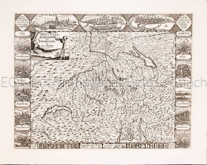
Eydtgnossschafft, oder Schweytzerlandt, mit dero Gräntzen. Nova et correcta tabula.
Langnau am Albis. Dorfpresse Gattikon, 1977. Gr.-4° und 8°. 1 Karte schwarz-weiss, 23 Seiten (Begleitheft).
書籍販売業者の参照番号
: 31031AB
|
|
|
Eydtgnossschafft, oder Schweytzerlandt, mit dero Gräntzen. Nova et correcta tabula.
Langnau am Albis., Dorfpresse Gattikon, 1977. Gr.-4° und 8°. 1 Karte schwarz-weiss, 23 Seiten (Begleitheft). + Wichtig: Für unsere Kunden in der EU erfolgt der Versand alle 14 Tage verzollt ab Deutschland / Postbank-Konto in Deutschland vorhanden +, A|B
書籍販売業者の参照番号
: 31031AB
|
|
 検索結果のメールを受信する
 PDFファイルの検索結果をダウンロード
 RSSフィード


