|
N/A.
ANNALEN VAN DE KONINKLIJKE OUDHEIDKUNDIGE KRING VAN HET LAND VAN WAAS.deel 85,
, Sint-Niklaas, 1982.**, Originele geillustreerde uitgeversomslag z/w, 17,5x27cm, 190pp, geillustreerd in kleur en z/w.
书商的参考编号 : 11058
|
|
|
N/A.
ANNALEN VAN DE KONINKLIJKE OUDHEIDKUNDIGE KRING VAN HET LAND VAN WAAS. Deel 76,
, Sint-Niklaas, 1973.**, Originele geillustreerde uitgeversomslag z/w, 17,5x27cm, 185 - 322pp, geillustreerd z/w.
书商的参考编号 : 11064
|
|
|
N/A.
ANNALEN VAN DE KONINKLIJKE OUDHEIDKUNDIGE KRING VAN HET LAND VAN WAAS.deel 88,
, Sint-Niklaas, 1985 Originele geillustreerde uitgeversomslag z/w, 16x24cm, 319pp, geillustreerd z/w.
书商的参考编号 : 11068
|
|
|
N/A.
ANNALEN VAN DE KONINKLIJKE OUDHEIDKUNDIGE KRING VAN HET LAND VAN WAAS. Deel 91,
, Sint-Niklaas, 1988.**, Originele geillustreerde uitgeversomslag z/w, 16x24cm, 349pp, geillustreerd z/w.
书商的参考编号 : 11071
|
|
|
N/A.
ANNALEN VAN DE KONINKLIJKE OUDHEIDKUNDIGE KRING VAN HET LAND VAN WAAS.deel 92,
, Sint-Niklaas, 1989.(db)**, Originele geillustreerde uitgeversomslag z/w, 16x24cm, 319pp, geillustreerd z/w.
书商的参考编号 : 11072
|
|
|
N/A.
ANNALEN VAN DE KONINKLIJKE OUDHEIDKUNDIGE KRING VAN HET LAND VAN WAAS.deel 96/1,
, Sint-Niklaas, 1993.**, Originele geillustreerde uitgeversomslag z/w, 16x24cm, 247pp, geillustreerd z/w.
书商的参考编号 : 11076
|
|
|
N/A.
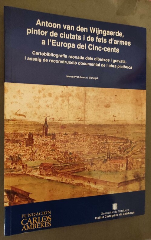
Antoon van den Wijngaerde, pintor de ciutats i de fets d'armes a l'Europa del Cinc-cents. Cartobibliografia raonada dels dibuixos i gravats, i assaig de reconstrucció documental de l'obra pictòrica.
Institut Cartografic de Catalunya/Fundacion Carlos Amberes, 1998. grand in-4°, 264 pages, nombreuses illustrations, broché.
书商的参考编号 : 81163
|
|
|
N/A.
Antoon van den Wijngaerde, pintor de ciutats i de fets d'armes a l'Europa del Cinc-cents. Cartobibliografia raonada dels dibuixos i gravats, i assaig de reconstrucció documental de l'obra pictòrica.
grand in-4°, 264 pages, nombreuses illustrations, broché. Très bel exemplaire - VG+++. [BD-E]
|
|
|
N/A.
Atlas. Geschiedenis, wetenschap en beeldende kunst.
Turnhout, Warande, 1990 Hardcover, 92pp., 24.5x34.5cm., ills. in kleur en z/w., goede staat.
书商的参考编号 : 37327
|
|
|
N/A.
Atlas. Geschiedenis, wetenschap en beeldende kunst.
Hardcover, 92pp., 24.5x34.5cm., ills. in kleur en z/w., goede staat.

|
|
|
N/A.
BIJDRAGEN TOT DE GESCHIEDENIS BIJZONDERLIJK VAN HET OUD HERTOGDOM BRABANT. Jaargang 42, 3de reeks, 11de deel: aflevering 4.
, Antwerpen, 1959., originele geillustreerde uitgeversomslag z/w, 16x24cm, 177 - 243pp.
书商的参考编号 : 6102
|
|
|
N/A.
BIJDRAGEN TOT DE GESCHIEDENIS BIJZONDERLIJK VAN HET OUD HERTOGDOM BRABANT. Jaargang 43, 3de reeks, 12de deel: aflevering 4.
, Antwerpen, 1960., Originele geillustreerde uitgeversomslag z/w, 16x24cm, 309 - 340pp.
书商的参考编号 : 6608
|
|
|
N/A.
BIJDRAGEN TOT DE GESCHIEDENIS BIJZONDERLIJK VAN HET OUD HERTOGDOM BRABANT. Jaargang 46, 3de reeks, 15de deel: aflevering 3 - 4
, Antwerpen, 1963., originele geillustreerde uitgeversomslag z/w, 16x24cm, 139 - 232pp.
书商的参考编号 : 9206
|
|
|
N/A.
BIJDRAGEN TOT DE GESCHIEDENIS BIJZONDERLIJK VAN HET OUD HERTOGDOM BRABANT. Jaargang 44, 3de reeks, 13de deel: aflevering 4
, Antwerpen, 1961., originele geillustreerde uitgeversomslag z/w, 16x24cm, 147 - 192pp.
书商的参考编号 : 9359
|
|
|
N/A.
BIJDRAGEN TOT DE GESCHIEDENIS BIJZONDERLIJK VAN HET OUD HERTOGDOM BRABANT. Jaargang 42, 3de reeks, 11de deel: aflevering 3
, Antwerpen, 1959., Originele geillustreerde uitgeversomslag z/w, 16x24cm, 113 - 176pp.
书商的参考编号 : 10917
|
|
|
N/A.
HANDELINGEN DER MAATSCHAPPIJ VOOR GESCHIEDENIS EN OUDHEIDKUNDE TE GENT.; XLIV,
, Gent, 1990 (5db)., Originele geillustreerde uitgeversomslag z/w, 16x24,5cm, 203pp.
书商的参考编号 : 2868
|
|
|
N/A.
HANDELINGEN DER MAATSCHAPPIJ VOOR GESCHIEDENIS EN OUDHEIDKUNDE TE GENT. XLIII, 1989,
, Gent, 1989 (db)., Originele geillustreerde uitgeversomslag z/w, 16x24,5cm, 271pp.
书商的参考编号 : 6446
|
|
|
N/A.
La Découverte du monde : Cartographes et Cosmographes.
grand in-8 (19 x 24 cm), 88 pages, nombreuses illustrations, broché.. Bel exemplaire. [WE-CA]
|
|
|
N/A.
Mapping Cyprus. Crusaders, Traders and Explorers. Kruisvaarders, handelaars en ontdekkinsreizigers. Croises, marchands et explorateurs.
Brussels, Silvana - Bozar Books, 2012 Paperback, 287x230mm, 240p, 120 colour illustrations, English/ French/ Dutch edition. New. ISBN 9788836623709.
书商的参考编号 : 36375
|
|
|
N/A.
Mapping Cyprus. Crusaders, Traders and Explorers. Kruisvaarders, handelaars en ontdekkinsreizigers. Croises, marchands et explorateurs.
Paperback, 287x230mm, 240p, 120 colour illustrations, English/ French/ Dutch edition. New. ISBN 9788836623709. Chypre se situe a l'extreme est de la mer Mediterranee, au carrefour de trois continents : l'Europe, l'Asie et l'Afrique. Autrefois, l'ile etait a la fois une pomme de discorde et un refuge pour l'Est byzantin, l'Occident latin et le monde arabe. Apres sa conquete par Richard Coeur de Lion, les Lusignans, les Venitiens, les Ottomans et les Britanniques se sont succede au pouvoir. Mapping Cyprus (1192-2012) se penche sur l'ile tant convoitee de Chypre a travers les yeux des artistes, ecrivains, pelerins et voyageurs europeens. Notamment la periode franque de Lusignan pendant les croisades est illustree par des personnages de legende comme la princesse Melusine. C'est l'illumination d'un episode de l'histoire de l'Europe qui frappe les imaginations et qui etait aussi determinante pour l'identite de Chypre, entree en 2004 dans l'Union europeenne et qui en assumera la Presidence en 2012. Musique, mots, multimedia et art contemporain donnent vie a une suite d'icones et autres tresors artistiques. L'exposition explore cette plaque tournante des cultures, avec tous les conflits et echanges qui la caracterisent. Le present de l'ile divisee est egalement mis sous les projecteurs. Cyprus ligt in de uiterst oostelijke uithoek van de Middellandse Zee. Drie continenten komen er samen: Europa, Azie en Afrika. Het eiland vormde een twistappel en een toevluchtsoord voor het Byzantijnse Oosten, het Latijnse Westen en de Arabische wereld. Na de verovering door Richard Leeuwenhart hadden de Lusignans, Venetianen, Ottomanen en Britten afwisselend de macht in handen. Mapping Cyprus (1192- 2012) bekijkt de begeerde bruid Cyprus door de ogen van Europese kunstenaars, schrijvers, pelgrims en reizigers. Vooral de Frankische Lusignan periode ten tijde van de kruisvaarders wordt belicht, met fabelachtige figuren als de prinses Melusine. Een illuminatie dus van een tot de verbeelding sprekend stukje Europese geschiedenis en sterk bepalend voor de identiteit van Cyprus dat in 2004 toetrad tot de Europese Unie en in 2012 het Voorzitterschap op zich neemt. Een reeks iconen en andere kunstschatten komt tot leven in samenspraak met muziek, woord, multimedia en hedendaagse kunst. De tentoonstelling dringt diep door in het knooppunt van culturen, met alle conflicten en uitwisselingen van dien. Tegelijk komt het heden van dit verdeelde eiland in het vizier. Cyprus is situated in the far eastern extremity of the Mediterranean Sea, where the three continents of Europe, Asia, and Africa are neighbours. The island has been both a bone of contention and a place of refuge for the Byzantine East, the Latin West, and the Arab world. After its conquest by Richard the Lionheart, power there was held at different times by the Lusignan dynasty, the Venetians, the Ottomans, and the British. Mapping Cyprus (1192-2012) looks at the coveted land of Cyprus through the eyes of European artists, writers, pilgrims, and travellers. Above all light is shed on the Frankish Lusignan period at the time of the crusaders and such fabled figures as Princess Melusyne.An illumination therefore of an evocative period of European history that was very determining for the identity of Cyprus that joined the European Union in 2004 and will be holding the EU presidency in 2012. A series of icons and other art treasures are brought to life in a dialogue with music, words, multimedia presentations, and contemporary art. The exhibition takes an in-depth look at this crossroads of cultures and at the conflicts and exchanges that have shaped it, while also focusing on today's divided island.

|
|
|
N/A;
ANNALEN VAN DE KONINKLIJKE OUDHEIDKUNDIGE KRING VAN HET LAND VAN WAAS. deel 95,
, Sint-Niklaas, 1992, Originele geillustreerde uitgeversomslag z/w, 16x24cm, 320pp, geillustreerd z/w.
书商的参考编号 : 11075
|
|
|
N/A;
BIJDRAGEN TOT DE GESCHIEDENIS BIJZONDERLIJK VAN HET OUD HERTOGDOM BRABANT, Reeks III Jaar III nrs 1 t:m 4 jaar 1952
Antwerpen, Bijdragen tot de geschiedenis, 1952 Originele geillustreerde uitgeversomslag, 16x24cm, 254pp.
书商的参考编号 : 46460
|
|
|
N/A;
BIJDRAGEN TOT DE GESCHIEDENIS BIJZONDERLIJK VAN HET OUD HERTOGDOM BRABANT, Reeks III Jaar V nr 1 jaar 1953
Antwerpen, Bijdragen tot de geschiedenis, 1954 Originele geillustreerde uitgeversomslag, 16x24cm, 254pp.
书商的参考编号 : 46461
|
|
|
N/A;
BIJDRAGEN TOT DE GESCHIEDENIS BIJZONDERLIJK VAN HET OUD HERTOGDOM BRABANT, Reeks III Jaar IV nr 2 jaar 1954
Antwerpen, Bijdragen tot de geschiedenis, 1954 Originele geillustreerde uitgeversomslag, 16x24cm, 254pp.
书商的参考编号 : 46462
|
|
|
N/A;
BIJDRAGEN TOT DE GESCHIEDENIS BIJZONDERLIJK VAN HET OUD HERTOGDOM BRABANT,
Antwerpen, Bijdragen tot de geschiedenis, 1957 Originele geillustreerde uitgeversomslag, 16x24cm, 254pp.
书商的参考编号 : 46465
|
|
|
N/A;
BIJDRAGEN TOT DE GESCHIEDENIS BIJZONDERLIJK VAN HET OUD HERTOGDOM BRABANT, Reeks III deel 19 aflev. 3 en 4 jaar 1967
Antwerpen, Bijdragen tot de geschiedenis, 1967 Originele geillustreerde uitgeversomslag, 16x24cm, 320pp.
书商的参考编号 : 46466
|
|
|
N/A;
BIJDRAGEN TOT DE GESCHIEDENIS BIJZONDERLIJK VAN HET OUD HERTOGDOM BRABANT, vierde jaargang Mei 1905
Antwerpen, Bijdragen tot de geschiedenis, 1905 Originele geillustreerde uitgeversomslag, 16x24cm,
书商的参考编号 : 46469
|
|
|
N/A;
BIJDRAGEN TOT DE GESCHIEDENIS BIJZONDERLIJK VAN HET OUD HERTOGDOM BRABANT,vierde jaargang April 190
Antwerpen, Bijdragen tot de geschiedenis, 1905 Originele geillustreerde uitgeversomslag, 16x24cm,
书商的参考编号 : 46470
|
|
|
Naim Samia (sous la direction de)
Yémen. D'un itinéraire à l'autre
illustrazioni

|
|
|
Naipaul V. S.
Fedeli a oltranza. Un viaggio tra i popoli convertiti all'islam

|
|
|
NANDO CECINI
LA BELLA VEDUTA
IN 4° ( cm.29 X 26 ), pp.230. COPERTINA EDITORIALE TELATA RIGIDA ROSSA CON TITOLO IN ORO + SOVRACOPERTINA ILLUSTRATA A COLORI CON TITOLO. VOLUME RICCAMENTE ILLUSTRATO in b/n/col. CON VEDUTE, PIANTE E CARTE DEL TERRITORIO CON RELATIVE SCHEDE DI PESARO, URBINO, FANO, FOSSOMBRONE, URBANIA, CAGLI, PENNABILLI, PERGOLA, S. ANGELO IN VADO, SAN LEO. TESTO SU DUE COLONNE. NELLA PARTE FINALE COSPICUA BIBLIOGRAFIA. TRA LE VEDUTE DI PESARO, SONO RIPORTATE ANCHE LE TARSIE DEL CORO DI S. AGOSTINO DATABILI AGLI ANNI 1487 - 1490.OTTIMA CONSERVAZIONE. ESAURITO. ID 5318

|
|
|
Nangeroni Giuseppe
La morfologia della Conca del Verbano in base a una nuova carta batimetrica
Opuscolo in brossura spillata con copertina editoriale a stampa in estratto dal "Bollettino della Società Geografica Italiana" (27I).
|
|
|
NANGERONI GIUSEPPE
LE CARTE GEOGRAFICHE
PP. 36 + CARTA 1:100000 DI COMO IST.GEOGRAFICO MILITARE AGGIORNATA AL 1952, CM. 24X17, CART.LEGGERA.<BR>SERIE "LA RICERCA" ENCICLOPEDIA MONOGRAFICA LOESCHER A35, SERIE GEOGRAFICA, CLASSE A.
|
|
|
Nanni Francesco
Il forestiere in Ravenna
8°, mm 210x135, pp. XVIII, 132, brossura editoriale azzurra con difetti e mancanze, dorso praticamente assente, fogli in barbe e ben conservati. Esemplare discreto ma completo delel 5 tavole fuori testo di cui due ripiegate tra le quali la pianta della città di Ravenna. ID 6500

|
|
|
Nanni Ugo
Che cosa è l'Etiopia
1 carta, 8 tavole

|
|
|
Nanni, Romano - Taddei, Monica (a Cura di)
Amerigo Vespucci e La Scoperta Dell'America Negli Studi Di Gustavo Uzielli
Mm 230x280 Mostra biblio-cartografica. Catalogo della mostra del Museo Leonardiano, Palazzo Uzielli, Vinci, 18 ottobre -30 novembre 2003. Brossura editoriale con bandelle, 108 pagine, ricco apparato iconografico a colori. Libro in condizioni di nuovo. SPEDIZIONE IN 24 ORE DALLA CONFERMA DELL'ORDINE.

|
|
|
Natali Carlo
Territori di carta. Dalla lettura delle carte al riconoscimento dei luoghi. Ediz. italiana e inglese
br. La cartografia descrive i luoghi attraverso una rappresentazione simbolica che ne comunica forme, dimensioni, caratteri. Dalla corretta e approfondita decodifica dei simboli e delle loro relazioni l'utente è in grado di entrare nell'identità dei luoghi. Questo manuale offre un metodo razionale e consequenziale di lettura della carta per consentire all'utente di trarvi tutte le informazioni necessarie per capire e immaginarsi i luoghi rappresentati, per poi utilizzarle ai propri fini. Il libro è rivolto in primis agli studenti e ai tecnici delle varie discipline territoriali, ma anche a tutti coloro che hanno interesse e curiosità di approfondire la conoscenza dei luoghi per percorrerli consapevolmente.

|
|
|
Natalini,Adolfo.
Temporanea occupazione.
<br/> STATO: NUOVO.<br/> TITOLO: Temporanea occupazione. <br/> AUTORE: Natalini,Adolfo.<br/> CURATORE: Traduz.di A.T.Rocchiccioli.<br/> EDITORE: Alinea Editrice<br/> DATA ED.: 2000,<br/> EAN: 9788881254033

|
|
|
National Geographic Society
Historical Atlas of the United States Revised Edition
Washington D. C.: National Geographic Society 1993. NOT a library discard. 1993 revised edition. Fine condition but for slight rubbing to the paste-down map on the front cover. SEE PHOTO. Strong binding. Hinges are PERFECT. Bright clean square and tight. Sharp corners. NO owner's name or bookplate. Internally fresh and crisp -- apparently seldom if ever read. Lavisly illustrated with hundreds of photographs prints and drawings -- most in beautiful full color. Map endpapers. Contains some 140000 words of text 380 maps and 80 graphs. Includes a 4000 item index. Bound in the original blue cloth stamped in bright gold. Oversize Hardcover. 12.25" wide by 18.5" tall. This huge very heavy book will require extra postage for Priority and International shipments but only the standard charge for media mail. 1993 revised edition. Oversize Hardcover. Near Fine condition/No dust jacket as issued. Illus. by NOT a library discard. 289pp. Great Packaging Fast Shipping. National Geographic Society Hardcover
书商的参考编号 : 020410 ???????? : 0870449702 9780870449703

|
|
|
NATIONAL MARITIME MUSEUM.
Catalogue of the Library.
First Edition, 5 vols., in 7 [all published], 4to, ex-library, orig. cloth, d.w's. Vol. 1. Voyages and Travel. 1968. Illustrs., 2 maps, 428pp. Vol. 2. Biography. 2 Parts, 1971. Illustrs., 1196pp. Vol. 3. Atlases & Cartography. 2 Parts, 1971. Illustrs., 1166pp. Vol. 4. Piracy & Privateering. 1972. Illustrs., 175pp. Vol. 5. Naval History. Part 1: [All Published] The Middle Ages to 1815. 1976. 12 plates, 209pp.
|
|
|
Nave / Imhof
Gerard Mercator en de geografie in de Zuidelijke Nederlanden (16de eeuw). G rard Mercator et la g ographie dans les Pays-Bas m ridionaux
, Antwerpen, Museum Plantin Moretus/ Stedelijk Prentenkabinet, 1994, softcover geillustreerde kartonomslag, 205 x 295mm., 175pp., zeer mooie illustratie in kleur en z/w. Text in FR/NL
书商的参考编号 : 18745
|
|
|
Nave / Imhof
Gerard Mercator en de geografie in de Zuidelijke Nederlanden (16de eeuw). Gérard Mercator et la géographie dans les Pays-Bas méridionaux
softcover geillustreerde kartonomslag, 205 x 295mm., 175pp., zeer mooie illustratie in kleur en z/w. Text in FR/NL Publikaties van het Museum Plantin-Moretus en het Stedelijk Prentenkabinet nr. 29. Tweetalige uitgave. Verscheen naar aanleiding van de gelijknamige tentoonstelling die liep van 30 april tot 24 juli 1994. Boek is in goede staat. // Publications du Musée Plantin-Moretus et du Stedelijk Prentenkabinet n° 29. Édition bilingue. Publié à l'occasion de l'exposition du même nom qui s'est déroulée du 30 avril au 24 juillet 1994. Ouvrage en bon état

|
|
|
Naymiller Filippo; Allodi Pietro
Atlante di geografia universale cronologico, storico, statistico e letterario disegnato ed inciso da Filippo Naymiller e Pietro Allodi ed illustrato da Ratti, Vajani, Basile, Baldi, Focosi, Barbieri e Fiorentini
In-folio oblungo(51 cm) (2) 81 c. (tavole). Mezza tela con piatti rivestiti di carta marmorizzata. Piatti staccati. Esemplare da restaurare.

|
|
|
Nebenzahl Kenneth
Maps from the Age of Discovery : Columbus to Mercator
London: Times Books 1990. 168pp. 50 plates each with a text description. D.j. a little torn to the edges on the rear cover. Pictorial wrapper. A nice copy. 37.5 x 29 cms. 1st ediiton. hard back. Fine/V G rubbed. folio. Times Books hardcover
书商的参考编号 : S266 ???????? : 0723003580 9780723003588
|
|
|
Nebenzahl Kenneth
Maps of the Holy Land Images of Terra Sancta through Two Millennia 1986 first edition
New York: Abbeville Press 1986. A gorgeous pristine copy in perfect condition. Brand New in a Brand New dust jacket. NO chips. NO tears. NO creases. NO rubbing. NO fading. Bright shiny clean square and tight. Sharp corners. NO owner's name or bookplate. NO remainder mark. Fresh and crisp. Obviously never read. 1986. First Edition. Featured here are 60 Holy Land maps some foldout and most in striking full color. Nebenzahl's informative commentary provides historical context and cartographical details for 60 maps from 150 AD through 1818. Bound in the original black cloth stamped in shiny gold. Complete with dust jacket. Oversize Hardcover. 12" wide by 15.25" tall. This large heavy book will require extra postage for Priority and International shipments but only the standard charge for media mail. First Edition. Oversize Hardcover. New/New. 164pp. Great Packaging Fast Shipping. Abbeville Press Hardcover
书商的参考编号 : 017442 ???????? : 0896596583 9780896596580
|
|
|
Nebenzahl Kenneth
MAPS OF THE HOLY LAND
New York: Abbeville Press Inc. 1995. 164pp. . Maps in colour & b/w. 4 fold-out map illustrations. A fine clean copy. Uncommon in the UK. 1st edition. hard back. Fine/Fine. Folio. Abbeville Press Inc. hardcover
书商的参考编号 : S245 ???????? : 0896596583 9780896596580
|
|
|
NEBENZAHL Kenneth -
Maps from the Age of Discovery. Columbus to Mercator.
London, Times Books, 1990, 4to (cm. 37,2 x 28,7) legatura tutta tela con sovraccopertina illustrata a colori, pp. VIII-168 con illustrazioni in nero e a colori e 50 carte a colori (molte a pagina doppia) nel testo.

|
|
|
Nebenzahl, Kenneth
Maps of the Bible Lands: Images of Terra Sancta through Two Millennia.
300x385 mm. Gilt hardcover with dust-jacket. In good condition. PLEASE NOTE: This item is overweight. We may ask for extra shipping costs.
|
|
|
Nebenzahl, Kenneth
Maps of the Holy Land: Images of Terra Sancta through Two Millennia.
39x31cm. 164 pages. Gilt hardcover with dust jacket.In good condition. PLEASE NOTE: This item is overweight. We may ask for extra shipping costs.
|
|
|
Nebenzahl, Kenneth
Maps of the Holy Land: Images of Terra Sancta through Two Millennia
39x31cm. 164 pages. Gilt hardcover in dust jacket. In good condition. PLEASE NOTE: This item is overweight. We may ask for extra shipping costs.
|
|
 ?????????
 ?????PDF???
 RSS feed


