|
Skelton, R.A. and Melvin H. Jackson
The European Image and Mapping of America, A.D. 1000-1600 [with] Salt, Sugar, and Slaves: The Dutch in the Caribbean (The James Ford Bell Lectures, numbers 1 and 2)
The first two lectures in this important series. 8vo. Original wraps. FINE AND BRIGHT.
|
|
|
Skrivanic,Gavro A.
Monumenta cartographica Jugoslaviae II
NOTE : Volume TWO ONLY 101p. maps index Book
|
|
|
SLOT B. J.
Les origines du Koweit.
Koweït: Centre de recherches et d'études koweitiennes, 2005 in-4, 193 pages, 82 planches en couleurs. Bibliographie. Reliure d'éd., jaquette, très bon état. Histoire de la cartographie du Koweith.
书商的参考编号 : 1107309
|
|
|
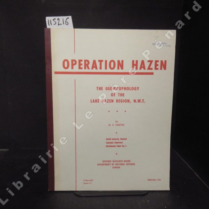
SMITH, David Ingle
Operation Hazen. The geomorphology of the Lake Hazen region, N.W.T.
1961 McGill University, Montreal, Geography Department, Miscellaneaous Papers No. 2 / Defence Research Board, Department of National Defence, Canada - February 1961 - In-4, broché, ouvrage ronéotypé - Ex-libris Paul-Emile Victor - 100 p. - Ouvrage en anglais
书商的参考编号 : 115216
|
|
|
Smith C.
MAP OF YORKSIRE East Riding Hull and Humberside
London: C. Smith 1823. Original hand-coloured map dated 1823 58x50 cms. Double-page folding plate printed on fine paper and original hand-colour. With a numbered list of the Wapontakes including 8 examples found on this plate. A lovely example of the 3rd 1823 issue of the Jan 6th 1804 map by C. Smith of 172 The Strand London. Smith's County Altas being a complete set of County Maps divided into Hundreds. Wide margins no wear and very clean example with no marks or wear to the centre-fold. Corrected 3rd Edition. Fine. Folding map. C. Smith unknown
书商的参考编号 : Map921
|
|
|
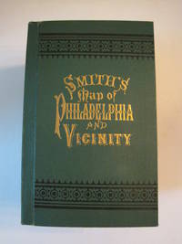
Smith J. L
New Map of Philadelphia and Vicinity Published by J. L. Smith 27 South Sixth St. Philadelphia 1894 : Cover title: Smith's Map of Philadelphia and Vicinity
Philadelphia: J. L. Smith 1894. Fine condition. SEE PHOTOS. A very attractive well preserved copy of this detailed two-part map of Philadelphia and vicinity published in 1894 copyright 1893. Tough-to-find in collectible condition as nice as this. A bright clean copy. NO chips. NO tears. NO creases. NO owner's name or bookplate. Clean and unmarked. Drawn on a scale of 1 inch to the mile. The map consists of two parts. The eastern half unfolds to 23" wide by 27" tall. The western part is 21.5" wide by 27" tall. Both are skillfully and attractively hand colored. The maps are backed in linen as issued. They are housed in the publisher's original green cloth portfolio which is printed in black and embossed in gold on the front cover and in blind on the rear. Gilt lettering is still as bright and shiny as new. 1st ed No additional printings listed. Hardcover. Fine condition. J. L. Smith Hardcover
书商的参考编号 : 016609
|
|
|
Smith William/ Overton Henry
A NEW MAP OF THE COUNTY OF NORFOLK 1713
London: Henry Overton 1713. 1603-1713 The rare re-issue with amendments by Henry Overton of Smiths original plate of 1603. Based on the map by Saxton in 1573. Un-coloured example in fine condition of the copperplate engraving. Paper size 55 x 46 cms. Plate size 48 x 33 cms. No splits or holes. Plain verso and part of the original hinge still present. Table with a list of the hundreds. One of the original 'anonymous' maps that were identified as being by Smith in recent times.PLEASE EAMIL FOR PHOTOS. original edition. Fine. Folio. Henry Overton unknown
书商的参考编号 : Map868
|
|
|
SMITH & Son.
Extendes tape indicator map of London and visitors guide.
Cartella in tela di cm. 17 X 11 contenente una grande pianta a colori (telata) di Londra più volte ripiegata di cm. 90 X 30 con divisioni in quartieri, misure delle distanze, linee tranviarie, ecc. oltre ad un indice dei nomi di 70 pagine. Ben conservata la cartella in tela rossa con titolo in oro e impressioni a secco al piatto.
|
|
|
Smith, Clofford T
Geografia storica d'Europa. Dalla preistoria al XIX secolo
8°, 21 cm, pp. XI, 742, alcune figure nel testo, 42 tavole fuori testo, brossura editoriale illustrata, titolo al piatto e dorso, Collana: Biblioteca universale Laterza, esemplare ottimo

|
|
|
Smith, George Adam
The Historical Geography of the Holy Land: Especially in Relation to the History of Israel and of the Early Church - With Six Maps - Twenty-Third Edition
Includes six folded maps. 15x23 cm. 713 pages. Hardcover. Spine slightly faded. Chafe on inner cover. Ex-libris sticker on first white page. Pen writing on title page. Several pages slightly stained in edges. Else in good condition. PLEASE NOTE: This item is overweight. We may ask for extra shipping costs.
|
|
|
Snead, R.E
Atlas of world physical features.
New York u.a. Wiley & Sons, (1972). 4°. M. zahlr. Ktn. 158 S. OLwd. Kleberest v. Rsign. St. a. Tit.
书商的参考编号 : 134413
|
|
|
Snyder George S.
OUDE HEMELKAARTEN. Hoogtepunten uit tien eeuwen cartografie.
Ril. in tela con sovr.a col., cm 39x31, pp 144, molte splendide tavv. e ill. a col.. - ISBN: 9023005635

|
|
|
Snyder, George Sergeant
Maps of the heavens.
London, Andre Deutsch Limited, 1984. Groß-4°. 39 cm. 144 Seiten. Original-Leinenband mit Original-Schutzumschlag.
书商的参考编号 : 50105BB ???????? : 23397721

|
|
|
SOCIETE D'HISTOIRE MODERNE ET CONTEMPORAINE
Revue d'histoire moderne et contemporaine - tome 54 -n°4, octobre-décembre 2007.
Paris, Belin, 2007 1 volume 16 x 24cm Broché 191p. Très bon état.
书商的参考编号 : 13762
|
|
|
SOCIETE D'HISTOIRE MODERNE ET CONTEMPORAINE
Revue d'histoire moderne et contemporaine - tome 54 -n°4, octobre-décembre 2007.
Au sommaire, "Ecole et société en France": article de Jean-Michel CHAPOULIE sur l'école sous la IVè République; "Politiques et pratiques coloniales (XVIIIe-XXe siècles)": articles de Laurent DUBOIS et de Bernard CAMIER sur le théâttre des Lumières à Saint-Domingue, de Hélène BLAIS sur la cartographie en Algérie dans les années 1830-1840, de Romain BERTRAND sur la politique coloniale des Pays-Bas en 1880-1930, d'Eric JENNINGS sur l'émigration depuis Saint-Pierre et Miquelon en 1903-1939; comptes rendus d'ouvrages. Français
|
|
|
Societe de Cartographie du Maroc
Rabat Plan_Guide
ont> Societe de Cartographie du Maroc : Rabat 1967 Book. Very Good. Hardcover. An unusual and very scarce French language guide to Rabat. This very scarce very unique guide to the Moroccan capital of Rabat contains a large folding map along with details and addresses of a variety of amenities and services including Ambassades Cultes and Service Public. Rabat was made the French administrative centre in 1912 becoming the capital city when Morocco achieved independence in 1955. Undated date estimated using a listing of Rabat's population. In French language. With large coloured map of the city. An interesting guide for tourists this work details a street-level view of the historic city of Rabat. Condition: In the original paper and staple binding. Externally well worn with handling marks to the board creasing from use to the joints and shelfwear to the head and tail of the spine and extremities. Internally generally firmly bound with rear hinge a little strained. Pages are generally bright and clean with some age-toning and handling marks. The map is generally bright and clean with some minor handling marks. Overall Condition: Very Good. ont> Societe de Cartographie du Maroc : Rabat hardcover
书商的参考编号 : 062975
|
|
|
Soffer, Arnon ; Kipnis, Baruch [Eds.]
Atlas of Haifa and Mount Carmel.
370x310 mm. 122 pages. Hardcover with dust-jacket. Jacket edges torn and worn. Spine edges slightly rubbed. Pages slightly yellowing. Else in good condition.
|
|
|
Soldi Fiorino
Undicesima ora. La missione di Bartolomeo da Cremona al gran khan di Karakorum nel 1254 [MONGOLIA]

|
|
|
Soley, Ramon
ATLES DE BARCELONA. ICONOGRAFIA DE LA CIUTAT DE BARCELONA. VISTES I PLANOLS IMPRESOS DE 1572 A 1900 (Barcelona atlas / catalogue raisonnÈ of maps, 2 volumes, complete)
Two volumes, complete. The monumental catalogue raisonnÈ of maps and views of Barcelona printed from 1572 to 1900. LXXII, 1093 pp. with 740 large high-quality color plates. Text in Spanish, Catalan, and English. Edition limited to 1000 sets. Large oblong folio (31 x 44 cm). Publisher's cloth, with a design by Antoni T‡pies. FINE AND BRIGHT, WITH NO DEFECTS. As new.
|
|
|
Soprintendenza generale agli interventi post – sismici in Campania e Basilicata ( a cura della )
Atlante di Napoli. La forma del centro storico in scala 1 : 2000 nell'ortofotopiano e nella carta numerica.
In – 4to ( misure 30x30 ), copertina rigida con sovraccoperta illustrata, cofanetto in tela rigido con illustrazioni applicate ai piatti, pp. 83 + 196 tavole a colori fuori testo. Prima edizione. Con 98 tavole fotografiche della città ripresa dall'alto e 98 tavole con le relative trasposizioni cartografiche fuori testo, numerose riproduzioni di antiche stampe, dipinti e piantine varie nel testo. Scritti di Stefano De Caro, Mario De Cunzo, Nicola Spinosa, Anna Maria Campofredano, Licinio Ferretti e altri. Esemplare come nuovo, niente strappi, macchie, mancanze, sottolineature o altro difetto degno di nota.
|
|
|
Sotheby's
Important American Voyages and Explorations Property from a Private Collection - Auction: Thursday October 31 1985 at 2 p.m. with prices realized
New York: Sotheby's 1985. Fine condition. NOT a library discard. NO owner's name or bookplate. NO underlining. NO highlighting. NO margin notes. Sotheby's Sale # 5418. Oct 31 1985. 43pp. Illustrated on nearly every page. 43 lots with prices realized laid-in. Comprehensive descriptions of works by Theodore De Bry Hernando Cortes Louis Hennepin Pedro De Medina Gerard Mercator Claudius Ptolemaeus John Smith Amerigo Vespucci etc. Bound in the original gilt-stamped red cloth with a pictorial John Smith paper label on the front. A yellow silk ribbon page marker is bound in. 8.5" wide by 10.75" tall. First Edition. Hardcover. Fine condition/No jacket as issued. Unpaged but 43 pages. Great Packaging Fast Shipping. Sotheby's Hardcover
书商的参考编号 : 018114
|
|
|
Sotheby's.
THE WARDINGTON LIBRARY: IMPORTANT ATLASES & GEOGRAPHIES. Part One: A-K. Part Two: L-Z. London 10-18 October 2005
(Codice BB/0761) Due volumi in 4º (28 cm) 348+372 pp. Catalogo d'asta, 562 splendidi pezzi descritti e illustrati con molte foto a colori. Prezzi di stima in sterline ed euro. Rilegati in tela rossa editoriale e titolo oro. Freschissimi. ~~~ SPEDIZIONE IN ITALIA SEMPRE TRACCIATA

|
|
|
SOUS LA DIRECTION DE MARCEL MONMARCHE
Les guides bleus Pyrénées (41 cartes, 28 plans et 12 panoramas).
Hachette, 473 pages, in12, etat moyen (couverture tachée).
书商的参考编号 : 5296
|
|
|
Spada Alessandra
Che cos'è una carta geografica
br. Le carte geografiche, uno strumento antico diventato oggi prodotto di sofisticate tecnologie, raccontano del nostro modo di vedere La terra su cui abitiamo. Ma quanto sono cambiate? Possiamo ancora chiamarle "carte"? A che cosa servono? Ogni mappa si manifesta come la rappresentazione di una parte di territorio, ma può svelare a chi la osserva qualche cosa di più: il rapporto di potere tra chi la commissiona, chi la disegna, chi dovrà usarla. Obiettivo di questo volume è costruire un ponte tra riflessione scientifica e uso pratico, ma anche offrire, a chi ancora lavora al disegno di nuove immagini geografiche, suggestioni di mappe antiche e contemporanee.

|
|
|
SPADA Valerio (Colle di Val d'Elsa 1613-1688)
Pianta della Candia dell'anno 1668
Veduta obliqua della città veneziana e della fortezza di Candia, che mostra lo stato dei lavori di assedio, con alcune linee di trincea e linci nel 1668 durante la fase finale della guerra e il penultimo anno del lungo assedio ottomano, iniziato nel 1648 e proseguito fino alla capitolazione della città il 27 settembre 1669. Orientata da sud verso l'alto (i punti cardinali non sono corretti; essi mostrano il nord che punta a sinistra, mentre l'est, che dovrebbe quindi puntare verso l'alto, è contrassegnato con la "P" per Ponente, in modo che ovest e est siano invertiti). L'opera appartiene al cospicuo numero di cosidette "carte d'occasione" - stampe che servivano per documentare e diffondere notizie, specialmente di avvenimenti bellici - che illustrano la quinta guerra ottomano-veneziana o guerra cretese (1645-69).La tavola è incisa da Valerio Spada ma il probabile ideatore è tale Vincenzo Vangelisti, il cui nome appare in alto, nella dedica ad Antonio Maria Vincenti, ambasciatore della Repubblica di Venezia a Firenze.Non abbiamo trovato nessuna notizia su Vangelisti, ne su questa rarissima opera di Valerio Spada, che non appare nemmeno sulla monografia di Massar.Acquaforte, con ampi margini, tracce di piega centrale visibili al verso, per il resto in ottimo stato di conservazione. A high oblique view of the Venetian town and fortress of Candia, showing state of the siege works, with some of the trenches and saps in 1668 during the final phase of the war and the penultimate year of the long Ottoman siege, begun in 1648 and continuing until the city capitulated on 27 September 1669. Oriented with south to top (cardinal points are incorrect; they show north pointing to the left while the east, which should therefore be pointing to the top, is labelled 'P' for Ponente, so that west and east are reversed). The work belongs to the large number of so-called "separately published prints" - prints that were used to document and disseminate news, especially of war events - that illustrate the fifth Ottoman-Venetian or Cretan war (1645-69).The plate is engraved by Valerio Spada but the likely creator is Vincenzo Vangelisti, whose name appears at the top, in the dedication to Antonio Maria Vincenti, ambassador of the Republic of Venice in Florence.We have found no news about Vangelisti, nor about this very rare work by Valerio Spada, which does not even appear in Massar's literature.Etching, with wide margins, traces of central fold visible on the verso, otherwise in excellent condition. cfr. Phyllis Deaborn Massar, The Prints of Valerio Spada, in “Print Quarterly” Vol. III, Num. 3 (1986) pp. 217-238 e Vol. IV, Num. 1 (1987), pp. 19-39.

|
|
|
SPADA Valerio (Colle di Val d'Elsa 1613-1688)
Veduta della città di Firenze dal muricciolo del prato de’ padri di San Francesco al monte
Acquaforte, metà del XVII secolo, firmata in lastra in alto nel cartiglio. Magnifica prova, impressa su carta vergata coeva (due fogli reali uniti), lievi pieghe di carta, rifilata al rame o con sottile margine, restauro perfettamente eseguito nella parte inferiore, per il resto in ottimo stato di conservazione. Valerio Spada fu allievo, a Firenze, di Lorenzo Lippi; divenne un fine incisore e calligrafo, tanto da meritarsi la stima di Cosimo III de Medici. Questa ambiziosa rappresentazione di Firenze descrive l’intera città, dal Belvedere alla Zecca, includendo le colline e la città di Fiesole. Inoltre, il panorama è notevole per i suoi dettagli bucolici raffigurati nel primo piano, che comprendono figure, vigneti e oliveti. L’opera è dedicata a S.A.R, il Principe Leopoldo; la dedica è contenuta nel grande cartiglio in alto, che include il titolo, costituito dallo stemma dei Medici, sostenuto da due angeli. Ottimo esemplare. Etching, half of the XVII century, signed on upper plate, in the cartouche. Magnificent work, printed on contemporary laid paper (two royal sheets joined together), light paper fold, trimmed to platemark or with thin margins, a perfectly executed repair on lower part, otherwise in excellent condition. Valerio Spada was pupil of Lorenzo Lippi, in Florence, thus becoming a fine engraver and calligrapher, a thing which gained him the appreciation of Cosimo III de Medici. This ambitious representation of Florence describes the whole city, from the Belvedere to the Zecca, including the hills and the city of Fiesole. The panorama is noteworthy due to its bucolic details in the foreground, including figures, vineyards and olive grove. The work is dedicated to H.R.H Prince Leopoldo; the dedication is enclosed in the cartouche on upper part, together with the title, formed with the dei Medici coat of arms held by two angels. Excellent example. Mori-Boffitto 62; Phyllis Deaborn Massar, The Prints of Valerio Spada, in “Print Quarterly” Vol. III, Num. 3 (1986) pp. 217-238 e Vol. IV, Num. 1 (1987), pp. 19-39.

|
|
|
SPAGNA E PORTOGALLO ..
Carta incisa in rame e acquarellata a mano.
Carta di cm 36 x 48 alla battuta, più i margini, su tav. piegata a metà. Ampio testo storico-descrittivo incorniciato a destra e a sinistra. Tratta da 'Atlante storico, geografico, genealogico, cronologico e letterario di M. A. Le Sage in ogni sua parte corretto, ampliato e proseguito sino all'anno corrente. Prima Veneta Edizione'.
|
|
|
Spagnol Mario - Dossena Giampaolo (a cura di)
Avventure e viaggi di mare. Giornali di bordo, relazioni, memorie
illustrazioni

|
|
|
Spallanzani Lazzaro
Viaggi nell'Appennino modenese e reggiano
10 tavole fuori testo

|
|
|
SPAVEN David
Mapping the Railways. FINE COPY IN UNCLIPPED DUSTWRAPPER
Roy., 8vo., First Edition, with coloured photographs and maps throughout, and coloured endpaper maps; laminated pictorial boards, a fine copy in unclipped dustwrapper.
|
|
|
Speed John
GLOUCESTERSHIRE Original Map
London: John Sudbury and George Humble 1646. 1611-1646. An original map of the county of Glocestershire. Nice old hand-colouring a dark impression. One or two tiny holes near the centre-fold repaired. 39.5 x 52cms. 15.5 x 20.5 inches. The margins are all about 1cm outside the plate. ENGLISH TEXT to the reverse. The imprint is John Sudbury and George Humble. Floral initial letter to reverse in the style of John Legett. PLEASE EMAIL FOR PHOTOS. V.g. Folio. John Sudbury and George Humble unknown
书商的参考编号 : Map735
|
|
|
Speed John
Original Map of THE NORTH AND EAST RIDINS OF YORKSHIRE
London: John Sudbury and George Humble 1646. 1611-1646 . An original map of North and East Riding of Yorkshire Nice old hand-colouring a dark impression. One or two tiny holes. 40 x 52cms. 15.75 x 20.5 inches. The margins are all about 1cm outside the plate. ENGLISH TEXT to the reverse. The intiial letter on the reverse is an un-bordered floral pattern with the letter 'T' enclosed within a plain square 1x1cm. The imprint is John Sudbury and George Humbell. PLEASE EMAIL FOR PHOTOS. V.g. Folio. John Sudbury and George Humble unknown
书商的参考编号 : Map734
|
|
|
Speed John
THE KINGDOME OF SCOTLAND
London: John Sudbury and George Humble 1610. 44x52 cms. 38.5x51 cms The rare first edition of Speed's Kingdome of Scotand map with original outline colouring and printed on thick paper. Portraits of the Scottish Royal family border the side margins and the imprint reads' Performed by John Speed and are to be sold in 'Popeshead alley by John Sudbury and George Humble Cum Privilego 1610'. In the upper right corner is the inset ' The Yles of Orkney'. The map reverse has the text description in English. The map is complete to the margins but has been rather crudely repaired to the rear in past times and is generally a trifle grubby. Edges and centrefold repaired from the back.The top and bottom margins are wide but the side margin are close to the plate mark.The impression however being the first edition is very good with dark and clean lines throughout. The faded colouring is original with very understated with subtle lines and wash to the portraits and sea creatures. The Inital letter to the text is the first issue and by William Hall 1611-12. PLEASE EMAIL FOR PHOTOGRAPHS. 1st Edition. V.g. Folio. Copperplate engraved map. John Sudbury and George Humble unknown
书商的参考编号 : Map903
|
|
|
Speed John
THE KINGDOM OF IRELAND
John Sudbury and George Humble 1970's FACIMILE REPRINT of 1610 ed. full printed colour 520 x 390 fine We have acquired the end run of this facimile edition printed on attractive thick good quality buff coloured paper. facimile reprint. Fine. Folio. John Sudbury and George Humble, 1970's, unknown
书商的参考编号 : Map733
|
|
|
Speed John
THE KINGDOM OF SCOTLAND
John Sudbury and George Humble 1970's FACIMILE REPRINT of 1610 ed. full printed colour 520 x 390 fine We have acquired the end run of this facimile edition printed on attractive thick good quality buff coloured paper. facimile reprint. Fine. Folio. John Sudbury and George Humble, 1970's, unknown
书商的参考编号 : A365
|
|
|
Speed John
THE KINGDOM OF ENGLAND
John Sudbury and George Humble 1970's FACIMILE REPRINT of 1610 ed. full printed colour 520 x 390 fine We have acquired the end run of this facimile edition printed on attractive thick good quality buff coloured paper. facimile reprint. Fine. Folio. John Sudbury and George Humble, 1970's, unknown
书商的参考编号 : A363
|
|
|
Speed John
THE KINGDOM OF IRELAND
John Sudbury and George Humble 1970's FACIMILE REPRINT of 1610 ed. full printed colour 520 x 390 fine We have acquired the end run of this facimile edition printed on attractive thick good quality buff coloured paper. facimile reprint. Fine. Folio. John Sudbury and George Humble, 1970's, unknown
书商的参考编号 : A362
|
|
|
Speed John
WALES
John Sudbury and George Humble 1970's FACIMILE REPRINT of 1610 ed. full printed colour 520 x 390 fine We have acquired the end run of this facimile edition printed on attractive thick good quality buff coloured paper. facimile reprint. Fine. Folio. John Sudbury and George Humble, 1970's, unknown
书商的参考编号 : A364
|
|
|
Spekke Arnold e altri
Lettonia
tavole in bianco e nero fuori testo

|
|
|
SPERANDIO Antonio (a cura di)
CARTOGRAFIA STORICA E INCISIONI DEL TERRITORIO DEL LAZIO. Dalla Collezione di Fabrizio Maria Apollonj Ghetti.
In-4 (cm. 31.80), tela editoriale, sovracoperta editoriale illustrata, pp. 366, (2), con illustrazioni in bianco e nero nel testo. In ottimo stato (nice copy).
|
|
|
SPHYROERAS, Vasilis - AVRAMEA, Anna - ASDRAHAS, Spyros.
Maps and Mapmakers of the Aegean.
Athens : Olkos, 1985. Hardcover in-4, 263 pp. 166 colour and b/w historic maps of Greece, , the Greek Islands and Archipelago, and the Aegean Sea.- Fine copy with no inscriptions, in a Good dustwrapper
书商的参考编号 : 50377
|
|
|
Sphyroeras Vasilis, Avramea Anna, Asdrahas Spyros
Maps and Map-Makers of the Aegean
Olkos Cartonné avec jaquette 1985 In-4 (22 x 29 cm), cartonné toilé sous jaquette, 263 pages, texte en anglais, cartes en couleurs et en noir et blanc ; jaquette usée (usures, petites pliures et petites déchirures sur les bords, traces au dos, frottements aux plats), par ailleurs le reste de l'ouvrage est en bon état général. Livraison a domicile (La Poste) ou en Mondial Relay sur simple demande.
书商的参考编号 : wa878
|
|
|
Sphyroeras Vasilis; & Anna Avramea; Spyros Asdrahas
Maps and Map Makers of the Aegean
Athens: Olkos Ltd. 1985. Fine condition in a Very Good dust jacket lightly rubbed at the corners. NO chips. NO tears. NO fading. Bright clean square and tight. Sharp corners. NOT a library discard. NO owner's name or bookplate. NOT a remainder. Pages are crisp and unmarked. 1985 First Edition. Beautifully illustrated with 166 maps nearly half in full color and many double page spreads. Spanning the period from the early 15th century to recent times this excellent history of the cartography of the Greek Archipelago contains a wealth of detail especially on the lives and works of the early cartographers. Translated from the Greek by G. Cox & J. Solman. Bound in the original gilt-stamped reddish-brown cloth. Complete with dust jacket. Oversize Hardcover. 8.5" wide by 11.5" tall. This large heavy book will require extra postage for Priority and International shipments but only the standard charge for media mail. First Edition. Oversize Hardcover. Fine condition/Very Good dust jacket. 264pp. Great Packing Fast Shipping. Olkos Ltd. Hardcover
书商的参考编号 : 018069
|
|
|
SPHYROERAS, Vasilis - AVRAMEA, Anna - ASDRAHAS, Spyros.
Maps and Mapmakers of the Aegean.
Hardcover in-4, 263 pp. 166 colour and b/w historic maps of Greece, , the Greek Islands and Archipelago, and the Aegean Sea.- Fine copy with no inscriptions, in a Good dustwrapper Qq accrocs à la jaquette sinon très bel exemplaire. [QU-2] Text in English.
|
|
|
Sphyroeras,Vasilis. Avramea,Anna. Asdrahas,Spyros.
Maps mapmakers
<br/> TITOLO: Maps mapmakers <br/> AUTORE: Sphyroeras,Vasilis. Avramea,Anna. Asdrahas,Spyros.<br/> CURATORE: Trad.dal greco di G.cox e J.Solman.<br/> EDITORE: Olkos<br/> DATA ED.: 1985,<br/> testo in inglese.
|
|
|
Spier, Leslie
American Anthropologist. New Series. Volume 39. Organ of the American Anthropological Association, the Anthropological Society of Washington, the American Ethnological Society of New York and the Philadelphia Anthropological Society.
New York, Kraus Reprint Co., 1969. 738 S. Gr.-8°, Halbleinen
书商的参考编号 : 98859

|
|
|
SPRECHER von BERNEGG / KLÜWER, Philipp:
Neue Karte des alpinen und verbündeten Rätien und seiner Untertanen / Georges Grosjean: Die Rätia-Karte von Fortunat Sprecher von Bernegg und Philipp Klüwer aus dem Jahre 1618.
Dietikon-Zürich, Verlag Bibliophile Drucke Josef Stocker, 1976, 52x65 cm. 4 S. Text, 1 faksim. Karte. Eines von 490 numm. Exemplaren (GA 530 Ex.). Ex. Nummer 90. Pappband-Mappe mit Leinen Rückenstreifen. (OHLn.-Mappe - Titelschild auf Umschlag vorne).
书商的参考编号 : 118961aaf
|
|
|
Spruner
DR. KARL VON SPRUNER'S HISTORICO-GEOGRAPHICAL HAND ATLAS
London: Trubner & Co. 1869. 26 Coloured plate maps engraved on copper each with a description. Original brown blind-stamped decorative borders gilt titles. head and tail of the spine rubbed otherwises a fine copy. Karl Spruner von Merz 1803-92. 2nd edition. hard back. Fine. Oblong 4to. Trubner & Co. hardcover
书商的参考编号 : Le273
|
|
|
Spruner, K.v
Historisch-geographischer Hand-Atlas. Tl. 1: Atlas Antiquus.
Gotha, Perthes, 1850. Fol. M. 27 doppelblattgr. gest. grenzkolor. Ktn. 4 Bl. Hldr. m. mont. Deckeltitel. Einbd. stark berieben u. bestoßen. Rücken beschäd. bzw. laienhaft repariert. Innendeckel m. Bibl.-Aufkl. Besitzverm. a. Vorsatz. M. mehr. St. Gebräunt u. teils stockfl.
书商的参考编号 : 191959

|
|
|
St. Paul Minneapolis & Manitoba Railway Company Alexander WS Matthews Northrup Company David Rumsey Collection Cartography Ass
St. Paul Minneapolis & Manitoba Railway : Red River Valley Line through the park region to the New Northwest 1886 Leather Bound
2019. Leather Bound. New. Leather Binding on Spine and Corners with Golden Leaf Printing on round Spine. Reprinted in 2019 with the help of original edition published long back 1886. This book is printed in black & white sewing binding for longer life Printed on high quality Paper re-sized as per Current standards professionally processed without changing its contents. As these are old books we processed each page manually and make them readable but in some cases some pages which are blur or missing or black spots. If it is multi volume set then it is only single volume if you wish to order a specific or all the volumes you may contact us. We expect that you will understand our compulsion in these books. We found this book important for the readers who want to know more about our old treasure so we brought it back to the shelves. Hope you will like it and give your comments and suggestions. Lang: - eng Pages 12. EXTRA 10 DAYS APART FROM THE NORMAL SHIPPING PERIOD WILL BE REQUIRED FOR LEATHER BOUND BOOKS. FOLIO EDITION IS ALSO AVAILABLE. hardcover
书商的参考编号 : LB1111003436945
|
|
 ?????????
 ?????PDF???
 RSS feed


