|
|
|
Jaillot
Carte : Partie du cercle d'Austriche divisé en haute et basse par le Sr. Sanson, géographe ordinaire du Roy
Jaillot H. Carte 1677 Cartes en deux parties, 55 par 86 cm, titre hors cartouche : partie du cercle d'Austriche sçavoir l'archiduché d'Austriche divisé en Haut ou au dessus de l'Ens et Bas ou au dessous de l'Ens ; frontières surlignées en couleur, mouillure en marge inférieure, bon exemplaire. Livraison a domicile (La Poste) ou en Mondial Relay sur simple demande.
Riferimento per il libraio : bb3412
|
|
|
Jaillot
Carte : Partie du cercle d'Austriche divisé en haute et basse par le Sr. Sanson, géographe ordinaire du Roy
Jaillot H. Carte 1677 Cartes en deux parties, 55 par 86 cm, titre hors cartouche : partie du cercle d'Austriche sçavoir l'archiduché d'Austriche divisé en Haut ou au dessus de l'Ens et Bas ou au dessous de l'Ens ; frontières surlignées en couleur, mouillure en marge inférieure, bon exemplaire. Livraison a domicile (La Poste) ou en Mondial Relay sur simple demande.
Riferimento per il libraio : ag656
|
|
|
JAILLOT (Jean-Baptiste Renou de Chauvigné);
Recherches critiques, historiques et topographiques sur la ville de PARIS, depuis ses commencements connus jusqu'à présent; Avec le plan de chaque quartier.
Auteur, Lottin Paris 1772-75 5 vol. 5 vol. in-8 de 2 ff.n.ch. XXIV 216 pp. 79 pp. 56 pp. 58 pp. et 94 pp., 2 ff.n.ch. 64 pp. 2 ff.n.ch. 51 pp. 1 f.n.ch. 40 pp. 2 ff.n.ch. 94 pp. et 2 ff.n.ch. 94 pp., 3 ff.n.ch. 56 pp. 1 f.n.ch. 36 pp. 1 f.n.ch. 40 pp. 1 f.n.ch. 48 pp. et 1 f.n.ch. 138 pp., 3 ff.n.ch. 181 pp. 1 f.n.ch. et 1 f.n.ch. 234 pp. 1 f.n.ch., 3 ff.n.ch. 150 pp. 1 f.n.ch. 1 f.n.ch. 120 pp. 1 f.n.ch. 88 pp. et 92 pp. (table), plein veau fauve marbré de l'époque, dos lisse orné, pièces de titre et de tomaison, tranches rouges (accroc à la coiffe supérieure du tome V).
Riferimento per il libraio : 15588

|
|
|
Jaillot,Sanson Guillaume
Carte : Basse partie de l'évéché de Munster et le comté de Benthem tiré des mémoires les plus récents, par le Sr. Sanson géographe ordinaire du Roy
Jaillot H. Carte 1674 Carte de 43 x 57 cm en une partie : frontières colorées ; petites déchirures marginales sans gravité, bon exemplaire. Livraison a domicile (La Poste) ou en Mondial Relay sur simple demande.
Riferimento per il libraio : ag662
|
|
|
Jaillot,Sanson Guillaume
Carte : La seigneurerie d'Utrecht dressé par le Sr. Sanson Géographe Ordinaire du Roy à Paris chez H. Jaillot
Jaillot H. Carte 1675 Carte de 41 x 56 cm en une partie : frontières colorées ; petits défauts, très bon exemplaire. Livraison a domicile (La Poste) ou en Mondial Relay sur simple demande.
Riferimento per il libraio : bb3400
|
|
|
Jaillot,Sanson Guillaume
Carte : La seigneurerie d'Utrecht dressé par le Sr. Sanson Géographe Ordinaire du Roy à Paris chez H. Jaillot
Jaillot H. Carte 1675 Carte de 41 x 56 cm en une partie : frontières colorées ; petits défauts, très bon exemplaire. Livraison a domicile (La Poste) ou en Mondial Relay sur simple demande.
Riferimento per il libraio : ag657
|
|
|
Jaillot,Sanson Guillaume
Carte : Le duché de Berg, le comté de Homberg, les seigneuries de Hardengberg et de Wildenborg dressé sur les mémoires les plus récents par le Sr. Sanson géographe ordinaire du Roy
Jaillot H. Carte 1695 Carte de 43 x 57 cm en une partie : frontières colorées ; petites déchirures marginales sans gravité, bon exemplaire. Livraison a domicile (La Poste) ou en Mondial Relay sur simple demande.
Riferimento per il libraio : bb3406
|
|
|
Jaillot,Sanson Guillaume
Carte : Le duché de Berg, le comté de Homberg, les seigneuries de Hardengberg et de Wildenborg dressé sur les mémoires les plus récents par le Sr. Sanson géographe ordinaire du Roy
Jaillot H. Carte 1695 Carte de 43 x 57 cm en une partie : frontières colorées ; petites déchirures marginales sans gravité, bon exemplaire. Livraison a domicile (La Poste) ou en Mondial Relay sur simple demande.
Riferimento per il libraio : ag659
|
|
|
Jaillot,Sanson Guillaume
Carte : Le marquisat et l'eslectorat de Brandebourg qui fait parti du cercle de la haute Saxe divisé en ses parties principales parties par le Sr. Sanson, géographe ordinaire du Roy
Jaillot H. Carte 1676 Cartes en deux parties, 53 par 90 cm ; frontières surlignées en couleur, très bel exemplaire. Livraison a domicile (La Poste) ou en Mondial Relay sur simple demande.
Riferimento per il libraio : bb3407
|
|
|
Jaillot,Sanson Guillaume
Carte : Le marquisat et l'eslectorat de Brandebourg qui fait parti du cercle de la haute Saxe divisé en ses parties principales parties par le Sr. Sanson, géographe ordinaire du Roy
Jaillot H. Carte 1676 Cartes en deux parties, 53 par 90 cm ; frontières surlignées en couleur, petites déchirures marginales, bel exemplaire. Livraison a domicile (La Poste) ou en Mondial Relay sur simple demande.
Riferimento per il libraio : ag661
|
|
|
Jaillot,Sanson Guillaume
Carte : Partie orientale du Palatinat et eslectorat du Rhein, les évéchés de Spire, de Wormes et le comté de Linange tiré des mémoires les plus nouveaux par le Sr. Sanson géographe ordinaire du Roy
Jaillot H. Carte 1674 Cartes en une partie, 42 par 56 cm ; frontières surlignées en couleur, mouillures marginales, n'atteignant pas la carte, bel exemplaire. Livraison a domicile (La Poste) ou en Mondial Relay sur simple demande.
Riferimento per il libraio : ag658
|
|
|
Jaillot,Sanson Guillaume
Partie occidentale du Palatinat et eslectorat du Rhein, le Duché de Simmeren, lmes comtés de Spanheim et de Veldentz à la maison Palatine où sont encore les comtés de Rheingravenstein, de Falkenstein, et la baronnie de Reipoltzkirch
Jaillot H. Carte 1674 Carte de 43 x 57 cm en une partie : frontières colorées ; mouillure marginale sans gravité, bon exemplaire. Livraison a domicile (La Poste) ou en Mondial Relay sur simple demande.
Riferimento per il libraio : bb3404
|
|
|
Jaillot,Sanson Guillaume
Partie occidentale du Palatinat et eslectorat du Rhein, le Duché de Simmeren, lmes comtés de Spanheim et de Veldentz à la maison Palatine où sont encore les comtés de Rheingravenstein, de Falkenstein, et la baronnie de Reipoltzkirch
Jaillot H. Carte 1674 Carte de 43 x 57 cm en une partie : frontières colorées ; mouillure marginale sans gravité, bon exemplaire. Livraison a domicile (La Poste) ou en Mondial Relay sur simple demande.
Riferimento per il libraio : ag660
|
|
|
Jaillot,Sanson Guillaume
Partie orientale du temporel, de l'archevesché et l'eslectorat de Treves tiré des mémoires les plus nouveaux par le Sr. Sanson, géographe ordinaire du Roy à Paris Chez Jaillot
Jaillot H. Carte 1674 Carte de 42 x 55 cm en une partie : frontières colorées ; très bon exemplaire. Livraison a domicile (La Poste) ou en Mondial Relay sur simple demande.
Riferimento per il libraio : bb3401
|
|
|
JALLIFFIER R. & BUCHNER A.
Cartes et Croquis Des Campagnes De 1789 à Nos Jours
Paris Garnier Frères In-8 XL ( 72 cartes et textes ), édité vers 1900, légère décoloration sur le plat
Riferimento per il libraio : 25749
|
|
|
JAMAGNE M.
Carte des sols et de la vegetation du Congo, du Rwanda et du Burundi. 19: Maniema, A: Notice explicative de la carte des sols
Bruxelles, Institut National pour l'étude agronomique du Congo 1965 132pp. + 11 photos hors-texte & 2 grandes cartes dépliantes, sous étui d'éditeur, 29cm., bon état, C117989
Riferimento per il libraio : C117989
|
|
|
Jan Parmentier (editor)
Wereld gespiegeld. Wereldkaarten van de Middeleeuwen tot nu
Hardback, 285x210mm, 176p, throughout colour illustrations, Dutch (NL) edition . ISBN 9789085866923. Het aardoppervlak is 510 miljoen vierkante kilometer. Al eeuwen proberen mensen overal ter wereld die grote aarde bevattelijk te maken op een kleiner formaat: in wereldkaarten. Wereldkaarten, van vroeger tot nu, laten zien wat wij weten over de wereld. Wereldkaarten zijn spiegels van een tijdsgeest. In de christelijke middeleeuwen was Jeruzalem het middelpunt van de wereldkaarten. De onbekende werelddelen werden bevolkt met monsters en fabelachtige figuren. Later verlegden ontdekkingsreizen de horizon. Oosterse en westerse kennis ontmoetten elkaar. Globes zagen het licht. Dankzij de satellietkaarten van Google lijken we vandaag de hele wereld te kennen. Maar is dat wel zo? 'De wereld gespiegeld' vertelt de geschiedenis van het westerse wereldbeeld aan de hand van unieke kaarten en globes. De wereld werd elke eeuw verder ingekleurd, maar werd ook elke eeuw anders voorgesteld. Enkele hedendaagse kunstenaars voegen hun spiegeling van de wereld toe aan dit verhaal.

|
|
|
Jan Parmentier (editor)
Wereld gespiegeld. Wereldkaarten van de Middeleeuwen tot nu
, [BE] BAI - MAS Books , 2015 Hardback, 285x210mm, 176p, throughout colour illustrations, Dutch (NL) edition . ISBN 9789085866923.
Riferimento per il libraio : 46726
|
|
|
Jan Parmentier (editor)
world in a mirror . World maps from the Middle Ages to the present day
Hardback, 285x210mm, 176p, throughout colour illustrations, English edition. ISBN 9789085866930. The surface of the earth covers 510 million square kilometres. For centuries, people across the world have tried to render this great planet intelligible by reproducing it on a smaller scale: in the form of world maps. World maps, from the past to the present day, reveal what we know about the world. World maps mirror the spirit of the times. In medieval Christendom, Jerusalem was placed at the centre of world maps. Unexplored parts of the world were populated with monsters and mythical beings. Subsequent voyages of discovery extended our horizons. Eastern and Western knowledge joined forces. Globes saw the light of day. Nowadays, thanks to Google's satellite maps, we would appear to have full knowledge of the whole world. But is that really the case? 'The World in a Mirror' relates the history of the Western conception of the world based on unique maps and globes. The world was coloured in a little more with each passing century, however, it was depicted differently in each century as well. Several contemporary artists have added to this story their own mirrors on the world.

|
|
|
Jan Parmentier (editor)
world in a mirror . World maps from the Middle Ages to the present day
, [BE] BAI - MAS Books , 2015 Hardback, 285x210mm, 176p, throughout colour illustrations, English edition. ISBN 9789085866930.
Riferimento per il libraio : 46727
|
|
|
Jan-M. Goris, L. C. van Dyck, Herman van der Haegen
Een kaartboek van de Abdij Tongerlo 1665-1794
Hardcover, 238 pagina's, Nederlands, 345 x 250 mm, Nieuw, met illustraties in kleur en z/w,. Het is een prachtig kunstboek. Naast inleidende en verklarende teksten van J.-M. Goris, L.C. Van Dyck en H. Van der Haegen omvat het circa 240 pagina's kleurplaten, een plaatsnamen- en zakenregister, alsmede uitvoerige bijlagen. De gepubliceerde kaarten zijn de interessantste en mooiste exemplaren die aanwezig zijn in het rijke kaartenarchief van de abdij. De hier gepresenteerde kaarten hebben zowel betrekking op de hoeven, die met hun percelen en bodemgebruik worden weergegeven, als op dorpsvormen, op de ontginning van de heide, molens, wippen, schansen, staakkapellen, stadswallen en stadspoorten. Meer in het bijzonder omvat het kaartboek een verzameling van unieke en in vele gevallen onbekende documenten zoals een prachtig beeld van een turfontginning, van een schuurkerk, van de kuip van Herentals, van de doelen der Geelse schutters en van de Franse Linie. Het kaartboek lokaliseert verder een aanzienlijk aantal oude schansen en verdwenen pleinen. Met andere woorden, allerlei levensfacetten die in de 17de en 18de eeuw relevant waren voor de Kempen en die het toenmalige en gedeeltelijk ook het hedendaagse landschap vorm geven, worden in hun rijke variatie getoond. Dit kaartboek omvat overigens niet alleen kaarten van de Kempen, maar aanvullend zijn ook een aantal documenten opgenomen van Noord-Brabant, het Hageland en Haspengouw. Tenslotte omvat dit boek ruim 50 mooie, speciaal voor deze publicatie genomen foto's van hoeven, kerken en pastorieen uit de provincies Antwerpen, Noord-Brabant, Vlaams- en Waals-Brabant die elk getuigen van het doorwerken van het verleden van Tongerlo tot in de hedendaagse wereld. Tongerlo, eens de belangrijkste abdij der Nederlanden, bezat op het einde van de 18de eeuw nog meer dan 3.500 ha gronden met behorende opstallen. Het is daarom begrijpelijk dat in dit kaartboek vele plaatsen met kaarten vertegenwoordigd zijn. Dit betreft onder meer: Aarschot, Alphen, Bertenheide, Brecht, Broechem, Broekhoven, Chaam, Diest, Duffel, Eindhout, Eindhoutham, Ekstervoort, Emblem, Essen, Ezaart, Geel, Gelendel, Goetsenhoven, Goirle, Grobbendonk, Gunningen, Hakendover, Herentals, Herselt, Heultje, Hezewijk, Hoegaarden, Huijbergen, Hulshout, Kalmthout, Kapellen, Keerbergen, Laar, Lichtaart, Lier, Maret, Meerhout, Millegem, Mol, Molenstede-Schaffen, Morkhoven, Nieuwmoer, Nieuwer-Kapellen, Nijlen, Nispen, Noorderwijk, Oelegem, Oevel, Olen, Oosterlo, Oplinter, Orp-le-grand, Orp-le-Petit, Oud-Turnhout, Outgaarden, Overwinden, Putte, Ravels, Retie, Roosendaal, Scherpenheuvel, Schoonbroek, Schriek, Stelen, Testelt, Teteringen, Tongerlo, Turnhout, Veerle, Viersel, Vissenaken, Vorselaar, Vorst, Weelde, Werbeek, Westerlo, Westmeerbeek, Wiekevorst, Zammel, Zetrud-Lumay, Zoerle-Parwijs.

|
|
|
Jan-M. Goris, L. C. van Dyck, Herman van der Haegen
Een kaartboek van de Abdij Tongerlo 1665-1794
, Algemeen Rijksarchief 2001, 2001 Hardcover, 238 pagina's, Nederlands, 345 x 250 mm, Nieuw, met illustraties in kleur en z/w,.
Riferimento per il libraio : 57315
|
|
|
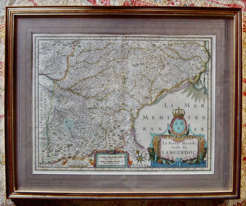
JANSON
La partie méridionale du LANGUEDOC
Édition allemande.Beau coloris ancien. Encadré XVIIè siècle XVIIè siècle 53,5 x 65,5 cm avec le cadre.
Riferimento per il libraio : 6009
|
|
|
JANSONIO, GIOVANNI (JANSSONIUS, JOHANNES - IANSONIUS, IOANNES - JANSONN, JAN).
Dominio Fiorentino.
Dall’ “Atlas Major,” edito tra il 1658 e il 1661. Amsterdam, 1660 circa. Dall'Atlas Major, edito tra il 1658 e il 1661. Incisione in rame, confini in colore d’epoca, cartigli colorati, cm 38,5 x 49,2 (alla lastra) più margini bianchi. In basso a destra, titolo entro cartiglio decorato; accanto a sinistra: “Amstelodami, Excudebat Ioannes Ianssonius”; in basso a sinistra, cartiglio decorato con sfera, compassi e putti e con scala in miglia italiane e miglia tedesche. Foglio con testo in germanico gotico al verso. Un leggero ripiegamento della brachetta centrale, per il resto trattasi di bell’esemplare in bella efine coloritura e in ottimo stato di conservazione.

|
|
|
JANSONIO, GIOVANNI (JANSSONIUS, JOHANNES - IANSONIUS, IOANNES - JANSONN, JAN).
Dominio Fiorentino.
Dall’ “Atlas Major,” edito tra il 1658 e il 1661. Amsterdam, 1660 circa. Incisione in rame, confini in colore d’epoca, cartigli colorati, cm 38,5 x 49,2 (alla lastra) più stretti margini bianchi. In basso a destra, titolo entro cartiglio decorato; accanto a sinistra: “Amstelodami, Excudebat Ioannes Ianssonius”; in basso a sinistra, cartiglio decorato con sfera, compassi e putti e con scala in miglia italiane e miglia tedesche. Foglio senza testo al verso. .
|
|
|
JANSONIUS, Joh.:
Territorium Argentoratense. (Strassbourg).
Amstelodami), Ioannes Ianßonius (1588-1664) / Excudit. Petrus Kaerius Caelavit (1571-1624). um 1630, 34x47 cm, Schöne teils handkolorierte Kupferstich-Karte von Strassburg, links unten Titel in Kartusche, rechts oben 2 heraldische Wappen, ca. 1650, 34 x 50 cm, kleine Beschädigungen am Rand links unten.
Riferimento per il libraio : 14299aaf
|
|
|
JANSSON JEAN (1588-1664).
GASTINOIS ET SENONOIS.
AMSTERDAM. JANSSON. SANS DATE (VERS 1660). JOLIE CARTE GRAVEE (50 X 39 CENTIMETRES ENVIRON, 60 X 49 AVEC MARGES) SUR DOUBLE PAGE, COLORIEE A L'EPOQUE. TEXTE DESCRIPTIF AU DOS. PETITE DECHIRURE AVEC PETIT MANQUE DE PAPIER SUR LE COURS DE LA LOIRE, SINON BEL ETAT, COULEURS FRAICHES.
Riferimento per il libraio : 437
|
|
|
Jansson, Johannes
Coloniensis Archiepiscopatus. [Altkolorierter Kupferstich / handcolored copper engraving].
o.J. Johannes Jansson (Johann Janssonius, eigentlich Jan Janszoon), geboren 1588 in Arnhem; gestorben 1664 in Amsterdam.
Riferimento per il libraio : 43574BB

|
|
|
Jansson, Johannes
Ducatus Geldriae novissima descriptio. [Altkolorierter Kupferstich um 1680 / colored copper engraving].
o.J. Johannes Jansson (Johann Janssonius, eigentlich Jan Janszoon), geboren 1588 in Arnhem; gestorben 1664 in Amsterdam.
Riferimento per il libraio : 49968BB

|
|
|
Janssonius van Waesberge, Gillis; Pitt, Moses; Swart, Steven
Comitatus Mansfeldiae Descriptio. Auctore Tilemanno Stella Sig. Apud Janssonio-Waesbergios, Mosem Pitt et Stephanum Swart. [Altkolorierter Kupferstich, gerahmt / handcolored copper engraving, framed].
o.J. [3 Warenabbildungen] Gillis Janssonius van Waesberge, geboren am 2. April 1646 in Utrecht,, gestorben am 6. Februar 1708 in Amsterdam. Nieder
Riferimento per il libraio : 13826DB

|
|
|
JANSSONIUS, JOHANNES (JANSONIUS, IOANNEM).
Ischia isola olim aenaria.
Amsterdam, 1660 circa. Probabilmente dall’ “Atlas Major”, edito tra il 1658 e il 1661. Incisione in rame, colore d’epoca, cm 38 x 49 (alla lastra). Ampi margini, rinforzo nella parte inferiore centrale della brachetta. Buono stato.

|
|
|
JANSSONIUS, JOHANNES (JANSONIUS, IOANNEM).
Territorio di Bergamo.
Amsterdam, 1660 circa. Dall’ “Atlas Major” edito tra il 1658 e il 1661. Incisione in rame, colore d’epoca, cm 38 x 49 (alla lastra), testo francese al verso. Patina di lieve ingiallimento e foxing marginale, in margini, buono stato.

|
|
|
JAQUES- NICOLAS BELLIN
CARTE DELL'ISLE DE CAP VERD
Carta dell'isola di Capo Verde del Cartografo Jaques- Nicolas Bellin -buono stato di conservazione - dimensione lastra cm22.8x29.8- leggere bruniture ai margini

|
|
|
Jean Sellier et André Sellier
. Atlas Des Peuples D'Orient: Moyen Orient Caucase Asie Centrale
Softcover, 200 pages, Texte en Francais, 240 x 180 mm, une bon exemplaire,. ISBN 9782707122223. n 100 cartes pour 1 000 ans d'histoire orientale, Jean et André Sellier, géographe et historien, dessinent de façon très synthétique l'histoire très complexe des peuples d'Orient. Arabes, caucasiens, iraniens, turcs, juifs, arméniens... y sont présentés tour à tour, cartes et commentaires à l'appui, de l'Antiquité à nos jours. Cet ouvrage sert d'introduction à la période contemporaine : il permet de comprendre la naissance des États-nations issus du démantèlement des empires ottoman, perse, et plus récemment, russe. Avant l'Atlas des peuples d'Orient, Moyen-Orient, Caucase, Asie centrale, Jean et André Sellier étaient déjà reconnus pour d'autres atlas présentant avec la même clarté l'histoire des entités nationales : l'Atlas d'Europe centrale, véritable succès de librairie, et l'

|
|
|
JEAN-BAPTISTE DUROSELLE
STORIA DELL'EUROPA
COME NUOVO, LIEVISSIMI SEGNI DEL TEMPO, QUALCHE FIORITURA LUNGO I TAGLI. Informazioni bibliografiche Titolo: Storia dell'Europa Titolo originale: Europe Autore: Jean-Baptiste Duroselle Ideatore: Frédéric Delouche Introduzione di: Sergio Romano Traduttori: Francesco Saba Sardi, Olimpio Cescatti, Doriana Camerlati Edizione: illustrata Editore: Roma, Milano: Edizione Club su licenza Gruppo Fabbri, Bompiani, Sonzogno, Etas, 1991 ISBN-10: 8845216322, ISBN-13: 9788845216329 Lunghezza: 418 pagine; 25 cm Peso: 1,9 Kg Soggetti: Storia europea, Regionale, Europa, Consultazione, Riferimento, Storiografia, Saggi, Popoli e Paesi, Cartografia, Universale, Moderna, Rivoluzioni, Pensiero, Greci, Impero romani, Crociate, Medioevo, Cristianesimo, Rinascimento, Chiesa, Radici culturali, Assolutismo, Stato, Carlo Magno, Democrazia, Monarchie, Borghesia, Industrializzazione, Illuminismo, Riforma, Realpolitik, Imperialismo, Colonialismo, Guerre di religione, Romanticismo, Guerre Napoleoniche, Napoleone Bonaparte, Congresso di Vienna, Restaurazione, Unità, Socialismo, Marxismo, Ideologie, Prima e seconda guerra Mondiale, Fascismo, Nazismo, Hitler, Shoah, Nazionalismo, Guerra Fredda, Muro di Berlino, Movimenti politici, sociali, Società, Charlemagne, Russia, German, Italy, Spain, Rome, Roma Empire, Britain, Celts, Catholic, Byzantine, Carolingian, Council, Revolution, Netherlands, Slavs, Crusade, King, Pope, Portugal, Poland, Sweden, Rhine, Western, Congress, Conquest, France, Christian, Church, Emperor, Countries, civilization, colonies, Language, Greece, History, Louis the Pious, Latin, The development of Europe, History, Middle Age

|
|
|
JEAN-MICHEL BARRAULT
LA TERRA è ROTONDA MAGELLANO IL VIAGGIO DELLE MERAVIGLIE
RAFFAELLO CORTINA 1998 LIEVI SEGNI DEL TEMPO, PER IL RESTO, INTONSO, PARI AL NUOVO. Fallimentare dal punto di vista economico e politico, la spedizione di Magellano mandava in pezzi le tradizionali concezioni del nostro globo e dimostrava concretamente la rotondità della Terra, rivelando al tempo stesso le meraviglie e i pericoli di nuovi paesi offerti all'audacia di corsari e di conquistatori. Ribelle contro il suo re, mercenario della corona di Spagna, astronomo dilettante, curioso di ogni scienza, comandante spietato ma di coraggio insuperabile, Magellano incarna la figura dell'avventuriero che con il suo folle volo ha plasmato il mondo moderno.

|
|
|
Jean-Paul Duviols
Le Nouveau Monde - Les voyages d'Amerigo Vespucci (1497-1504)
Relié, 303 pages, paru le 1er mars 2005 chez Chandeigne, livre en très bon état général. Nous avons d'autres exemplaires des éditions Chandeigne, retrouvez les dans notre catalogue grâce au mot-clé "Chandeigne".
Riferimento per il libraio : VOY4424M

|
|
|
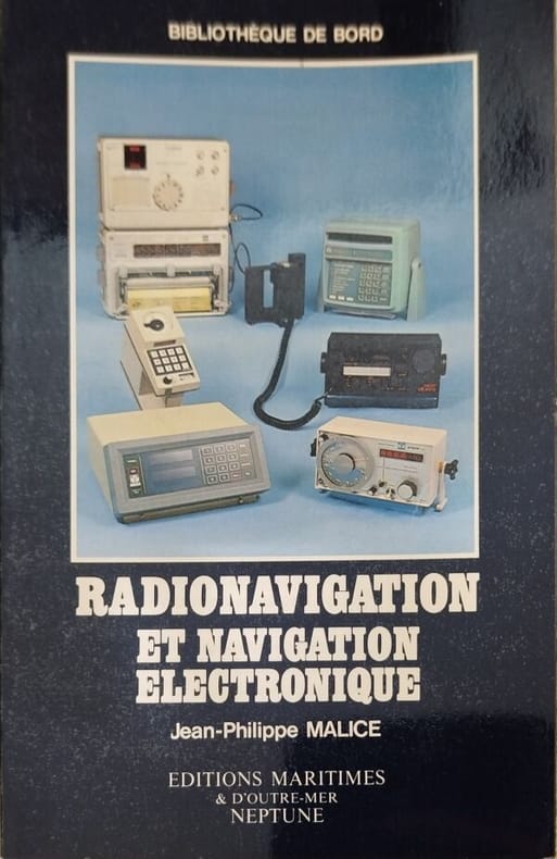
Jean-Philippe Malice
Radionavigation et navigation électronique
Editions Maritimes & d'Outre-Mer Neptune 1981 191 pages in8. 1981. broché. 191 pages.
Riferimento per il libraio : 9121
|
|
|
Jenichen Balthasar (attivo dal 1560, morto nel 1599)
Costantinopoli
SCONOSCIUTA PROVA DI STAMPA, prima dei numeri chiave e della legenda numerica in basso. La veduta è molto simile a quella attribuita a Balthasar Jenichen, e illustrata solo da Hollstein (e poi da Meurer), mentre Andresen (Handbuch fur Kupferstichsamrnler, 1870-73) riporta solo il titolo dell'opera. Ma rispetto alle illustrazioni di Hollstein e Meurer, il presente foglio, magistralmente inciso, è diverso. Confrontandola con le altre tavole di Jenichen è chiaro che l’immagine illustrata in Hollstein e Meurer non è corretta, e viene illustrata una copia coeva, non attribuibile a Jenichen. Siamo stati in grado di trovare solo un altro esemplare della mappa, nella collezione della Stanford University: https://purl.stanford.edu/bq807my1592 Questo esemplare è terminato e contiene la legenda numerica in basso, con i numeri all'interno della veduta. La mappa è attribuita dal curatore della Stanford University a Balthasar Jenichen. Dal lettering della legenda, e dal confronto con le altre mappe firmate di Jenichen, è chiaro che questa è la lastra originale. Balthasar Jenichen (attivo dal 1560 e morto nel 1599) è conosciuto anche come Jenisch, Balthasar. Incisore, iniziò la sua carriera nella bottega di Virgilio Solis; dopo la morte di Solis nel 1562, sposò la sua vedova e portò avanti la bottega fino alla propria morte. Acquaforte e bulino, circa 1570/75, stampata su carta vergata contemporanea con filigrana "stemma con uccello" (cfr. Woodward 86), con margini, in ottime condizioni. La filigrana è stata trovata da Woodward in un altro “broadsheet” tedesco - Das is die wahrhafte Contrafettung des stat Zara in Dalmatia (Newberry Library 2F60), datato 1571. Esemplare appartenuto alla collezione di Fritz Hellwig; al verso vecchie annotazioni in inchiostro. Bibliografia Bachmann III, 223; Drugulin I, 433; Andresen II, Nr. 281; Hollstein XV B, 146; Meurer, Peter H., 'Karten und Topographica des Niirnberger Kupferstechers Balthasar Jenichen', p. 46, 7; Passavant IV, 203, 60; Heller, Zusatze, 76. UNKNOWN PROOF STATE, before the key numbers and the numeric legend at the bottom; the lower part of the plate with a space for a larger legend here The view is very similar to that ascribed to Balthasar Jenichen, and illustrated only by Hollstein (and then by Meurer), while Andresen (Handbuch fur Kupferstichsamrnler, 1870-73) report only the title of the work. But in comparison with the illustrations in Hollstein and Meurer, the present, masterfully engraved leaf is different. Comparing it with the other plates by Jenichen it's clear that the image illustrated in Hollstein and Meurer is the wrong one! We are able to find only another copy of the map, in the collection of the Stanford University. https://purl.stanford.edu/bq807my1592 This example is complete, with the key legend at the bottom and the numbers inside the view. The map is ascribed by the museum's curator to Jenichen. From the lettering of the legend, and comparing it with the other signed Jenichen's maps, it's clear that this is the original plate. Etching with engraving, circa 1570/75, printed on contemporary laid paper with watermark "Coat of arms with a bird" (cf. Woodward 86), with margins, very good condition. The watermark was found by Woodward in another German broadsheet — Das is die wahrhafte Contrafettung des stat Zara in Dalmatia (Newberry Library 2F60), dated 1571. Verso old annotations in ink. Example from the Fritz Hellwig collection. A very rare broadsheet of Istanbul, that we are not able to find in any Public Collection. Balthasar Jenichen (printmaker; German; Male; 1560 fl. - 1599 died) is also known as Jenisch, Balthasar. Etcher and engraver, began his career in the workshop of Virgil Solis; after Solis's death in 1562, he married his widow and carried on the shop until his own death. Literature Bachmann III, 223; Drugulin I, 433; Andresen II, Nr. 281; Hollstein XV B, 146; Meurer, Peter H., 'Karten und Topographica des Niirnberger Kupferstechers Balthasar Jenichen', p. 46, 7; Passavant IV, 203, 60; Heller, Zusatze, 76.

|
|
|
Jenne, W
Kettenbruchformeln u. Korrelatentabellen für trigonometrische Netze. Mit einigen Beiträgen zur Auflösung beliebiger Systeme einfacher linearer Gleichungen mit Hilfe v. Kettenbrüchen.
Potsdam, 1937. 4°. M. 211 Abb. u. 178 Tab. 101 S. OBr. Umschl. schmutzrandig. (Veröffentl. d. Königl. Preus.Geodät. Inst. N.F. 107)
Riferimento per il libraio : 159765
|
|
|
Jenner, Thomas
Map of Dorsetshire
London: Thomas Jenner 1643. Original Map . printed Map. Vg. An uncoloured original map of Dorsetshire with a distance grid showing the miles between the principal towns 125x130mm. A nice dark copy with a couple of worm holes <br/> <br/> Thomas Jenner unknown
Riferimento per il libraio : Map275b
|
|
|
Jenner, Thomas
Map of HUNTINGDON
London: Thomas Jenner 1643. 1st Edition . printed Map. Vg. An uncoloured original map of Dorsetshire with a distance grid showing the miles between the principal towns 125x130mm. A nice dark copy with a couple of worm holes <br/> <br/> Thomas Jenner unknown
Riferimento per il libraio : Map275a
|
|
|
Jenner, Thomas
Map of NORTHAMPTONSHIRE
London: Thomas Jenner 1643. Original Map . printed Map. Vg. An uncoloured original map of Northampton with a distance grid showing the miles between the principal towns 125x130mm. A nice dark copy with a couple of worm holes <br/> <br/> Thomas Jenner unknown
Riferimento per il libraio : Map476a
|
|
|
Jenner, Thomas
Map of NOTTINGHAMSHIRE
London: Thomas Jenner 1643. Original Map . printed Map. Vg. An uncoloured original map of NOTTINGHAMSHIRE with a distance grid showing the miles between the principal towns 125x130mm. A nice dark copy with a couple of worm holes <br/> <br/> Thomas Jenner unknown
Riferimento per il libraio : Map476
|
|
|
Jenner, Thomas
Map of SOMERSETSHIRE
London: Thomas Jenner 1643. printed Map. Vg. An uncoloured original map of Somersetshire with a distance grid showing the miles between the principal towns 125x130mm. A nice dark copy with a couple of worm holes <br/> <br/> Thomas Jenner unknown
Riferimento per il libraio : Map555a
|
|
|
Jenner, Thomas
Map of SURREY
London: Thomas Jenner 1643. Original Map . printed Map. Vg. An uncoloured original map of Surry with a distance grid showing the miles between the principal towns 125x130mm. A nice dark copy with a couple of worm holes <br/> <br/> Thomas Jenner unknown
Riferimento per il libraio : Map588
|
|
|
JEPPE (Friedrich Heinrich), Jeppe (Carlos Friedrich Wilhelm), RISSKI (Johann)
Jeppe's Map of the Transvaal or S.A. Republic and Surrounding Territories.
London, Stanford, 1899.
Riferimento per il libraio : 43164

|
|
|
Jerry Brotton
La storia del mondo in dodici mappe
Coperta cartonata ed illustrata a colori. Ottimo stato, tagli regolari e pagine ben salde alla costa, libro completamente fruibile, n. 9028 della collana "Universale Economica Feltrinelli / Saggi", traduzione dall'inglese di Virginio B. Sala, presenti 38 figure in nero nel testo e 56 illustrazioni a colori fuori testo, prima edizione, numero pagine 526 USATO

|
|
|
Joan BLAEU
AETHIOPIA SUPERIOR vel interior vulgo ABISSINORUM sive presbiteri Ioannis Imperium
Carta in b/n- dimensioni foglio cm 50,5x 59.7- lievi abrasioni ai margini- ed. francese - lievi bruniture ai margini - nel complesso buono stato di conservazione
|
|
|
Joan BLAEU
MONTGOMERIA comitatus et comitatus MERVINA
carta Inghilterra Occ. - dimensioni foglio cm 50,5x60, bella colorazione probabilmente successiva- tratta dall'edizione francese dell'Atlante "Teatro del Mondo"- buono stato di conservazione

|
|
|

 Ricevere i risultati per e-mail
 Scaricare i risultati in PDF
 RSS feed
 Link
Link


